
|
|
Route |
|---|---|
|
|
39.39700°N / 106.1°W |
|
|
Hike to Scramble |
|
|
Most of a day |
|
|
Class 3 |
|
|
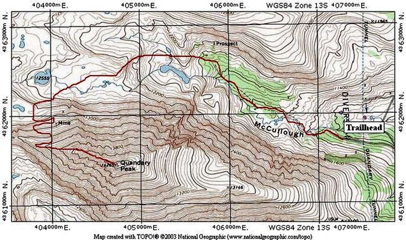
Approach
McCullough Gulch Trailhead:
Take CO-9 eight miles South of Breckenridge or two miles North from Hoosier Pass. Turn west on County Road 850 and an immediate right onto a dirt road, County Road 851. This is the standard approach for the popular Quandary Peak and parking along the road may be at a premium. Continue 2.1 miles to the trailhead. Near the 2 mile mark, the road Ys. Take the left. Parking is along the road side before a gated closure.
This road is not often plowed in the winter and may be impassable into late Spring.
 |
Route Description
From the trailhead, begin on the McCullough Gulch trail, which is easy to follow from the gated closure. Follow this good trail for about 2 miles into the gulch. There are several social trails here, so use your map to judge which one you should take. In general, follow the largest one.
The trail will fade in the upper basin, once you have passed several lakes. Veer toward Quandary's Northwest Slopes. There is a surprisingly good trail on this aspect of Quandary. To find it, go almost below the Quandary - Fletcher saddle and look sharp for its beginning.
Once you find the trail, it will offer good access through the loose rock on this slope. Gain the West Ridge of Quandary, and find the climber's trail on the North side of the ridge. Follow this trail. Everything up to here is Class 2.
From here, you are on the West Ridge of Quandary Peak. I'll defer to mpbro's excellent route description. Click here to read the description of the Class 3 ridge ahead to Quandary Peak's summit.
A good descent option, and a nice tour, would be to descend the East Ridge of Quandary, and then walk back up CR 851 to parking.
Route Stats:
Round Trip Mileage (McCullough Gulch): 8.4 miles
Elevation Gain: 3,700 feet
Round Trip Mileage (with descent of East Ridge): 8.9 miles
Elevation Gain: 4,200 feet
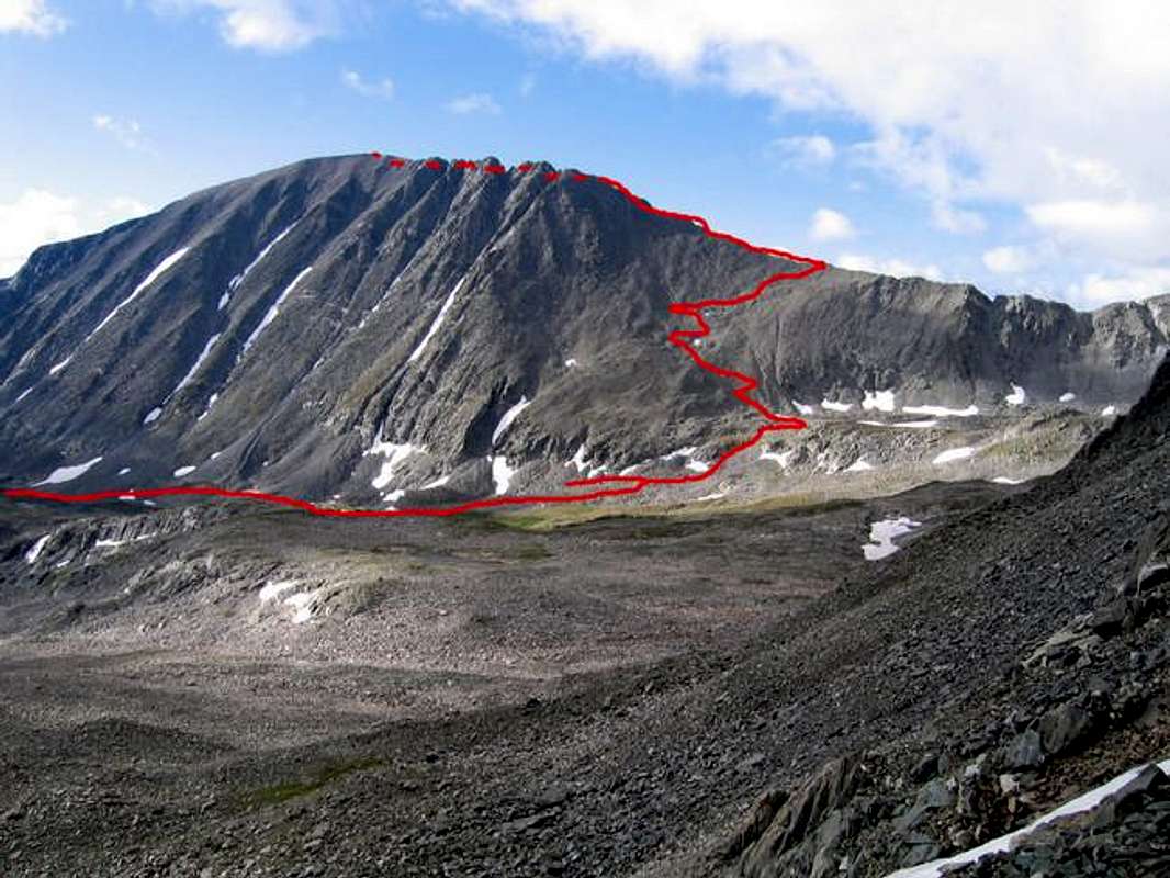
This Route Photo shows most of this route from the upper basin.
Essential Gear
A helmet is a good idea for the scrambling on the West Ridge. Other than that, just hiking gear.