
-
 12465 Hits
-
 83.69% Score
-
 17 Votes
|
|
Mountain/Rock |
|---|---|
|
|
46.33416°N / 13.83458°E |
|
|
Hiking, Scrambling, Skiing |
|
|
Spring, Summer, Fall, Winter |
|
|
6847 ft / 2087 m |
|
|
Overview
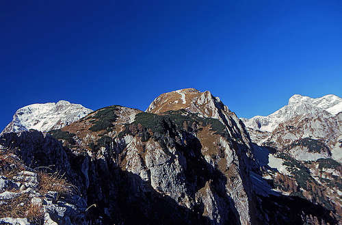
Ogradi summit ridge
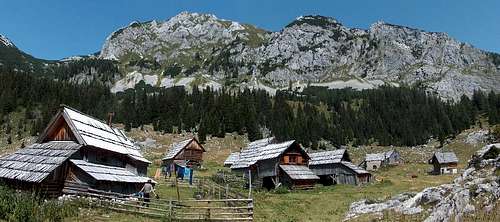
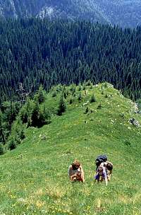
This is the world of Bohinj alpine pastures. Many of them are still alive. Well, many huts are also weekend huts, but on major pastures people still arrive at the begining of summer from lower places, stay there with cattle and sheeps till early autumn and then descend in Bohinj valley. You can get milk, cheese and other milk products if you come there during summer.
It's not a famous and very frequented summit, this Ogradi. Yet it's a nice hike and the summit is very panoramic. Crossing it in either direction (N-S or S-N) is a nice round tour which already requires some experience in a steep terrain, some passages finding and some dwarf-pine fighting. In winter and early spring it happens that a tour skier visits the summit - good skiing skill is required as the ridge access is steep.
Summit Panorama
The panorama from Ogradi is quite broad. The highest part of Triglav group is seen on the North, the rest of Bohinj group on the West, towards the South Bohinj valley and the South Bohinj Ridge stretch, while towards the East the view is open - towards Karavanke and Kamnik Alps. 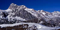 NE view - Triglav
 | 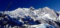 North view
 | 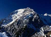 Debeli vrh
 |
Getting There

Above Laz
Laz alpine meadow
There's only one way how to get into Bohinj valley - by the road from the East, from the Jesenice - Ljubljana road and via Bled. All right, the other option is the train, which can bring you to Bohinjska Bistrica also from the South.
Once in Bohinj you can drive by car to Stara Fuzina and further to the North into Voje valley. Trailheads are by the mountain hut Planinska koca na Vojah, 690m, and at the end of the valley, some 700m. A better option to access Ogradi and other Bohinj mountains is the mountain road to Blato pasture. From Stara Fuzina you drive by car towards the North into Voje valley. After 2 km there's a crossroad, where you take the left forrest road. It takes us through Suha valley to Planina Blato (alpine pasture), 1147m. There's a big parking place. In summer, the road through Suha valley needs to be paid (in winter it's cleared quite late).
Alpine Pastures
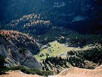
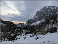
On the high Bohinj plateau there are still 'live' alpine pastures where shepherds come early in a summer, stay there with their cattle and sheeps and produce cheese and other milk products. I think that still today cheese is made on the two biggest pastures in the neighbourhood: Laz and Krstenica.Laz is situated in a big basin east of Ogradi and south of Debeli vrh. There are also some weekend huts, but in summer you can still see cattle there. On the SE part you can find a good water source. From Blato parking place it can be reached in 1h 30min.
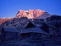
Krstenica has nowadays for my taste too many weekend huts, but the original architecture is kept to a reasonable degree. Its position is fantastic. On a high, broad grassy ridge you can enjoy nice panorama on the South Bohing Range and on Triglav Group. From Blato parking place it can be reached in 1h 30min.
 Laz meadow
 | 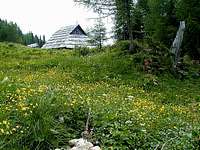 Krstenica meadow
 | 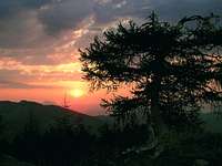 Krstenica Sunrise
 |
Routes Overview
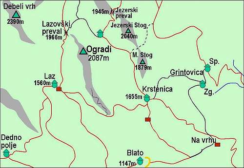
2. North Ridge. The starting point of the tour is Lazovski preval (saddle), 1966m. It can be fastest reached from Blato parking place, via Laz alpine meadow (3h) or from Blato via Krstenica and behind Ogradi (3h-3:30). From Lazovski preval we can clearly see the steep N ridge of Ogradi and its summit. The only problem is again a section of dense dwarf-pine in the beginning. Later the ridge is steep and requires also some scrambling or easy climbing (maksimum UIAA I). From the saddle 30min, altogether 3:30h to 4h.
So a good proposal is a round tour: Blato - Krstenica (1:30h) - Jezerce (2:30h) - Lazovski preval (3h) - N ridge (3:30h) - S ridge (4_30h) - Laz (5h) - Blato (6h).
 South ridge
 | 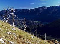 South ridge
 | 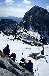 North ridge
 |
Red Tape
The mountain is in the Triglav National Parc.In summer, for the road from Voje valley trough Suha valley up to Blato alpine pasture you have to pay toll.
Huts and Camping
The nearest huts are:Koca na Planini pri Jezeru, 1453m, (041)901 999, (050) 632738 and
Vodnikov dom na Velem polju, 1817m, (050) 615621.
Official camping place is in Bohinj valley - here is the link to the tourist web site.
When To Climb?
North view in winter
For weather see here.
Even better site is wunderground - here's the direct link to Kredarica station, 2515m (below Triglav summit).