The sight of my VW bus all alone in the middle of such a huge empty backpacker lot seemed a bit ominous. Maybe this wasn't such a great idea...
DAY ONE...
It was a rare sight. The entire South Lake trailhead parking lot was empty- except for my VW van. We weren't surprised, though. It was late September and it was raining pretty hard. I guess even most diehards were inclined to sit this one out. Fortunately, my partner and I were both born without that 'killer-of-trips': Common Sense.
We choose a space near the middle of the empty lot and began the delicate job of putting on our gear inside the cramped space of my bus- trying not to get too wet before we could don our ponchos. Soon enough we were sloshing our way up the Bishop Pass Trail.
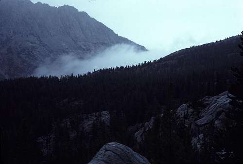
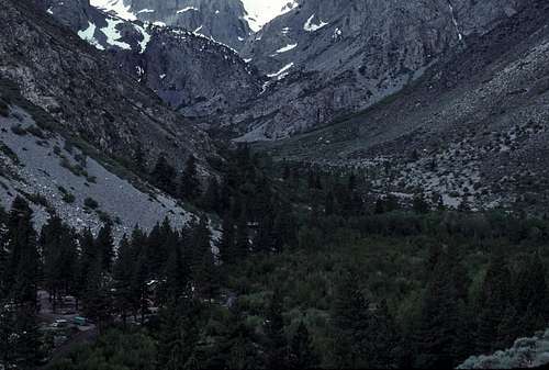
![Bishop Creek Canyon]() Bishop Creek Canyon
Bishop Creek CanyonBelieve it or not, we were on our way to make an attempt on North Palisade- the crown jewel of the Palisades group of peaks on the eastern boundary of Kings Canyon National Park. My companion was David McLaughlin- an old friend from Junior High and High School days. We had been on many prior trips together that included peaks such as Mount Ritter and Middle Palisade. I had been up North Palisade a few years earlier and had been wanting to repeat this climb with Dave. He had never been up there and was, as usual, pretty enthusiastic about making this attempt. Usually, whenever we went on a climbing trip together, we became an invincible team.
As we slowly rose above South Lake on the soggy trail, I glanced upward hoping for a view of the surrounding peaks, but was rewarded with a face full of rain and the blurry sight of gray clouds- all but completely obscuring the mountain tops high above us.
Oh, I nearly forgot to introduce the third member of our party. Her name was Olivia. Tropical Storm Olivia, that is. A few days earlier, when she had been off the west coast of Mexico, she had been known as Hurricane Olivia- a Category 4 monster. We were well aware that with Olivia around, we had a very slim chance of getting anywhere near North Palisade, let alone climbing it. The forecasters said that the storm would likely last for one or two days in the Sierra before dissipating in the desert. We were hoping that if we could brave the storm long enough to get to within reach of North Palisade- say, to Dusy Basin perhaps, then we could quickly bag the peak and head back to the van and drive home. This was only intended to be a three day trip and, yeah, it was definitely a long shot, but what the hell?
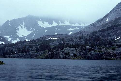
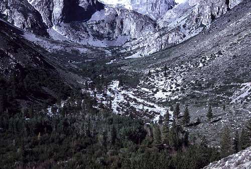
![Long Lake]() Long Lake
Long LakeSo, onward and upward we hiked. The only sounds were the sloshing of our boots on the wet trail and the more prominent patter of rain as it hit the hoods of our ponchos near our ears. It's okay. I enjoy hiking in rain. To me, there is a certain sense of peace and solitude that is experienced while hiking in a storm. Camping in the rain is okay too, but it involves a bit more work than camping in fair weather does. Keeping the mud and water out of the tent and off your sleeping bag can be pretty challenging. Cooking, eating and using toilet paper usually demands significant planning and care.
We reached Long Lake- about two or three miles from the parking lot. As we progressed on the trail around the east side of the lake, the wind began picking up significantly rendering our ponchos nearly useless. We reached the inlet and decided that this would be far enough for now. If the storm showed signs of letting up, we could continue on up and over Bishop Pass tomorrow. If not, we would have an easy retreat back to the trailhead. Bishop Creek, above the lake inlet, was still reasonably tame in spite of the heavy rainfall so we crossed over to stay at one of our favorite camping spots.
Olivia continued to pour her rain on us for most of the rest of the afternoon confining us to the tent. Late in the afternoon, however, there was a brief letup and we went for a short hike up towards Margaret Lake. It felt good to stretch our leg muscles for that short time. We were hoping that the storm was finally subsiding.
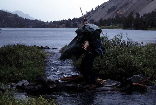
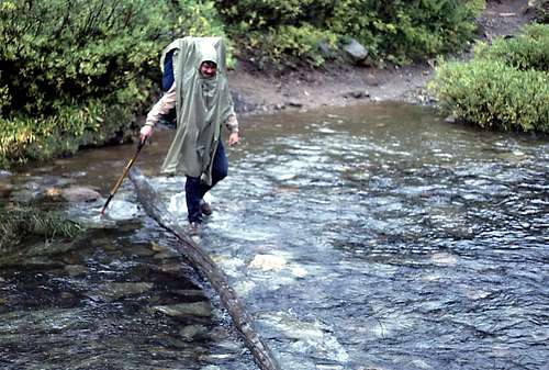
![Dave Crossing Bishop Creek]() Dave Crossing Bishop Creek
Dave Crossing Bishop Creek | ![Cloudripper]() Cloudripper
Cloudripper
|
Soon, however, the rain was back- stronger than ever. Our evening meal was a less than stellar bag of reconstituted freeze-dried mac-n-cheese. I don't know about Dave, but my thoughts were beginning to turn towards some hot burgers and fries served up at one of those fast food places back in Bishop. Those treasonous thoughts were quelled by the appearance of a flask of Jack Daniels that, per tradition, was usually an important part of our trips. Normally, this was reserved for after successfully reaching a summit. This time it served as a morale booster.
The rain lasted through the night. Instead of enjoying the sound of nature's power, I laid awake for a while and worried about the more than likely rising water levels of Bishop Creek. Maybe crossing over to camp on this side had been a bad idea, but the campsites were more isolated and better sheltered. Dave was awake, too. We discussed the fact that this whole venture was probably (okay, definitely) a bad idea in the face of this relentless storm. It was decided that we should head back to the trailhead as early as possible the next day. North Palisade would just have to wait for better conditions on some future trip. (Oops, a smidgen of Common Sense was beginning to creep in...)
DAY TWO...
We were up at first light and had a quick easy breakfast of granola cereal with instant milk. We hurriedly packed up our gear as we were anxious to get going before Bishop Creek rose any more than it probably already had. When we arrived at the creek crossing, we were relieved to find that the creek was only about six or eight inches higher than it was the day before. Crossing wasn't a problem. Now all we had to do was hike back to the trailhead. Tropical Storm Olivia continuously battered us with heavy rain all the way back. There wasn't even a hint of a let-up in the storm's intensity. As it turned out, she was just getting started.
![Dave Re-Crossing Bishop Creek]() Dave re-crossing Bishop Creek
Dave re-crossing Bishop Creek
We left the worst of the storm behind us as we drove down the road towards the Owens Valley. The town of Bishop was relatively dry. Not a big surprise. The Sierra Nevada is a formidable barrier that will challenge even a major storm like Olivia. A stray cloud or two broke free of the immense dark storm to the south and east and provided a little scattered shower here and there as we drove into town.
We still had another whole day before we had to be back to work on Monday. We decided that it would be fun to camp in the desert at the very edge of the storm and enjoy the show. We stopped at the local grocery store and stocked up on necessary supplies: ground beef, buns, ketchup, beer, etc. Then we headed south on US 395. I told Dave that I knew of a perfect place to camp.
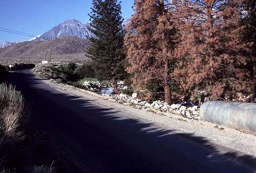
We drove into the little town of Big Pine and turned west on Glacier Lodge Road. Just beyond the first bridge that crosses Big Pine Creek, was a well traveled dirt road that branched off to the left. This was McMurray Meadow Road. As we followed this road southwest for several miles, the rain grew steadily heavier as we were now driving closer to the mountains and re-entering the storm. It was already late in the afternoon. No sunset to enjoy on this day! Everything to the west of us, including the immense eastern escarpment of the Sierra Nevada, was completely obscured by Olivia. Darkness would come early.
Finally, just before the road crossed Birch Creek, we turned off on a short gravel road that led off to the right. This led to a level tree-sheltered sand and gravel area near Birch Creek. Usually this is a pretty popular car campsite. I almost always see others camping here as I drive by on my way to nearby trailheads. I correctly assumed it would be empty now. I was also pretty sure no one else would show up wanting to share the site with us. We were only a few hundred feet off the main dirt road. The storm still gave us some concern, though. The rain was coming down harder than ever. There was no sign that it would ease up any time soon.
We rigged a large tarp over the top of my bus and tied off two corners on the ground to create a fairly spacious area where we could cook and eat (and drink) while staying relatively dry. The nearby creek was a safe distance away from our camp, but it was pretty swollen, turbulent and muddy. While our food cooked on the propane stove, I built a small cairn right next to the creek in an attempt to roughly gauge any changes to the water level in the creek.
It was after dark when we finally ate our meal. Perhaps some of the best burgers imaginable topped off with the kind of great conversations that only two old buddies (armed with a couple of six-packs of brew) could have. Eventually, I had to take a leak, so I put on a rain poncho and ventured into the dark and stormy night. I decided to hike the short distance to the main road to take care of my business. I directed my flashlight toward the part of the road that crossed Birch Creek, and what I saw there almost made me forget about my full bladder. The water of the creek had risen to the level of the roadway and small rivulets had already started to erode into the surface. The road was about to be washed away right before my eyes!
I hurried back to camp and told Dave what I'd seen. I aimed my light toward the edge of the creek where I'd built that small rock pile. To our horror, it was completely submerged! While we'd been partying away, the creek had risen significantly. The edge was noticeably closer to our campsite. We quickly threw our camping gear into the back of the van. We weren't concerned about organization or neatness (okay, were we ever?). We were focused on escape.
I threw the vehicle into gear and cautiously drove back up to the main road. When we arrived we could see that, to the right, the creek had completely breached the road surface and there was a good-sized stream running across the road and flowing down a quickly growing gully on the down-stream side of the road where it rejoined the turbulent main part of the creek as it emerged from the culvert under the road. Luckily, our route was to the left- back toward the floor of Owens Valley and Highway 395.
The rain continued to pour as we slowly drove through the black night. My hands were tightly wrapped on the steering wheel as I negotiated the dirt road through slippery mud and poor visibility. We couldn't wait to get back onto smooth asphalt pavement. We discussed how great a warm dry motel room in Bishop was going to be. The rain seemed to decrease in intensity the further from the mountains we drove. We were driving back out of edge of the storm. At last, the road became wider and firmer and we knew we were near the junction with Glacier Lodge Road- which was paved.
Finally, we came to a rise and then the dirt (mud) road drops down to the pavement of Glacier Lodge Road. We breathed a sigh of relief as we made the right turn onto smooth quiet pavement. But, our relief was quickly turned to anxiety when, just ahead, we suddenly saw bright spotlights and flashing amber warning lights. Oh, shit! Now what?
There were two or three highway maintenance vehicles just beyond the short bridge where Glacier Lodge Road crossed Big Pine Creek. Bridge? Apparently, the bridge was the center of attention since all the spotlights were aimed at it. We were astonished to see that the creek had risen high enough to completely submerge the road surface. Just the tops of the guard rails were visible in the churning dark water. Then we saw someone on the other side of the bridge was waving for us to move back. I realized that we were likely in a danger zone and immediately reversed back up to the junction with McMurray Meadow Road.
We considered traveling up the road and spending the night in the Glacier Lodge area. It would be raining harder up there in the mountains, but at least the road was paved and maybe we could find a sheltered spot in the Glacier Lodge parking lot. There would also likely be a public telephone just in case we needed to use one. Who knew how long we would be trapped up here. We agreed on the plan and I slowly began driving up the road. At least the rain had pretty much stopped, but what would it be like further up the canyon? We never found out. I'd forgotten that the Glacier Lodge Road re-crosses Big Pine Creek again just above the McMurray Road turnoff. As we approached the upper bridge, we found the road was covered with a layer of silt mixed with an assortment of wet rocks of all sizes ranging from pebbles to basketball sized. This area had just been under water- probably only moments before! We realized that the creek had likely overwhelmed this bridge, also. Once again I backed up to the junction with McMurray Meadow Road. We were trapped between two flooded bridges and a raging tropical storm that seemed to have a limitless amount of energy.
We decided to drive back up the dirt road to the top of the rise where we hoped we would be high enough to be safe from the flood if it got worse. We left the vehicle on top of the rise and took a short walk back down to the main road. We were alert and ready to run back up the hill at a moments notice if need be. In the dark, we could hear and feel the thunderous creek just beyond the opposite side of the road. We stood there, hopefully, high enough above the swollen creek to be relatively safe. I aimed my flashlight down toward the raging torrent. We couldn't see much beyond the small swirling foaming area that was illuminated by my light. Then we saw, above us, the dark silhouette of a moving tree. Yes, moving! It was one of those huge pine trees that grow along the banks of the creek (now they were in the middle of the flood). We watched in awe in the dim flashlight beam as it slowly leaned over and fell into the creek. It was not more than a few dozen feet away. The roots must have been undermined by the rushing water. Soon we saw another topple over- seemingly in slow motion. We looked at each other. Were we really seeing this? It began to rain again, so we hiked back up to the van to wait.
I don't remember exactly how long we sat in the front seats listening to the intermittent showers patter on the metal roof of the van. We were exhausted, but a little too stressed for any real sleep. We pulled out a map of the area and looked at it by flashlight. There were several alternate routes back to US 395, but nearly all crossed a creek or a wash along the way. Besides, most of these dirt roads were likely too rough for my VW van even in dry conditions; what would they be like after two or more days of rain? We realized that finding another way out wasn't much of an option.
As we sat there and waited- drifting in and out of semi-sleep, we suddenly heard an engine revving up. It sounded like a bulldozer and it was coming from the direction of the flooded bridge. Something was happening. We drove back down to the paved road and, once again, turned east and sure enough, there were the same highway maintenance vehicles with their flashing amber lights. This time, the spotlights revealed that the flooded creek had receded a bit and the water was now only an inch or two high as it flowed across the road surface on the bridge. A bulldozer, whose engine we heard, had arrived and was on the bridge pushing a mound of saturated mud, silt and small rocks toward where we sat a safe distance away. The driver pushed the mound off to the side of the road and then drove up to my van. I rolled down the window. He yelled over the sound of his engine, "Follow me across!" The rushing water swirled around my tires as we quickly crossed the bridge behind the tractor. Then, at last, we were free.
We gratefully waved at the maintenance workers and then headed down toward Big Pine. The town seemed to be deserted as we turned left and headed north on US 395- going toward Bishop. I told Dave that I knew of another spot to camp just north of there. "Oh, really?", he said. I could detect the undisguised skepticism in his tone probably remembering my last suggestion. I quickly assured him that there were no creeks or streams nearby.
It was quite late by the time we reached our destination. We were on top of the southern edge of the Volcanic Tableland overlooking the north side of Bishop. We built a small campfire and sat up drinking and reliving various parts of our ordeal as we looked down on the quiet street lamps and the occasional headlights of a passing truck. Some stars were visible above our heads, but looking to the south and west, there was nothing but inky blackness where Olivia still raged in the High Sierra. At last we squeezed into our sleeping bags and fell into deep sleep.
DAY THREE...
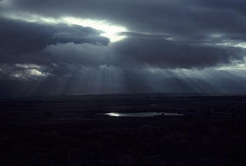
![Dawn in the Owens Valley]() Morning
Morning
We awoke at about 7:30 the next morning and quickly ate breakfast and prepared for the long drive back to San Jose. The clouds were breaking up and the morning sun shone spectacularly on the mountains- now only partially hidden by the waning storm. It appeared that Olivia had finally given up trying to get across the Sierra Nevada and had resigned herself to a slow death in the high country. She wasn't finished yet, though. There was still one more trick up her sleeve, but we wouldn't find out about that until we got home.
The quickest way home for us was to go north on US 395 and then west on route 120 over Tioga Pass through Yosemite National Park. We had just turned onto 395 and were driving on that long straight part the heads directly for Mount Tom when the radio announcer began to go through a long list of travelers advisories. We learned that Tioga Pass was closed due to rock slides. The next pass north of Yosemite was Sonora, but we decided that it would be more fun and scenic to travel south through Owens Valley and cross Walker or Tehatchape Passes. We made a 'U' turn and began back-tracking towards Bishop.
As we approached the north end of Main Street, the announcer came on again and claimed that US 395 south of Big Pine was closed due to flooding. Not a big surprise for us. Even as she was dying, Olivia was still toying with us. We made another 'U' turn and started traveling north again. We hoped there would be an open pass somewhere so we wouldn't have to drive all the way to Lake Tahoe to get back to San Jose.
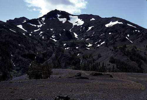
![Sonora Pass]() View From Sonora Pass
View From Sonora Pass
It turned out that Sonora Pass was open and we lumbered across in my van- pausing at the summit for some photos and a bite to eat. The sky was clear and cold with a brisk post-storm wind blowing across though the pass. It was hard to believe that a mere eight or so hours ago this range was in the clutches of a powerful storm. Now only the fresh patches of snow on the higher elevations were all that was left. Olivia was gone at last. We drove back to San Jose under mostly clear skies.
That night Olivia was on the TV newscast. It seems that while Dave and I were driving back and forth in Bishop looking for a way home, the earthen dam at North Lake failed and caused the evacuation of hundreds of homes along Bishop Creek- 200 of which were in Bishop.
I bought a newspaper the next day (which I still have) that gave more details about the dam failure and the effects of the storm in general on the region:
-Police used bullhorns to evacuate about 200 homes in Bishop. It turned out that the flooding never quite reached the town itself and people were allowed to return that evening.
-30 people were stranded at Cardinal Village Resort (Near Aspendell, just below the dam)- cabins were flooded while electricity was cut. Sidewalks and sewers were washed away.
-Several homes in Aspendell itself were destroyed.
-On the west side of the Sierra, about 230 people were stranded in the Cedar Grove area (Kings Canyon National Park) due to the washing out of the road near Boyden Cave.
-More people were stranded in the Mineral King area due to road washouts.
-Of particular interest to us, was the fact that 24 people were stranded at Glacier Lodge because the bridge on the main road to Big Pine was washed out. I wondered if my VW van was one of the last civilian vehicles allowed to cross to the Big Pine side before it was finally washed out.
EPILOGUE
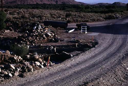
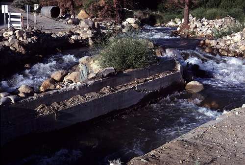
In 1984, nearly two years after our 'Olivia Trip' (as we came to call it), I returned to Big Pine Creek for an attempt on Mount Winchell. I drove up Glacier Lodge Road and found that a small detour had been built around the remains of the bridge where we had been trapped. I took a couple of pictures so I could show Dave.
![Temporary Road Realignment]() Detour Around the Destroyed Bridge
Detour Around the Destroyed Bridge | ![Bridge Remnants]() Bridge Remnants
Bridge Remnants |
![Our Flood Viewpoint]() Flood Aftermath- This is where we watched the trees fall over.
Flood Aftermath- This is where we watched the trees fall over. | ![Upper Bridge]() Overview- Portion of Glacier Lodge Road between the bridges.
Overview- Portion of Glacier Lodge Road between the bridges.
|
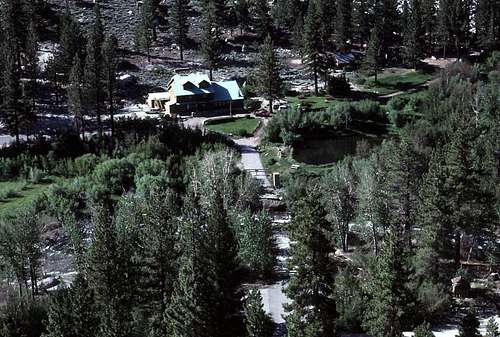
When I arrived at the Glacier Lodge area, I was surprised at the extent of the storm-caused damage still evident even after two years. The bridge over Big Pine Creek to Glacier Lodge itself was completely washed away. I hated to think about what would have happened if we had been successful in our attempt to reach this area during the storm.
![Glacier Lodge, 1984]() Glacier Lodge
Glacier Lodge
Upstream from Glacier Lodge, the damage to the aspens and willows along the creek were readily apparent. I eventually found some pictures I took of this area from about three months prior to the storm to use for comparison.
![Before...]() Before
Before | And... | ![...And After]() After
After |
I guess I could say that we learned a few lessons from this trip. Maybe a little more Common Sense can be a good and beneficial thing. But, on the other hand, I don't think too many people would be interested in reading a story about staying home, getting high, and watching the Three Stooges.
Dedicated...
...To my closest friend and climbing partner, David McLaughlin (1954 – 2004). This trip probably wasn't one of our finest moments, but it sure gave us a lot to laugh and talk about over the years. This one's for you, old friend.
![Dave McLaughlin]() Dave McLaughlin
Dave McLaughlin


Comments
Post a Comment