
-
 4258 Hits
-
 79.78% Score
-
 11 Votes
|
|
Route |
|---|---|
|
|
34.01513°N / 116.16304°W |
|
|
Trad Climbing |
|
|
Spring, Summer, Fall, Winter |
|
|
Less than two hours |
|
|
5.5 (YDS) |
|
|
5.5 |
|
|
2 |
|
|
I |
|
|
Overview


Zigzag is the name of a route on Intersection Rock in Joshua Tree National Park, California.
Zigzag has a reputation for being the first technical route climbed in Joshua Tree National Park. There is, however, some confusion as to exactly which one of the three different variations is the original. It is my belief that my topo shows the original route.
Intersection Rock seems to be a gift that keeps on giving. It should come as no surprise that this formation gets as much attention as it does. This rock embodies routes for all abilities and tastes. Zigzag may not be one of the more popular routes, but it shows how a climber can weave his/her way up a rock formation. This route is located on the northeast side of Intersection Rock, to the left of Half Track and far to the right of Mike's Books.
--------------------
Pitch 1: First pitch starts on the low angle slabs to the left of Half Track. Climb toward a ledge below an overhang. Climb around the overhang from the right. Then, head left on top of the overhang to the base of a chimney.
Pitch 2: This is the easier of the two pitches, also known as the "Escape" route. From the end of Pitch 1, continue going left to reach the first right facing low angle dihedral and the top.
Variation 1: From the end of Pitch 1, climb the chimney above you. I have never done this variation , but I have seen ratings from 5.7 to 10b. There seems to be a huge gap in the rating here, or that if this chimney was the original second pitch. In my humble opinion, I do not think so.
Variation 2: From the end of pitch 1, go right to reach the upper section of Left Ski Track. I have never done this variation either and have no information on the rating.
--------------------------
To descend: Use any one of the rappel stations on top to descend.
------------------------
Essential Equipment: One sixty meter rope, standard rack, pro to 3 inches, many slings to reduce rope drag, especially for this climb.
Getting There
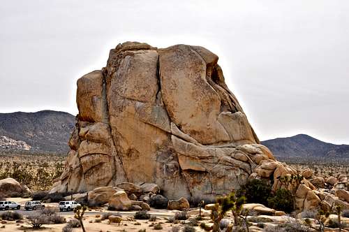 North Face of Intersection Rock and parking lot
From the western entrance to Joshua Tree National Park drive on Park Boulevard, formerly known as Quail Springs Road, for about nine miles to a major rock formation called “Intersection Rock.” Intersection Rock is a major landmark on the north side of Park Boulevard with ample parking for visitors and climbers alike. This rock, true to its name, sit at the cross roads to “Hidden Valley Campground”, Barker Dam Road and the road to “Day use and picnic” area. The north face of Intersection Rock is unmistakable. The two obvious parallel cracks are the Right and Left ski tracks. To the left of those you will see the Half Track. Zigzag starts to the left of Half Track.
Camping, Noise considerations, Environmental concerns,
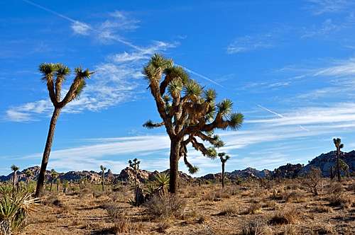 Typical Joshua Tree landscape
 protecting native plants
Please tread lightly. The Access Fund has gone to great lengths posting trail markers for approaches to many of the more popular crags. Do your best to stay on these trails, and where you are forced to use a different path, choose the ones that rain can mend in time. Drainages make for good trails where there are no established trails.
Avoid stepping on native and fragile plants, and do not feed the coyotes. Coyotes are very much used to people and often hang around picnic areas and campgrounds in hopes of getting a hand out. It’s better to let them live their natural life.
Camping

Joshua Tree Camping