
-
 7967 Hits
-
 86.85% Score
-
 23 Votes
|
|
Mountain/Rock |
|---|---|
|
|
46.58240°N / 12.28160°E |
|
|
Veneto |
|
|
Trad Climbing |
|
|
Summer |
|
|
8399 ft / 2560 m |
|
|
Overview
Geographical classification: Eastern Alps > Dolomites > Cadini di Misurina Group > Pala di Punta Ellie
Pala di Punta Ellie m. 2560
In the middle of the Cadini di Misurina Group, a peculiar range built by an endless number of slender towers, needles, pinnacles and huge sharp flakes of "dolomia", the not very gaudy but fine Pala di Punta Ellie really offers a very satisfactory route on extra quality rock along its shady North-East face.
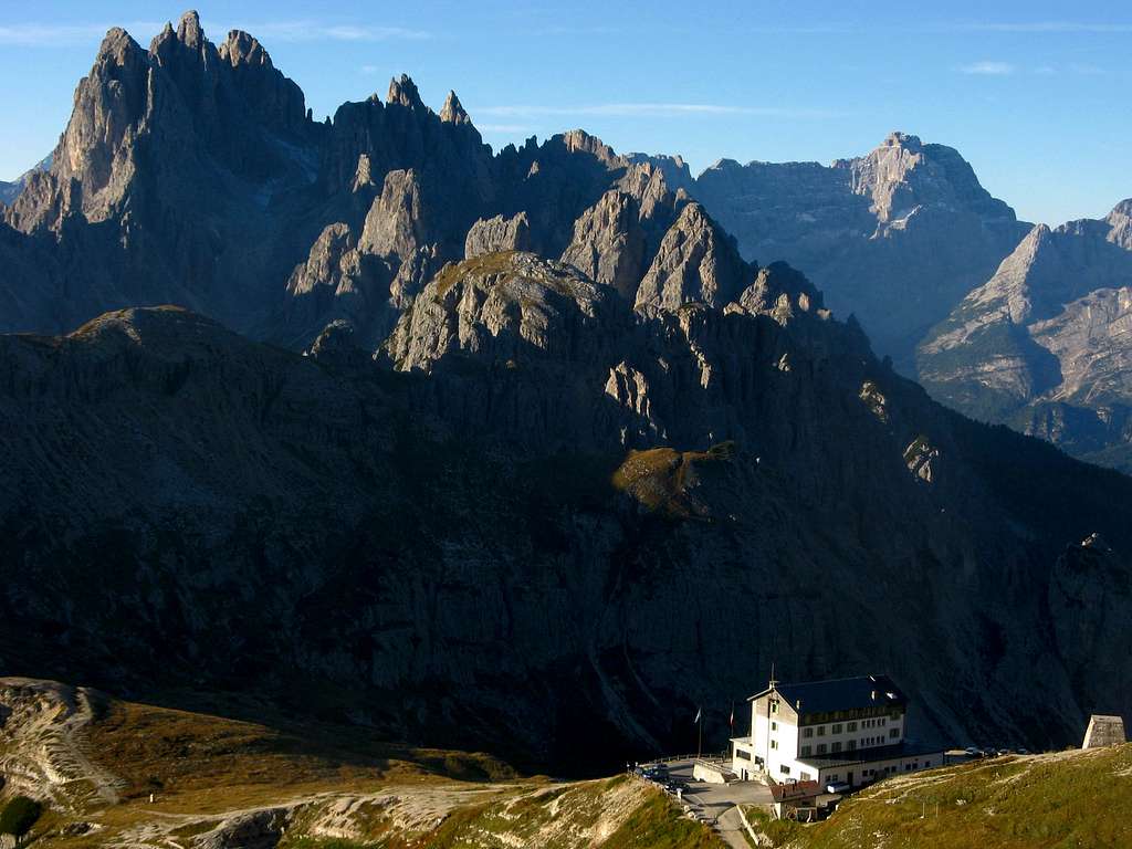
The tower - belonging to the Subgroup Cadin dei Tocci- it's located just in front of Torre Wundt and dominates the Vallone dei Tocci and Fonda Savio Hut.

Amongst the routes running on the peak, the classic one is "Mazzorana", realized in 1942 by the alpine guide Piero Mazzorana with Renata Scaramuzza. First ascent of the tower: Junk, Kann and Schonlanck 23-8-1911.
Getting There - Road Access
The best starting point is Misurina mt.1752, a small village situated on the shore of the lake with the same name. From Bolzano follow Brennero Highway, exit to Bressanone and then follow Val Pusteria reaching Brunico and Dobbiaco; from Dobbiaco follow on the right Val di Landro, reaching Carbonin mt. 1432 and Misurina.

From Misurina mt. 1752, the main village in this area, follow the road towards Tre Cime di Lavaredo and Rifugio Auronzo. After the road to Monte Piana - starting on the left-hand side of the main road - and before reaching the small bucolic Antorno Lake, turn to right to an unpaved road entering a wood and leading after a few kilometers to Pian degli Spiriti (Spirits’ Plane) mt. 1880. Parking.
Getting There - Walking access

From Pian degli Spiriti follow the good path to Rifugio Fonda Savio (n. 115, marked), rising along Cadin dei Tocci with several hairpins and reaching the edge of a wide vegetated and gravelly basin. (half an hour from the parking). From here a fine view on several towers and needles is just appearing; Pala di Punta Ellie is situated on your right-hand side (going up), showing a narrow black and yellow face. Carry on along the path for a few meters, then leave the main path following on the right a not very obvious trail, rising between grass and gravel to reach a gravelly gully descending from Forcella del Diavolo (Devil’s Saddle). Before reaching the characteristic and tall tower named Paracarro, head to right rising to the route’s starting point. It’s convenient to climb the route directly from Pian degli Spiriti, but another way is spending the night to Rifugio Fonda Savio: -Fratelli Fonda Savio Hut mt. 2367 (CAI – Club Alpino Italiano Sez. XXX Ottobre - Trieste) Beds 43 – Phone +39-0435-39036 open from june 20 from september 20. Link to Rifugio Fonda Savio
To reach the hut carry on along the main path for another half an hour (in all 1 hour from Pian degli Spiriti). The day after it’s possible to reach Pala di Punta Ellie in half an hour from the hut following Bonacossa Path.
Mazzorana route report
Mazzorana Route
Summit Altitude: 2560 m
Difficulty: D inf., max UIAA V
Climbing length: 200 m
Exposure: NE
First ascent: Piero Mazzorana and Renata Scaramuzza 7-8-1942
Starting point: Pian degli Spiriti
A fine satisfactory route and a very pleasant climb with amazing views on Tre Cime di Lavaredo South faces; dolomia’s quality is extraordinarily good. All the belays are equipped. Quick protections are available.


Mazzorana Route report - UIAA scale
P1 – Climb a slanting ramp with a crack towards right, reaching a second ramp slanting in the opposite side. Follow a black crack, then some easy steps slants to left. Belay below a black slab. III, III+, 30 mt. P2 – Climb the slab slants to right, then reach a pleasant ramp and climb it. Comfortable belay. IV, III, 25 mt. P3 – Slants to left climb a magnificent crack - excellent possibility to use quick protections – reaching easier rocks below a chimney-Crack. Climb the slab on the left-hand side of the chimney, then go slants towards left to a comfortable stance. IV, 30 mt.


P4 – A very long pitch, in case divisible by two. Traverse right, reaching a chimney crack. Follow the whole chimney-crack with very pleasant climb, cross a gully and then reach an edge overlooking a scree- gully. Climb the edge towards left, reaching a belay under a steep black wall. III, IV, 55 mt. P5 – Climb straightly the short black wall overlooking the stance (crux), reaching a small ledge. Climb slants towards right some black easier rocks, leqding to another easier black wall; climb it reaching a good belay. V. IV, 20 mt. P6 – Up towards right along a gully leading to a small stance below the magnificent and carved ending wall leading to the top. III+, 35 mt.


Descent: attention is required while scrambling down from the summit to reach the lower abseils-anchors. From the summit heads to NW scrambling down some steep gullies and short rocky-steps, reaching a small saddle with a characteristic yellow pinnacle NW from the top. Don’t head towards North - even if the ground seems easier – but skirt the yellow pinnacle on the left (cairn) reaching an easy grassy ridge. Follow it to a grassy saddle, then head to North-East (towards Fonda Savio Hut), follow a slanting ledge, then descending along some rock-steps leading to a grassy terrace on a steep face. Head to right towards a gully – cairn – finding the first equipped abseil. Two abseils (20 mt., then 30 mt.) are leading to the base close to the starting point.
Other routes

Other Routes:
- ENE Ridge D inf., max UIAA V, 200 mt. First ascent: Mazzorana-Rossi-Scaramuzza 1942
- Great North Chimney AD, max UIAA III+, 180 mt. First ascent: Mazzorana – Bò 1946
- West Crack AD inf., max UIAA IV, 200 mt. First ascent: Mazzorana – Cumino 1949
Red tape
There are no special restrictions or prohibitions in hiking and climbing. Cadini Group is situated inside the "Northern Dolomites", one of the nine mountain systems of the Dolomites acknowledged as UNESCO World Heritage Site and deserve the best care and respect. More info about Dolomiti Unesco World Heritage on SP in my article: Dolomites living mountains
Unesco Official website: Dolomiti Unesco
Hut

- Rifugio Fonda-Savio m. 2367
When to climb
Best season goes from middle June to middle September.
Guidebooks and maps
- Guidebooks


“IV grado in Dolomiti” by Emiliano Zorzi – Ed. IDEA MONTAGNA
“Arrampicare a Cortina d’Ampezzo e dintorni – Le vie più belle nelle Dolomiti” by Mauro Bernardi Athesia Editore
“Dolomiti Orientali” Vol. I Parte II by Antonio Berti – Collana Guide dei Monti d’Italia CAI-TCI
- Maps
Map: Tabacco n. 010 – Dolomiti di Sesto 1:25.000
Meteo
ARPAV DOLOMITI METEO
DOLOMITI METEO - VENETO
ARPAV DOLOMITI METEO Phone +390436780007 fax +390436780008 CENTRO VALANGHE DI ARABBA Phone +390436755711 fax 043679319 e-mail cva@arpa.veneto.it