
-
 7195 Hits
-
 84.27% Score
-
 18 Votes
|
|
Mountain/Rock |
|---|---|
|
|
61.01346°N / 149.55608°W |
|
|
Hiking, Scrambling |
|
|
Spring, Summer, Fall |
|
|
3920 ft / 1195 m |
|
|
Overview
Peak 3920 is a pretty, little known Chugach summit tucked away between grander neighbors along Turnagain Arm. What it offers is a few delightful hours in high meadows and tundra, a glimpse of the wild Chugach State Park hinterland, easy routefinding, and good footing. You won't have to scrabble your way up scree or teeter on crumbling footholds for this one. What it doesn't offer is bragging rights--just about nobody's heard of it, and you'd have a hard time pointing it out from any roadside viewpoint. With about 300 feet of prominence, some would even deny it the honor of being called a peak. But whatever it is, it's big enough to give you a workout: you'll have to start at sea level and climb every one of those 3920 feet the old fashioned way.
|
|


Getting There
To approach Peak 3920, drive about 15 miles south of Anchorage to the pullout parking for the Falls Creek Trail at Mile 105 of the Seward Highway (Alaska Highway 1).Routes
Follow the Falls Creek Trail. The trail initially climbs at a moderately steep grade through forest, emerging abruptly at about 3/4 mile onto a kind of shelf at elevation 800 feet, where there is a big boulder with a bit of a view. You want to bear left, downhill at first, to continue following the main creek up the valley. Over the next mile you'll gain another 1400 feet, at first in heavy brush and then through intermittent lush meadows. This brings you to a major fork in the valley at elevation 2200 feet, with the right fork heading toward the cirque under Indianhouse Mountain and the left leading to the big bowl under South Suicide Peak. The main trail crosses the little stream coming out of the right fork and climbs the brushy headland between the two forks. Follow this, climbing another 400 feet onto a broad, nearly level tundra ridge. Here the trail itself forks, offering you two routes to the summit.South Ridge (class 3): Take the right fork that heads around the east flank of the south ridge. After a couple of hundred yards, strike upslope to gain the crest of the ridge, where you will find a path. Follow the ridgecrest. Some easy scrambling begins at about 3500 feet. After a short knife-edged section, a class 4 rock step can be bypassed by traversing left about a hundred feet onto the west face on a sheep trail (on descent, this bypass is a little bit difficult to spot). Regain the ridge crest and continue easily to the top.
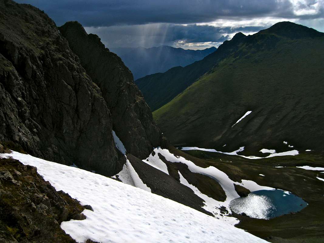
Falls Lake Route (class 2): Take the left fork and ascend gently over broad tundra meadows to pretty Falls Lake, elevation 2900. From the lake, continue east to the low point in the ridge ahead, which connects Peak 3920 with South Suicide. Once on the ridge, turn right and scramble easily to the top.
Both routes have excellent footing (essentially no scree) and are equally pleasurable. Going up by the South Ridge and descending via the lake makes a nice loop, with a total of six miles round-trip travel from the trailhead.
More experienced routefinders can make a fast descent by heading a short way down the east ridge (the one leading toward Indianhouse Mountain), then dropping down its south flank, descending grassy ribs in the direction of the little tarn in the cirque below Indianhouse. Withing a couple of hundred vertical feet a prominent sheep trail will be seen to skier's right. It traverses the whole southeast face and dumps you out conveniently on the lower south ridge.
![Map]()
Trail in purple; cross-country routes in red and black, as labeled. ![Approaching Peak 3920]()
At about 2000' along Falls Creek. Peak 3920 is in the distance.
The upper Falls Creek Valley has steep sides, and in winter and spring it receives medium-sized avalanches with some regularity.
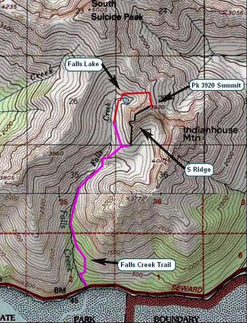
Trail in purple; cross-country routes in red and black, as labeled.
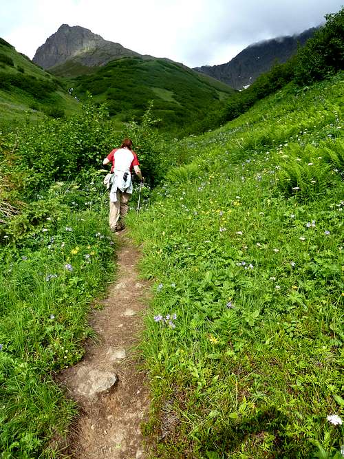
At about 2000' along Falls Creek. Peak 3920 is in the distance.
Camping
Falls Lake makes a beautiful campsite, and if you camp there you will often have the valley to yourself once the dayhikers leave. The cirque south of the peak, below the massive face of Indianhouse Mountain, also offers gorgeous camping. In either case, fires aren't permitted, and large groups (12+) will need a permit to camp.Red Tape
Chugach State Park has few restrictions. As of 2016 there are no parking fees at the trailhead parking.Safety Concerns
In summer, take bear precautions, particularly in the brushy midsection of the hike where it would be easy, and unfortunate, to take a grizzly by surprise.The upper Falls Creek Valley has steep sides, and in winter and spring it receives medium-sized avalanches with some regularity.