

-
 73721 Hits
-
 96.07% Score
-
 57 Votes
|
|
Area/Range |
|---|---|
|
|
61.27287°N / 149.02405°W |
|
|
Hiking, Mountaineering, Sport Climbing, Bouldering, Ice Climbing, Mixed, Scrambling, Skiing |
|
|
Spring, Summer, Fall, Winter |
|
|
13176 ft / 4016 m |
|
|
Overview
Introduction
The Chugach Mountains are a popular destination for outdoor enthusiasts all over the world. Among the many sights and activities are glaciers, alpine lakes, rivers, abundant wildlife, salmon fishing, ice and rock climbing, hunting, gold panning, and abandoned mines. Also of interest is a portion of the original Iditarod trail which passes through the Chugach on the way up from Seward before continuing on goldfields in western Alaska. The Iditarod trail was used by early miners in the late 1800’s and early 1900’s who sought to strike it rich. Large parts of the Chugach Mountains are protected by Chugach State Park, Chugach National Forest, and Wrangell-St. Elias National Park.
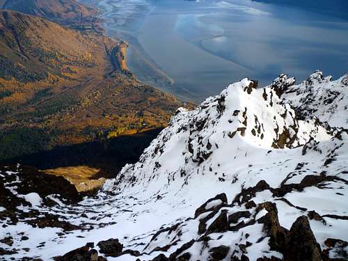
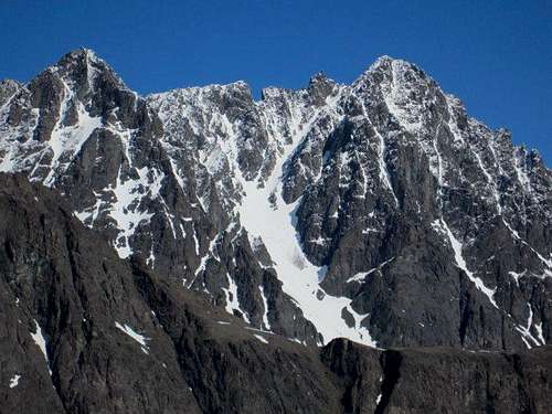
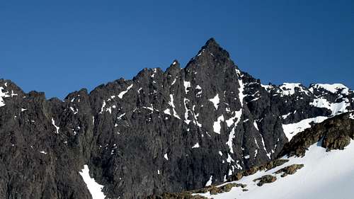
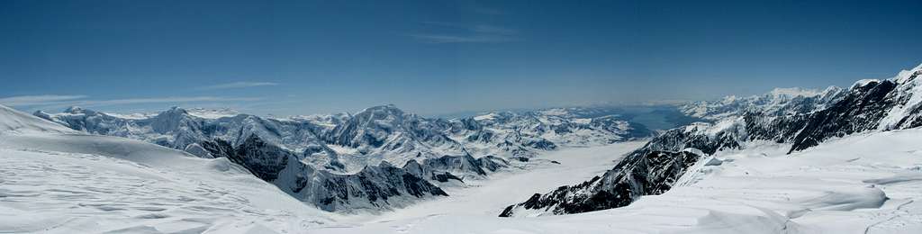
The Chugach Mountains are the northernmost of several ranges that make up the Alaska Coastal Range system. The mountains span approximately 250 miles east to west and 100 miles north to south, with a total area about the same as the country of Switzerland. In general, their formation comes from the action of the Pacific plate as it drives against and under the southern Alaska coastline. In contrast to the crystaline peaks of the Alaska Range, the Chugach are largely made of metamorphic rock that is often brittle or friable. The Chugach crest is heavily glaciated, with the total ice area measured at 8300 square miles in 1980 (it would be a little less today). Even where not surrounded by ice, the mountains are largely glacier-carved, giving them a distinctly alpine appearance. According to Wikipedia, the name "Chugach" is from the Eyak tribal name Chugachmiut recorded by the Russians and written by them "Chugatz" and "Tchougatskoi"; in 1898 U.S. Army Captain W. R. Abercrombie spelled the name "Chugatch" and applied it to the mountains. For expediency, the Chugach Mountains can be subdivided into three geographical sections: The Western Chugach, Central Chugach, and the Eastern Chugach.
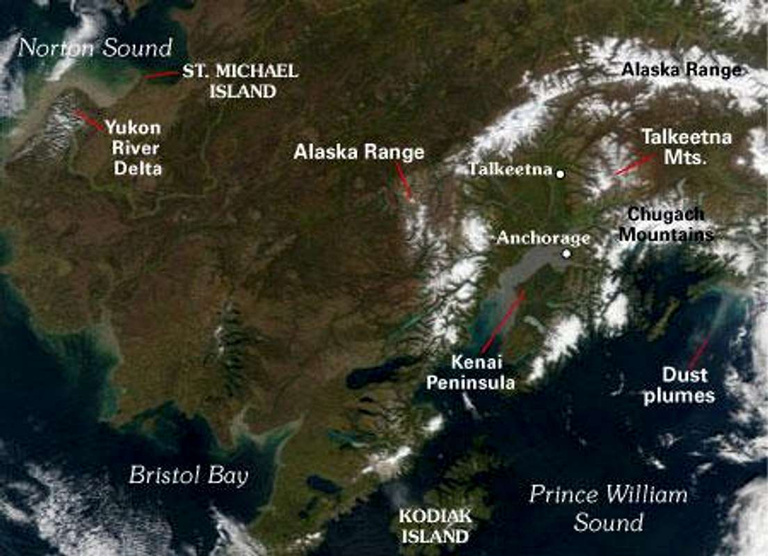 Location of the Chugach Mountains on the right Location of the Chugach Mountains on the right | 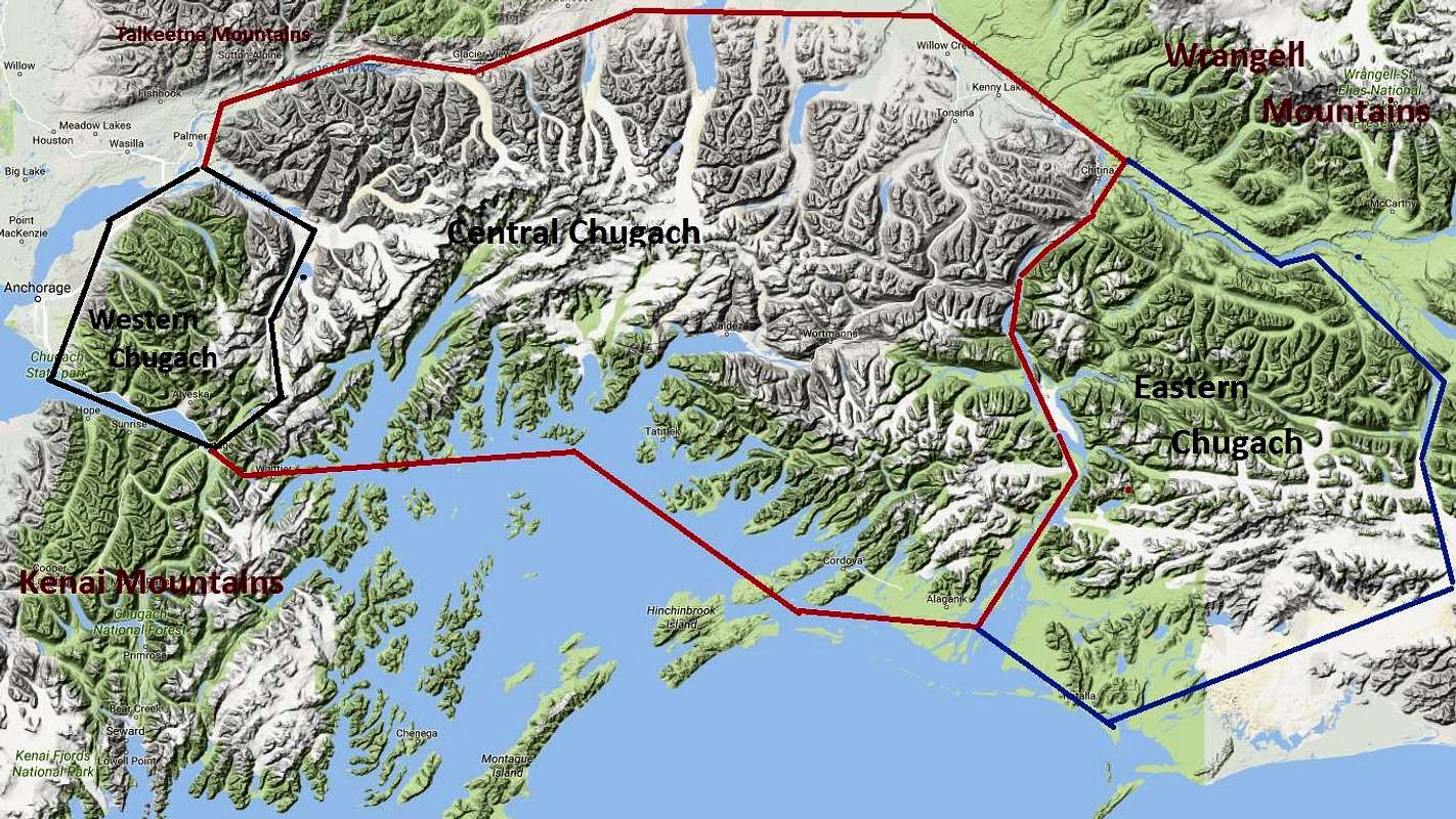 Regions of the Chugach Mountains Regions of the Chugach Mountains |
Western Chugach Mountains / Chugach State Park

The Western Chugach is the region covered by Chugach State Park and its immediate surroundings. Chugach State Park is one of the four largest state parks in the U.S., falling behind only Alaska's Wood-Tikchik State Park, California's Anza-Borrego Desert State Park and maybe--depending how you count acreage--New York's Adirondack Park. It is the most accessible, developed, and well explored of the three Chugach regions. The Western Chugach can be subdivided into several smaller locales as well, including the Hillside, Eagle River, Eklutna Lake, Ptarmigan Valley, Turnagain Arm, Girdwood, Lake George, and Twentymile.
The Western Chugach is bounded by the Knik Arm, the Knik River, the Lake Fork of the Knik River, Inner Lake George, Sparrow Creek, Bagg Pass, the West Fork of the Twentymile River, the Twentymile River, and Turnagain Arm. Most (but not all) of the Western Chugach Mountains have been climbed. The highest peaks in the Western Chugach Mountains are Bashful Peak (8005), Baleful Peak (7990), Bellicose Peak (7640), Hunters Peak (7549), and Mount Yukla (7535). Despite this, many of the peaks in the Western Chugach taper before 6,000 feet.
Central Chugach Mountains

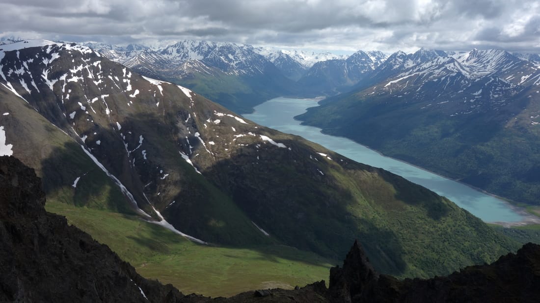
The Central Chugach extend from the borders of Chugach State park to the riverbanks of the Copper River. The highest peaks of the Chugach fall into this region. It is also characterized by several large interlacing glacier systems including the Knik Glacier, Tazlina Glacier, Columbia Glacier, and Nelchina Glacier among others. The Central Chugach is bounded on the south by Turnagain Arm, Portage Creek, Portage Lake, Portage Pass, Divide Lake, Shakespeare Creek, Passage Canal, and Prince William Sound and on the north by the Matanuska River, East Fork of the Matanuska River, Trail Creek, Trail Lake, Tahneta Pass, Lake Leila, Tahneta Lake, Eureka Creek, the Nelchina River, Tazlina Lake, the Tazlina River, and the Copper River. The Central Chugach see some climbing attention, getting more than the Eastern Chugach, but far less than the Western Chugach. The highest peaks that have been climbed in the Central Chugach are Mount Marcus Baker (13176), Middle Summit of Mount Marcus Baker (12850), Mount Thor (12521), North Peak of Mount Marcus Baker (12360), and Mount Valhalla (12135).
Eastern Chugach Mountains

The Eastern Chugach the least developed and least explored of the three regions. The region, which is reachable only by air and has essentially no infrastructure, comprises the area east of the Copper River, west of the Bering and Tana Glaciers, south of the Chitina River, and north of the Gulf of Alaska. The Eastern Chugach Mountains see relatively little climbing attention. Many of the peaks in the Eastern Chugach remain unnamed, both officially and officially. Named peaks in that area that have been climbed include Hanagita Peak (8504), Mount Hawkins (10295), Ragged Mountain (3315), Mount Steller (10515), and Mount Tom White (11191). Some prominent glacier systems in the Eastern Chugach include Miles Glacier, Wernicke Glacier, Stellar Glacier, Bering Glacier, and the Bagley Ice Field.
Notes: Thanks to Steve Gruhn, who provided a large portion of this information.
 Early Morning Light Early Morning Light |  Sheridan Glacier Above the Copper River Delta Sheridan Glacier Above the Copper River Delta |  Rainbow Peak Rainbow Peak |
 Cantata and Triangle Peaks from Eagle Lake Cantata and Triangle Peaks from Eagle Lake |  Tail Feather Peak Tail Feather Peak | 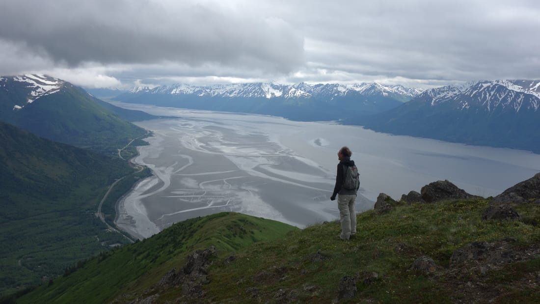 The Turnagain Arm from the slopes of Indianhouse The Turnagain Arm from the slopes of Indianhouse |
Western Chugach Mountains / Chugach State Park
Access Points
There are many trailheads easily accessible from Anchorage that give access to the Western Chugach. We will briefly describe the main ones below, starting from the north and working around to the south. Refer to the great map shown in the next section for an overview of the area.
Austin Helmers-Pioneer Ridge Trailhead
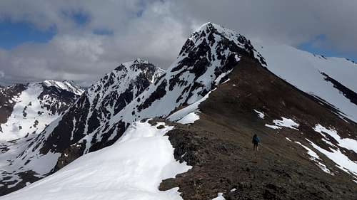
About 30 miles north of Anchorage, the Old Glenn Highway branches off the freeway and twists eastward along the south bank of the Knik River. The Old Glenn eventually crosses the river, but if you continue along the south bank on Knik River Road, another four miles brings you to a developed trailhead for the Pioneer Ridge Trail. Bring $5 for the Mat-Su Borough fee. From here a marked trail switchbacks 5300 feet from sea level to the ridge crest east of Pioneer Peak. It is primarily used for access to Pioneer's south summit, but a ridge ramble in the direction of Bold Peak Valley is also possible.
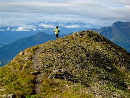 Ridgerunning on Pioneer Ridge, a vertical mile above the trailhead.
Eklutna Valley
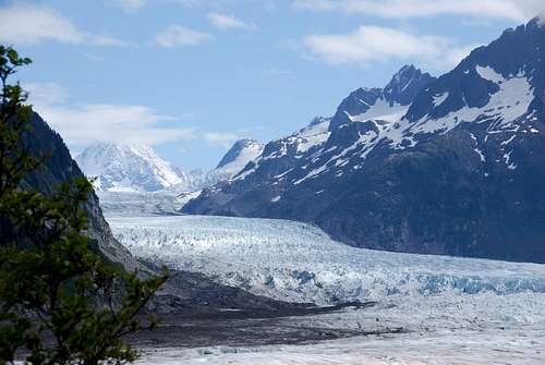
26 miles northeast of downtown Anchorage along the Glenn Highway (Alaska Highway 1), take the paved Eklutna Lake Road ten miles to its terminus on the north end of Eklutna Lake. This trailhead allows access to most of the higher peaks at the north and east end of the Chugach State Park (such as Bold, Bashful and Baleful Peaks). From the trailhead and car park, atv/bike trail (no cars) continues around the large lake for about 10 miles to the Serendipity Falls hut, which is a very nice cabin with many bunks and lots of space. You can rent bikes from the shack at the trailhead for a reasonable price, or bring your own. In winter, snow machines are allowed on this track as well. Near the hut, the track crosses a bridge to the west side of the Eklutna River and continues another mile to its end. Bikes/ATVs cannot go past the end of the road.If you wish to continue past the end of the ATV track towards the massive Eklutna Glacier, there is a mile long hiking trail along the west side of the river; however you will have better luck making the trek in spring, when snow bridges still allow passage across the Eklutna River, and snow still covers the toe of the glacier. In recent years, due to the rapidly changing nature of the glacier, the route onto the Eklutna Glacier from below is becoming very difficult. The river, along with cliffs on both sides of the valley do not allow easy access to the glacier later in the summer. In fact, from the end of the hikers trail, you will be forced to cross the raging Eklutna River to get back to the east side so you can scramble further up the valley (or you can bushwhack along the east side of the river from the hut and not cross the bridge). An impassible cliffy buttress blocks passage on the west side of the river just beyond the end of the trail. For those groups that do manage to get onto the glacier, Pilchers Perch is an amazing MCA hut to rest for a night. For more information about getting onto the Eklutna Glacier see the link below:
Another great option from the car park at the north end of Eklutna Lake, is the Twin Peaks hiking trail that heads north towards the Twin Peaks, which likely offer some of the better scrambling in the entire region.
 Eklutna Lake from the summit of East Twin Eklutna Lake from the summit of East Twin | 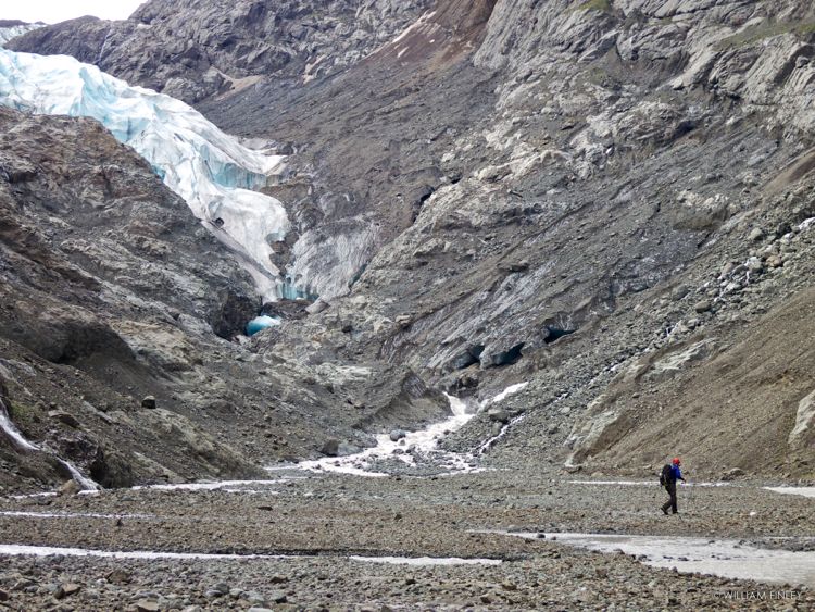 Typical terrain near the toe of Eklutna Glacier Typical terrain near the toe of Eklutna Glacier |
 Pilchers Perch
Peters Creek Valley
The next major drainage to the south is Peters Creek, where a long 13 mile trail heads to the main fork in the valley. Continuing off trail up the left fork (Wall Street Creek) eventually leads to the Wall Street glacier with access for climbing Bellicose Peak. The right fork leads to the Raisin Glacier Cirque, which connects to the Wall Street Glacier via Rumble Pass, which is a better route then continuing up Wall Street Creek via the left fork. Very few people venture into this part of the park, and the Rumble Pass approach for Bellicose Peak is long and arduous. See the link below for a great brochure on the Peters Creek Trail.
 Rumble Pass
Eagle River Valley
Further south is the main Eagle River drainage, where the Eagle River Road heads 12 miles east from the small town of Eagle River to the nature center sharing the same name. Many short trails leading to yurts and viewing platforms can be found around the nature center, but for anyone climbing, follow the main trail that continues up the north side of the river. This is part of the Iditarod National Scenic Trail, and eventually goes to Crow Pass (where you might stay in the quaint Crow Pass Hut, if you made a reservation six months ago) and then down towards Alyeska. This is a very popular 2-3 day backpacking trip, while climbers can use this great trail to access some lesser known peaks like the Kiliak Group.
 Mount Kiliak from Crow Pass
The Eagle River Valley supports smaller developed trailheads at Mt. Baldy (access to Black Tail Rocks and Vista Peak) and Mile Hi (access to Mt. Magnificent and Mt. Significant). Streets above Eagle River Road cab also be the starting point for the fabled Ram Valley and Bombardment Pass, but fully legal access is currently difficult.
South Fork Eagle River Valley
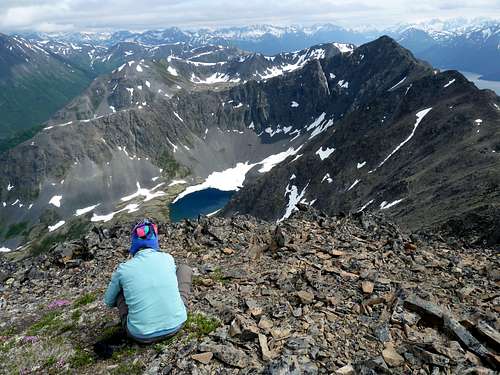
Similar to the north fork just above, reach the trailhead for the south fork from the small town of Eagle River (about 15 miles northeast of downtown Anchorage on the Glenn Highway). Rather than taking the Eagle River Road to the nature center though, take the Hiland Road which branches east (right) off the Eagle River Loop Road immediately after the southern exit for Eagle River. Hiland Road weaves through small neighborhoods and enters the South Fork valley, where signs mark the trailhead. The main trail that continues up the valley goes around private property, and after 5 miles reaches Eagle Lake, and just over the next hill is Symphony Lake. This is a beautiful area with access to the popular musical group, including Cantata Peak, Calliope Peak, Triangle Peak, Eagle Peak, Flute Peak and Hurdygurdy Mountain). Flute Peak, which is accessed by continuing past Eagle Lake to the head of the Valley (scramble up the left side of the waterfall) and up the Flute Glacier, definitely offers the best mountaineering and alpine climbing around. With a handful of decent 5th class routes with steep snow/glaciers, few people get to visit this remote summit. Eagle Peak is also a worthy objective with incredible views. Most of these peaks make extremely long day trips and are more pleasant as backpacking objectives.
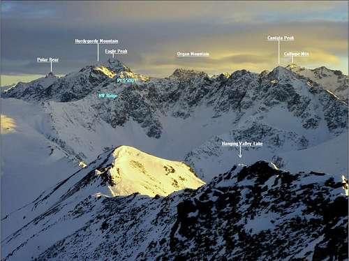 South Fork Eagle River Peaks South Fork Eagle River Peaks |  Sunset on Eagle Peak Sunset on Eagle Peak |  Cantata from the Northwest Cantata from the Northwest |
Ship Creek Valley
 King Salmon in Ship Creek
Perhaps the largest drainage basin within the heart of the Chugach State Park is Ship Creek, which runs west and goes right through downtown Anchorage. In fact, you will typically find hundreds of people fishing along the downtown banks of Ship Creek at high tide every day during summer. This is a good king salmon run, and the only urban king salmon run in the world! I myself caught a 35 pound King in late June one time I was in Anchorage. The bait shack right there has all inclusive rentals with the fishing license included for about $75 for a day. If you catch a fish...it's more than worth it. If not, well at least you tried!
Few people hike all the way up Ship Creek to access anything since the trail that once followed the entire length of the valley has long been in a state of disrepair, very muddy, and largely overgrown. The only major peak that likely requires utilizing at least part of Ship Creek would be Organ Mountain, which is most easily approached from the south via Ship Creek. However climbers will utilize the Bird Valley Trailhead, and hike over Bird Creek Pass to avoid the bushwhacking in the lower ~20 miles of Ship Creek. That being said, Organ Mountain is a gorgeous peak and worthy climbing objective with lots of first ascent potential. If you do decide to venture deep into the Ship Creek Valley, do yourself a favor and go in early spring when snow covers all the brush. The skiing would be easy as well. The Ship Creek drainage has small developed trailheads at Arctic Valley/Alpenglow ski area (access to Rendezvous Pass and small hiking peaks) and below Snowhawk Valley (muddy trail access to Temptation and Tanaina Peaks; special JBER access pass required).
 Organ Mountain from the route up Eagle Peak
Campbell Creek Zone
The area at the far western edge of Chugach State Park abuts large residential areas. Numerous trails weave around the southern Chugach Front and provide easy, quick hikes and shorter peaks like Flattop Mountain (the most popular peak in Alaska), O'Malley Peak, Wolverine Peak, and Avalanche Mountain. Most peaks in this area are at or below 5,000 feet in elevation and can be done after a day at work in summer. The top trailhead in this area is Glen Alps at 2200 feet, near the upper end of Toilsome Hill Drive--any cab driver can get you there--with trails fanning out along Campbell's south and middle forks to Flattop Mountain, Powerline and Ship Creek Passes, and the Williwaw Lakes. The North Fork of Campbell Creek is accessed from the Prospect Heights and Basher trailheads, needing a JBER access pass for fully legal access. The biggest peak in the area, Mt. Williwaw, makes a nice overnight trip or a longish day and can be approached from any of these trailheads.
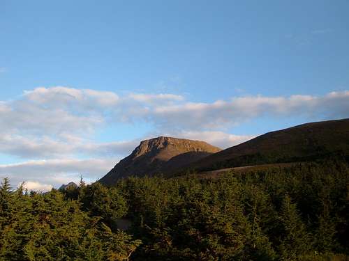 View of Flattop Mountain from near the parking area
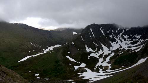
Rabbit and McHugh Creek Valleys
These two valleys both have a great trail through them, and both terminate at Rabbit Lake at the foot of the two Suicide Peaks, both of which are excellent scrambles. The trail along Rabbit Creek starts at the end Canyon Road, unpaved but usually reachable by two-wheel-drive vehicles. The highly developed McHugh Creek trailhead is on the shore of Turnagain Arm, at milepost 112 of the Seward Highway. Note the trailhead for the Rabbit Lake Trail that follows Rabbit Creek is at nearly 2,000 feet elevation, while the trail up McHugh Creek starts at sea level. Of the peaks near Rabbit Lake, South Suicide is the easiest, with a good Class 2+ Route, while North Suicide is Class 3, and slightly higher in elevation. The best routes on Ptarmigan Peak are likewise Class 3 scrambles. Rabbit Lake is a beautiful spot to camp or fish as well, and can be reached with just a couple hours hiking.
 Hiking up South Suicide Peak
Falls Creek Valley
Falls Creek is a steep, short trail that starts along the Seward Highway at sea level (limited parking, no fee), and terminates at Falls Lake after just 2.5 miles. This provides access to Peak 3920 and also is another access route for the Suicide Peaks, albeit one with an unrelenting vertical mile of elevation gain.
 Hiking up the Falls Creek Valley
Indian Valley
Fifteen miles after leaving the southern edge of Anchorage, at mile 103 of the Seward Highway, a turnoff by the Turnagain Arm Pit (BBQ) takes you a mile inland to the Indian Creek trailhead (no fee). One trail from here goes over Powerline Pass to Glen Alps, making a nice traverse and offering a side trip to inspiringly-named Homicide Peak. The other, nicely laid out with multiple bridges, takes you six miles to gorgeous tundra at Indian Creek Pass, with access beyond to Upper Ship Creek. Indianhouse Mountain is also accessed from Indian Valley, but not from this trailhead.
 Indian Valley from Indianhouse Mountain
Bird and Penguin Creek Valleys
Continuing east along the Turnagain Arm, you will reach the tiny settlement of Bird, where the Bird Valley Trail heads north. As stated above in the information for Ship Creek, this is the best way to access upper Ship Creek. At the mouth of the valley, excellent, short but steep trails up Bird Ridge and Penguin Peak offer a good workout, and stunning views across Turnagain Arm. Branching off to the east a couple miles above the town is the Penguin Creek Valley, where a primitive path gets you through the almost impenetrable thickets in this area and accesses the rough, lonely country around Bird and Nest Peaks. Also in this area, if you're lucky, you can watch the bore tide from Bird Point just a few more miles to the east along the highway. For more information about bore tides see the link below. The Turnagain Arm is one of the best places in the world to see these rare events, with bore tide waves sometimes over 10 feet high, and very popular with kite/wind surfers.
 Looking into the Penguin Creek drainage from Penguin Peak
Girdwood/Alyeska Zone
This is probably the most popular part of Chugach State Park that you access via the Seward Highway along the Turnagain Arm. The small town of Girdwood has a few services, and a great cafe. As described above in the North Fork Eagle River section, the Iditarod National Scenic trail more or less begins here in Girdwood and connects over to Eagle River. However most people will drive up the Crow Creek Road to it's end below Goat Mountain, where the Crow Pass hiking trail then starts. It's a nice short hike to Crow Pass and the hut, and from there you can climb one of many different peaks including the rarely climbed Rook Mountain, as well as Jewel and Summit Mountains on the east side of the pass. On the west side, Magpie and Crow Peaks are good scrambles. Most hikers trek to the pass to see an up close view of the Raven Glacier, which makes the hike more than worth it by itself. In winter and early spring, the Alyeska ski area is a great ski hill for more advanced skiers, as the lines are steeper than the average lines in resorts found in the lower 48. The Hotel Alyeska, anchoring the resort, is the starting point for the Winner Creek Trail, leading in about ten miles to the lake-dotted tundra of Berry Pass, thence onward to the upper Twentymile River drainage.
 Rook Mountain from Crow Pass
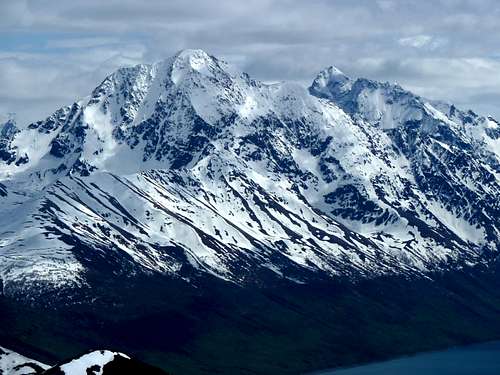
Central Chugach Mountains
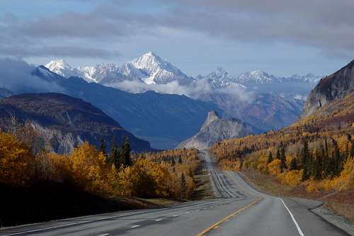
The Central Chugach is where all the highest mountains in the range are found, like Mount Marcus Baker (13,176 feet), Mount Thor (12,521 feet), and Mount Valhalla (12,135 feet). It is the Central Chugach that widen the eyes of climbers driving into the state via Glennallen, shooting up pinnacles and spires just to the left of the Glenn Highway. A few good-sized peaks on the northern margin of the region can be accessed by from this road, although this will generally entail a packraft or snow-bridge river crossing and an arduous bushwhack.
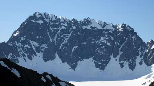
 Amulet Peak (8290') is a fine mountaineering objective that rises above the Glenn Highway 110 road miles northeast of Anchorage (early September photo).
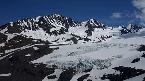
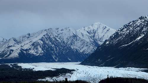
Most people venturing into this part of the range are likely attempting the even higher summits to the south, such as Mount Marcus Baker, the highest peak in the Chugach. Also, most people will opt for a ski plane approach, unless you have the time and energy for at least a week of difficult terrain in both directions to get to an objective in the Central Chugach icefields. Even if that's the case, the only real feasible way to hike in for the area around Marcus Baker is via the Matanuska Glacier starting from the Alaska Highway. Be sure you are allowed to park at the popular Matanuska Glacier trailhead though, since it's private property you have to pay a fee to access the glacier here. Another route that has been done to access Marcus Baker is the Knik Glacier, involving some 40 miles of glacier walking to get somewhere close to Marcus Baker.![Matanuska Glacier View]() Matanuska Glacier View
Matanuska Glacier View![HarvardGlacier]() Looking south down Harvard Glacier on a clear day deep in the central Chugach
Looking south down Harvard Glacier on a clear day deep in the central Chugach
 Matanuska Glacier View
Another option, that may or may not make much sense, is to take a boat all the way to the head of College Fjord and finagle a route north up one of the tributary glaciers of the Harvard Glacier. Although this would be the shortest approach to Marcus Baker without a plane, this method would be borderline crazy since the boat ride likely isn't much cheaper than the plane ride, and the Harvard Glacier would be a real pain in the ass to walk on due to huge crevasses that span the entire width of the glacier. Plus there is usually a 100 foot vertical wall of ice at the toe of the Harvard Glacier you'd have to navigate just to get off the boat! Few attempts have been made on Marcus Baker entirely of foot.
 Looking south down Harvard Glacier on a clear day deep in the central Chugach
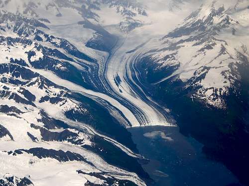 This is what you would contend with at the toe of the Harvard Glacier This is what you would contend with at the toe of the Harvard Glacier | 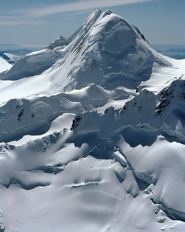 Mount Goode - Another big peak in the Chugach Mount Goode - Another big peak in the Chugach |
Cool Trip Report for Mount Marcus Baker
Good report from a bunch of guys with tons of money skiing all around the central Chugach
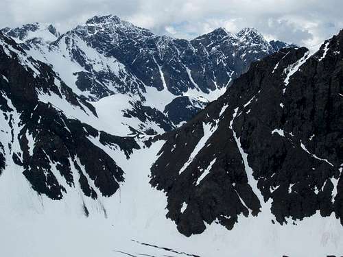
Moving east, Mount Thor is the second highest peak in the Chugach. This mountain has a somewhat more reasonable walk in approach than Marcus Baker, utilizing the Nelchina River Trail that starts off the Glenn Highway a couple miles west of the Eureka Roadhouse. It's a 32 mile hike to the base of Mount Thor from the road, following a trail to Goober Lake, then down a 1,200 foot gully to the Nelchina River and up the west side of the river to the tow of the Nelchina Glacier. The last bit of the approach follows up the small Sylvester Glacier right to the base of Thor's reasonable north ridge. To the south of Mount Thor lies a huge ice field some 600 square miles in size extending all the way to Columbia Bay and the Valdez Arm. Few, if any climbers have done much in this area, however heli-skiers out of Valdez do sometimes visit this area from late winter through summer.
Southeast Subregion of Central Chugach:
Alaska Highway 4 (the road to Valdez) provides reasonable access to some of the lower peaks and valleys in the far northeastern part of the central Chugach. However the group of mountains between Valdez and the mouth of the Copper River is another area rarely visited by hikers or climbers, but more frequented by heli-skiers. Basically...just be rich and you can explore this area!
 View of Mount Thor
One of the few reports online for Mount Thor
Southeast of Valdez is the cute fishing port of Cordova, reachable by ferry or by the occasional jet to its Merle K. "Mudhole" Smith Airport (CDV). There are trails to the high country from the town itself and from the Sheridan Glacier terminus a dozen miles to the east, but the extreme ruggedness of this stormy, rain-soaked coastline make it a challenging area to explore. It does not lack for scenery.
 Sheridan Glacier and Peak 6523, from the access trail near Mudhole Smith Airport (June).
Knik-Matanuska Triangle: A distinct appendage of the Central Chugach is the rugged triangle of six and seven thousand foot mountains between the Knik and Matanuska Rivers, west of the Metal Creek canyon. Though not particularly remote, the river barriers, coupled with the proximity of more easily accessible mid-sized peaks surrounding the Matanuska Valley, make this an overlooked 200 square miles of mountains. The biggest peak in the region, by a considerable margin, is known as Ice Cream Cone or Skybuster (8675'), a challenging summit with ascents reported in the AAJ in the 1960s and 2000.
Lazy Mountain/McRoberts Trailheads
This pair of trailheads near Palmer, Alaska offer the only easy access to the triangle. The trailheads are linked by a short trail, and both access the Lazy Mountain/Matanuska Peak trail network. Reach the trailheads from Clark-Wolverine Rd. or Smith Drive of the Old Glenn Highway just east of Palmer. Bring $5 or purchase a Mat Su Borough annual parking pass here. Matanuska Peak, known to some as Byers Peak, is the biggest objective immediately available from these trailheads. Apart from the borough-owned trailheads, land in this area is mostly state-owned, but is not park land.
 Matanuska Peak
Knik River Public Use Area
Those with ATVs can also access the mountain triangle between the Knik and Matanuska Rivers by launching from a trailhead at the end of Sullivan Avenue, off the Old Glenn Highway just north of the Knik River. From here there is a route running about 22 miles, first along the river and then turning north by the Knik Glacier terminus into lower Metal Creek. It is the RS 2477 right of way shown on this map. This is a very wet route with stream crossings up to four feet deep, not to be confused with a hiking trail. It's been used by fat tire bikers after freezeup.
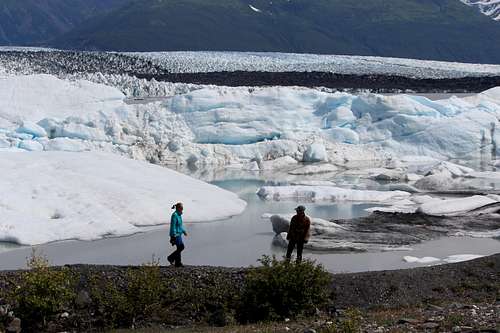 Knik Glacier terminus
Eastern Chugach Mountains
This region is about equally divided between Wrangell-St. Elias National Park (to the north of the crest) and Chugach National Forest (to the south). It comprises about 4000 square miles and has no roads, unless you count a spot where the Copper River Highway (Alaska Highway 10) briefly makes landfall on the east bank of the Copper River--and even that stretch of road has been unreachable for years due to bridge collapses in the Copper River Delta. There are no trails either. For a great photographic report of an intrepid 33-day odyssey through the region, go here. As for the authors of this page ... yeah...we haven't ever been there, and know next to nothing about this area. Someone want to chime in?
Chugach Mountains Overview Map (Western and Central Only)
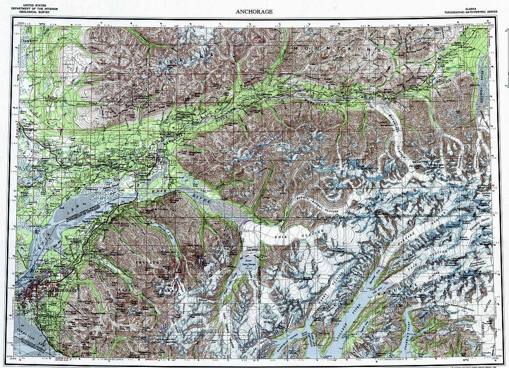 Chugach Mountains Overview Map - Click to Enlarge
Camping/Red Tape
Camping locations are abundant but range from primitive to very primitive. The detailed information about provided camping sites can be found at the Chugach state park website: Chugach State Park Camping Information Camping is permitted throughout the Chugach Mountains, not just at designated facilities. Campers should be aware of land ownership before making use of the terrain. Leave No Trace attitudes are strongly supported in Alaska. Depending on where you find yourself in the mountains, different regulations apply. Realize that besides the National Forest and State Park, many private owners exist as well.
Chugach State Park: The following are generalizations: -Most State Park trailheads require a $5.00 parking fee per vehicle. You can get an annual pass for $50.00 from various locations including the REI in Anchorage, or purchase one online. Some trailheads (e.g. Pioneer Ridge) are regulated by the Mat-Su Borough and may charge a few dollars not covered by the annual pass. Other trailheads such as Arctic Valley are privately owned and also charge a separate fee. Always read the trailhead markers carefully to see what fees are required. Plan ahead and bring cash. -Firearms are allowed, but target shooting is strictly prohibited within the Chugach State Park. Outside the state park in the National Forest, few rules govern the land. It's up to you to keep the area clean and wild. Pack out your trash, and follow good morals (ie. don't kill anyone)! -Hunting is only allowed during seasons permitted by the state, and only in the locations the state defines. Hunting is strictly regulated in Alaska. Read the regulations carefully before planning a hunting trip in the state. -Open fires are only permitted in areas along the shorelines below high-water mark and in designated fire pits. -Destroying, altering, or removing vegetation and landmarks is prohibited. See the State Park website for more up-to-date and accurate information.
Chugach National Forest: -Firewood may only be gathered from dead trees and may not be sold -Motorized vehicles should not wander off designated trails
Other Areas: Few regulations exist for the unprotected areas of the Chugach mountains, but explorers need to be aware that few boundary markers distinguish private land from public. Many Alaskans value their privacy and don't look favorably upon trespassers. Be especially careful of this issue along the northwestern edges of the range, such as the Hunter Creek drainage.
Chugach Terrain and Weather
Traveling in Alaska on foot can be very challenging. Very little flat grassland exists, especially in the Chugach Mountains. Explorers can expect to encounter a variety of terrain. The following are personal commentaries and observation by Matt Lemke on dealing with Alaskan wilderness. Terrain types have been divided up into two rough categories.
Lowlands
Creeks – Will vary in size from barely discernible trickles to impassible floods. Creeks are encountered all throughout the Chugach. Bring extra shoes or plan on occasional wading when traveling by foot. Creeks are usually snow melt or glacier fed, and will be more likely to flood during hot days and after heavy rain.
River – Vary in size and intensity. Typically glacier fed. Some rivers like the Eagle River are only fordable in certain locations. Many rivers are wide and shallow. Typical Chugach rivers are surrounded by either gravel bars or mud. Gravel bars shift along with the force and whims of the water, usually causing the river to split into multiple sections called ‘braids’. Gravel bars usually make easy traveling. Mud embankments are usually found closer to the coast and can be deep. Exercise caution.
Marsh - Much of the lowlands of Alaska are marshland. Expect different combination of water, mud, and vegetation. Vegetation can grow in lumps called 'tussocks' that float on the water. They are difficult to navigate. A similar form of floating vegetation known as 'Muskeg' also grows in the marshland. It usually resembles collections of tussocks that forms large pads of vegetation. These pads appear to be stable terrain but then give way. Most Alaskan marshland is extremely difficult to travel and can cause injury.
Alder Thickets – Ranges between small, ankle-high scrub brush to head-high impassible walls of vegetation. Alder bushes can alternate between being passable and impassible within a few yards. Travel here is frustrating overall.
Forest - Chugach forests are usually composed of black spruce, white spruce, and birch. White spruce and birch forests are usually very passable and pleasant to travel. Black spruce forests are usually located in tundra and marshland and are very difficult to travel.
Highlands
Scree, Talus, and Moraines - Broken up rock, usually due to glaciation that has carved out massive amounts of rock and deposited them in lateral, terminal or medial moraines. Also forms when unstable sections of a mountain drop chunks of rock over long periods of time, creating a slope of loose chunks of rock of all sizes. Scree tends to be small, loose rocks, while talus is closer to large rocks or boulders in size. Both can be dangerous to cross, but they often make the only feasible route through a section of terrain. As long as care is taken it can usually be crossed without incident.
Mountains - The rocks composing the mountains in the Chugach are largely metamorphic, and heavily carved by glaciation. They tend to take on the classic upside-down 'V' shaped ridge-lines. Mountains and ridges can make for easy travel once you get past the treeline, so long as you are comfortable scrambling on exposed areas. The rock is known as the 'Chugach Crud' here, and hand holds are sometimes exactly that...held in your hand! Exercise caution when scrambling more difficult and exposed terrain.
Alpine Meadow - Found between or on the slopes of many ridges, the alpine meadows are usually moss covered or only lightly vegetated. Some of the easiest (and prettiest) terrain to hike in the Chugach Mountains!
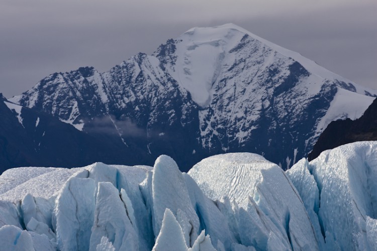
Glaciers - Heavy snowfall and year-round cold temperatures make the Chugach Mountains glacier factories. It is true that the in recent years the glaciers have receded dramatically, but icefields and mountain glaciers still dominate the upper reaches of the range. Many of the lowland rivers and creeks are derived from snow and glacier melt off. Glacier traverses/climbing requires mountaineering/glacier crossing experience. Glaciers can be some of the most dangerous terrain to cross because of ice, crevasses, and calving (ice boulders breaking away). Somewhat ironically, glaciers can make a good site for base camps when exploring the higher reaches of the Chugach mountains. Plan on using crampons, good boots and ice tools.
Weather
The climate in the Chugach Mountains varies considerably depending on which area you are in. The Western Chugach is much drier, and coincidentally (or luckily?), this coincides with the most popular part of the range. Snowfall tends to melt off in much of the Chugach State Park by mid June, and the long days allow for travel without headlamps at any hour. Rain is common in the summer but typically does not involve heavy downpours. Summer (June-August) snowfalls are uncommon below 5000 feet, and the short nights mean that deep overnight temperature dips are also unusual. Commonly, summer temperatures oscillate between 45 and 65 F at treeline in the Western Chugach. But you want to always be prepared for cold and wet conditions. Mid-September brings a very steep descent toward winter, with even the warmest and driest mountains in the park usually locked in deep powder by mid-October (although exceptional years do occur). Winter temperatures are not as extreme as in interior Alaska, but will often be well below zero. Strong winter temperature inversions are common, with the peaks sometimes 30 and 40 degrees warmer than the deepest hollows.
The central and eastern Chugach get much more precipitation at all times of the year. In fact, nearly the entire central and eastern Chugach, as one whole landmass can still be considered an icefield. The amount of snow these mountains receive annually can't be truly calculated since no weather stations exist. Snow is common all summer. You can bet that if it's raining along the Glenn Highway by the Matanuska Glacier, it's definitely snowing high on the mountains. Climbers venturing into this area will need a full array of high elevation mountaineering gear similar to what you would bring on Denali. You will be camping on glaciers the entire time you are here, even if you walk in from the Glenn Highway (since walking the Matanuska Glacier would probably be the only feasible way in). The typical summertime snow line during rain events is probably between 6-8k feet, depending on how warm it is. Below 5,000 feet in mid-summer it will almost always rain rather than snow.
Wildlife
Except where glaciated, the Chugach is well-endowed with wildlife. The range of the larger mammals is summarized below:
Grizzly bear: In their inland form or the larger coastal brown bear form, these are present throughout the range except for a few a few pockets near Prince William Sound. They show up in surprising places, including far above treeline. In areas of restricted visibility, it is best to take precautions against surprising them--make noise, carry bear spray, and learn what to do if you encounter one. Serious maulings, including fatalities, have occurred in the Western Chugach.
Black bear: Black bears are also present almost everywhere in the range. The drill for what to do in a black bear encounter is different than for grizzlies, and so it's worthwhile to learn to tell them apart, which is not quite as easy as commonly thought. Blackies are particularly dense around Girdwood in the Western Chugach.
Moose: Present nearly everywhere in the Chugach except around Prince William Sound. Moose can be quite ornery and a moose with murder in its eye is (or should be) as scary as any bear. Give them plenty of room or be prepared to jump behind a tree.
Wolf: Present from time to time in most of the range but rarely encountered. I have seen one in the Chugach in 30 years. They pose no appreciable risk.
Coyote: A relative newcomer to the area, but now found everywhere in the Chugach, although it it pretty rare to see one. They are about a third the size of wolves, but people still mistake them for one another.
Dall sheep: This white relative of the bighorn sheep of the Rockies is present throughout the Chugach. There is good viewing along Turnagain Arm if you look up the cliffs.
Mountain goat: Often confused with Dall sheep, these animals are often creamier in color and they have straight horns. They can be encountered almost anywhere in the range, but they don't usually coexist with Dall sheep. The sheep dominate the drier slopes and the goats are prevalent in the wetter, more maritime areas.
Lynx: The only cat in the range, found all over the Chugach but very hard to spot, although you may see tracks. From a distance they can look surprisingly tall, almost like a deer.
Wolverine: They exist, but you'd have to be incredibly fortunate to see one.
Deer: The Chugach historically had no deer, but tiny Sitka blacktail deer are starting to spread from Prince William Sound. You won't see any north of the Chugach crest.
Caribou, polar bear, mountain lion, musk ox, elk: Not present.
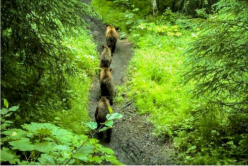 Grizzly bears on a trail in the Chugach foothills (photo: ADF&G trail cam).
External Links
Chugach State Park Official Website
Chugach Mountains on Peakbagger
Chugach Mountains on Wikipedia
Alaska Hike Search - Excellent source for tons of hiking trails
Very interesting geological information on the Chugach