
-
 3414 Hits
-
 81.84% Score
-
 14 Votes
|
|
Mountain/Rock |
|---|---|
|
|
46.49002°N / 22.67277°E |
|
|
Bihor / Alba |
|
|
Hiking, Skiing |
|
|
Spring, Summer, Fall, Winter |
|
|
5440 ft / 1658 m |
|
|
Topographic isolation: 5 km
Nearest higher peak: Curcubăta Mare / Nagy-Bihar (1849 m)
Prominence: 147 m![View of CurcubÄta Mare from the peak of Piatra GrÄitoare]()
View of Curcubăta Mare from the summit![Piatra Graitoare - view from south]()
Piatra Grăitoare - view from south![Waterfall Vârciorog]()
Waterfall Vârciorog![Rock outcrop on Piatra GrÄitoare]()
Rock outcropI give both the Romanian and the Hungarian versions of the geographical names. Why? The mountain is in Romania, but it was part of Hungary or the Hungarian Principality of Transylvania during 1000 years. And it is a favorite hiking destination for tourist who live in eastern Hungary and in Budapest.Romanian name of this mountain is Piatra Grăitoare. In Hungarian the mountain has a few various names:
• Zengő
• Zengő-kő
• Öreg-Bihar
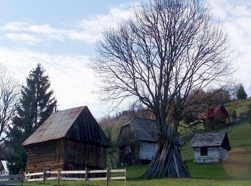
• Grejtor![The wooden church of FînaÅ£e/Fonóháza]()
The wooden church of Fânațe![Cardamine glanduligera]()
Cardamine glanduligeraThe land east from our mountain is the famous ethnogeographical region Țara Moților/Mócvidék. The inhabitants of this land are known as "Moți". They are a special group of Romanian people, living in scattered hamlets on mountain highlands in archaic living conditions. West to the mountain there is the valley of Crișul Negru/Fekete-Körös. Today this valley is mostly populated by Romanians. But before the 16th century Hungarians were the majority here yet. ![CurcubÄta Mare / Nagy-Bihar]()
The view of Curcubăta Mare![Meadow with junipers]()
Meadow with junipers• N: Vf. Poienii/Mező-havas (1625 m) and Vf. Cârligatele/Horgas-havas (1694 m)
• NE: Silha (1670 m)
• E: Muntele Mare/Öreghavas (1826 m) and Vf. Poienița/Poienica-csúcs (1437 m)
• S: Curcubăta Mare/Nagy-Bihar (1849 m)
• W: Pleșu/Szár-tető (1112 m)![Hill farm on Piatra GrÄitoare]()
Hill farmRoad no.75 connects Lunca/Biharlonka with Turda/Torda. From any of the directions you can get to the mentioned two trailheads.
Trailhead of red trail is at Şaua Vârtop/Bihar-hágó. Trailhead of the yellow trail is in Arieșeni/Lepus.![View of the Åaua Vârtop ski resort]()
Şaua Vârtop ski resort![ArieÈeni - a typical settlement of the MoÈi]()
ArieșeniThere is no tourist hut on the mountain. But you can find several lodgings either at Şaua Vârtop/Bihar-hágó or in Arieșeni/Lepus.![Wood anemone (Anemone nemorosa)]()
Wood anemone (Anemone nemorosa)Mountain rescue service is provided by Salvamont Bihor, for details see their website: www.salvamontbihor.ro
Nearest higher peak: Curcubăta Mare / Nagy-Bihar (1849 m)
Prominence: 147 m
Overview
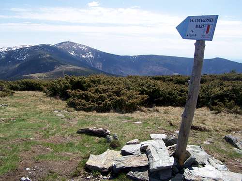
View of Curcubăta Mare from the summit
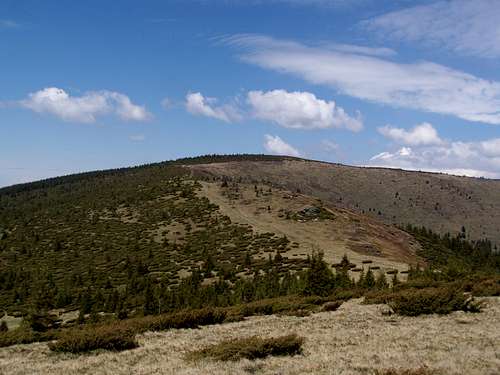
Piatra Grăitoare - view from south
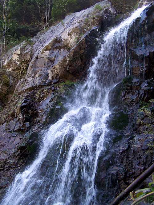
Waterfall Vârciorog
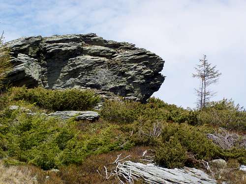
Rock outcrop
• Zengő
• Zengő-kő
• Öreg-Bihar
• Grejtor
This mountain is among the higher peaks of the Western Transylvanian Mountains with its elevation of 1658 meter.
I have an interesting old geography book of Hungary, published in 1905 in Budapest, in the times when this area was part of Hungary yet. In this book the highest mountain group of the Western Transylvanian Mountains is referred as “Hármas Bihar-csúcs”. It could be translated as Bihar Trimontium or Bihar Triple Mountain. The 3 summits of Bihar Trimontium are the following:
• Curcubăta Mare/Nagy-Bihar – the highest peak
• Piatra Grăitoare/Öreg-Bihar (as called in the book) but now it is generally referred as Zengő
• Vf. Tăul Mare/Zanoga-csúcs
Piatra Grăitoare/Zengő is between Şaua Vârtop/Bihar-hágó and Curcubăta Mare/Nagy-Bihar (1849 m). Şaua Vârtop/Bihar-hágó is a mountain pass where road no. 75 crosses the Western Transylvanian Mountains. There is also a smaller ski resort here. It’s only 3 km distance from the pass to the peak of the mountain. The demanded elevation gain for this tour is 500 meter. The peak can be a hiking destination in itself, but more “serious” hikers go on for the highest peak of the range, to Curcubăta Mare/Nagy-Bihar, in southern direction. It is an additional 6 km to the already done 3 km. And likely the hiker wants to return from Curcubăta Mare/Nagy-Bihar to its starting point, so on this route an 18 km walk should be expected (marked red trail).
The top of the mountain is dotted by juniper bushes. The south eastern hillside is grassy, while the rest of the mountain is covered with spruce forest.
The huge mass of the mountain is built from schist. There are a few rocky outcrops where this rock can be seen well, but not these rocks define the character of the mountain. Still one of the attraction of Piatra Grăitoare/Zengő is in connection with its rocks: there is a valley on the south eastern side of the mountain with the stream called Valea Vârciorog/Vércsorog-patak. This stream forms a beautiful 15 meter high and waterfall on the rocks of the deep valley. The area around the waterfall is defined as a protected natural area. The waterfall can be easily reached from eastern direction, from Arieșeni/Lepus, on the marked yellow trail. Unfortunately it is not so easy to visit this beautiful attraction and the peak within a single tour. There in no trail at all between the waterfall and the peak. There is a hill farm on half way between the waterfall and the peak. The waterfall and the hill farm are connected with a road, though from the hill farm to the peak there is no trail at all, just the steep hillside. Despite the expected difficulties I hiked from the peak to the waterfall. But I didn’t dare to go close to the hill farm: I didn’t want to risk meeting with shepherd dogs. So I bushwhacked through the nearby spruce forest (risking to meet bears).
People
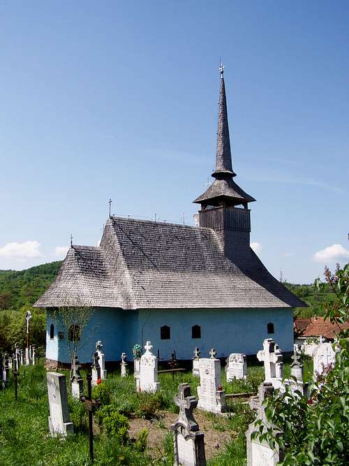
The wooden church of Fânațe
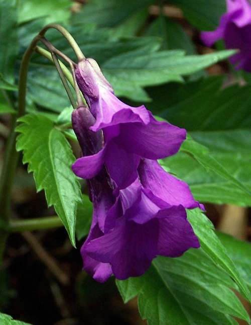
Cardamine glanduligera
At the western foot of the mountain a mining town: Băița/Rézbánya has been founded in the 16th century which had Romanian population with Hungarian and German minority. The miners of this town explored Piatra Grăitoare/Zengő and mined various ores: copper, silver, gold, molibden and bismuth. The peak of mining activities was in the 1950's when 30000 people worked in the uranium mines of the mountain.
View from the Peak
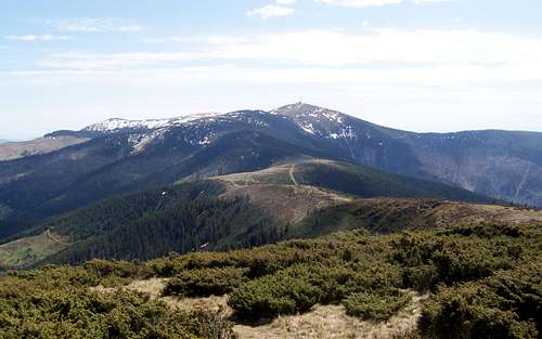
The view of Curcubăta Mare
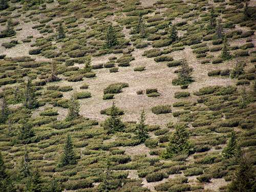
Meadow with junipers
• NE: Silha (1670 m)
• E: Muntele Mare/Öreghavas (1826 m) and Vf. Poienița/Poienica-csúcs (1437 m)
• S: Curcubăta Mare/Nagy-Bihar (1849 m)
• W: Pleșu/Szár-tető (1112 m)
How to Get There
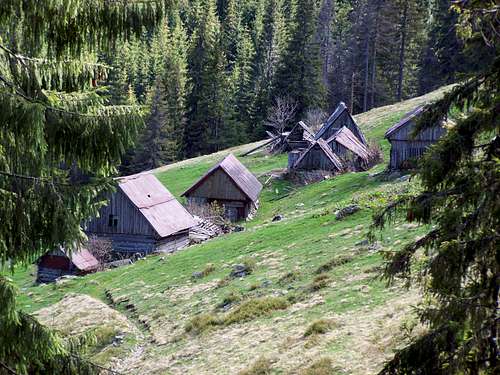
Hill farm
Trailhead of red trail is at Şaua Vârtop/Bihar-hágó. Trailhead of the yellow trail is in Arieșeni/Lepus.
Tourist Huts
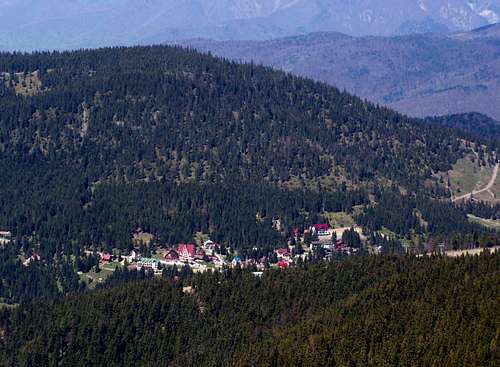
Şaua Vârtop ski resort
Arieșeni
External Links
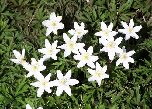
Wood anemone (Anemone nemorosa)
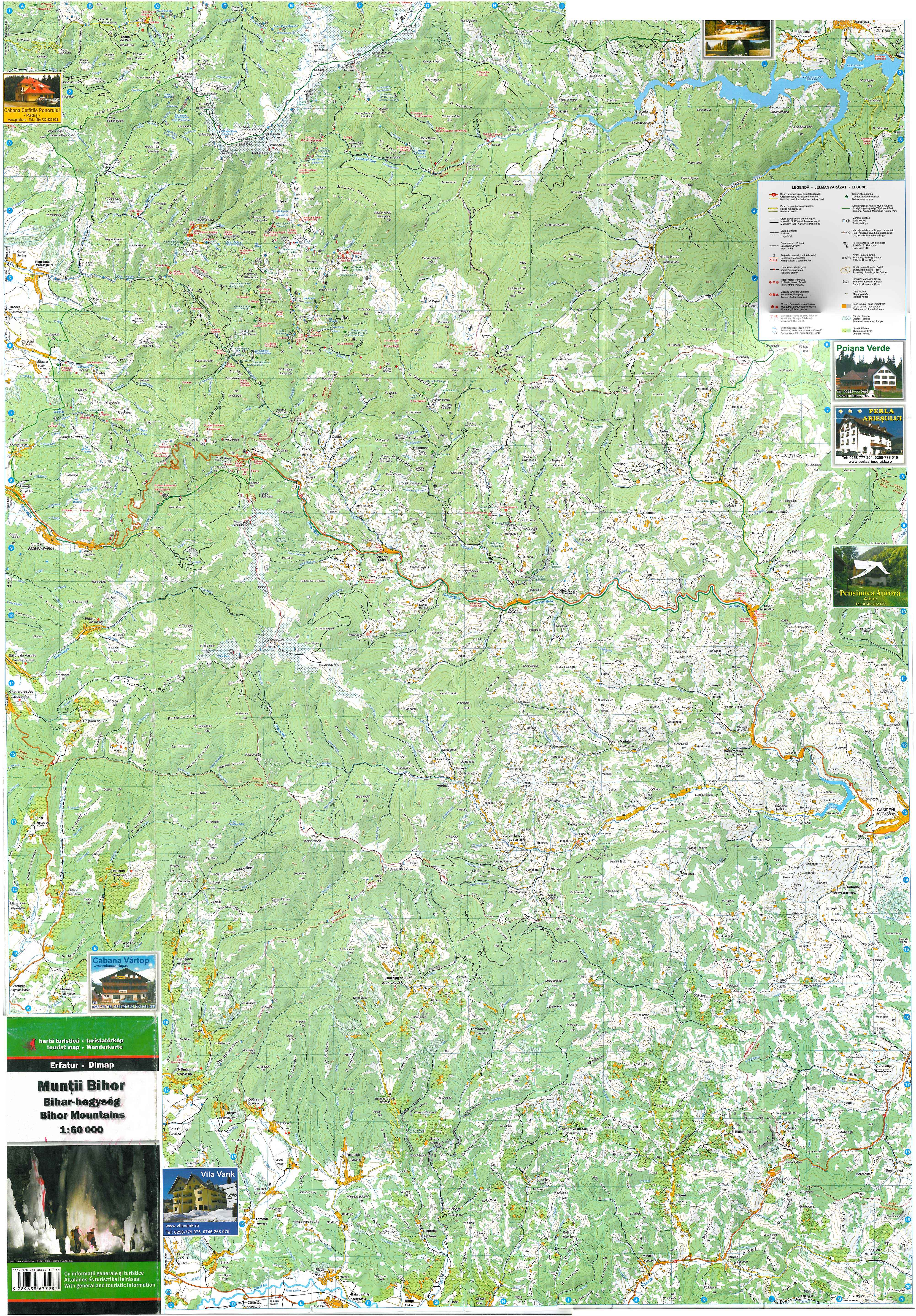
Online map: www.bihariturak.hu/sites/default/files/bihar-hegyseg_terkep_2008.jpg