
-
 3340 Hits
-
 78.27% Score
-
 9 Votes
|
|
Mountain/Rock |
|---|---|
|
|
46.66759°N / 22.64361°E |
|
|
Bihor |
|
|
Hiking |
|
|
Spring, Summer, Fall, Winter |
|
|
5331 ft / 1625 m |
|
|
Topographic isolation: 1.5 km
Nearest higher peak: Vf. Bohodei / Istenek havasa (1654 m)
Prominence: 145 m
![The valley of Dragan with Buteasa (1792 m)]()
The valley of Dragan with Buteasa (1792 m)Romanian name: Vf. Poienii
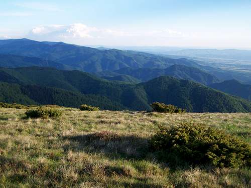
![The land of Pádis]()
Spotted Junipers on the flat summitHungarian name: Mező-havas
In the following text I give both the Romanian and the Hungarian versions of the geographical names. Why? The mountain is in Romania, but it was part of Hungary or the Hungarian Principality of Transylvania during 1000 years. And it is a favourite hiking destination for tourist who live in eastern Hungary and in Budapest.![The rocky Vf. Bohodei]()
The neighbouring peak - the rocky Vf. BohodeiThe western slopes of the summit is covered by pasture land, while the eastern slopes are covered by low bushes of junipers. This vegetation allows 360 degree panoramic view for its visitors. Since the summit is enough high, you can see many important summits of the Western Transylvanian Mountains:
![Soldanella]()
Soldanella![Blueberry - colored with the lights of sunset]()
BlueberryBorder of the Apuseni Mountains Natural Park is just over the summit of Vf. Poienii / Mező-havas.
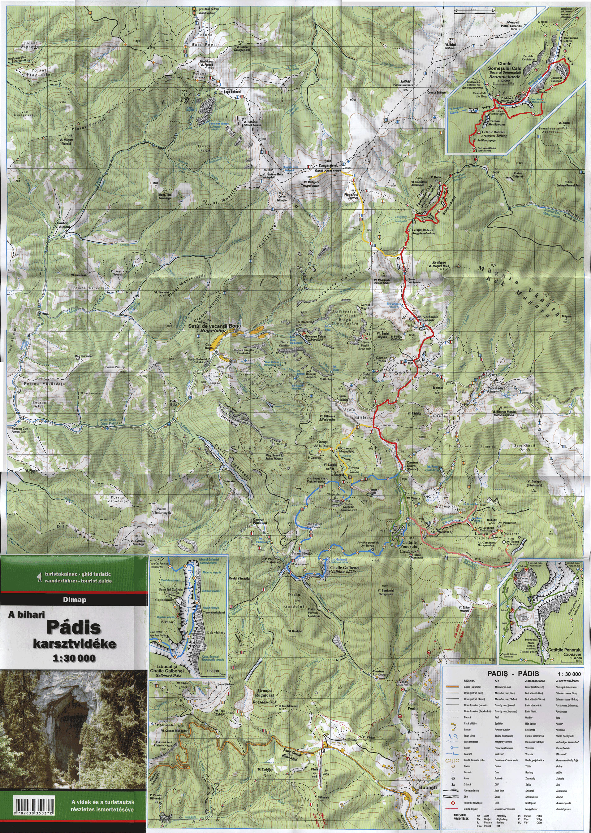
Map in scale 1:30000 about Padis: please click here!
Nearest higher peak: Vf. Bohodei / Istenek havasa (1654 m)
Prominence: 145 m
Overview
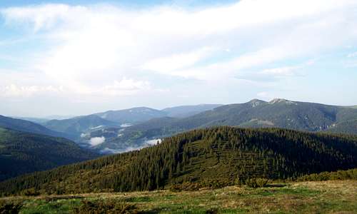
The valley of Dragan with Buteasa (1792 m)
Spotted Junipers on the flat summit
In the following text I give both the Romanian and the Hungarian versions of the geographical names. Why? The mountain is in Romania, but it was part of Hungary or the Hungarian Principality of Transylvania during 1000 years. And it is a favourite hiking destination for tourist who live in eastern Hungary and in Budapest.
Most of the Western Transylvanian Mountains are covered by forests. Exceptions are some inhabited and cultivated areas – and some higher mountain ridges. One of these higher grassy mountain ridges in the western part of the mountain range is a long U-shaped ridge that close in the valley of Drăgan/Nagy-Sebes.
This 18 km long grassy ridge has the following summits in sequence from northwest to northeast:
- Vf. Piatra Calului / Ló-havas (1463 m)
- Belvedere Raia / Édenkert (1395 m)
- Vf. Muncei / Kis-havas (1411 m)
- Vf. Poienii / Mező-havas (1625 m)
- Vf. Bohodei / Istenek havasa (1654 m)
- Vf. Fântâna Rece / Hideg-kút (1654 m)
- Vf. Cârligatele / Horgas-havas (1694 m)
- Vf. Briței / Sík-havas (1759 m)
- Vf. Stânişoara / Ugrókő (1683 m)
- Buteasa / Bocsásza (1792 m)
As you can see from this list, Vf. Poienii/Mező-havas is not the highest of the summits. But it is one of the summits that can be reached relatively easily.
Vf. Poienii/Mező-havas forms part of the watershed between Crișul Negru/Fekete-Körös and Crișul Repede/Sebes-Körös. Sebes-Körös is 209 km long river while Fekete-Körös is 168 km long. Though their sources are in Romania, their confluence is in Hungary.
On the Summit
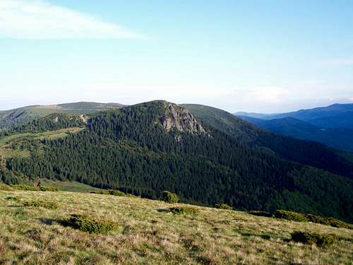
The neighbouring peak - the rocky Vf. Bohodei
- NE: Vlădeasa/Vigyázó (1836 m) and Buteasa/Bocsásza (1792 m)
- E: Vf. Briței/Sík-havas (1759 m)
- SE: Vf. Bohodei/Istenek havasa (1654 m)
- S: Vf. Cucurbăta Mare/Nagy-Bihar (1849 m)
- W: Vf. Pleşu/Szár-tető (1112 m)
Routes
The summit of Vf. Poienii/Mező-havas can be accessed from three directions on marked trails:From Stâna de Vale/Biharfüred. This is the shortest route. Distance: 2 x 4 km. Elevation gain 525 m.
From Saua Băiţa/Feredő-nyereg. This is the route with the smallest elevation gain. This trail has an exciting section on a sharp rocky ridge near Vf. Custurilor/Kusztura. Distance: 2 x 5 km. Net elevation gain 427 m. Cumulated elevation gain: 510 m
From Satul de vacanţă Boga/Bogatelep. Long approach from south. This route is recommended if somebody wants to hike from Satul de vacanţă Boga/Bogatelep to Stâna de Vale/Biharfüred. The effort to walk this long route is rewarded also by the rocky peak of Vf. Bohodei/Istenek havasa. Distance: 2 x 10 km. Net elevation gain 1105 m. Cumulated elevation gain: 1445 m.
All these 3 trailheads can be accessed with car, from western direction, on narrow but paved roads. These mountain roads are side-roads of the European transit road E79 that connects Oradea/Nagyvárad with Deva/Déva.
 Fresh green Fresh green |  Companion Companion |  Sunset Sunset |  Time to go home Time to go home |
Red Tape
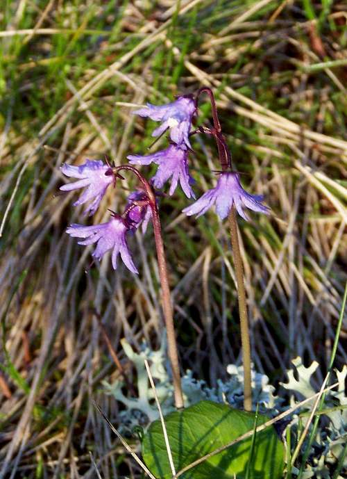
Soldanella
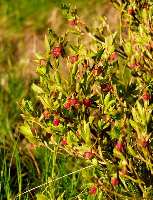
Blueberry
Bears and wolves live in this area – take care!
External Links - Maps
Map in scale 1:60000 about Bihor Mountains: please click here!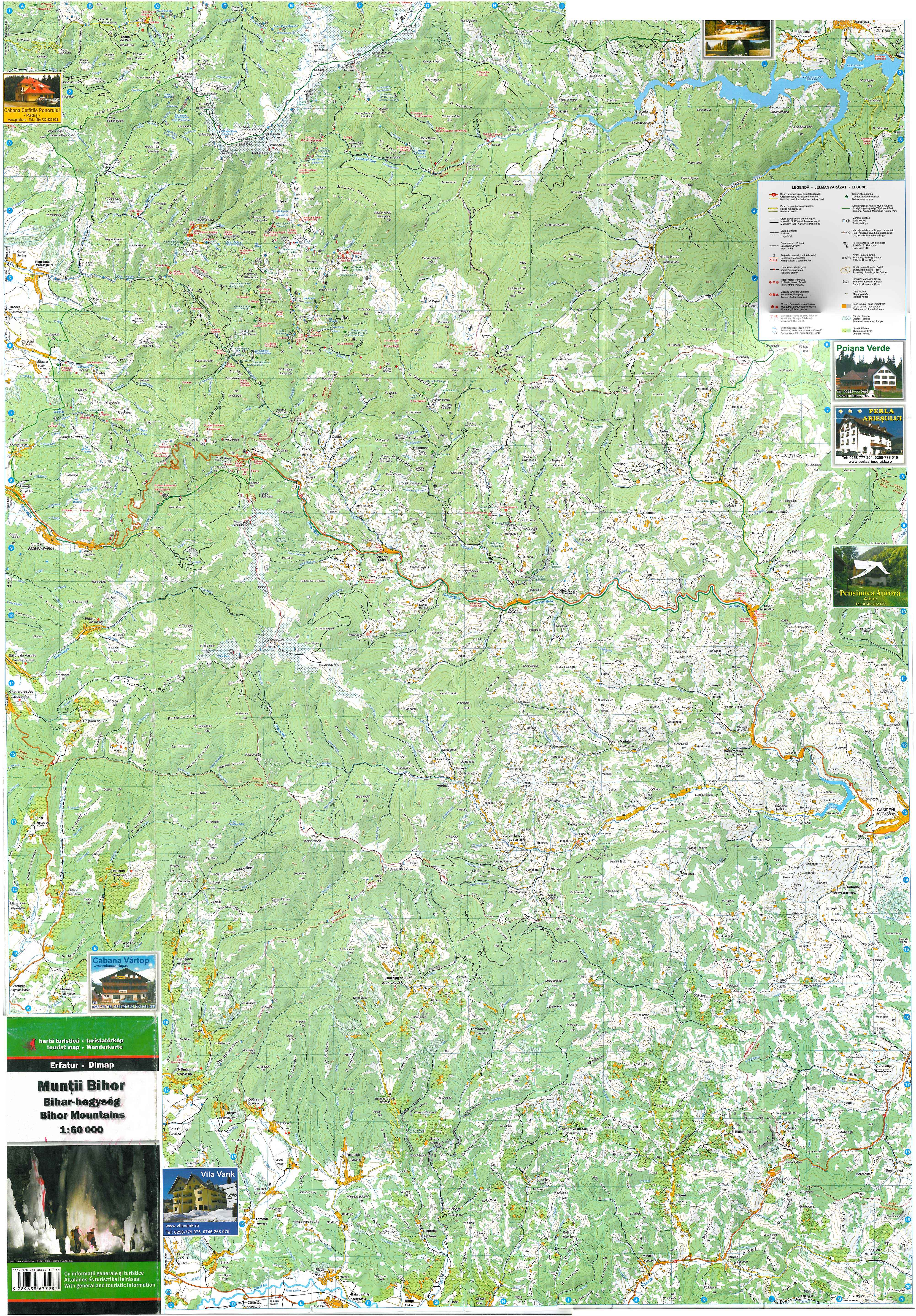
Map in scale 1:30000 about Padis: please click here!