-
 6443 Hits
-
 84.27% Score
-
 18 Votes
|
|
Mountain/Rock |
|---|---|
|
|
46.33774°N / 114.32529°W |
|
|
Ravalli |
|
|
Hiking, Scrambling |
|
|
Spring, Summer, Fall |
|
|
8650 ft / 2637 m |
|
|
Overview
Latitude & Longitude – 46.33774 N / 114.32529 W
Route Type – Scramble
Elevation – 8,650'
Class Levels – Class 2+ to 4
Length of Time Required To Complete Route – One Day
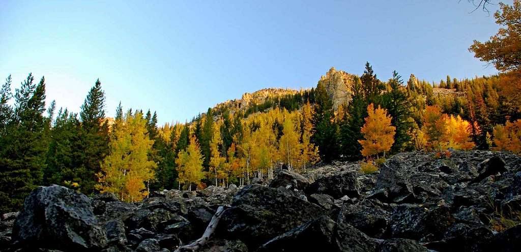
Sheafman Creek originates in one of the Bitterroot Mountain "closed-end" drainages – meaning there is no through-trail from Montana into Idaho over the west end of the canyon. As is true with some of the similar Bitterroot drainages, Sheafman Canyon is less visited than many of those that do have through trails.
Still, people do follow the recently-maintained trail to a group of lakes at the extreme west end of the canyon. One of them, Knaack Lake is a comparatively popular spot for weekend camping during the summer and early fall.
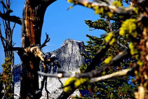
Rising high above the west end of the canyon and the group of lakes is Castle Crag that, because it can be seen from many points in the Bitterroot Valley, is a well-known landmark. But it is seldom climbed, being more than seven miles from the trailhead.
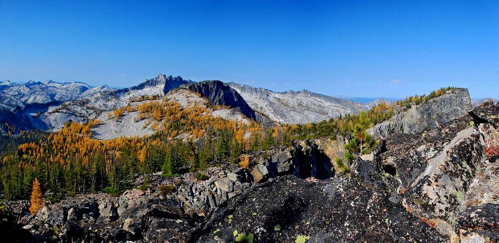
As for mountain peaks in the area of Sheafman Canyon, the easily-recognized Castle Crag receives most of the attention in spite of the fact that there are at least three other highpoints along the crest of the canyon's rim which are well worth visiting, one of which is Point 8650, or East Sheafman Peak as I call it.
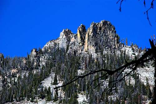
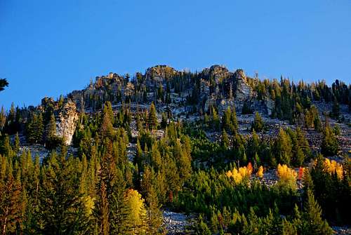
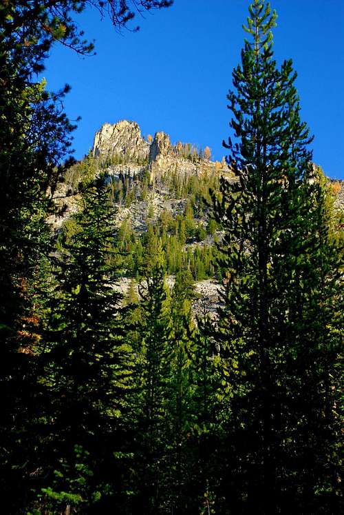
Sitting high on the canyon's north rim behind many gendarmes guarding its south side, the summit of East Sheafman Peak cannot be seen from the Sheafman Creek Trail. In fact, when climbing the South Face Chute, the actual summit remains hidden from view until one is on the ridge-crest of the rim.
In comparison with the eye-catching gendarmes and pinnacles a person sees while climbing toward the canyon's rim, when the summit finally becomes visible, it seems unimposing, almost a disappointment. But once the actual summit is reached any sense of disillusionment quickly evaporates.
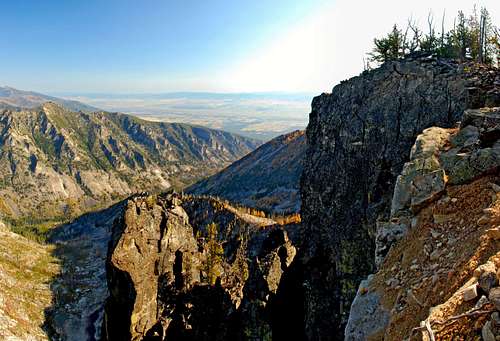
The north side of East Sheafman Peak is one of the most shear faces in the Bitterroots, dropping away in stages many hundreds of feet. Guarded by some truly gargantuan pillars and pinnacles, the north side of East Sheafman Peak will steal your breath and, if you're standing close to the edge, give you a case of vertigo you'll not soon forget.
Getting There
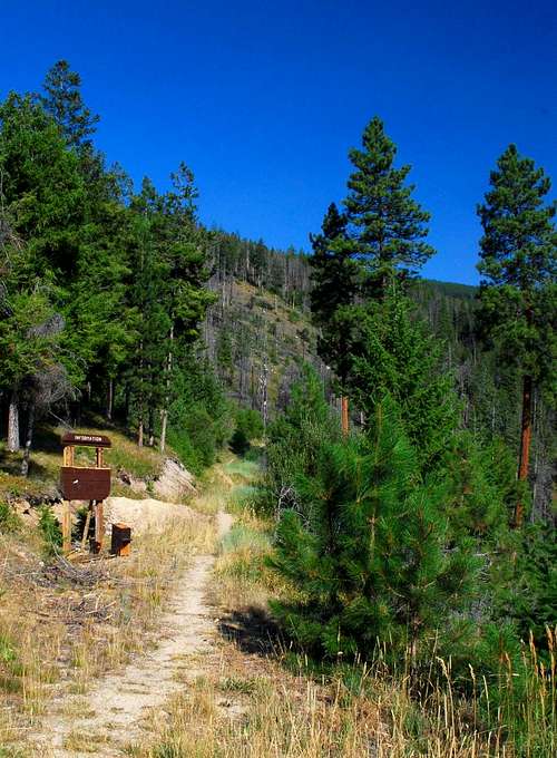
From Hwy 93 about 5 miles north of Hamilton, turn west at the Woodside Crossing (marked by a stop light) onto Dutch Hill Road.
In about 2.5 miles you will reach a T intersection. Turn right (north) onto Bowman Road and follow it as it completes two 90 degree turns (left then right – west then north).
In 1.2 miles turn left (west) onto the gravel West Cow Creek Road.
Staying on the main road, drive an additional 5 miles to the trailhead, which is marked (right side of the road) with a Forest Service sign.
Parking is available for several vehicles along both sides of the road.
Area Restrictions (Red tape)
Just over two miles from the trailhead you pass into an official wilderness area, The Selway-Bitterroot. All wilderness rules and regulations apply.
Additionally, the road to the trailhead is gated between October 15th and June 15th to provide a "partial" winter sanctuary for big game animals. What that means is, at least they won't be bothered by motorized vehicles; however hunters on foot and on horseback still have access during hunting season. I'm guessing the elk, deer, and goats must be pretty good at staying hidden in this canyon, because I've seen little evidence of stock animals in Sheafman Canyon.
Camping
About a half mile from the trailhead there is a much-visited overlook area where some camp, especially if they want an overnight with their small children. But as far as camping goes, it's not much.
Most people who camp in the Sheafman drainage set up in the fairly level grassy area just east of Knaack Lake. This is a much better spot for climbers to spend a night or two in the canyon.
The Routes
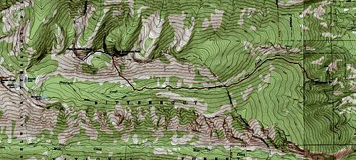
There are two good routes to the summit of East Sheafman Peak. The most direct leaves the well-maintained trail about 4 miles from the trailhead and uses a chute to reach a saddle on the ridge just west of the summit. This is a Class 2+ route.
The other route follows the connecting ridge between East and West Sheafman Peaks, and, though requiring more climbing skill (Class 3 to 4), is more enjoyable. Of course it is longer because it necessitates one to first summit West Sheafman Peak.
South Face
Approach – Trailhead to the South Face Chute
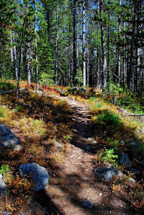
From the trailhead, follow the trail as it traverses northwest across the end of a ridge. As the trail curves west then southwest around the ridge, it loses a bit of elevation before beginning to ascend at a fairly consistent rate.
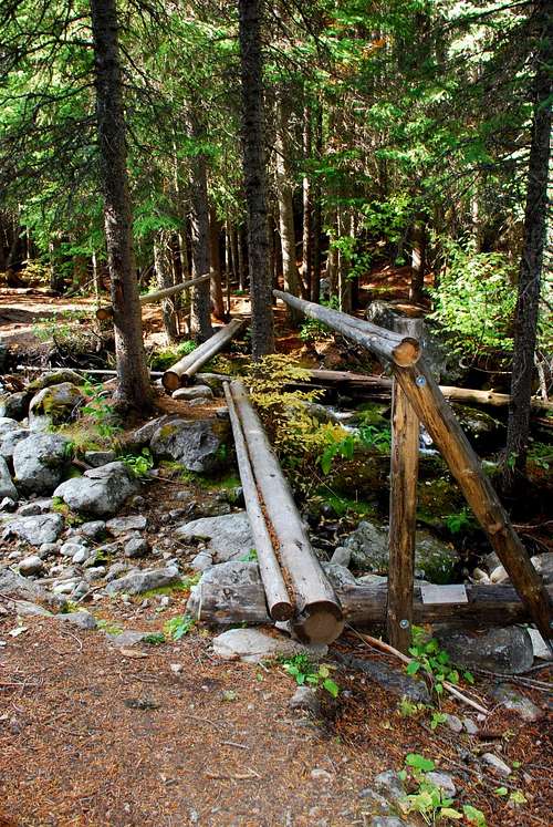
At a point slightly more than 2 miles from the trailhead – which also happens to be the wilderness boundary – the trail crosses to the north side of Sheafman Creek on a nice log bridge built by a local Boy Scout Troop.
Stay on the trail, now meandering in a westerly direction, until you reach the area of the chute. The spot – exactly 4 miles from the trailhead – is not marked in any way and, unless you've followed this route before, is most-easily found by using GPS coordinates (46.32941 N / 114.31845 W) and elevation (6,615 feet).
Climbers' Route – From the Maintained Trail to the Summit
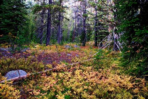
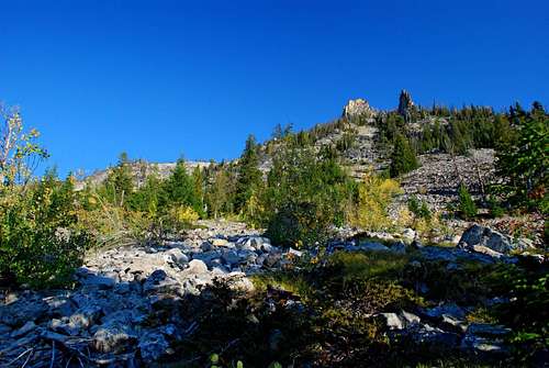
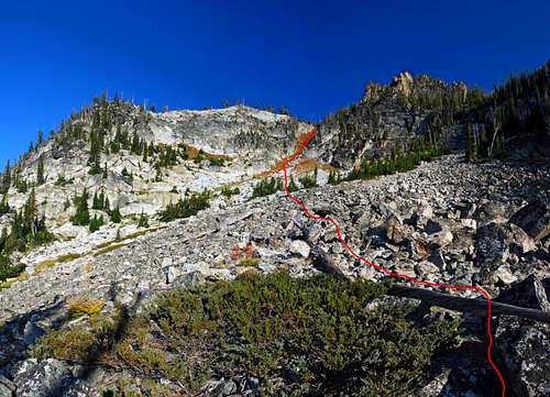
Leave the maintained trail, heading north-northwest through an open woods with little underbrush or deadfall. Keep this heading until you reach the edge of the forest in just a few hundred yards. Breaking free of the main forest, you will see a ridge to the north, topped with a couple of rock fins.
Traverse across the mixture of stable talus and groupings of trees until you're slightly past (west of) the fin-topped ridge. At this point the chute leading to the ridge-crest is easily visible. Pick a line toward the chute, avoiding obstacles whenever possible.
Once you enter the chute proper, you'll notice its sides are mostly formed by slab-granite. This is especially true of the west (left) side. Because the slabs are particularly steep in places, the easiest line to the ridge-crest is probably up the throat of the chute.
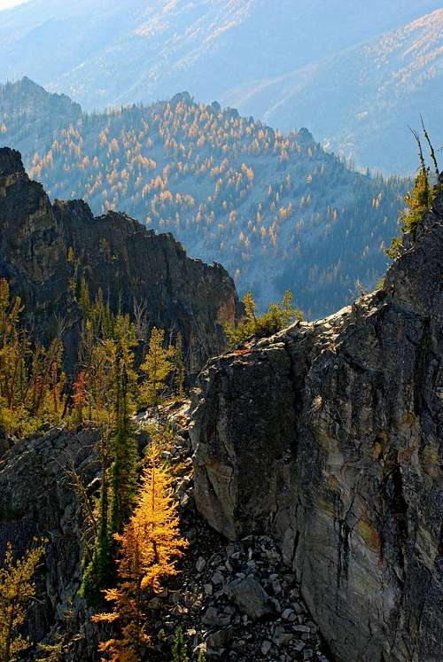
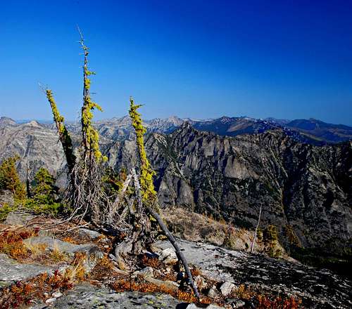
When you exit the top of the chute, hike through the open woods of Alpine Larch and Whitebark Pine in a northeasterly direction until you reach the ridge-crest. Make a hard right and make your way east-southeast through the small trees to the small, but obvious, summit block.
Connecting Ridge
Climbers' Route – From West Sheafman Peak to East Sheafman Peak
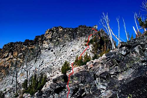
From the summit of West Sheafman Peak, head southeast along the ridge-crest. When you reach the edge of the summit area, down-climb the granite blocks – following small ledges and cracks – until you reach the talus.
Note: The down-climb is the crux of this route, and involves careful route-finding and climbing ranging from Class 3 to 4, depending upon the exact route you follow.
From the bottom of the down-climb, head southeast toward a place on the ridge-crest obviously unguarded by rock outcroppings.
When you reach the ridge-crest change your direction of travel to northeast and circumnavigate the large bowl, keeping it to your right (south).
As you skirt the bowl, slowly changing direction to east then east-southeast, traverse across the face of the highpoint on the ridge-crest to your left (north) and head directly toward the summit area of East Sheafman Peak.
Follow the ridge-crest upward through the open woods until you reach the small summit block of East Sheafman Peak.
When To Go
Winter is probably not a good time to try summiting this peak using the South-Face Chute. Though I saw no evidence of recent avalanche activity, it was obvious the chute has had activity in the past.
During the winter it would be safer (and advisable) to access the summit by first climbing West Sheafman Peak (from Knaack Lake) then following the connecting ridge. Even this has its own hazards, especially in the area of the ever-present cornices which form along the ridge-crest between the two summits.
The best times to climb East Sheafman Peak are in the spring when the snow is well consolidated, or during the summer and fall when here is little or no snow on the route.
Essential Gear
During the normal climbing season only sturdy footwear and weather-appropriate clothing is required for the routes to the summit of East Sheafman Peak.
On consolidated snow in the spring, you will need crampons and an ice axe to climb the South Face Chute. Following the connecting ridge between East and West Sheafman Peaks is likely to require the use of an ice axe in many spots and may also require crampons. I would certainly not climb either route without carrying both when snow is present at any elevation above 7,000 feet.
Route Statistics
South Face Route
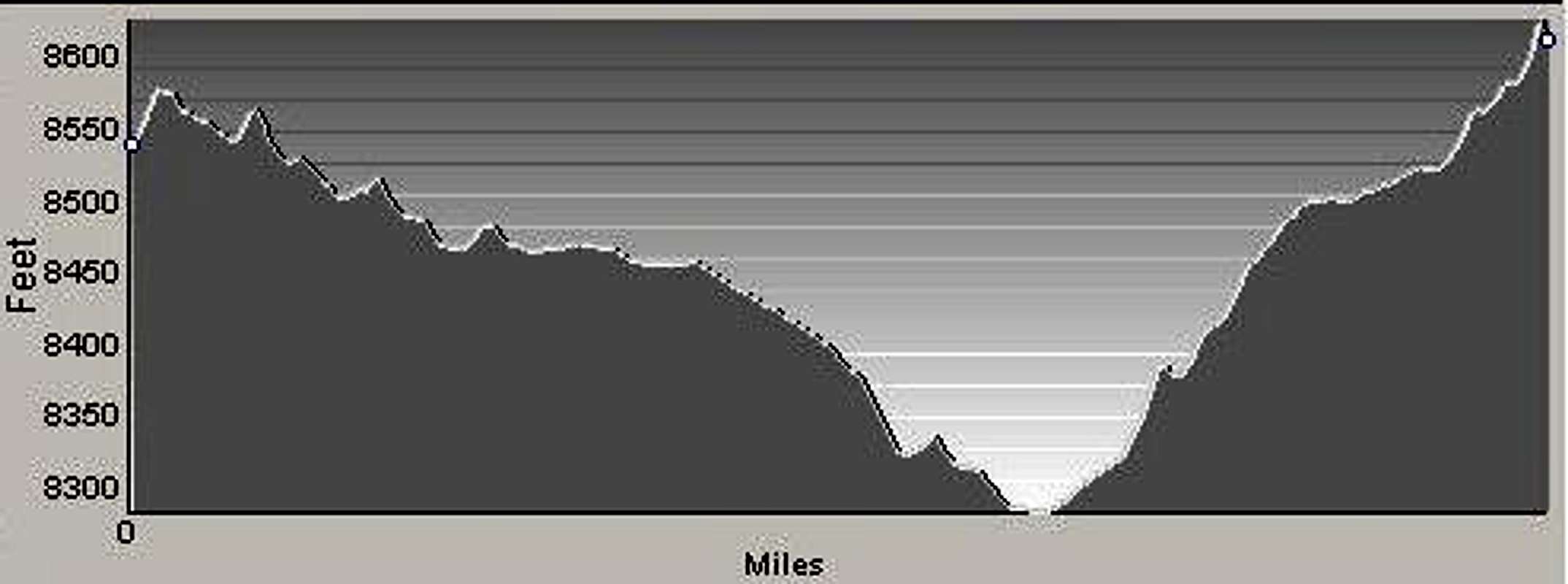
Gain – 3,862' (total)
Distance – 4.9 miles
(one way)

