-
 12078 Hits
-
 72.08% Score
-
 2 Votes
|
|
Trailhead |
|---|---|
|
|
46.33084°N / 114.24602°W |
|
|
Ravalli |
|
|
Spring, Summer, Fall |
|
|
5438 ft / 1658 m |
Climbers' Access to Castle Crag Plus East and West Sheafman Peaks
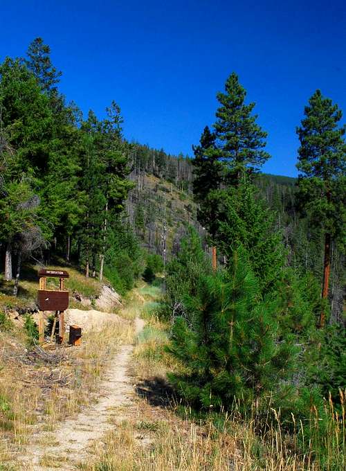
From Hwy 93 about 5 miles north of Hamilton, turn west at the Woodside Crossing (marked by a stop light) onto Dutch Hill Road.
In about 2.5 miles you will reach a T intersection. Turn right (north) onto Bowman Road and follow it as it completes two 90 degree turns (left then right – west then north).
In .2 miles turn left (west) onto the gravel West Cow Creek Road.
Drive an additional 5 miles to the trailhead, which is marked (right side of the road) with a Forest Service sign. This often-vandalized sign was in good shape when I last visited (1oct08).
For information about the climbers' route accessed from this trailhead, see these pages:
