
|
|
Area/Range |
|---|---|
|
|
39.89952°N / 16.18794°E |
|
|
Hiking, Mountaineering, Trad Climbing, Scrambling, Via Ferrata, Canyoneering, Skiing |
|
|
Spring, Summer, Fall, Winter |
|
|
7438 ft / 2267 m |
|
|
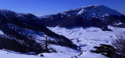
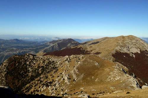
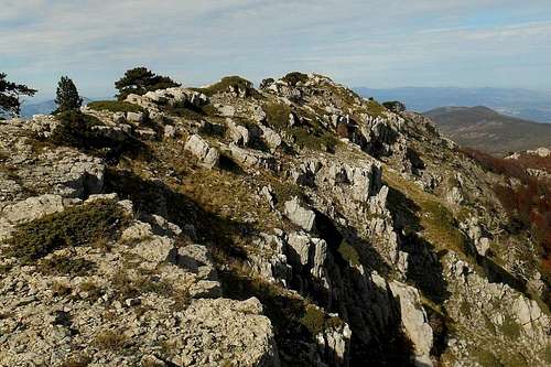
The Pollino high plains
Allocation & subdivision
The peaks of the Pollino massif represent one of the most southern extentions of the Apennine Mountains on the Italian mainland. Having taken its name from the mountain range, the Pollino National Park comprises also the contiguous Orsomarso mountain range (or Pellegrino massif), the peaks of Pizzo Falcone (6,233ft/ 1,900m) and Santa Croce (6,210ft/ 1,893m), pertaining to the Monte Alpi group and the peaks of Monte La Spina (5,419ft / 1,652m) and Monte Zaccana (5,183ft / 1,580m), offset of the Lucanian Apennines.
There is some confusion about the subdivision and the allocation of certain mountains and ranges of South Italy. The vast territory of the Pollino National Park, for instance, comprises mountains and ranges which do belong to the Lucanian Apennines (Monte Alpi, La Spina - Monte Zaccana group), to the Calabrian Apennines (Pellegrino massif) and the peaks of the actual Pollino massif which is located on the territory of both regions, with some of its highest peaks (Monte Pollino, Serra del Prete) situated right on the demarcation line.
Note: Mountain range and Natural Park are homonymous but not coextensive.
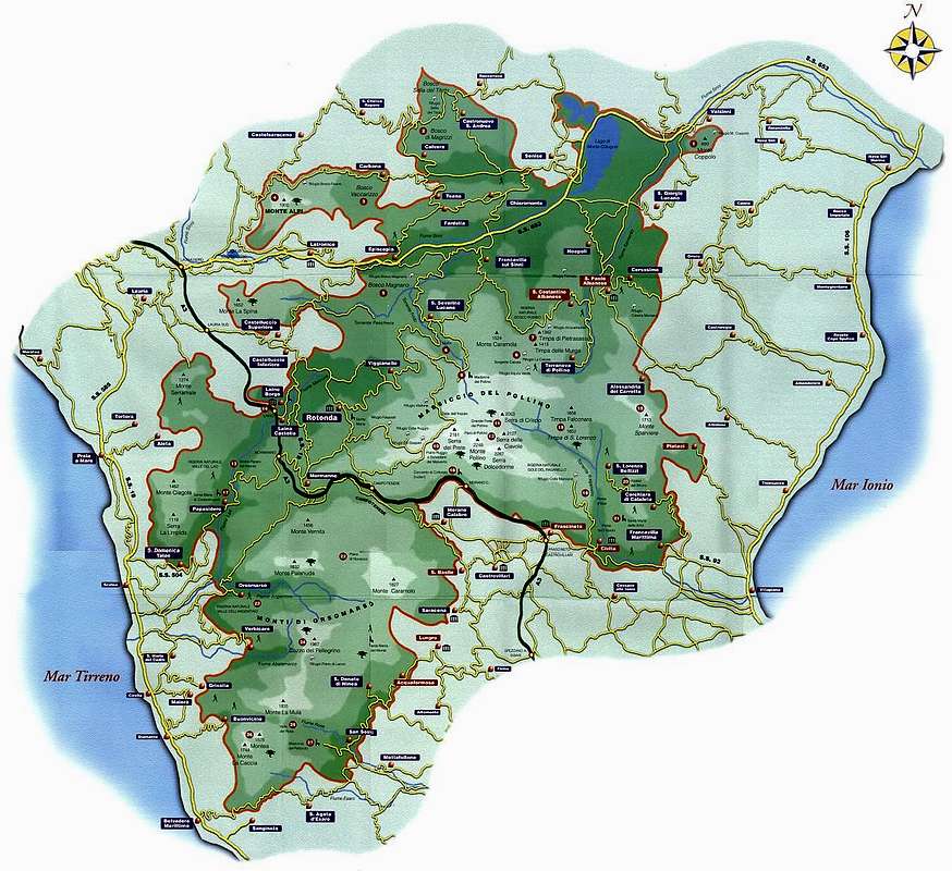
![Map of the Pollino National Park]()
Map of the Pollino National Park
Origin of the name
Etymologically, the name 'Pollino' is generally believed to derive from 'Apollo', the Greek god of light. Although a number of different theories have been proposed, the former is backed by recent findings of ancient Greek remains on the crest of Monte Manfriana. These rather unexpected finds (about two dozens of rectangular shaped blocks of granite, a lintel, fragments of terracotta and a coin etc.) are dated back to about 500 BC and could be the remains of either a lookout tower or, in fact, a shrine (or small temple) dedicated to the worship of the god Apollo.
The earliest evidence for man's presence in this territory has been discovered in a cavern known as 'Grotta del Romito' (halfway between the Calabrian towns of Mormanno and Papasidero, state road SS504). A prehistoric burial site and numerous cave engravings were discovered here in 1961, and they date back to the Upper Palaeolithic, between 20,000 and 10,000 years ago. (more info)
There is some confusion about the subdivision and the allocation of certain mountains and ranges of South Italy. The vast territory of the Pollino National Park, for instance, comprises mountains and ranges which do belong to the Lucanian Apennines (Monte Alpi, La Spina - Monte Zaccana group), to the Calabrian Apennines (Pellegrino massif) and the peaks of the actual Pollino massif which is located on the territory of both regions, with some of its highest peaks (Monte Pollino, Serra del Prete) situated right on the demarcation line.
Note: Mountain range and Natural Park are homonymous but not coextensive.
Map of the Pollino National Park
Origin of the name
Etymologically, the name 'Pollino' is generally believed to derive from 'Apollo', the Greek god of light. Although a number of different theories have been proposed, the former is backed by recent findings of ancient Greek remains on the crest of Monte Manfriana. These rather unexpected finds (about two dozens of rectangular shaped blocks of granite, a lintel, fragments of terracotta and a coin etc.) are dated back to about 500 BC and could be the remains of either a lookout tower or, in fact, a shrine (or small temple) dedicated to the worship of the god Apollo. The earliest evidence for man's presence in this territory has been discovered in a cavern known as 'Grotta del Romito' (halfway between the Calabrian towns of Mormanno and Papasidero, state road SS504). A prehistoric burial site and numerous cave engravings were discovered here in 1961, and they date back to the Upper Palaeolithic, between 20,000 and 10,000 years ago. (more info)
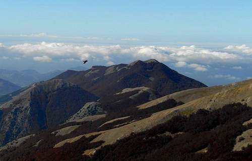
Panorama
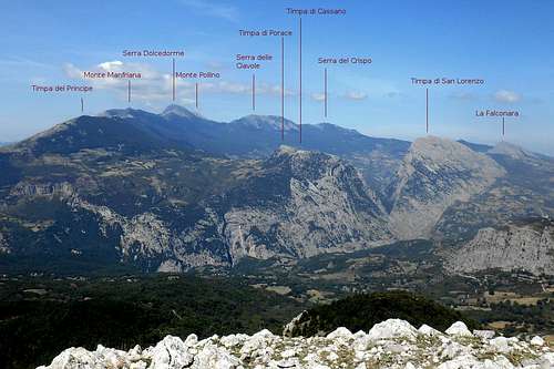 Pollino massif - Panorama shot (from Monte Sellaro) | 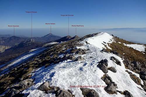 Pollino massif - Eastern chain (from Serra Dolcedorme) |
National park & Mountain range
The National Park
With a total area of 1960 square kilometres the Pollino National Park (Category II IUCN) is the most extensive national park in Italy. Officially founded in 1993, today the park comprehends a considerable part of the territory of two regions of South Italy: Basilicata and Calabria.Symbol of the park is the Bosnian Pine, - with a trunk diameter of up to 2 meters a truly majestic tree. Originating from the Balkans and northern Greece, on the Italian peninsula it can be found exclusively within the boundaries of the Pollino national park.
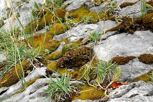 Lichened limestone rock | 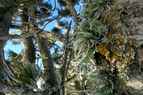 Lichened bark of a Bosnian Pine |
The mountain range
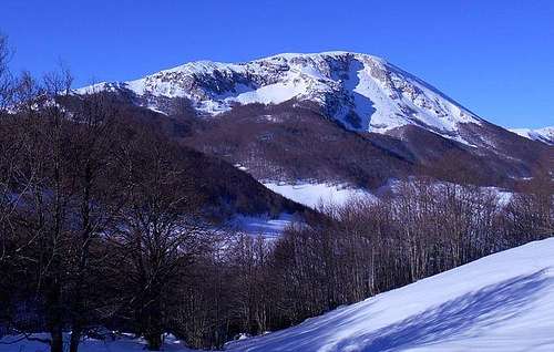
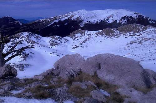
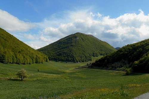
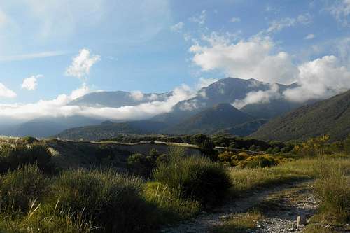
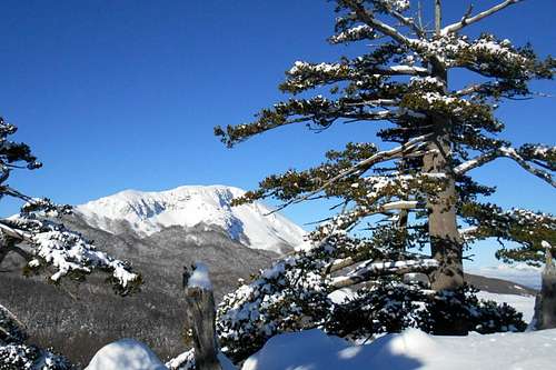
The core region of the national park are the fabulous Pollino high plains (Piano di Toscano, Piano di Pollino and Piana di Pollino) which are girded by some of the highest peaks of the entire mountain range. From their tops it is possible to enjoy a unique view. Depending on the visibility conditions, you may see simultaneously the Tyrrhenian Sea (north-east), the Gulf of Corigliano (south-west) and, soaring afar over the blue expanse of the Mediterranean, the white cone of Mount Etna (10,967ft / 3,343m), Sicily.
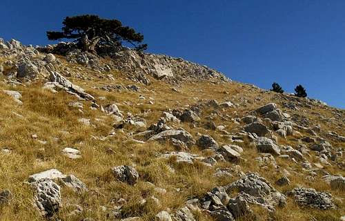
South slope of Monte Pollino in late autumn
There are a good many of varied hiking paths and trails which are generally marked with red and white stripes. However, the signposting itself is not always reliable, or more often, simply non-existent. Some rather obvious tracts may be meticulously signposted while a crucial road fork or junction will not bear any helpful indication at all. Due to this overall lack of signposting the proper use of map and compass (or a GPS device) might be required. Especially within the vast beech forests orientation can become a serious issue for less experienced hikers. Depending on the seasonal rainfalls, snow melt etc. trails are prone to turn into rivulets, rivulets can turn into torrents blocking the way.
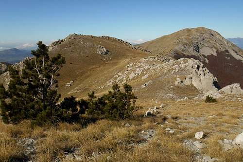
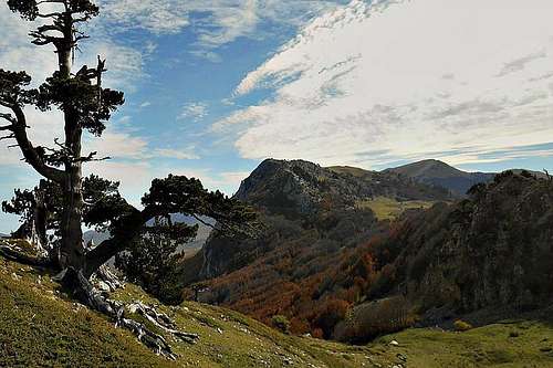
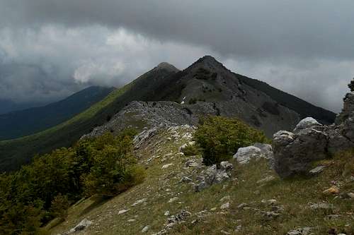
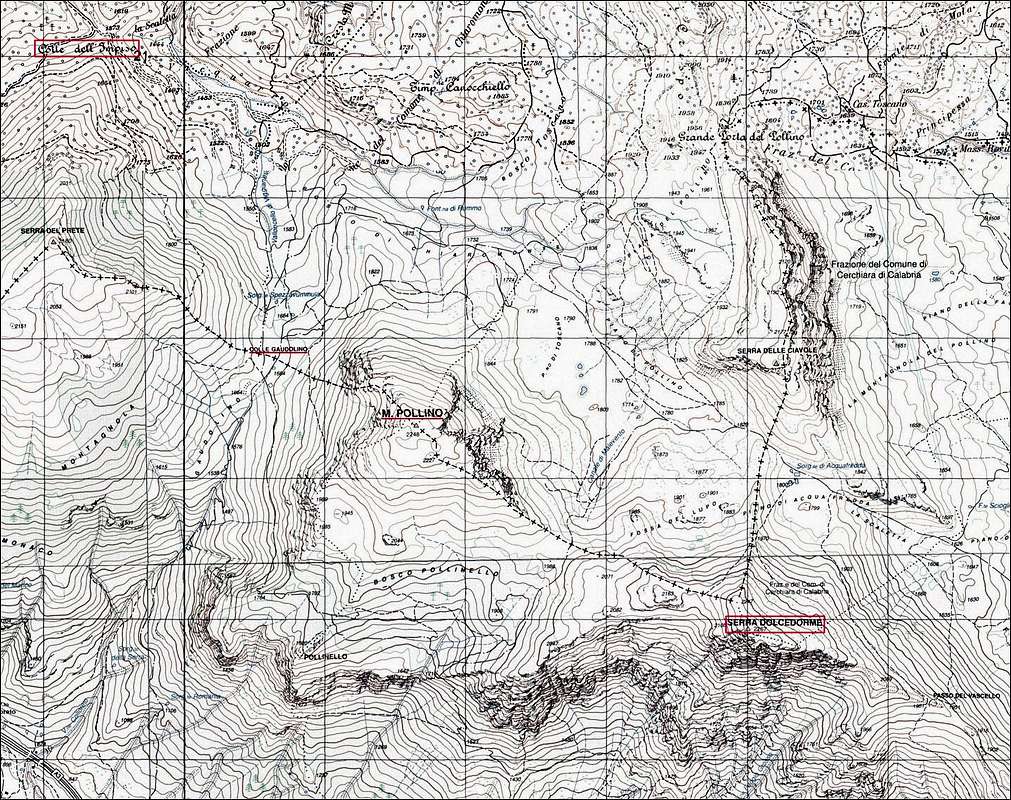
The major peaks of the Pollino massif form a vee-shaped mountain chain that is enclosing the three high plains on two sides of an oblique triangle whose vertex points in a south-eastern direction. The third side is all covered by thick and mostly pathless beech forests (Bosco di Chiaromonte and Bosco Toscano). These woods are traversed by deep ravines, like that of the torrent Frida and the Iannace Gorges ('Gole di Iannace'), and are dominated by another minor peak, Timpone Canochiello (6,177ft / 1,883m).
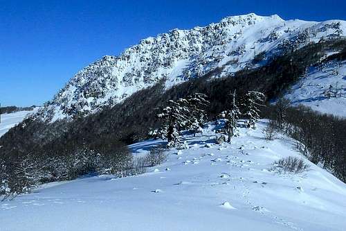
![Twilight]()
Twilight (Pollino)The northern line is basically formed by the elongated crests of Serra di Crispo (6,738ft / 2,053m) and Serra delle Ciavole (7,181ft / 2,130m), broken only by a col called the 'Great Pollino Gateway' (6,387ft / 1,947m). Probably one of the best ways to explore these parts and enjoy the stunning view is a traverse which is touching also Serretta della Porticella and the foresummit of Serra delle Ciavole. As trailhead for a full traverse you may choose either Madonna di Pollino or Fosso del Vascello.
Twilight (Pollino)
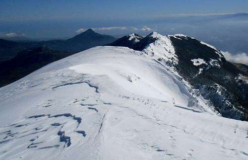
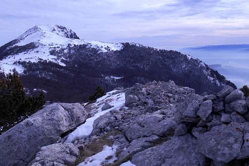
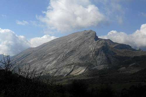
With an elevation of 7.437ft / 2,267m Serra Dolcedorme is highest peak of the Pollino massif, closely followed by Monte Pollino (7,375ft / 2,248m). Both peaks are strung upon the southern line instead, which comprises also Serra del Prete, Serra del Pollinello, Timpa di Valle Piana, Timpa del Pino di Michele, Mt. Manfriana, Serra di Malaverna and Timpa del Principe. Also on this side a traverse is well possible. Sometimes called the 'Traverse of the Infinite', recommended trailheads for this very long but varied hike are either Colle d'Impiso (from the north-west) or Colle della Scala (from the south-east).
Apart from the actual "centrepiece" of the Pollino massif, there are also two smaller mountain groups which differ significantly both from each other and from the main group:
View from the north slope of Serra Dolcedorme
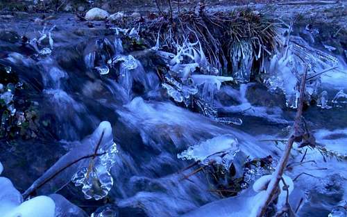
Torrent Frida
Landmarks & impressions
 High plains Piani di Vacquarro and Monte Pollino High plains Piani di Vacquarro and Monte Pollino | 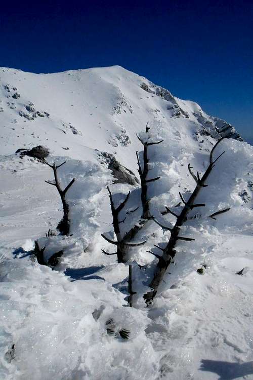 Timpa di Valle Piana and Serra Dolcedorme Timpa di Valle Piana and Serra Dolcedorme | 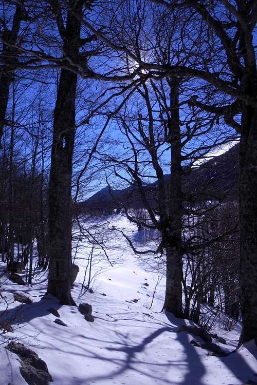 Piano di Acquafredda and Monte Manfriana Piano di Acquafredda and Monte Manfriana | 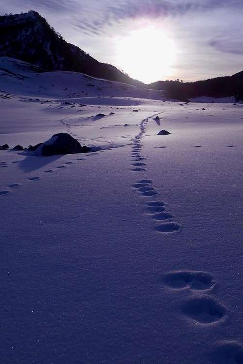 Pollino high plains and Serra delle Ciavole at sunrise Pollino high plains and Serra delle Ciavole at sunrise |
 Cemetery of the Bosnian Pines and Timpa La Falconara Cemetery of the Bosnian Pines and Timpa La Falconara | 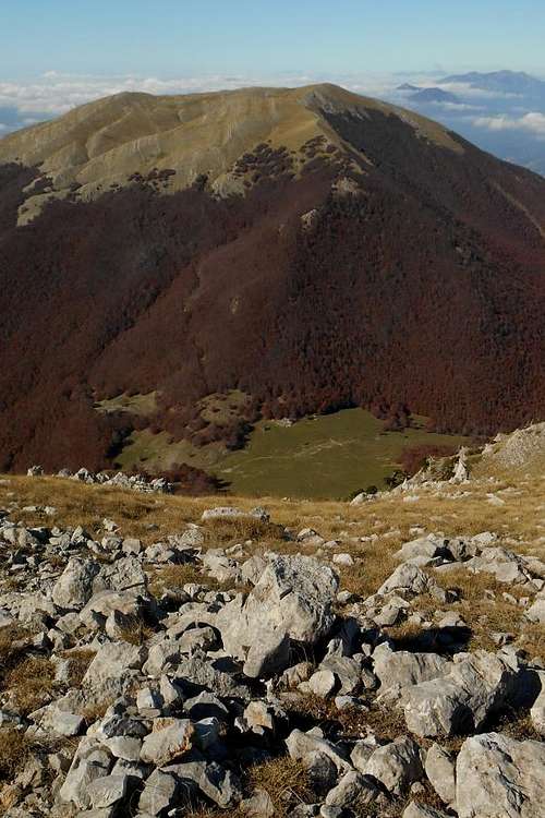 Serra del Prete and the pass Colle Gaudolino Serra del Prete and the pass Colle Gaudolino | 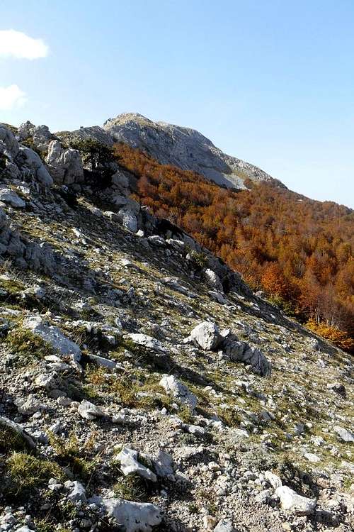 Canale di Malevento and Monte Pollino Canale di Malevento and Monte Pollino | 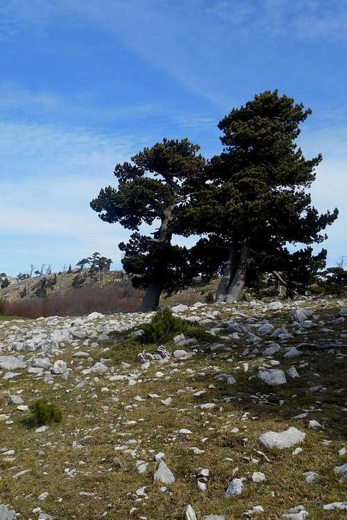 The 'dancing trees' and Serra di Crispo The 'dancing trees' and Serra di Crispo |
Four seasons & outdoor activities
Any season is the right season for a visit to the Pollino mountains. But of course, every season will permit different kinds of outdoor activities. Temperature fluctuations are considerable for this latitude and the proximity of the Mediterranean. In late summer the temperature maximum in the valley can easily pass the 35°C / 95°F mark. On the Pollino high plains the temperature may reach 25°C / 77°F during daytime (in late July and August) only to touch freezing just before dawn. The lowest temperature so far was measured on 'Piano Toscano' (north-west of Mt. Pollino), in a clear night of February. The thermometer dropped to a quite remarkable -30,8°C / -22°F, thus probably making it the coldest spot in southern Italy.

Temperature
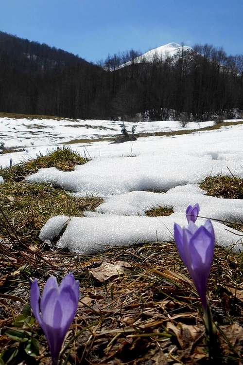
Spring & autumn
- Spring and autumn are the ideal seasons for scrambling, hiking, trekking and exploring the Mediterranean plant species. The Pollino high plains and the 'Garden of the Gods' (close to Serra di Crispo) are most beautiful during these periods of flowering.
 Cresta delle Aquile (Timpa di San Lorenzo) | 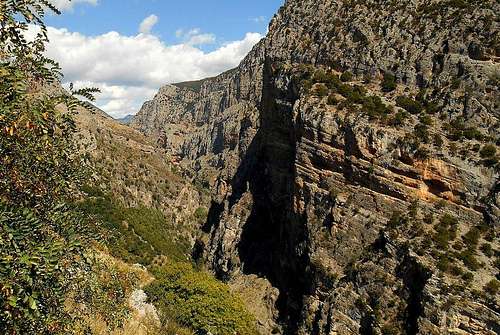 Canyon of the Raganello gorge | 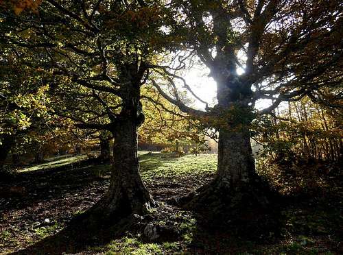 Colle Gaudolino |
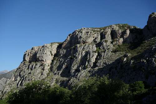
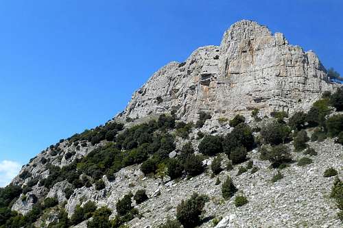
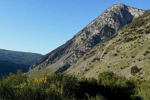
- Rock climbers will also find perfect conditions. The south-west face of the Timpa La Falconara (5,433ft / 1,656m), for example, offers numerous interesting climbings routes, with pitches of varying demands and difficulties up to VII+ (UIAA), some of them partly equipped (pitons covering the crux sections of some of the routes) and with bolted stances. Bringing full climbing and safety gear is necessary, though, especially because the quality of the limestone rock varies considerably with short but insidious passages on loose terrain. Expect also some harder pitches and several stances not to be equipped at all. The same applies to the nearby Timpa di San Lorenzo (5,413ft / 1,652m), Timpa di Porace and Timpa di Cassano, the twin peaks of Monte Sellaro and Monte Panno Bianco and the steep and sunny cliffs of the impressive south and west face of Timpa Pietra di Sant'Angelo which holds numerous demanding climbing routes in store, the latter even pitches with a respectable difficulty up to VIII (UIAA).
 Timpa Pietra Sant'Angelo (SW) | 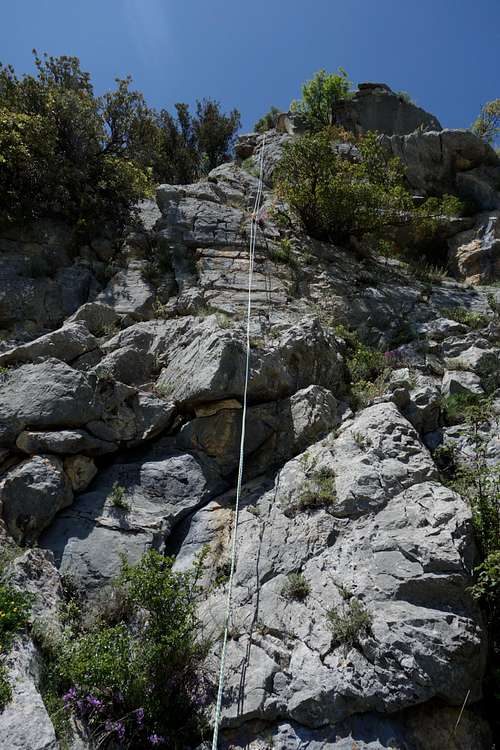 Punta Maria (1st pitch) | 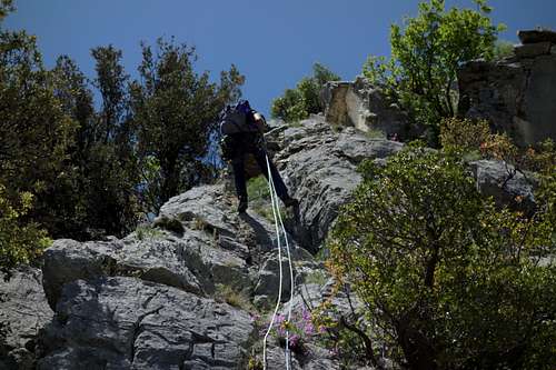 Rappelling (Punta Maria, V- UIAA) |
Summer
- Summer is the right time to explore the shady forest trails and the deep ravines, instead. Gold standard for local canyoneering is a traverse of the Raganello gorge (about 6km long, between the location Barile and the so-called "Devil's Bridge" (Ponte del Diavolo), near the village of Civita). Other exciting itinerary are the Barile gorge (about 4km long) or the Caldanello gorge. For both destinations it is possible to hire local guides. Another exceptional beautiful destination is the "Scala di Barile" (Barile Staircase), a sometimes slightly exposed but quite easy footpath that follows the upper part of the Raganello torrent between the rugged cliffs of Timpa di San Lorenzo and Timpa di Cassano. Access is from the location Barile, in vicinity to the village of San Lorenzo Bellizzi.
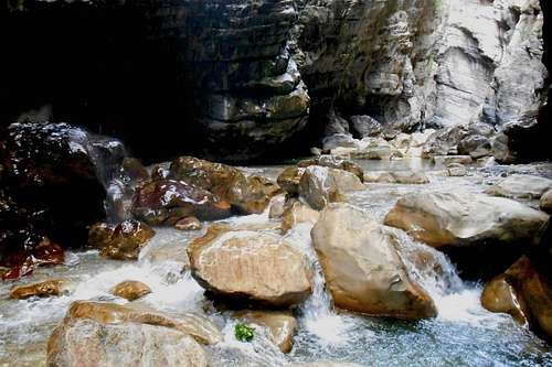 The Raganello gorge | 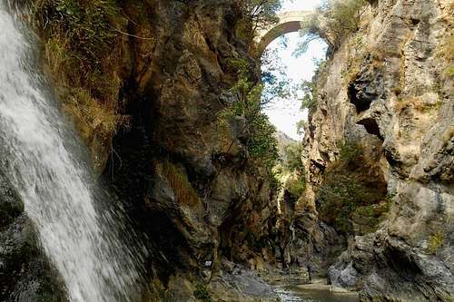 Ponte del Diavolo (Civita) |
- At Cerchiara di Calabria (only about 13km from San Lorenzo Bellizzi) it is possible to traverse the only Via Ferrata in southern Italy, the 'Ferrata del Caldanello' (also known as the 'Ferrata della Gravina'), extended in 2012, fully reconditioned and reopened in June 2016. There are several access points right at the historic town center. Also in proximity to Civita, you can find the so-called 'Ferrata del Raganello' (or 'Via delle capre'). Actually a extremely narrow and very exposed path high above the Raganello tumultuous torrent, it is only partly equipped with steel cables. Caution: The actual path is an impasse. Without full climbing equipment you will not be able (nor wanting) to continue and will have to return on your own tracks, i.d. you will have to make the path twice.
- Rafting tours and related activities are also possible on the Lao River (Pellegrino massif, valley of the Mercure), in proximity to the Calabrian village Laino Borgo and the evocative ghost town of Laino Castello Vecchio or the village Papasidero.
Winter
- Winter can arrive early. The upper slopes of the major peaks are generally covered by snow from late November through late April (or even May). The southern slopes are widely exposed to the intense Mediterranean sun and the warm and humid sea winds. The Sirocco may carry sand and dust particles from North Africa, the Arabian or Sahara desert, thus staining the snow dark orange or red.
Climbing Monte Pollino
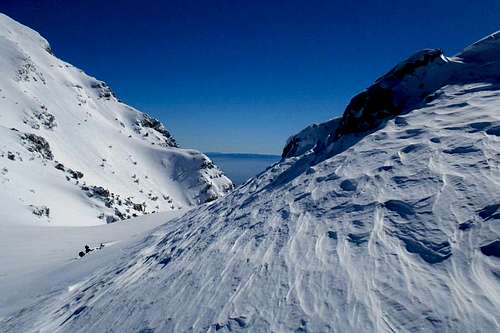
- Other parts of the Pollino massif, however, may hold several meters of snow for months. Alpine skiing is definitely an option, especially on the north-west flank of Monte Pollino or from Serra della Ciavole towards the central high plains.
 Serra Dolcedorme (from Tipa di Valle Piana) |  Passo delle Ciavole |  View from the west slope of Monto Pollino |
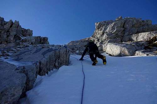
- Standard mountaineering gear (ice axe, crampons etc.) will be required for the winter ascend to the highest peaks of this range. Interesting routes can be found, for instance, on the steep and severe east face of Serra delle Ciavole (after a very long and tiresome approach, though), the snowy or iced gullies of the west and north face of Monte Pollino or around the icy rock chutes of the south face of Serra Dolcedorme. Also the narrow and corniced ridge of Serra del Prete will make an interesting destination, with lots of snow. Snowshoes are useful for the approach and traversing the high plains. With little snow, or very late in the season, try the shaded northface of Monte Pollino, as some of the winter routes may still hold hard snow or ice that will make for a fine climb.
- Safety note: Major avalanches are quite rare around these mountains and generally only to expect after sudden rises in temperature. Most avalanche-prone areas, however, are the east face of Serra delle Ciavole and the steep and narrow gullies of the south-face of Serra Dolcedorme.
Major peaks and their subsidiary summits
| No. | mountain | height | recommended trailhead(s) | details / related SP page |
| 1. | Serra Dolcedorme | 7,437ft / 2,267m |
|  Serra Dolcedorme |
| 2. | Monte Pollino | 7,375ft / 2,248m |
|  Monte Pollino |
| 3. | Serra del Prete | 7,155ft / 2,180m |
|  Serra del Prete |
| 4. | Timpa di Valle Piana (s. Serra Dolcedorme) | 7,096ft / 2,163m |
|  Timpa di Valle Piana |
| 5. | Serra delle Ciavole | 6,988ft / 2,130m |
|  Serra delle Ciavole |
| 6. | Timpa del Pino di Michele (s. Serra Dolcedorme) | 6,788ft / 2,069m |
|  Timpa del Pino di Michele |
| 7. | Serra di Crispo | 6,738ft / 2,053m |
|  Serra di Crispo |
| 8. | Serra del Pollinello (s. Monte Pollino) | 6,706ft / 2,044m |
|  Serra del Pollinello |
| 9. | Serretta della Porticella (s. Serra di Crispo) | 6,561ft / 2,000m |
|  Serretta della Porticella |
| 10. | Monte Manfriana | 6,499ft / 1,987m |
|  Monte Manfriana |
| 11. | Coppola di Paola | 6,295ft / 1,919m |
|  Coppola di Paola |
| 12. | Timpone della Capanna | 5,980ft / 1,823m |
|  Timpone della Capanna |
| 13. | Pollinello & Gavutu Russu | 5,469ft / 1,820m |
|  Gavutu Russo (Pollinello) |
| 14. | Timpa della Falconara | 5,433ft / 1,656m |
|  Timpa della Falconara |
| 16. | Timpa di San Lorenzo | 5,420ft / 1652m |
|  Timpa di San Lorenzo |
| 17. | Monte Sellaro | 4,721ft / 1,439m |
|  Monte Sellaro |
| 18. | Timpa di Cassano | 4,514ft / 1,376m |
|  Timpa di Cassano |
Main trailheads
The north (from San Severino Lucano, Terranova di Pollino, Viggianello)
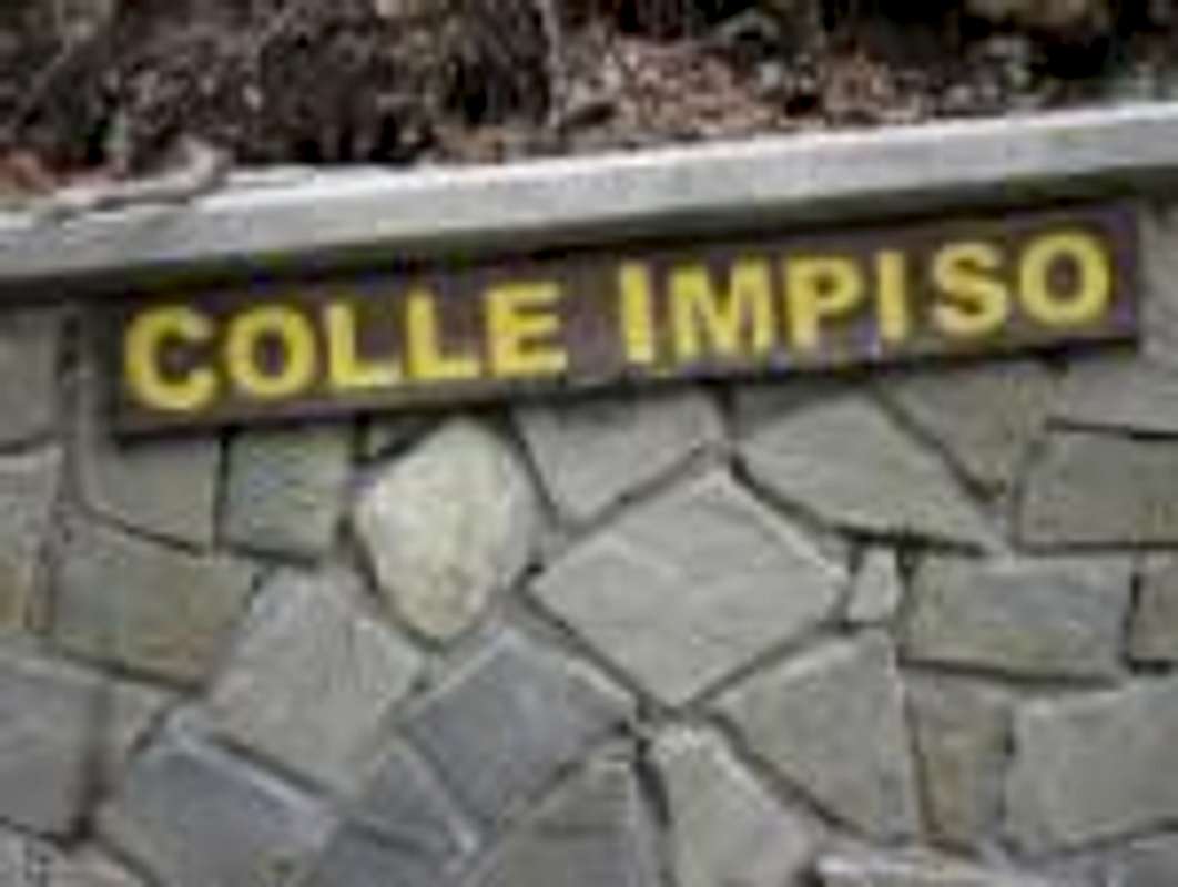
- Colle d'Impiso (5,160ft / 1,573m): Perhaps the most frequented of all the trailheads of the central part of the Pollino massif. It can be reached both from San Severino Lucano (Loc. Varco, Loc. Voscari) and Viggianello by taking the country road SP4. Indications are little (for Massicio del Pollino) to none, so check the approach road beforehand. You can park your car at the trailhead - at the side of the road, close to the wall. Make sure to not block the forest track, as it is used by the park guards, and - with winter snow - leave enough space for the snowplow to pass.
![Colle d'Impiso]()
Colle d'Impiso
- The signposted hiking trails (red and white) starting from here will take you to the beautiful Pollino high plains and to the peaks of Monte Pollino, Serra del Pollinello, Serra Dolcedorme (a quite long approach way) and Serra del Prete.
- The nearest habitations are Voscari and Varco di Pollino (both of them belonging to the municipality of San Severino Lucano), about 11 km down the road to the north. The anfractuous and narrow asphalt road passes between high pastures before entering a vast beech forest. Here you may encounter horses and cattle crossing or grazing at the roadside.
- Madonna di Pollino (5,042ft / 1,537m): In proximity to the homonymous sanctuary 'Madonna di Pollino' ('Our Lady of Pollino'), so from San Severino Lucano just follow the indications for the santuary. The actual trailhead is somewhat hidden. You will find it right at the back of the mountain hut. At the end of the asphalt road there are sufficent parking opportunities. Where the road ends, turn left and simply follow the path uphill for approximately 200m. (The sactuary and the grotto of the Madonna can be found about 200m to the right, instead.) For the most parts the trail is well marked with the usual red and white signposts on boulders and tree trunks. It leads first to Piano Iannace, an extensive high plain, and, further uphill, to the high plain Piana di Pollino and the 'Great Pollino gateway' (ital. 'Grande Porta del Pollino'). From there turn left for Serretta della Porticella, Serra del Crispo and 'Giardino degli Dei' (engl. 'The Garden of the Gods'), right for the two peaks of Serra delle Ciavole.
- Alternatively, you may park the car already a few kilometers before reaching the sanctuary, at the roundabout ofFosso Iannace (4,117ft / 1,255m), and hike up the impressive Gole di Iannace, a canyon-like mountain gulch. This very interesting and sportful trail is a much more arduous approach way, though, especially in ascent. Be careful during the high water periods (the spring snowmelt) and while crossing the numerous timber bridges, as they might be slippery or in need of repair.
![Gole di Iannace]()
Gole di Iannace
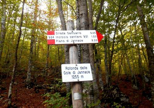
- Starting from Fosso Iannace and following the forest track to Madonna di Pollino in order to save the Gole di Inannace as the return path could be yet another and less exhausting alternative route.
Note: The sactuary itself will see the annual procession (with thousands of devotees) on the 1st Sunday of June (Friday, Saturday and Sunday) and on the 2nd Sunday of September.
- Lago Duglia (4,484ft / 1,367m): This might be your trailhead when approaching the Pollino Massif from a northeast direction, i.e. from Terranova di Pollino and Casa del Conte. There are a few road signs, but it is quite easy to find. The asphalt road, though, is in rather bad conditions and becomes regularly impassable both after abundant snowfall (all winter) and heavy rains (rest of the year). The easy hiking trails starting from this location are well recognizable and will lead to Serra del Crispo and Serra delle Ciavole (west), or to Toppo Vuturo and the Falconara (south, south-east).
- A fountain for replenishing water supplies can been found directly at the spacious and quite popular picnic area. Another well you will encounter somewhat further up the trail to Lago Fondo, a shallow pool which is used by local herdsman to water their cattle. Sometimes these herds are only guarded by herding dogs. But if you stay calm, avoid rapid moves and keep your direction, they eventually will lose interest and resume their business.
Piano Ruggio
- Piano Ruggio (5,085ft / 1,550m): This wide and remote high plain is not signposted. It can be approached both from San Severino Lucano (passing Colle d'Impiso) and Viggianello / Rotonda (via Piano Pedarreto). During wintertime the access is limited to vehicles with snow chains and/or 4WD. It is situated at the feet of Serra del Prete (to the northeast) and encircled by the tree-covered slopes of Coppola di Paola, Timpone della Capanna, Timpone di Viggianello, and Mt. Grattaculo.
- Hiking paths starting from here include one to 'Belvedere del Malvento' and further up the south ridge of Serra del Prete, an easy roundtour to Coppola di Paola and, in a southernly direction, to the valley of 'Fosso Sambucoso' and a smaller mountain group (Timpa dell'Orso, Monte Grasta, Tavolara, Cozzi dell'Anticristo, Serra di Mauro etc.). There are two alpine huts located in this area: Rifugio de Gaspari and Rifugio Fasanelli.
The east (from San Lorenzo Bellizzi, Civita, Terranova di Pollino)
- Barile (2,125ft / 648m) and Sant'Anna (4,133ft / 1,260m): Both trailheads are approachable from San Lorenzo Bellizzi (south) and Terranova di Pollino (north). The latter is recommendable only with 4WD (or all terrain vehicles), though. Because of periodic landslides the country lanes are generally in bad shape, with frequently occuring tracts of dirt or gravel.
Barile
- Sant'Anna, a quaint rural chapel, is signposted. It is situated halfway between the rocky cliffs of San Lorenzo and Timpa La Falconara. From this location both peaks are easy to reach. The jagged rock face of the west shoulder of Timpa La Falconara makes a fantastic backdrop, and in late summer the whole area will take on the appearance of a grassland savanna.
- The location of Barile (the name 'Barile' derives from a nearby farm house) is the main entrance portal for anyone who wants to explore the magnificant gorges of the torrent Raganello (follow the road signs from San Lorenzo Bellizzi) - the Barile gorge (about 4km long) and, of course, the Raganello gorge (about 6km long). A steep and very rocky hike without obligatory path or any indications but with difficulties up to III (UIAA) - depending on the route of choice, leads up to the spectacular crest of San Lorenzo and follows the craggy and truely abyssal ridge ('Cresta delle Aquile') to the peak. Other rocks which can be accessed from this trailhead are Timpa di Cassano and Timpa di Porace.
- Colle Marcione (4,028ft / 1,228m) is another interesting trailhead which can be reached by taking the ashpalt road that branches to the left short before the village of Civita. The condition of this serpentine road is rather okay. From this trailhead a hiking trail ascends towards the ridge between Timpa del Principe and Monte Manfriana. Also close are the peaks of Timpa di Porache and Timpa di Cassano. From there it is also possible to start exploring the high plain 'Bellizzi' or to descend to the canyon of the Raganello and the Barile gorge. A (closed) mountain hut is situated about two hundred meters from the actual trailhead from where you may enjoy the view on the impressive east face of Serra delle Ciavole and on the "Cresta dell'Infinito", a ridge that runs from Timpa del Principe to the summit of Serra Dolcedorme.
The south (from Castrovillari, Frascineto, Morano Calabro)
- Cozzo Palumbo (2,723ft / 830m) and Valle Piana (2,952ft / 900m): Approaching some of the highest peaks of the Pollino from their south side (Valle del Coscile), these two locations are the most popular trailheads. Both can be found only a few kilometers from the Calabrian village Frascineto and the town of Castrovillari. The altitude difference to be handled is often considerable higher than from the north or north-west. Hiking paths tend also to be steeper. It is a right choice for anyone planing for a slightly more demanding ascend, especially in winter, as the approach road is generally in fair conditions (free of snow and ice) and accessible all year round without snow chains.
![Cozzo Palumbo]()
Cozzo Palumbo
- Seen from the south the Pollino massif and its peaks offer a completely different sight. The southern escarpment, its ridges and gullies hold some of the most beautiful ascent routes. There are several old hiking trails traversing the forest of Valle Cupa, but almost all of them are rather hard to recognize, partly overgrown, discontinued and may suddenly end - leading nowhere in particular. Because of the general lack of maintenace signposts are either absent or withered and open to interpretation. Orientation can become a serious problem, especially with low clouds and fog on the steep slopes and gullies.
- Note: Cozzo Palumbo is not signposted at all. It can be accessed only via two dirt tracks (one from Frascineto, the other from Castrovillari) which clearly have seen better times. Lately they have become almost impassible and can be recommended only with 4WD or similar vehicles. If you should want to take them anyway, you should leave the car immediately at the small bridge that crosses the highway A3/A45 (Salerno - Reggio Calabria) and follow the trail that is skirting the pine plantation. Right at the end of the plantation turn left and follow the escarpment to the onset of the south ridge of Serra Dolcedorme, or head straight for the valley (Valle Cupa).
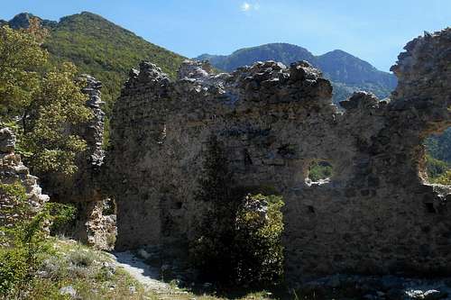
- Colloreto (2,952ft / 900m): This trailhead is situated in the vicinity of the evocative remains of an abandoned Augustinian monastry from the sixteenth century. In order to reach the trailhead you may leave the motorway A3/E45 (Salerno - Reggio Calabria) at the exit "Morano Calabro". After a few hundred meters on the right you will come upon indications for a location called "La Locanda del Parco". Turn right and after about one hundred meters right again. The road is now rising and becomes a broad dirt track. At the bifurcation take the left road that descends towards the bottom of a small valley. Simply keep on this road and follow it until you pass a number of farm houses. At the "Agriturismus Colloreto" (map) you will find a widening where you can leave the car without blocking the road. Take the hiking path that leads up to the ruins of the former monastry. The actual trailhead is situated somewhat north of the motorway which runs right beneath the ruins of the monastry.
![The monastry of Colloreto and Monte Pollinello]()
Colloreto
- Note: There is plenty of water to be found on the first part of the trail. Indeed, many small torrents, cataracts and wellsprings can be found along this ancient mule track, the so-called "Via dei Moranesi", which leads to the mountain pass Colle Gaudolino, situated right between Monte Pollino (right) and Serra del Prete (left).
 Map of the central high plains (IGM 1:25.000) | 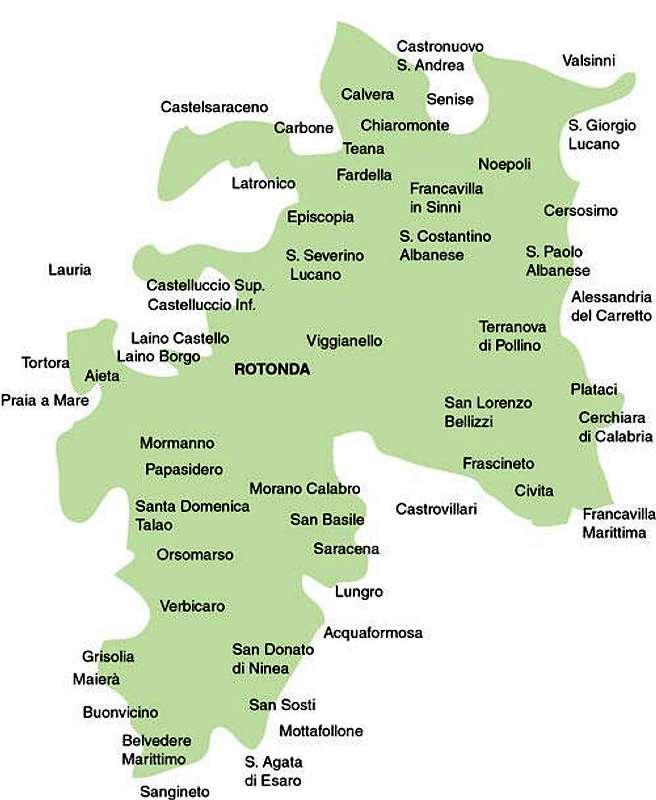 The town centers and villages |
Getting There
The nearest airports are Naples (about 230 km), Bari and Brindisi (also about 220-230 km). From Rome and its big international airports it is a considerably long journey of almost 450 km. There is limited public transport in this region.Trains will go as far as Potenza and Matera (Basilicata, FAL) or Scalea or Sibari (Calabria, FS). Buses do operate infrequently between some of the bigger towns and villages, but are rather unreliable. Hence, visitors will mostly depend on private transport in order to reach the villages or trailsheads mentioned above.
The actual mountain roads are largely in bad conditions, especially the high passes might become impassable after snowfalls as road patrol service is scarcely to be seen around. If you should consider to visit the Pollino Massif between late October through early May, don't forget to bring snow chains or allow extra time for the approach way.
 South Italy, the Pollino massif
- from Napoli: Take the A3/E45 in direction Reggio Calabria, Salerno (about 195 km). Take the Exit (Uscita) Lauria Sud and follow the state the State Road SS19. At Castellucio Inferiore turn left and follow the indications for Viggianello or San Severino Lucano. - Alternatively, you may leave the A3/E45 at the location Pecorone and follow indications for the State Road SS653 (called "Sinnica"). Take the Exit Valle Frida and follow indications for San Severino Lucano.
- from Bari: Take the State Road SS100 (or the highway A14/E843) for Taranto. Turn left (indications for Jonica/Palagiano/Matera/Reggio Calabria) and take the coastal road E90. After passing Policoro pay attention, as he Exit can easily be miss, and turn left, taking the State Road SS653 (indications for "Sinnica". Take the Exit Valle Frida and follow indications for San Severino Lucano.
- from Brindisi: Simply take the E90 for Taranto and keep on this road. After Taranto follow the same indications as above (Bari). In case you should want to approach from the south, keep on the E90 and exit after Sibari, taking the SS534 (indications for Castrovillari). From here you can easily reach the villages of Civita, Frascineto, San Lorenzo Bellizi or Cerchiara di Calabria.
Flora & fauna
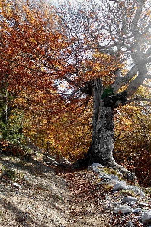
Secular beech tree
Bosnian Pines
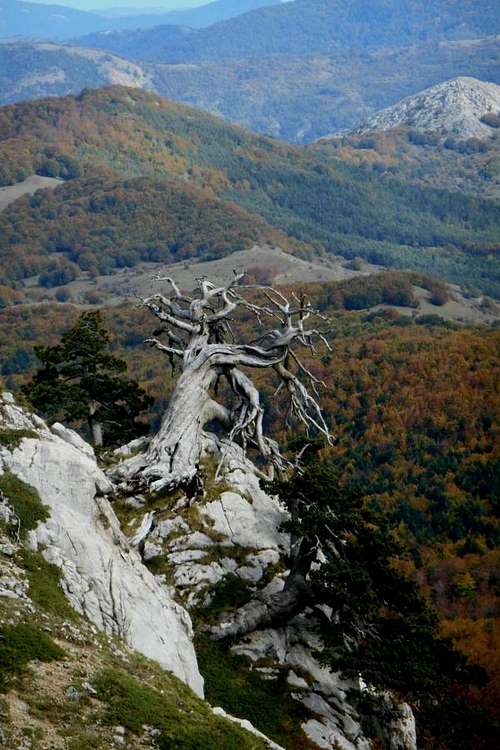
Above the 6,500ft mark, however, only the towering Bosnian Pine feels entirely at home, with some specimen easily reaching a stately 100ft. This tree can be found almost on all peaks of the central massif. The largest accumulations of mature Bosnian Pines are on the west flanks of Serra delle Ciavole and Serra di Crispo, but also on the west face of Mt. Pollino and the south face of Serra Dolcedorme. The oldest living speciman, commonly known as the 'patriarch', stands on the south slope of Mt. Pollino (Pollinello) and has an estimated age of 1,000 years.
Another very characteristic group, the so-called 'dancing trees', can be found in the 'Garden of the Gods', in proximity to Serretta della Porticella. Having being exposed for centuries to the strong and persisting uphill winds, the stems of these primordial giants are noticeably slated towards the mountain slope.
Lower regions hold a range of different oak trees, prevalently the Turkey Oak (Quercus cerris) and the Downy Oak (Quercus pubescens), but also alders, willows, poplars, chestnuts etc.
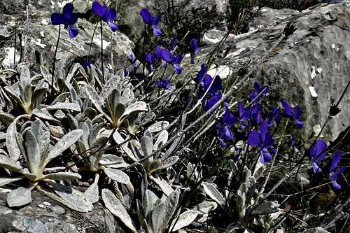
Mountain Violet (Viola calcarata)

Rosalia longicorn
The shady beech forests and the narrow valleys are home to about 25 mammal species. To name only a few: crested porcupine, badger, fox, otter, marten, weasel, European polecat, forest dormouse, Corsican hare, Mediterrean squirrel, hedgehog, roe deer, wild boar, wildcat and, of course, the rather shy Italian wolf. At least six bat species are known to inhabit the area.
Birdlife is represented, for instance, by the Common Raven, the Egyptian Vulture, the Black Woodpecker, the Green Woodpecker, the Red-billed Choug, the Peregrine falcon, the Eurasian Eagle-owl, the Golden Eagle, the Red Kite and the Rock Partridge.
The insect world includes the endangered Goldstreifiger (Buprestis splendens), the hermet beetle (Osmoderma eremita) and the splendid Rosalia longicorn (Rosalia alpina). Also a large number of butterly species can be found, like the Italian Marbled White (Melanargia arge).
Red Tape
The Pollino Massif is an integral part of the Pollino National Park. With its 1,960 square kilometres it is the most extensive national park in Italy. The park was officially founded in 1988. The same rules apply as for other national parks in Italy. Free camping is generally not encouraged. But it might be tollerated from dusk until dawn and as emergency bivouac. No open fire etc. will be tollerated, though. No fees or permits are required. Official tour guides are optional and usually available, at reasonable cost, for smaller groups (5-12 persons).
Fortunately the entire core region of the National Park, and the Pollino massif in particulare, are uncontaminated and free from litter. Still, don't think twice if you should find anything that in your book does not belong there. Please pick it up and dispose it later at a proper place.
External Links
- http://www.parcopollino.gov.it - official web site of the Pollino National Park (in Italian only)
- http://www.parks.it/ - another page regarding the Natinal Park (in English and Italian language)
- http://www.bed-and-breakfast-in-italy.com/ - a list of accomodations (mostly B&B) in proximity to the Pollino Massif
- http://www.bbplanet.com/ - another page with Bad & Breakfasts of the the region
- http://www.avventurieridelsud.it/ - guided tours (canyoneering, rafting, Via Ferrata, trekking, climbing etc.)
Video
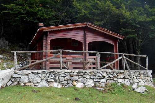
Accommodation, mountain huts & camping
The best chance to find accomodation is in trying out one of the local town centers: Rotondo, Viggianello, San Severino Lucano, Terranova di Pollino or Civita. There are lots of smaller inns and Bed & Breakfasts. Especially Civita offers a great range of good value Bed & Breakfast opportunities.There are also several rural structures and farm houses ("Agriturismo"), with local cuisine, that will also rent rooms. In San Severino Lucano you can find a small hostel. Camping grounds are open during the summer month at Mezzana Salice - San Severino Lucano (Phone: 349 636 2056 – 340 374 9086) and at Mormanno (Phone: 392 988 6611).
Forgotten your tent pegs? An outdoor and sports wear store (Decathlon) can be found at Corigliano Calabro, about 15km south from the Exit for Castrovillari (state road SS92) following the E90 (Jonica: Taranto - Reggio Calabria).
Forgotten your tent pegs? An outdoor and sports wear store (Decathlon) can be found at Corigliano Calabro, about 15km south from the Exit for Castrovillari (state road SS92) following the E90 (Jonica: Taranto - Reggio Calabria).
There are several mountain huts listet for the Pollino Massif. But almost all of them are by now either closed or in a piteous state (and closed, of course). To name only the few exceptions to the rule:
- Rifugio de Gaspari (Piano di Ruggio, 5,036ft / 1,535m) - to reach both from Viggianello and San Severino Lucano and close to the trailheads Colle d'Impiso and Piano di Ruggio: open all year, with 3 rooms (with 4, 5 and 7 beds), bathroom with showers. Phone: (+39) 973 661 813 / facebook - Reopened!
- Rifugio Madonna di Pollino (Madonna di Pollono, 5,085ft / 1,550m) - accessable from San Severino Lucano (or Terranova Pollino) and close to the homonymous trailhead and the trailhead Bosco Iannace: Phone (+39) 973 576 418 - Apparently closed.
- Rifugio Fasanelli (Piano Pedarreto, 4,396ft / 1,300m) - to reach from Rotonda, Mormanno and San Severino Lucano. Located close to the trailheads Colle d'Impiso and Piano di Ruggio. Rather expensive, but they do offer board and lodging, as well as excursions. Phone: (+39) 973 667 304 or (+39) 973 667 223 / official webpage
- Bivouac Colle Gaudolino (Colle Gaudolino 5,524ft / 1,684m) - situated right on the pass between the major peaks of Serra del Prete and Monte Pollino, it can be reached by feet from either Piano di Ruggio or Colle d'Impiso: always open, unguarded, no service, water can be found at a fountain nearby or the natural well "Spezzavummola".
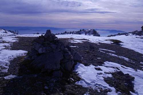
Bivouc Colle Gaudolino
In case of an emergency - list of emergency numbers, by region (Basilicata and Calabria): CNSAS
Guidebooks & Maps
- Sui sentieri del Pollino, author: Giorgio Braschi, Edizioni Pugliesi, 2nd Edition 2007. - Without any doubt still the most recommendable guidebook to this region, with several detailed maps (scale 1:25.000), a large removable map (scale 1:50.000), numerous itineraries and comprehensive information about the geological origins of the massif etc.
- By the same author is also available a book with more than 250 photographs: Pollino. Viaggio interiore in una realtà irreale, Edizioni Pugliesi, 1990.
- Sud Verticale, author: Guido Gravame, Idea Montagna, 2015. - Finally, a new guide book (in Italian language) with alpine routes, climbing routes etc. of the Pollino range and the Lucanian Apennines.
- In cammino sul Pollino. Natura, cultura, sentieri, authors: Luigi Troccoli abd Emanuele Pisarra , Edizioni Prometeo, 2nd edition (also in English translation?? not verified, yet). - A guidebook with 53 itineraries.
- Escursioni sul Pollino, author: Vincenzo Perrone, Il coscile Editore, 2nd Edition 1995. - A small but essential guidebook (pocket book) with removable maps.
- A piedi sul Pollino, author: Emanuele Pissara, Edizioni Prometeo, 2001. - Guidebook containing more than 100 itineraries
(with detailed descriptions, photographs and useful information).![Pollino National Park]()
Pollino National Park

- ESCURSIONI. Parco del Pollino, author: Michele Zanetti, Cierre Edizioni 2000. - Guidebook containing selected hiking trails and a few recommanded mountain bike tours.
- Il Pollino Orientale, author: Antonio La Rocca, Il Coscile Editore. - An interesting guidebook dedicated exclusively to the eastern parts of the Pollino massif.
- I 2000 dell’Appennino, author: A. Osti Guerrazzi, Edizioni Il Lupo, 2nd edition 2010. - The book contains a chapter dedicated to the mountains of the Pollino Massif and detailed descriptions of the standard itineraries (master routes) to the major peaks (Serra Dolcedorme, Monte Pollino, Serra delle Ciavole etc.).
- Carta Turistica - Parco Nazionale del Pollino, Edizioni Il Coscile, map scale 1:55.000
- Parco Nazionale del Pollino, Prometeo, map scale 1:65.000
- Fiori e piante del parco del Pollino, author: Liliana Bernardo, Prometeo, 3rd Edition 2001. - Field guide to flowers and plants of the Pollino National Park.
It can be quite challenging to find a decent high resolution map* of the Pollino massif (or the Pollino National Park). Even agreeable publications in Italian language are rare and rather hard to find. To my knowledge, to this day not a single guidebook in English language is available**, though some general guidebooks to Southern Italy may mention at least the National Park.

Pollino massif (IGM 1:100,000)
*Maps in a scale of 1:25.000, 1:50,000 and 1:100,000 are available for purchase directly from the IGMI - Istituto Geografico Militare Italiano ( here ) or ordered online ( here ).
**If you should own any recommendable publication (or map) about the Pollino massif or the Pollino National Park that is not yet listed above and/or know where to order it, please do not hesitate to add a comment.