| Range | Peaks |
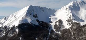
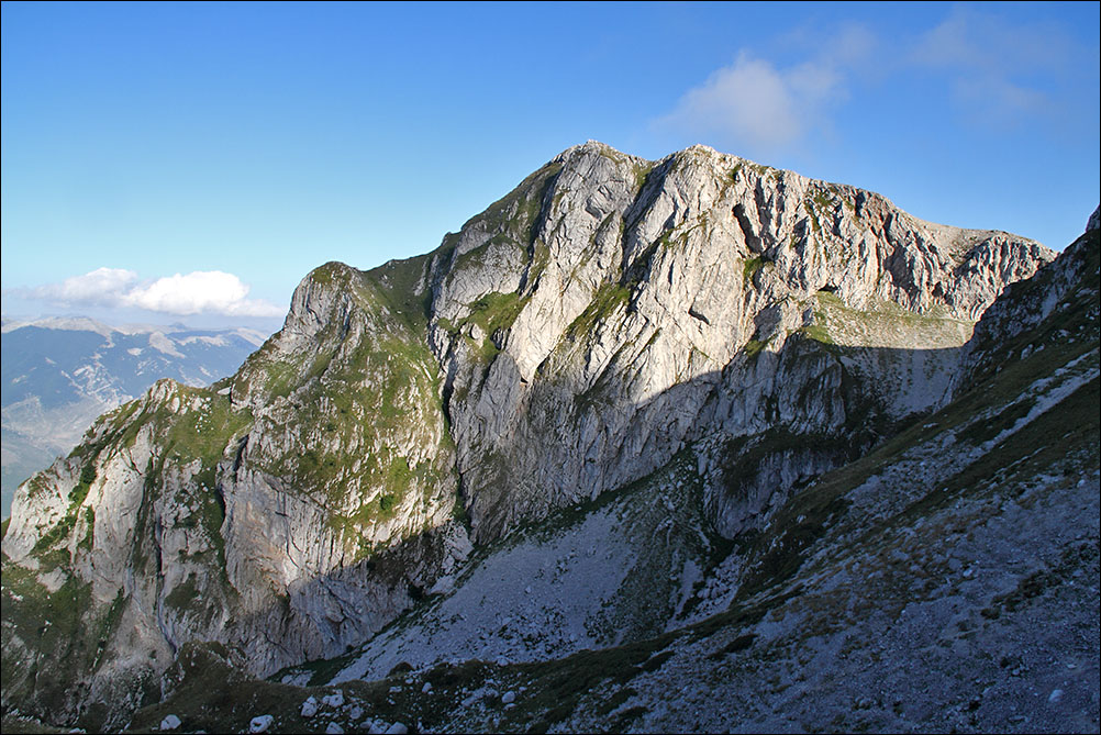
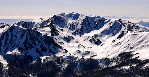
![Monte Pollino]() Monte Pollino
Monte Pollino
|
Pollino massif (Appennino calabro)
highest elevation: Serra Dolcedorme (2,267 m)
prominence: 1,715 m peaks: 10 coordinates: 39°54′18″N 16°12′00″E region(s): Basilicata, Calabria
The Pollino massif is the most southern range of the Apennine mountains. Its peaks mark the borderline between the two regions Basilicata and Calabria.
With 1,820 square kilometres the Pollino National Park, instituted in 1988, is the largest national park of Italy. It comprises also the Pellegrino massif (Cozzo del Pellegrino 1,987 m, Monte Montea 1,825m etc.) and the twin peaks of the splendid Monte Alpi massif (Pizzo Falcone 1,900 m and Santa Croce 1,893 m).
Notable also the eastern extension of the massif with its rugged, cliff-like peaks like La Falconara (1,656m), Timpa di San Lorenzo (1,652 m), Timpa di Cassano (1,637 m) and Timpa di Porace (1,423 m). They do offer some fairly demanding climbing routes up to VII+ (UIAA).
|
Serra delle Ciavole (south)
| 2,127 m |
| Timpa Pino di Michele | 2,049 m |
| Serra del Pollinello | 2,047 m |
| Serretta della Porticella | 2,000 m |
|
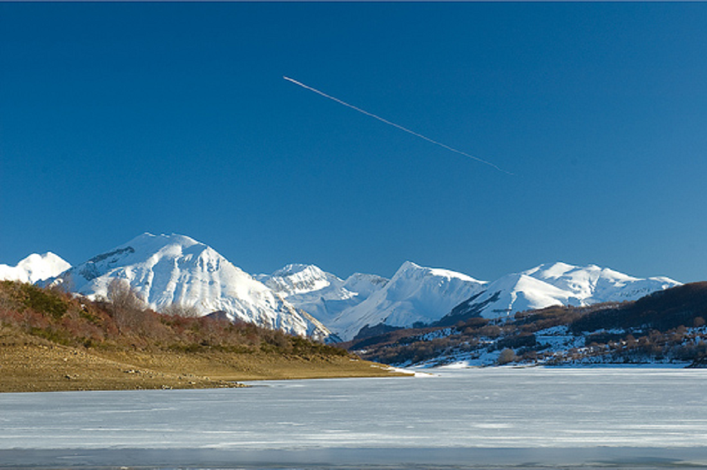
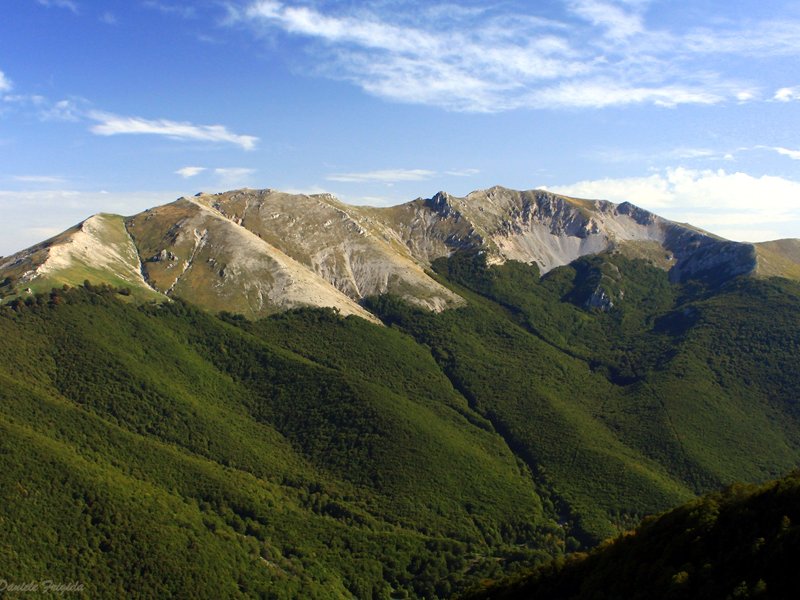
 Monte del Papa
|
Sirino massif (Appennino Lucano)
highest elevation: Monte del Papa (2,005 m)
prominence: 1,167 m peaks: 1 coordinates: 40°07′57.69″N 15°50′09.67″E region(s): Basilicata
Monte del Papa is the only mountain within the territory of the Basilicata which reaches the 2,000 meter mark. A ski resort is situated on the north slopes and impedes ascents on the (prosy) normal route. Good alternatives are the north east and the north west ridge.
With Lago Laudemio the Sirino massif holds Italy's most southern lake of glacial origins. Other peaks are the eponymous Monte Sirino (1,907 m) and Timpa Scazzariddo (1,930 m).
|
|
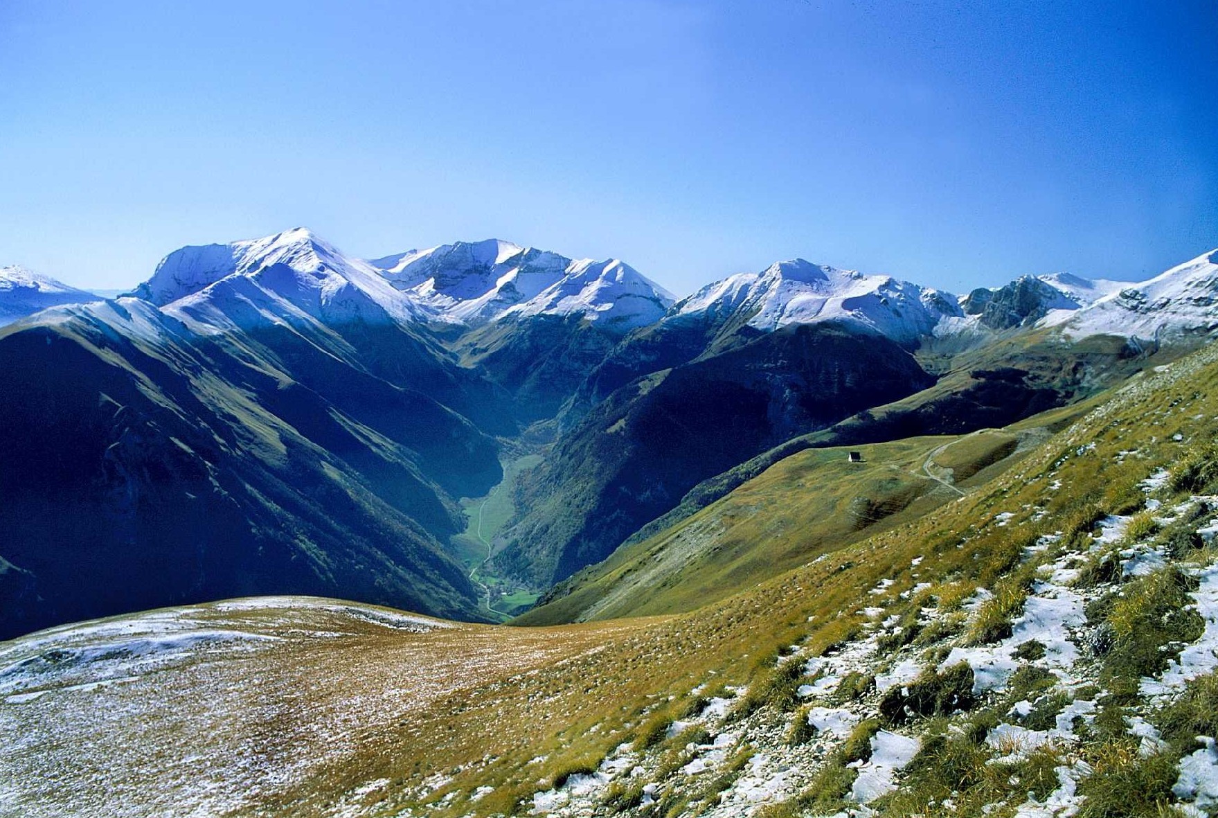
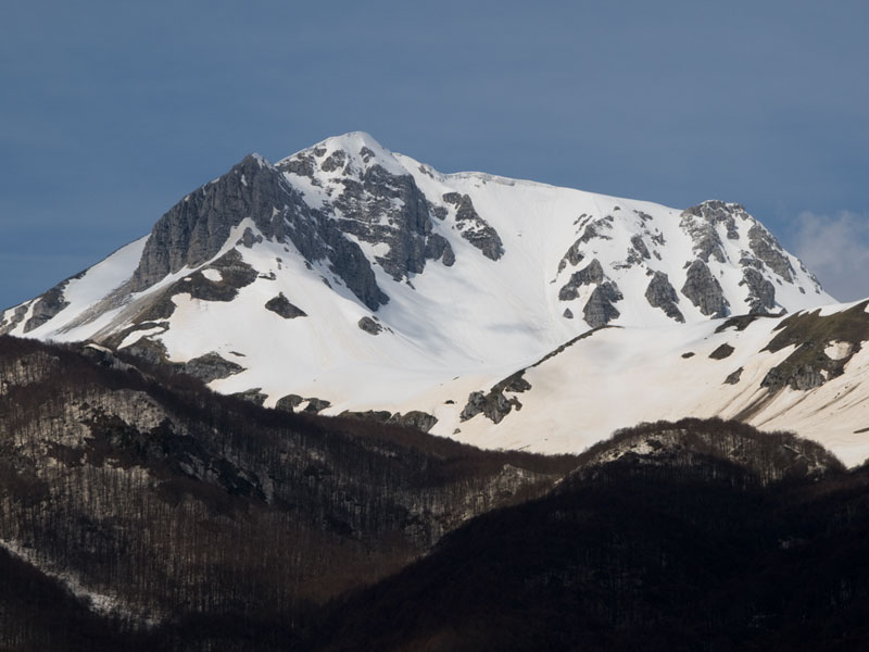
![View from Monte Amaro (Majella)]() View from Monte Amaro (Majella)
View from Monte Amaro (Majella)
|
Maiella massif or La Majella
highest elevation: Monte Amaro (2,793 m)
prominence: 1,810 m peaks: 32 coordinates: 42°03′38.79″N 14°06′45.81″E region(s): Abbruzzo
The Mailella massif holds some of the highest peaks of the entire Central Apennines. Best to describe it is, perhaps, as a vast and remote highland, with more or less independent peaks.
Because of the substantial altitude difference between the trailheads and the peaks almost all approach routes are quite long and arduous.
Many of these mountains are characterized by broad, prolonged ridges and extensive summit plateaus which are divided by deep, funnel-shaped valleys.
There are many interesting and varied trekking routes to explore. The north face of Cima delle Murelle counts among the most challenging multi-pitch walls of the Apennine mountains. A special highlight is the bivouac hut right on the summit of Monte Amaro.
Two ski resorts are situated at the extreme northern and southern extensions ('La Maielletta' and 'Guado di Coccia'). |
| Monte Acquaviva (fores.) | 2,727 m |
| Cima dei Tre Portoni | 2,673 m |
| Monte Pescofalcone | 2,657 m |
| Cima di Fondo di Maiella | 2,593 m |
| Cima di Fondo di Femmina Morta | 2,487 m |
| Cima di Femmina Morta | 2,423 m |
| Monte Il Martellese | 2,259 m |
| Cima Sala del Monaco | 2,214 m |
| Cima Colle d'Acquaviva | 2,200 m |
| Cima di Mucchia di Pacentro | 2,001 m |
|
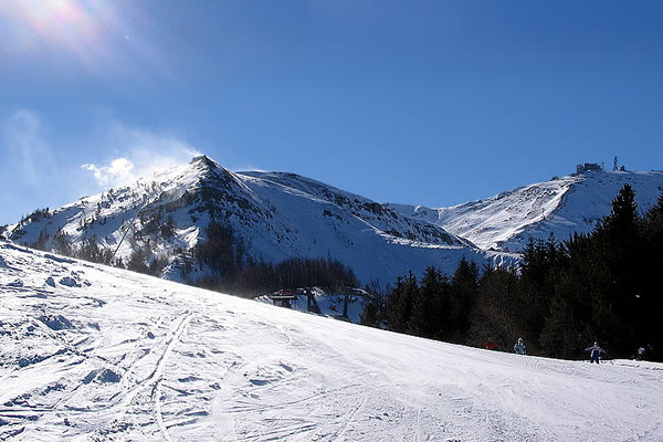
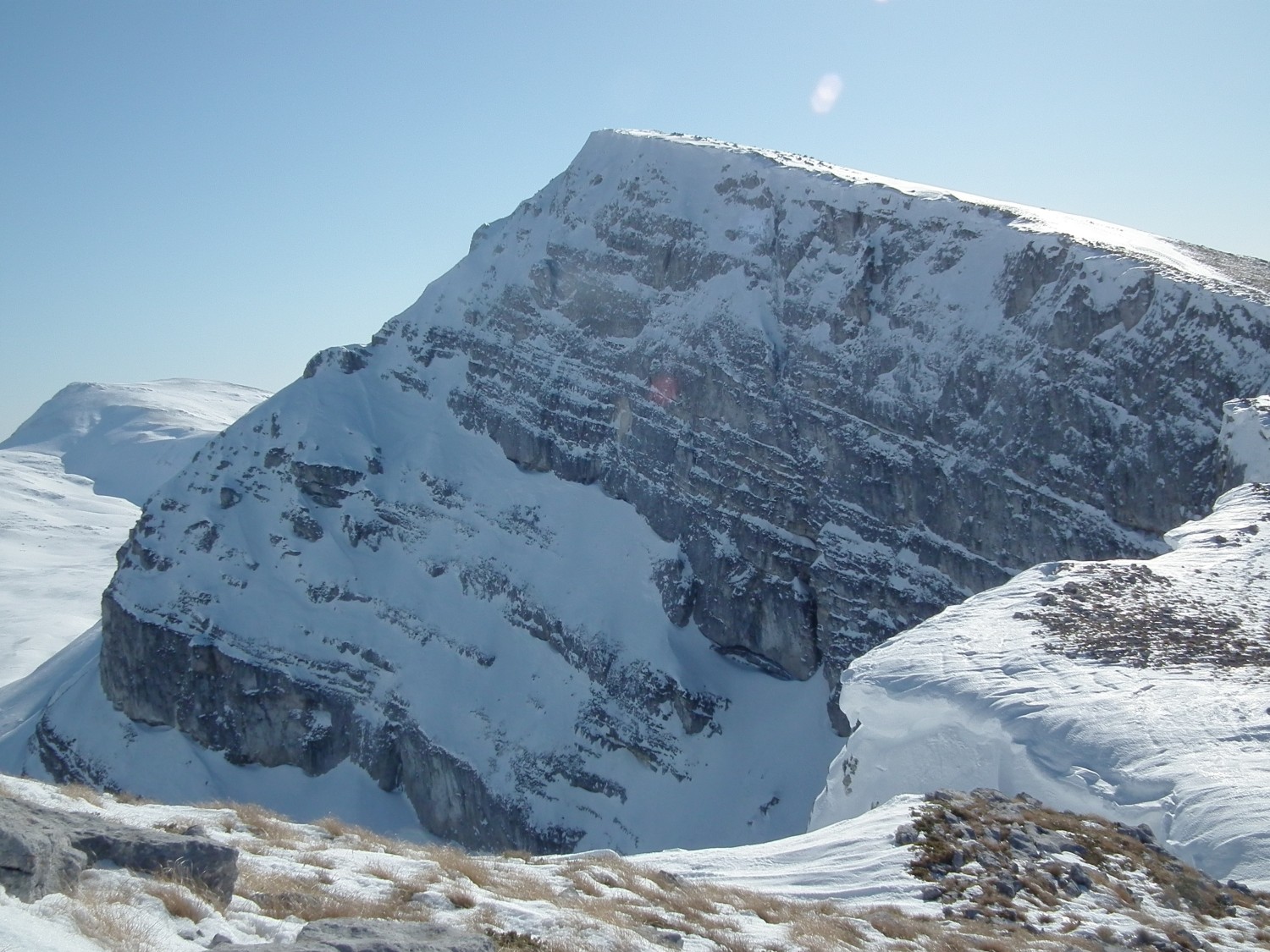
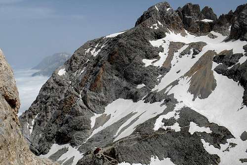
![Corno Grande (from Corno Piccolo)]() Corno Grande (from Corno Piccolo)
Corno Grande (from Corno Piccolo)
|
Gran Sasso d'Italia
prominence: 2,476 m peaks: 39 coordinates: 42°28′12″N 13°33′00″E region(s): Abbruzzo
The Gran Sasso d'Italia is without question the best know and most frequented of all the mountain ranges of the Apennines. With Corno Grande it shows the highest elevation of the Italian mainland outside the Alps.
The flow of 'tourists' is concentrated on the central part of the massif, the 'Calderone', Europe's southernmost known glacier (42°28′N, 13°33′E), and the surrounding peaks, including Corno Piccolo with its dolomite-like walls.
Both Corno Grande and Corno Piccolo are also equipped with a number of via ferratas. (State and accessibility of these routes should be checked on location. You may ask the nice people who run the mountain huts Rifugio Franchetti and Rifugio Duca degli Abruzzi.)
The much less frequented eastern chain of the Grand Sasso offers some fine alpine routes, too, f.e. the Centenario trail which touches almost all the highest peaks. Further to mention are the south routes to Monte Prena, Via dei Laghetti and Via Brancadoro, and the
the truely impressive north face of Monte Camicia, the so-called “Eiger of the Apennines”, first climbed in 1934.
With Pizzo d'Intermesoli and Monte Corvo also the western chain of the Gran Sasso holds two extraordinarily beautiful mountains.
Very picturesque destination are the extensive high plains of 'Campo Imperatore', the moraine landscape of 'Campo Pericoli' and the valley 'Val Maone'.
|
| Corno Grande (west) | 2,912 m |
| Corno Grande (east) | 2,903 m |
| Corno Grande (central)* | 2,893 m |
| Corno Grande (east, fores. north) | 2,700 m |
| Monte Corvo (west) | 2,533 m |
| Pizzo d'Intermesoli (north) | 2,483 m |
| Cima delle Malecoste | 2,444 m |
| Cima Giovanni Paolo II | 2,425 m |
| Monte Portella (north-east) | 2,422 m |
| Monte Brancastello | 2,385 m |
| Cima di Sella Malecoste | 2,282 m |
| Pizzo San Gabriele | 2,214 m |
| Monte Scindarella (fores.) | 2,199 m |
| Monte San Gregorio di Paganica | 2,076 m |
| Cima delle Veticole | 2,044 m |
|
 Monti della Laga
|
Monti della Laga
prominence: 1,183 m peaks: 17 coordinates: 42°37′04.08″N 13°23′46.68″E region(s): Abbruzzo, Marche, Lazio
This mountain range is greatly relegated an existence in the shadow of the adjacent Gran Sasso. Composed mainly of marl and sandstone these peaks differ geologically from the calcarious rock of other mountain chains of the Apennine.
The water-rich valleys hold a multitude of impressing cataracts, f.e. Cascata della Morricana (north of Cima Lepri), Cascate dei Fossi del Molinaro, Cascate di Selva Grande, Cascate dell'Ortanza and Cascata delle Barche (south west). Indeed, a very interesting hiking trail is the trail of the 'Cento Cascate' (Hundred cataracts), right at the feet of the highest peak Monte Gorzano.
During the winter months these valleys offer countless opportunities for ice climbers.
|
| Cima della Laghetta (north) | 2,372 m |
| Cima della Laghetta (central) | 2,369 m |
| Cima della Laghetta (south) | 2,270 m |
| Monte Pelone (south) | 2,259 m |
| Monte La Cipollara | 2,191 m |
| Monte di Mezzo di Campotosto | 2,155 m |
| Monte di Mezzo del Sevo | 2,138 m |
| Monte Macera della Morte | 2,073 m |
| Monte Pelone (north) | 2,057 m |
|
 Valle del Lago Pilato
|
Sibillini mountains
highest elevation: Monte Vettore (2,467m)
prominence: 1,463 m
peaks: 27
coordinates: 42° 49' 28'' N; 13° 16' 30'' E
region(s): Marche, Umbria
national park: Parco Nazionale dei Monti Sibillini
The highest peaks of this mountain range, Monte Vettore, Monte Redentore, Cima del Lago, Punta di Prato Pulito and the craggy pillars of Pizzo del Diavolo, are grouped around the long and articulated valley of the Pilato lake.
From the summit of Monte Redentore, proceeding in a northern direction, a long and betimes aerial ridge is connecting numerousness main and subsidiary peaks. Also the grassy slopes of these mountains show a notable inclination. In the winter month they tend to be avalanche prone.
A spledid destination for a hike is the narrow gorge 'Gola dell'Infornaccio', situated between the slopes of Monte Prioria and Monte Sibilla.
In winter the steep walls of Monte Bove (north) offer demanding mixed routes, especially the east face (750 m), first climbed in 1955, and the north face.
Of interest is also the vast high plain Pian Grande di Castellucio which during the flowering period (May, June, July) is turned into a multicolored sea of blossoms. |
| Punta di Prato Pulito | 2,373 m |
| Cima dell'Osservatorio | 2,350 m |
| Cima di Pretare (Monte Il Pizzo) | 2,281 m |
| Quarto San Lorenzo | 2,247 m |
| Monte Bove (south) | 2,169 m |
| Monte Palazzo Borghese | 2,145 m |
| Sasso di Palazzo Borghese | 2,119 m |
| Cima di Vallinfante | 2,113 m |
| Monte Bove (north) | 2,112 m |
| Cima di Passo Cattivo | 2,065 m |
|
 Lago Matese and Mt. Miletto
|
Matese massif
prominence: 1,306 m peaks: 1 coordinates: 41° 26' 59'' N; 14° 22' 19'' E region(s): Molise, Campania
Monte Miletto is the only peak of the region Campania that exceeds the 2,000 meter mark. Two main routes lead up to the summit, one from the south (Lago Matese) and one from the north. The latter, however, is somewhat defaced by ski lifts and the adjacent ski resort.
An alternative route is approaching the summit via its north west ridge.
With clear weather conditions the view from the summit of Monte Miletto reaches as far as the Maiella massif.
Noteworthy on the south route, a small natural arch and, of course the surroundings of the lake Lago Matese.
Varied hiking trails and short but interesting climbing routes - f.e. Campanariello di Valle (1,605 m) - are to be found in and around the valley Valle Fondacone.
Minor peaks of interest are Monte La Gallinola (1,923 m), Colle Tamburo (1,923 m), Monte Mutria (1,823 m), Monte Crocetta (1,723m), Monte Erbano (1,385 m) and, further afar, Monte Il Taburno (1,394m).
|
|
 Sirente GROUP
|
Sirente GROUP (Velino-Sirente massif)
prominence: 1,009 m peaks: 7 coordinates: 42° 8' 43'' N; 13° 36' 39'' E region(s): Abruzzo
This circa 13 kilometer long mountain range is part of the Velino-Sirente massif. Its north and south face stand in great contrast to one another; steep and rocky the former, soft and grassy the latter.
Other peaks of interest are Monte di Mandra Murata (1,949 m) and, perhaps the most beautiful peak of this range, Serra di Celano (1,924 m).
Of further interest also also the 'Gole di Celano', a 4 kilometer long and very narrow (between 6 and 3 meters) gorge.
|
|
 Monte Velino
|
Velino GROUP (Velino-Sirente massif)
prominence: 1,385 m peaks: 39 coordinates: 42° 8' 50'' N; 13° 22' 54'' E region(s): Abruzzo
The larger part of the Velino-Sirente massif, the Velino GROUP, is separated form the Sirente GROUP by the highlands of 'Altopiano delle Rocche' which has a total of circa 60 square kilometers and in altitude varies between 1,400 m and 1,600 m.
In contrast to the most other ranges of the Apennines the Velino-Sirente massif is constetuted by several mountain chains or groups.
Its sub-ranges are: Monti della Magnola, Monti di Campo Felice, Monti della Duchessa and, of course, the Velino - Cafornia double peak.
|
| Cimata Fossa dei Cavalli | 2,301 m |
| Monte Costone (west) | 2,239 m |
| Costa della Tavola | 2,182 m |
| Monte Capo di Pezza | 2,177 m |
| Cimata della Cerasa | 2,159 m |
| Cimata di Puzzillo | 2,140 m |
| Cima del passo del Puzzillo (north) | 2,131 m |
| Monte Puzzillo (fores. north) | 2,128 m |
| Costone della Cerasa | 2,119 m |
| Cima del Morretano | 2,098 m |
| Cimata di Macchia Triste | 2,090 m |
| Cima di Iaccio dei Montoni | 2,083 m |
| Cima dei Monti di Bagno | 2,073 m |
| Monte La Torricella | 2,071 m |
|
 Monte Terminillo
|
Reatini mountains
highest elevation: Monte Terminillo (2,216m)
prominence: - peaks: 7 coordinates: 42° 28' 24'' N; 12° 59' 50'' E region(s): Lazio
This small mountain range is situated entirely within the boundaries of the region Lazio and anything but off the beaten (tourist) tracks.
However, the highest peak, Monte Terminillo, offers some quite interesting ascent routes, for example 'Via Chiaretti-Pietrostefani' (UIAA II) which approaches the summit from the north.
Other interesting, though rarely frequented peaks are Monte Brecciaro (1,954 m) and Monte Ritornello (1,874 m). Both of them can be approached from the summit of Monte Elefante, via a sharp and areal crest.
|
| Monte Terminilletto | 2,108 m |
| Cima di Vall'Organo | 2,080 m |
|
 Monte Cimone
|
Cimone GROUP (Appennino Tosco-Emiliano)
prominence: 1,577 m peaks: 2 coordinates: 44° 11' 38'' N; 10° 41' 56'' E region(s): Emilia-Romagna
The Cimone GROUP is actually a sub-range of the Appennino Tosco-Emiliano, consisting of Monte Cimone itself and its foresummit Monte Cimoncino.
It is the highest elevation of the region Emilia-Romagna and, unfortunately, greatly defaced by man-made structures like ski resorts and telecommunication antennas.
|
|
![Monte Prado]() Monte Prado
Monte Prado
|
Appennino Tosco-Emiliano
highest elevation: Monte Cusna (2,121m) prominence: - peaks: 5 coordinates: 44° 17' 16'' N; 10° 23' 30'' E region(s): Tuscany
The Appennino Tosco-Emiliano is the northernmost range of the Northern Apennines with peaks exceeding the 2,000 meter mark.
The national park and the mountain range offer a close-meshed net of varied hiking trails and a wide range of accommodation opportunities.
Some other peaks of interest are, for instance, Monte Giove (1,991 m), Alpe Tre Potenze (1,940 m), Monte Alto (1,904 m), Punta Buftanaro (1,878m) and Monte Acuto (1,756 m).
A via ferrata like route, partly equipped with steel cables, connects Punta Buftanaro with Monte Alto.
|
|
 Pizzo Deta
|
Ernici GROUP (Simbruini-Ernici massif)
highest elevation: Monte del Passeggio (2,064 m) prominence: 724 m peaks: 5 coordinates: 41° 48' N; 13° 29' E region(s): Lazio
The Ernici mountains are generally taken together with the Simbruini mountains, thus forming the Simruini-Ernici massif.
The outstand and best know mountain of this range is the almost pyramidal Pizzo Deta.
A prolonged ridge line conects other peaks of this range: Monte Pozzotello (1,995 m), Monte Ortara (1,900 m), Monte Monna (1,952 m), Monte Fanfilli (1,952 m) and Monte Rotonaria (1,750 m).
|
| Monte del Passeggio | 2,064 m |
|
 Monti Simbruini
|
Simbruini & Cantari GROUP (Simbruini-Ernici massif)
prominence: 1,422 m peaks: 4 coordinates: 41° 53' 5'' N; 13° 22' 26'' E region(s): Lazio, Abbruzzo
The Simbruini or Cantari GROUP of the Simbruini-Ernici massif is about 10 kilomenter long and situated between the regions Lazio and Abruzzo.
With Monte Viglio it holds a mountain which in winter offers great ascent routes with impressive cornices of often rather unstable snow. Although technically not too demanding, the exposed and porous ridge between the Gedarme del Viglio and Monte Viglio should be treated with caution.
Other peaks of this range of some interest are Monte Crepacuore (1,997 m), Monte Pratiglio (1,884 m) and Colle Le Lisce (1,870 m).
|
| Gendarme del Viglio | 2,113 m |
|
 Monte Meta
|
Le Mainarde & Monti della Meta (Marsicani mountains)
prominence: - peaks: 22 coordinates: 41° 43' 38'' N; 13° 55' 7'' E region(s): Lazio, Abbruzzo, Molise
This mountain range is almost entirely situated on the territory of the national park and is the home to many (critically) endangered species like the Marsican Brown Bear (Ursus arctos marsicanus).
It consists mainly of one prolonged mountain chain that comprises a number of the highest peaks.
Some of the here listed peaks (¹) are located within the Strict nature reserve of the national Park (Zone 1 / category I), leaving the marked trails is generally not allowed. (For Monte Meta, for example, these are the trails N1 and I1.)
In order to avoid trouble with the park authority (and surcharges) hikers might be well-advised to consult the personal of one of the park's visitor centers. |
| Monte Petroso (fores. north) | 2,171 m |
| Monte Petroso (fores. south)¹ | 2,170 m |
| Monte Balzo della Chiesa¹ | 2,073 m |
| Monte Cappello del Prete | 2,013 m |
| Cima di Serra Matarazzo | 2,007 m |
| Monte La Vedetta (Cima dei Biscurri) | 2,007 m |
|
 Serra Rocca Chiarano
|
Marsicani mountains
prominence: 1,005 m peaks: 32 coordinates: 41° 48' N; 14° 0' E region(s): Abbruzzo
Also these mountains are mainly situated on the territory of the national park, and partly within the bounderies of the Strict nature reserve (¹).
Although they are not to be counted among the highest peaks of the Apennines, the aspect of a many of the Marsicani mountains is rather rocky and rugged. They bear extensive traces of the Pleistocene glaciation.
|
| Serra Rocca Chiarano | 2,262 m |
| Monte Marsicano (east) | 2,253 m |
| Cima di Colle Angelo | 2,217 m |
| Monte della Corte¹ | 2,182 m |
| Serra della Terratta | 2,163 m |
| Serra della Terratta (south) | 2,122 m |
| Serra del Carapale (south) | 2,106 m |
| Monte Argatone (fores. north) | 2,103 m |
| Serra del Carapale (north) | 2,086 m |
| Serra Cappella (south) | 2,056 m |
| Serra Cappella (north) | 2,038 m |
| Serra del Campitello | 2,026 m |
| Monte del Campitello | 2,014 m |
| Serra di Monte Canzoni | 2,000m |
|


