
|
|
Mountain/Rock |
|---|---|
|
|
39.90945°N / 16.29070°E |
|
|
Calabria |
|
|
Hiking, Trad Climbing, Scrambling |
|
|
Spring, Summer, Fall |
|
|
5420 ft / 1652 m |
|
|
Overview
Timpa di San Lorenzo (5,413ft / 1,652m) is surely the most impressive limestone rock face of the Pollino massif and probably among the most interesting of the southern Apennine mountains. Its very characteristic shape is that of a fossilized wave. Its crest is about 4 km long, its vertical western rock face drops away for almost 2,800ft to meet the gorge of the Raganello torrent. Comparatively bare and next to vertical, the west face stands in a sharp contrast to the less-steeper and in some parts heavily vegetated east slope.
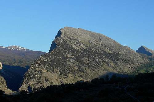 Timpa di San Lorenzo (from south east) | 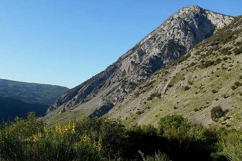 At the base of San Lorenzo (Barile) | 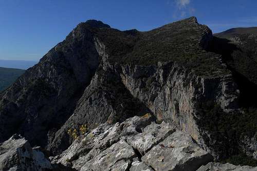 Timpa di Cassano and Timpa di Porace |
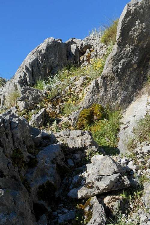
While the west face is strictly reserved for more experienced rock climbers (with the appropriate equipment), the east face will give an interesting playground for scrambling enthusiasts. A particularity of the east slope are the so-called 'lisci' (from the Italian word liscio = slick, smooth). The 'lisci' are almost uncreased limestone slabs. They can be of various size and might form an extensive maze. Although rarely exceeding an inclination of 50 degree they should be treated with utmost caution, as useful hand and footholds can become increasingly rare during an ascent or descent. Those few visible fissures are not seldom filled with loose dirt and overgrown by cunning moss and grass, making them virtually impracticable and potentially dangerous. Although inclination and exposure are not excessive, these areas are not to be underestimated, especially when wet.
Other obstacles are the ubiquitous scree ramps and large spots of prickled thicket formed by low-growing hawthorn and oak trees. The actual crest line shows numerous rifts and gashes and allows great views of vast beech forests and some of the highest peaks of the Pollino massif: Serra Dolcedorme, Monte Pollino, Serra di Crispo and the impressive east face of Serra delle Ciavole. In a southern direction the view goes on the Gulf of Corigliano (or Gulf of Sibari). A heap of rocks marks the highest point.
Other obstacles are the ubiquitous scree ramps and large spots of prickled thicket formed by low-growing hawthorn and oak trees. The actual crest line shows numerous rifts and gashes and allows great views of vast beech forests and some of the highest peaks of the Pollino massif: Serra Dolcedorme, Monte Pollino, Serra di Crispo and the impressive east face of Serra delle Ciavole. In a southern direction the view goes on the Gulf of Corigliano (or Gulf of Sibari). A heap of rocks marks the highest point.
There are basically two trailheads to mention: Sant'Anna, a rural chapel to the north, and the wide base of the east slope of the mountain, a location named Barile. Other great rocks in close vicinity to Timpa di San Lorenzo are the almost pyramidal Timpa della Falconara (to the north) or the rutted Timpa di Porace and Timpa di Cassano (to the south). In order to reach the base of the west face you will have to descend to the bed of the Raganello torrent. A not easily discernable hiking path starts right behind the small chappel and descends south-eastern direction. Pass the cliffs on the left and hold to the escarpment of the east face.
Note: The whole area is exposed to occassional rockfall.
 'I Lisci' di San Lorenzo | 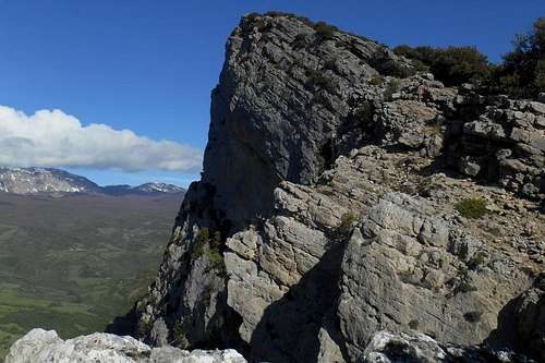 Following the crest line |
The actual trail, called "Scala della Lamia" (engl. Lamia Stairway), runs across talus and scree. It has been washed out by rain and meltwater and is largely flanked or overgrown by thorny shrubs. Always keep close to the wall, as there is a lot of loose terrain and the slope angle is quite respectable. At the bottom you will come upon a natural spring, the so-called "Sorgente della Lamia", where water supplies can be refreshed before climbing the wall or following the path that skirts the gorge of the Raganello.
Note: The term 'Timpa' is another word for mountain (ital. monte) and usually indicates mountains that feature a precipitous rock cliff or a particularly steep face on either one side. It finds a use especially in the southern parts of the Apennine mountains.
Routes
Depending on your personal preferences and, of course, your climbing skills, there are 3 different ways for you of getting to the top of this multifaceted mountain: hiking (the easy way), scrambling (the hard way) and climbing (the elegant way).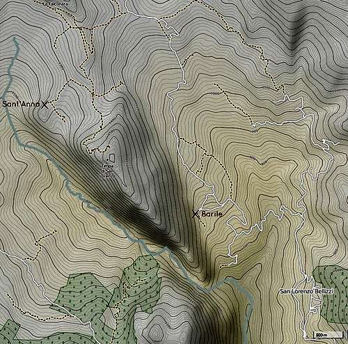 Trailheads (Timpa di San Lorenzo) | 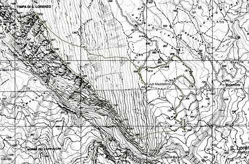 Timpa di San Lorenzo (IGM 1:25.000) |
| trailhead, approach | orientation | itinerary | recommended gear | difficulty | |
| Hiking | Sant'Anna, from the north | dirt track, no specific waymarks or indications | ascending the north side of San Lorenzo from Sant'Anna; then along the ridge |
| no particular difficulties; without notable exposure |
| Scrambling | Barile, from the east | no waymarks or signposting; without any recognizable hiking path; cross-country | ascending from the base of San Lorenzo to the ridge; then always along the rugged cliff |
| dependent on the individual route, quality and quantity of handholds may vary considerably; partly exposed terrain; scree ramps and thick vegetation |
| Climbing | Sant'Anna, from the west | vertical rock face, no way-marks or similar | descending from Sant'Anna towards the Barile gorge and the 'Scale di Barile' |
| generally around III to IV (UIAA), with a few passages up to VI+ (UIAA), partly equipped (pitons); mostly of fair quality; ledges with loose rock and scree |
 Approach way |  Higher up the slope | 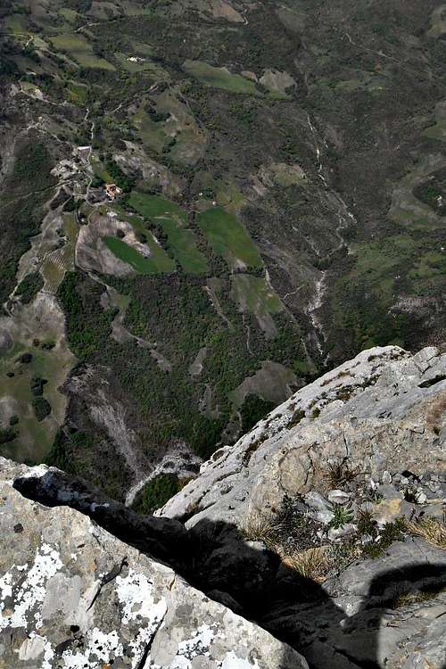 The drop |
Getting there
The nearest airports are Naples (about 230km), Bari and Brindisi (also about 220-230km). From Rome and its big international airports it is a considerably long journey of almost 450km. There is limited public transport in this region. Trains will go as far as Potenza and Matera (Basilicata, FAL) or Scalea or Sibari (Calabria, FS). Buses do operate infrequently between some of the bigger towns and villages, but are rather unreliable. Unless you should have plenty of time at your disposition, you will mostly depend on private transport. The actual mountain roads are largely in bad conditions.
- from Napoli: Take the A3/E45 in direction Reggio Calabria, Salerno. After Castrovillari take the Exit for Frascineto (state road SS263) and follow indications San Lorenzo Bellizzi/Civita.
- from Bari: Take the State Road SS100 (or the highway A14/E843) for Taranto. Turn left (indications for Jonica/Palagiano/Matera/Reggio Calabria) and take the coastal road E90. Exit at Villapiano Scalo (state road SS92) and follow indications for San Lorenzo Bellizzi.
- from Brindisi: Simply take the E90 for Taranto and keep on this road. After Taranto follow the same indications as above (Bari).
Red Tape
Note that Timpa di San Lorenzo is an integral part of the Pollino National Park. The same rules and regulations apply as for other national parks in Italy. No entrance fees or permits are required. Unless expressly authorized by the park authority, camping is generally not consented within the boundaries of the park.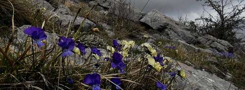
Viola calcarata (Mountain violet)
When to Climb
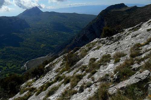
Best period for scrambling and climbing is perhaps springtime through early summer. But also autumn is a recommendable season, provided that no rain is imminent. Especially the less-steeper east face can become a really vicious place to visit if the weather should deteriorate, or with moisture or condensed liquid (drizzling rain, dew, fog etc.) in general. The slick limestone slabs will turn into dangerous and almost impassable obstacles.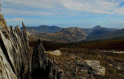 Timpa di San Lorenzo (from Serra di Crispo) |
Accommodation
There are several smaller inns and Bed & Breakfasts to be found in the proximity. A great variety can be found at Civita (about 25km), but also directly at San Lorenzo Bellizzi and Cerchiara di Calabria (about 11km). Alternatively also Terranova di Pollino (about 16km) could be taken into consideration, but the approach way from the north is at times practicable only with 4WD.External Links
- http://www.bed-and-breakfast-in-italy.com - a selection of Bed & Breakfasts in the proximity of San Lorenzo Bellizzi
- http://www.elenchi.com - a list of country houses ('Agriturismo') that rent rooms