|
|
Route |
|---|---|
|
|
49.08034°N / 22.75211°E |
|
|
Hiking |
|
|
Spring, Summer, Fall, Winter |
|
|
Most of a day |
|
|
Overview
przełęcz (pronounced psheh-whench) = pass
This hiking route can be thought of as a Bieszczady National Park classic.
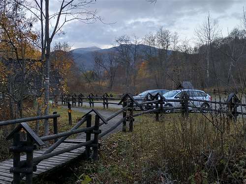
There are a few variants of it (each can be hiked in either direction), of which I chose (in October 2022) the one highlighted in bold print in the table below, which means that I took a bus from Ustrzyki Górne to Wołosate. For parking at an entrance to the national park or inside either village, you had to pay 20 zlotys, which was an equivalent to over €4. A standard national park entry fee cost 8 zlotys per person per day.
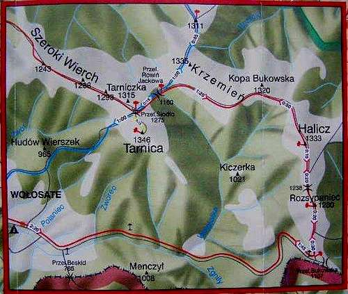
| Route variant | Distance (km) | Approx. total elevation gain (m) | Approx. walking time (h) |
| Wołosate – Przełęcz Bukowska – Halicz – Tarnica – Ustrzyki Górne | 23 | 900 | 7 |
| Ustrzyki Górne – Wołosate – Przełęcz Bukowska – Halicz – Tarnica – Ustrzyki Górne | 29 | 1,000 | over 8 |
| Wołosate circuit: Wołosate – Przełęcz Bukowska – Halicz – Tarnica – Wołosate | 20 | nearly 900 | 6 |
Maps
Plastic/Paper maps:
- Bieszczady Wysokie by W. Krukar, 1:30,000 Ruthenus
- Bieszczady Połoniny, 1:25,000 Galileos
Route Description
|
From the bus stop / car park near the park entry in Wołosate continue along the tarmac road for over 1.5km. You will see Tarnica (1346m), the highest summit in the Western Bieszczady, on your left. 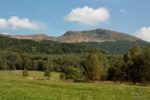
Then the road turns right (to the south) heading for the Poland-Ukraine border (no entry!) and the trail switches to a much narrower road with occasional patches of old tarmac. 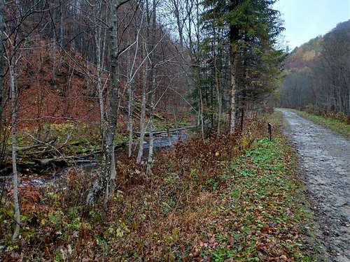
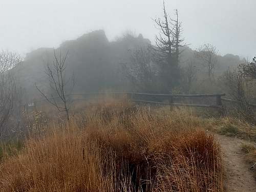
All the time you have Wołosatka brook on your right. About 3km from the start there is the first rain shelter. (Along the road, until its end at Bukowska Pass, wooden Stations of the Cross have been placed. On a couple of days during Lent hundreds of Bieszczady lovers come to celebrate Christ's Passion here. Until 2016 that was performed along the blue trail from Wołosate to Tarnica.) 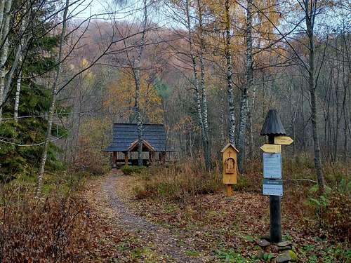
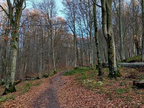
Another kilometre and you stand on a bridge over Wołosatka. Soon after the bridge an ascent of Rozsypaniec via Bukowska Pass begins. After two kilometres, where the slope of Rozsypaniec becomes steep, the road forms a very sharp bend running north for a few hundred metres, then back to the southeast, through beech woodland, to the pass. At the pass there are a toilet and a rain shelter. 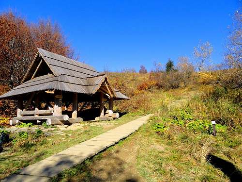
Here the waymarked trail leaves the road and turns north, up the ridge that extends to the summit of Rozsypaniec and then Halicz. Before you start going up, you can walk another 150 metres along the same road that has led you here to a viewpoint located on the Poland-Ukraine border (nearly 8km from the trailhead). From there you can have the first views towards Ukraine. 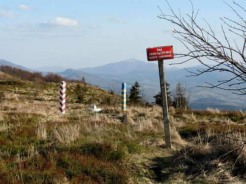
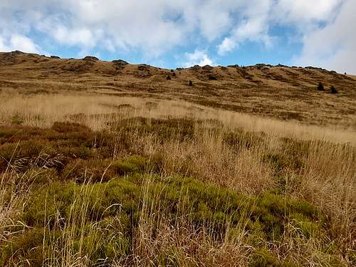
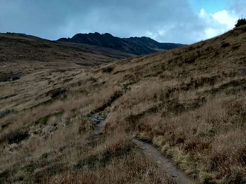
After the trail leaves the road you will have to come to terms with various measures installed to prevent erosion as well as protecting the flora: railing, wooden stairways, duckboards, no trampling signs. They seem to be necessary since at weekends and during the summer holidays the park trails are packed with tourists. For the same reason, although the ridge of Rozsypaniec has a few interesting rock formations just by the trail, access to them is banned. 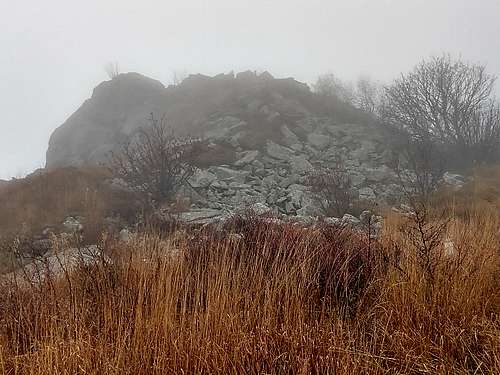
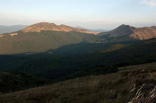
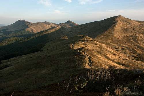
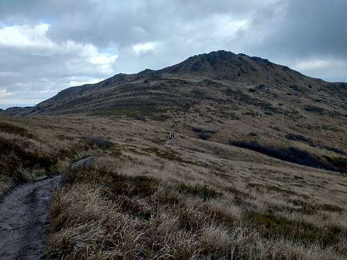
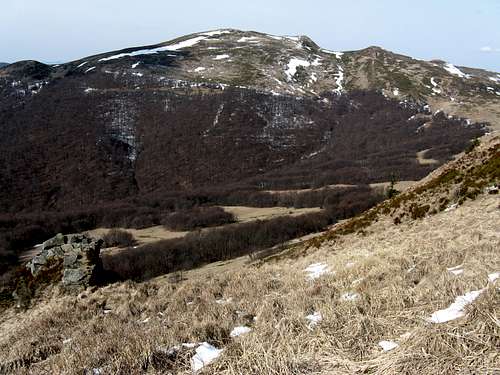
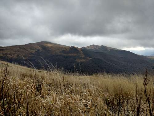
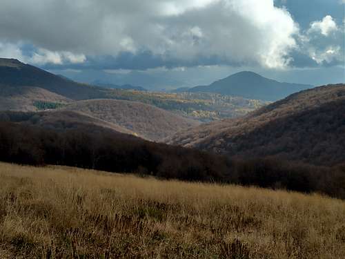
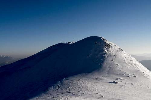
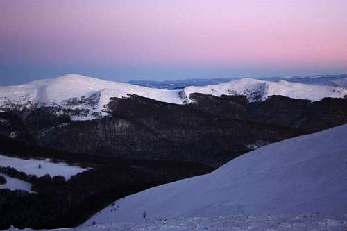
From Rozsypaniec, and later from the summits of Halicz and Tarnica, weather permitting you will have panoramic views. (On each of the summits are wooden benches, so they are perfect places to have a snack besides admiring the views.) In fact, most of the trail above the treeline is very scenic. 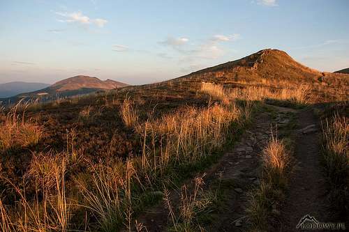
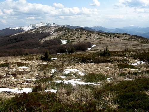
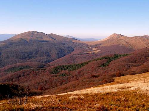
The trail descends the north side of Halicz, then – after about half a mile – turns west towards the saddle between Tarnica and Krzemień (Przełęcz Goprowska). You traverse the south side of Kopa Bukowska (1319m) almost horizontally, then slowly lose elevation traversing the southwest side of Krzemień (excellent views!) to get to Przełęcz Goprowska. This broad saddle at 1160m was originally called Rowiń Jackowa. 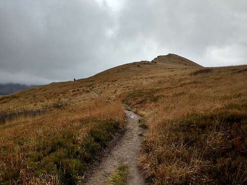
Goprowska Pass lies 5.7km away from Bukowska Pass (via the trail), which means that when you get to the pass, you have covered a distance of over 13.5km from the TH in Wołosate. From the pass blue marks can take you near the summit of Krzemień, whose rocky ridge looks tempting. Unfortunately, the summit and the ridge have been closed for hikers by the park authorities. 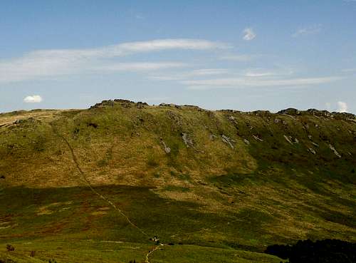
From Goprowska Pass it is 0.75km to the pass at 1286m (Przełęcz Sidło/Siodło, sometimes called Przełęcz pod Tarnicą, whose elevations is often mistakenly given as 1275m) which separates Tarnica at 1346m from Tarniczka at 1315m (the highpoint of Szeroki Wierch). From that pass yellow marks will take you to the summit of Tarnica, the highest in the Western Bieszczady. 
When you have come back to the pass (it is 400m up and then back), you pick up the red marks again to follow the long and broad top of the ridge of Szeroki Wierch to Ustrzyki Górne. That will be over 7.5km and just several metres up. 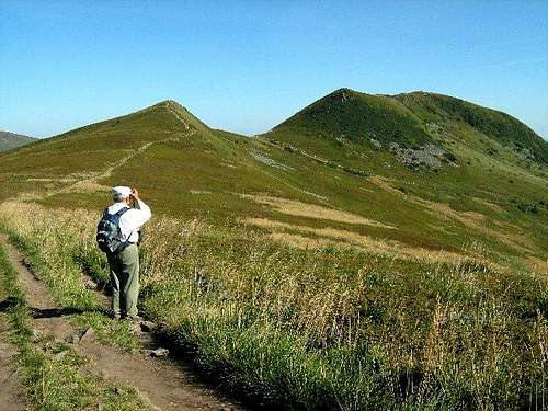
Instead of walking over Szeroki Wierch, from Przełęcz pod Tarnicą you can descend to Wołosate via blue marks. This is the shortest route to the highest summit, taken by most of the visitors to the national park, so it only makes sense if you have parked your car in Wołosate. The distance is 4km. |
Red Tape & Camping
Camping, bivouacking, dogs and walking off the trail are not allowed. The nearest campsite is in Ustrzyki Górne.
When To Go
- There will be crowds in summer (except September) and at weekends.
- Winters can be harsh.
- Bear in mind that bears are most dangerous during spring. I have never heard of any problems with bears on this route, but you should be bear aware.
- The best time to go seems to be late summer or early autumn.
- Weather forecast for Ustrzyki Górne at approx. 650m on AccuWeather
Other Information
Please check out the parent page.