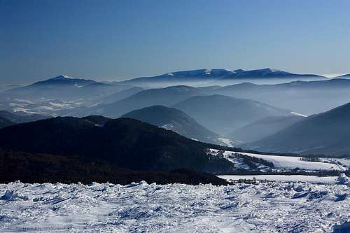
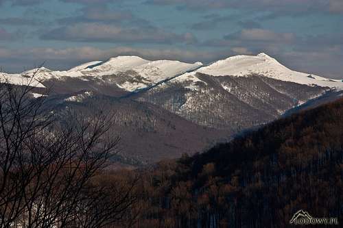
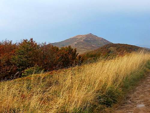
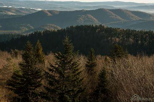
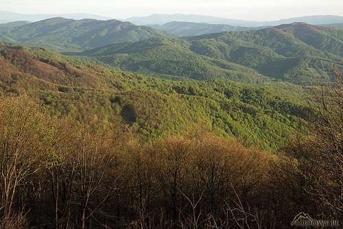
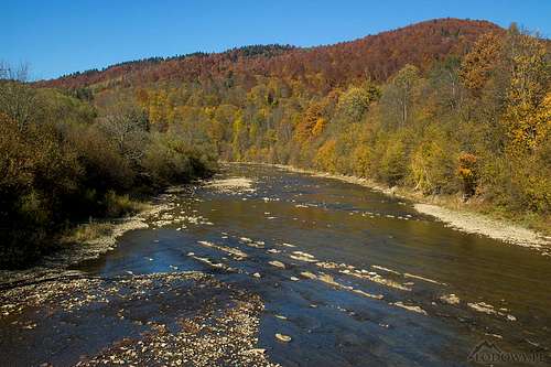
The Bieszczady Mountains belong to the Northeastern Carpathians and are made of flysch, their highest summits of hard sandstone. They are usually divided into the Western and the Eastern Bieszczady. The Western Bieszczady extends between Łupków Pass (Przełęcz Łupkowska) in the west and Uzhok Pass (Użocka Przełęcz/Uzhotskyi pereval) in the east. Most of the main ridge of the Western Bieszczady constitutes the border between Slovakia and Poland. Its easternmost bit forms the Poland-Ukraine border, then ends just beyond it at the pass of Uzhok in the territory of Ukraine, where - according to most Polish geographers - the Eastern Bieszczady begins, whose highpoint is nearby Pikui at 1408 m. The highest summit of the Western Bieszczady, Tarnica, stands inside the southeast tip of Poland, topping out at 1346 m. To the northeast of the Western Bieszczady strech their foothills named Góry Sanocko-Turczańskie, meaning the Sanok-Turka Mountains, in Ukraine known as Verkhnodnistrovs'ki Beskydy, reaching 1022 m. People on the ground as well as some geographers tend to think these mountains are part of the Bieszczady - they are often called the Low Bieszczady. West of the Western Bieszczady, beyond the Osława River, Łupków Pass and the sources of the Laborec River extends the Low Beskid (1002 m). To the southwest sits Vihorlat at 1076 m, belonging in the Carpathian volcanic belt. A bit further to the southeast rise the massifs of Ostra Hora and Polonyna Rivna/Runa (1480 m), which were once regarded as part of the Bieszczady, but are now usually considered a distinct range.
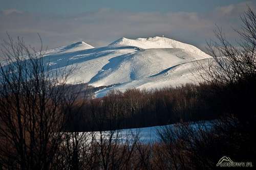
The highest
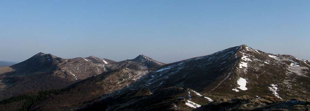
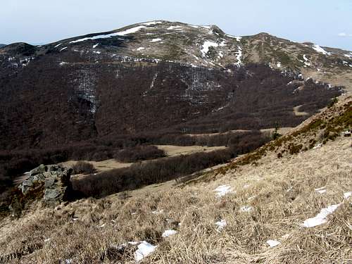
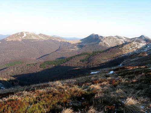
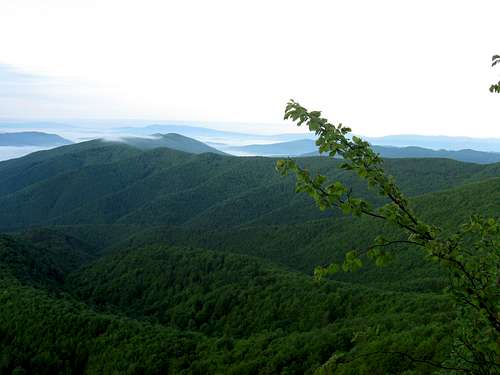
Towards Ostra hora & Rivna
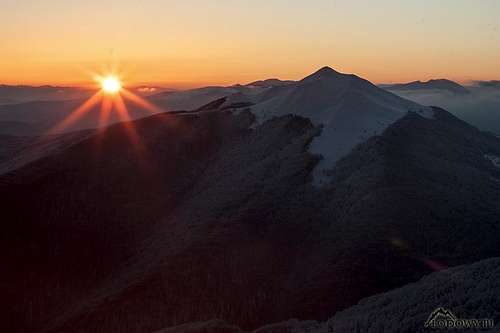
The 2nd highest
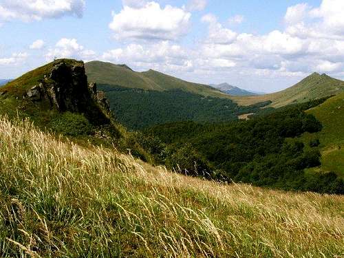
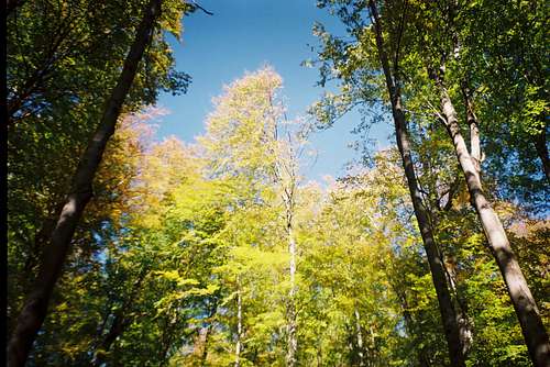
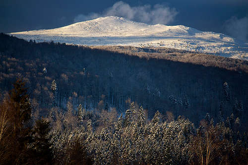
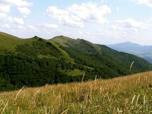
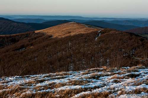
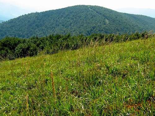
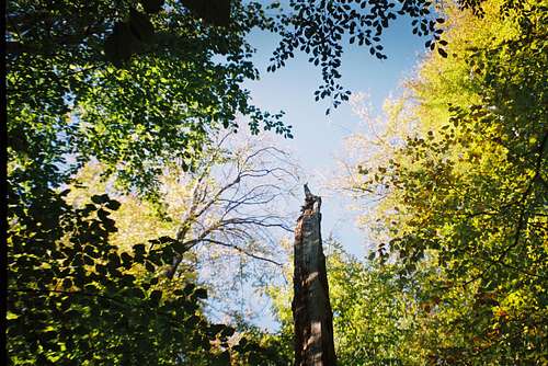
The Bieszczady mountains differ from the other mountain ranges in Poland rising over 1200 m in that they lack the upper montane forest level, normally formed of spruce in this part of Europe. Above the beech woodland stretches a distinctive grassland zone known as połonina/polonina/polonyna. This is believed to be a natural phenomenon, although some scientists disagree. The treeline in the Bieszczady often runs strikingly low, a couple of hundred meters below the expected 1250 m, which is due to a few centuries of grazing. Until the 15th century few people had lived in the Bieszczady, but the second half of the second millennium A.D. saw extensive colonization, exploitation of woodland in the valleys and its destruction on mountain tops and the upper slopes so that it made way for pastures, on which enormous herds of livestock were grazed. As a result, the połoninas have been greatly extended and the treeline lowered.
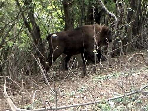
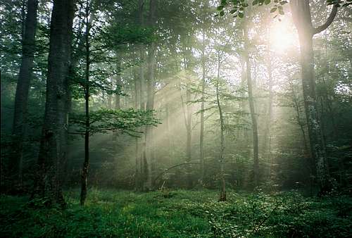
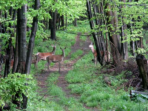
Extensive grazing in the Western Bieszczady as well as overpopulation in the area ended in the middle of the 20th century, when after World War II the local Rusyn/Ukrainian population was deported and dispersed in the north and west of Poland in retaliation for genocide against Poles committed by the Ukrainian Insurgent Army. Since then the Western Bieszczady has undergone rewilding - nature has replaced human management. Now these mountains rank among the wildest corners of Europe and can be considered a true 'wildlife hotspot'. There is hardly any other place in Europe where you can encounter such a wide range of ungulates (European bison aka wisent, red deer, wild boar, elk, roe deer) and predators (brown bear, wolf, lynx, wild cat, fox). Please see chapter 8 for more information.
Subranges
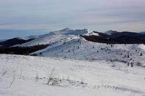
The highest summits of the Western Bieszczady rise in the southeast corner of Poland.
E reaches of Połoninas Ridge
There are several mountain ridges in the Polish part of the range:
The main ridge - both an international border and an important water divide trending WNW-ESE whose highest summit is Wielka Rawka (1304 m)
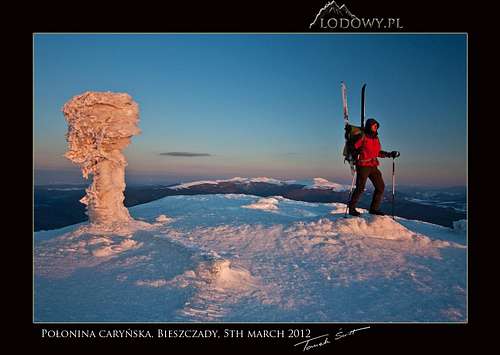
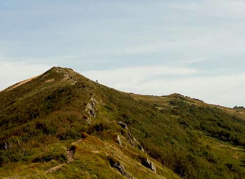
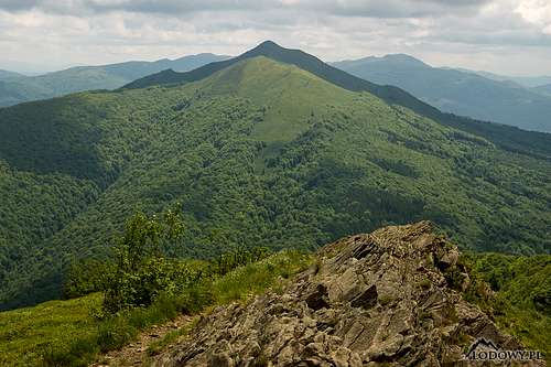
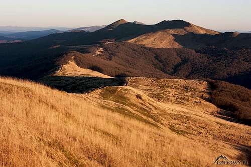
The Ridge of the Połoninas, which stretches to the north of the main ridge, parallel to it, and boasts the highest parts of the Western Bieszczady - from NW to SE: Połonina Wetlińska at 1255 m, Połonina Caryńska at 1297 m, Tarnica Group (Tarnica at 1346 m) and Połonina Bukowska (Halicz at 1333 m), which connects to the main ridge at Bukowska Saddle
Wysoki Dział in the west (Wołosań at 1071 m), east of the Osława River: few human visitors, vast forest, good chance of seeing the big Carpathian mammals, such as the bear and the wisent
Łopiennik Group (1069 m), east of the ridge of Wysoki Dział
Otryt (Trochaniec, 939 m), on the north side of the San River just above Solina Dam. The ridge of Otryt can be classified as part of the Sanok-Turka Mountains
Wysoki Dział
Łopiennik
Otryt
In Slovakia, the Western Bieszczady mountains are called Bukovské vrchy. In the west they are surrounded by Laborecká vrchovina (905 m) and in the south by Beskydské predhorie (661 m). They are covered by extensive woods which contain clusters of primeval beech forest inscribed on the World Heritage List as part of the Primeval Beech Forests of the Carpathians and the Ancient Beech Forests of Germany. Nature is not the only thing that can be found there. In the villages of Ulicske Krive, Rusky Potok and Topola stand wooden churches with rare iconographic decorations of the interior. Bukovské vrchy can be divided into two subgroups: Bukovce in the north, whose highest summit is Veľký Bukovec at 1012 m, and Nastaz in the south (800 m).
Bukovské vrchy
Stynka
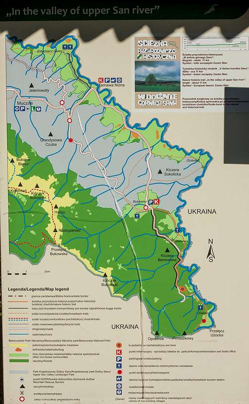
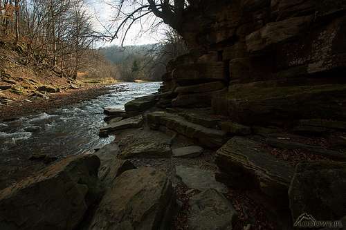
The San
The Ukrainian corner of the Western Bieszczady between the Slovak and Polish borders, south of the main ridge, is called Stuzhitski Beschady. Its southern boundary is formed of the uppermost course of the Uzh River. Wilderness lovers will head for Stuzhytsia primeval beech-fir forest – a UNESCO World Natural Heritage Site. Those who are keen on cultural sites will be pleased to see the wooden church in Uzhok - part of UNESCO World Cultural Heritage named Wooden Tserkvas of the Carpathian Region in Poland and Ukraine. Besides, some may feel like visiting the frontier massif of Stynka/Stinka (1019 m), where the largest meteorite in Europe, Knyahynskyi fell in 1866.
Highest Summits
The table below lists the highest peaks in the Western Bieszczady. The names of the summits which are given in brackets were once used by some of the local villagers and were later collected by Wojciech Krukar. They (along with many more old local names) can be found on his excellent map Bieszczady Wysokie published by Ruthenus (Krosno 2020).
Western Bieszczady's highest peak whose name originally meant 'saddle'! See the mountain page for more information - please click 'Tarnica' to the left of the photo
Krzemień
(Kremiń or Hrebeń)
1335
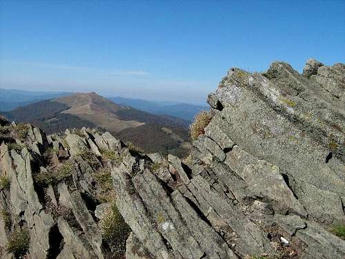
2nd highest peak, the rockiest of all in the Western Bieszczady, 1 km long sandstone ridge which was originally called Hreben (Comb/Crest) by the locals. The waymarked trail used to climb the summit and run along the ridge, but now it (blue marks) runs away from them and climbing the summit is illegal
Three-summit ridge with sandstone crags extending north of Krzemień. According to W. Krukar, until World War II the whole ridge was called Połonina Dźwiniacka by the local people, today its second highest summit at 1238 m bears that name. Blue stripes Otryt-Wołosate, yellow stripes from Muczne.
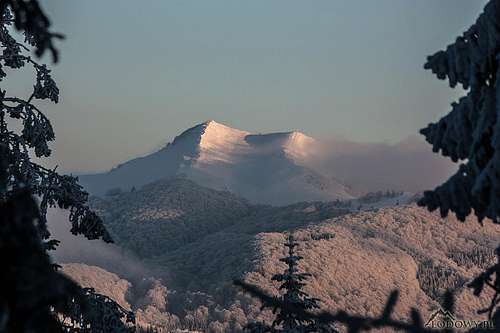
The most prominent summit in the Western Bieszczady (523 m of prominence) and the highest summit on the main ridge, dome-shaped, with an avalanche-prone NE face, blue stripes from Ustrzyki Górne, green stripes from Przełęcz Wyżniańska/Wetlina, then yellow from Mała Rawka
At the southeast end of the Ridge of the Połoninas - see the mountain page for more information
Mała Rawka
1272
'Mała' translates as 'little'. Just north of the summit of Wielka (Great) Rawka. There is a small clearing, i.e. a tiny 'połonina' on the top; green stripes from Przełęcz Wyżniańska/Wetlina
Highpoint of Połonina Wetlińska rises in the eastern part of the massif and is called Roh (literally 'horn' in Rusyn/Ukrainian); steep S face, Chatka Puchatka (former hut, today shelter/café in summer) situated at the easternmost summit, red stripes from Smerek/Berehy Górne, yellow stripes from Przełęcz Wyżna/Zatwarnica/Wetlina, interpretive trail
Kińczyk Bukowski
(Rozsypaniec Beniowski)
1251
Highest summit of Uzhanskyi National Park, situated on the PL/UA border. The southernmost tip of Poland - Opołonek peak rises a few kilometers past Kińczyk Bukowski, access to the area is officially forbidden! A grey stripe interpretive trail from Verkhovyna Bystra/Uzhok Pass
At the northwest end of the massif of Połonina Wetlińska. Smerek is now named after a nearby village, but it was originally called Wysoka, i.e. theHigh One, by the locals. It is separated from the main part of the massif by a low (1075m) pass named after Mieczysław Orłowicz, renowned Polish hiker, author of about a hundred guidebooks - see the mountain page for more information
T-junction of three international borders (Slovakia-Poland-Ukraine) - see the mountain page for more information
Video created by LukZem during his eight visits to the Western Bieszczady: part 1/2
Video created by LukZem during his eight visits to the Western Bieszczady: part 2/2
When To Go
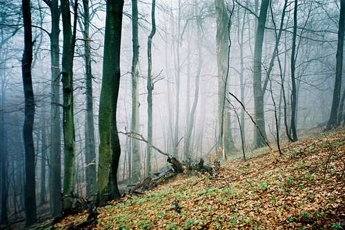
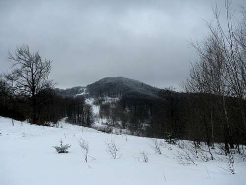
The climate of the Western Bieszczady is continental with snow cover lasting from November till the beginning of May. The annual amount of precipitation exceeds 1100 mm and July is the rainiest month. If you are seeking solitude, a hike in the Bieszczadzki National Park in the middle of the summer season is definitely not a good idea. September is often said to be the best option - for two reasons: fewer people and leaves turning colors.
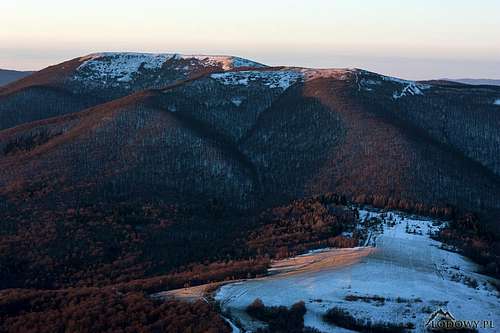
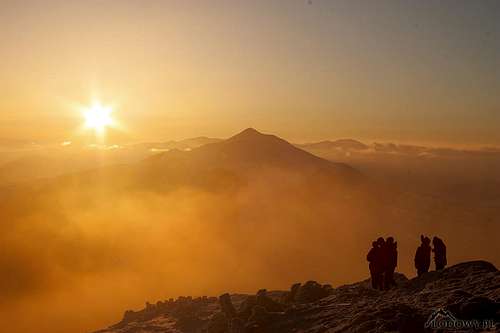
Late summer and early autumn often offer favorable weather conditions, besides the gorgeous scenery of the colorful broadleaved woodland. Winter in the Bieszczady Mountains can be freezing cold, but is very romantic as there are hardly any visitors and you have unique panoramic views for yourself: From the High Tatras on the western horizon to the Gorgany Mountains far east inside Ukraine.
Red Tape, Camping & Bears
The Western Bieszczady range is one of the best protected areas in Europe. The bulk of the mountains is part of the East Carpathians Biosphere Reserve - the first trilateral UNESCO Man and Biosphere project in the world. It is the largest biosphere reserve in Europe with a total area of nearly 2,000 square kilometers. It contains six protected areas within the confines of three countries. Please see chapter 8 for more information.
Wild camping in the Polish and Slovakian territories is forbidden.
The Ciśniańsko-Wetliński and San Valley landscape parks form the buffer zone of the Bieszczadzki National Park. Most of the area of the latter (70%) has the status of a strictly protected zone where hiking is only allowed along the waymarked trails. Camping, bivouacking and entering areas where there are known bear dens are prohibited. (There have been several bear attacks on people in recent years, nearly all of them on forest workers or the locals picking mushrooms or red deer antlers.) Biking is only allowed along public roads. Horseback riding in the BNP and its buffer zone is only allowed along marked trails and only on the Park's horses (Hutsul horses). A small fee (an equivalent of about €2) is charged for entry.
Almost the same goes for Slovakia's Poloniny National Park except that there is no entry fee and you are allowed to stay overnight in a couple of cabins, such as those at Ruské sedlo/Przełęcz nad Roztokami Górnymi or sedlo pod Čierťažou, both on the main (border) ridge. Hikers are allowed to cross the Slovak-Polish border at the two following crossing points:
Border-crossing point
Season
Open daily
Hiking trail
Located at
Balnica (PL) - Osadné(SK)
1 June - 30 September
9:00 - 18:00
yellow stripes
westernmost part
Roztoki Górne (PL) - Ruské sedlo (SK)
1 April - 30 September
9:00 - 18:00
yellow/blue stripes
west-central part
Bivouacking in Slovakia
Stuzhytsia campsite
The situation in Ukraine's Uzhanskyi National Nature Park is now getting better and some campsites, hiking trails and rest places have been set up. You can follow the newly marked red stripe trail Velikiy Bereznyi - Yavirnyk - Dubovy Haj - Stynka - Stuzhytsia - Ceremcha - Lubnya - Verkhovyna Bystra - Scherbyn - Uzh Pass.
NB: Ukraine is not part of the European Union, so the regulations are much stricter, and border-crossing is out of question. From experience, it is a good idea to ask the border police if you can visit the Ukrainian piece. It is also advisable to report your plans at the headquarters of the Uzhansky NNP at the town of Velikiy Berezniy. The Nadsanskyi Regional Landscape Park is accessible only with a permit from Mostyska border office!
The highest part of the Western Bieszczady is readily accessible from the north (Poland). The driving distance from the city of Rzeszów to the village of Ustrzyki Górne in the middle of the Bieszczady National Park is less than 170 km (a car journey takes over 3 hrs, bus 4 hrs with a likely change at the town of Sanok). From Košice, the largest city in the east of Slovakia, it takes up to 2.5 hrs to drive to the village of Uličské Krivé that sits in the heart of the Bukovské vrchy.
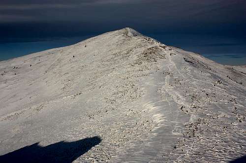
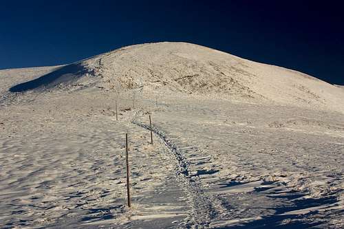
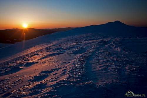
avalanches - in the Western Bieszczady there are about a dozen places that experience avalanches almost every year, the sides of Wielka Rawka and Szeroki Wierch being most at risk. Avalanches can occur on any steep slope, not necessarily above the treeline.
Poland (GOPR) emergency number in the mountains: (+48) 601 100 300 or 985
Slovakia (HZS) (+421) 18 300
Warning In Slovakia - unlike in Poland - those who do not carry commercial insurance have to pay for any rescue services rendered by Mountain Rescue Service (HZS).
GOPR Head office Sanok, 49 Mickiewicza Street: tel. 13 4632204
Aviation emergency – Sanok: 13 4630477
Emergency station
Phone
Ustrzyki Górne
13 4610606
Cisna
13 4684734
Przysłup Caryński
13 4611848
Połonina Wetlińska
603449516
Mountain rescue service in Ukraine
Name of MRS
Address
Telephone/e-mail
Mobile phone
Transcarpathian
Uzhorod, Vereshcahina 18, 88006
+38 0312 671 413 zak.resque@tn.uz.ua
+38 097 585 6685
Lviv
Zaliznichna 16, 79905
+38 0342 222 165 resque_tur@ukr.net
+38 0322 395 070
Vyshka
Krasiya summit, 89023
+38 0312 671 413
+38 050 527 1705
Volovets
Karpatska 100, 89100
+38 0313 622 290
+38 068 502 8551
Duty officer of Ministry of Emergency (+38 0321) 660 701, 660 114 or (+38 0442) 473 103 Emergency number of rescue service: 101 (only from UA operators)
Accommodation
Rabe
Balnica
Pod Małą Rawką
Chatka Puchatka
There is a wide range of accommodation options in the Polish Bieszczady: Take a look here or here
Video created by LukZem during his eight visits to the East Carpathian Biosphere Reserve
The East Carpathians Biosphere Reserve in the Western Bieszczady Mountains is the largest biosphere reserve in Europe. In 1992, under the UNESCO Man and Biosphere Program, a bilateral, Polish-Slovak Biosphere Reserve was designated. In 1998 Ukraine joined and the first trilateral biosphere reserve came into being - a treasure of global importance combining immense wildlife value with rich cultural heritage. The reserve contains some of the least disturbed ecosystems in Europe, such as the largest on the continent, well-preserved beech forest complex and East Carpathian mountain meadows ("poloniny"). It is home to several endemic and threatened plant species and communities as well as a number of animal species, including large predators such as the brown bear, wolf, lynx and golden eagle. Along with the carnivores, big herbivorous mammals live here: Carpathian red deer, European bison (also known as wisent) and Hutsul horse. The East Carpathian Biosphere Reserve covers 200,000 hectares (of which 53% is in Poland, 19% in Slovakia and 27% in Ukraine) and encompasses the following six protected areas:
Video created by LukZem during his visits to the Bieszczady, Poloniny and Uzhanskyi National Parks
Video created by LukZem during his visits to the Cisniansko-Wetlinski, San Valley and Nadsanskyi Landscape Parks
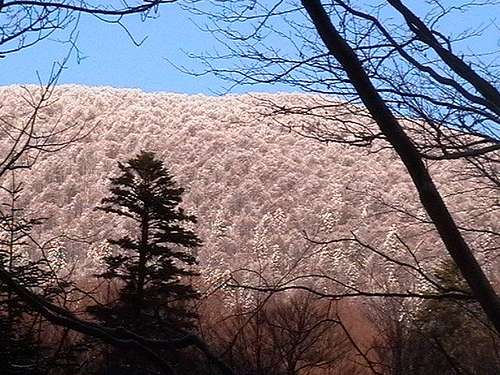
Europe's largest area of montane beech forest can be found in the Western Bieszczady. The dominance of beech is reflected by the Slovak name of the mountains, Bukovské vrchy (Beech Hills). Special circumstances made it possible for extensive remnants of virgin forests to persist in this transboundary area until today. The first forest reserve called Stuzhytsia was established in 1908. In 2007 this primeval forest with other well-preserved forest reserves such as Udava, Havešová and Rožok were inscribed on the UNESCO World Heritage List as Primeval Beech Forests of the Carpathians. In 2021 component cluster in the Bieszczady NP including the best-preserved areas of beech forests of primeval character with four component parts named: Polonyna Wetlinska and Smerek (the Tworylczyk and Hylaty stream valleys) in the nortwest, the Border Ridge and the Upper Solinka Valley in the southwest, the Wolosatka Stream Valley and the Terebowiec Stream Valley in the southeast were additionally inscribed on the UNESCO World Heritage List as Ancient and Primeval Beech Forests of the Carpathians and Other Regions of Europe.
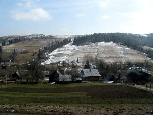
The park was first established in 1973, but later substantially enlarged in 1990s. Today (in 2022) it covers an area of 292 sq km encompassing the most valuable, highest, eastern part of the Western Bieszczady that lies in the southeastern tip of Poland fondly known as the 'Polish Wild East', including a narrow exclave stretching along the uppermost reaches of the San River, divided from the core area of the park by a swathe of its buffer zone designated as the San River Landscape Park. The Bieszczady National Park is the largest mountain national park in Poland. It protects montane forest ecosystems, the połoninas and the so-called 'land of valleys', i.e. the cultural landscape of what is left from the villages of the Ukrainian/Rusyn Boyko and Łemko ethnic groups. It may be worth mentioning here that since the end of the 1940s the flora and fauna of the area have been developing as a result of spontaneous, secondary, regenerative succession.
The BNP has 140 km of waymarked hiking trails furnished with wooden signposts, rain shelters, benches, bridges over streams, duckboards, steps and railings to prevent erosion by walkers. Some stretches of the trails, furnished with information panels, marked with an image of a wild animal or plant and described in detail in a booklet that you can purchase at the entrance, function as interpretive paths. There are also some trails for horseback riding (around 65 km in total).
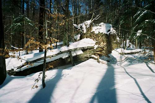
The BNP is one of the few European mountainous areas with relatively well preserved native fauna and flora, although forest of primeval character, beech or beech-sycamore with an admixture of fir, covers only a few percent of it, growing in the wildest, hardly accessible nooks, such as the valley heads of Solinka, Wołosatka and Hylaty creeks. The woods of the Western Bieszczady had the hardest time from the 19th to mid-20th cent., when they were decimated to meet the needs of industry, but much of them had been altered or destroyed by humans since a few centuries earlier when a greater number of farmers became settling in the valleys and herders practicing transhumance arrived. The poloninas were extended but oxen and sheep were grazed in the woods as well. Also, livestock sought shelter from scorching summer heat there. A testimony to the pastoral economy of the past is bizarre 'pasture beeches', which used to be nibbled by livestock or pruned by sheperds.
Rain shelter
Wołosatka wilderness
Bear Creek
'Pasture beech'
Outside the Park
The timberline that is closest to what it must have been before the arrival of herds of cattle and flocks of sheep can be seen at about 1250 m on the sides of Wielka Rawka, where grazing ended over a century ago. The upper level of the beech wood shrinks to krummholz, then green alder appears, then grasses and subalpine or alpine flowers. Połoninas, i.e. the meadows above the treeline, are a species-rich formation characteristic of the Northeastern Carpathians. Most are secondary communities that arose owing to cattle grazing on mountain ridges. Some of the most beautiful flowers have been recognized as Dacian migroelements, namely the bellflower (Campanula abietina), Dacian violet (Viola dacica), monkshood (Aconitum lasiocarpum) and compact pink (Diantus compactus). In recent years the poloninas have undergone floristic and faunistic changes due to the fact that the grassland is not grazed by livestock or cut any longer. Generally, the grassland is slowly losing its human-induced biodiversity. Therefore the park authority is considering a resumption of grass-cutting on selected połoninas.
Glaucopsyche aleksis
Siberian Iris
Dacian violet
Compact Pink
The term 'land of valleys' is used to refer to the romantic remnants of the Boyko villages, whose residents were deported from the part of the mountains that remained within the borders of Poland in 1947. (Please see this album.) These patches within the park, the largest of them being the exclave along the uppermost reaches of the San, are under partial protection, which means, for example, that its semi-natural meadows are cut and grazed by livestock.
Fog over 'land of valleys'
Where Jaworzec village was
Sianki village in 1939
Tomb of Countess
Unfortunately (or fortunately, depending who you ask) the number of tourists visiting the BNP (450,000 in 2017) keeps growing every year. This doesn't change the fact that it is a perfect place for day hikes, a cult location for everyone who admires wild nature, tranquility and sweeping mountain vistas. Especially, if you come in the off-season.
Bieszczady in April
LukZem video from his two visits to the Bieszczady NP
Wildlife
Video of a rare encounter with a wolf in the Western Bieszczady (by LukZem)
Black stork in the valley of the Upper San
The East Carpathian Biosphere Reserve is one of the wildlife 'hotspots' where big forest animals roam free and small animals are aplenty. The table below shows LukZem's recorded wildlife observations, which were taken during his several visits to the Western Bieszczady.
Species
Photo
Observed in
A few words
Wolf
San Valley Landscape Park (PL)
About 150 individuals, the highest density of wolf packs in Europe.
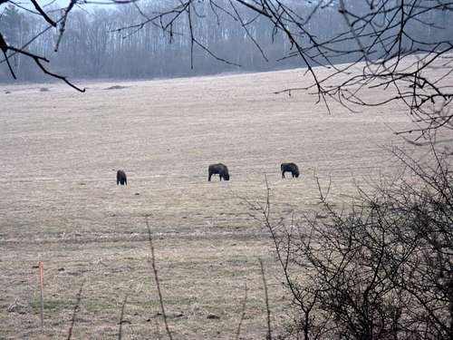
Wisent
Poloniny National Park (SK)
About 200 animals roaming free especially in the Polish part.
Ural owl
Stuzhytsia primeval forest (SK)
Forest-dwelling species, its territorial call can carry up to two km
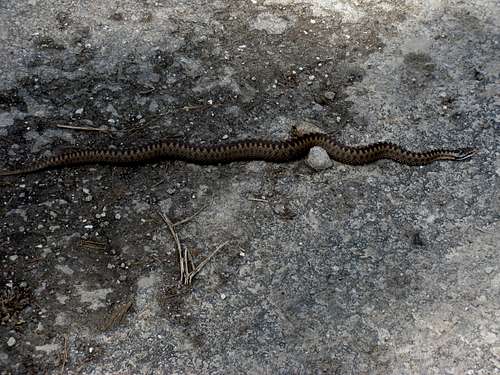
Viper
Poloniny National Park (SK)
Encountered on the trail without any signs of fear from my presence.
Black stork
Bieszczady National Park (PL)
Its favourite areas are the valleys of the San, Wetlinka, Prowcza and Osława.
Red deer
Poloniny National Park (SK)
Several hundred individuals preferring remote forest complexes; rich food resources result in healthy populations of mature animals that can weigh over 250 kg
Nutcracker
Stuzhytsia primeval forest (UA)
This typical inhabitant of spruce woodland has also found refuge in Stuzhytsia's primeval beech forest.
Roe deer
Poloniny National Park (SK)
These game animals are common and serve as a nutritional base for large predators.
Silver-washed Fritillary
Uzhanskyi National Park (UA)
Its preferred habitat is thin, sunny, deciduous woodland.
Grey-headed Woodpecker
Poloniny National Park (SK)
This rare bird species was observed near Stuzhytsia's mixed woodland.
Fox
San Valley Landscape Park (PL)
I was lucky to observe six lone foxes in the meadows near Zatwarnica.
European Dipper
Poloniny National Park (SK)
This expert diver likes fast-flowing rivers and streams.
Grass snake
Poloniny National Park (SK)
It lives near water and reproduces in water-filled depressions.
Buzzard
Bieszczadski National Park (PL)
It breeds in the woodland, usually on its fringe, but favors hunting in an open land.
Squirrel
Poloniny National Park (SK)
Its diet consists primarily of a wide variety of plant food, including nuts, seeds, conifer cones, fruits and fungi.
Grey Wagtail
Poloniny National Park (SK)
Usually seen on open marshy ground or meadows, where they walk solitarily or in pairs.
Common frog
Bieszczadski National Park (PL)
It breeds in shallow, still, fresh water. The females, which are generally larger than the males, lay about 1,000 eggs, which float in large clusters.
Black woodpecker
Poloniny National Park (SK)
Typical inhabitant of Stuzhytsia and Havešová primeval forests.
Wasp spider
Uzhanskyi National Park (UA)
This spider weaves a spiral orb web in about an hour, at dawn or dusk, commonly in tall grass a little above the ground.
Carpathian blue slug
Poloniny National Park (SK)
This species is endemic to the Carpathian Mountains.
White stork
Poloniny National Park (SK)
A nesting pair in the center of Runina village.
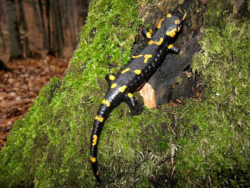
Spotty salamander
Havešová primeval forest (SK)
I happened to observe more than 30 individuals in a single rainy day.
Meadow Brown
Uzhanskyi National Park (UA)
Its larvae feed on grasses, such as Sheep's Fescue.
White-backed Woodpecker
Rožok primeval forest (SK)
It is the largest of the spotted woodpeckers living in the boreal and temperate climates.
Blackspotted pliers support beetle
Poloniny National Park (SK)
Larvae develop in silver fir, hazel and European beech.
Video created by LukZem during his eight visits to this trilateral wilderness: part 1/2
Video created by LukZem during his eight visits to this trilateral wilderness: part 2/2
Children refers to the set of objects that logically fall under a given object. For example, the
Aconcagua mountain page is a child of the 'Aconcagua Group' and the 'Seven Summits.' The
Aconcagua mountain itself has many routes, photos, and trip reports as children.
Parents refers to a larger category under which an object falls. For example, theAconcagua mountain page has the 'Aconcagua Group' and the 'Seven Summits' asparents and is a parent itself to many routes, photos, and Trip Reports.


 30880 Hits
 88.9% Score
 28 Votes


 Bear refuge - no entry
 Cabin 240 m
 Bivouacking in Slovakia
 Stuzhytsia campsite
 Coming from W
 Bieszczady railway
 Uzhok viaduct
 Into highest chunk
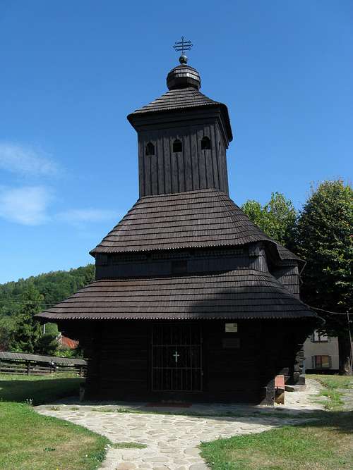 Church in Uličské Krivé
 Above Ustrzyki Górne
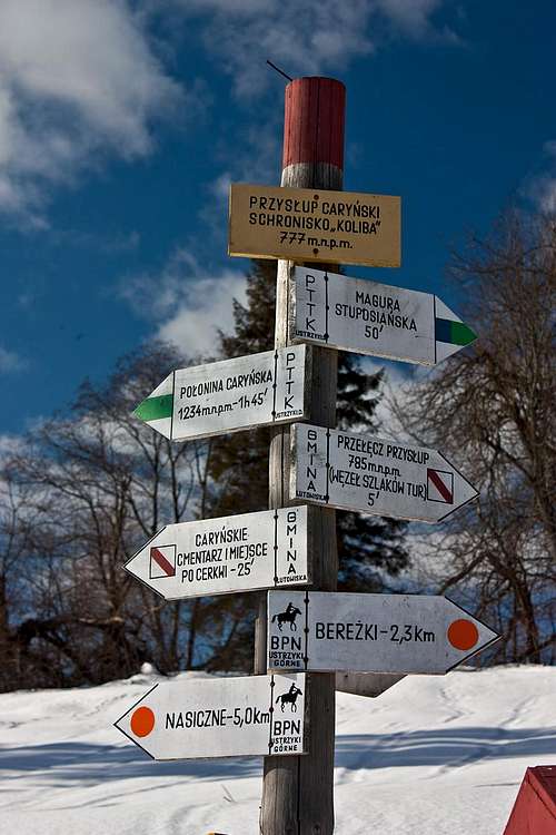

 Rabe
Rabe Balnica
 Pod Małą Rawką
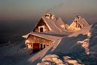 Chatka Puchatka

 Jaworzec
 Przysłup Caryński
 A shelter (see chapter 3!)
 Chata Socjologa
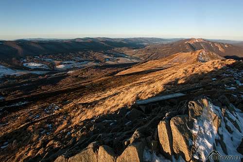
 Havešová
 Udava
Udava Stuzhytsia
 View from N
 Check in
 Backcountry skiing
 Controversial, right?
 Wołosatka wilderness
 Bear Creek
 'Pasture beech'
 Outside the Park
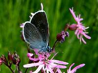 Glaucopsyche aleksis
 Siberian Iris
 Dacian violet
 Compact Pink
 Fog over 'land of valleys'
 Where Jaworzec village was
 Sianki village in 1939
 Tomb of Countess
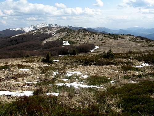 Bieszczady in April
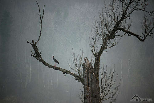


 W Bieszczady at W end
 W Bieszczady at E end - photo by agra
 Campanula serrata