-
 12334 Hits
-
 83.1% Score
-
 16 Votes
|
|
Mountain/Rock |
|---|---|
|
|
46.63006°N / 114.26421°W |
|
|
Ravalli |
|
|
Mountaineering, Scrambling, Skiing |
|
|
Spring, Summer, Fall, Winter |
|
|
8867 ft / 2703 m |
|
|
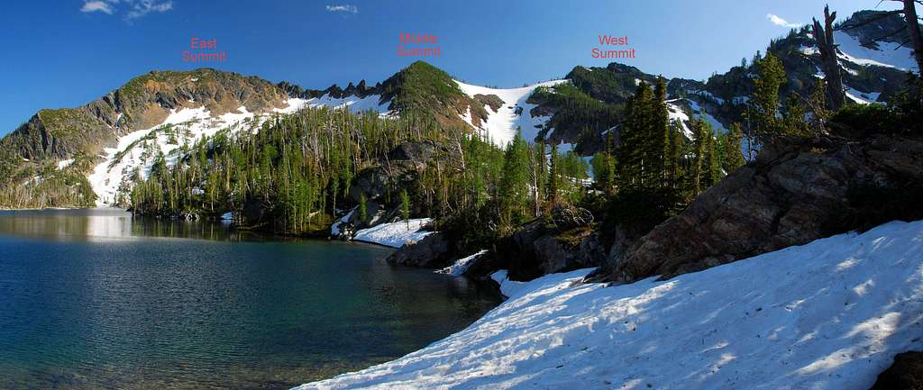
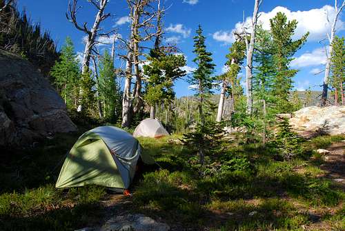
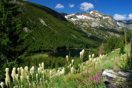
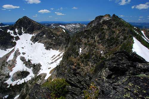
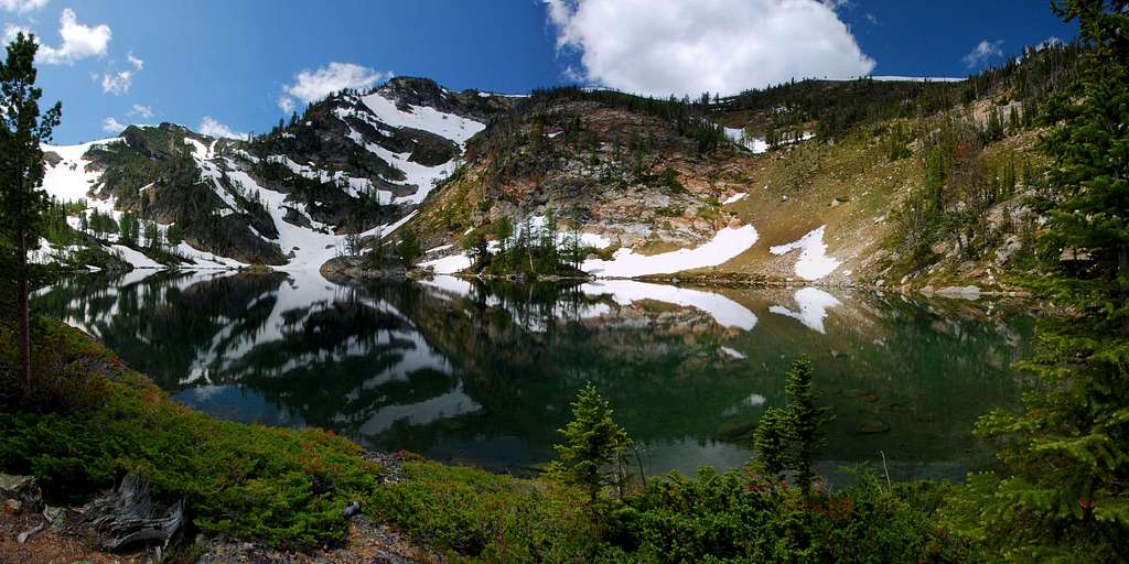
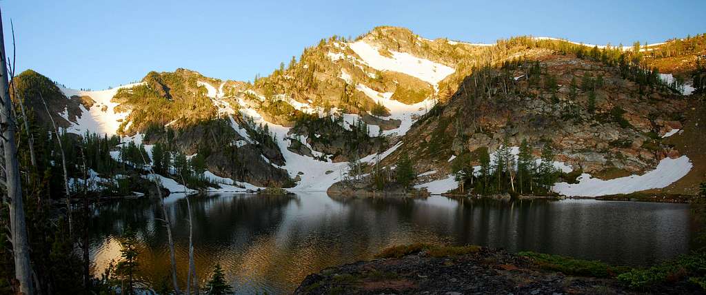
OverviewBackpackers sometimes venture to the base of the Pyramid Buttes, generally to camp in the vicinity of Duffy Lake, Holloway Lake, or Mills Lake, not to climb mountains. It’s a pity because this small group of summits and ridges provides very interesting climbing and some of the best views available at the northern end of the Bitterroot Mountains. The three summits on the south ridge of the cirque containing Holloway and Mills Lakes are referred to as The Pyramid Buttes. Seldom visited, much less climbed, no doubt because of their distance from the trailhead – about 7 miles – these peaks provide a stunning background for those visiting the two high mountain lakes. To make the round-trip distance more manageable, I suggest a multi-day outing which includes camping near Duffy, Holloway, or Mills Lake. Of the three lakes, Duffy has established campsites, but I prefer setting up at Holloway for its closeness to the summits.
Getting ThereFrom Florence, MT, drive south on Hwy 93 about 1.5 miles and turn right (west) onto Sweeney Creek Loop. Where the road turns left (south) after one mile, continue straight (west) for about 0.4 miles on gravel past residences to a junction. Turn right (north) onto FR 1315 following the signs to Sweeney Creek Ridge Trail. Drive nearly six miles to the end of the road. There are no restroom facilities. Parking space is limited, so arrive early, especially on weekends. In the winter one can simply drive to the snow-line and park on the side of the road. Area Restrictions (Red tape)CampingThere is no camping at the trailhead for these routes.There are a couple of places along the trail where you can set up camp. However, the best spots are at one of the lakes – Duffy, Holloway, or Mills. I prefer a base-camp at Holloway Lake because of its closeness to the summits. The Routes
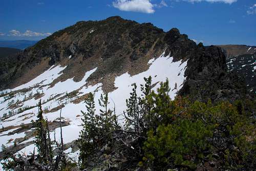
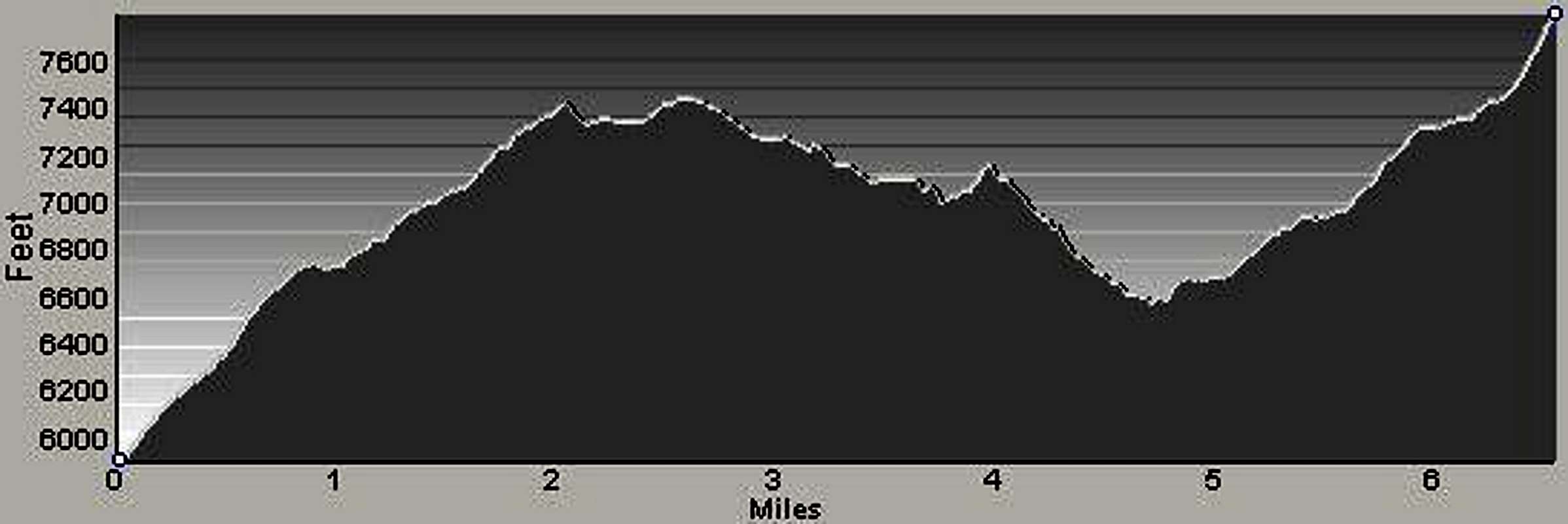
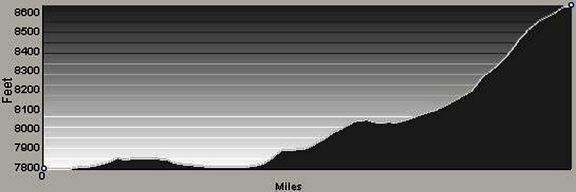
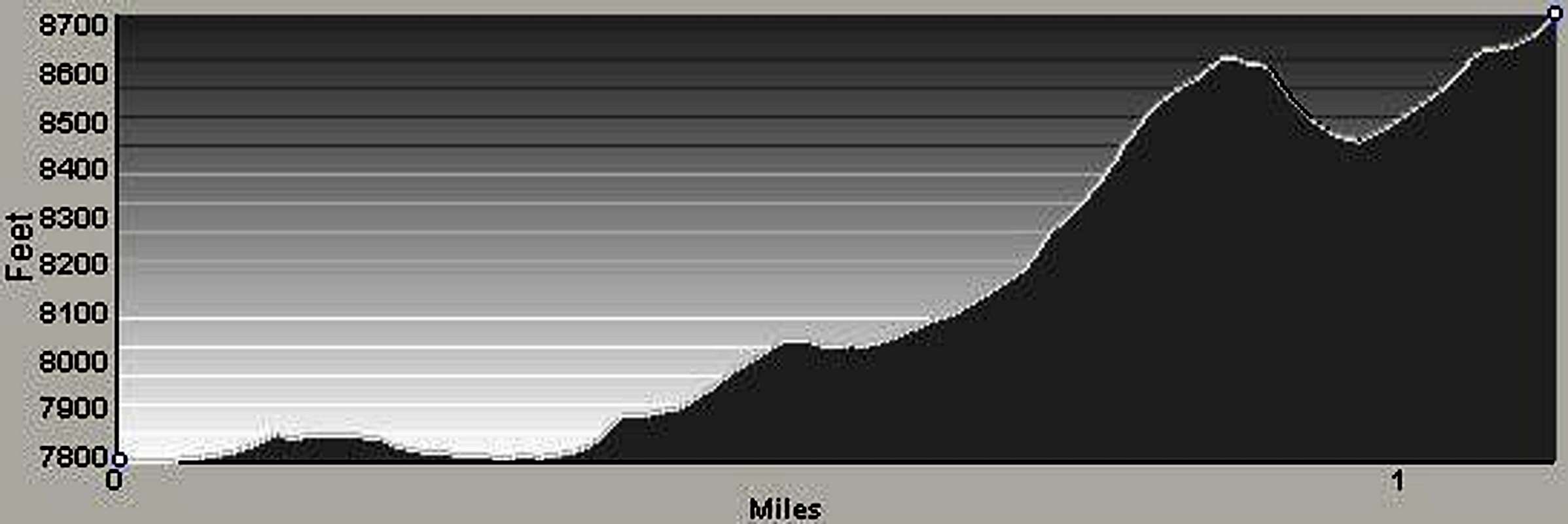
Approach – Trailhead to a Camp near Holloway Lake The apex of the trail occurs about 2.3 miles from the trailhead (46.63391 N / 114.18281 W, elevation 7,350’). This spot is where one leaves the maintained trail to climb Sweeney Peak, just where a small stream crosses the trail. If you look to the right (north-northeast) immediately after stepping over the foot-wide stream, there is an obvious trail leading uphill into the trees. (Someone has established a place to set up a tent or two at this spot.) For the next 2.5 miles the trail makes a long slow descent toward Peterson Lake and affords some wonderful views of the lake, canyon, and surrounding summits, including Saint Joseph Peak. After passing Peterson Lake – reached by using a side trail – the trail again begins an upward climb. Progressing mostly in a westward direction, the trail moves in and out of wooded and open sections which offer great views of the surrounding Wilderness. About 1.5 miles past (west of) Peterson Lake, the trial passes along the south side of Duffy Lake before making a turn to the southwest. The track proceeds upward and the woods becomes thinner as you approach a series of small slab-granite cliffs below Holloway Lake. There is a trail up and through these easily-negotiated cliffs to the outlet of the lake, but because plant growth in this area is rampant, it is often difficult or impossible to find. The cliffs are interspersed with many grassy ledges and, rather than spending time looking for this hard-to-find portion of the trail, it is generally simpler and less time-consuming to simply find your own route by switching back and forth back up the cliffs on the grassy ledges until you reach the lake. South Ridge Climbers’ Route – Base Camp to the Summits Middle Summit Hike around the north end of Holloway Lake to the narrow strip of land between it and Mills Lake. There is an obvious ridge which climbs southward from between the lakes to the middle of the three summits. Climbing this ridge to the middle summit is the simplest way to bag both the middle and west peaks. To the middle summit is nothing more than a steep hike – Class 2 – up the ridge to the middle summit. As you climb stay as close to the ridge-crest as possible to minimize having to side-hill. Though the shortest of the three, the middle summit has some of the best views, certainly the best of the east summit. Descend by reversing your route and returning to Holloway Lake or continue to the west summit before descending. West Summit From the middle summit descend to the west along the connecting ridge toward the west summit. Until you reach the saddle, this route is only an off-trail hike; however, as you begin to climb toward the west summit, Class 2+ climbing is required in several places, especially when, just west of the saddle, you must either climb over or go around a section of rock outcrops which guard the ridge-crest. Descend by reversing your route to the middle summit then Holloway Lake. East Summit To reach the east and highest of the three Pyramid Buttes, start on the strip of land between Holloway and Mills Lake and begin climbing the ridge leading to the middle summit. When you reach an elevation of 8,200’ leave the ridge and traverse southeast across the talus and boulders toward a point high on the south ridge just below the east summit. There is a series of cliffs and small gullies which, with careful route-finding, can be negotiated from the talus and boulders of the cirque onto the summit’s south ridge using Class 2+ climbing. Class 3 routes are there if you want them. From the crest of the ridge it’s and easy uphill walk to the summit. Warning: It looks tempting to follow the connecting ridge from the middle summit to the east summit. If you’re an advanced technical climber, go ahead. If not, don’t do it. Climbing along this connecting ridge is lower Class 5 in many areas that are very exposed. If you fall, it’s highly likely you will be seriously injured. Descend by reversing your route back to the south ridge of the middle summit then on to Holloway Lake. When To GoYou can climb the Pyramid Peaks any time of the year. However, if you do so in the winter months while the road to the trailhead is snow covered, you’re going to be adding plenty of additional miles to your outing. Additionally, you better be a good at route-finding, because once west of Peterson Lake the trail will be impossible to follow.The best times to climb these summits is after the snow has melted from both the access road and the trail to Holloway Lake. I like climbing them even later, after most of the biting insects have disappeared! Essential GearUnless you’re planning to climb on snow – which requires ice axes and crampons at a minimum – only the standard hiking gear is required to reach these fine wilderness peaks. For me it makes more sense to carry camping gear and stay in the area of the lakes for a couple of days.Route StatisticsEast SummitMiddle Summit West Summit |


