After a quick hike of Medicine Bow Peak and Bridger Peak on Tuesday, I drove down into Ft. Collins on Wednesday to pick up my debit card. It was there where I bought myself a brand new climbing helmet and a new laptop (my old one broke in Laramie Wyoming). Before buying the laptop though, I went to the public library and to my chagrin, found forecasts for TStorms in the Aspen area for the remainder of the week. What’s more, these tshorms were supposed to start around 11 AM daily. Not good.
I had found a liking for the Elks (who doesn’t?) last summer after climbing Castle, and over the winter and the ensuing spring, as I planned this summer’s trip, began serious consideration towards an attempt at Pyramid, seeing as it seemed a little easier than either one of the Bells. Of course, the original plans were for July; now it was late September I was already seeing snow anywhere over 13,000 feet in Colorado. I did not picture the ledges on Pyramid to be pleasant with a dabble of snow and ice.
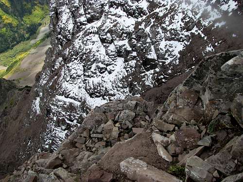
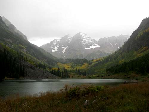
I departed Ft Collins still unsure of my plans and stayed overnight at Frisco, having a few drinks at a local establishment. The next day I drove into Maroon Lake around noon to scout the weather and see if there were, indeed, thunderstorms. The cloud cover was fairly low, and there were some sprinkles of rain in the area, but I heard neither thunder nor lightning. Despite the fact that the north face of the peak was obviously, and frighteningly, snow covered, and looming most ominously over the Maroon Lake Road, I decided to give it a shot, figuring, if the weather didn’t hold, or if the ice was too much, I could still reach the 13,000 ft saddle and turn back with more than a good workout under my belt.
I stayed the night in Basalt thinking of omens. It had been a Murphy’s Law situation on the drive from Boston to Colorado (see Medicine Bow trip report), and I figured that if my bad luck continued on the mountain I was a goner. I slept early and got a good 8-9 hours of sleep before waking up and checking out in the middle of the night. I arrived at Maroon Lake sometime after 5 AM, and after some more apprehensive pondering, started off towards Pyramid sometime before six. The sun began to rise maybe a mile into the hike, and I located the turnoff for Pyramid fairly easily, with a large cairn marking the way.
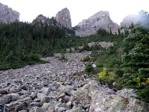
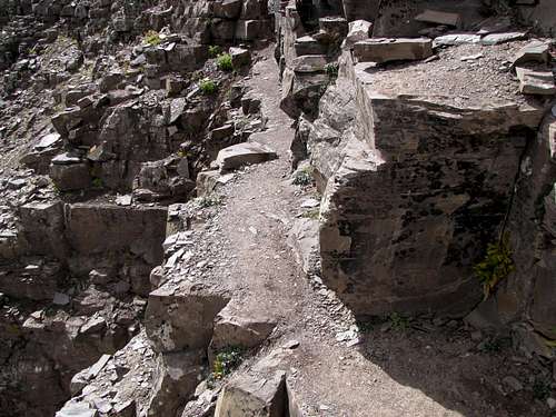
The climb up into the amphitheatre was not as difficult or steep as it’s been made out to be. The new trail is impeccable and gently switchbacks up the slope, traversing but never being absorbed by the talus fields. The entrance to the amphitheatre crept up on me; I was not aware of my arrival until that sudden moment when I found the great north face of Pyramid staring back at me, neither hostile nor welcoming.
![Up towards the amphitheatre]() Towards the amphitheatre Towards the amphitheatre |
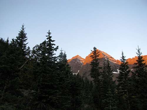
![Back towards Maroon Lake]() Sunrise in Aspen Sunrise in Aspen |
![Back towards Maroon Lake]() Morning views Morning views |
![Bells rising above the ridge]() Bells Bells |
![Simply amazing]() Entering the amphitheatre Entering the amphitheatre |
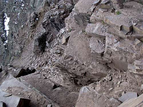
It was here when the trail morphed to talus form. Climbing up towards the amphitheatre I tried the strip of snow to my left but found it a little too slippery for boots; I returned to the talus and circled around, sometimes in the snow as long as it covered only level ground, towards the nightmare that still haunts me from time to time.
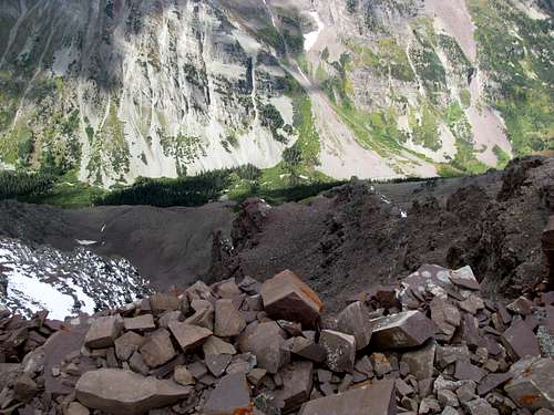
Yes, the scree slope. Straight up, loose dry dirt and ball bearing pebbles. Maybe someone can disprove my theory, but I believe that this scree slope would be absolutely impossible ascending, and even more so descending, without the aid of trekking poles. The bottom portion is the steepest, and at points I found myself crawling in quicksand-like terrain (if the quicksand were on a steep incline, and below you hundreds of feet of more inclinded quicksand) just to gain a few feet. The slope eases a little once you reach the top third of the thousand foot slope, and soon I found myself on the saddle, the remaining route to the top in view.
![Around 13,100 ft]() Right after the saddle Right after the saddle |
![Elks and Castle Peak]() Castle after gaining the NE Ridge Castle after gaining the NE Ridge |
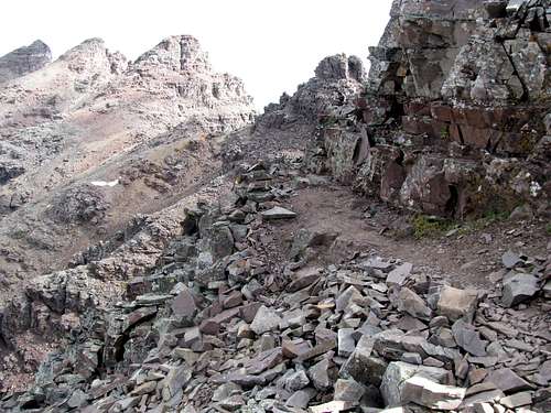
There are two lumps on the ridge (I wouldn’t really call them gendarmes) before you get to the main massif and the green rock. The standard route, according to 14ers.com, traverses to the right of both of them. The problem was, the right side faced north, and thus was subject to more snow cover, whereas the left side faced south and was completely dry (as was the green gully; if that looked icy then I was heading back down pronto. Well, probably more probable than pronto). The traverse around the first bump had some snowy and muddy portions, but overall I felt comfortable with the climbers trail and the exposure to the right. Reaching a saddle between the two bumps I saw that the route around the second lump was a little too snow-covered for comfort, so I made the nervous decision of veering off route along the left side of the ridge.
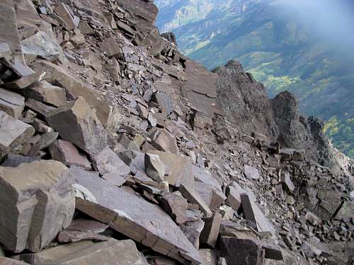
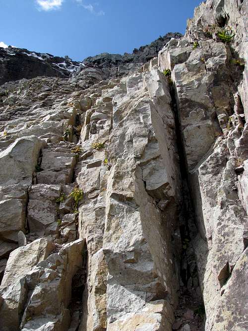
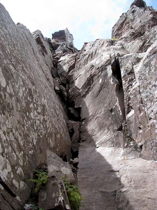
This side was completely dry, and the climbing consisted of good class 3-easy 4 scrambling up the ledges, as I tried to find the path of middle resistance (avoiding the loose stuff in return for some slightly more difficult climbing). Luckily, it wasn’t before long when I saw the cairns reappear again, and I rejoined the standard route right before it climbed up some sandy steps to reach THE ledge crossing, no lost elevation either. I was more worried about the giant gap before the crossing, as opposed to the ledge itself, and I chose to traverse the inside edge rather than jump across. A few minutes later I found myself at the green gully, where the scrambling was very enjoyable. I had been a little worried about the exposure in this gully, but looking back down it was what it was; exactly like the pictures I had scouted out on this website and others.
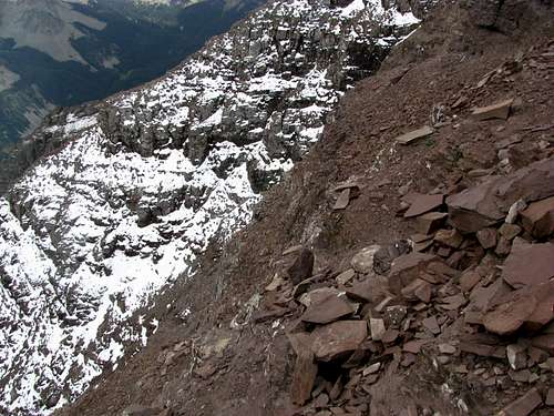
![Looking back at the ledgy terrain]() Rough terrain Rough terrain |
![The last 1000 before the ledge]() A long way to go A long way to go |
![The gap before the ledge]() Gap before the ledge Gap before the ledge |
![The gap before the ledge]() Gap before the ledge Gap before the ledge |
![Another picture of the ledge]() The ledge crossing The ledge crossing |
![The terrain after the ledge]() Right before THE ledge Right before THE ledge |
![The base of the green gully]() Base of the Green Gully Base of the Green Gully |
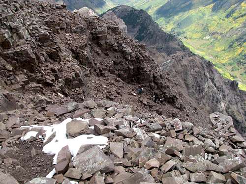
The skies began to darken as I was climbing the green rock, and soon I spied a roped party of three about a hundred feet above me (I had first glimpsed them on the ridge while I was ascending the scree slope), as well as a solo climber descending. I chatted with the solo climber for a bit and wished him luck on the descent. He was a little worried about descending the green rock.
![A guided group]() Guided group around 13,600 ft
Guided group around 13,600 ft
I wanted to avoid ridge crest and the drop offs of the north face, so I began veering towards the left. The climbing began to get a little more difficult; the memories are blurry, but I do remember one section with an easy dihedral. Soon I caught up with the roped party at the base of a class 4 block about 5-6 feet high. It turns out they were a guided party; two real estate guys from Texas with the guide, hired from a company in Aspen. They were paying about 350 each for the trip.
They began climbing the block at a point where it was fairly protected by a somewhat wide ledge below. Not feeling like waiting for all three of them, I decided to approach the block from the left, where the footholds were a little better, but the ledge below was razor thin, meaning that if I fell, it would have been a 3500 ft tumble. Fortunately, this didn’t happen, and the group was nice enough to let me pass them as I continued up the last 500 feet or so up the mountain. I’m a little hazy on the route details, but past that block it was just fairly easy scrambling up class 3-4 blocks and ledges; at that point you’ll probably never lose sight of the various cairns scattered around the mountain.
![Staring down the precipice]() Exposure below a class 4 move Exposure below a class 4 move |
![Towards the summit]() Summit is within sight Summit is within sight |
![The exposure near the top]() Exposure Exposure |
After another few hundred feet the summit made itself obvious to the beholder, and the terrain mellowed down. Soon I was on top, where I could see that the weather was deteriorating, with an obvious storm in the distance to the right of Capitol Peak. I took the requisite pictures, and about 5-10 minutes later the guided party joined me on the summit. We chatted, took pictures, had some food (Cliff Bars for me, the guide was smart enough to have brought a burrito). I asked the guide how often he did this. He said five times a week. Meanwhile, one of the other climbers took out a container of oxygen.
![Near the top, looking down]() Exposure Exposure |
![Last hundred feet to the summit]() Near the top Near the top |
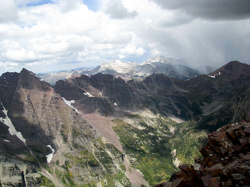
![Three 14ers and a storm]() Rain in the near distance Rain in the near distance |
![The Bells]() Yes, it's the Bells Yes, it's the Bells |
![Towards Thunder Pyramid]() Thunder Pyramid peeking over the ridge Thunder Pyramid peeking over the ridge |
![Castle from Pyramid]() Castle Peak Castle Peak |
![Back towards Aspen]() Aspen towards Aspen Aspen towards Aspen |
![The guided group making their way up]() Guided group approaching the summit Guided group approaching the summit |
![Down the east face]() 4000 ft straight down to E Maroon Creek 4000 ft straight down to E Maroon Creek |
![Four 14ers and a storm]() 4 14ers and a storm 4 14ers and a storm |
![Summit shot]() Summit pose Summit pose |
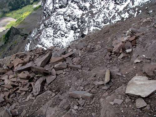
It started snowing around the same time, and as I made my way down, turned into full-scale hail. This lasted all the way to the bottom of the green gully. I made most of my descent on my ass (and a very nice pair of work slacks, which emerged somewhat unscathed, surprisingly). However, at some point I had downclimbed too much to the left of the green gully, and near the base I found myself uncomfortably descending a class 4-5 chimney. After re-crossing the (less than) exposed ledge, which seemed harder on the way back, I considered my options. I could return the way I came, on the south facing side of the ridge, or traverse on the north side. Though I figured the standard route was snow covered, I didn’t feel comfortable descending and routefinding through the ledges I’d climbed earlier. The ledges on the north side were snowy as expected, and to my surprise, there was a lot of scrambling too, as the cairns led me to the top of one of the bumps on the ridge. The snow situation improved as I lost elevation, and soon I found where I had left my trekking poles at the 13000 ft saddle. Now, for the tedious descent down that awful scree slope, where I would lose my footing more than once.
![The way down]() Looking down before the Green Gully Looking down before the Green Gully |
![A chimney near the bottom of the green gully]() Had to downclimb this chimney Had to downclimb this chimney |
![Going back to the ledge]() Ledges near THE ledge Ledges near THE ledge |
![Making my way back to the ledge]() Near the ledge Near the ledge |
![Cresting the ridge]() On the standard route On the standard route |
![Looking back at Pyramid]() Looks pretty formidable Looks pretty formidable |
![The Great North Face]() North Face from the NE ridge North Face from the NE ridge |
![Back down towards the amphitheathre]() Down towards the amphitheatre Down towards the amphitheatre |
Upon returning to the amphitheatre, I cut straight through the middle while trying my best to not have to regain any elevation. I cut around the crater-like section and soon returned to the main route and the long strip of snow, which I tried to slide down, but it really wasn’t steep enough for a quick and easy glissade (also, I learned that you can't really force a glissade). Thus, I reluctantly returned to the talus and painfully hopped down rock by rock. It started raining during the last 1000 feet of descent, and the mountains were enshrouded in clouds, and I assume, more hail, by the time I returned to Maroon Lake. I arrived at the parking lot to find that someone had audaciously torn off one of my McCain bumper stickers. I was a little peeved, but all in all, after a successful ascent of Pyramid, it was a fair trade.
I drove into Aspen, parked in a parking garage, paid twenty bucks for a cheesesteak, and drove back to Denver for the night. The next day I pulled into Ft Collins to see an old friend. I had planned to take him up some 14ers, but my legs were mush, so we just watched football and drank through the weekend. That Monday night I returned to my car only to find a horrible stench. Apparently a mouse had climbed into my ventilation and died while I was parked at the parking garage in Aspen. I took it into a Grease Monkeys the next day and they took care of it. That done, it was a long drive into Salt Lake City, where I picked up another old buddy and started planning the next leg of my 3 week vacation, now more than one week complete.
![Snowmass and Capitol]() Snowmass and Capitol from the saddle Snowmass and Capitol from the saddle |
![Four 14ers from a 14er]() 14ers from the saddle 14ers from the saddle |
![Clouds and the Bells]() The Bells back down at Maroon Lake The Bells back down at Maroon Lake |
![A second round of hail]() Looking back at Pyramid Looking back at Pyramid |


Comments
Post a Comment