-
 10155 Hits
-
 83.1% Score
-
 16 Votes
|
|
Mountain/Rock |
|---|---|
|
|
42.94751°N / 116.63203°W |
|
|
Owyhee |
|
|
Hiking |
|
|
Spring, Summer, Fall |
|
|
8082 ft / 2463 m |
|
|
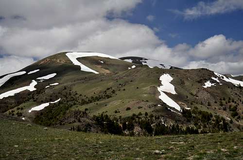
Quicksilver Mountain
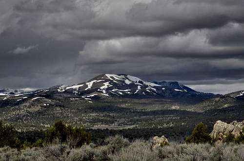
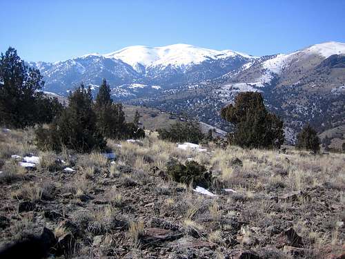
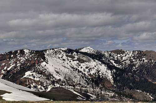
Quicksilver Mountain is a prominent peak with three major points along it's ridgeline. The middle point is the high point, and when viewed from the Treasure Valley (Boise Area) Quicksilver is the clearly visible southern anchor of the tallest 4 Owyhee peaks. Located just to the south of the Owyhee Range's tallest mountain, Hayden Peak, Quicksilver is a very typical Owyhee broad and open mountain with many points and valleys surrounding the peak. Like much of this area, snow covers the northeast slopes of Quicksilver well into May or June most years.
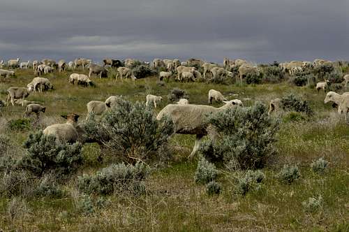
Quicksilver lies in a heavily mined region and is no doubt named for the mercury based process of extracting gold. Just to the northwest of Quicksilver is the old west mining town of Silver City. Once a boom town of the late 1800's and town center for the vast mining in the region, Silver City is now a living ghost town with just a few residents. Like neighboring War Eagle Mountain, Quicksilver Mountain is riddled with old mining claims, addits, and mining pits. Today, cattle grazing takes place on the neighboring slopes of Quicksilver. There are numerous cattle grazing gates to pass through. In fact there are sections where cattle gates are located just 20 feet across from each other, creating a silly partition of property. Along the Southeast Ridge Route there were dozens of gates, but none were marked private. This indicates the property is most likely federally owned, with grazing rights.
Although a fairly prominent peak, getting to the summit of Quicksilver Mountain requires a long cross country route from any direction and few have been to the top. Further complicating things is the various tracts of private property surrounding the peak, mostly on the western side of the peak. These tracts of land are mostly just legacy ranches, grazing property, or abandoned homesteads. The easiest route to the summit starts near Toy Pass, to the southeast of the peak. This route covers Points 6171, 6210, 6442, 6499, 6241, 6335, 6771, 6726, and 7929 and is an interesting cross country ridgeline traverse that involves 15 miles and over 5700 feet of elevation gain (roundtrip). It would be extremely rare to see another person hiking along this ridgeline. During the summer, one may encounter or hear ATVs in the distance.
Routes
Southeast Ridge (Class 2):
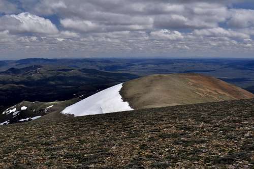
Park at Toy Pass or in the prominent turnout just east of the pass. Follow faint jeep roads up, over, and around the highest ridgeline. The route is pretty straight forward with lots of ups and downs. It is possible to side hill to save some time. If there is any doubt about the route, look for the ridgeline. The steepest section is just before point 7929. The true high point is the middle bump on this peak- Point 8082. This point is a completely bare and open slope with a new summit register. As of this writing, Point 7929 contained a small summit register with signatures from 1987 and 1989. There will be no water sources along this route much of the year.
15.0 miles and 5703 feet gain (round trip)
Round Trip Time Estimate: 6-8 hours
Getting There
From ID-78, south of Boise, drive south to the tiny town of Oreana. Follow the road toward the Bachman Grade. The road turns to dirt and climbs to Toy Pass. The road is maintained to the Pass, but not beyond. Snow usually covers the Pass area in the winter and mud lingers beyond the Pass.