

-
 26407 Hits
-
 94.02% Score
-
 45 Votes
|
|
Mountain/Rock |
|---|---|
|
|
46.85060°N / 10.96590°E |
|
|
11646 ft / 3550 m |
|
|
Overview
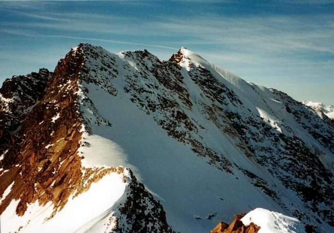 Mittlerer and Großer Ramolkogel from the east - Photo from RM Liu, pic credit to Roman Meyer - 2001 Mittlerer and Großer Ramolkogel from the east - Photo from RM Liu, pic credit to Roman Meyer - 2001 |
In memory of Rahel Maria Liu, the former maintainer of this page. Rahel died on the Innominata Spur to Mont Blanc in a snowstorm on August 24th, 2004.
 |
 |
 |
 |
 |
| View from Breslauer Hut | Großer Ramolkogel | View from Vent | Seen from Linker Fernerkogel | Alpenglow |
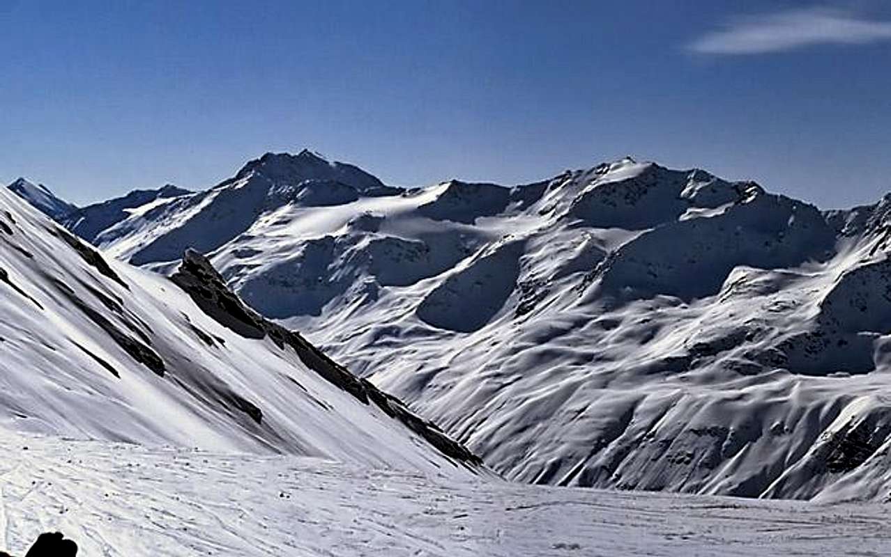
RAMOLKOGEL - a big rock and glacier massif
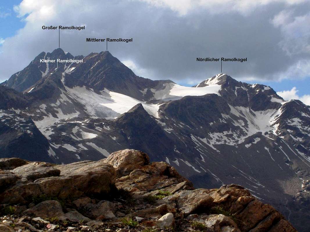
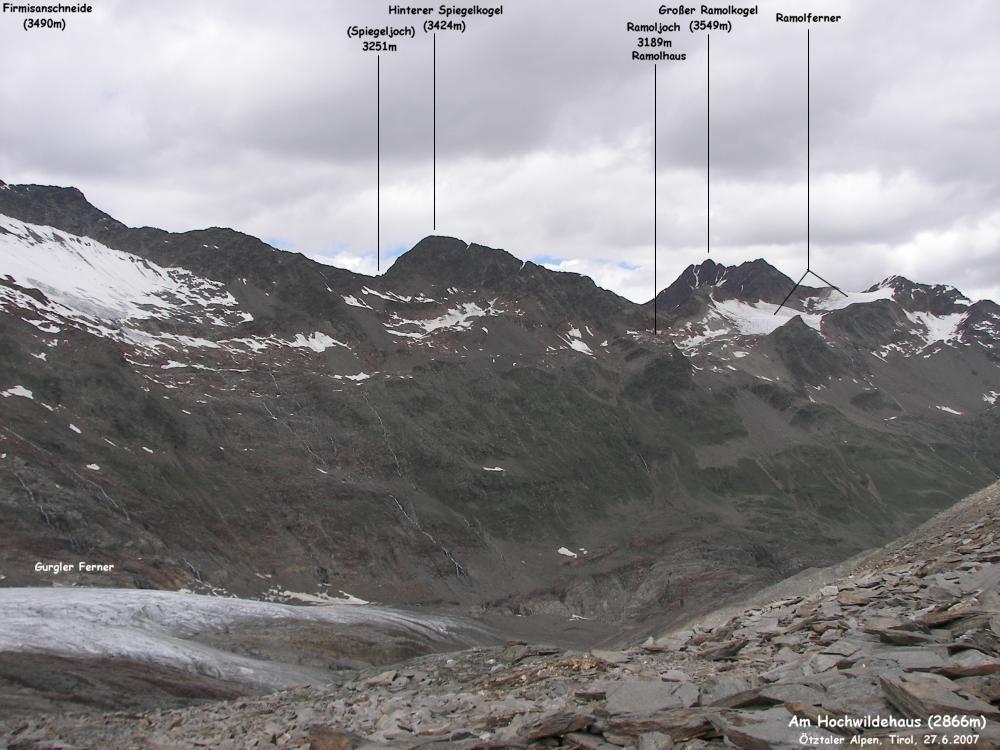
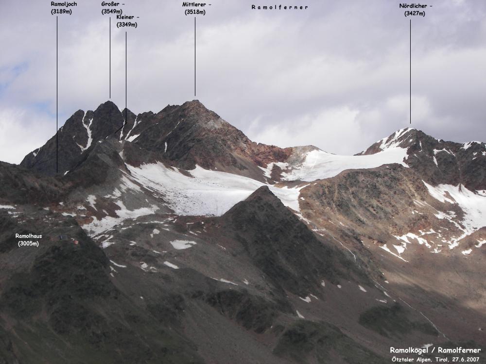
- The Ramolkogel is a big rock and glacier massif with a few summits: Großer Ramolkogel (3550m), Mittlerer Ramolkogel (3518m), Kleiner Ramolkogel (3351m). On the east side of the Mittlerer Ramolkogel is also the Nördlicher Ramolkogel (Anichspitze, 3428m), which is often climbed together with the Großer and Mittlerer Ramolkogel. All together often climbed. There are many routes to reach the Ramolkogel.
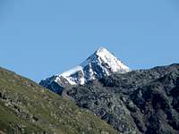
 View of RAMOLKOGEL (Photo by rgg, 2011) View of RAMOLKOGEL (Photo by rgg, 2011) |
Routes Overview
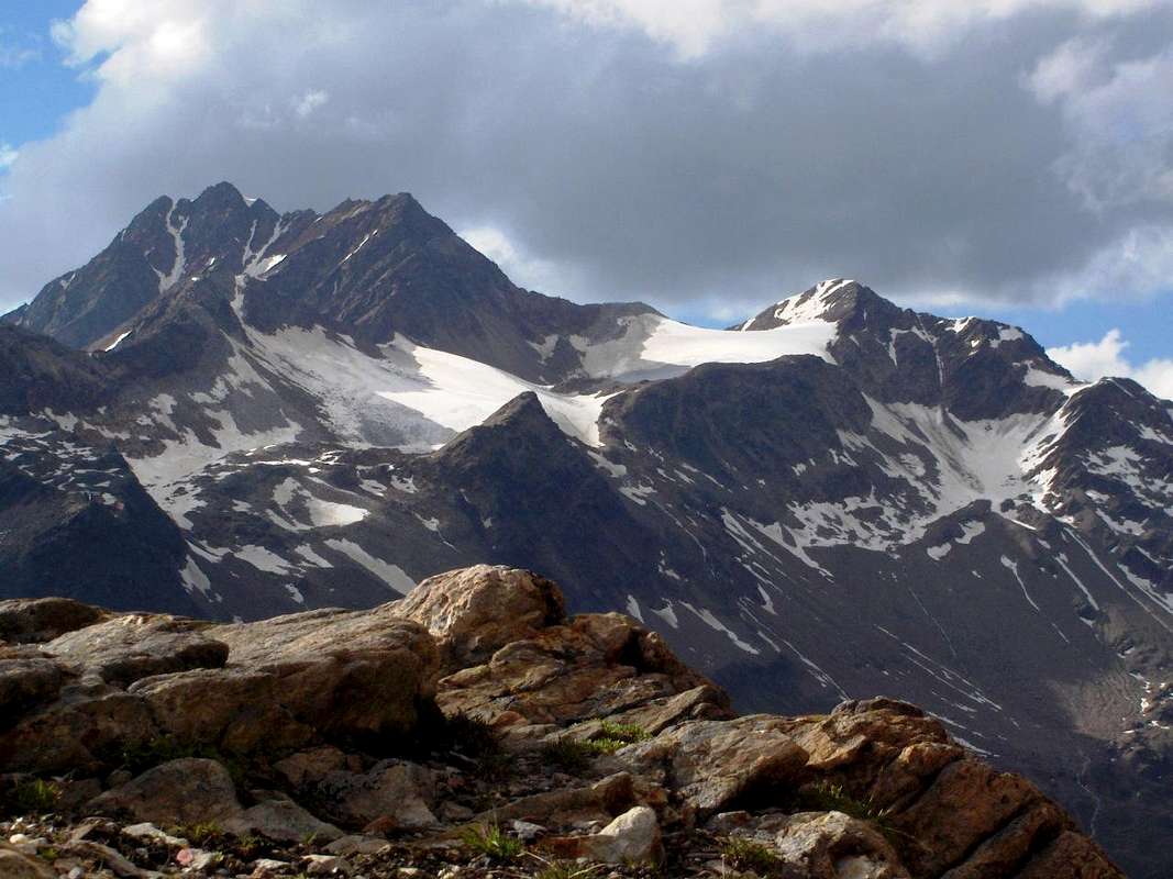
View of Ötztal Alps - Photo by Gangolf Haub/pvangeenen
 Spiegelkogel - Ramolkogel - Manigenbachkogel - Gampleskogel Spiegelkogel - Ramolkogel - Manigenbachkogel - Gampleskogel |
Normal Route/NE Ridge to the Mittlerer Ramolkogel + E Ridge to the Großer Ramolkogel:
- II (2 passages), 3 h from Ramolhaus, mostly rock, some firn and ice
S Ridge to the Mittlerer Ramolkogel:
- II, 2-3 h from Ramolhaus
NW Ridge:
- III and II, 5 h from Vent, 7 h via Latschglacier
North Face:
- 50°, 400 hm, 2-3 h (face)
NE Face Descent through the S flank to the Spiegelglacier
- III, II
Traverse Mittlerer Ramolkogel - Nörderkogel
- II, mostly easier, 4-4,5 h to the Gurgler Schartl, from here 3 h to the Nörderkogel. Beautiful, but staying power necessary (According to Klier)
Getting There
* The Ötztal Alps at sunrise seen from Obergurgl (Photo by Hiltrud Liu)
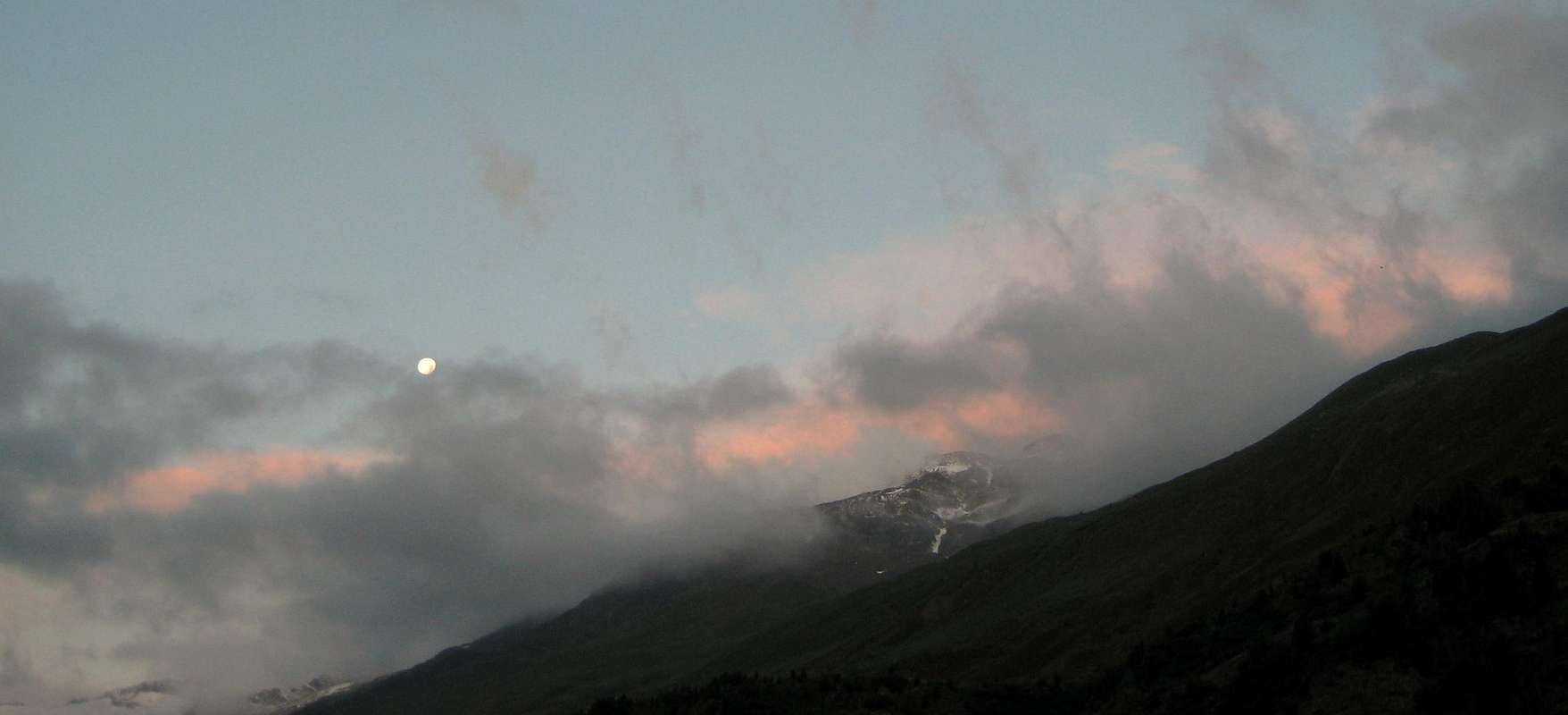 The moon above Ramolkogel The moon above Ramolkogel |
To the Ramolkogel:
- You can come from the Ramolhaus.
- You can come
- .
To the Ramolhaus:
- You reach the hut
from Obergurgl (1910m) in Ötztal
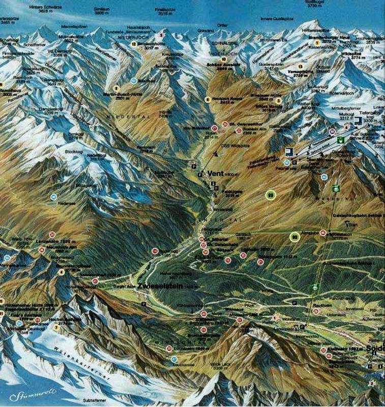
- on the marked hiking way no. 902 in 3,5 - 4 h. This is a wide way without any problems. You cannot miss it. You only have to follow this way through the valley until you reach the hut. You reach Obergurgl on the road through the Ötztal from Ötztal (trainstation, 692m)) via Ötz, Sölden and Zwieselstein. In Zwieselstein, you have to turn left (to the Gurgl Tal) and leave the Venter Tal to the right (which goes to Vent). You reach Ötztal by train (station: Ötztal Bahnhof) or car on the A12 from Innsbruck (E) or from Bludenz (W) on the E60 and A12 via Landeck. Turn off at Ötztal.
From Vent to the NW Ridge:
- You reach the NW Ridge
- in 5 h. In Vent, you start behind the hotel "Vent" in SW direction from the village. You follow a good way up to the Ramolalm, 2218. You turn left over the Ramolbach and traverse the grass hangs in steep zigzag till you reach the tongue of the Spiegelglacier. You go the northern valley side of the Spiegeltal up. You leave the way and go northeastern to the Rotkarle. You go over lumps of rocks and firn passages to the beginning of the NW Ridge. You reach the NW Ridge from Vent via the Latschglacier in 7h. You go to the Ramolalm (see above). Here, you traverse to the NE over very steep hangs to the valley of the Latschbach. You continue along the stream to the Latschglacier. At the SW Side of the glacier, you go over the moraine to the NW Ridge.
General Information
* Climbing RAMOLKOGEL
 |
 |
 |
 |
 |
| Ramolkogel, from Jurgen Mesman | Ramolkogel - Photo by Mathias Zehring | Route Ramolhaus, from Keith T | Ramoljoch - Photo by dalton1 | SE Ridge, from Jurgen Mesman |
- (with information concerning the bus from Imst to Ötztal)
- (also information concerning the bus from Sölden)
OBB, Online-TicketCamping WEATHER Ötztal/Weather
- Phone: ++49-89-295070 (DAV) Avalanches (Tyrol): ++43-512-1588 (OeAV)
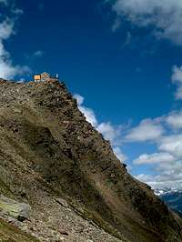
Mountainhut
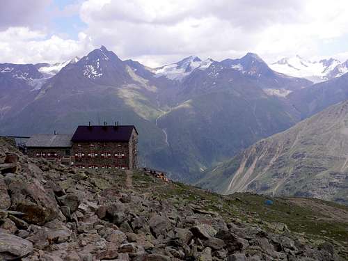
 View from the Ramolhaus towards the Gurgl Ferner - Photo by Helmut Dodel, marked by Mathias Zehring View from the Ramolhaus towards the Gurgl Ferner - Photo by Helmut Dodel, marked by Mathias Zehring |
THANKS for your help, Helmut and Mathias!
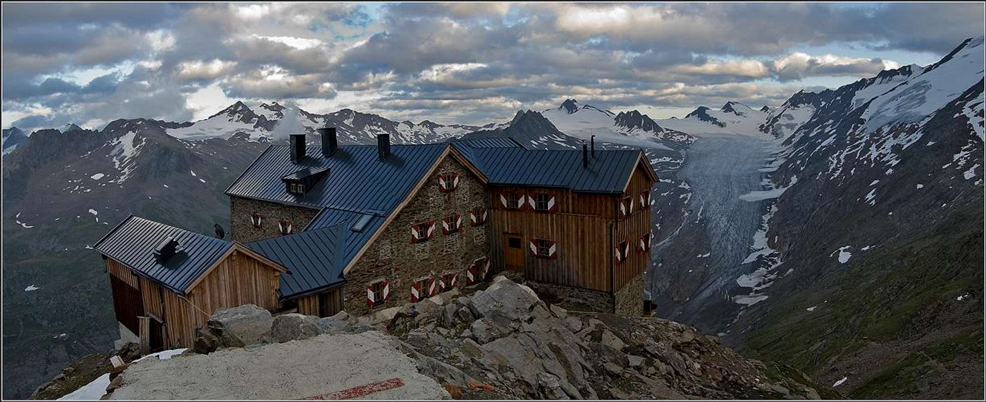
The Ramolhaus is situated at the SE hang of the back Gurgl valley, on a rock peak above the tongue of the Gurgl Glacier.
- Phone: 05256/6223(6224) Email: info@edelweiss-gurgl.com Internet: www.edelweiss-gurgl.com Guarded: from July to September, 64 beds
 Breslauer Hütte - Photo by Schwiebi - Wikipedia
 View of Ramolkogel - Photo by rgg, 2011 View of Ramolkogel - Photo by rgg, 2011 |
Map&Book
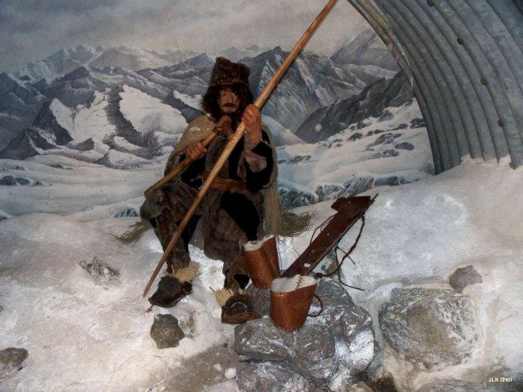 Ötzi - the Iceman (Photo from Huberschwiller) Ötzi - the Iceman (Photo from Huberschwiller) |
Alpenvereinskarte
- 1:25000 no. 30/1 Ötztaler Alpen. Gurgl
DAV Shop hikr.org/ Ramolkogel Ramolkogel Map
 * Ötztal Alps - Ramolkogel (Photo from Rahel Maria Liu) * Ötztal Alps - Ramolkogel (Photo from Rahel Maria Liu) |
Books
- Walter Klier, Ötztaler Alpen. Alpenvereinsführer, Bergverlag Rother (2005).
- Henriette Klier und Walter Klier, Ötztal. Rother Wanderführer, Bergverlag Rother (2010).
Link - MountainArea
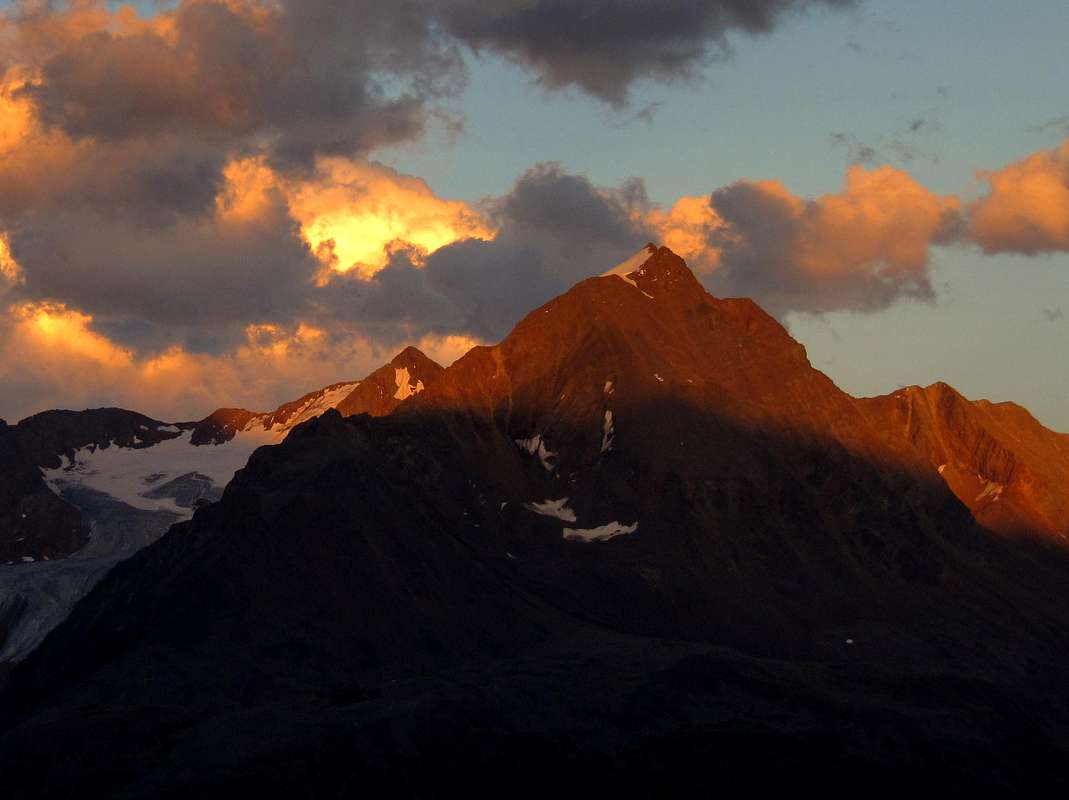 Ramolkogel Alpenglow (W Face) - Photo by Lodewijk Ramolkogel Alpenglow (W Face) - Photo by Lodewijk |

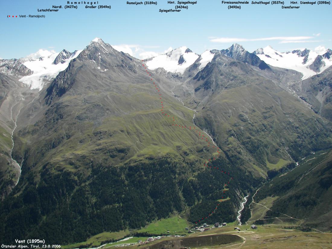
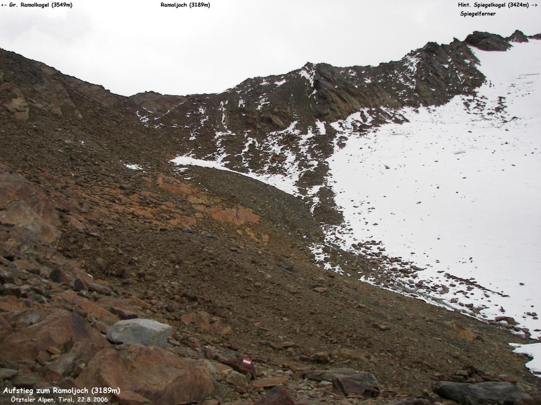
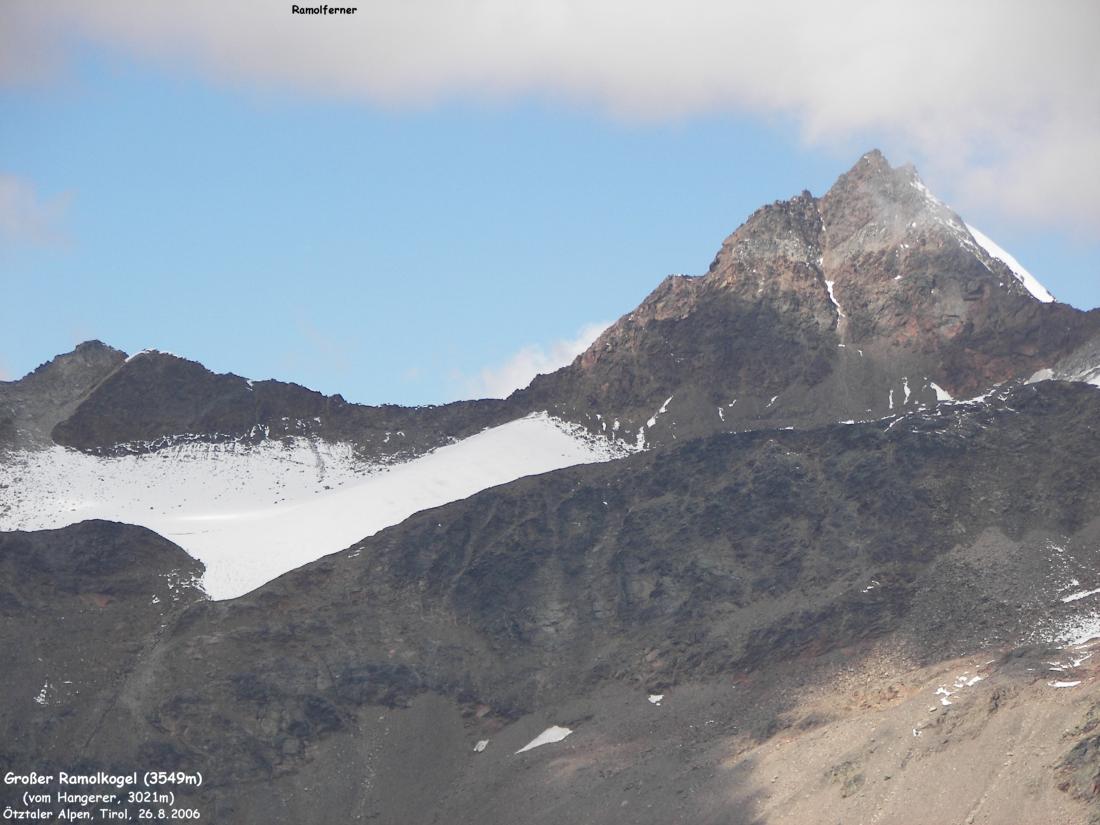
Panorama 1 Panorama 2 Panorama 3 To the Ramolkogel from Vent Mittlerer and Großer Ramolkogel - Photo by Sascha Sauer (Gaehnchen) View of Nördlicher Ramolkogel (Anichspitze) - Photo by Sascha Sauer (Gaehnchen) Aufstieg - Ramoljoch - Photo by Christian Engl Vent - Ramoljoch - Photo by Christian Engl Ramolkogel - Hochwildehaus - Photo by Christian Engl Ramolkogel - Ramolferner - Photo by Christian Engl Großer Ramolkogel from Hangerer - Photo by Christian Engl Nördlicher, Großer and Mittlerer Ramolkogel - Photo by Thehighrisepages Großer and Nördlicher Ramolkogel - Thehighrisepages