
-
 8578 Hits
-
 83.1% Score
-
 16 Votes
|
|
Area/Range |
|---|---|
|
|
37.90987°N / 122.4858°W |
|
|
Hiking, Bouldering |
|
|
Spring, Summer, Fall, Winter |
|
|
602 ft / 183 m |
|
|
Overview
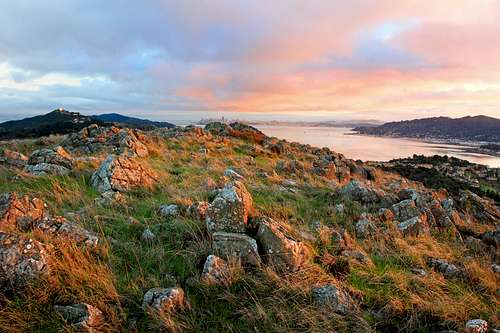
Sunset from Ring Mountain west highpoint
Nature lovers will find a delicate balance of wildlife with birds and especially butterflies.
This is a fine place to stretch your legs for short easy hikes to a few high points that offer good views of Mt. Tamalpais, the north bay hills and the San Francisco skyline 10 miles south.
The western high point (588') covered with serpentine rocks is the most interesting viewpoint.
Getting There
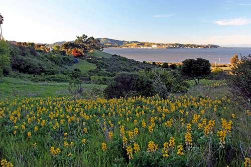
Spring flowers on Ring Mtn. north side
This is the longest approach from sea level.
South side access: From Hwy. 101 in Mill Valley, take the Tiburon Blvd/E.Blithedale Ave exit east on Tiburon Blvd and turn left on Reed Ranch Rd. MCOSD gate is at the end.
This approach is short with a starting elevation of 300'.
East side access: From Hwy. 101 in Corte Madera, take th Paradise Dr/Tamalpais Dr exit east onto San Clemente Dr. which merges into Paradise Dr. and go about 1.5 miles. Turn right at Taylor Rd, MCOSD gate is at the end.
This is the shortest approach with an elevation of 450'.
West side access: From Hwy. 101 in Corte Madera take the Paradise Dr/ Tamalpais exit east onto San Cemente Dr which merges with Paradise Dr. and go about a half mile. Turn right on Prince Royal Dr. and go .3 miles.Turn right on Endeavor Dr. a short distance to the gate.
This is a short approach below the west highpoint with an elevation of 300'.
Red Tape

Red Tape sign
Camping

SF from Ring Mtn.
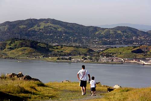
Dad and son hikers looking north
Bouldering on Ring Mountain

Mt. Tamalpais from Ring Mtn. west highpoint

Turtle Rock
More on Ring Mountain
GeologyRing Mountain Rocks! Bay Nature Institute
Hiking
Bay Area Hiker