
-
 10699 Hits
-
 85.87% Score
-
 21 Votes
|
|
Area/Range |
|---|---|
|
|
37.89527°N / 122.58113°W |
|
|
Hiking |
|
|
160 ft / 49 m |
|
|
Overview
Muir Woods is a National Monument created in 1908 by Theodore Roosevelt formed through a generous donation of land by William and Elizabeth Kent and it contains ancient redwoods in a canyon that has never been logged. According to the National Park Service, when this forest was named after John Muir by the Kents, John Muir said: “This is the best tree-lovers monument that could possibly be found in all the forests of the world.” This national monument is located a mere 12 miles north of Golden Gate Bridge and is a remnant of an ancient coast redwood forest. According to the Golden Gate National Park Conservancy it is “one of the last stands of old-growth redwood forests on Earth,” and it receives nearly one million visitors a year. The mailing address for this national monument, which covers 559 acres, is Muir Woods National Monument, Mill Valley, CA 94941-2696 and its general telephone number is 415-388-2696.
Getting There
The National Monument is accessed from CA-101 via the Highway 1/Stinson Beach exit. After exiting CA-101 you follow a well-marked, winding road that takes you the park’s parking lots.
Trails
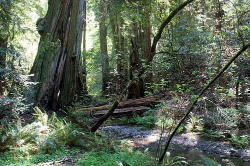
1. The Main Trail. Round-trip distance is 0.5 to 2.0 miles, depending upon the loop. This trail is a combination of boardwalk and asphalt which is fully accessible by wheelchairs and strollers. This trail goes through the central area of the monument along Redwood Creek and has four bridges. Each of the first three bridges can be crossed to start a loop back to the beginning whereas the fourth bridge leads to other trails which are not accessible by wheelchairs and strollers. Early along the main trail one can pick up a more detailed Muir Woods National Monument Park Map of various trails originating inside of the park for $1. This map contains information for ten stops of interest along the main trail and a more detailed description of six additional trails. The six additional trails are not suitable for wheelchairs and strollers and are summarized as follows (more detailed information is provided in the Park Map).
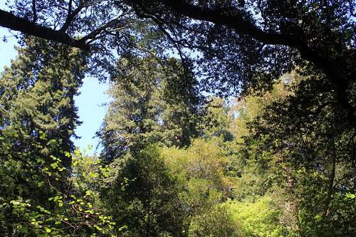
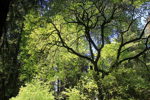
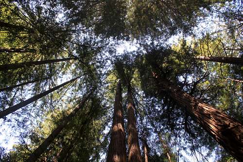
This picture was taken along The Main Trail on April 18, 2013. The picture is not of redwood trees, but it does have a tree with the sky in the background highlighted by the light at the particular time the picture was taken. The fact that the main tree in this picture is not a redwood shows that the old forest here has many different types of trees of interest.
2. Bootjack Trail to Ben Johnson Trail Loop. Round-trip distance is 6 miles. The Main Trail Loop becomes Bootjack Trail after the fourth bridge, and then takes a left fork along the Tamalpais Conservation Club trail, to connect to Stapelveldt Trail which then comes back to the Ben Johnson Trail and back to Muir Woods.
3. Ocean View to Lost Trail to Fern Creek. Round-trip distance is 3 miles. The trailhead is along The Main Trail and returns to The Main Trail.
4. Ocean View Trail to Redwood Trail to Sun Trail to Dipsea Trail. Round-trip distance is 5 miles. This trail proceeds along trail 3 but then diverges where it proceeds north to pick up the Panoramic Trail and then proceeds to follow a different path back to Muir Woods.
5. Ben Johnson Trail, Return via Dipsea Trail. Round-trip distance is 4 miles. This trail is accessed from the end of the fourth bridge on The Main Trail Loop and returns across the Redwood Creek footbridge.
6. Fern Creek Trail to Camp Eastwood. Round-trip distance is 3 miles. This trail is accessed from The Main Trail, proceeds up Fern Creek Trail, goes up to Camp Alice Eastwood, then proceeds down Plevin Cut trail to Camp Eastwood Trail to The Main Trail.
7. Redwood Creek Trail to Muir Beach. One-way distance is 3 miles. This trail is not really in Muir Woods National Monument, but it is described in their map. It ends at Muir Beach.
Note that there are many other trails that can be accessed from trails described above, including trails to Mount Tamalpais and to Stinson Beach. The Muir Woods National Monument Park Map contains trails outside of its boundaries north to Mount Tamalpais, west to Stinson Beach, south to Pirates cove and east to Homestead Valley.
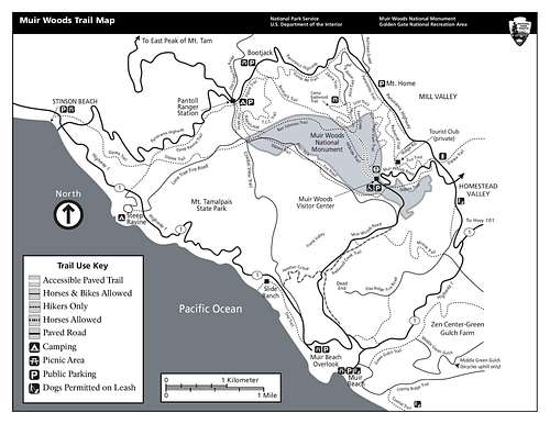
Trails at Muir Woods National Monument
Red Tape
There is normally an entrance fee unless you have one of the America the Beautiful passes. The fee is collected at a station along a walking entrance into the monument from parking. There is no charge for parking.
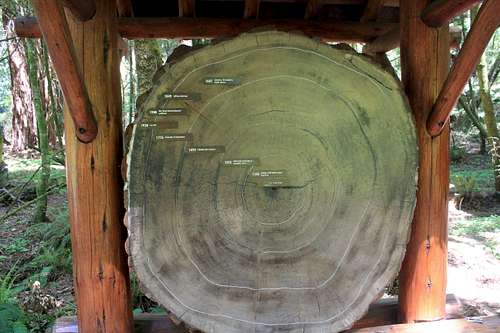
This exhibit is found near the visitor center. The cross section is not as large as you find at Sequoia National Park, but it is interesting and a commonly seen photograph from this national monument.
External Links
http://www.nps.gov/muwo/index.htm National Park Services site complete with hours, fees, restrictions and much other information
http://en.wikipedia.org/wiki/Muir_Woods_National_Monument
http://www.yelp.com/biz/muir-woods-mill-valley contains over 500 reviews by people with various anecdotal comments
http://bioweb.uwlax.edu/bio203/s2009/hemmeric_nata/reproduction.htmdiscussion of redwood burls and reproduction of redwood trees
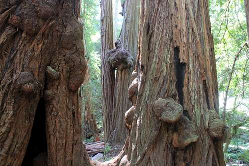
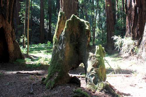
This picture was taken April 18, 2013 and shows redwood burls. A redwood burl is used for reproduction of redwood trees.
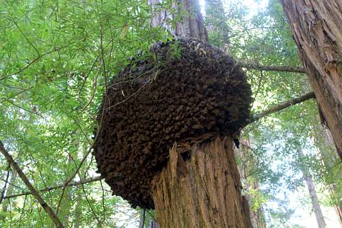
A large redwood burl.