
-
 7987 Hits
-
 84.82% Score
-
 19 Votes
|
|
Mountain/Rock |
|---|---|
|
|
46.54180°N / 10.46154°E |
|
|
Hiking, Scrambling |
|
|
Summer, Fall |
|
|
9925 ft / 3025 m |
|
|
Overview
 Rötlspitz / Punta Rosa seen from Trafoier Höhenweg Rötlspitz / Punta Rosa seen from Trafoier Höhenweg |
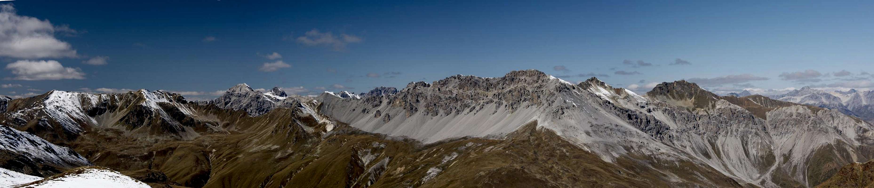
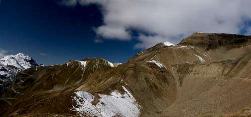
Rötlspitz / Punta Rosa is the southernmost mountain of the Falatschkamm Ridge, a northern subgroup of the Ortler / Cevedale Group. Strictly speaking it is part of a side ridge which runs in parallel to Fallatschkamm, separated by Val Costainas, one of the ascent routes to the mountain. As its name indicates the mountain is made up from red rocks, which make it stand out among the granite and limestone summits of the area.
 From Dreisprachenspitze From Dreisprachenspitze |  From Piz Umbrail From Piz Umbrail | 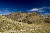 From Umbrailpass From Umbrailpass |
Rötlspitz / Punta Rosa is located to the north-east of Stilfser Joch / Giogo dello Stelvio, east of Umbrailpass / Giogo di Santa Maria / Wormser Joch, two of the highest road passes in the Alps and in Europe. Both serve as the standard trailheads for the mountain, consequently making it one of the most easily approachable 3000ers of the Alps. This, of course, makes the mountain very popular and on a sunny summer day you'll find crowds on the hiking routes and on the summit.
  |
Its position right above Stilfser Joch / Giogo dello Stelvio makes Rötlspitz / Punta Rosa a perfect lookout mountain, mainly because of the views towards the central Ortler Group and the neighbouring Umbrail Group. When you climb the mountain via the Trafoier Höhenweg panoramic trail from Furkelhütte in the north-east you're in for an unforgettable day with wonderful views.
 The ruins of the WW I Austrian barracks beneath Rötlspitz
Rötlspitz / Punta Rosa is located on Swiss territory though part of the ascent route runs across Italian ground. Before and during WW I this was the border region between Italy, Switzerland and Austria, with the three-countries-point on Dreisprachenspitze / Cima Garibaldi in its south. During the war Stilfser Joch / Giogo dello Stelvio saw heavy fighting, which you can witness still today by all the ruiins of artillery positions and barracks. Even the Swiss - who were neutral during the war were forced to shift their batallions towards the border in order to protect their own territory. Dreisprachenspitze / Cima Garibaldi is home to one of the largest WW I memorials since during the wartime a whole military city was built here.
 |  |  |  |
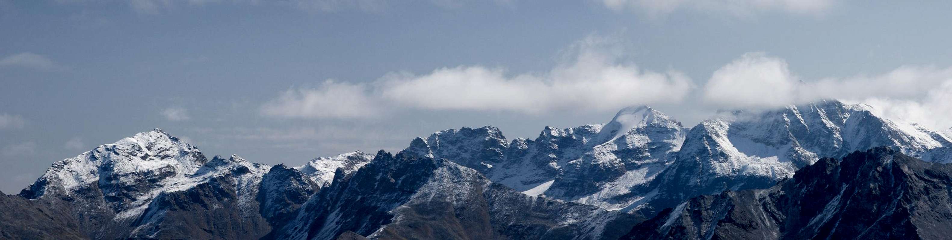
Summit View
 |
Getting There
 Monte Scorluzzo, Dreisprachenspitze, Rötlspitz, Korspitz
The trailheads for Rötllspitz / Punta Rosa are at Stilfser Joch / Giogo dello Stelvio and at Umbrailpass / Giogo di Santa Maria / Wormser Joch. There is an additional trailhead near the road to Umbrailpass, about halfway up, which serves the route through Val Costainas. Finally, you can also start from Trafoi on the Stilfser Joch road. Take the chair lift to Furkelhütte and hike the panoramic Trafoier Höhenweg.
From South Tyrol / Alto Adige
- Take SS38 from Bozen / Bolzano through Meran / Merano and Vinschgau / Val Venosta.
- At Spondinig / Spondigna the road turns off in direction of Stilfser Joch Passo di Stelvio.
- Drive through Trafoi and along the 48 switchbacks to the pass.
- Alternatively, at Spondinig / Spondigna turn onto SS40 to Schluderns / Sluderno.
- Here turn onto SS41 which leads into Switzerland.
- Called B28 there the road leads to Santa Maria, where the road to Umbrailpass turns off south.
- The road is open from 6 a.m. through 8 p.m.
- From Umbrailpass you can reach Stilfser Joch easily, it is roughly 2km to the east.
From Lombardia
- Take SS38 direction Stilfser Joch / Passo di Stelvio.
- Shortly before you reach the pass the Umbrailpass road turns off left (north).
From Graubünden / Grischun
- Take B28 across Ofenpass / Pass dal Fuorn until you reach Santa Maria.
- Here turn south onto the road to Umbrailpass (open 6 a.m. through 8 p.m.).
- Turn left onto the Stilfser Joch road to reach the pass.
From Austria
- From Landeck take B180 across Reschenpass / Passo di Resia into South Tyrol / Alto Adige.
- The road, SS40 in Italy, takes you to Mals / Malles Venosta.
- Here, turn onto a side road through Laatsch / Laudes, which heads for Switzerland, joining SS41 several kilometres in front of the border.
- In Switzerland follow B28 to Santa Maria, where you turn onto the road to Umbrailpass (open 6 a.m. - 8 p.m.) and Stilfser Joch.
Red Tape
 Marmot watching us walk by
Rötlspitz / Punta Rosa is part of the Parco Nazionale dello Stelvio and is located close to the Swiss / Italian border. Be sure to bring passport or ID.
And once again: the border on Umbrailpass is open only between 6 a.m. and 8 p.m. so that during the night you might be forced to take a rather long detour depending on your destination.
Accommodation
- Vinschgau / Val Venosta
- Val Müstair / Münstertal
- Lombardia (select region "Lombardia" and/or town "Bormio")
Weather Conditions
Maps & Books
Maps
- Nationalpark Stilfserjoch / Parco Nazionale dello Stelvio
Kompass Map WK072
1:50000
ISBN: 3-85491-391-5
Books
- Unterengadin
R. and S. Weiss
Rother Verlag
ISBN: 3-7633-4043-2
- Ortleralpen
P. Holl
Alpenvereinsführer
Rother Verlag
ISBN: 3-7633-1313-3