
|
|
Mountain/Rock |
|---|---|
|
|
45.85858°N / 110.95612°W |
|
|
Gallatin |
|
|
Hiking, Scrambling, Skiing |
|
|
Spring, Summer, Fall, Winter |
|
|
9003 ft / 2744 m |
|
|
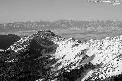
Ross Peak - Bridger Mountain Range, Montana, USA
Editor's Note
There were some gaps in the Bridger Range listing and Ross Peak was one of them (as pointed out by Tie-Dye Mike on his Bridger Range page). Hopefully this page will suffice in describing the craggy beast that holds together the middle of the Bridger Range. Please sign the climber's log, add route descriptions, and make additions and suggestions. A special thanks goes out to Bridger Outdoor Gear for use of some of their high quality NavAid aerial photography contained below.
 East Ridge of Ross Pass
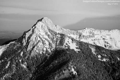
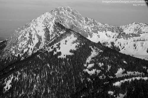
 Ross Peak - 2012-04-07
Ross Peak, Bridger Range, Montana, USA
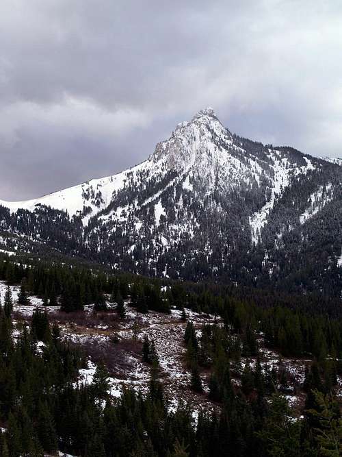
Ross peak is the fourth highest peak in the Bridger Range (highest point: Sacagawea Peak 9665 ft/2945 m). It is located next to the unique Ross Pass which gives the craggy peak a bit of prominence when viewed from the East and West. Of the ten peaks in the Bridger Range, Ross Peak is the fifth from the South. One will find Ross Peak's summit on the Saddle Peak USGS 7.5 min. quad. map.
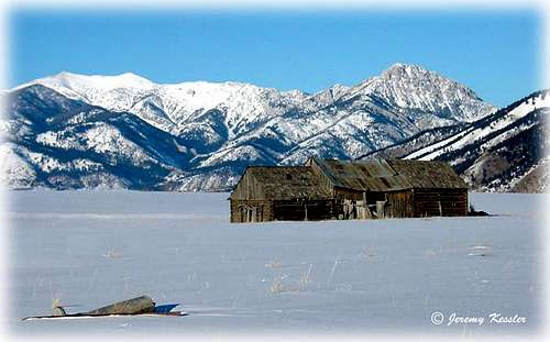 Snowy Ross Peak and idyllic barn.
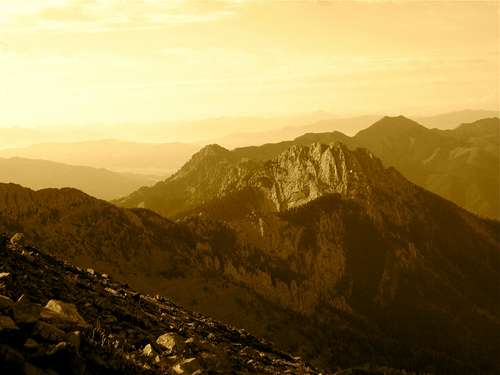
 Northeast Face of Ross Peak
Area Map and Getting There
Ross peak is located North of Bozeman and East of Belgrade. Bozeman is the wiser choice as it allows easier access to either the East or West sides of the Bridger Range.
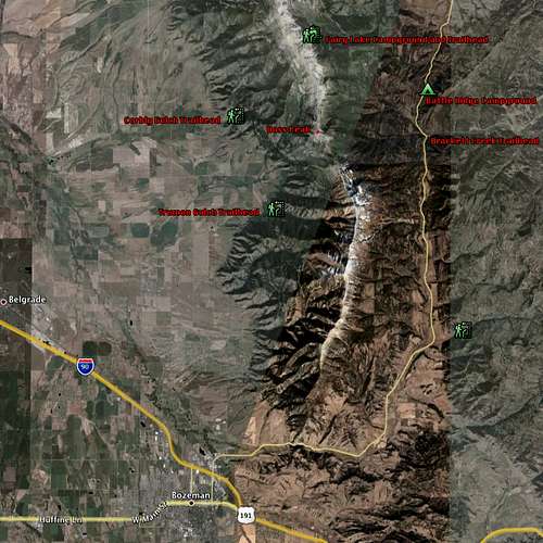 Ross Peak - Access Map - trailheads and campgrounds
Camping and Lodging
Ross Peak is located in Gallatin National Forest so camping options are virtually unlimited for the backpacker. For car-based camping, sites are located nearby to the primary East and North accesses at campgrounds Battle Ridge and Fairy Lake. For the comfort-prone, numerous hotels are available in Bozeman as well as an active couch-surfing host population.
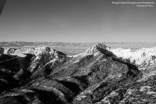 Looking Southwest to Ross Pass
Climbing
Climbing Ross Peak is via three main trailheads:
- Brackett Creek
- Corbly Gulch
- Fairy Lake
The South Fork of Brackett Creek provides a drive-able road terminating at a gate at approximately 6500 ft. elev (this gate was open as of July, 2008). From here the road is walkable all the way to Ross Pass. At this point one must make choices on their route to the craggy top of Ross Peak.
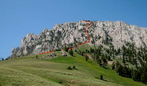 Ross Peak - Typical route up Ross with faint use trail.
Corbly Creek is a trailhead at approximately 5500 ft. elev. but is a shared-use trail so that someone inclined to take a motorcycle up to the approx. 9000 ft pass adjacent to Sacagawea Peak could then walk the Bridger National Recreation Trail southward to Ross Peak and either approach the technical Northface or proceed around the peak for an easier option from the Southeast.
Fairy Lake is a drive-in campground located about a thousand feet in elevation below the pass described above in the Corbly Creek description. Gain the pass, cross around Sacagawea Peak and follow the instructions above.
Other access methods do exist by entering the range at more remote points and enchaining other peaks on the prominent Bridger Range Ridge.
Technical Climbing
The North Face of Ross Peak is home to some difficult technical trad/bolted rock climbing routes. More information is currently being collected (Aug. 2010). was being collected but abandoned. Please build separate route pages and contact page editor to have them added here.
 Ross Peak - The technical North Face of Ross Peak as seen from the North.
 Northeast Face of Ross Peak
Winter Ascents and Descents
Ross Peak is not just a climbing destination, but a backcountry skiing one as well. The most popular ski descent on Ross Peak is the prominent East-facing 'Banana Couloir'. Access for a ski ascent/descent is from the Brackett Creek trailhead located on Hwy 89. Two roads lead away from the trailhead, one along Brackett Creek, the other along the South Fork. Either road can be taken and both provide an easy grade which are often tracked up for quick skinning.
Gain Ross Pass and follow the climber instructions found on this page or, before gaining the pass ascend directly up the couloir. If the latter is chosen ice axe and crampons may be necessary. All snow safety should be taken into consideration as well. Follow the local avalanche conditions, bring the right equipment and a knowledgeable partner as well.
 Banana Couloir