

-
 56959 Hits
-
 92% Score
-
 37 Votes
|
|
Area/Range |
|---|---|
|
|
45.89600°N / 110.968°W |
|
|
Hiking, Mountaineering, Trad Climbing, Sport Climbing, Toprope, Bouldering, Mixed, Scrambling, Skiing |
|
|
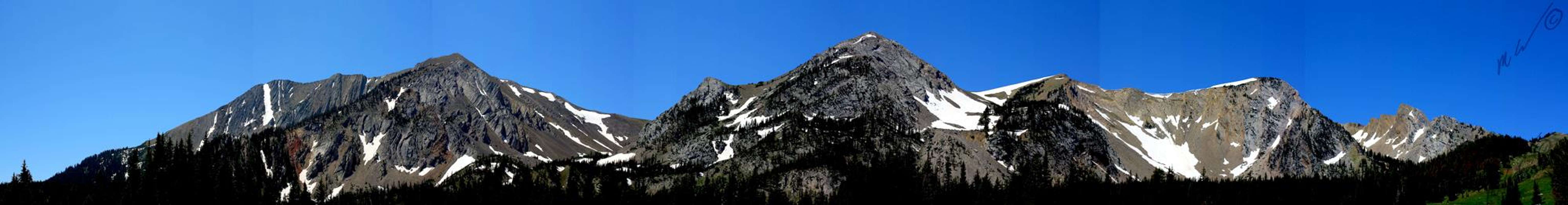
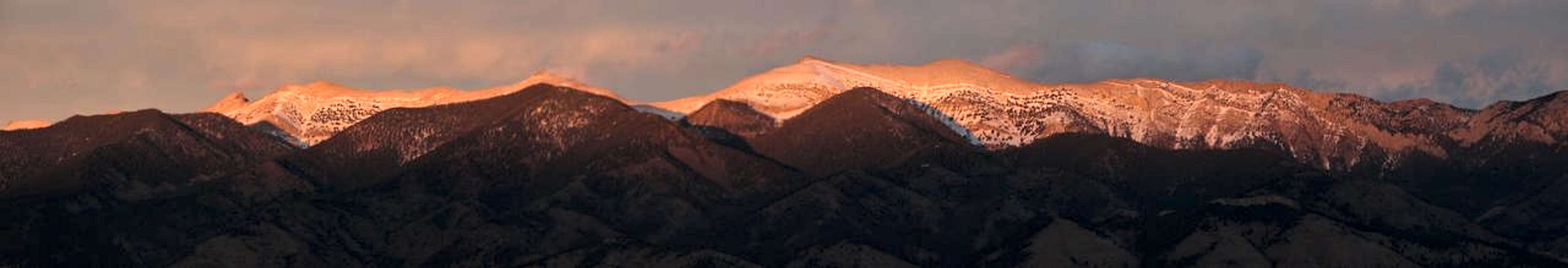
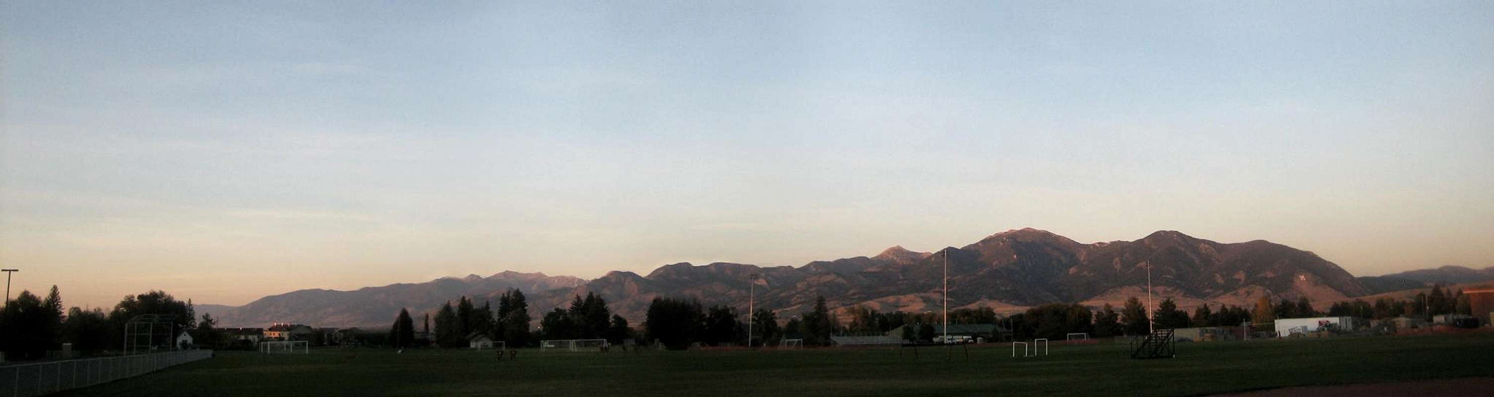
Overview of the Bridger Range
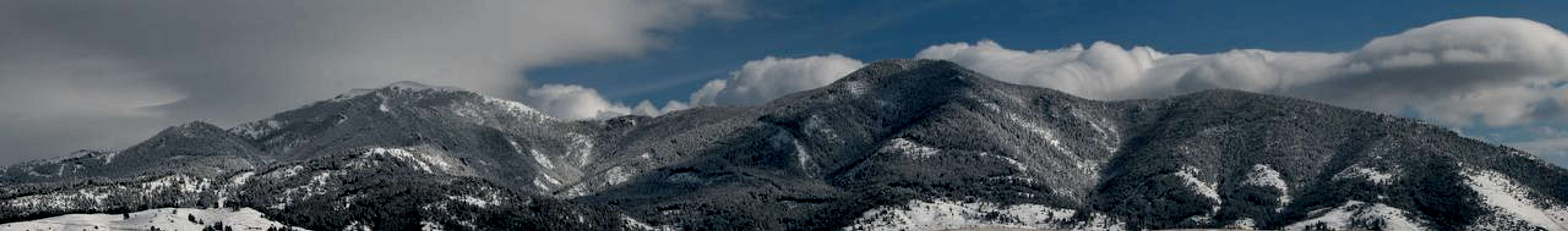
The Bridger Range is located in Northwest Montana near the town of Bozeman. It was named after Jim Bridger who pioneered a trail through the mountains in Southern Wyoming into the Bighorn Basin in the year 1864. At it's South end, Bozeman Pass separates the Bridger Mountain Range from the Gallatin Mountain Range. Bozeman Pass carries some taboo with it as it was named after John Bozeman rather than Sacagawea who's namesake many feel should be bestowed upon the pass. Sacagawea was a Native American woman whom led the Lewis and Clark Expedition through the pass on their exploratory journey across the Northern lands of what is now the United States. The Bridger Range is aligned generally North and South with a spine measuring approximately forty-five mi. (43 km) in length and lies within an area of land (including lowlands) sized approximately 1,174 sq mi (3,041 sq km) most of which is located in the Gallatin National Forest. A defining human element of the range is clearly visible from the town of Bozeman. At the ranges south end, facing the city of Bozeman is a large "M" constructed out of rocks which have been painted white. It is representative of Montana State University and is located on the side of Baldy Mtn. The Bridger range offers great skiing, fishing, hiking, biking and mountaineering. The tallest peak in the range is Sacagawea Peak (9665 ft/2,946 m) followed by Hardscrabble Peak (9575 ft/2918 m), Saddle Peak (9162 ft/2793 m), Ross Peak (9004 ft/2744 m), Mount Baldy (8914 ft/2717 m), and Bridger Peak (8635 ft/2632 m). |
||||||||||||
The Mountains of the Bridger Range Sacagawea from the West  Sacagawea from the East Sacagawea PeakSacagawea Peak (9665 ft/2,945 m) is the highest point in the Bridger Range. It's prominence is 1203 m (3946 ft) above Bozeman Pass. This ranks Sacagawea Peak at 19th in Montana for prominence. The Fairy Lake trailhead is the most popular access point for climbing this peak. Fairy Lake offers camping (w/outhouse) and very good fishing, located less that 1/4 mile away on a well maintained trail. The road to Fairy Lake campground from Hwy 86is often closed until at least the 1st of July.View the Sacagawea Peak page on Summit Post for peak details. |
||||||||||||
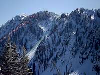
 East Closeup of Saddle Peak  Saddle Peak, East-Southeast Saddle PeakSaddle Peak (9160 ft/2792 m) is located to the north of Baldy Mountain. It is one of the more prominent bumps on the long sharp ridge of the Bridger Range. Impressive views from the summit include the Gallatin Range, Madison Range, the Crazy Mountains, the Absaroka Range and the Tobacco Root Range. Much of southwest Montana is visible from this highpoint. This peak has several routes to choose from in order to summit.View the Saddle Peak page on Summit Post for peak details. |
||||||||||||
 Baldy Mountain  View from Baldy Mountain Baldy MountainBaldy Mountain (8914 ft/2716 m) can be seen easily from most locations in and around Bozeman, MT. Near it's base is a large "M" made of laid stones which represents Bozeman's Montana State University. The "M" sits at about 5800 ft. and is accessable via a short, highly used trail that climbs about 850 vertical feet over 0.8 miles. There is a large brown sign off Hwy 86 that points to the parking area. Upon starting the trail one must choose between several different routes marked by a sign. (See "M" trail under the "Hiking in the Bridger's section below for more info).View the Baldy Mountain Page on Summit Post for peak details. |
||||||||||||
 Hardscrabble from Fairy Lake 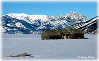 Barn and Ross Peak Hardscrabble Peak"Hardscrabble Peak (9575 ft/2918 m) is a beautiful alternative to the very popular Sacajawea Peak as it is accessible from the same trailhead at Fairy Lake. Between Hardscrabble Peak and Sacajawea there are two unnamed peaks also providing beautiful views. From the top of any of these peaks a plethora of mountain range are visible including The Crazy Mountains, Gallatin and Madison Ranges, the Beartooths, and the Tobacco Root Mountains. This peak is an easy day hike and can be accessed at any time of the year.View the Hardscrabble Peak on Summit Post for peak details. |
||||||||||||
 Ross from Truman Gulch  Naya Nuki from Sacagawea Ross PeakRoss peak (9003 ft/2744 m) is the fourth highest peak in the Bridger Range. It is located next to the unique Ross Pass which gives the craggy peak a bit of prominence when viewed from the East and West. Of the ten peaks in the Bridger Range, Ross Peak is located fifth from the South. One will find Ross Peak's summit on the Saddle Peak USGS 7.5 minute quadrangle map. Both class two, class three and technical summits are possible on Ross Peak. Winter ski descents are common in the Banana Couloir as well.View the Ross Peakpage on Summit Post for peak details. |
||||||||||||
 Naya Nuki and Sacagawea  "M" bouldering area. Naya-Nuki PeakNaya Nuki (9449 ft/2880 m) is named for a Shoshone native American girl and can easily be identified from both the West and East sides of the Bridger Range. There are however no distinguishing cliffs on the west side or along the ridge top that would make this a 'destination climb. Probably its main claim to fame is that it at the top of "The Great One", a couloir often filled with snow year-round and therefore ski-able for the greater part of the summer.View the Naya-Nuki Peak page on Summit Post for peak details. |
||||||||||||
Rock Climbing in the Bridgers Bouldering  The Resort BoulderingThere are several possible areas to begin bouldering in the Bridger Range. One of the areas that is easily accessible from the easier of the "M" trails, located about 1/2 up the trail to the left from the parking lot. This area has some anchors already placed, but bouldering is highly recommended, but the area has many overhangs. Some of the climbs are rated at 5.9 meaning they should go on top rope. Some of the lower routes, and some of the upper routes seem impossible from a bouldering point of view but top-roping should be possible. |
||||||||||||
Skiing in the Bridgers Bridger Entrance  Snowy Saddle Resort Downhill Skiing and SnowboardingThe Bridger Range is also home to the non-profit ski resort, Bridger Bowl located fifteen miles north of Bozeman. With the first rope tow installed in 1951, Bridger Bowl quickly became a 'locals' mountain. The area has a top elevation of 8700 ft and a base elevation of 6100 ft and encompasses about 1800 skiiable acres. On average the ski area receives 350 inches of snow every year. Backcountry skiing is also very popular with snow being available on peaks such as Sacagawea from early November until late May/early June. Beginning the 2005-2006 ski season, Bridger Bowl will allow backcountry travel from the ski area via access gates on the northern and southern boundaries. See the 'Backcountry Skiing' section of this page below for more info. Visit the Bridger Bowl Homepage. |
||||||||||||
 Sample Ski Route 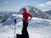 The Ridge Nordic SkiingThe Bridger Range offers many opportunities for winter pursuits beyond the boundaries of Bridger Bowl. There are excellent cross-country touring opportunities on Forest Service land, in addition to Bohart Ranch Cross Country Ski Center. Bohart is a local nordic center with 27 km of groomed trails in a scenic north Bridgers location Bohart Ranch Website. They are located 16.6 miles from Bozeman on Hwy 86/Bridger Canyon Road. |
||||||||||||
 Baldy Mountain  Flora of the Bridgers Backcountry Skiing and SnowboardingBackcountry skiers and ski mountaineers are also drawn to the Bridgers for a wide variety of terrain. The range offers everything from gentle bowls, to steep faces and narrow chutes. The best spots may be local's secrets, but generally speaking there are many great areas to access backcountry powder. Bridger Bowl offers some lift served gated access to backcountry terrain. Forest Service roads and accesses also provide starting points to skin, hike or climb for backcountry skiing and riding. Information on avalanche safety, current advisories and weather for the Bridgers can be found at Montana Avalanche.com. Snow conditions in the Bridger Range can be found at the Montana Snotel site for Brackett Creek or Sacagawea Peak. |
||||||||||||
Picnic and Camping Areas in the Bridgers Fairy Lake from Above  Fairy Lake Entrance "M" picnic areaThe parking area to the "M" trail is also a picnic area. It is located about 3 miles North of Bozeman on Hwy 86 on the left. Look for a large brown sign on the right indicating the turnoff. Many available routes are available on this hike. Also see the "Rock Climbing in the Bridgers" section for some rock climbing on this trail. |
||||||||||||
 Battle Ridge Entrance  Elk in the Bridgers Fairy Lake CampgroundFairy Lake has nine camping units, and 3 picnic units. There is a parking area that you can leave a vehicle while hiking or fishing. The area contains drinking water and also has an outhouse available. The dirt road is very narrow and dangerous for vehicle's pulling a trailer and the campground and is about seven miles off Hwy 86 or about twenty-one miles from Bozeman. The road is usually snow-choked until about the 1st of July. The lake itself serves as a Yellowstone Cutthroat Trout breeding area, and offers great fishing. |
||||||||||||
 Route Choices  Baldy Mountain Battle Ridge CampgroundBattle ridge is about 1 mile South of the turnoff for Fairy Lake and approximatly twenty miles North of Bozeman on Hwy 86. It has thirteen camping units, and four picnic areas. The campground has an outhouse and drinking water. |
||||||||||||
Trails in the Bridgers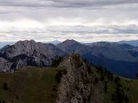 Saddle Peak from above  Sacagawea Peak "M" Trail #513The Bozeman "M" Trail is located on the south end of the Bridger range, three miles north of Bozeman on Hwy 86. With plenty of parking, you begin the .8 miles up the trail that climbs 850 vertical feet (Vigorous Route) and returns on the same path you took up. There is also a junction to trail #534 (Bridger Mountains National Recreational Trail) that extends for twenty-one miles along the top of the Bridger Range, ending at Fairy Lake. |
||||||||||||
img:446603:alignleft:small:Adventure Racers]img:199228:alignright:small:View from the "M"]
Bridger Mountains National Recreational Trail #534This trail begins at the "M" trail (#513) and extends twenty-one miles paralleling the summits of the Bridger Range. The trail ends near Fairy Lake. |
||||||||||||
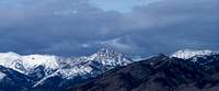
Events in the Bridgers Bridger Elk 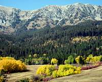 Bridgers from the East Bridgers from the EastThe Bridger Ridge RunThe Bridger Ridge Run is a difficult, yet immensely popular twenty-mile race traversing the Bridger Ridge from Sacagawea Peak Southward to the "M". For more info visit the Big Sky Wind Drinkers Web site about the Bridger Ridge Run. |
||||||||||||
Wildlife in the Bridgers Baldy and Saddle Peak Baldy and Saddle Peak Bouldering on Baldy Bouldering on BaldyVarieties of WildlifeWildlife in the Bridger Range, range from the Yellowstone Cutthroat trout in Fairy Lake, to the hundreds of elk, mountain goats, and deer in the area. There have also been sightings of Black Bears in the area. Although the mountain goats are an interesting species they are not native to the Bridgers but were planted there by a federal organization some years ago. |
||||||||||||
Select Photos of the Bridger Range
|
||||||||||||


tmbass - Feb 19, 2008 11:11 am - Hasn't voted
Great Page/BC SkiingGreat page on the Bridgers. Since these mountains are such an important local destination for backcountry skiing and touring, I though you could add the avalanche center as a resource. Also, maybe add some brief text about general BC skiing and even X-C touring. I would be glad to submit the text for review if the page author was game. Avy center link: http://www.mtavalanche.com/
samh - Jul 26, 2008 1:26 am - Voted 10/10
Re: Great Page/BC SkiingWould you care to put together some descriptive winter backcountry access tips for the Ross Peak page here on Summit Post? **edit** This information has been requested and fellow members of Summit Post are attempting to gain this data for inclusion on the various Bridger Range pages.
FlatheadNative - Nov 7, 2008 6:45 pm - Voted 10/10
wonderingwhy are there basically two of the same photo of the "M" and Baldy Mountain? Also would recommend formatting to fit a "1024 x 768" screen
samh - Nov 11, 2008 6:01 pm - Voted 10/10
Re: wonderingI must've missed this comment before. I went through and reformatted all my pages to be better suited for computer monitors sized at 1024 pixels wide a week ago. Also, I just now removed the duplicate photo. Good eye ; )
FlatheadNative - Nov 11, 2008 9:17 pm - Voted 10/10
Re: wonderingThanks Sam. Glad I could help. Nice job on this really like the format. It gave me a few ideas to try on future pages.