
|
|
Mountain/Rock |
|---|---|
|
|
46.96730°N / 10.94910°E |
|
|
Hiking, Skiing |
|
|
Spring, Summer, Fall, Winter |
|
|
9669 ft / 2947 m |
|
|
Note: As the Rotkogel is quite close to the Schwarzkogel, the two pages are similar. I've chosen to repeat some information rather than just refering to it, so that this page is complete on it's own.
Overview
A few German words
| Ferner, Gletscher | Glacier |
| Kamm | Ridge |
| Kogel (plural: Kögel, also Koegel) | Mountain top |
| Rot | Red |
| Schwarz | Black |
| See | Lake |
| Straße (also Strasse) | Road |
| Tal | Valley |
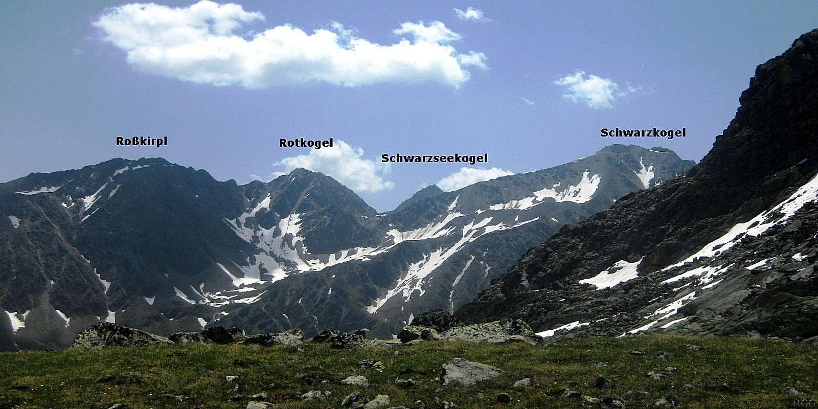
There are several higher peaks on the Polleskamm to the southwest, starting with the Schwarzkogel (3016m), with the lake separating the two. In all other directions, the views are unobstructed. To the south, the Schwarzsee is further hemmed in by the Schwarzseekogel (2931m), but since it's slightly lower, you can look over it to see the big glaciated peaks of the southern Ötztaler Alps, including its highest, the Wildspitze.
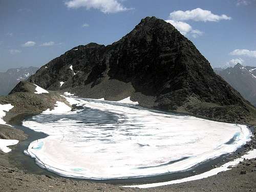
Rotkogel from across the Schwarzsee

Puitkogel summit
Until recently, there was a small summer ski area on the glaciers further south, at the end of the Rettenbachtal. However, the glaciers have receded too far to keep it economically feasible, so the area closed for summer skiing a couple of years ago. But to get skiers up there, a toll road was constructed, the Ötztaler Gletscherstraße, which provides easy access to the valley. In winter it's buried below the snow, but as soon as it opens again sometime in spring, the road can get you high into the mountains quickly, making the mountain easy to reach.
There's also a bus service along the road. And one of the easiest way to get to the Rotkogel is by the Gletscherstraße. The shortest route starts at Gasthof Falkner (2145m). Alternatively, from Sölden you can take the Giggijochbahn, one of the few lifts in the area that operate in summer to quickly transport hikers up into the mountains. Or you can simply walk up from Sölden.
Terrain map of Rotkogel. The green paddle points at the summit.
Click here to view a larger map
View towards the Rotkogel from the NW, from the slopes of the Geigenkamm on the other side of the Pollestal
Getting There
Click here to view a larger map
The paddle points at Sölden.
There are ski resorts all over the long Ötztal valley, but the nearby village of Sölden is arguably the most important one. It's easy to get there by car or by public transport, but being such a popular place, in winter it's not as easy to get a bed if you just walk in without a reservation.The paddle points at Sölden.
In summer, there are far less tourists and that makes it a very different place. Most visitors come for hiking, mountain biking, cycling and sight seeing; a small minority come for other activities, such as climbing the big glaciated peaks in the southern Ötztal area. All in all, in summer, while Sölden is far from crowded, it's not deserted either. While some few restaurants are closed, there are still plenty open for business. At first glance, all the ski outlets seem to have turned into specialist outdoor stores - and the staff really know what they are talking about. Public transport is excellent, and if you arrive unannounced, you'll quite likely have no trouble finding accommodation - unless you happen to stumble in during one of the special summer events, especially the Ötztal cycling marathon. All this make it an excellent base for exploring the area.
Sölden can be reached from only two directions, north or south.
The northern entrance to the Ötztal lies at the small village of Ötztal Bahnhof, and can easily be reached by train or car from east, west or north. The city of Innsbruck lies just east of there. It has a small international airport, but further north, Munich is still close and it has much better connections, and you can take a train from there.
From Italy in the south, you can drive over the very scenic Timmelsjoch, a high mountain pass. It's closed in winter and when there is too much snow. In that case the alternative route from the south is over the Brenner pass, via Innsbruck.
Approach
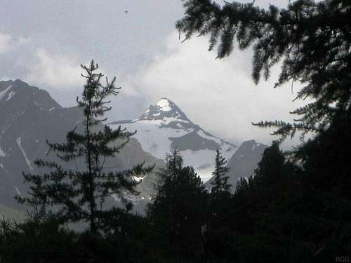
Zuckerhütl, in the Stubai Alps, from the forested slopes above Sölden
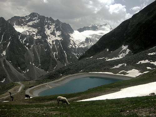
A small artificial lake next to the Rotkogelhütte
- Hike all the way from Sölden (1368m). There are several possible trails, some of which occasionally cross or even follow the Gletscherstraße. The steepest and therefore shortest route basically follows the Rettenbach mountain stream from Sölden all the way up to Gasthof Falkner (2145m) by the side of the road. From there, a steep zig zag trail leads to the hut. A slightly longer alternative would be to hike via Hochsölden (2050m). Either way, the lower half of the route steeply ascends through woodlands, higher up it's grassy slopes. The forest is pleasant enough for hiking and once above the tree line the views are great, but the elevation gain involved makes for a long day.
- Ride the Giggijochbahn (cable car) from Sölden up to 2284m, a bit above the tiny village of Hochsölden, then hike west along a winding and gradually ascending trail (1 hour).
- Use either your own transport or the bus to Gasthof Falkner (2145m) along the Gletscherstraße (toll road), then hike up a steep zig zag trail (1¼ hours).
- The easiest but also the least scenic route starts just above 2500m on the Gletscherstraße, where there is a turnoff with a dirt road heading northeast (46.9530°W / 10.9454°W) to the ski area. To get to the Rotkogelhütte, follow the gently rising dirt road for half an hour. It's not very clearly marked, but for part of the route, there is also a hiking trail, a little ways above the road.
Routes
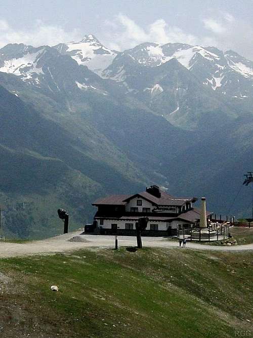
Rotkogelhütte
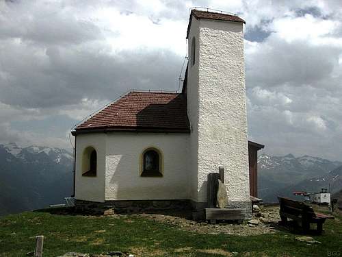
A tiny chapel sits at the base of the Rotkogel east ridge, next to the Rotkogelhütte
The normal route
From the Rotkogelhütte (2660m) a marked steep hiking trail leads to the summit. Count on 45 minutes. Not many people go there, because, from the Rotkogelhütte, the Schwarzsee and Schwarzkogel are much more popular. For the most part, the trail follows the east ridge. The south side of the ridge is steeper than the north side, and the trail occasionally veers away a bit to the north. There are no serious difficulties.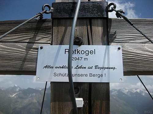
Sign on the Rotkogel summit cross
Roßkirpl
To the northeast, the next named summit on the Polleskamm is the Roßkirpl (2942m). There is no trail and I didn't try it, but according to the Alpenvereinsführer (see below), the ridge between them is easy.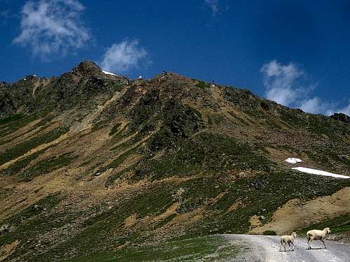
Rotkogel east ridge, from the dirt road next to the Rotkogelhütte, with Roßkirpl is just visible on the far right
I did not see the mountain in winter conditions, but neither the east ridge itself nor the bowl to the northeast looked too steep for an off piste run. Any other side would be a much more serious matter.
Red Tape
Apart from the toll road, none.When to Climb
All year around, but for logistical reasons, it is easier during the summer season when the Gletscherstraße or Giggijochbahn are open, or during the ski season when you take one of the ski lifts to the Rotkogelhütte.Camping
Although the name may suggest otherwise, the Rotkogelhütte offers food, but no overnight accommodation. The nearest place to stay is the tiny tourist village of Hochsölden (2050m), but there is much more choice in Sölden itself.Wild camping is not allowed.
External Links
SöldenRotkogelhütte
References
You really don't need a guidebook for this mountain, but it is mentioned in the Alpenvereinsführer Ötztaler Alpen, Walter Klier. 14th ed. Bergverlag Rother, 2006. ISBN 3-7633-1123-8. In German.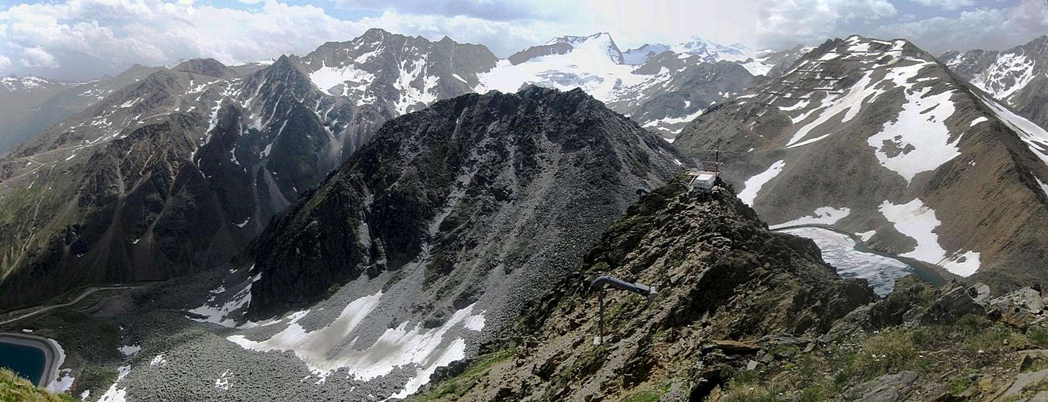
Rotkogel summit panorama to the south. The dark mountain in front is the nearby Schwarzseekogel (2931m), the brown one on the right the Schwarzkogel (3016m). Further back, behind the Schwarzseekogel, are the Äußere and Innere Schwarze Schneide, with the Seiter Jöchl between the two.