
|
|
Area/Range |
|---|---|
|
|
46.98948°N / 10.91009°E |
|
|
Hiking, Mountaineering, Scrambling, Skiing |
|
|
Spring, Summer, Fall, Winter |
|
|
11142 ft / 3396 m |
|
|
Overview
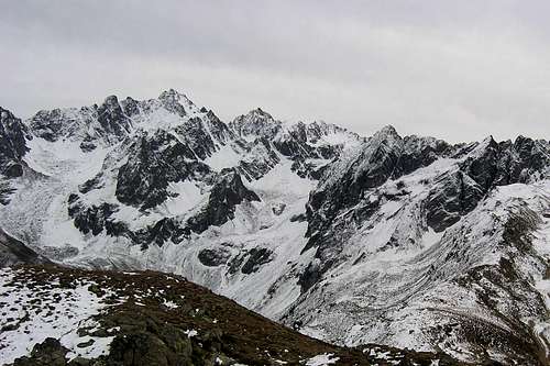
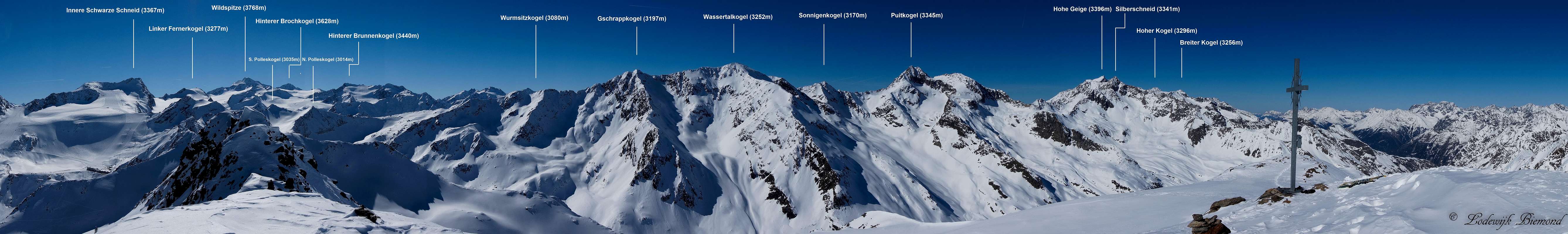  Annotated Geigenkamm Panorama with a part of the Weisskamm; as seen from Schwarzkogel (3016m) |
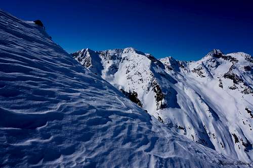
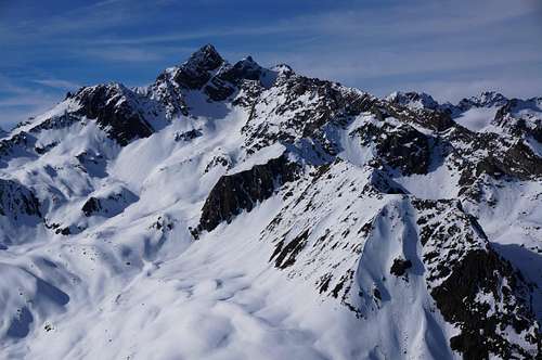
The Geigenkamm is a wild and rugged mountain ridge at the eastern border of the Otztal Alps. It lies in the heart of the Eastern Alps and is great place for hiking, climbing and enjoying nature as a whole. The Geigenkamm is one of the more quiet ranges in the Otztal Alps, which makes it, in my opinion, even more attractive. You can hike along the famous Mainzer Hohenweg for many hours without meeting a single person on the way. There are many mountain huts in the range as well, which makes the Geigenkamm a great destination for a multiple day visit, since you can travel from hut to hut through the whole range. The rugged, sharp peaks like Hohe Geige and Puitkogel offer a great scenery. To summarize the above: The Geigenkamm is a great place for a (multiple day) visit.
Between 1953 and 1957 Ibex were imported in Tirol. First they settled in the Kaunergrat and somewhat later in Geigenkamm range. Today you are, particularly in the area around the Rüsselsheimerhut, likely to meet one.
 Hohe Geige (3396m) | 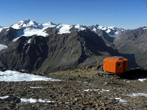 Wassertalkogel (3252m) |
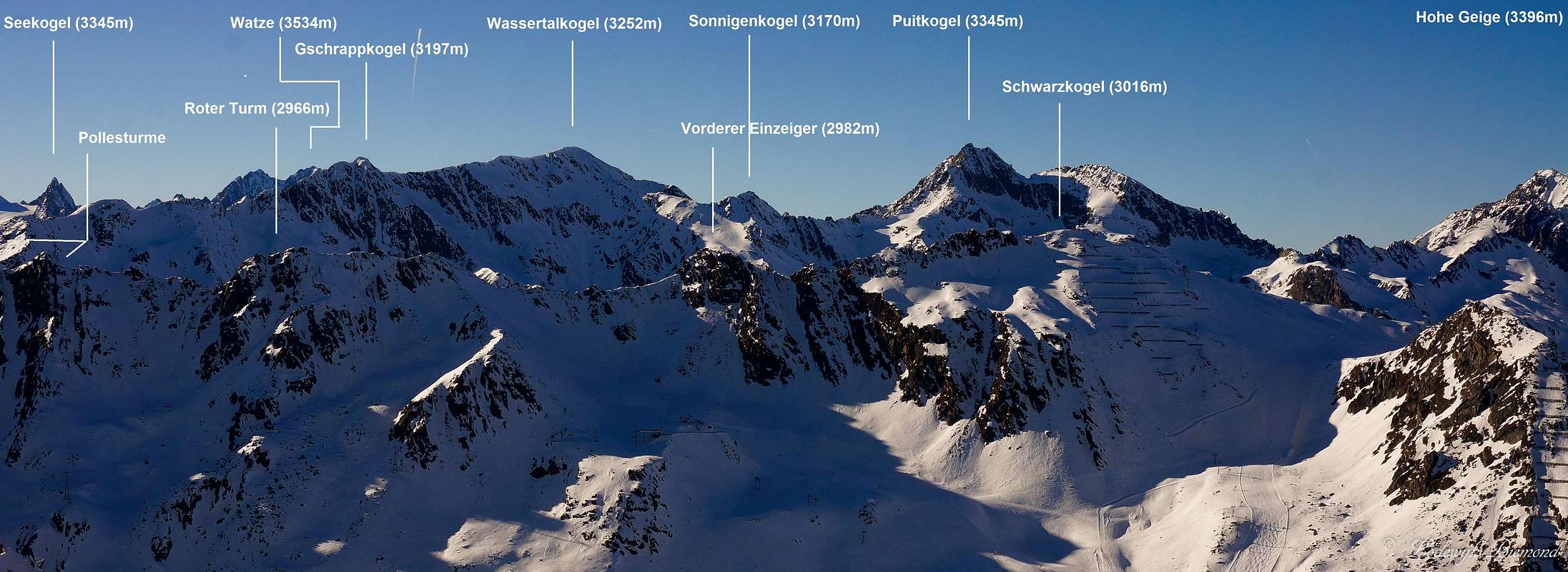
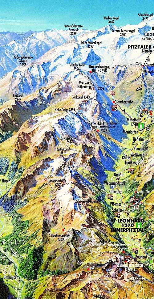
The Geigenkamm (kamm is the German word for ridge/crest) has as many as 28 peaks of over 3000 meters in altitude and over 40 main peaks with an altitude between 2500 and 3000 meters. The highest peak of this range is Hohe Geige with an altitude of 3395 meters. The Geigenkamm is a popular area for hiking as well as climbing. It is home to the Mainzer Hohenweg; a well-known high alpine mountain trail that crosses a large part of the Geigenkamm ridge. This route starts at the Braunschweiger Hutte and the trail goes over a large part of the Geigenkamm ridge to its highpoint: the summit of Wassertalkogel at 3254 meters of altitude. The Mainzer Hohenweg ends at the Russelheimer Hutte at 2323m. The Hohe Geige itself is a popular destination for experienced hikers and climbers. The normal route is a relatively easy (F+ / T4; for the experienced hiker) for a mountain of this altitude and can be reached in 3,5 hours from the Russelheimer Hut.
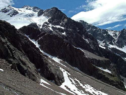
Another, somewhat more difficult but popular destination is the 3110m high Luibiskogel. It can be climbed from both the Pitztal valley and the Otztal valley and is graded PD-. Last but not least there is Fundusfeiler, a 3080 meters high mountain which is also relatively easy to climb for the experienced hiker. It is located at the northern end of the Geigenkamm and offers great views in all directions. For more demanding mountaineering routes you can climb the Puitkogel Nordostgrat (AD, III) or go the the neighbouring Kaunergrat ridge with famous peaks like Watzespitze and Seekogel.
 Wassertalkogel (3252m) and Puitkogel (3340m) |  Rosskirpl (2942m) |  Puitkogel and Hohe Geige (3396m) |
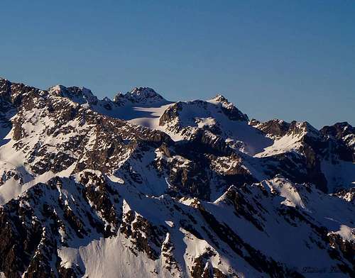
The Geigenkamm ridge is oriented in a North-South direction and is bounded by the Inntal Valley to the North and the Weisskamm Ridge to the South, where the Pollesjoch forms the southern boundary. All mountains are on Austrian ground and carry only German names. At the west side the Geigenkamm is bordered by the Kaunergrat and in the east by the Stubai Alps. In comparison to the two neighbouring ranges the Geigenkamm ridge is least glaciated although it holds many peaks above 3200 meters ofaltitude like Hohe Geige (3395 m),Puitkogel ( 3345m),Silberschneide (3343m),Hoher Kogel ( 3296m),Breiter Kogel (3256m) and Wassertalkogel ( 3247m).
Directly to the west of the Geigenkamm ridge lies the Pitztal valley with its main villages from north to south: Jerzens, Zaunhof, St Leonard im Pitztal, Bodele, Kofels, Tieflehn and Mittelberg. Directly to the east of the ridge lies the Otztal main valley with the main villages being from N to S: Sautens, Oetz, Umhausen, Langenfeld, Huben, Solden and Zwieselstein.
 Wildgrat (2974m) by EricChu | 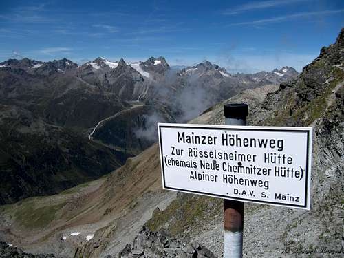 Mainzer Hohenweg | 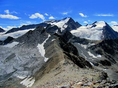 Sudlicher Polleskogel (3035m) |
The Geigenkamm is home to the following mountain huts: Armelenhutte(1750m), Innerbergalm (1990m), Stabele Alm (1908m), Forchheimer Biwakschachtel (2443m), Erlanger Hütte (2550m), Hochzeigerhaus(1876m), Ludwigsburger Hütte (1935m),Frischmannhütte (2192m), Hauerseehütte (2383m), Rüsselsheimer Hütte (former Chemnitzer Hut; 2323m), Hahlkogelhaus (2042m),Rheinland-Pfalz-Biwak (3247m, on the summit of Wassertalkogel)
The ten highest mountains of the Geigenkamm are (in order of descending height): Hohe Geige (3395 m), Puitkogel ( 3345m), Silberschneide(3343m), Hoher Kogel ( 3296m), Breiter Kogel (3256m), Wassertalkogel( 3247m).Gschrappkogel (3194m), Ampferkogel (3186m), Sonnenkogel (3170m) and KleineGeige (3163 m).
Geigenkamm on SP
The mountains of the Geigenkamm on SP:
- Funduspfeiler
- Äußerer Hahlkogel
- Hohe Geige
- Wassertalkogel
- Südlicher Polleskogel
- Nördlicher Polleskogel
- Rotkogel
- Schwarzkogel
 |
The Summits (Names)
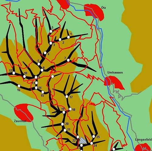 Hand drawn schematic map (Northern Part) by Gangolf Haub | 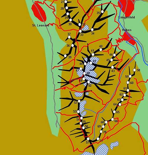 Hand drawn schematic map (Southern Part) by Gangolf Haub |
- Erster Karkopf (2511m)
- Mitter Karkopf (2588m)
- Hoher Karkopf (2686m)
- Weiter Karkopf (2777m)
- Blose (2538m)
- Murmentenkarspitze (Murmentenkarkopf, 2784m)
- Kreuzjochspitze (2675m)
- Brechkogel (2918m)
- Wildgrat (2974m)
- Dreirinnenkogel (2679m)
- Schwendkopf (2786m)
- Hochzeiger (2582m)
- Riegelkopf (Rifflspitz 2936m)
- Kreuzjöchlspitze (2908m)
- Schafhimel (2821m)
- Gemeindekopf (2771m, 2566m)
- Leierskopf (2812m)
- Fundusfeiler (3080m)
- Lehner Grieskögel
- Northern Grieskogel (3032m)
- Central Grieskogel (3030m)
- Southern Grieskogel (3038m)
- Hairlacher Seekopf (3055m)
- Rotbleißkogel (Rotpleiskopf, 2894m)
- Blockkogel (S:3098m, N:3083m)
- Plattigkogel (3092m)
- Hinterer Felderkogel (2837m)
- Hohe Seite (2857m)
- Wenderkogel (2200m)
- Langkarlesschneid (3048m)
- Griesskogel (2986m)
- Dristenkogel (S:2996m, N:2976m)
- Äußere Feuerkögel (S:2950m, N:2940m)
- Luibiskogel (S:3112m, N:3090m)
- Hintere Feuerkögel
- Reiserkogel (3090m)
- Breitlehner Felderkogel (3075m)
- Hauerseekogel (Oppenkogel, 3059m)
- Hundstallkogel (N:2948m, S:3073m)
- Wildgartenkogel (2556m)
- Grabkogel (2651m)
- Sturpen (2718m)
- Niederer Breitlehnkogel (2820m)
- Kleine Geige (Hoher Breitlehnkogel, 3163m)
- Breiter Kogel (3256m)
- Wartkogel
- Innerer Wartkogel (2590m)
- Äusserer Wartkogel (2550m)
- Äusserer Hahlkogel (2658m)
- Innerer Hahlkogel (2739m)
- Hoher Kogel (3296m)
- Hoher Kopf (2784m)
- Hohe Geige (3395m)
- Silberschneide (3343m)
- Ampferkogel (3186m)
- Vorderer Ampferkogel (2911m)
- Puitkogel (3345m)
- Sonnenkogel (3170m)
- Wassertalkogel (3247m)
- Gschrappkogel (3194m)
- Wurmsitzkogel (3080m)
- Polleskögel
- Southern Polleskogel (3005m)
- Northern Pollekogel (3035m)
- Pollesfernerkopf (3015m)
- Graskogel (2766m)
- Schartlaskogel (2791m)
- Grahnsteinkopf (2800m)
- Söldner Grießkogel (2911m)
- Lange Wand (Polleswand, 2876m)
- Breitlehner (2793m)
- Breitlehnerturm (2765m)
- Roßkirpl (2942m)
- Rotkogel (2947m)
- Schwarzseekogel (2931m)
- Schwarzkogel (3016m)
- Vorderer Einzeiger (2982m)
- Roter Turm (2966m)
- Pollestürme
- Einzeiger (2957m)
- Zweizeiger (2975m)
- Dreizeiger (2980m
The Summits (Photos)
 9. Wildgrat (2974m) | 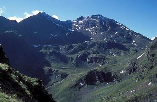 18. Fundusfeiler (3079m) |  31. Luibiskogel (3110m) | 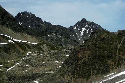 33. Reiserkogel (3082m) | 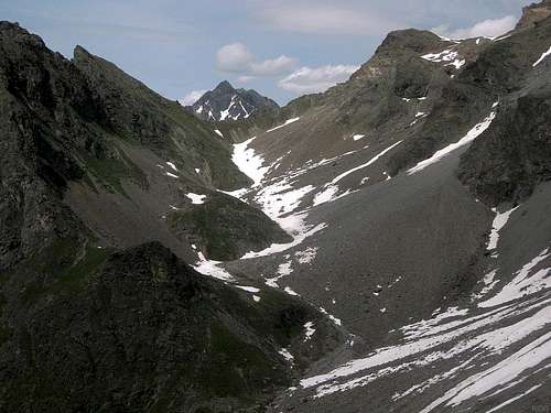 34. Felderkogel (3071m) |
 42. Breiter Kogel (3256m) | 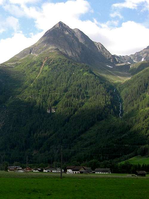 44. Ausserer Hahlkogel (2655m) |  45. Innerer Hahlkogel (2739m) | 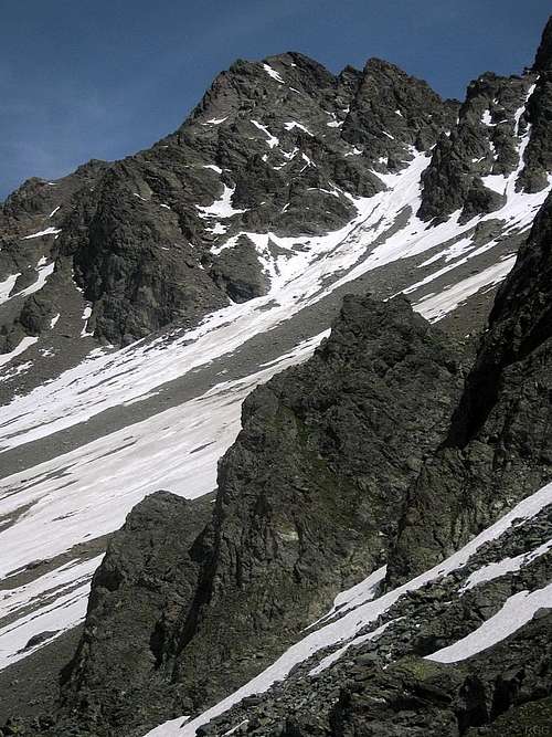 46. Hoher Kogel (3293m) |  48. Hohe Geige (3396m) |
 49. Silberschneid (3341m) |  50. Ampferkogel (3183m) | 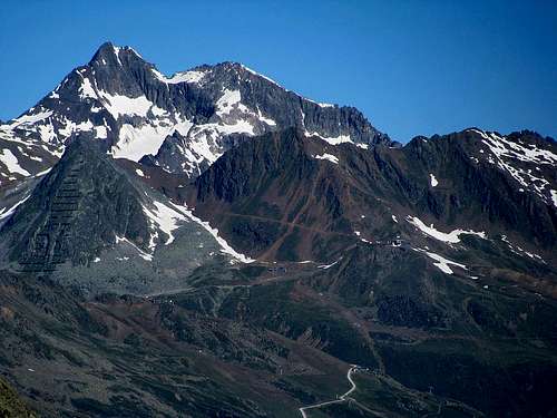 52. Puitkogel | 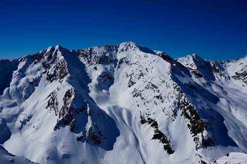 53. Sonnenkogel (3176m) | 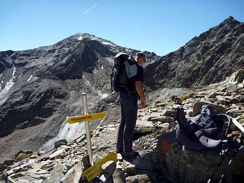 54. Wassertalkogel (3252m) |
| 55. Gschrappkogel (3196m) |  56. Wurmsitzkogel (3076m) |  57;2. Nordlicher Polleskogel (3015m) | 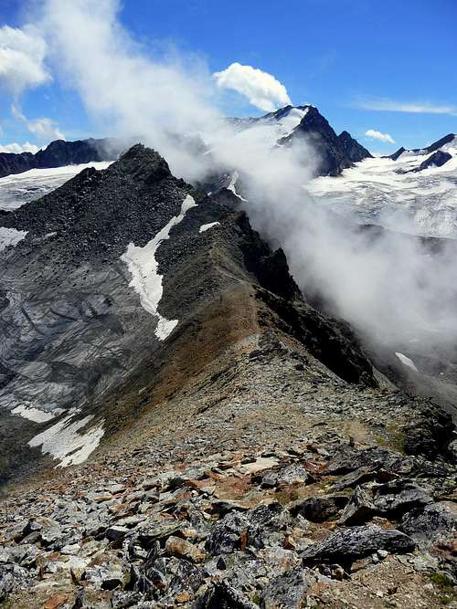 57;1. Sudlicher Polleskogel (3035m) |  63. Breitlehner (2793m) |
| 65. Rosskirpl (2942m) |  66. Rotkogel (2947m) |  67. Schwarzseekogel (2931m) | 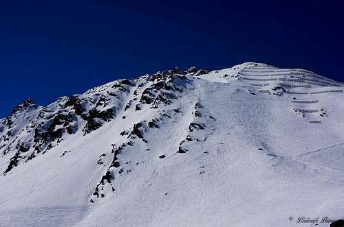 68. Schwarzkogel (3016m) | 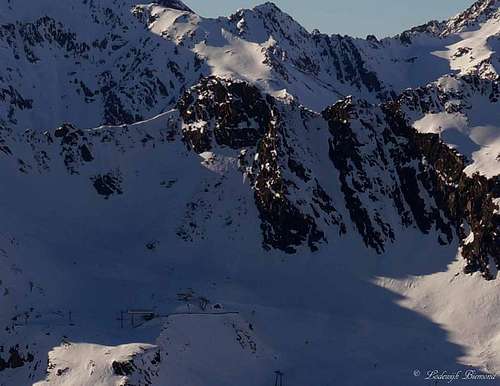 69. Vorderer Einzeiger (2982m) |
 70. Roter Turm (2966m) | 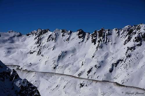 71. The Pollesturme |
Geigenkamm Schematic Map
 Geigenkamm Schematic Map | 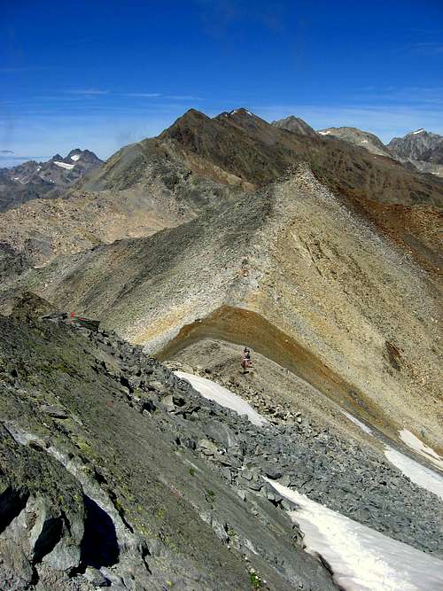 Geigenkamm; View North to Wassertalkogel |
Main mountains to be climbed
Hohe Geige | Difficulty: F+(I) Altitude Gain: 1050m StartingPoint: Russelheimer Hut (2323m) Duration(up& Down): 5/6hours |
Luibiskogel | Luibiskogel (3110m) Difficulty: PD-(I) Altitude Gain: 750m StartingPoint: Hauerseehutte (2383m) Duration(up& Down): 4 hours |
Fundusfeiler | Difficulty: F Altitude Gain: 530m StartingPoint: Erlanger Hut (2550m) Duration(up& Down): 5/6hours |
 Sudlicher Polleskogel | Difficulty: F Altitude Gain: 300m StartingPoint: Parking lot Soldener Glacier Street Duration(up& Down): 2/3hours |
 Schwarzkogel | Difficulty: F Altitude Gain: 730m StartingPoint: Giggijoch (2284m) Duration(up& Down): 3/4 hours |
Wassertalkogel | Mainzer Hohenweg (Wassertalkogel) Difficulty: PD(II) Starting Point: Russelheimer Hut or Braunschweiger Hut Highpoint: Wassertalkogel (3250m) Duration(up& Down): 9-12 hours (depending on conditions) |
Accomodation
| Hut | Height | Summer | Winter | Telephone | Photo |
| Armelenhütte | 1750m | n.a. | n.a. | +43/5236/502 | |
| ErlangerHütte | 2550m | end July - mid Sept | self service for 4 | +43/664/3043335 | 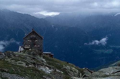 |
| Hochzeigerhaus | 1876m | mid June - End Sept | End dec. - End April | +43/5414/87335 | |
| Frischmannhütte | 2192m | end June - end Sept | two weeks around Easter | +43/676/3355436 | 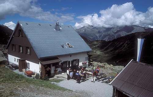 |
| Innerbergalm | 1990m | n.a. | n.a. | +43/5253/5631 | |
| Stabele Alm | 1908m | n.a. | n.a. | +43/5253/5825 | |
| Hauerseehütte | 2383m | end June - end Sept | closed | +49/7141/927893 | |
| Rüsselsheimer(Chemnitzer) Hütte | 2323m | mid June - end Sept | sefl service for 12 | +43/664/2808107 | 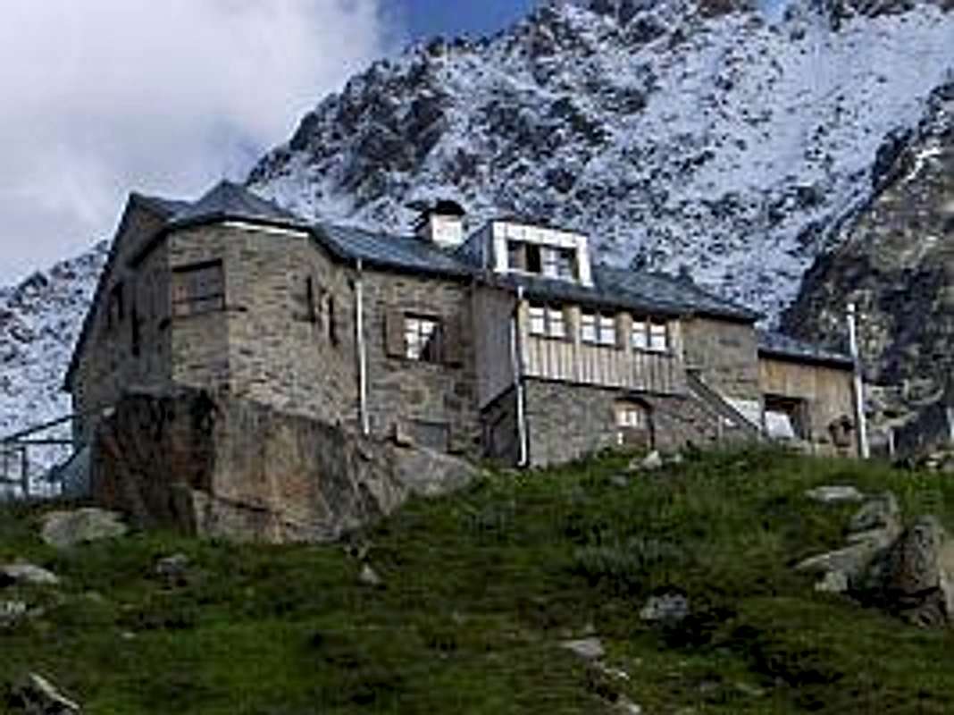 |
| Hahlkogelhaus | 2042m | n.a. | n.a. | +43/5253/5897 | |
| Ludwigsburger Hütte | 1935m | end June - end Sept | self service for 12 | +43 (5414) 20204 | 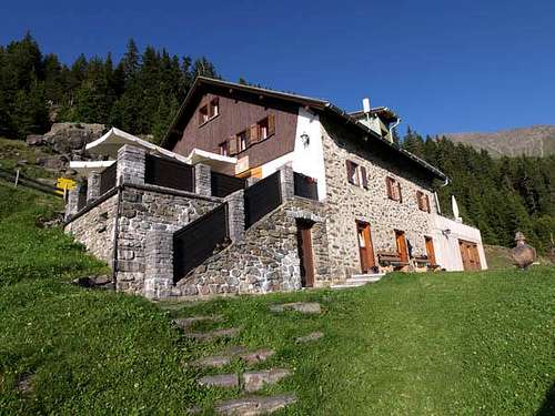 |
Bivak / Shelters
| Bivak / Shelter | Height | Accomodation | Summer/Winter | Photo |
| Rheinland-Pfalz-Biwak | 3247m | 9 beds | Always open (Self service) | 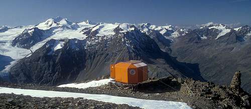 |
| Forchheimer Biwakschachtel | 2443m | 2 persons | Always open (Self service) | 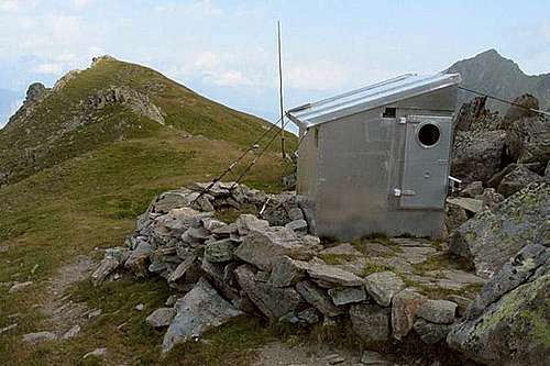 |
Weather Conditions
How to get There
Route Map Geigenkamm (Otztal and Pitztal)
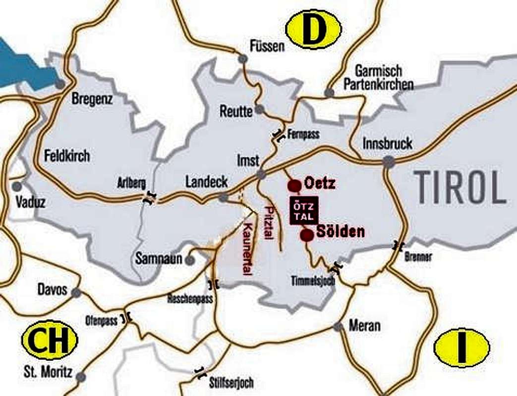
The Geigenkamm can be reached from two sides, Pitztal Valley in the west and the Otztal valley in the east.
From Austria:
1) Take motorwayA12 / E60 to Arzl/Pitztal
2A) Switch to L16into the Pitztal
or:
2B) Take motorway A12 / E60 to Otztal; Switchto B186 into the Otztal valley
From Italy:
1)Take Motorway A22 to Bozen / Bolzano
2) Switch to SS38 to Sponding / Spondinga
3A) Stay on course on SS40 to Reschenpass /Passo di Resia where it turns into B180 north of the Austrian border; At Fliess take the L17 into the Pitztal
or
3B) Take SS44 and SS44bis to the Timmelsjoch Hochalpenstrasse The passroad is opened from the start of June until the end of Oktober; Tollroad. Passroad is closed in Winter! At the border with Austria take B186 into the Otztal valley
From Switzerland:
1)Take motorway A3 and A13 to Landquart
2)Switch to B28 across Flüelapass to Susch
3)Switch to B27 to Vinadi
4)Across the border the road turns into B180 through Inntal Valley
5A)At Fliess take the L17 into the Pitztal
or
5B)Take motorway A12 / E60 to Otztal; Switch toB186 into the Otztal valley
Maps and Books
Maps
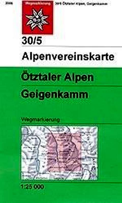 |  |
- Ötztaler Alpen, Geigenkamm
Map No: 30/5
1:25000
ISBN:9783928777445
- Ötztaler Alpen
Kompass Map WK43
1:50000
ISBN: 3-85491-049-
Books
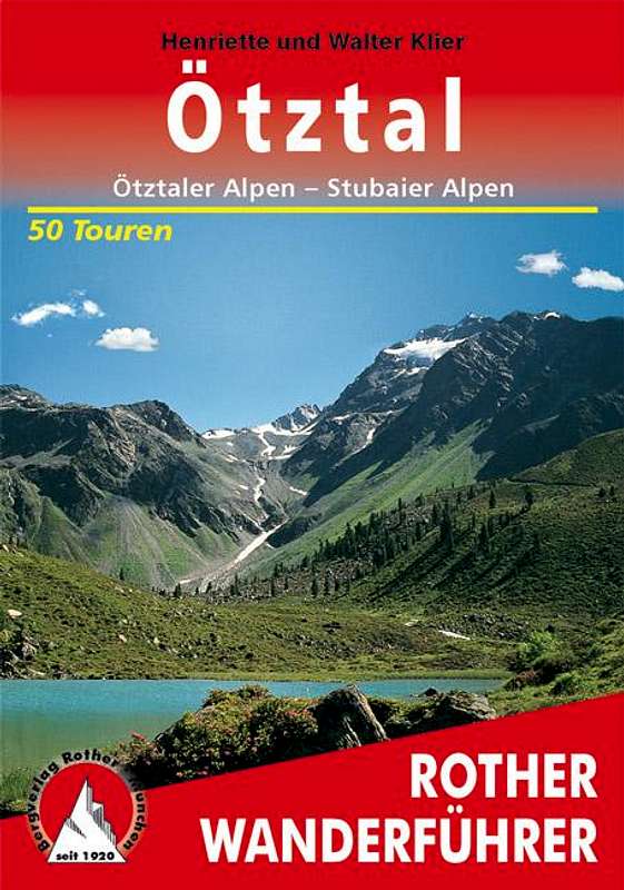 |  |  |
Ötztaler Alpen
W. Klier
Alpenvereinsführer
Rother Verlag
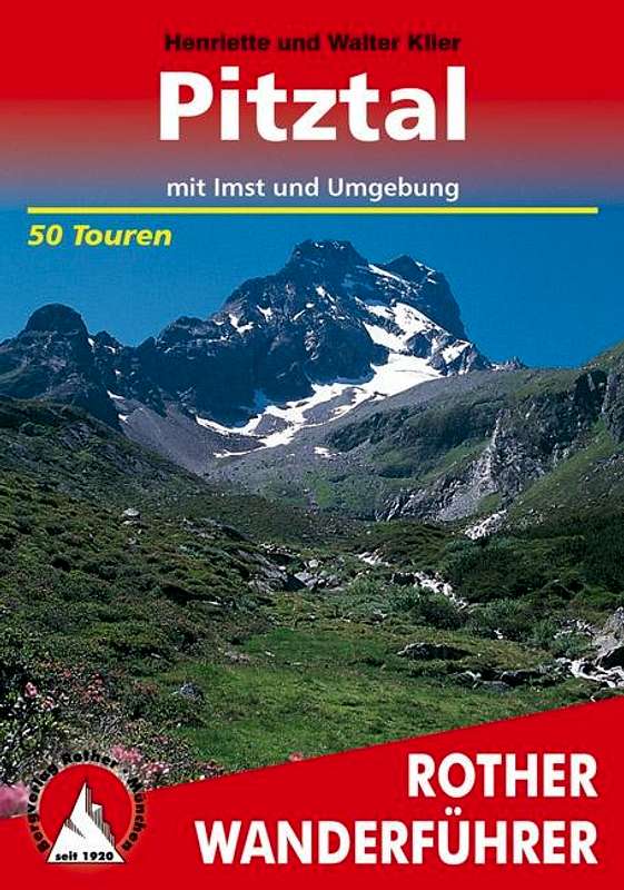
ISBN: 3-7633-1123-8Pitztal
Henriette und Walter Klier
Rother Verlag
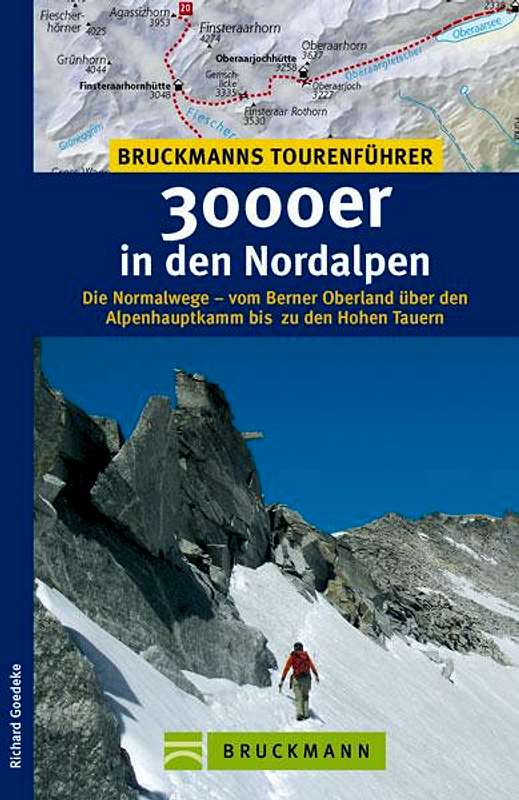
ISBN:978-3-7633-4058-33000er in denNordalpen
RichardGoedeke
Bruckmann
ISBN13:9783765455438