
-
 29579 Hits
-
 90.06% Score
-
 31 Votes
|
|
Area/Range |
|---|---|
|
|
44.59691°N / 115.11958°W |
|
|
Hiking, Mountaineering, Trad Climbing, Ice Climbing, Aid Climbing, Big Wall, Mixed, Canyoneering |
|
|
Spring, Summer, Fall |
|
|
Overview
 Idaho Regional Overview
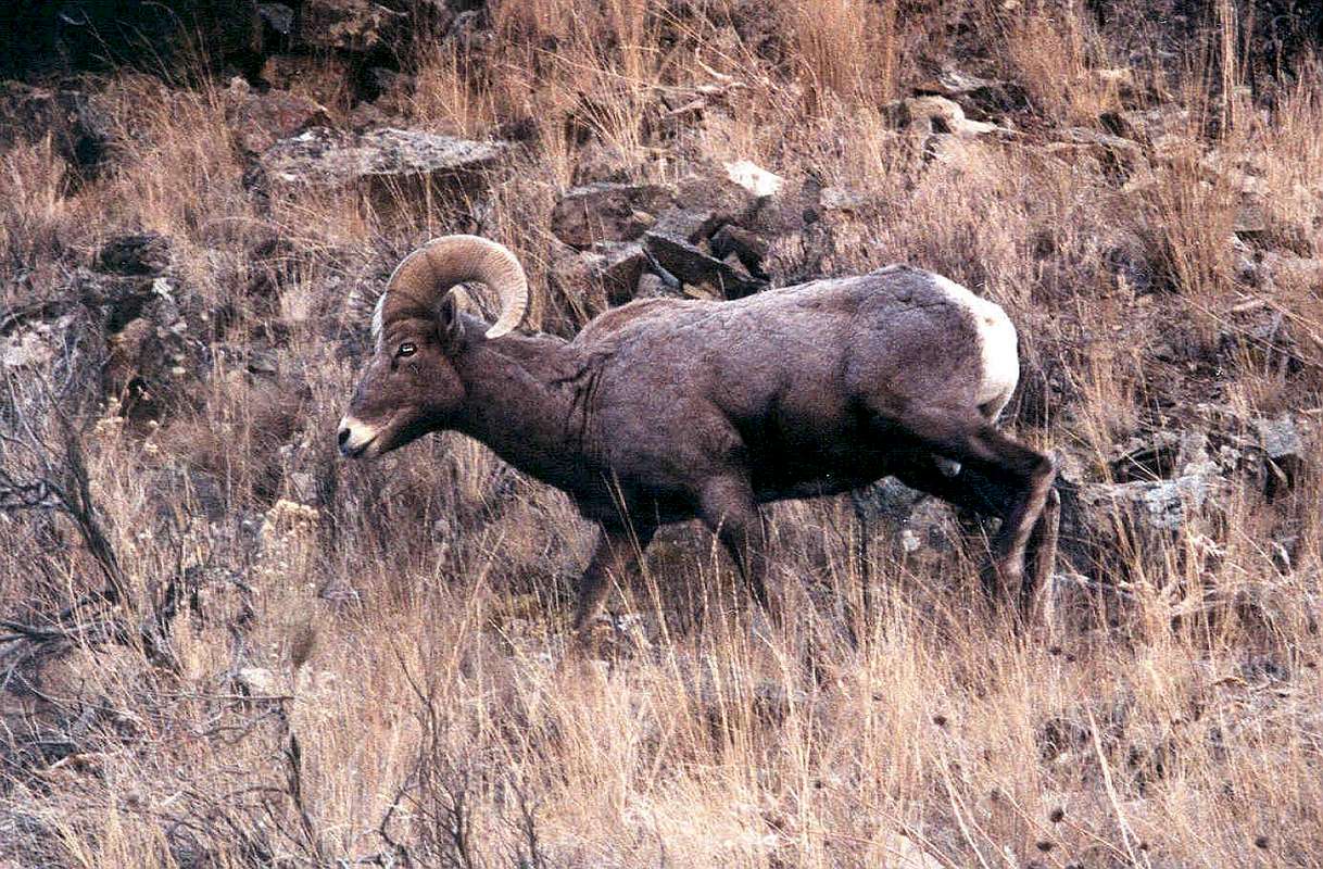
If one was to leave the paved road north of Stanley, Idaho and head directly north, the next paved road would be encountered over 200 miles away. This includes part of the Clearwater Mountains (not part of this region) and would rank as one of the largest tracts of backcountry terrain in the lower 48 states. Included in this terrain are huge river valleys with elevation changes of over 5200 feet and the largest of peaks topping out at 10,400 feet (White Mountain). Also nestled within the region is the Middle Fork of the Salmon River. Completely protected from roads, a journey to this river usually requires a small plane trip into a narrow landing strip on the Middle Fork. The usage of this pristine river is tightly restricted with a very limited number of permits being issued each year. This is a float trip popular with the famous, but can taken by anyone willing to pay the price. A float trip on the Middle Fork of the Salmon with a guide usually has a Dutch Oven cooking experience and the regulations require packing everything out- campfire ashes and human waste included. When your not busy negotiating Class 3 or 4 rapids, the Bighorn Sheep on the hillside make for exceptional wildlife viewing.
Noteworthy Peaks
|
Noteworthy Peaks |
   |
| Mt. McGuire- tallest in the Bighorn Crags | |
| Nick Peak- visible from McCall, longish hike | |
| Slick Rock- 5.7-5.9 Climbing near McCall | |
| Cabin Creek Peak- 5.3 (close to Stanley) | |
| Needles Peak- Class 4 Spire Climbing | |
| Wolf Fang Peak- New Climbs Possible | |
| The Rust Nail-Easy 5th, <10 summits | |
| White Mountain-highest in the region (Class 3) | |
| Knuckle Peak- Easy 5th Class in the Bighorns | |
| Snowslide Peak- Class 3 Scramble | |
| Red Mountain- Near Lowman (Class 1) | |
| Pinnacles Peak- Class 3 scrambling | |
| Ramskull Peak- one of the most impressive |
History
With ever growing pressures from the exploitation industries of Idaho (mining / logging), the area withheld the political pork barreling that so often defined the pre-conservation era. In the late 1970's conservation movement, Congress solidified the wilderness designation of this area by creating the Frank Church River of No Return Wilderness, protecting 2.3 million acres. Church was the rare Idaho conservationist, and remarkably, the incumbent U.S. president at the time had explored the region and enjoyed it's beauty, further supporting the cause.
In the 1990's as the high tech and internet boom occurred in many areas, including the Boise Valley to some extent, the rest of Idaho was left behind and pushed to explore the extraction of wood and ore from areas around the Salmon River Mountains. President Clinton, sensing this general movement, declared a limitation on the amount of new roads built into the backcountry. The state legislature resented the limitation of their exploitive powers. With George W. Bush, the pendulum has swung again, as he has essentially nullified the Clinton Road less Plan by turning power back over to the states and those industries (mining, logging, oil) that had monetarily supported his election and re-election campaigns.

Defining the Bounds of the Region

- the northern edge boundary is the scenic Salmon River, with the town of Riggins exactly in the northwest corner of the region
- the eastern edge boundary is the Salmon River, with the town of Salmon in the northeast corner of the area
- the southern edge boundary is the South Fork of the Payette River (southwest), and the Salmon River (southeast).
- the western edge boundary is the North Fork of the Payette River (southwest), and the Little Salmon River (northwest)
Dean - Aug 1, 2009 6:51 am - Voted 10/10
Big BaldyAnother peak that is a member of the Salmon River Mountains is Big Baldy. It is of interest to some since it is the county highpoint of Valley county and a peak that has over 3000 feet of prominence. It is also not easy to get to.
SawtoothSean - Aug 1, 2009 11:57 am - Hasn't voted
ThanksDean- Thanks for the update and great page on Baldy. I've added it as a child to the Salmon River Mtns page.