Background
My infatuation with the 9 Peaks Challenge of the San Gorgonio Wilderness goes back to around 2001 on my first trip up 'Ol Greyback. A friend was out visiting and we decided hiking Gorgonio sounded like a great idea, despite not having nearly any backcountry experience and being completely out of shape. (Speaking for myself, I weighed nearly 40 pounds more than I do now). In any case, traveling up the South Fork Trail, I vividly remember being hunched over my trekking poles while slumping on a rock. This guy a little older than I was at the time came bouncing up the trail with this tiny backpack. I think I made some remark about him moving quickly, whereupon he told me he was tagging 9 peaks in a single day, STARTING with Gorgonio. I was floored, but sure enough when I stopped by the ranger station on the way home, they had a little sign describing the 9 Peaks Challenge.
On that first trip up Gorgonio I puked somewhere around 10,000 feet and didn't summit. I vowed to return and, one day, complete the 9 peaks traverse.
A number or reasons had prevented me from doing the 9 peaks earlier, most notably a recurrance of injuries on and off, other interests in mountaineering, rock climbing, marathon training, and family obligations. Family life more or less consumes 99% of my time, so most "technical" aspects such as rock climbing and mountaineering have more or less weeded themselves from my reach. For this reason, as of late, I've put my energy into longer dayhikes, which fits perfectly with the 9 Peaks Challenge.
The Plan
I had originally planned on doing the Nine Peaks in late June to provide a couple extra weeks of training, but traveling and family obligations basically consumed the remainder of June AND July, which basically thrusted the first weekend in June as a "do it now, or you're probably not going to do it" kind of weekend. Not wanting to put it off, or possibly put 4 months of solid training in jeopardy because of travel plans, I jumped at the chance for June 4th.
I was jumping back and forth trying to decide whether I would ascend Momyer first, then loop around, doing Gorgonio last. I wouldn't have anyone to help with a car shuttle, which means I would have to somehow get from the Vivian Creek trailhead to the Momyer, either by walking, hitching a ride, or possibly by bike.
In the end, I decided to park my car at Momyer, load up my pack, ride my bike to the Vivian Creek trailhead (where I could lock it up, and ascend Gorgonio first. This would get most of the elevation gain out of the way early in the day, and on an established trail. The other benefit would be doing most of the climbing with a full pack early in the day when it was cooler, verses traveling uphill for the majority of the day.
The day before I was noticeably tense, and I my wife asked me what I was thinking about. "Just contemplating tomorrow," I told her.
"Why? How long do you think it will take?"
"Not sure... maybe 12 to 14 hours," I told her. She kind of just looked at me.....
"How far are you going?"
"Not sure... maybe 25 - 27 miles." She just kind of raised her eyebrows at me.
Packing up I packed:
Golite Breeze backpack
(3) 70-90oz water bladders plus (1) one liter platypus bladder, all filled with gatorade mix (Total water was more or less 8 liters)
Patagonia Specter Shell
Patagonia Down Sweater (weather for Forest Falls was supposed to be mid to low 70s, putting the ridge in high 50's to low 60's, plus possible wind gusts)
10 essentials bag
Delorme PN-40 gps
Sony Cybershot Camera
Tom Harrison San Gorgonio Wilderness Map
8x10 7.5minute printout of Jepson to Anderson peaks
3 Clif Bars, 7 other 100 calorie bars
8 Gus
I woke up at 3am, left the house by 3:20am, and got the to Mill Creek Ranger Station just about an hour later. I had faxed in a permit request the day before, but no permit was left for me. The woman on the phone told me they don't issue dayhike permits until 7am, but luckily some self-issue permits were left outside. None for Vivian, but some were left for Momyer. I was thinking I was going to have to change my plans and ascend Momyer first, but upon closer inspection, "Momyer" was listed as the "exit trailhead." I wrote "Vivian" as the entrance trailhead, popped it in the slot, and hoped it would be okay..... I would find out later in the day when I met up with a ranger....
Momyer to Vivian to Gorgonio
By the time I got up to Momyer, put my bike together and got everything together, it was just about 5:10am, which was well after when I had planned to start. If I was hiking slow, that would put me back at my car around 7pm. Yikes... time to get moving.
Shouldering my pack with my 8 liters of water, I began my "warm up" of riding my bike up to the Vivian Trailhead, which was no easy task. About 20 minutes later I was chaining up my bike and found some other hikers starting there day. I took this as a bad sign because I'm used to starting far earlier than most people, and I began to already question whether this was going to be feasible or not. "How can I be doing 9 peaks and starting at the same time as everyone else?"
Despite having my doubts, I trudged on. My other motive was I really wanted to hit the trail before any rangers would be out, just in case there was a problem. I was PRETTY SURE it would be okay, but I didn't want to take any chances. I should note that on EVERY trail I've hiked in the Gorgonio Wilderness I've had my permit checked, with the exception of Momyer.
Well, sure enough, today would be no exception. I started passing some people early on, and sure enough, one of the people I started by was wearing a San Gorgonio Wilderness uniform. "Oh S**T, Oh S**T, Oh S**T....Don't get turned back NOW," I'm thinking. Lucky for me, the ranger was shedding some layers as I went by and didn't ask for my permit. PHEW! Despite having a totally valid permit filled out in my pocket, I didn't want to take ANY chances at not completing the 9 peaks, so I used the knowledge of having the ranger behind me to keep me moving briskly up the Vivian Trail. (Sometimes that voice inside your head can get a little loud).
With the ranger behind me, I began the steep, early section of the Vivian Trail. Luckily, it doesn't last too long, I was soon contouring up a long, smoothly contoured trail along a small creek. The truth about the Vivian Trail is the majority of it is very easy going. It's only really the first mile, then ascending after the "High Camp," which has lots and lots of switchbacks, that gets a little difficult.
Unfortunately, due to my late start time and the ranger behind me, I ended up pushing myself a little too hard early on, not taking a single break all the way up to just before the trail junction to the summit. I think the only time I stopped was to put on my Specter shell, and that was maybe for 20 seconds.
Exhausted, I finally forced myself to sit down, put on some sunscreen as the sun was now out, and take a breather. At this point I contemplated calling the whole thing off. I was at a crawling pace going uphill. I couldn't hear anything except for the constant "THUMP, THUMP, THUMP" reverberating from my chest.
I felt like I was just shuffling my feet back and forth, struggling to catch my breath. I hadn't even done Gorgonio, and I was already wasted. Maybe getting most of the elevation out of the way early on was a bad idea? It was with my head hung low, I finally got to the summit trail junction.
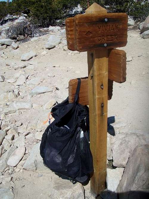
I hung by bag on the trail junction, grabbed my 1 liter summit bottle, and figured I would at least tag Gorgonio and see how I felt.
Gorgo to Jepson.... Jepson?
Sans pack, I felt way, WAY better.
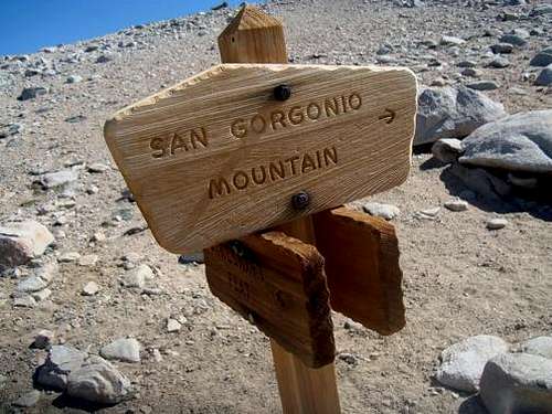
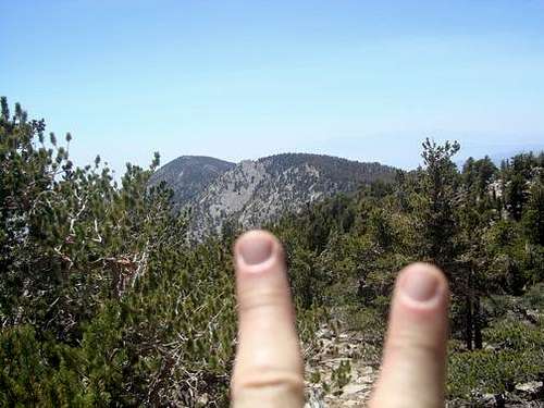
I caught up to a larger group in front of me and summited at nearly the same time. It was now 9:47am, roughly 4.5 hours from when I started back at Momyer. I opened the summit register and found a slew of papers. No real "register" in there, so I just grabbed a piece of paper, wrote "#1 of 9," the time, and exhaled. I stood up and left, after being on the top maybe 2 minutes.
Just before 10am I was back at my backpack, checking the map targeting Jepson. It was at this point I realized some of the peaks weren't going to be as obvious I'd thought. There are quite a few subpeaks with cairns at the top, which can be a bit misleading, especially when you're trying to decide which is the "real" peak. Originally I had decided to primarily just use my map and leave the GPS in the back to record my track, but I quickly learned it was far faster to have the GPS, on which I had preloaded the summits of each of the 9 peaks, and pinpoint which "peak" was the true apex. I also figured this would save some guess work and, mostly, TIME, which I needed to gain as much as possible because of the late start.
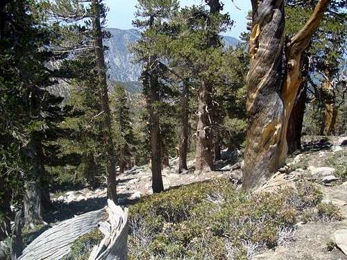
![User Profile Image]() Looking towars Jepson
Looking towars Jepson
So I find Jepson on the GPS and head up to the top..... no summit register? Hmm.... there are some people on the adjacent peak next to me, maybe I'll go check that out. Sure enough, I had labeled the incorrect peak into my GPS, and the summit register was on the adjacent peak. Lucky for me, the 3 people I met on Jepson had done the 9 peaks before, and they congratulated me on the attempt. They also gave me some beta on how to head off Jepson by going over "Little" or "Baby Jepson" (another subpeak) and how to head off of Charlton. (Out of view at this point).
I thanked them for the encouragement and the info, and I was on my way.....
Jepson to the Charltons...
![User Profile Image]() Looking down of near Jepson's Peak
Looking down of near Jepson's PeakFrom the summit of Jepson you follow the ridge over Baby Jepson and then contour down the ridgeline towards the trail. It was now 10:45am. The backside you descend on gets somewhat steep and is uber sandy. I wasn't wearing any gators, so after getting to the trail I had to pull my shoes off to get all the gravel out. Once back onto the trail, it's pretty easy going, and you wrap around corner and get a better look at the Charltons.
![User Profile Image]() Looking towards the Charltons
Looking towards the Charltons
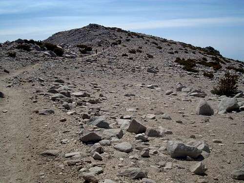
Man... here I thought things were going to be downhill from here. You get to a little saddle, then the leave the trail and head up the ridge leading to Little Charlton.
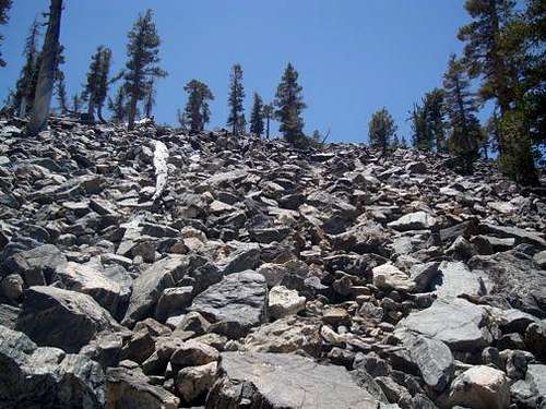
![User Profile Image]() Notice the rocks behind the trees...UP UP UP
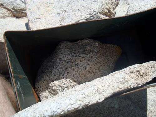
Notice the rocks behind the trees...UP UP UPBy 11:15 I was up on the top, despite my lackluster uphill pace, which basically consisted of shuffling my feet and lots of rest steps. At first I couldn't find the register on Little Charlton, but then I found the summit box. There was no paper or pen inside, just a big honkin' rock.
![User Profile Image]() Little Charlton Summit Register
Little Charlton Summit RegisterWhat's up with people not treating these summit boxes with some respect? This one has the top totally ripped off?
I then cruised over to Charlton Peak, where there was a register. It was at this point I discovered just a week before me, there was someone else who attempted the 9 peaks in the same order I was going. Aside from that, the last summit entry was the 26th of February 2012. It was now 11:39am.
Now the people I met on Jepson told me that going straight over Charlton would have me sliding on my backside, so I decided to contour left down to the trail from the summit. These seemed to work out well, and you basically we've in and out trees.
![User Profile Image]() Coming off Charlton
Coming off Charlton
By noon I was back at the trail and on my way to Dollar Lake Saddle.
Charlton to Alto Diablo
On my way to Dollar Lake Saddle I was thanking the heavens I had not chosen to try the 9 peaks in the opposite direction. I could just see myself trying to slog my way to the top of Charlton after ascending from Dollar Lake Saddle. FUH-GET-UGH-BOUT-IT. That would be 800 feet of solid elevation gain up that hillside, with Jepson and Gorgonio still left to go....
Anyhow, at Dollar Lake Saddle there was a little quarum, and two people happened to be rangers. One asked to see my permit, and he checked it out and said all looked good. When I described what I did (leaving from Momyer and riding my bike to the Vivian Trailhead) it didn't seem like he understood. In any case, I showed him how the permit said "Exit Trail - Momyer" and he said that was fine. I was relieved and was on my way. Just before I left, there was a tall, thin guy I noticed before heading over Alto Diablo. I'm not positive, but I think he was another hiker doing the 9 Peaks in the opposite direction. (I would find his name in the Alto Diablo summit register).
Here I thought the 9 peaks was somewhat of a rarity, and lo-and-behold someone else was doing it the same day as I was, and someone had done it the week before!
After Dollar Lake Saddle, the going gets much easier. The trail, although going uphill, doesn't nearly have the steepness of Vivian. You pass through Red Rock Flat and a trail heading off ot High Meadow Spring, and then come across a couple of false summits, until you find Alto Diablo Peak, almost right on the trail.
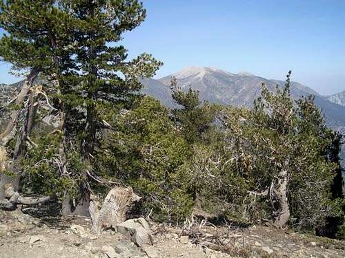
![User Profile Image]() Gorgo from Alto Diablo
Gorgo from Alto DiabloI looked at my watch: 12:55pm. This was now my 5th summit, and I had broken the halfway point. I figured if I could average at least 1 more summit per hour, I would be done with San Bernardino Peak at 5:00pm, putting me back at Momyer at 7:30pm. Hopefully I could be a little faster than that....
Alto Diablo to Shields
Thinking of getting back to the car in the dark, I headed off through Shields Flat and made my way over to Shields Peak. Forget trying to find a use trail to the top of that slog heap.
![User Profile Image]() CRAP! Shield Peak
CRAP! Shield PeakThere's just a pile of broken, crumbly, and loose pile of rubble you have to ascend from the trail. This part was pretty draining, and I was hoping this would be the "worst" of the remaining summits. (It was, by the way). After snapping a couple of pictures, I noticed I had made the summit in just over 30 minutes from Alto Diablo. It was now 1:30pm.
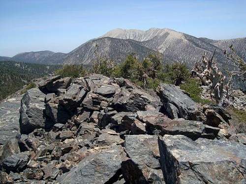
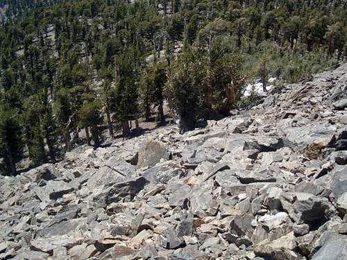
![User Profile Image]() Gorgo from Shields
Gorgo from Shields![User Profile Image]() Looking down what you came up...PHEW!
Looking down what you came up...PHEW!Shields to Anderson
After following the rocky summit ridge of Shields back down the trail, I set my sights on Anderson Peak. Anderson lies a little further off the trail than Alto Diablo and Shields, and you just leave the trail when you can start to make out the peak. It's pretty straight forward, and you get a good view back to Gorgonio and also a peak at your final two summits far off in the distance.... Hmmm.... 1:57pm. 3 peaks in the last hour! NICE.
![User Profile Image]() DOS MAS...
DOS MAS...
7 down and two to go...
Anderson to the San Berdoos
It was on top of Anderson I finally realized that I was going to complete the day. Even though I still had a ways to go, the whole day I was thinking I would probably get over to San Bernardino East and have to bail early because of time or darkness or who-knows-what. But now, standing atop of the 7th summit of the day at 2:00pm, I was confident I could pull off the last two summits.
The great thing about Anderson is its summit stands at 10,840 feet, so the trail after coming off the summit is pretty much flat until you get to the junction that heads down the Momyer. Originally I had planned to do San Bernardino East last, even though it was the next summit en route. I decided against it, though, and figured I would do all the summits in order.
It was at this point I finished my second 70+oz water bladder, so I sat down and refilled with my final 70oz into my hydration sleeve. I also had about 1/2 a liter left in my 1 liter bladder, so I decided to top it off, grab some gu and a bar, and leave my pack aside the trail. I figured with the weight off my back, I'd be able to to knock out the last two summits more quickly. Of course I had all these crazy thoughts about returning to find a bear eating my pack or squirrels ripping apart my hydration sleeve, but I looked around and didn't hear a soul, so I just hung the pack on a tree and was gone. It was now 2:30pm at the top of the Momyer Trail
Six minutes later and I was standing on top of San Bernardino East.
I sat down like I did on every summit to take a breather and sign the summit register. As soon as I closed the lid, an ENORMOUS swarm of bees came out of nowhere. I was off that summit so flippin' fast I couldn't believe it! No joke, probably over a thousand bees just came out of nowhere while I was sitting up there. WOWZA.
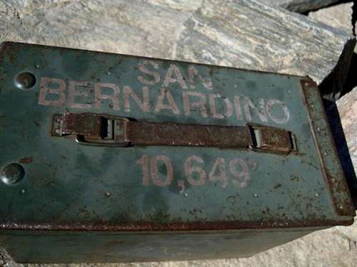
With the bees to my backside, I hightailed it over to San Bernardino Peak. The trail between the two peaks gets a little thin, but it was fun to follow the ridgeline and not have a pack on. I even ran a little bit of the trail, which I thought must be adrenaline or something. You do drop down a bit after San Berdoo East, but the trail isn't steep by any means to get over to the other peak. Finally, I saw it: My final little green box with the words "San Bernardino - 10,649" on it.
I checked my GPS and it read 19.42 miles since I started.
It had taken me 30 minutes from San Berdoo East to get over to the summit. I was swearing loudly to myself when I heard some voices, the first I had heard since Dollar Lake Saddle. Two hikers were coming up from Angeles Oaks. I asked them if they heard me cursing to myself, and they said they only thing they could hear was their hearts pounding.
I told them I knew the feeling. One of them looked at me with my water bottle and asked if that's all I was carrying and how the hell did I get up there. I told him this was my final peak of the day and that I had started at 5am. He was like, "MAN, here I was thinking I was doing a pretty good job just doing ONE." We both kind of laughed, and I explained how I had left my pack back at the trail junction. Then they said, "Well, how much further do you have to go? What time are you going to finish?"
That got me thinking.... It was now around 3pm...At least 30 minutes to get back to my backpack, plus 6.5 or so miles back down Momyer...That will probably take about 2 or so hours, so probably between 5:30 and 6:00pm.
Time to get moving.
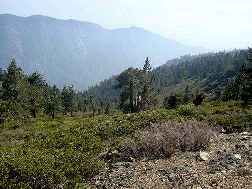
![User Profile Image]() Gorgonio a ways off from San Bernardino Peak - 9 Peaks Completed!
Gorgonio a ways off from San Bernardino Peak - 9 Peaks Completed!Descending the MO-my-er
Including summiting San Berdoo East, San Bernardino Peak, and BS'ing, I still made it back to my backpack in an hour. It was now just past 3:30pm, and I was glad I still had the GPS track to guide me down the Momyer Trail, which I had scouted just 3 weeks before.
The top part of the trail has a slew of downed trees, which make for sticking on the trail a little tricky.
![User Profile Image]() A "Happy" Tree... ?
A "Happy" Tree... ? Instead of taking the long switchback, I found a broken rock tongue extending down and decided to take that instead. For this trip, knowing about the thicket fields on my last foray up and down the Momyer Trail, I brought my REI convertible pants and zipped up the lower portions to cover my calfs through the hoards of buckthorn that awaited.
The only notable changes I observed on descending were an abundance of wildflowers blooming, especially around the burn area. Quite the contrast with the blackened trunks scattered about.
Past the Alger Creek sign, and then you can start to hear it again... Mill Creek. It seems like you stay well above the creek for next to forever, but then you're on those south-facing slopes again, crossing the boulder field, and walking along the river. As anxious as I was to get to the car and head home, I made time to take off my shoes and wash off the STENCH that I could smell eminating from clothes. (You know you smell back when you can smell yourself.... and Patagonia Capilene may breathe well, but MAN does it reek!) Anyhow, it was 6:00pm and the creek was all but deserted and I had my choice of spots.
![User Profile Image]() Mill Creek
Mill CreekFound a nice little pool just deep enough and sat down and leaned back. WHOOOOOOOOOOOOOSHHHHHHHHH.......
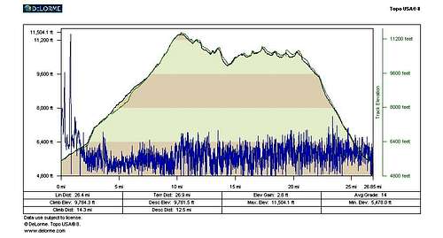
Finally got back to the car and flipped out the GPS.
End Time: 6:13pm
Odometer: 26.44 miles
Trip Time: 13 hours 13 minutes
I pulled out my cellphone to call wifey and tell her I was alright. DEAD. Peerrrrrrrfect. Had to find a payphone in Redlands. (Can you believe they still have those things! Who knew?)
Reflections
For me, that was a new record for total miles done in a day. Honestly, I was really surprised I completed the whole thing. For a better part of the day I was guessing I wouldn't be able to complete it. Even before I hit Gorgonio I felt completely useless and SLOW.
I remember reading in the Inland Empire hiking book anyone will a reasonable amount of fitness should be able to do the 9 Peaks Challenge. I thought about that for awhile and wondered just how "in shape" or "out of shape" I was ....because I thought it was pretty damn challenging, although I felt far, far better descending.
One thing that was unique about this hike for me was it was the FIRST time I have ever used both all of my water AND all of my food. I had drank a liter of water on the way to the trailhead, plus roughly 8 liters over the course of the day, for a total of 9 liters of water.
As for food, I finished my last bar right after the Alger Creek junction.
I couldn't believe that over 10 years had gone by since my first trip up the flanks of Gorgonio. I was glad to have this "Life List" hike with a check mark next to it. If I had to sum up my experience, it would be this:
"The Nine Peaks... Once is good enough."
Gusto
GPS Data


Comments
Post a Comment