
|
|
Area/Range |
|---|---|
|
|
46.17730°N / 115.2047°W |
|
|
Hiking, Trad Climbing, Sport Climbing, Bouldering, Aid Climbing, Big Wall, Mixed, Scrambling |
|
|
Summer, Fall |
|
|
8021 ft / 2445 m |
|
|
Overview
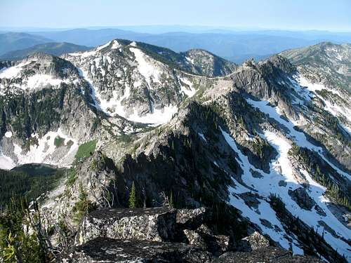
Looking southwest from Fenn Mountain.
Introduction

Looking NW from Fenn

South Three Links Basin

Head of Old Man Basin

Fenn Mt. Crags

Looking north from Cove

View from Coolwater

Canteen/Three Links Divide

Florence Lake Island

Canteen Basin

Western Lochsa/Selway Divide

Fenn Mt and Pk 7,558

Fenn Mt from the East

South Three Link Falls

Unnamed Peak 7,515
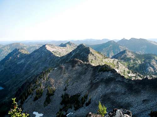
The Selway Crags are a small local group of high, rugged mountains straddling the divide between the Lochsa River on the north and the Selway River on the south in the Clearwater River basins about 35 miles east of Kooskia in north central Idaho. Proper reference the Selway Crags (or simply The Crags), would include a small area of the highest and most rugged peaks that cover approximately 40 to 45 square miles mostly situated in the adjacent headwaters of the Old Man Creek, Gedney Creek and Three Links Creek basins. However, there are connected ridges and mountains of note in the general vicinity and often there are no logical or good geographic breaks to form boundaries with these connected areas. For this page the Selway Crags area have logically been expanded to be better treated as a geographic unit with identifiable boundaries and to include areas of interest that users would include as destinations or as necessary means to pass through to reach the high central Crags. While the name Selway Crags is used here, the area covered in this report could accurately be thought of as part of the western Selway Bitterroot Mountains or simply the Selway Crags Vicinity.
The area included in this report is bounded on the north be the Lochsa River and on the south by the Selway River. The southeast portion is easily separated from the mountains to the east by the broad, low elevation North Fork of Moose Creek and lower Moose Creek drainages. In fact the actual mountains included are well to the west of this boundary and the higher mountains continuous with the Crags do not extend any further east than Big Rock Mountain approximately five miles east of the primary peaks. The division is more difficult and artificial to the northeast. The higher country in the western portions of Rhoda Creek and Wounded Doe Creek (tributaries to the upper North Fork of Moose Creek) are included. Also included are the high points and subalpine lakes around the perimeter of the Boulder Creek drainage, some of which may radiate out one or two miles from the actual divide. Except for these high points on or connected to the divide of Boulder Creek, the drainages such as Lake Creek, Fish Creek and Stanley Creek that flow north to the Lochsa River are not included. This boundary includes all the high country continuous or closely connected to the central Selway Crags.
Most of this area is included in the extensive Selway Bitterroot Wilderness. Coolwater Ridge and all but the headwaters of Gedney Creek are excluded from the wilderness. Though the area is relatively small, access to much of it difficult being limited to trailheads mostly in the bottom of the Lochsa or Selway canyons. A road does run the length of Coolwater Ridge and another connects the bottom of the Selway to Big Fog Saddle, which is half a mile from the wilderness boundary. Both of these roads have very difficult sections that should not be driven by vehicles without high clearance. In the core areas, there are very few trails and cross country travel is often necessary. For more information on accessing these mountains, see the Access section.
The area is used heavily for recreation and hunting that utilizes the steep mountain slopes, jagged ridges, 74 subalpine lakes or ponds and hundreds of miles of remote inaccessible stream bottoms. Biological diversity is very high due to abrupt elevation gains that range from low elevation disjunct coastal rainforest communities to the subalpine. In the high country, rugged rock and late to perennial snow precludes significant forest, but stunted groves of subalpine fir and whitebark pine occur. Below this extensive lodgepole pine forest originated from past large fire activities dominate. These give way below to the mixed fir forests and finally the large moist western red cedar forests. These lowest forests provide ample shade over lush fern communities dominated by sword fern, maidenhair fern, lady fern, and many others. Many lower and mid elevations are dominated by extensive brush fields, also the result of past forest fires on the warm dry south aspects.
Peak List
This list is limited to named mountains over 6,800 feet or any point over 7,000 feet with greater than 300 feet of prominence. Points that are part of the high central Crag core area are noted with an *. This distinction is somewhat arbitrary in some cases.
 Fenn Mountain Fenn Mountain Peak 7,835 Peak 7,835 Peak 7,671 Peak 7,671 Peak 7,623 Peak 7,623 Peak 7,515 Peak 7,515 Stanley Butte Stanley Butte Unnamed 7,140 Unnamed 7,140 Louse Point Louse Point Ghost Mountain Ghost Mountain |
|
Elevation | Prominence | Lat./long. | |
| *Fenn Mountain | 8,021 | 1,962 | 46.1773N 115.2047W | ||
| *East Peak | 7,852 | 992 | 46.2155N 115.1656W | ||
| *East Peak (north point) | 7,847 | 301 | 46.2227N 115.1632W | ||
| *Unnamed Peak 7,835 | 7,835 | 695 | 46.1799N 115.2259W | ||
| *Unnamed Peak 7,688 | 7,688 | 428 | 46.2057N 115.1940W | ||
| *Chimney Peak | 7,681 | 680 | 46.1914N 115.2595W | ||
| *Unnamed Peak 7,671 | 7,671 | 811 | 46.2089N 115.1792W | ||
| *Unnamed Peak 7,623 | 7,623 | 403 | 46.1584N 115.2176W | ||
| *Unnamed Peak 7,558 | 7,558 | 300 | 46.1789N 115.1913W | ||
| Unnamed Peak 7,530 | 7,530 | 990 | 46.2897N 115.1275W | ||
| *Unnamed Peak 7,515 | 7,515 | 514 | 46.1575N 115.1950W | ||
| Eagle Mountain | 7,427 | 687 | 46.3356N 115.1177W | ||
| *Gedney Mountain | 7,380 | 800 | 46.1502N 115.2593W | ||
| Stanley Butte | 7,362 | 742 | 46.2479N 115.2104W | ||
| Sponge Mountain | 7,349 | 209 | 46.3433N 115.1178W | ||
| End Butte | 7,303 | 203 | 46.3086N 115.1125W | ||
| *Unnamed Peak 7,264 (E. ridge East Pk) | 7,264 | 324 | 46.2133N 115.1410W | ||
| Unnamed Peak 7,181 | 7,181 | 428 | 46.2977N 115.1531W | ||
| Unnamed Peak 7,161 | 7,161 | 421 | 46.3138N 115.0947W | ||
| Unnamed Peak 7,140 | 7,140 | 480 | 46.1779N 115.1556W | ||
| Big Fog Mountain | 7,122 | 327 | 46.1289N 115.1805W | ||
| *Lizard Peak | 7,104 | 364 | 46.2288N 115.1405W | ||
| Big Rock Mountain | 7,096 | 1,296 | 46.2067N 115.0402W | ||
| Unnamed Peak 7,081 | 7,081 | 341 | 46.3285N 115.0980W | ||
| Unnamed Peak 7,084 | 7,084 | 344 | 46.2498N 115.2308W | ||
| North Peak | 7,025 | 365 | 46.2155N 115.0410W | ||
| Louse Point | 7,020 | 440 | 46.1783N 115.3094W | ||
| Rhoda Point Ridge | 7,012 | 432 | 46.2823N 115.0871W | ||
| Blacktail Butte | 7,003 | 463 | 46.2084N 115.0908W | ||
| Unnamed Peak 7,003 (Round Lake) | 7,003 | 383 | 46.3397N 115.1448W | ||
| Coolwater Ridge | 6,929 | 1,129 | 46.1545N 115.4570W | ||
| Lottie Peak | 6,906 | 366 | 46.2712N 115.2537W | ||
| Long Lake Point | 6,888 | 369 | 46.3458N 115.1618W | ||
| Ghost Mountain | 6,861 | 241 | 46.1576N 115.3473W | ||
| Flea Ridge Point | 6,850 | 270 | 46.2074N 115.3074W | ||
| Greenside Butte | 6,840 | 460 | 46.2997N 115.2195W | ||
| Frisko Peak | 6,820 | 80 | 46.2084N 115.10785W | ||
| Round Top Mountain | 6,807 | 307 | 46.1289N 115.3819W |
 East Peak
 Chimney Peak
 Peak 7,688
 Peak 7,558
 Gedney Mountain
 Big Fog Mountain
 Coolwater Ridge
 Round Top Mountain
Other Significant Crags
 Unnamed Crag 7,740 above Rainbow Lake
This rugged area has many noteworthy crags that are not on the peak list because they do not have enough prominence. Unfortunately these include some of the more spectacular points in the Selway Crags and are deserving of mention. The following table lists some of these. All are limited to the higher, more rugged core area of the Crags.
 Crag 7,780 (North 3-Links Crag 7,780 (North 3-Links Crag 7,740 (Rainbow Lake) Crag 7,740 (Rainbow Lake) Crag 7,580 (South 3-Links) Crag 7,580 (South 3-Links) Crag 7,382 (South 3-Links) Crag 7,382 (South 3-Links) |
 Peaks and crags north of Fenn Peaks and crags north of Fenn
|
Elevation | Prominence | Lat./long. | |
| Crag (North Three Link lakes) | 7,780 | 280 | 46.1978N 115.1894W | ||
| Crag (Kettle Lake) | 7,740 | 200 | 46.1882N 115.2332W | ||
| Crag (West Ridge of Fenn) | 7,750 | 120 | 46.1710N 115.2174W | ||
| Crag (Rainbow Lake) | 7,740 | 160 | 46.1734N 115.2247W | ||
| Crag (Elizabeth Lake) | 7,636 | 276 | 46.2011N 115.2002W | ||
| Crag (middle South Three Links) | 7,580 | 240 | 46.1610N 115.2092W | ||
| Crag (lower South Three Links Lake) | 7,382 | 162 | 46.1918N 115.1648W | ||
| Crag (Elizabeth Lake) | 7,336 | 276 | 46.2090N 115.2059W |
 West ridge of Fenn Mt.
 Crag 7,740 (Kettle Lake)
 Crag 7,636 (Elizabeth Lake)
 Crag 7,550 (West Fenn Ridge)
 Crag 7,336 (Elizabeth Lake)
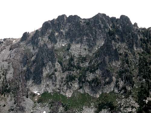 West Face of Unnamed Crag 7,740 (Kettle Lake)
Other Area Features
The Canyons and Rivers

The Selway Canyon

Selway Falls
The entire area drains into the Lochsa River to the north and the Selway River to the south. The east drainage is into the large Rhoda or Three Links basins, both of which flow south into the Selway. The south slope of the central Crags is drained mostly by the Gedney Creek basin. The primary basins draining the north into the Lochsa are Old Man Creek and Boulder Creek. All these basins (with the exception of the 319 road in part of the Gedney drainage) are roadless and very remote.
The Lochsa and Selway rivers are the two central tributaries of the large Clearwater Basin and merge at Lowell to form the Middle Fork Clearwater River, which is one of the largest rivers in Idaho. These cold crystal clear waters flow through lush evergreen forests of cedar and ferns and provide excellent recreational opportunities. The trout fishing is excellent, and both rivers are world famous for wild whitewater rapids. Most of the Selway is within the Selway Bitterroot Wilderness, while the Lochsa is accessed by Highway 12 for nearly its entire length. Black Canyon upstream from Lowell is a good waterfall area. Highway 12 can be hazardous due to the narrow windy conditions that are icy in the winter and choked with semis, RV’s, log trucks and bicycles in the summer. The Middle Fork Clearwater, Lochsa and Selway rivers are all designated Wild and Scenic Rivers.
Selway Falls just beyond the road 319 road turnoff is a worthwhile stop for anyone visiting the lower Selway Canyon. Its not so much of a real “fall” as it’s an incredibly large and steep rapid with huge waves, drops and rolls through building-sized boulders. A few people have floated the falls, but being as this rugged stretch of water is class V or VI, depending of flow levels, it’s not advisable.
Fenn Mountain Research Natural Area
The Fenn Mountain Research Natural Area
The Forest Service designates and manages RNAs that are permanently protected and maintained in natural conditions, for the purposes of conserving biological diversity, conducting non-manipulative research and monitoring, and fostering education. Included in this network are high quality examples of widespread ecosystems, unique ecosystems or ecological features and rare or sensitive species of plants and animals and their habitat. These RNAs help protect biological diversity at the genetic, species, ecosystem and landscape scales. RNAs in common landscapes are representative of ecosystems in natural condition and serve as baseline or reference areas to improve practices on similar managed areas.
Fenn Mountain proposed RNA occupies approximately 600 acres of a subalpine cirque basin and contains two lakes, Florence Lake and Hjort Lake. The RNA boundary is defined by the Fenn Mountain ridge to the east and an unnamed ridge to the west and south. Elevations in the area range from 6210 feet (1893 m) to 8021 feet (2445 m). Vegetation consists of small forest stands interspersed with shrub fields and herbaceous communities. Rock cliffs and talus slopes are common and predominate upper elevations. Forest habitat types in the RNA are in the subalpine fir (Abies lasiocarpa) series. Shrub communities are dominated by undergreen willow (Salix commutata) and Sitka alder (Alnus sinuata). A small area is dominated by glacous willow (Salix glauca). Sizable portions of rocky side slopes are dominated by alpine knotweed (Polygonum phytolaccefolium) with other moist site forbs such as mountain boykinia (Boykinia major) and arrowleaf groundsel (Senecio triangularis). Wetlands adjacent to the lakes contain sedges (Carex aquatilis, Carex illota and many others).
Hot Springs
There is one hot springs found within the Selway Crags area and three others close enough to interest area users. Stanley hot springs is situated in the lower Huckleberry Creek drainage just upstream from its confluence with Boulder Creek. This hot springs has numerous good dispersed campsites and three pools. People visiting these springs occasionally share them with moose. To reach these springs hike south from the Wilderness Gateway Campground on Trail 211. Near the mouth of Huckleberry Creek, turn right on the 221/222 trail and cross Boulder Creek. This crossing is potentially treacherous, especially at high water as Boulder Creek is a very large and rocky stream. There once was a bridge here, but it has never been rebuilt after washing out in the mid-1990s. Once Boulder Creek is crossed its just a few hundred yards on the trail to the pools. The total distance from the trailhead is approximately four miles.
Further up Highway 12 there are also undeveloped hot springs at Weir Creek and Jerry Johnson. Weir Creek hot springs are close to Highway 12 near mile marker 142. There is a well marked pull out to park at and a path leading north of the pavement for about a quarter mile to the hot water. Jerry Johnson hot springs is found about a mile up Trail 49. The trailhead is about one and a half miles east of Jerry Johnson Campground near mile marker 152. Jerry Johnson hot springs is a day use only. At both of these springs do not expect privacy. Clothing is optional.
The final hot springs in the area is at the Colgate Licks National Recreation Trail near mile marker 148. There is not a hot springs to soak in here but rather hot water seeping out of the ground. This very short loop trail takes a few minutes to walk around and is intended to provide a break for travelers on Highway 12. The large burned cedar snags, hot water and interpretive sign revealing the tragic history of poor George Colgate of the Carlin hunting party, provide distraction from the road. Mr. Colgate was the cook for a hunting party that got caught in the wilderness by winter in 1893. He had medical needs that he did not plan for and he was left to die by the others who were trying to save their own lives. Restrooms are available at this well marked pull out.
South Three Links Waterfalls
There are probably many waterfalls in the Selway Crags due to the glacial morphology. One of the more spectacular can be found dropping off the hanging valley containing the upper South Three Links Lake to the basin below that contains the middle South Three Links Lake. Here a continuous series of drops and slides fall for a total of approximately 400 feet. If passing through the area, one must go by these. Its certainly best to do so on the open slopes north of the falls. But it is possible to climb the rocks immediately adjacent the falls on the south side. But there will be some difficult rocks that one can get into trouble with if they don't know what they are doing.
 |
 |
 |
 |
 |
 |
 |
Access
 Trail to Legend Lake

Jesse Pass
There are relatively few access points into the Selway Crags. This is due to much of the area being designated wilderness and the geography of the large, generally access poor river canyons. The main trails through the Crags offer only a skeletal transportation network and many trails seen on older maps and quad maps no longer exist. To reach many of the primary peaks and lakes in the area one will have to do a fair amount of difficult cross country bushwhacking and route finding. It’s not an area for anyone who cannot read a good topographic map well. The best routes to reach the central Selway Crags would be the Big Fog Road or the Coolwater Road if the west edge is desired. Following are the primary access points to the area. For trails to specific locations within the area refer to the individual mountain pages, area maps or contact the Forest Services offices listed in the Additional Information section.
Coolwater Road (317)

Coolwater Ridge/rd 317
This road accesses the western portion of the Crags. From the small town of Lowell at the confluence of the Selway and Lochsa rivers, take the Selway road and look for Forest Service road 317, which turns up the hill to the left less than a mile from Highway 12. This road is narrow, but in good shape up to the Andy’s Hump vicinity where the subalpine country starts. From here the road is very rugged and should only be driven with high clearance, 4wd vehicles that you don’t mind banging up. From the trailhead on the east side of Coolwater Ridge its approximately 10 miles on the trail 31* to Chimney Peak, which represents the west edge of the higher, central Crags.
*Note: some sources refer to the main trail connecting Coolwater to Big Fog as Trail 3. In this report and on SP mountain pages in this vicinity, we (at least this author) refer to it as Trail 31.
Big Fog Road (319)

Fog Mt/rd 319
The trailhead most commonly used to access this area is at Big Fog Saddle. To reach this trailhead travel up the Selway River from Highway 12 at Lowell almost to Selway Falls. This is about 18 miles. The first several miles are paved, but most of the road is gravel. Some places are narrow and traffic can be heavy at times so watch the corners. Just before Selway Falls, take a left up the Fog Mountain road (Forest Service road 319). This road is well signed. From the Selway River the trailhead at road’s end is thirteen miles. The first half of this road is narrow, but in fair condition. The second half of the road gets progressively rough with large jutted rocks and seasonal streamlets breaking up the surface. A high clearance vehicle is advisable. The thirteen miles likely will take over an hour. This trailhead provides access to trail 31 to the Cove Lakes and trails 343/363 to the Three Links basin and the divide between that and the Gedney Creek basin.
Lochsa Trailheads

Junc. 31/206

Rough ground, few trails
There is one primary trailhead into the Crags from the north. This significant access point is found at the Wilderness Gateway Campground at the mouth of Boulder Creek and can be reached at approximately the 122 mile mark of Highway 12. The campground provides access to three trails that break up into an extensive network over the entire Boulder Creek basin and into more far flung points of the main Selway Bitterroot Wilderness beyond. The first few miles of access from Little Boulder are on very steep hillsides so use caution. It’s a long way to anything via these routes and consequently outfitters with horses and mules tend to use this trail system extensively. The many concentrated lakes of the Seven Lakes Basin are reached from this trailhead, but to reach the central Crags, an extended hike is required.
Other trailheads into the area from the Lochsa side are also used primarily by outfitters, especially during hunting season. The Lochsa trails are summarized in the following table.
|
Trailhead Location | Hwy 12 Marker | Area Accessed | |
| 341 | Kerr Creek | ~ mile 100 | Idaho Pt./Coolwater | |
| 337/332 | Apgar Campground | ~ mile 104 | Idaho Pt./Coolwater | |
| 334 | Near Coolwater Creek | ~ mile 110 | Sheep Hill/Coolwater | |
| 133 | Split Creek | ~ mile 112 | Flea Ridge/west Crags | |
| 220/211/198 | Wilderness Gateway CG | ~ mile 122 | Boulder Creek/7 Lakes | |
| 215 | Bald Mt. State Hwy shed | ~ mile 129 | upper Boulder Ck/Fish Ck |
Selway Trailheads

Big Fog Saddle
Almost all entries to the southern Crags are via the 319 road as described above. It is possible to use one of the low elevation trailheads along the Selway River to reach the 317 road out Coolwater Ridge and enter the Crags from the west. Unless one is really looking for an extended hike with significant vertical gain there is little reason to use any of these trails to access the upper elevations of these mountains. They are more appropriate for local use. Trail 708 does go directly to Gedney Mountain, but the upper parts of this trail can be very brushy and is not often maintained. Most of the trailheads are found at campgrounds along the Selway River road.
Trail 4 up the Selway River goes several miles and provides access to some spur trails that enter the mountains up the steep canyon breaklands or up the large Three Links Creek or Moose Creek basins. These routes into the mountains would require long term extended hikes, generally involving pack animals. They are not covered here.
|
Trailhead Location | Selway Rd Mile | Area Accessed |
7343C Camp~ mile 6Coolwater Ridge703Boyd Creek CG~ mile 10Round Top Mt/Coolwater704Glover CG~ mile 14Round Top Mt/Coolwater708Selway Falls CG~ mile 17Gedney Creek/Mountain
Geology
Crags north of Fenn Mountain
The mountains of the area are underlain by the Proterozoic and Paleozoic rocks of the North American plate. This was intruded approximately 120 million years ago when subduction of the dense oceanic Farallon Plate related to the accretion of the Wallowa/Seven Devils Mountains caused the formation of deep plutons. These basaltic magma chambers caused by the melting rock and superheating of water rose up through the lithosphere causing melting of the continental crust to form a melt of granitic composition. The plutons stopped a few kilometers below the surface and slowly cooled before crystallizing into the granites of the Idaho Batholith. The cooling at different rates resulted in different rock types and textures. The northern or Bitterroot lobe of the batholith at 85 to 65 million years old, is younger than most of the other portions of the batholith in Idaho. Isostatic rebound between 65 and 50 million years ago contributed to erosion of the overlying rock, which exposed the batholith.
South Three Links Cirques
Most of the resulting Selway Crags are Cretaceous orthogneiss, and foliated granodiorite and granite, Cretaceous tonalite and quartz diorite, and lesser Eocene granite, syenite, and rhyolite in the southeast part of the area. Metamorphic rocks of the Syringa metamorphic sequence and quartzite gneiss of the Wallace Formation are exposed in lesser amounts, primarily west and south of the higher central Crags.
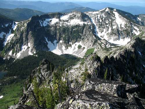
The finale chapter to the geologic story of the Selway Crags is the alpine glaciation of the Pleistocene. There have probably been several episodes where these glaciers expanded and contracted and while most of the glaciers were probably small, some may have been moderate in size. The north aspects contain typical glacially carved features such as hanging valleys that are dotted with numerous glacial lakes in cirques formed by the ice. Arêtes and horns are found along the main ridges of the Crags. As expected the results of this process are less developed on the south aspects.
History

Probable pre-historic sturcture

Coolwater Lookout - the last one

Fires are no longer suppressed
The Lochsa and Selway basins and associated mountains are on lands used historically by the Nez Perce Indians. While there probably was some utilization of the higher peaks, the use would not have been high because of the absence of camas meadows used for food and gathering and the lack of trails to Montana that cut through the mountains further south. Most use would have been in the lower warm canyons.
The first minors and prospectors came into north central Idaho in the 1860s and concentrated on areas to the south were gold was discovered. Undoubtedly some of these early inhabitants would have explored the Lochsa/Selway country, but without finding valuable ore, the area was not mined to any significant degree.
There were two primary factors bringing people into the canyons of the Clearwater Basin – fire suppression and timber. The impetuous for the first was the huge forest fires of 1910 and other early years. Gifford Pinchot played on the fears of the public with the need to put fires out at all costs to initiate the U.S. Forest Service. The need to put out all fires was never the case and some even realized it at the time. But there was a need to install a land management agency to protect and conserve timber lands on a National scale to prevent random and sometimes extensive exploitation of the land. With a mission of saving the world from fires, the creation of the Forest Service fulfilled this management need.
As a result the agency built miles of trails for transportation between the many lookouts, cabin, and ranger stations that once dotted the back country. There were nearly 1,000 fire lookouts atop Idaho peaks at one time, with most being in north and north central Idaho. Early in the 1900s lookouts could be found on 17 summits in this area. Many were on relatively low vantage points that offered good views of the large canyons. Some more notables in the higher mountains were on Gedney Mountain, Fog Mountain, End Butte, Lizard Ridge, Round Top, Sponge Mountain, Coolwater and Stanley Butte. Over the years the lookout has been replaced by air patrol and only the lookout at Coolwater is still manned. Most have been abandoned or removed for liability purposes, but some old remains can still be found on the summits. At least four burned in the huge Pete King Fire of 1934 that burned a quarter million acres. During the Depression the CCC was active in the area fighting fires, building roads (including the 317 and 319) and building Fenn Ranger Station among other things.
The closest Ranger Station to the Selway Crags was on the Lochsa River near the current day Wilderness Gateway Campground and trailhead. This historic station is still used seasonally for irregular uses and has been restored for interpretative purposes. Another old station was (is) at Fenn, in the lower Selway Canyon a few miles up from Lowell. Fenn Ranger Station is still functioning and provides administrative services for much of the area. For decades many people used these resources to quickly jump on and snuff out any fire as soon as it started. As the lookouts declined, and roads made the need for stationed firefighters obsolete, the trail network supporting this infrastructure has slowly faded from the landscape.
Due to past large fires and the remoteness and ruggedness of the country, the area of the Crags has avoided larger timber harvests. Several small towns downstream popped up or increased in size to process lumber floated down the Clearwater basin from other locations. Most of these human uses had little but peripheral effects on the Crags vicinity and in 1964 the Selway Crags and some of the adjacent areas were included within the western boundary of the Selway-Bitterroot Wilderness. Like most of mountainous north central Idaho, fewer people live in the woods today than in the past. But it could be said the third wave of people in the area has started. This would be the increased human presence due to emphasis on outdoor recreation including such activities as hiking, fishing, river running, hunting and others.
Lochsa Historic Ranger Station
Located on Highway 12, approximately one mile west of Wilderness Gateway Campground is the historic Lochsa Ranger Station. This ranger station was built in the 1920s and was typical of those that served as a base for fire fighting and administrative activities early in the 1900s. It has been restored to its historic operative condition for interpretative purposes. Present are historic log offices and living quarters that can be toured to provide a look into the life of those who lived at these remote outposts. When the station was built access was only by pack trail up the Lochsa River. Road access did not arrive until the 1950s. The station also offers a fish pond and restroom facilities. Seasonal public hosts are available to provide information. Small cabins and livestock facilities are present and used by Forest Service personnel working in the area so this still is a working Forest Service station.
Climate
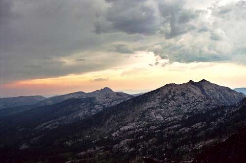
Thunderstorm bearing down on the Crags
The climate of the region exhibits a strong Pacific maritime influence and represents the warm and moist extreme of forest environments in the Northern Rocky Mountains. Temperatures at the middle and lower slopes can exceed 100°F in July and August, yet protected slopes maintain sufficient moisture to support wet-site vegetation. Average summer temperatures are in the mid-60°s and in winter average around 20°F. Due to the abrupt elevation changes, temperatures can vary wildly from the lower to upper elevations.
The area receives about 40 inches of precipitation annually, occurring primarily in the form of rain and snow in the spring and winter. July and August are very dry with usually less than one inch of precipitation each month as a consequence of West Coast subtropical high pressure system shifting northward in late June causing the prevailing westerlies to carry dry subsiding air across northern Idaho. Most summer precipitation is associated with convectional storms that may occur frequently on warm afternoons. The lightning from such storms are the primary cause of wildfires that are so important to the ecology of the area.
 |
 |
 |
 |
 |
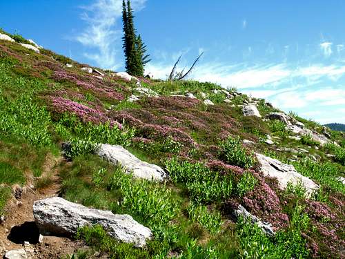
Flora
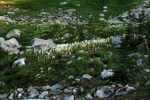 Beargrass at the foot of Fenn Mountain
Vegetative Zones

Subalpine Meadow

Balds and Lodgepole

Dry Subalpine Forest

Subalpine Parkland

Mid-slope Shrub Disclimax

Mature High Forests

Subalpine Marsh

High Rock Garden

Rocky Riparian

Shrubby Riparian
The moist climate and relatively low elevations give this area a dense cover of coniferous forests. Also a contributing factor to the lush vegetation in the area is a thick ash layer deposited by the collapse of Mt. Mazama several thousand years ago. Volcanic ash has remarkable water holding capabilities, which make the soils of north Idaho very conducive to supporting very mesic forests. Without the catastrophic eruption of Mt. Mazama, this part of the inland northwest would be covered with drier pine forest rather than the moist fir and cedar that dominate the area today.
The moister zones are in the lower elevations, which are dominated by western redcedar. These trees grow to very large size and have at times been called the “redwoods of Idaho”. While they do not achieve near the height of the redwoods, they often are of similar diameter. The floor of these forests is fern dominated, mostly with sword fern, maidenhair fern and lady fern. However, 18 other fern species can be found here. It is in this zone where most of the coastal disjunct species occur. Occasionally these forests can be found at higher elevations on gentle slopes that retain more moisture through less draining.
Higher up on the slopes and on drier aspects the forest are more dominated by grand fir and Douglas fir. These forests are drier due to the draining of steeper slopes and occupy most of the area between the moist lowlands and the breaks into the mountain tops. Historically these forests burned much more frequently than today, which kept the forest more open. Areas the burned frequently or very hot are in a shrub disclimax stage of succession and will not support substantial tree cover. Due to the suppression of natural fire, the ageing fir forests have become dense. They are also rapidly dieing off because that’s what these species due in this area after approximately 100 years. As a result the fuel loads are rapidly building up and the forest in some areas have become little more than a snag patch over increasing brush. A fire will clean it up someday, but with all the fuel on the ground, it will be very hot and possibly damaging to the soils and watersheds. The local management on lands outside the wilderness attempts to implement controlled burns to ease the threat of a future catastrophic fire and restore the landscape to a more natural condition.
Above the fir the next general forest zone is dominated by fire-originated lodgepole pine then subalpine fir and whitebark pine over beargrass, huckleberry, menziesia and whortleberry. Insects are killing large areas of lodgepole pine and the red swaths can be seen on many mountain slopes. This is setting up for the next big burn that will reinitiate the next lodgepole forest. If the topography allows, these forests would cover the tops of the highest mountains, which they do in part, but due to rocky crags, thin soils, and south slopes, much of the upper elevations are dominated by outcrops and subalpine grasslands associated with the timberline zone. Much of these forests have been burned by wildfire in recent years, which the prevalent forest management has allowed in recent years. The more open subalpine habitats are important for wildlife and add much to the scenic splendor of the area, especially in the fall when the huckleberries and other foliage turn. The dominant vegetation here is beargrass, mountain heather, assorted sedges, grasses (mostly green fescue) and numerous subalpine forbs that can form spectacular rock gardens. The rocky slopes and outcrops support compact juniper and stunted or matted trees.
Unique elements

Pale Yellow Penstemon

Pink Coiled-beak Lousewort
There are dozens of coastal plant species with most being found in the lower elevations where moisture and temperatures are higher, but there are a few subalpine species typically found in the Cascade Mountains. There are also species that are endemic to the area and are found nowhere else on earth. The list of coastal/Cascade plants is far too long to present here, however some of the more noteworthy species being found in this part of Idaho are Henderson sedge, red alder, Tweedy’s ivesia, Redwoods violet, phantom orchid, California sedge, and luetkea. Some of these species are very rare in Idaho, while others can be locally common. Some of the species endemic to this area are bank monkeyflower, Constance’s bittercress, pale yellow penstemon, evergreen kittentails, dasynotus and pink coiled-beak lousewort. Clustered lady’s-slipper is a rare orchid that is found sparsely throughout much of the west including the Clearwater Mountains of Idaho.
 Tweedy's Ivesia
Fauna
Wildlife

Blue Grouse

Fake Bee Moth
The Selway Crags nearly has a full, historic compliment of wildlife species. Mountain goats, deer and elk are all present. The elk population in the Clearwater Mountains was very small historically, but as a result of huge forage producing fires in the early 1900s and modern game management, the population exploded. Now after a combination of factors including some severe winters, fire suppression, decline of forage producing logging, hunting pressure and the recent introduction of wolves, the elk population is in serious decline. Before the wolves returned, the cougar and black bear were the primary predators in these mountains. Coyotes are also abundant, but have been largely pushed out of some local areas by the highly territorial wolves.
Other rare species known to inhabit that area include the fisher, pine marten, wolverine and possibly the lynx. Bald eagles also turn up during the winter to feed on spawning fish in the lower river canyons. Young fledgling eagles have been seen during the summer indicating a resident population must be present, yet little is documented about this. There have been rare reports of grizzly bears in the mountains, but the official position of the Idaho State Fish and Game, US Forest Service and US Fish and Wildlife service, which manages rare species under the Endangered Species Act, is that there are no grizzly bears in north central Idaho. The reports are probably based on misidentifications of brown colored black bears, or occasional far wandering grizzly bears passing through the area. The grizzlies were here historically but were lost to extermination hunting and the decline of anadromous fish which were a staple of their diet.
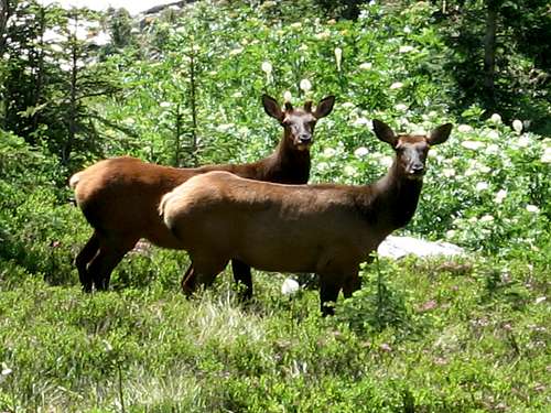 Elk on Fenn Mountain
Fish

Cutthroat Trout
Historically few of the lakes in this area had fish. Perhaps larger lakes with substantial inlet streams were exceptions. Native fish populations in the rivers and larger streams surrounding and draining the Selway Crags included cutthroat trout, bull trout and rainbow trout. Historically anadromous species such as Chinook salmon and steelhead spawned in these streams in large seasonal runs. Today these runs are small, but have slowly been increasing with modern management. In the 1960s the Idaho Department of Fish and Game began stocking area lakes with rainbow, west slope cutthroat, rainbow-cutthroat hybrids and brook trout. Emphasis has moved away from brook trout, which can move into the streams where they displace the native species, especially the Threatened bull trout. The native stream fisheries are under much more restrictive regulations than in the past, which has resulted in increased stocks of these fish.
Lakes
 The Upper Unnamed Lake, South Three Links Lakes
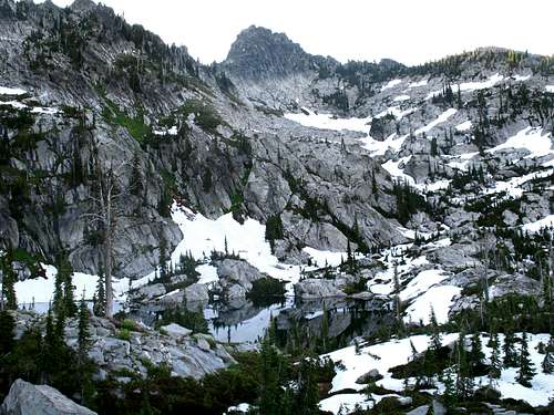
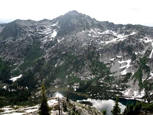
There are approximately 74 lakes and larger ponds within the Selway Crags vicinity. Many of these provide excellent back country camping and fishing for rainbow trout, cutthroat trout, and brook trout. In most cases no fish are native in these lakes, however and are dependant on periodic stockings. The mosquitoes in these areas can be horrendous most of the year outside of the long winter months. In the fall, fishing and scenery often improve, and people (except for hunting season) and mosquito clouds decline. Below is a list of the lakes and larger ponds within the area covered by this page. Some of the bodies, especially ponds may partially dry up, becoming marshes with pools by summer’s end. Many still may be a nice place to visit and contain fish.
Noteworthy lake basins include the Seven Lakes vicinity that includes 11 lakes, the four Lizard Lakes, the three North Three Links Lakes, the three lakes and six ponds of the South Three Links basin and the multiple large lakes in the headwaters of Old Man and Florence basins. Elevations in the table are approximate.
Big Fog Lake6,340Chimney Lake6,115Coolwater Lake6,017Cove Lake (lower)6,300Cove Lake (upper)6,300Crystal Lake6,180Dishpan Lake6,140Eagle Mountain Lake6,643East Peak Lake6,340Elizabeth Lake5,868Fire Lake6,200Flea Lake6,054Florence Lake6,288Hjort Lake6,260Kettle Lake7,140Legend Lake6,780Lizard Lake #3 (lower)6,220Lizard Lake #4 (upper)6,387Lizard Lake #2 (west)6,763Lizard Lake #1 (east)6,500Lloyds Lake6,206Lone Lake, North6,380Lone Lake, South6,500Long Lake5,858Lottie Lake (lower)6,140Lottie Lake (upper)6,193Maude Lake6,078Mud Lake6,379Old Man Lake5,940North Three Links Lake (north)6,840North Three Links Lake (lower)6,780North Three Link Lake (upper)6,940Parsons Lake5,780Pollywog Lake6,571Rainbow Lake7,040Rock Lake5,897Round Lake6,185Shasta Lake6,430South Three Link, lower6,180South Three Link, middle6,300South Three Link, upper6,740Sponge Lake6,025Two Lakes (lower)6,091Two Lakes (upper)6,509Wood Lake6,328Unnamed (Big Fog, east)6,140Unnamed (Big Fog, north)6,100Unnamed (Big Fog, northeast)5,780Unnamed (Big Fog, southwest)6,100Unnamed (Gedney Mt.)6,615Unnamed (Legend Lake, north)6,400Unnamed (Lizard Pk)6,020Unnamed (Lone Lake, south)6,420Unnamed (Maude Lake, east)6,359Unnamed (Maude Lake, northeast)6,180Unnamed (Old Man, upper)5,980Unnamed (Pk 7,671)6,820Unnamed (Pk 7,623)7,300Unnamed (Pk 7,530)6,740Unnamed (Pt. 7,336)6,460Unnamed (Rhoda Ck headwaters)6,420Unnamed (South Three Link, lower)(4)6,160Unnamed (South Three Link, middle)6,260Unnamed (South Three Link, upper)6,720Unnamed (Stanley Butte, southwest)6,500Unnamed (Surprise Creek, lower)6,420Unnamed (Surprise Creek, middle)6,420Unnamed (Surprise Creek, north)6,165Unnamed (Surprise Creek, upper)6,484Unnamed (Wounded Doe Ck source)6,435
 Big Fog Big Fog Coolwater Coolwater East Pk East Pk Dishpan Dishpan Florence Florence Lizard 1 Lizard 1 Lizard 3 Lizard 3 Lizard 4 Lizard 4 Old Man Old Man Rainbow Rainbow S 3Links mid S 3Links mid |
|
||
| Andy’s Lakes (3) | 5,800 |
 S 3Links upper
 Chimney
 Chimney pond
 Elizabeth
 Fire
Fire Hjort
Hjort Legend
 Lloyds
 Lone
Lone N 3Links lower
 N 3Links north
 S 3Links lower
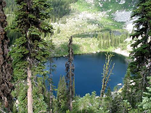 The Cove Lakes
Camping

Legend Lake is a popular camping spot

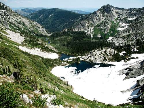
South Three Links Basin
Backpackers will find excellent camping at any of the many lakes in the Selway Crags vicinity. Some of these may be difficult to reach and the most accessible can get high use certain times of the year. Most lakes will offer isolation and are little used; however, you may run into company at Legend Lake, Cove Lakes, Old Man Lake and the Seven Lakes vicinity. Use of Legend Lake is generally limited to backpackers and day hikers, but the others are likely to be visited by stock users, especially during the fall. Many of the lakes do not have any trails to them so be sure to plan well before venturing cross country in this rugged country.
Several campgrounds are found along the Lochsa and Selway rivers. These are not approximate enough to the peaks to serve as a base for most of them, but could be useful upon arrival or departure from the area. Wilderness Gateway Campground, located approximately at mile 122 on Highway 12 is the major trailhead for the northern entrance from the Lochsa River. From it downstream to about mile 104, there are four smaller campgrounds, including Knife Edge, Major Fenn, Glade Creek and Apgar. Information for camping along Highway 12 as well as other interesting area features can be reviewed at the camping information page on the Clearwater National Forest web site.
On the Selway River road there are ten developed campgrounds in the approximately 18 miles between Lowell on Highway 12 and Selway Falls. These are 3C, O’Hara, Rackliff, Twenty Mile Bar, Slide Creek, Boyd Creek, Twenty Three Mile, Twenty Five Mile, Glover, Selway Falls and Race Creek. Information for these campgrounds and other points of interest can be found on the Selway Corridor page of the Nez Perce National Forest web site.
There are also a few good undeveloped dispersed camping spots along both the 317 and 319 roads.
Red Tape
None, other than standard wilderness regulations for those areas within the Selway Bitterroot Wilderness.
Additional Information and Current Conditions
Go to the mountain prepared for variable conditions. With over a mile of vertical lift from the canyons of the Lochsa and Selway basins to the top of the Crags, mountain temperatures and weather conditions can vary dramatically. Many years the trails and slopes are open from snow by mid-July, but in heavy snow years some high ground may not lose snow until fall or not at all.
Contact the Moose Creek Ranger District of the Nez Perce National Forest for information and current conditions.
Moose Creek Ranger District/Fenn Ranger Station
831 Selway Road
Kooskia, ID 83539
(208) 926-4258
Office hours
Mon-Fri, 7:30 - 4:00
The north side of the Lochsa/Selway divide is on the Clearwater National Forest, Lochsa Ranger District.
Lochsa Ranger District/Kooskia Ranger Station
Route 1 Box 398
Kooskia, ID 83539
(208) 926-4274
NOAA Forecast
 The South Three Links Basin