
|
|
Mountain/Rock |
|---|---|
|
|
40.68080°N / 105.934°W |
|
|
Larimer |
|
|
Hiking, Mountaineering |
|
|
Spring, Summer, Fall |
|
|
11820 ft / 3603 m |
|
|
Overview
Sheep Mountain is a summit in the Medicine Bow Mountains of Northern Colorado in the Rawah Wilderness Area. Sheep Mountain has 600ft of prominence and isolation of 1.5 miles from it's highest neighbor South Rawah Peak. Sheep Mountain is situated a little east of the main spine of mountains and as a result, it has awesome views of the higher Rawah Peaks.
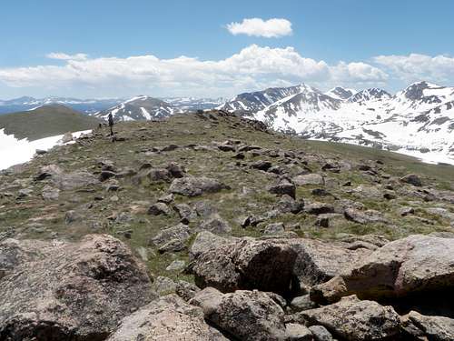
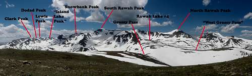 Rawah Panorma from the summit of Sheep Mountain
Surrounded by grassy, alpine tundra, I think Sheep Mountain is one of the coolest peaks in the Rawah. In the spring, snow disappears off Sheep Mountain first, so vegetation that melting snow yields draws an array of wildlife such as Rocky Mountain Bighorn Sheep and Rocky Mountain Elk. Like all summits in the Rawah, Sheep Mountain will provide one with solitude and amazing views.
Route Info

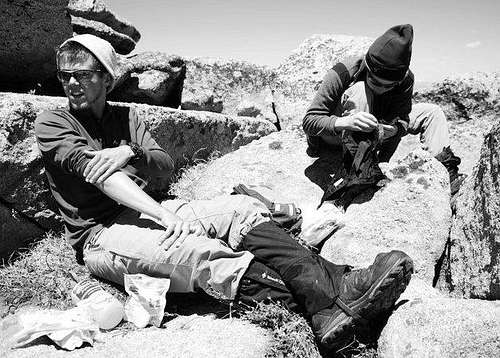
Bighorn Sheep-the namesake
Sheep Mountain is best accessed from Grassy Pass (40.67198°N/-105.94189°W), which is a main corridor for extended hikers in the Rawah. Most people hiking this peak will hike it from here and be passing through and drop their packs for a quick jaunt up to the summit. Grassy Pass lies above the Rawah Lakes and just below Rawah Lake #4. There are two "passes"; an east and a west one. The west pass is slightly higher and has a little lake (a good water source). The east one is the pass that directly connect to Sheep Mountain. From the east pass, head NE up a somewhat steep (~30 degree). You will probably be following game trails. Veering more north, you will eventually work your way up to a rock summit ridge. To the east is a east cirque that drops down to Camp Lake. To the SE is a sub peak of Sheep Mountain that does not quite meet the requirements for a true summit. From the pass to the summit it is 600ft of elevation gain and is about 1 mile of hiking.
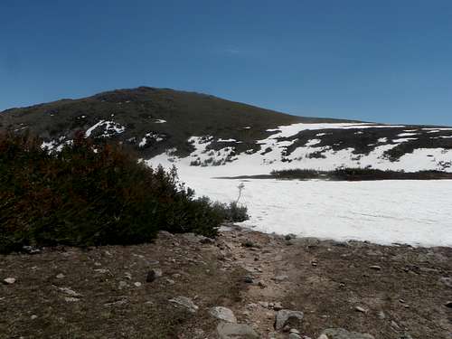 Sheep Mountain from "west Grassy Pass" |
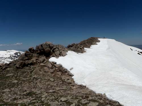 Summit ridge |
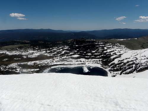 Camp Lake from the summit |
 Down the summit Ridge |
Red Tape
The only Red Tape in the Rawah's is the snow. The Medicine Bow Mountains are a notoriously snowy range. Roads to the the trail heads open late May to early June (with the exception of the Blue Lake Trailhead which can be open year round because it is along HWY 14). For current conditions, HERE. If the roads are still open, access higher wont normally be snow free until mid-June. Bugs are bad in June as well. Groups are limited to 12 people.
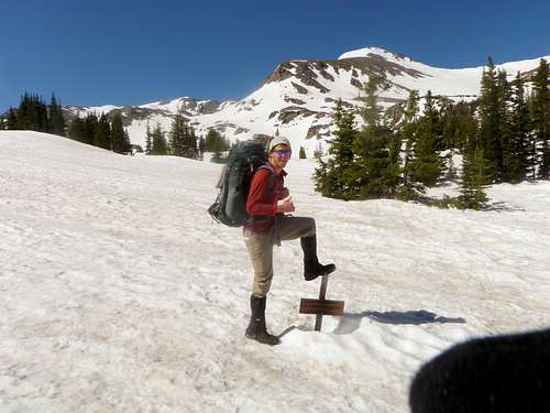 Grassy Pass sign in June 2011 |
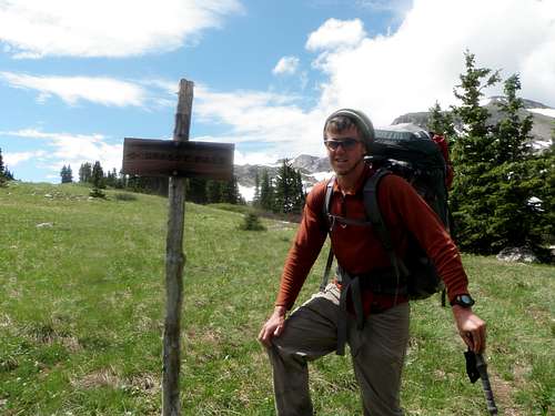 Grassy Pass sign in July 2011 |
Camping
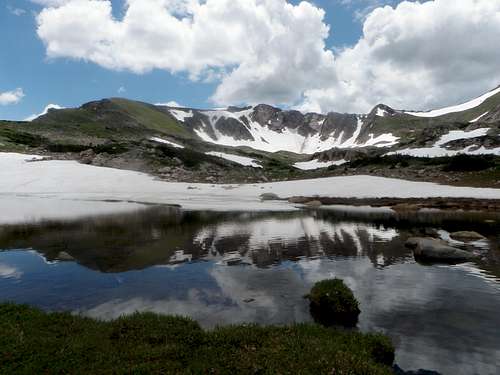
Grassy Pass Lake- one could camp here
Camping can be found all over the Rawah Wilderness and around Sheep Mountain. Steller camping can be found at any of the Rawah Lakes (Rawah Lakes 2 and 4 are my favorites. Camp Lakes and Sandbar are also awesome places to camp, but they dont provide one with the easiest access to Sheep Mountain. You can pretty much camp anywhere in the area. Here are some camping rules and regulations:
-Camping and fire building are prohibited within 200 feet of all lakes, streams and trails to protect water quality, sensitive vegetation and to help assure solitude.
-Camping is prohibited within one-quarter mile of Blue Lake and Hang Lake. Do not camp or use a fire in revegetative sites. These areas are seeded with native, high-altitude grasses and need protection to grow.
-Campfires are prohibited in the alpine areas above 10,800 feet. Campfires consume scarce vegetation and leave permanent scars on the fragile soils of the area.
-No camping around Blue Lake or Hang Lake
The closest established camping can be found at Chambers Lake Campground.
Getting There
From Fort Collins to the West Branch Trailhead- Head west on HWY 14 (Poudre Canyon Highway). Follow the Poudre Canyon Highway for 51 miles until you reach CO Road 103 (if you reached the Chambers Lake Campground you have gone too far). Take a right and follow this road around the east side of Chambers Lake. Follow this nice dirt road for just under 7 miles until you reach the West Branch Trailhead on the left-you cant miss it. For other trailhead information, see the page on the Medicine Bow Mountains
If you are starting at the Rawah Trailhead, continue down CO Road 103 for another 3.5 miles until you see a trailhead on the right side.
External Links
Rawah Wilderness
Arapaho National Forest Service page for the Rawah Wilderness.
Current Weather Conditions
Current weather conditions for Sheep Mountain as forcasted by NOAA.
Misc
If you have any more additional information or photos, please contact me or add them to this page. Thank you!
 Yours truly on the summit |
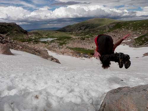 Doing a flip into the snow below Rawah Lake #4 |
hgrapid - Jan 29, 2012 8:32 pm - Voted 10/10
topographic coordinatesJust an FYI, seems like you may want to double check your coordinates. Click on the topo map to see what I mean.
Alex Wood - Jan 29, 2012 8:40 pm - Hasn't voted
Re: topographic coordinatesFixed them. I am still in the process of working out the kinks in this page. Thanks for the feedback!