
|
|
Mountain/Rock |
|---|---|
|
|
36.31538°N / 50.70840°E |
|
|
Mountaineering |
|
|
Summer |
|
|
13196 ft / 4022 m |
|
|
Overview
Note About Elevation: My GPS measured an elevation of 4035 m. The 4022 m figure is per the Iranian 1:50 000 Map.Note About Name: The name “Siah Darreh” appears on the Iranian 1:50 000 Map to the southwest of this peak. I am otherwise not aware of any names for this peak.
 South Face, Photo by Nomad
 NW Face
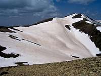 NE Face
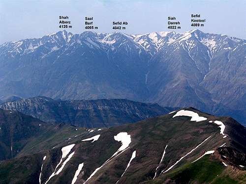
In the western portion of the Central Alborz Mountains of northern Iran, on the crest of the ridgeline that separates the Taleghan Valley to the south from the Alamoot Valley to the north, you will find a series of five 4000 m peaks. East to west, these peaks include:
1) Shah Alborz 4125 m
2) Saal Barf 4065 m
3) Sefid Ab 4042 m
4) Siah Darreh 4022 m
5) Taleghan Peak (Sefid Kootool) 4089 m
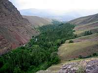
To the east, Siah Darreh is separated from the Sefid Ab Peak via a 3910 m saddle and to the west, Siah Darreh is connected to the Sefid Kootool Peak by a 3930 m saddle. The northern slopes of Siah Darreh are quite steep and drop into a valley that eventually goes down to the bottom of the Alamoot River Valley (1800 m). The southern slopes of Siah Darreh give rise to the Hasan Joon Stream which joins the Taleghan River near the Taleghan Lake behind the Taleghan Dam.
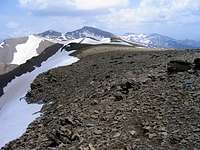
 North Face
The easiest way to reach Siah Darreh is from the summit of Saal Barf where one could follow the ridge-top west all the way to Sefid Kootool Peak. (Please note that the cliffs that form the western slopes of the Shah Alborz Peak make it difficult to access Saal Barf via the summit of Shah Alborz. For this reason Shah Alborz may be best climbed in a separate program). The usual trailhead is the village of Hasan Joon (elevation 1980 m) to the south. From Hasan Joon Village, the trail will take the hiker up the tree-filled valley of Hasan Joon Stream before climbing the grassy lower slopes of the mountains.
 Shah Alborz from Siah Darreh Shah Alborz from Siah Darreh |  Looking South from Siah Darreh Looking South from Siah Darreh |
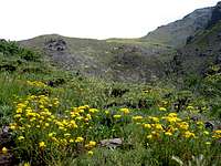
A few pictures from the valley of Hasan Joon Stream:
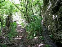 | 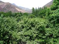 | 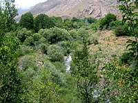 |
 |  |  |
A few pictures from the grassy lower slopes:
 | 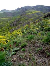 |  |
 |  |  |
Route:
The starting point for this route is the summit of Saal Barf Peak. Click here to see the Route Page for the Saal Barf Peak.
From the summit of Saal Barf (4065 m), head west and follow the ridge-top down to a 3980 m saddle and then up to the 4042 m summit of Sefid Ab (Hiking distance 1.1 Km). From Sefid Ab, continue to follow the ridgetop another 2.5 Km west down to the 3910 m saddle and then up to the summit of Siah Darreh.(Distance from Hasan Joon Village is 20.7 Km).
Getting There
Directions to Hasan Joon Village:From the western parts of Tehran, Drive the Tehran-Qazvin Freeway 40 Km west to the town of Karaj, continue roughly another 60 Km to a village called Abyek. A little on the west side of Abyek, take the exit to “Ziyaran-Shahrak”. Drive this road 40 Km north past a 2350 m high point and then down into the Teleghan Valley by the Taleghan Reservoir to reach Shahrak (or Shahrake Taleghan). This town sits at the bottom of the Taleghan (Shah Rood) River Valley. At the main square, you will see a sign for Hasan Joon Village which is only a few Kilometers away.