Day 1 Saturday March 12, 2011
After the drive out to the San Rafael Swell from Denver Friday night, we got as far as we could on the dirt roads to the middle of the swell and set up camp just off the road.
The plan for Saturday was to hike down Faultline Canyon and meet up with Upper Chute Canyon. We would then hike up and down as far as we wanted in Upper Chute. I got up right at sunrise and started breaking camp. We had been driving since 2am the night before so my partner was hesitant to get out of the bag. After eating we drove down the old dirt road towards McKay Flat in my jalopy. We only got about a mile and had to walk from there.
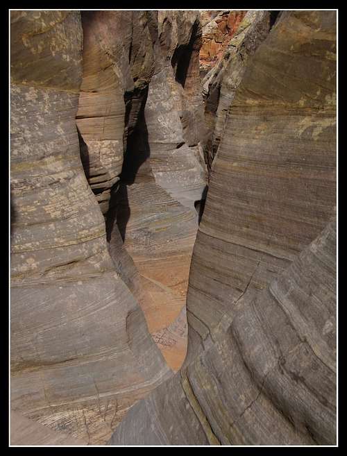
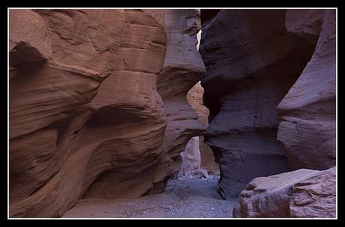
Faultline Canyon is pretty uninteresting however its geologic significance was interesting to me. I kept looking for slickenlines to tell me which way the fault had moved but after never seeing any I figured they have all been eroded away by now. When we got to the junction with Upper Chute Canyon the first thing I noticed was the high water line along the trees and shrubs around me. First of all, we were in a very open area of the canyon and the flood line was about 10 feet high!
I was told that back in August of 2010 there was a massive rainstorm that flooded all the canyons in the swell and changed many of the canyons indefinably. Apparently the large wedged log in the Main Fork of Bluejohn canyon can now be touched since so much sand had been moved down-canyon.
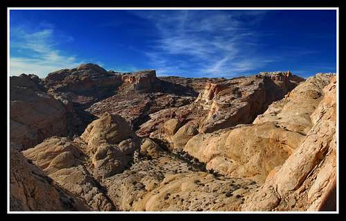
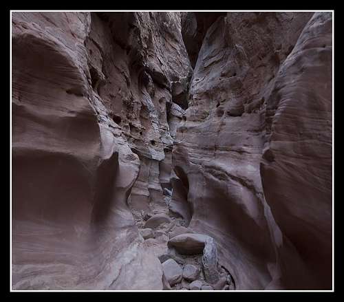
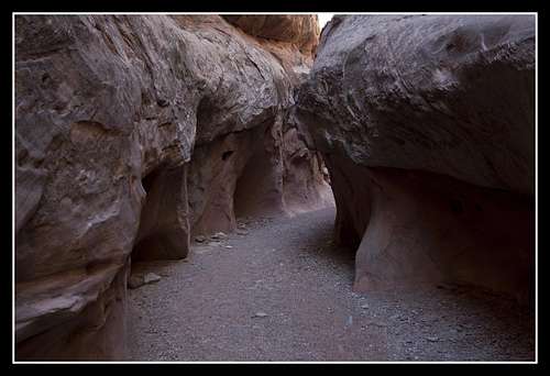
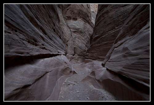
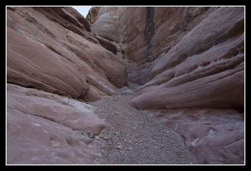
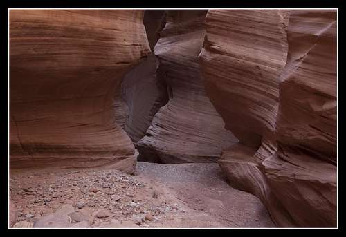
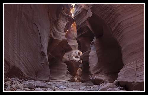
We started by walking up into the deep gorge of Upper Chute Canyon and even though the canyon was very easy in this section, it was spectacular as the canyon walls towered 600 feet above us. We went through the very windy section before turning around.
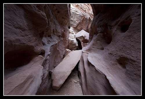
We then started hiking downstream from the junction until we got to the lower technical portion. I was planning on descending this short and sweet technical portion that included 6 or so small rappels but when we got to the first rappel and noticed everything below was riddled with water, we decided to take the dry route and head back.
Kind of lame that I have been swimming competitively my whole life but I don't want to get wet with pothole water! Maybe if it were summer I'd be more inclined. Anyway, we headed back up Faultline canyon and to the car where we drove down to Hidden Splendor Mine to camp for the night in preparation for our Quandary Canyon descent the next day. Photos of Upper Chute Canyon follow.
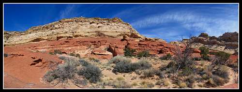
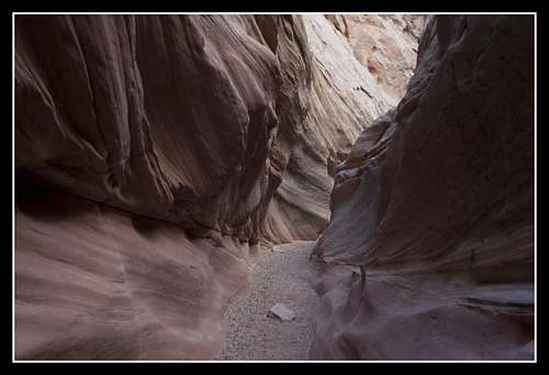
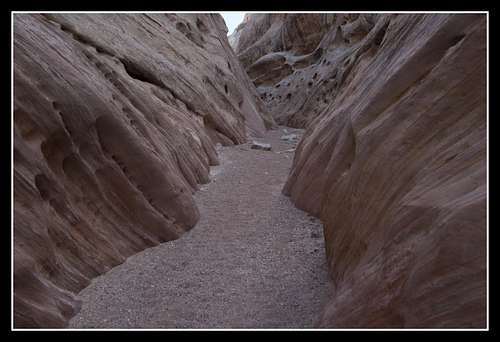
![Upper Chute Canyon]() Upper Chute Canyon
Upper Chute Canyon![Upper Chute Canyon]() Looking down at the lower technical portion of Upper Chute
Looking down at the lower technical portion of Upper Chute![Upper Chute Canyon]() Upper Chute Canyon
Upper Chute Canyon![Upper Chute Canyon]() Upper Chute Canyon
Upper Chute Canyon![Upper Chute Canyon]() Upper Chute Canyon
Upper Chute Canyon![Upper Chute Canyon]() Upper Chute Canyon
Upper Chute Canyon![Upper Chute Canyon]() Upper Chute Canyon
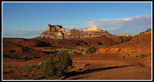
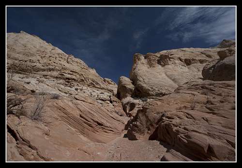
Upper Chute Canyon![Faultline Canyon Junction]() View from the junction of Faultline and Upper Chute
View from the junction of Faultline and Upper Chute
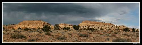
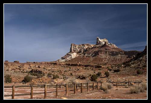
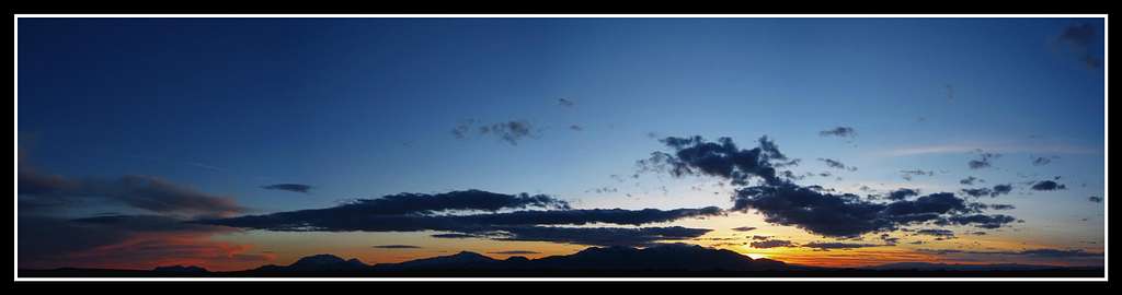
On the drive down to Hidden Splendor I stopped at numerous places to take photos. When we finally got there (that road is a long 11 miles when you're piled into a jalopy!) the sunset was beautiful. We ate a good dinner as the sun set and went to bed.
![Hidden Splendor]() View from the Hidden Splendor Road
View from the Hidden Splendor Road![Hidden Splendor]() View from the Hidden Splendor Road
View from the Hidden Splendor Road![Hidden Splendor]() View of the Henries from the Hidden Splendor Road
View of the Henries from the Hidden Splendor Road![Hidden Splendor]() Sunset at Hidden Splendor
Sunset at Hidden Splendor![Hidden Splendor]() Sunset at Hidden Splendor
Sunset at Hidden Splendor![Hidden Splendor]() Sunset at Hidden Splendor
Sunset at Hidden SplendorDay 2 Sunday March 13, 2011
After a windy night and some failed attempts at star trail photography, we woke and packed our packs for a long day down Quandary Canyon. See my page for detailed route information about the canyon itself. On this day we didn't do anything very technical but we sure tested our route-finding skills to the maximum.
We started by driving up to the small 4WD track that leads to the old Ford. We had to walk this but it wasn't long. We started up the old mining roads and made our way to the pass that was blasted out by miners back in the day.
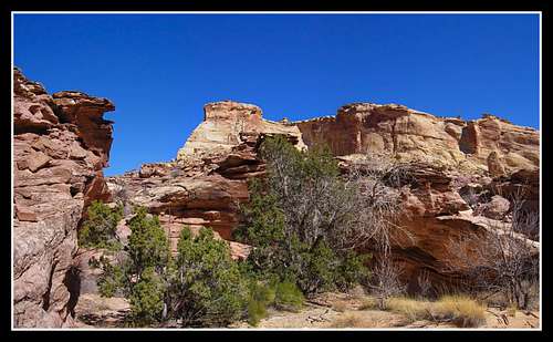
![Sy Butte]() The old ford and Sy Butte
The old ford and Sy Butte![Quandry Canyon]() Morning sun on Sy Butte
Morning sun on Sy Butte
We started down the wash and quickly turned up the Knotted Rope Crack climb. Since I had done this climb before I knew exactly where to go but this would be the last of that!
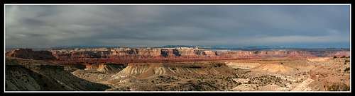
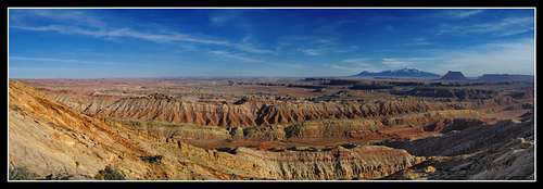
The climb was still enjoyable despite my second time doing it. Upon reaching the top of the Swell, we wandered over to the top of the cliffs to see the view I call one of the best in southern Utah. My partner had never been here before.
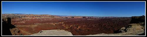
![High on the Swell]() View into the heart of the San Rafael Swell
View into the heart of the San Rafael Swell![Hidden Splendor]() View into the heart of the San Rafael Swell
View into the heart of the San Rafael Swell
After relaxing for a bit we started descending towards the open area in Upper Quandary Canyon. We didn't want to down climb the crack so we planned to bypass the two short 12 foot rappels in the upper canyon.
I knew there was an escape route from the open area and I planned to find it. However finding it was harder than I thought. We finally found the right bowl and descended onto a bench. We had to walk all the way around that bowl before we could completely finish the descent into the canyon bottom. The views the entire time and the ones in the open area were great and the lighting was perfect.
![Quandry Canyon]() View from the open area in Quandary Canyon
View from the open area in Quandary Canyon![Quandry Canyon]() View from the open area in Quandary Canyon
View from the open area in Quandary Canyon
We then started heading down canyon. We passed by the small natural arch on the way.
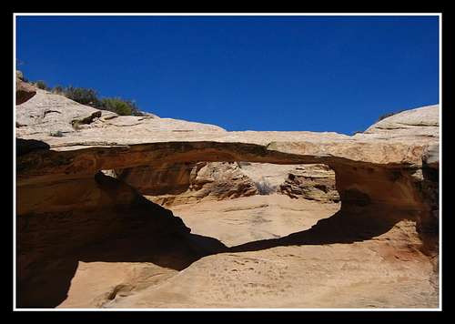
![Arch in Quandry Canyon]() The natural arch in Upper Quandary
The natural arch in Upper Quandary
The upper portion of the canyon was filled with little obstacles here and there. When we hit our first rappel we anchored in from the left and went down. Followed was a nice set of small potholes and Navajo slickrock.
![Quandry Canyon]() Upper Quandary Canyon
Upper Quandary Canyon![Quandry Canyon]() Nice walking section
Nice walking section
When we camp to the narrow chute that dropped into a pothole below us, we were mistaken and thought this was the first keeper pothole. Plus the canyon did make a right turn and there was what looked like a great bypass route head up and to the left. In my page I called this route the "Emergency Exit" and we didn't intend to take this route; it just happened after a series of mistakes. The Quandary Canyon descent turned into a route-finding nightmare and a complete cross country hike up and down remote areas of the swell. The views were fantastic though!
So instead of rappelling from the small arch to bypass the single pothole we started climbing up the joint in the rock and found ourselves climbing up a very steep gully for 600 vertical feet to reach a narrow pass in the sandstone that led to a VERY loose descent down the other side.
![View from the swell]() Views from the Emergency Exit route
Views from the Emergency Exit route![View from the Swell]() Views from the Emergency Exit route
Views from the Emergency Exit route![Henry s and Factory Butte]() Views from the Emergency Exit route
Views from the Emergency Exit route
We finally made our way into the large wash at the base of the reef and started up Ramp Canyon. Wouldn't you know it but it got dark on us just as we reached the big chalkstone in Ramp. Luckily my partner was able to get up quickly before total darkness hit and he was able to jerry-rig a rope for me to climb up. I used that and squeezed through the hole in the chalkstone on the right side instead of climbing up the ledge.
After that is was an easy walk under nice "Supermoon" light to the car where we threw down the bags and went to sleep.
Day 3 Monday March 14, 2011
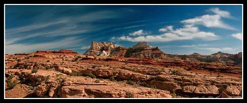
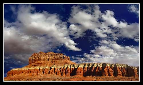
We slept in a good amount this day and spent most of the morning driving to Temple Mountain. I felt good that I was able to make up miles of ground on someone ahead of me in a high clearance 4WD vehicle when I am in a little Toyota that should be working anymore!
Views on this road were also good.
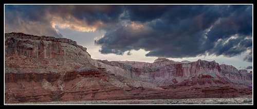
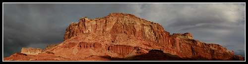
![Temple Mountain]() Views from the road to Temple Mountain
Views from the road to Temple Mountain![Temple Mountain]() Views from the road to Temple Mountain
Views from the road to Temple Mountain![Temple Mountain]() Temple Mountain Panorama
Temple Mountain Panorama![Temple Mountain at Sunset]() Temple Mountain
Temple Mountain![Temple Mountain]() Temple Mountain
Temple Mountain
Our initial plan was to attempt to climb Temple Mountain but we were both tired and decided to head to Little Wild Horse and Bell Canyons. These two canyons were the first ones I ever did in Utah back in October of 2008 so I figured it couldn't hurt to go through them again when I actually know what I'm doing with a camera.
Here are the photos I got of the Little Wild Horse Canyon narrows.
![Little Wild Horse Canyon]() Little Wild Horse Canyon
Little Wild Horse Canyon![Little Wild Horse Canyon]() Little Wild Horse Canyon
Little Wild Horse Canyon![Little Wild Horse Canyon]() Little Wild Horse Canyon
Little Wild Horse Canyon![Little Wild Horse Canyon]() Little Wild Horse Canyon
Little Wild Horse Canyon![Little Wild Horse Canyon]() Little Wild Horse Canyon
Little Wild Horse Canyon![Little Wild Horse Canyon]() Little Wild Horse Canyon
Little Wild Horse Canyon
Upon reaching the upper end of the canyon, the sun was hitting the cliffs so perfectly I went crazy with photos. The colors were so vibrant!
![Little Wild Horse Canyon]() Little Wild Horse Canyon
Little Wild Horse Canyon![Little Wild Horse Canyon]() Little Wild Horse Canyon
Little Wild Horse Canyon
We then descended Bell Canyon.
![Bell Canyon]() Bell Canyon
Bell Canyon![Bell Canyon]() Bell Canyon
Bell Canyon![Bell Canyon]() Bell Canyon
Bell Canyon
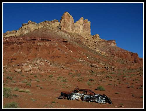
We got back to the car and drove down to Burr Point south of Hanksville to get ready for a long hike down to Happy Canyon. Shot this beautiful scene of Wild Horse Butte on the way out.
![Cliffs above Little Wild Horse Canyon]() Wild Horse Butte
Wild Horse Butte
We camped at Burr Point in complete solitude.
Day 4 Tuesday March 15, 2011
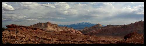
After Passing through Hanksville, we drove down Highway 95 towards Lake Powell, but turned off onto the rough Burr Point Road. This long road gets worse every year but my trusty jalopy made it to the end of the road where we set up a nice place to camp under beautiful clear skies and warm weather. I brought the camera and tripod out and took some long exposure photos as we gazed across the seemingly endless Dirty Devil River Gorge. Very quiet and calm night that I would never forget. The sunrises and sunsets in Utah are just incredible. I did manage to get some interesting photos and we played around writing our names and taking odd pictures in the dark. The sunrise was very nice over the Henry Mountains the next morning.
![Henry Mountains]() Sunrise panorama over the Henries
Sunrise panorama over the Henries
We packed up and started walking towards the steep dugway trail. The plan was to use the Miners Trail and Rappel to get down to the Dirty Devil River, cross it and enter Happy Canyon. Then return the same way up-climbing the rope. To see more information see my Happy Canyon page.
To our surprise though we saw a couple and their truck parked only a half mile further than us near Burr Point. They were able to drive to the very start of the dugway. We basically followed one another the whole day but they were cool to talk to and they hiked just as fast as us...if not faster. I was impressed as I hike
really fast.
Upon getting to the top of the rappel following a well cairined route, we set up our rope and repelled the 15 meter drop onto the massive talus slope below. Descending this slope afterwards took awhile and I wasn't looking forwards to climbing back up it. We made our way to the Shimarump Bench of the Chinle Formation and followed it around and around until we got to the distinctive pile of petrified logs and the start of the old mining track that goes to the Poison Spring Canyon 4WD road.
Upon finishing the descent to the river, we took a break and prepared to cross. It was only thigh deep at its deepest and moving at a few knots. It was however completely opaque and even looked red from all the sediment it carries. Along the entire descent, I was going crazy with the camera. The area was beautiful. Here are the panoramas I shot on the descent.
![Wingate Cliffs]() Dirty Devil River Panorama
Dirty Devil River Panorama![The Dirty Devil River]() Dirty Devil River Panorama
Dirty Devil River Panorama![Dirty Devil River]() Dirty Devil River Panorama
Dirty Devil River Panorama![Dirty Devil River]() Dirty Devil River Panorama
Dirty Devil River Panorama![Dirty Devil River]() Dirty Devil River Panorama
Dirty Devil River Panorama![Crossing the Dirty Devil]() Crossing the river
Crossing the river![Petrified Logs]() Distinctive petrified logs
Distinctive petrified logs
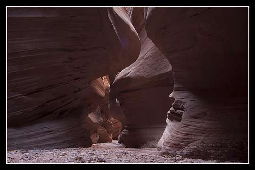
Upon entering Happy Canyon, I was marveled at the beauty of this canyon. It was deep, cool, colorful, dark and very wavy all at the same time.
I was able to get some great sharp photos in the dark canyon which can be hard to do.
![Happy Canyon Narrows]() Happy Canyon Narrows
Happy Canyon Narrows![Happy Canyon Narrows]() Happy Canyon Narrows
Happy Canyon Narrows![Happy Canyon Narrows]() Happy Canyon Narrows
Happy Canyon Narrows![Happy Canyon Narrows]() Happy Canyon Narrows
Happy Canyon Narrows![Happy Canyon Narrows]() Happy Canyon Narrows
Happy Canyon Narrows![Happy Canyon Narrows]() Happy Canyon Narrows
Happy Canyon Narrows![Happy Canyon Narrows]() Happy Canyon Narrows
Happy Canyon Narrows![Happy Canyon Narrows]() Happy Canyon Narrows
Happy Canyon Narrows![Happy Canyon Narrows]() Happy Canyon Narrows
Happy Canyon Narrows![Happy Canyon Narrows]() Happy Canyon Narrows
Happy Canyon Narrows![Sunset on the Henry Mountains]() Sunset on the Henry Mountains
Sunset on the Henry Mountains
To return we retraced our steps and made it back to the rope in good time. We up-climbed it using prusik ropes and were on our way back up the dugway trail. The sunset that evening was beautiful. This hike is also very interesting geologically because we traveled through seven different rock layers stretching a time period of 80 million years of rock record. I just find that so cool!
After getting back to the car we drove to Hanksville where I had three burgers! We drove north on Highway 24 and camped off the highway.
Day 5 Wednesday March 16, 2001
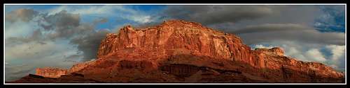
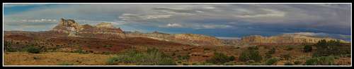
We planned to climb to the actual summit of the San Rafael Reef today but the weather was turning foul. After starting towards Iron Wash, the clouds were looking bad and we turned around. We didn't end up doing anything today and on Thursday morning when the clouds and drizzling looked even worse we just drove back to Denver.
Don't know what's up with that weather...thought Utah was a sunny place all the time!
Did get one photo of the swell in the clouds though.
![San Rafael Swell]() San Rafael Swell in clouds
San Rafael Swell in clouds
Even though I only got half of the things I wanted to do done, it was still a great trip as the weather the first half of break was great. I'll be returning soon though!


Comments
Post a Comment