
-
 16361 Hits
-
 80.49% Score
-
 12 Votes
|
|
Canyon |
|---|---|
|
|
38.58240°N / 110.92449°W |
|
|
Hiking, Scrambling, Canyoneering |
|
|
Spring, Summer, Fall, Winter |
|
|
Overview
Quandary Canyon is a very interesting canyon to explore and really is confusing. It is called Quandary Canyon for a reason. Before doing this canyon I read descriptions from five different reputable sources and was amazed at the amount of contradictory reports I read. I will try my best to make Quandary canyon less "Quandry" in this page. I caution anyone that goes out to this area though as it is very remote. Be sure you trust your vehicle as a tow from this area can cost over a thousand dollars and help in the event of an injury is barely possible.
Full technical canyoneering gear is needed even if you plan to bypass the direct route through the keeper potholes. This gear includes a harness, a 50 meter and a shorter 20 meter rope, some sort of rappel device (ATC or Figure 8), lots of biners, maybe 20+ feet of webbing, descent rings and ascenders just in case. For the direct route, additional gear that even I have never heard of is required. Google Earth images showing all possible routes for Quandary Canyon including the Emergency Exit are shown at the very end.
Getting There
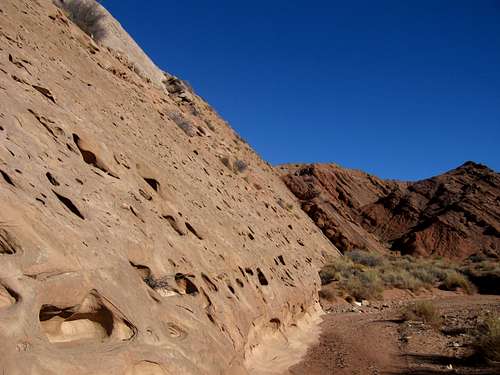
The canyon starts near the historic Hidden Splendor Mine at the southern end of the San Rafael Swell. To get there, stop at the small town of Green River, Utah and make sure your gas tank is full. From there drive west on I-70 about 29 miles and take exit number 131. Turn left off the offramp (or right if coming FROM the west), and continue on the very high quality frontage road that parallels the freeway for a short distance then turns south. Follow this very good dirt road for 10 miles to a junction. All the junctions are well signed in this part of the swell and all the roads needed to get to Hidden Splendor are good. At the first junction, veer right and go another 4 miles to another junction in which you will turn right. If you follow the signs for Hidden Splendor, you can't mess up! Go 1 mile and take a left at the road leading towards Hidden Splendor Mine and McKay Flat (heading right at this junction will take you down Reds Canyon). Now go 8 miles and take another left onto the road going down to Hidden Splendor Mine. This road is 10 miles long and ends at the mine in the middle of nowhere. This road is a little rougher and has a couple places that could ruin your low clearance car but driven carefully, all cars can make it.
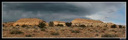
View on the road to Hidden Splendor
View from the Road to Hidden Splendor
View of the Henry Mountains from the Road to Hidden Splendor
At Hidden Splendor, you can camp or explore the old mines and shacks. This is the start for the hike down the Muddy River Gorge as well. There is a dirt airstrip here that used to be used for the mine but is now only used from time to time for private planes. Do not camp or play on the airstrip and tampering with landing aircraft is a federal crime. However it's very unlikely you will see any aircraft during your visit.
Sunset seen from Hidden Splendor
Sunset seen from Hidden Splendor
To get to the start of Quandary Canyon, go back up the Hidden Splendor road 3 miles to a 4X4 track that heads south towards the reef. If you are in a low clearance vehicle simply park on the side of the road here and walk the 4 wheel drive road. It is only 3/4 mile long otherwise if you have high clearance you can drive to its end at the old 1950, blue Ford car that has been sitting there riddled with bullet holes for who knows how long! Where this old car sits is where the hike officially starts. There is also a sign posted that says "Quandary Canyon foot trail"
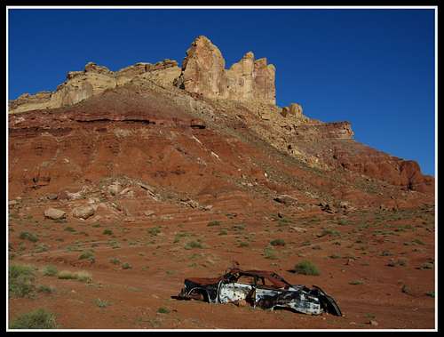
1950 Ford and Sy Butte marking start of the hike
History
This area was one of the richest Uranium mines back in the days of the Utah Mining boom in the 1950's. This was a time when Uranium was in high demand due to World War II and Miners did some pretty incredible things at Hidden Splendor to try to get it. One on the most notable was the road they constructed and blasted out of the reef that started where the old Ford sits and went up and over the reef into upper Quandary Canyon. Many other roads were plowed out of the steep talus all around the backside of the reef. Miners also had drilling equipment helicoptered up to the to of the reef which included thousands of feet of metal pipe to pump water up from Muddy River. A small mining shed with a large wood stove is along with drill hole remains are found at the upper end of both Quandary Canyon and Miners Hollow. As you work your way through Quandary Canyon, you will hike on this old road, see remnants of blasting and pass a drill hole with old mining equipment. If you continue west towards Miners Hollow, you will come across a long pipeline that at one point pumped water 1,400 feet up from the river below.Some people get very angry when they see mining remnants in a beautiful place like this however I see it as an interesting side trip where I take myself back in time and wonder what it was like during those days. Being a geologist myself I kind of enjoy seeing these things in such remote places. It puts things into perspective to realize that these areas are only very recently used for recreation. Not too long ago no one ever came to these parts and the ones who did were there for long periods of time living in hardship in the mines or as outlaws. Now we go to these areas only a few days at a time for fun. A lot has changed in a very short period of time.
The Hidden Splendor closed in the late 50's when the US government quit subsidizing the Uranium boom and most of the mines in the area closed with most of the equipment deserted. Another big mine in the San Rafael Swell was the Temple Mountain mine at at Temple Junction there was once a small town with a saloon and a post office. Today, only the foundations remain of this place. Turning off Highway 24 onto the Temple Mountain Road towards Goblin Valley, take a few minutes to roam around the foundations located on the southwest side of the intersection.
Quandary Canyon Part 1
This part of Quandary Canyon is done by all who wishes to see the canyon. Start at the old Ford and start hiking towards the reef following a small wash or an old road.
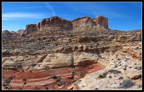
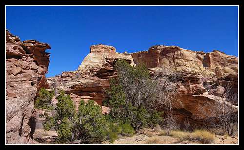
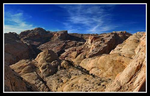
Looking towards the Wingate cliffs of the San Rafael Reef
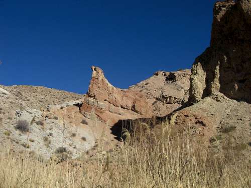
You will pass by Sy Butte to your right that glistens beautifully in the morning sun.
Sy Butte from the old road to Quandry Canyon
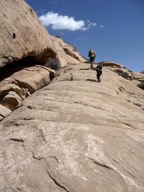
You will work your way up through the boulders until you get very close to the base of the large Wingate cliffs where the old road will be more apparent. Follow this road until you get to the pass that was blasted out of the Wingate cliffs to allow vehicles through. At this notch you are standing at the very head of the Quandary Canyon drainage. Descend into the very upper reaches of Quandary canyon and follow the dry wash for a short distance. After about 200 meters in this dry wash you will notice a steep talus slope going up to your right with two very large rocks at the top. This is where you have to make your first decision to climb up to the top of the cliffs through the Knotted Rope Crack or continue down canyon.
Quandary Canyon Variant 1a - The Knotted Rope Crack
If you really like views and steep climbs with some good scrambling and route-finding, this route may interest you more. It can bypass the first part of Quandary Canyon if you want. It's much prettier and worth the extra time. If your goal is to just descend the canyon, maybe disregard this variation. From the talus slope mentioned above, veer out of the dry wash and start climbing. The slope goes up about 400 feet where many rocks are loose so be careful not to jar any loose on your friends below! As you near the top you will come across two or three very large rocks that seem to block the way. Go around these to the left and you will see a crack underneath them. Work your way through this crack with some class 3 scrambling and emerge at the top.
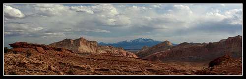
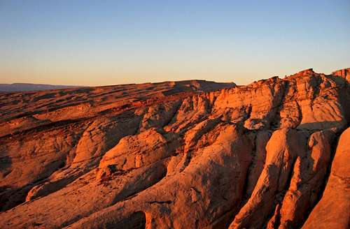
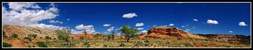
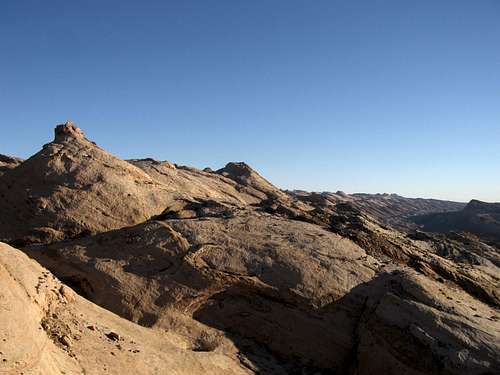
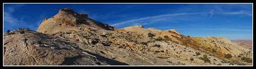
From here, walk due east working your way towards the top of the cliffs you saw above you at the Hidden Splendor Mine and prepare yourself for one of the best views in southern Utah. When you get to the cliffs you could simply sit and relax for a bit taking in the views. A sea of red rocks and little canyons in an area known as the Keesle Country sits below you. The San Rafael Reef fills the horizon as it wraps around to the north making a circle. I have done my best to capture this place with photographs but they still don't do justice.
View from the top of the reef
If you want to see the old mine sheds and long cable, wander your way further east along the cliffs for about a mile towards the upper end of Knotted Rope Canyon (the canyon just east of Quandary). I do not recommend looking for these mine ruins if you still plan to go down Quandary. Once you get to your first overlook it is recommended you continue on your hike. You don't want to run out of daylight in Quandary Canyon as you will also have your return hike to do. If however you wish to spend your day on the top of these cliffs and return the way you came up and save Quandary for another day then do so; I could easily live up there. Once you are satisfied with your views, you can retrace your steps back down the slope you climbed back into the dry wash and continue down canyon from there. If you go this route you will not miss any part of the canyon itself. This upper part of Quandary will have two short 12 foot rappels that have easy natural anchors to use before getting to the large open area.
Looking into Upper Quandry Canyon from the first 12 foot rappel
The first 12 foot rappel, Photo by Scott
The second 12 foot rappel, Photo by Scott
However if you want to test your route finding skills, start heading south from the top of the cliffs and hike along the east rim of a large side canyon. Ignore any cairns you see and don't drop down into this side canyon. Go maybe a half mile south until you see a second side canyon that is a large bowl. You will see it drains into a large open area. This is the open area you want to get to. Route find and down climb into the upper bench of this bowl. You will then have to walk all the way around the bowl to an easy spot to descend into the open area.
The bowl to descend into and walk around
This route took us awhile. If you are concerned about time, it's better to go back down the Knotted Rope Crack and quickly rappel the two short dry-falls and get to the open area that way. Note that the old mining road went down this part of the canyon to get to the large open area below. Since then, floods have reamed out these two dry-falls.
The Large Open Area
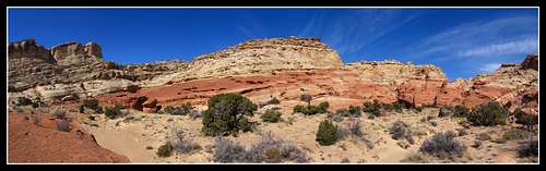
This part of Quandary Canyon is wide open and beautiful. When I was here the lighting was perfect so all this cliffs around me were bright red and orange and the sky was a bright blue. Slowly work your way down the dry wash until you get to a small natural bridge that you can easily climb up onto.
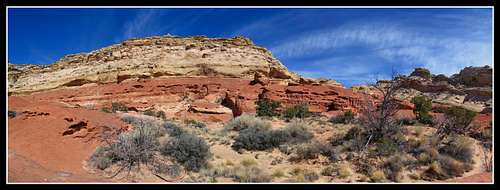
View of the open area in Upper Quandary Canyon
Quandary Canyon from the open area
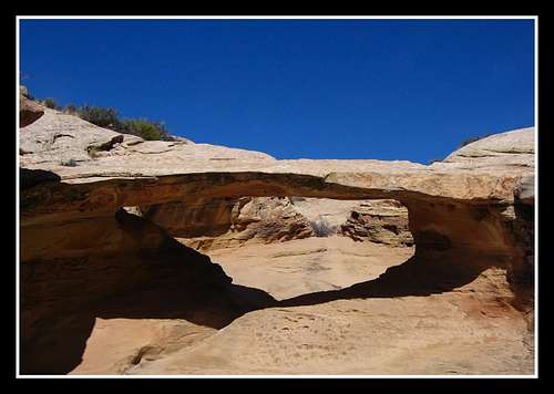
The small natural bridge
Beyond this the canyon gets more interesting.
Quandary Canyon Part 2
Once you pass the natural bridge, continue down canyon. The canyon is easy at first and works its way through large piles of rocks and small dryfalls.
Quandary Canyon
When you get to your first dry-fall that cannot be climbed down, backtrack about 50 feet and climb up and out of the canyon on the right side looking down canyon. You can then descend back into the canyon below the dry-fall. A large cottonwood tree and a pothole of water are at the bottom. You will then pass through a short section of easy walking before coming to a pothole that is a short jump into and walk through/climb out or a very short wade.
Easy walking section
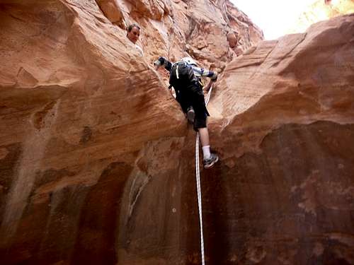
This poses no problem. Right after that small pothole is a 10 meter dry-fall with a rappel anchor high above on the left side looking down canyon. Climb up the slick-rock and anchor yourself in. Because the anchor is 5 more meters above the top of the dry-fall, it is a 15 meter rappel and a 30 meter rope is needed for this rappel. Once at the bottom, walk through the sandy pothole around the corner to the right and climb out. If this is filled with water it is a 25 yard swim or wade. It was empty in March 2011.
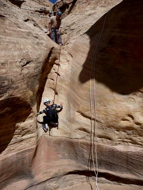
Rappel 3 in Quandary Canyon, Photo by Scott
You will then pass through an area with nice slick-rock and many small potholes. The canyon then turns slightly right TO FOLLOW A JOINT in the rock for about 25 yards and then comes to a narrow chute leading down to a pothole. If you look to the left up the joint you will see what appears to be a route out heading up and to the northeast. DO NOT climb out this way unless you absolutely have to. I'll explain this route later in the section called "Emergency Exit" Instead, there are two ways to get down the narrow chute. You could backtrack about 30 feet and climb up and out of the canyon on the right side looking down canyon. Walk around on this bench above the pothole and look for a small arch to set up an anchor for a 50 foot rappel back down into the canyon below the pothole. There are not very many places to set up an anchor on this bench and any slings currently there I would test. You could also DC the chute if you are a good canyoneer. If you choose to DC it, it might be a bit of work to get out of the pothole from inside it.
EDIT: As of early 2013 the chute I describe above is no longer there. Apparently floods have filled it in. Thanks to Scott for this information.
Section that follows the joint - Note the log
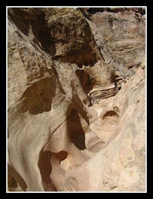
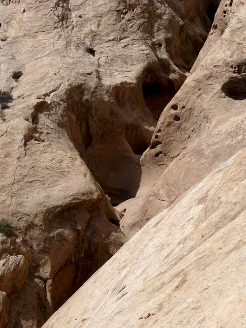
Below this the canyon narrows a lot and passes by many smaller potholes that may require wading or short swims. Squeeze your way through a narrow and tilted section of the canyon until you reach a small open area with an easy section. Just past this easy section the canyon makes a SHARP right turn at coordinates N-38 degrees 33 minutes 14 seconds and W-110 degrees 55 minutes 34 seconds and leads to a small pothole and a big drop.

Working through the narrows, Photo by Scott
Quandary Canyon Part 3a - Bypass Route
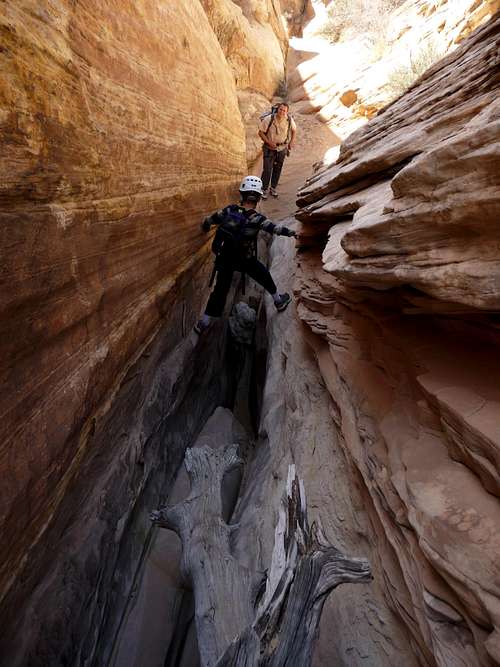
From here, backtrack 75 feet to the sharp right turn and locate a short gully heading southeast that climbs up the left side looking down canyon.
The correct way up for the bypass route, Photo by Scott
From the top of the gully, stay east along the base of the cliffs and instead of descending back into the canyon at the next gully you see, locate a small saddle.
The technical KPH section from the bypass saddle
Climb through this saddle and traverse along steep slick-rock and stay as far east as you can. When you hit a steep canyon wall, descend the steep gully seen right there and work your way over and under large boulders before meeting back up with the main canyon. Keep in mind that the bypass route is only a quarter mile long and only gains about 200 feet above the direct part of the canyon.
Quandary Canyon Part 3b - Direct Route
From the sharp right turn and steep drop, rappel the drop into the first keeper pothole. Knowledge of how to escape keeper potholes and the proper gear are required to descend this direct part of the canyon. At least three keeper potholes will have to be escaped from and numerous amounts of swimming. I have never done this route nor do I have the interest to. That being said, to improve this portion of the page, if anyone HAS done this route and wishes to add information and photos to this part of the page, please let me know.
Quandary Canyon Part 4 and Return Route
Once back in the main canyon, continue down-canyon where it makes nearly a complete U turn to the left and continue past some more minor obstacles. At the Navajo/Carmel contact you will see a trail that follows a wide ledge above the canyon bottom on the east side that takes you above and around a large drop. Take this trail and follow it down the ledges until it brings you to a couple ramps and finally into a thicket of cottonwoods and grasses.
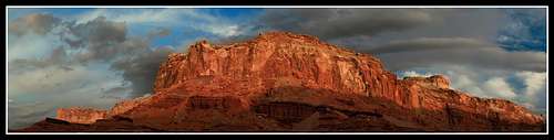
Sunrise on Quandary Canyon from the high ledges
That last photo was taken from a point way above the previously mentioned trail on the rim of the deep gorge that is Quandary Canyon. You could take a short side hike up the rim if you want for some spectacular views. Otherwise, whack your way through the bushes and emerge into a large dry wash at the base of the San Rafael Reef.
View of the reef from the mouth of Quandary Canyon
From there turn left (east) and hike the dry wash for 1.5 miles as it weaves its way through the steeply dipping beds of Carmel, Morrison and Entrada formations. After 1.5 miles you will come across a dry-fall that you climb over on the left side. After another half mile you will come to the junction of the Ramp Canyon drainage marked by a cairn. You'll also notice the deep gorge cutting through the San Rafael Reef that is Ramp Canyon before you actually get to the junction. Turn left into this wash and hike up Ramp Canyon.
Entering Ramp Canyon
Route Details for Ramp Canyon can be found in my "Ramp Canyon, Cistern Canyon and the Muddy River Gorge" page. You could also turn right at the bottom of Quandary Canyon and follow the dry wash until it intersects the Muddy River and then hike of the Muddy River Gorge just to hike 3 miles of the Hidden Splendor Road back to your car if you want. This route is much much longer though.
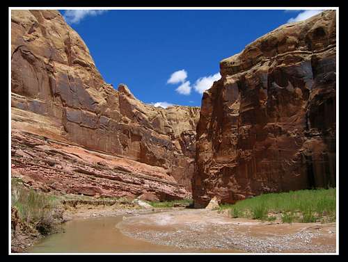
Hiking through the Muddy River Gorge
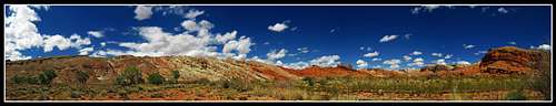
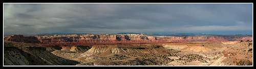
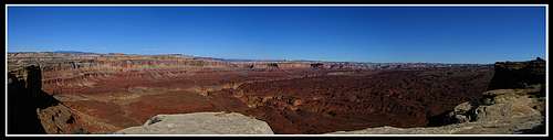
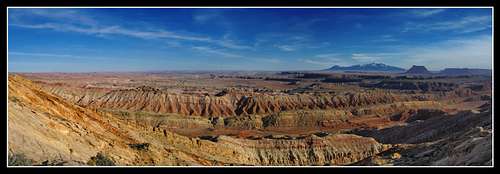
San Rafael Reef panorama from the bottom end of the Muddy River Gorge
San Rafael Reef panorama from the bottom end of the Muddy River Gorge
Emergency Exit
Refer back to the Quandary Canyon Part 2 section where I stated there is an escape route heading northeast and follows a joint in the rocks just below the described rappel. I want to reiterate this is an emergency exit to be used only if:1. You are in the path of a flash flood,
2. You find that your gear is not suitable for doing even the bypass route
3. You find that you are new to rappelling and technical canyoneering and you don't want to rappel anymore
4. Someone gets injured and cannot rappel anymore (although if someone is injured this escape route isn't easy by any means)
This route is mostly class 3 with one class 4 move that has exposure. Follow the joint in the rocks up the left side of the canyon looking down canyon from the prescribed place in the Part 2 section. You will quickly notice two side canyons emerge and a small ridge between them. When you get about 100 feet above Quandary Canyon and 125 meters horizontal, there will be a fork in the ridge. If you take the right fork there is a dry-fall that cannot be up-climbed. Take the left fork around a head of rock to a point where there is a class 4 climbing move with about 30 feet of exposure below.
If you want you can have the most experienced climber climb up this and set up an anchor on a small arch in the rock at the top to belay others up. Shortly after that is a small slot about 100 feet long that must be chimneyed or bridged over to get around the evil bushes that are growing inside. Once at the upper end of this little slot, the most technical work is over. Locate a long, steep talus slope that veers to the right and start climbing it. It ascends about 400 long vertical feet to a pass high on the swell with great views.
Quandary Canyon seen from the small pass
The Henry Mountains and Factory Butte seen from the small pass
Then descend a very slick talus slope down the other side to the east. THIS SLOPE IS VERY SLICK!!! Rocks were falling down the slope all around us when we went down. When you get to the small flat area at the bottom, continue heading southeast and climb up about 50 feet to the next little saddle and walk down the bedding planes of the reef from there.
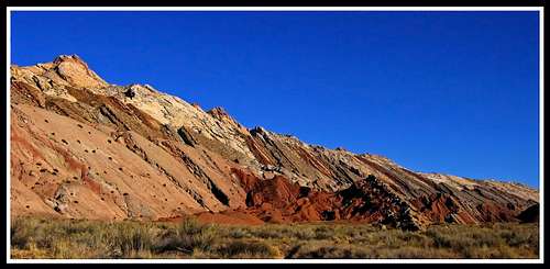
View of the rock layers seen from the east rim of Quandary Canyon
It is nearly impossible to get across this drainage to the slopes seen in this photo from where it was taken on the rim above the lower part of Quandary.
Walking down the steep reef
As you hike steeply downhill, generally head south and into a drainage that follows a straight set of Morrison cliffs southwest for about 300 meters. The drainage (having no name) is the drainage just east of Quandary Canyon. After 300 meters of following the cliffs that are on your left looking down canyon, it will turn to the left and take you through these cliffs and dump you out into the large dry wash at the base of the reef.
The mouth of Quandary Canyon
From there follow the wash up and head back to your car via Ramp Canyon.
Google Earth Images
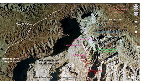
GE image showing Routes through Upper Quandary Canyon
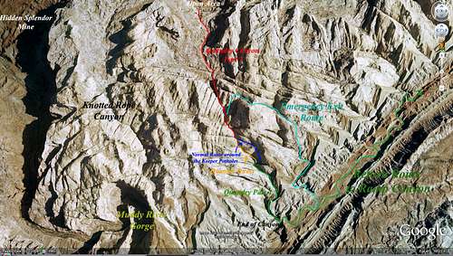
GE image showing Routes through Lower Quandary Canyon
External Resources
See Michael Kelsey's Hiking and Exploring Utah's San Rafael Swell pages 92 and 93 for his info about the canyon. Steve Allen also has a guidebook that includes Quandary Canyon.Tom's Canyoneering Guide - Quandary Canyon
Quandary Canyon
Weather Forecast