
|
|
Mountain/Rock |
|---|---|
|
|
48.40054°N / 122.07054°W |
|
|
Skagit |
|
|
4072 ft / 1241 m |
|
|
Overview
It is important to point out from the start that Teepee Peak is not a good hiking destination. Even by the shortest route (which requires a permit), it is over 16 miles round trip to the summit. For this reason, a mountain bike (or possibly a motorcycle) is recommended for the bulk of the approach.
While Teepee Peak will probably never top any peakbagger's list, it may be just the ticket for someone wishing to log some gravel road miles on the bike. Additionally, it would make a good early or late season ascent, when the more 'worthy' peaks are difficult to access. Who knows - you may even end up liking this area enough to bring your own teepee (or tent).
Getting There
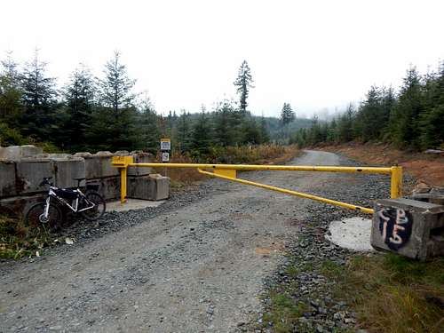
Access point for Teepee Peak
To the best of my knowledge, there are at least three different access points for Teepee Peak (and possibly more). The route that will be described assumes that you do not own an off-road motorcycle, or have a Weyerhaeuser permit in hand. These optional routings will receive a brief description below.
From the south:
From Arlington, follow SR9 north for 5.6 miles, and turn right on Finn Settlement Road. After a short distance, this road will turn into Granstrom Road. Follow Finn Settlement/Granstrom Road for 5.3 miles, then turn right on Lake Cavanaugh Road. Follow Lake Cavanaugh Road for 2.9 miles to an obvious yellow gate on the left (north) side of the road (Waypoint 284 on route map).
From the north:
From the south end of Big Lake (SE of Mount Vernon) on SR9, turn left onto Lake Cavanaugh Road. Follow the Lake Cavanaugh Road for 6.5 miles to an obvious yellow gate on the left (north) side of the road (Waypoint 284 on route map).
Route
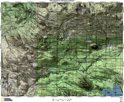
Teepee Peak route map. Yellow line shows a shorter route, which requires a Weyerhaeuser permit to access. Blue line shows the start of a link (I believe) into the Walker Valley ORV area. Green line near summit shows a side trip to a viewpoint/camping area.
Waypoint 280 is where the 'Weyerhaueser Route' will link in (shown as yellow on the route map). I don't know how to get the appropriate permit, or how much they cost, so I will leave that up to you if you are so inclined to get one. Make a sharp left at the intersection, and get ready for a big climb. Follow the mainline, ignoring spurs, for 3.0 miles (gaining 1300' in the process), to a major intersection at 3351'. I included Waypoint 278 along the way (for the benefit of the gas-powered crowd), as there is a gate installed here (currently open). When I rode this route six years ago on my motorcycle, the gate was closed. Interestingly, it is a single-bar design, and I was able to slide my motorcycle under it.
From the intersection at 3351', take a left, and follow this well-defined spur for 0.7 miles to an intersection at Waypoint 277 on the route map. Turn right here, and follow this road around the east, then north side of Teepee Peak (ignore two minor spurs along the way). At Waypoint 276 (just northeast of the summit), keep your eyes open for a low quality scrambler's path leading off to the left. This path is nothing to crow about, but it does help a little bit. Follow the path steeply uphill for about 200' through light brush and second growth to the summit.
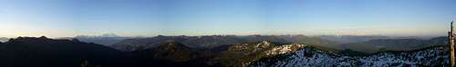
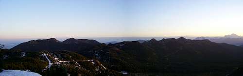
Teepee Peak northwest through south pano
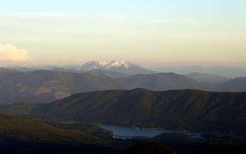
Cultus Mountains from Teepee Peak. Interesting side note: In Chinook Jargon, 'cultus' means means 'bad, worthless, useless, ordinary, evil or taboo'. Silo Mountain on lower right side of photo.
Mount Pilchuck from Teepee Peak. Bald Mountain at bottom of photo, Frailey Mountain above Lake Cavanaugh. Wheeler Mountain, Olo Mountain, and Blue Mountain above Frailey Mountain.
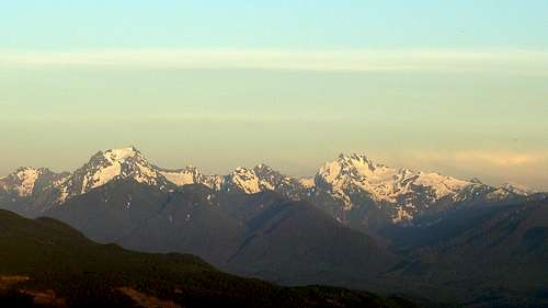
Whitehorse and Three Fingers from Teepee Peak. Jumbo Mountain on left edge of photo, Salish Peak and Mount Bullon in center.
Red Tape
When to Climb
Camping
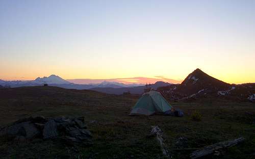
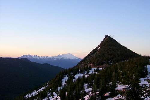
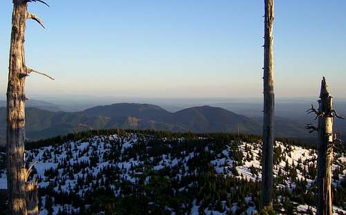
Sunrise on Teepee Peak