
-
 2865 Hits
-
 88.09% Score
-
 26 Votes
|
|
Mountain/Rock |
|---|---|
|
|
42.06570°N / 113.70848°W |
|
|
Cassia |
|
|
Trad Climbing, Sport Climbing |
|
|
Spring, Summer, Fall |
|
|
Overview
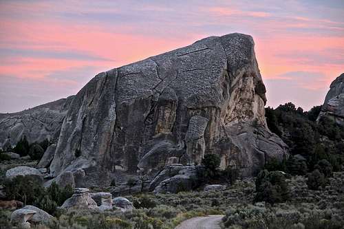
Elephant Rock at sunset - The Gallstone is to the left and behind.
City of Rocks is located in south central Idaho nearly on the border with Utah. As the name suggests the climbs are located on numerous granite domes and towers surrounded by high desert landscape. The surrounding area is very rural and reminds us of US from older times.
Best available guidebook is: City of Rocks: A Climber's Guide by Dave Bingham (7th edition)
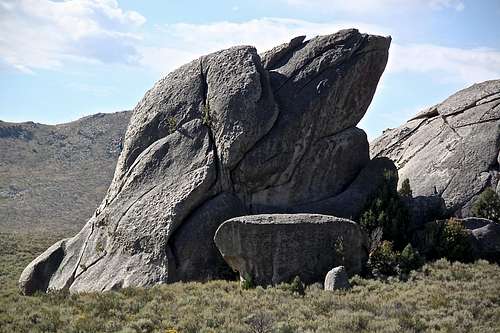
The Gallstone is located approximately 100 meters south of Elephant Rock. The crag is located on private property and was just recently opened to public for climbing. There is a nice established approach trail to it. Park at the Elephant Rock parking area, walk past the Elephant Rock climbing and follow a well established trail to the Gallstone formation, which is seen on your approach.
The Gallstone is a nice escape from the crowds at Elephant Rock.
Getting There
Directions from the south: Take I-15 north to I-84, Snowville. At Snowville, take exit 5 and go west on SR 30 for 15 miles, cross into Idaho and take 3600 south - it is marked for Almo and City of Rocks. Go west on this road for about 20 miles and follow signs (and visible City of Rocks) on this good dirt road.
You can also stay on paved road and exit 245 (Sublette), turn left and go west to Malta. From Malta take Hwy 77 to Conner Creek, and Almo. The paved road is longer, but time wise the driving is about the same.
Directions from the north: take I-84 east, exit 216 (Declo), go south of Hwy 77 to Conner Creek Junction, turn right (west) on Hwy 77 Spur to Almo.
| TOWN | APPROXIMATE DRIVING TIME |
| SALT LAKE CITY | 3 HRS |
| POCATELLO | 2.5 HRS |
| BOISE | 4 HRS |
| LAS VEGAS/RED ROCKS | 10 HRS |
| MOAB | 8 HRS |
| BOULDER/DENVER | 12 HRS |
| SMITH ROCKS | 9 HRS |
Route
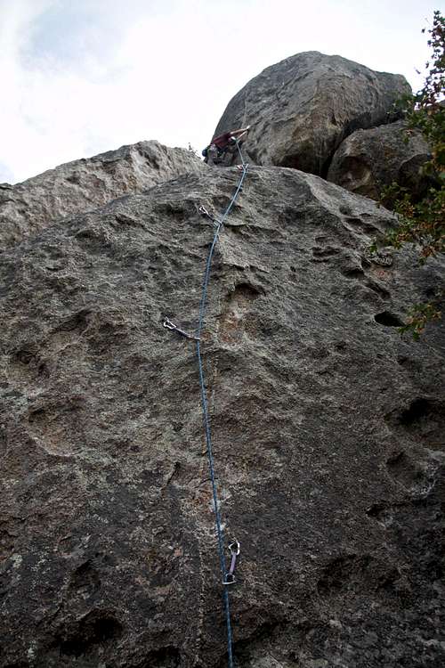
Climber on Conceptual Reality 5.9 - The Gallstone
Rock Lobster 5.7 * Same start as Conceptual Reality, but as the crack forks follow the right crack past 2 small trees. Gain an easy slab and higher up a wide crack.
Cholelithiasis 5.8- ** This climb is located right of Conceptual Reality, a bolted route on arete. 4 bolts to an easy slab and then 2 more bolts and chains at the top. A little fun route with easier section in the middle. 60 meter rope sufficient.
Cholecystectomy 5.8 ** This route is located just a couple of meters to the right of Cholelithiasis. It starts a little bit steeper than the previous climb and higher up joins with Cholelithiasis. A nice and little harder variation. Well bolted. Same anchors as Cholelithiasis.
Meningitis 5.12a *** The guidebook writes a classic short crimpfest. The route goes up the steep north face of the Gallstone. 4 bolts to anchors
Gangrene 5.12b ** The climb starts on the left edge of the steep west face. Go to the left higher up.
Toxic Shock 5.12c * Basically a variation of Gangrene, but go to the right.
 Cholecystectomy 5.8 | 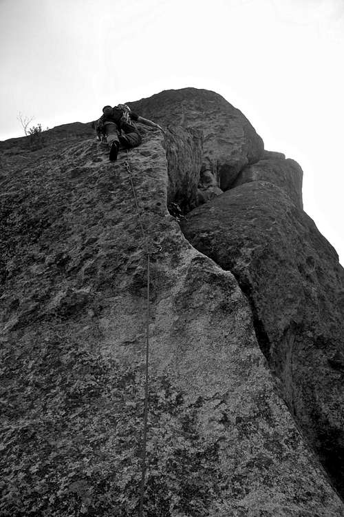 Cholelithiasis 5.8- | 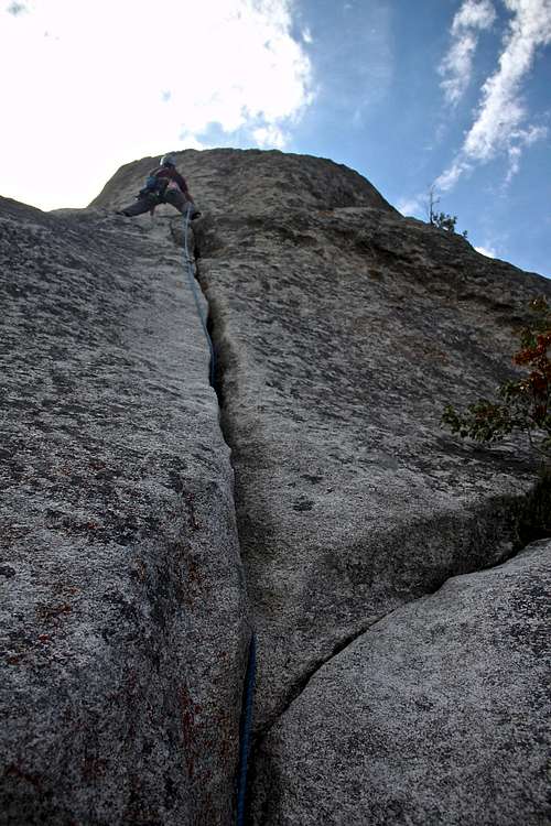 Conceptual Reality 5.9 |
Red Tape
There is no entry fee to City of Rocks.Local Amenities - Almo is 6.5 miles away and is very small. Buy most of your supplies prior your trip. There is a small gas station in Almo, but was out of gas during our trip.
When to Climb
Spring, summer, and fall.Climbing can be pleasant from April through October. Summer temperature range widely (midday nearing 100 F). Thunderstorms are common in the summer months (June-August). Keep in mind that camping is beautiful, but most sites do not offer much shade.
Camping
There is camping dispersed in between rocks, from most campsites you can hike to climbing, some you need to drive (especially if camping by Twin Sisters, which are closed to climbing currently).It is best to make reservations ahead for the campsites since the area is very popular especially during the weekends. 40 sites are drive up, and 24 sites are walk in sites.
Dry Toilets available and drinkable water at some sites (a really good water pump by the Upper Breadloaves).
External Links
- The Gallstone on Mountain Project
- City of Rocks NPS City of Rocks NPS
- Detailed weather forecast - City of Rocks
- City of Rocks Idaho: A Climber's Guide
- Rock City - a popular pizza/beer place
- Durfee Hot Springs
- Almo, Idaho - wiki page