|
|
Route |
|---|---|
|
|
53.11700°N / 3.99671°W |
|
|
Scrambling |
|
|
Spring, Summer, Fall, Winter |
|
|
Half a day |
|
|
Grade 1 Scramble or Grade II winter climb |
|
|
Overview
Tryfan's North ridge is probably the most popular scramble in the Glyderau. The route follows a logical line along a broad ridge from the A5 in Nant Ffrancon directly to Tryfan's summit and the twin monoliths of Adam and Eve. Although the ridge is broad, the scrambling is always interesting and varies from easy walking to short steep pitches that are furnished with plentiful handholds. One of the beauties of this route is that although the normal route is easily done even by mountain novices, for those who would like a bit more of a challenge harder lines can be picked out. The best scrambling can be found on the crest of the ridge, however it can get very busy, and for those who prefer their mountaineering experience to be a little quieter an early start is recommended. |
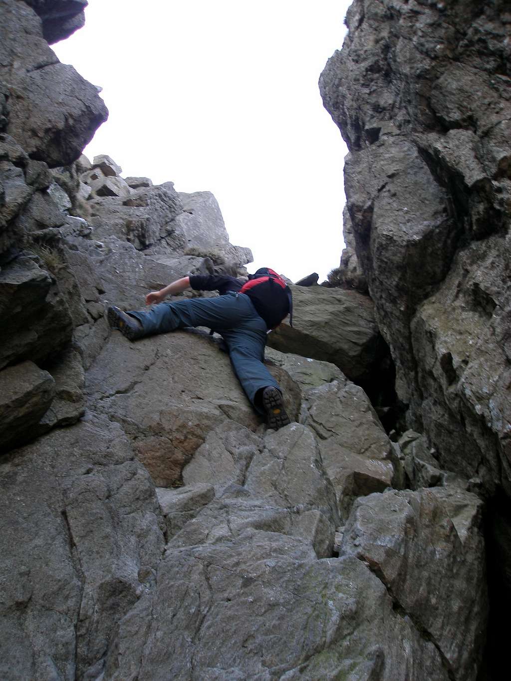
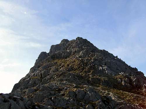
 Tryfan's North Ridge Tryfan's North Ridge(Photo by tphubbard) |  Scrambling Scrambling(Photo by Steve Moulding) |  North Summit North Summit(Photo by Big Lee) |
Getting There
 Tryfans North Ridge (Photo by JoeHarris) Tryfans North Ridge (Photo by JoeHarris)Conveniently, Tryfan is located very close to the A5 meaning that there isn't a long approach to the bottom of the mountain making it probably the most accessible mountain in Snowdonia. If approaching from the north or west, e.g. from Liverpool or Hollyhead, turn off the A55 and onto the A5 at the large junction (SH 593 694) that sign posts for Bethesda and follow the road until Llyn Ogwen where parking is available.If coming from the east, take the A5 through Bettws y Coed (SH798 599) and Capel Curig (SH 719 580) which will take you directly to the base of the mountain.If driving from the south, take the A470 through Blaenau Ffestiniog (SH 700 458) to Bettws y Coed, and turn off onto the A5 towards Bethesda which will take you the same way as if coming from the east.There is plenty of parking along the A5 near Tryfan, some of which you have to pay for, some of which you don't. My advice is to never bother with the official car parks and just park along the roadside. There is a wide 'pavement' type verge on the southern side of the road that can easily accommodate the width of a car or minibus, and is completely free and never full (even on bank holidays). It also allows you to park even closer to the base of the mountain and the start of the path. |
Route Description
The Milestone Buttress (a prominent feature on the lower west side of the ridge) can be seen from the road, and the route heads towards it slightly to its left (east) where it gains the shoulder of the ridge. It then ascends though a boulder-strewn slope and breaks through a short a barrier at its top. The route then continues slightly to the left side of the ridge to a quartz platform. Slightly to its right The Cannon can be found, a famous rock feature that protrudes from the ridge. Make sure you get a photo of yourself on it and then crop it so it looks like your standing over an enormous precipice, a shot that will definitely impress your non-mountaineering mates down the pub! |
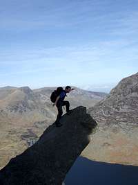 The Cannon The Cannon(Photo by Nanuls) |  The approach The approach(Photo by Steve Moulding) |  North Ridge North Ridge(Photo by Richard Purchon) |  The Cannon The Cannon(Photo by mountainmanjohn) |
|
The route carries on slightly to the left of The Cannon up a high crag and continues to another platform just before a prominent nose of rock. Its best to carefully inspect this barrier for the best line and then follow it over polished rock to Tryfan's North Summit, the route then descends the far side of the summit to The Notch.The route then heads right, out of the Notch, and ascends a gully to the north of the summit, continuing easily over scattered boulders to Tryfans true summit and Adam and Eve.Descent is usually made via the South Ridge (a grade 1 scramble itself) and then down to Llyn Bochlwyd and the A5.The ridge is part of the longer route of the Bochlwyd Horseshoe which incorporates an ascent of Glyder Fach via Bristly Ridge and descends via Gribin Ridge to the A5. |
Essential Gear
During the summer you will need all the equipment you would normally use on a Grade 1 scramble i.e. a good pair of boots and full waterproofs. A rope and helmet may be required for the inexperienced or those without a head for heights.If your lucky enough to climb the mountain in winter conditions then an ice axe (or ice axes on the harder routes), crampons, a helmet, a rope and a descent winter rack (if going for a more serious route) are all essential. |
Maps
|
| Navigation Maps OS 1:25k Explorer Series OL 17 Snowdon/Yr Wyddfa OS 1:50k Landranger Series 115 Snowdon/Yr Wyddfa Harvey Map Services 1:25k: Snowdonia North: Snowdon, Glyders, Carnedds Harvey Map Services/BMC 1: 40k British Mountain Map: Snowdonia North Road Maps |
Guidebooks
External Links
 Tryfan's West Face (Photo by JoeHarris) Tryfan's West Face (Photo by JoeHarris) Tryfan (Photo by Phillip Stasiw) Tryfan (Photo by Phillip Stasiw)Government Bodies and Official Organisations Snowdonia National Park Authority Association of National Park Authorities Royal Commission on Ancient & Historical Monuments in Wales Hiking, Climbing and Mountaineering Organisations and Companies British Mountaineering Council Plas y Brenin National Mountain Centre Weather Tourist Information North Wales Tourism Partnership Local Information from Gwynedd.com Local Information from Snowdonia Wales Net Travel Welsh Public Transport Information Accommodation Youth Hostel Association in Wales Maps and Guidebooks Cordee Travel and Adventure Sports Bookshop Wildlife and Conservation |