Northwest Territory
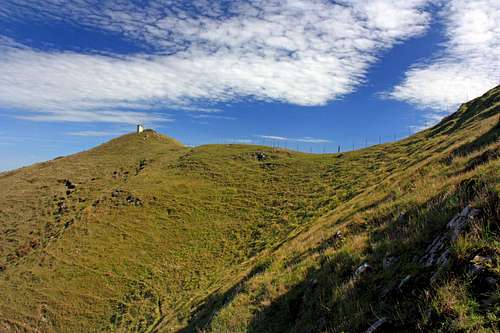
![Three Peaks summit from the northwest ridge]() Three Peaks east summit from the northwest ridge
Three Peaks east summit from the northwest ridgeHaving lived in Marin County for thirty five years and hiked the area for twenty of them there are few high points I haven't been to. Since moving to Fairfax, a small town on the west edge of urban Marin I am only a couple of miles from the rural countryside that extends out into the larger part of the county. So as a natural matter of course I've been exploring the west and northwestern areas from this easy jumping off point.
Three Peaks, 1,161', the farthest named high point in the northwest part of the county was one of the few that was still on the list to do. It is a small quaint hill but fairly steep by local standards. Two Peaks is more like it. The southwest "peak" is hardly a bump, maybe 20 feet.
The peak rises about a mile southwest of Soulajule Reservoir in cattle country. It can be approached from the reservoir or from Verde Canyon along Hicks Valley Road. After checking out a report by a fellow who was exploring near the Three Peaks Earth Station next to the reservoir I decided to go up from Verde Canyon to the west. Evidently the guy encountered a livid women screaming obcenities and threatening to have him arrested for trespassing.
Country Cruise
![Hicks Valley in bloom]() Hicks Valley in bloom
Hicks Valley in bloom![Hicks Mountain from Hicks Valley]() Hicks Mountain from Hicks Valley
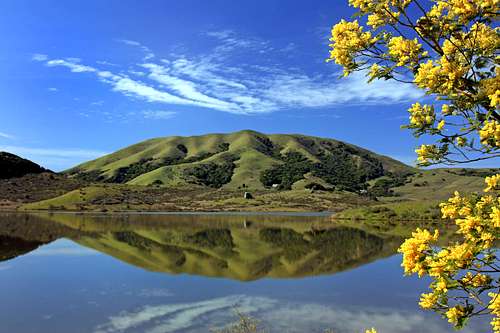
Hicks Mountain from Hicks Valley![Black Mountain from Nicasio Reservoir]() Black Mouintain from Nicasio Reservoir
Black Mouintain from Nicasio ReservoirIt's a 25 mile drive out winding hilly roads to the destination. As I drove by Nicasio Reservoir the hillsides were covered in yellow mustard weed and a small tree was also in full bloom next to the water. I got a few nice shots of Black Mountain in the process. Hicks Valley was also ablaze with mustard weed as well.
Stuff Along the Route Up
![Cow Skull]() Cow skull on the slope
Cow skull on the slope![Cow bones on the hillside]() Cow bones on the hillside
Cow bones on the hillside![The impenitratable thicket at the base of the hike to Three Peaks]() Thicket of obstacles below the slope
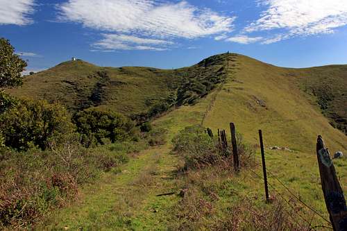
Thicket of obstacles below the slope![Three Peak northwest ridge]() Three Peaks northwest ridge
Three Peaks northwest ridgeThe hike is less than 4 miles round trip from the road up easy slopes. Nevertheless, as is often the case when exploring new terrain mother nature spiced up the approach throwing in a challenge right at the beginning.
After crossing a small field I encountered a nasty thicket of tangled branches and thorny vines that ran along the muddy 10 foot drop to the creek below the northwest slope leading to the peak. There was also a barbed wire fence hidden in the mess. It certainly wasn't worth the effort to bushwack it. I paced up and down for several minutes trying to find a way through to the slope which was literally a stones throw away. Finally I found a small clearing with no fence where the cattle crossed below the branches. Luckily the creek was less than a foot deep from not much recent rain and I was on my way up passing a giant rock that would be easy to spot on the was back.
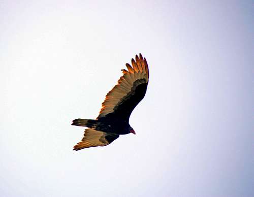
There was some living cattle in sight and a sparse history of the herd was displayed here and there with all manner of cow bones scattered about in places on the hillside. The buzzards circling above probably were descendants of the ones who picked those bones clean in years past.
![Turkey buzzard above Three Peaks]() Turkey Buzzard above Three Peaks
Turkey Buzzard above Three Peaks
Comments
No comments posted yet.