A Quick Hike to the Summit of Throop Peak
On May 3, 2015, I hiked to the summit of Throop Peak in the San Gabriel Mountains, via the trail from Dawson Saddle.
It is a very rare -- if not impossible -- to find a trail near Los Angeles where one can hike to the summit of a 9,000+ peak, with spectacular views from the beginning and throughout the hike, and yet not see a single other soul during the entire trip. Until the very end of this hike, I thought I could boast that I had found one. Alas, at the very bottom of the trail I encountered two hikers ascending. Still, seeing just two people is not bad at all.
My ambitions far outstrip my time, fitness level, and outdoor skills. I dream about hiking to the top of California's majestic mountains all the time, but have two young kids and a job that both demand far more time than I am able to provide. Finding the time for even short hikes, much less long ones, is difficult. Meanwhile I am not a natural athlete and have to work out to be able to hike any trail other than one classified in hiking guides as "easy." My ultimate ambitions for this year include Mt. Baldy and either Mt. San Jacinto or San Gorgonio later in the summer, when, hopefully, I am in better condition.
So, when my kind and understanding wife unexpectedly offered to let me go for a relatively short hike on May 3, I jumped at the chance, but then had to find a hike that fit the bill. The season for climbing the front range of the San Gabriels around Pasadena, near where I live, was drawing to a close. I thought about finally venturing beyond the San Gabriel Mountains, but couldn't find a short enough hike to be worth driving the extra distance.
I eventually settled on hiking to the top of Throop Peak from Dawson Saddle. I was initially a bit reluctant to do this hike, as I had hoped, sometime this summer, to do the popular traverse from Mt. Islip all the way to Baden-Powell, starting at Islip Saddle and ascending Islip, Middle Hawkins, Hawkins, Throop, Burnham, and ending at the summit of Baden-Powell. That entire trip is 17+ miles round trip. It is shorter if one can arrange a car shuttle at Vincent Gap, but still long. Given my time limitations, I decided to drop that plan for now, and just go to Throop, which was both short (about 4.5 miles long, according to Trails of the Angeles), well within my abilities, and with an expected good payoff in terms of views and scenery.
The Old and New Trailheads
Having settled on Throop, I left my house in South Pasadena shortly after 7:00 am. I had to fill gas and grab some snacks for the trip, so I didn't make it to the trailhead until about 8:30 am. Fortunately the drive was early enough that I was able to avoid the annoying traffic that descends on the Angeles Crest Highway during weekends -- a mixture of tourists driving too slow and amateur race-car drivers and motorcyclists who think the road is a race track.
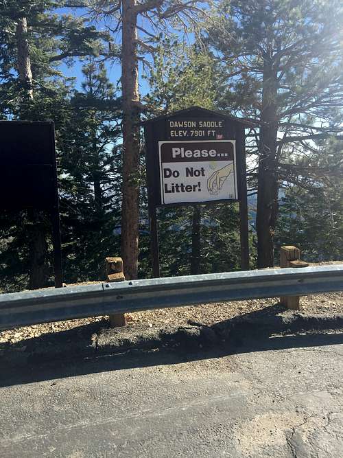
According to the Trails of the Angeles, the trip to the top has recently been reconstructed, but has two separate starting points -- and "old" one and the "new" one. The old one is located directly across from the first (coming from Los Angeles) parking area at Dawson Saddle, while the new one is located a bit further down the road. The first parking area had three parked cars and not a lot of space, so I decided to park at the second parking area, right in front of the sign at Dawson Saddle.
![Sign at Dawson Saddle]() Sign at Dawson Saddle
Sign at Dawson Saddle
![Beginning of the old trail]() Beginning of the old trail
Beginning of the old trail![Old trailhead at Dawson Saddle]() Old trailhead at Dawson Saddle
Old trailhead at Dawson Saddle
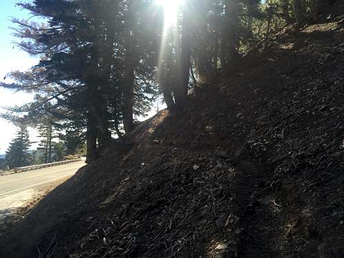
I took the "new" trail on the way down. It is very close to where I parked, just a couple hundred feet at most from the sign. The "new" trail is in better shape than the "old" trail. The beginning of the new trail looks like this:
![New Trail to Throop Peak]() New Trail to Throop Peak
New Trail to Throop Peak![Beginning of the new trail]() Beginning of the new trail
Beginning of the new trail
The Hike to the Junction with the Pacific Crest Trail
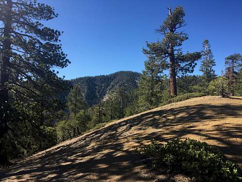
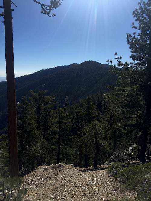
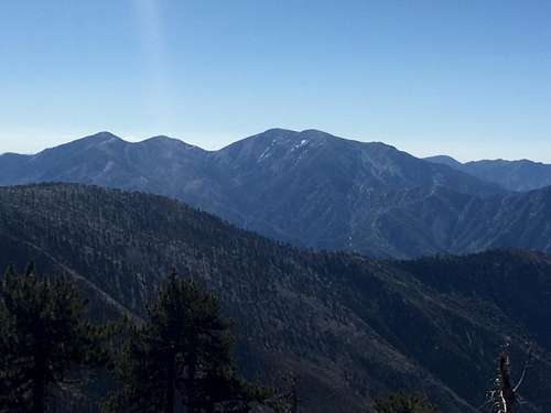
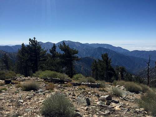
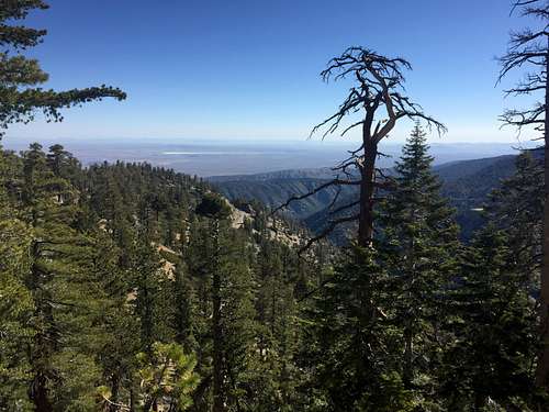
The first 1/4 mile or so was quite steep though not overly difficult, heading nearly due south from the trailhead. The views to the north made this portion easier to bear, with views of Mt. Lewis directly north of Dawson Saddle, Mt. Williamson to the west, and views of the lower northern part of the San Gabriels and the Mojave Desert Beyond. Mt. Islip could also be seen at times.
![Mt. Lewis]() Mt. Lewis
Mt. Lewis![San Gabriel Mountains and Mojave Desert]()
San Gabriel Mountains and Mojave Desert
![Mt. Islip]() Mt. Islip
Mt. Islip
![Mt. Williamson]() Mt. Williamson
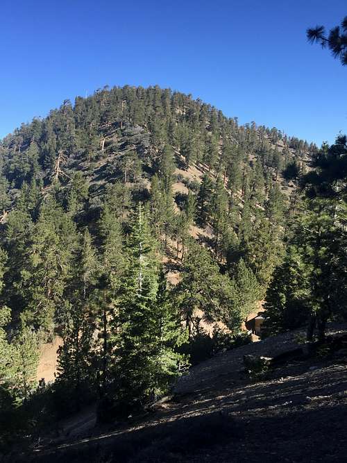
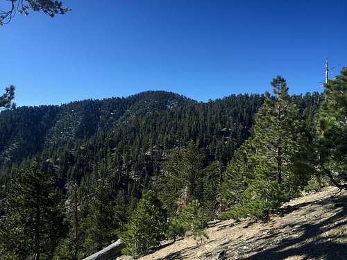
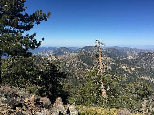
Mt. WilliamsonAbout a 1/4 mile in, the trail joined the "new trail" and proceeded along a ridge heading south toward the northern face of Throop Peak. Throop Peak showed a surprising (to me, at least) but pleasing amount of snow for May in such a dry winter. It later turned out that the trail had very little snow on it, and did not pose any problems. I suspect that, in a more normal winter, this trail would not open up until late May or June. For someone growing up in Idaho and living in the Northern part of the Untied States (after Idaho, New England, Boston, and Chicago) his whole life until 3 years ago, I enjoyed seeing the snow, and it added to the hike.
![Throop Peak]()
Throop Peak![Throop Peak]() Throop Peak
Throop Peak
![Throop Peak]() Throop Peak
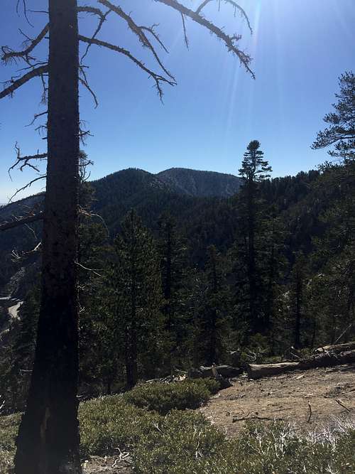
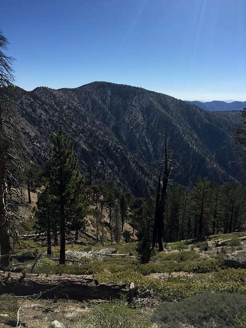
Throop PeakAlong this portion of the hike, views to the west opened up, with good vistas of Mt. Islip, Mt. Williamson, Twin Peaks, and the front range of the San Gabriel Mountains.
![Mt. Islip, Mt. Williamson, and Waterman Mountain]() Mt. Islip, Mt. Williamson, and Waterman Mountain
Mt. Islip, Mt. Williamson, and Waterman Mountain![Mt. Islip, Waterman Mountain, and Mt. Wilson]() Mt. Islip, Waterman Mountain, and Mt. Wilson
Mt. Islip, Waterman Mountain, and Mt. WilsonTo the east, I could see Mt. Burnham, but not, until later, Mt. Baden Powell, which lies directly above this "bump."
![Mt. Burnham]() Mt. Burnham
Mt. Burnham![Burnham and Baden Powell]() Burnham and Baden Powell
Burnham and Baden Powell
Perhaps most of all, I enjoyed being able to see real blue sky -- a nice dark blue hue, just about 30 miles (as the crow flies) or so from Los Angeles. Down in the city and suburbs, this sky color can never been seen.
![Real Blue Sky]() Real Blue Sky
Real Blue Sky![PCT Sign]() PCT Sign
PCT Sign
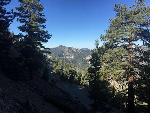
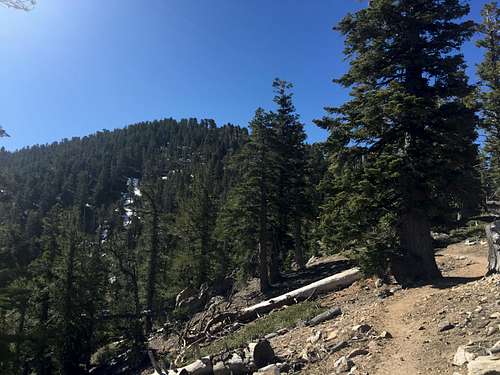
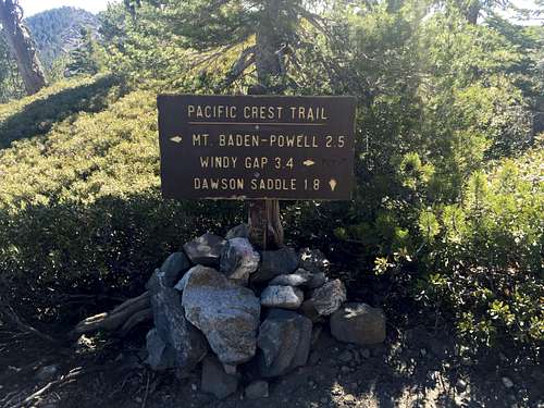
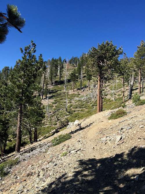
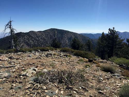
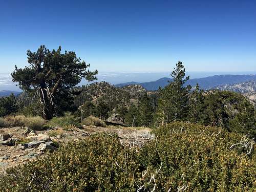
Eventually, the trail reaches the north face of Throop Peak, and turns more to the east, gradually heading uphill until the junction with the Pacific Crest Trail is reached.
From the Pacific Crest Trail to the Summit
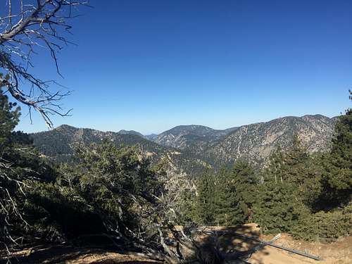
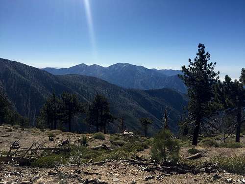
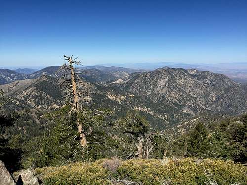
I headed right, toward Windy Gap -- wistfully thinking how enjoyable it would be to go all the way to Windy Gap, but not able to do it that day. Just after the junction, I spotted was a viewing area off the trail to the left (east), with truly spectacular views of Baden-Powell and Mt. Baldy. These views were perhaps the best out of the entire hike.
![Mt. Baden-Powell]() Mt. Baden-Powell
Mt. Baden-Powell![Mt. Baldy from the PCT]() Mt. Baldy from the PCT
Mt. Baldy from the PCT
![Mt. Baden Powell]() Mt. Baden Powell
Mt. Baden Powell![Mt. Baldy]() Mt. Baldy
Mt. Baldy
![Mt. Baldy from PCT near Throop Peak]() Mt. Baldy from PCT near Throop Peak
Mt. Baldy from PCT near Throop Peak
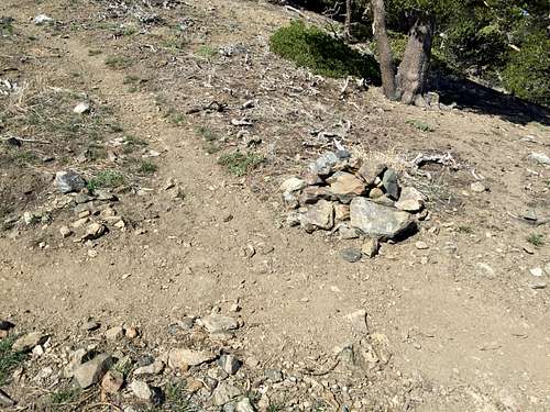
According to Trails of the Angeles, the "old" and "new" trails would soon split again, with the new trail being much easier than the old trail. Soon after the junction with the PCT, and looking for the correct route, I spotted an unmarked junction, with the unmarked trail heading directly to the summit of Throop, and the PCT continuing along the ridge. Mistakenly thinking this trail heading up Throop was the "old" trail - as it was the first trail I saw after the PCT junction -- I continued along the PCT, looking for the new trail. Wrong decision. I kept walking and walking, waiting for the "new" trail to appear. After rounding all of Throop, and seeing the PCT continuing on to Hawkins and beyond, I decided that either I missed the "new" trail, the "old" trail was really the "new" trail, or there had been changes since Trails of the Angeles was last published (but that was in 2013).
![Right way up Throop]() Right way up Throop
Right way up ThroopOn the bright side, the trail was level and enjoyable, and I could now boast that I had hiked the Pacific Crest Trail!
![Pacific Crest Trail near Throop Peak]() Pacific Crest Trail near Throop Peak
Pacific Crest Trail near Throop Peak
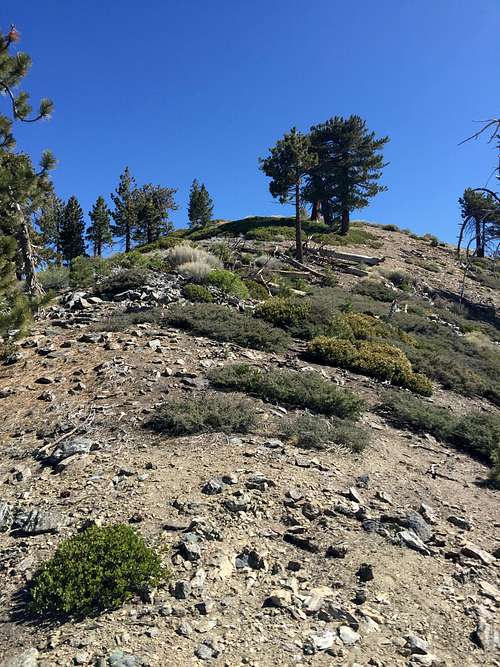
I decided that the time had come for me to head off the PCT and up the mountain. Unwilling to walk back to the last junction, I decided to just walk up the southeast ridge, which was quite doable and didn't even involve much scrambling. I did see scattered use trails, probably from people heading up Throop coming from Windy Gap and Hawkins rather than Dawson Saddle or Baden-Powell, but none were in good shape.
![Wrong way up Throop]() Wrong way up Throop
Wrong way up Throop![Throop Peak]() Throop Peak
Throop Peak
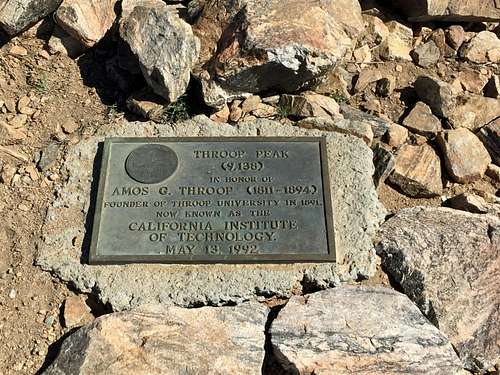
Not long after, I reached the top!
![Throop Peak Summit Placard]() Throop Peak Summit Placard
Throop Peak Summit Placard
The View from the Top
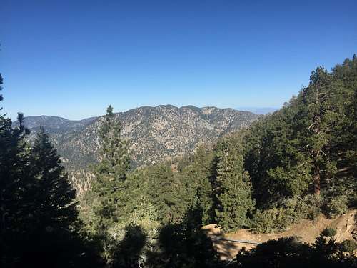
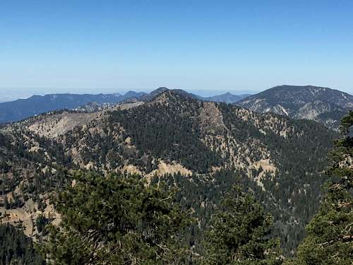
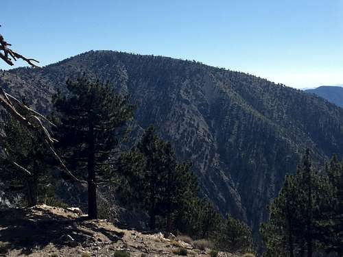
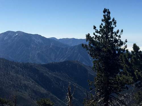
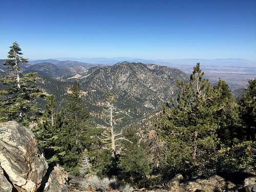
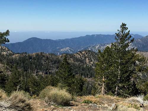
Views from the top were stellar. I was able to see virtually the entire San-Gabriel Range, from Mt. Baldy to the southeast, Baden-Powell to the East, and Islip, Williamson, Waterman, Twin Peaks, Wilson, and the rest of the Front Range to the west and southwest, and Mt. Hawkins and the Hawkins ridge to the south.
![Mt. Baldy]() Mt. Baldy
Mt. Baldy![Baden-Powell from Throop Summit]() Baden-Powell from Throop Summit
Baden-Powell from Throop Summit![Mt. Islip and Mt. Williamson]() Mt. Islip and Mt. Williamson
Mt. Islip and Mt. Williamson![Mt. Williamson from Throop Peak]() Mt. Williamson from Throop Peak
Mt. Williamson from Throop Peak![San Gabriel Mountains from Throop Peak]() San Gabriel Mountains from Throop Peak
San Gabriel Mountains from Throop Peak![San Gabriel Mountains from Throop Peak Summit]() San Gabriel Mountains from Throop Peak Summit
San Gabriel Mountains from Throop Peak Summit
![Mt. Hawkins]() Mt. Hawkins
Mt. Hawkins![View to the Southwest from Throop Summit]() View to the Southwest from Throop Summit
View to the Southwest from Throop Summit
After enjoying the view and a snicker's bar, I headed down. I reached the top around 9:00, and got back to my car at about 9:40. I then went to my office in downtown LA for some quick work, then to an extravagant 2-year old's birthday party (not of one my own), involving a horse carriage, an actress playing Cinderella, and a cake that looked more like a wedding cake than one for a kid turning two. All and all, not a bad way to spend one's Sunday.
Postscript
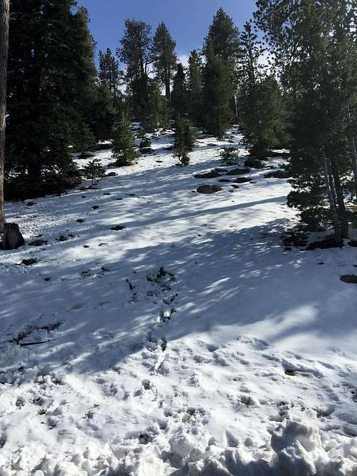
The week after I went on this hike, we had an unusually strong May storm that left some snow on the San Gabriel mountains. The following week, we had an even stronger storm. Because clouds have enveloped the San Gabriel Valley, where I live, I wasn't able to get any views of the mountains from down below to see what kind of snow had been left. On May 16, 2015, I dragged my far-too-understanding wife and kids on a drive through the Angeles Crest highway to check things out up close. I wasn't able to get any good pictures because most of the best photo points were covered in fog. But there was lots and lots of snow. I'm sure this hike would have been impassable without experience in winter travel, possibly including ice ax and crampons.
As mentioned, I was not able to get a good shot of what Throop Peak looked like afterthe storm, but this picture does give some idea of the changes these storms brought to the San Gabriel Mountains just before summer.
![San Gabriel Mountains after May snowstorms]() San Gabriel Mountains after May snowstorms
San Gabriel Mountains after May snowstorms
Comments
No comments posted yet.