
-
 10802 Hits
-
 85.87% Score
-
 21 Votes
|
|
Mountain/Rock |
|---|---|
|
|
34.47675°N / 119.67915°W |
|
|
Santa Barbara |
|
|
Trad Climbing, Sport Climbing, Toprope |
|
|
Spring, Summer, Fall, Winter |
|
|
2800 ft / 853 m |
|
|
Overview

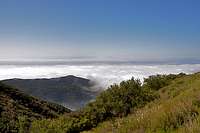
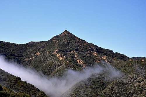
I have written about Gibraltar Rock at length in the past. Once the most accessible rock formations near the road were explored and climbed, it was only natural that the climbers’ attention began to focus on the nearby hillsides for more of the same. Upper Gibraltar was the recipient of that attention and sense of exploration.
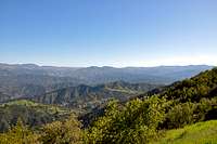
Upper Gibraltar turned out to be a large formation with many possibilities. It consists of a two tier system with a right and a left sides separated by a large chimney. The approach in terms of hiking minutes does not seem unreasonable. The main problem is trudging through steep hillsides covered in poison oak. There was an old brush-covered fire road that became the main approach route for many years, hence it received much improvement. The trail led to the top of Upper Gibraltar Rock. What that meant was that you had to rappel down the face and climb back up at the end of the day. At some point in time, this approach to Upper Gibraltar was abondoned. On my last visit to this area, the fire road was so over grown that I could not find it. Nowadays, the approach is made by following the base of Toxic Waste Wall. Be careful. After Toxic Waste Wall, you may run into a lot more poison oak.
 |  |  |  |
Climbs of Upper Gibraltar Rock

All the approach difficulties aside, a number of climbs have been established on Upper Gibraltar Rock. A few of these climbs became classic must-do’s. The Crescent, 5.7 was established in the mid seventies and still is the easiest of the old classics here. The route follows the obvious crescent shaped crack on the upper tier of the formation.
If you are looking for a more challenging climb, however, you should give “A Route Runs Through it” a try. This climb is rated 10b and climbs past thirteen bolts. Start the route by climbing the bolt-protected lower half of “The Crescent Direct” on the lower tier and continue straight up the upper tier past many more bolts.
The upper tier of Upper Gibraltar Rock offers the cleanest and the best quality sandstone. The abundance of features has resulted in the most number of routes. “A Route Runs Through it,10b, and The Soul, 11b, established by Jeff Buhl and Mike Brown would not have been possible without the quality of the rock on the Upper Gibraltar. Strangely enough, the right side of Upper Gibraltar has stayed virgin territory. I have no doubt the right side will get developed as well. All we need is to erradicate the poison oak on the approach.
| Climbs of Upper Gibraltar | |
| A | Dazed And Confused, 10b, can be done in one, or two pitches. Standard Rack, extra slings, Bolts |
| B | The Crescent, 5.7, standard rack to 3 inches |
| C | Triple Overhang, 5.6, standard Rack to 4 inches |
| D | The Crescent Direct, 5.8, Standard Rack to 3 inches |
| D, again | A Route Runs Through It, 10b. Do the lower part of Crescent Direct, then follow the line of bolts to the left of the wide crack to the top. |
| E | The Soul, 11b, Thin face, 8 bolts |
| F | The Gibbons, 8 bolts, Do the lower part of The Soul, then go right at the bulge. |
Poison Oak

On my last visit to Upper Gibraltar Rock I noticed some poison oak. I am not a doctor and this is not medical advice, however, a tip from a friend has saved my life many time for the past fifteen years. The tip is that if you rub alcohol where you think you may have come in contact with poison oak the oils will break down before they have time to penetrate the skin. I used to carry a small bottle of rubbing alcohol with me for that exact purpose. I am extremely allergic to Poison Oak, and I have not had any allergic reactions since I started this practice.
Camping
Unfortunately, there are no campgrounds close and convenient to Upper Gibraltar.
There is, however, one very large and well developed campground at Cachuma Lake, and a few less developed ones along Paradise Road off Highway 154. There are also a few campgrounds along Highway 101 at El Capitan State Park and Refugio State Park.
El Capitan Beach Camping
Refugio State Beach Camping
Cachuma Lake
How to Get There
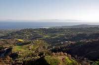
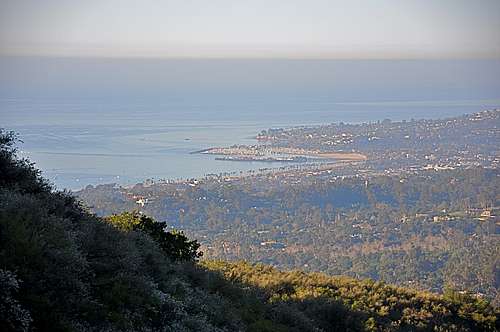
From Highway 101 take the Las Positas off ramp. For those coming from the south turn right; for those coming from the north turn left. In either case, drive toward the mountains to the north of Santa Barbara. Continue up Las Positas for .85 miles to State Street, where the name of Las Positas changes to San Roque. Continue driving straight toward the mountains until you come to HWY 192 (Foothill Road) in another .5 mile. Turn right at the intersection and continue up Foothill Road for 1.9 miles to its intersection with Mountain Drive. Turn left onto Mountain Drive and drive for .5 mile to its intersection with Gibraltar Road. Gibralatr Rock is about five miles from this point. You will recognize Gibraltar Rock located to the west of the road when you begin to see a large sandstone formation immediately to your right (east side of the road). This formation is “The Bolt Ladder.”
A hundred yards down the road from The Bolt Ladder you will notice a steep trail hugging the cliff and climbing up to the base of Toxic Waste Wall. You need to follow this trail past Toxic Waste Wall to where you have to climb a third class section and continue to the base of Upper Gibraltar.