Ammon Hatch
Offline
| Gender/Age | Male, 37 years old |
|---|---|
| Location | Bluffdale, Utah, United States |
| Power | 29 |
| Vote Weight | 58.5% |
| Occupation | Science Teacher |
| Website | http://ammon.azza.org |
A Little About Me
I grew up doing scouting things, and camp outs. I did a few hikes with my family, but nothing much. I always felt like it was something I wanted to do. Whenever I went to Target or another store I would go to sporting goods and look at the tents. I wanted one for some reason, but never got one. I got into the outdoors in June 2003 when I began rock climbing. The decision to finally start into what I had deep down longed to do changed everything.
In early 2004 I found Summitpost and started lurking, and finally joined in June. I owe a lot of how I am now to Summitpost as it changed my attitude towards the mountains. I immediately fell in love with mountains and summits, and started soaking in as much info as I could. One of my brothers wanted to go hiking with me a few months later, and I already had the peak bagging mindset. I got him to hike Sugarloaf Peak with me. It was the first time I planned a trip, collected the data, and summited a peak.
Currently, I am still in the peak bagger mindset. Here is the way I see it: Every peak is on my list. From Mount Everest, to an insignificant bump on a ridge spur, to the hill in your back yard. Every summit is on my tick list, but there is an order to my list. Mount Everest is not towards the top due to difficulty, objective dangers, and cost. The bump on the ridge spur is lower because the parent peak is significantly cooler. And the hill in your back yard is pretty low due to access issues. Every peak is a peak though, and were it possible, I would climb them all.
| SP members I've hiked/climbed with: | jshatch hatchmt elessar highonpeaks Travis Atwood madsjim madjohnbo climbingchic Bruce Christensen Curt RDG marauders Matthew Van Horn kris247 apachedino fowweezer mtn rnr Joseph Bullough MOCKBA lubos ZeeJay Moogie737 GlennMerrill vanman798 jareds sheldonjr(deceased) It has gotten to the point where I��?????��????��???��??��?���¢??m not even sure I met all of these people, but I was among them in a group at one point. This is an exception though, not a rule. |
|---|---|
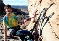
| Partner Details: | Sure. I try to get out on trips planned in the Utah Mountaineering Ongoing Threads (Here is the current one). In the summer I am a very strong hiker and scrambler. I err more to the side of safety when in a tight situation. In the winter I snowshoe, and come spring I like to get out on consolidated snow with my axe and pons. I'm looking to start skiing in the next couple of years. By way of technical climbing, I haven't done so much of it lately but really want to start back into it this spring. I own all my own gear, including a modest TRAD rack. Prefer moderate climbs (ie. Pentapitch, bushwack, beckeys wall), but enjoy it all to some degree. Interested mainly in summiting peaks. Non-summit hikes and cragging is fun too. |
| Favorite Places: |
|
| Outdoors Adventures: | Summits are up to date, everything else is a work in progress. Blue Tags: Summits Red Tags: Points with too little prominence to be a summit. Green Tags: Places I've camped (Backpacking). Teal Tags: Places I've camped (Car Camping). Yellow Tags: Hikes with no summit. Dotted Tags: Favorites. View Outdoors Adventures in a larger map |
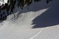
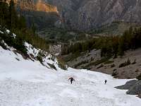
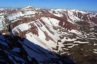
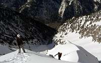
My Images

My Mountains & Rocks (1)
- Rocky Mouth Canyon Peak Wasatch Alpine Ridge
My Routes (2)
- Big Willow Canyon Rocky Mouth Canyon Peak
- West Ridge via Fish Lake Marsh Peak
My Albums (3)
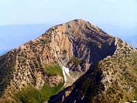
- Broads Fork Twin Peaks - Robinson Variation, September 1, 2007. Broads Fork Twin Peaks
- Lone Peak via Big Willow (Grizz's 100th) Lone Peak
- Triple Traverse - May 16, 2009
My Lists (1)
- Wasatch 11,000 foot peaks Wasatch Alpine Ridge
My Trailheads (1)
- Bells Canyon Trailhead Lone Peak
My Plans
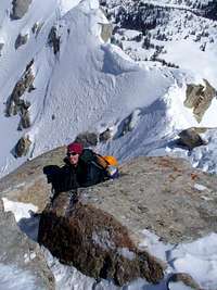
- Lone Peak winter ascent Orson Smith Trailhead -- On Jan 26, 2008
Climber's Logs I've Signed (72)
Mountains & Rocks (67)
- Bighorn Peak (Upper Bells Peak) Wasatch Alpine Ridge
- Murdock Peak Wasatch Range (Central)
- Mill Canyon Peak Wasatch Range (South)
- Ant Knolls (UT) Wasatch Range (South)
- Gannett Peak U.S. State Highpoints
- Thurston Peak Utah County Highpoints
- Frary Peak (Antelope Island) Utah Western Desert Ranges
- Mount Ellen (UT) Utah County Highpoints
- Willard Peak Utah County Highpoints
- Delano Peak (UT) Utah County Highpoints
- Peak 10,420 Wasatch Range (Central)
- Preston Peak Wasatch Range (Central)
- North Peak Wasatch Range (South)
- Tri-County Peak Wasatch Range (Central)
- Red Top Mountain Wasatch Range (Central)
- Pioneer Peak Wasatch Cottonwood Ridge
- Mount Millicent Wasatch Cottonwood Ridge
- Mount Majestic (Clayton Peak) Wasatch Cottonwood Ridge
- Box Elder Peak Wasatch Range (South)
- Grandeur Peak Wasatch Range (Central)
- Rocky Mouth Canyon Peak Wasatch Alpine Ridge
- Mount Whitney California County Highpoints
- North Schell Peak Ultra-prominence Peaks of the 48 States
- Bald Mountain (NV) Great Basin National Park
- Wheeler Peak Nevada County Highpoints
- Flagstaff Mountain Wasatch Cottonwood Ridge
- Scott Hill Wasatch Range (Central)
- Upwop Peak, UT. Wasatch Range (Central)
- South Thunder Mountain Wasatch Alpine Ridge
- Chipman Peak Wasatch Alpine Ridge
- Pfeifferhorn Wasatch Alpine Ridge
- North Timpanogos Mt. Timpanogos (UT)
- Mount Olympus Wasatch Range (Central)
- Circle All Peak Wasatch Range (Central)
- Bald Mountain Western Uinta / Lakes Roadless Area
- Mount Nebo Utah County Highpoints
- Cotopaxi Cordillera Oriental (Ecuador)
- Illiniza Norte (Iliniza Norte) Cordillera Occidental (Ecuador)
- Red Baldy Wasatch Alpine Ridge
- Honeycomb Cliffs Wasatch Cottonwood Ridge
- Borah Peak Idaho County Highpoints
- Lone Peak Wasatch Alpine Ridge
- Kings Peak Kings-Emmons Ridge
- West Gunsight (a.k.a. Dome) Peak High Uintas Wilderness
- Mount Watson Western Uinta / Lakes Roadless Area
- White Baldy Wasatch Alpine Ridge
- Mt. Dromedary Wasatch Cottonwood Ridge
- Broads Fork Twin Peaks Wasatch Cottonwood Ridge
- Sunrise Peak Wasatch Cottonwood Ridge
- Devil's Castle Wasatch Alpine Ridge
- Obelisk (Hogum Divide) Wasatch Range (Central)
- Provo Peak Wasatch Range (South)
- Sunset Peak Wasatch Cottonwood Ridge
- Deseret Peak Utah County Highpoints
- Gobblers Knob Wasatch Range (Central)
- Table Mountain Teton Range
- Mount Wolverine & Mount Tuscarora Wasatch Cottonwood Ridge
- Mt. Timpanogos (UT) Wasatch Range (South)
- Storm Mountain Wasatch Cottonwood Ridge
- Mount Raymond Wasatch Range (Central)
- Notch Mountain Western Uinta / Lakes Roadless Area
- Hidden Peak (Utah) Little Cottonwood Canyon
- Mount Aire Wasatch Range (Central)
- Mount Baldy (UT) Wasatch Alpine Ridge
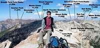
- American Fork Twin Peaks Utah County Highpoints
- Mount Superior & Monte Cristo Wasatch Cottonwood Ridge
- Sugarloaf Peak Wasatch Alpine Ridge
Routes (4)
- Bullion Divide American Fork Twin Peaks
- Triple Traverse Mt. Dromedary
- Beatout - Pfeifferhorn to Bells Canyon Pfeifferhorn
- Circle-All Pk - N & SE Ridges Circle All Peak
Canyons (1)
- Little Cottonwood Canyon Wasatch Alpine Ridge
My Lists
Content loading here...
Messages I Posted/ Editable Objects
Reviews I Posted/Reviews Posted to my Gear
Objects Others Have Attached to My Objects
Content loading here...
Photos Others Have Attached to My Objects
Content loading here...