|
|
Mountain/Rock |
|---|---|
|
|
38.60597°N / 106.36475°W |
|
|
Chafee/Gunnison |
|
|
Mountaineering |
|
|
Summer |
|
|
13024 ft / 3970 m |
|
|
Overview
 Brittle Silver Basin
 Hancock Lakes
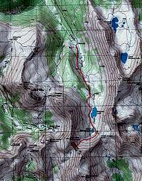
Van Wirt Mountain sits on the Continental Divide south of the ghost town of Hancock in the Sawatch Mountains of central Colorado. To the north, Van Wirt is connected to Point 13102 ft and to the south it connects to Point 13254 ft. To the east, the slopes of Van Wirt go down to a beautiful alpine bowl that houses the Upper and Lower Hancock Lakes (11740 ft & 11660 ft). To the west of Van Wirt, you will find the scenic Brittle Silver Basin which gives rise to one of the branches of the Gunnison River.
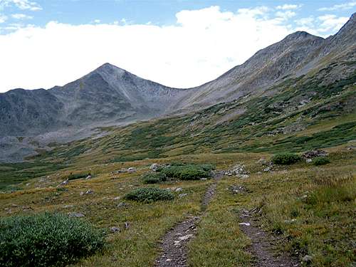
 Van Wirt & Upper Hancock Lake
 Point 13102 ft
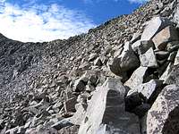 12600 ft Saddle
Van Wirt Mountain can be climbed from the north via the Hancock Pass. From the ghost town of Hancock (11050 ft), you will hike or drive a 4 wheel drive road to the 12150 ft Hancock Pass, where you can hike to the top of Point 13102 ft, descend to a 12750 ft saddle and then ascend again to the top of Van Wirt Peak (see photo).
A more scenic option is to hike or drive a rough 4 wheel drive road from the ghost town of Hancock to the Lower Hancock Lake and then go up the eastern slopes of Van Wirt. Jacobs & Ormes’ “Guide to the Colorado Mountains” says that Van Wirt can be climbed from the Chalk Creek Pass (above the Hancock Lakes). Be ware that if you go to Chalk Creek Pass, you will first have to climb Point 13254 ft and then descend to a 12600 saddle before climbing Van Wirt.
 (R) Van Wirt & (L) Point 13254 ft
 Monumental Peak
 Point 13254 ft
From Hancock Lakes, Point 13254 ft appears as an impressive triangular peak that dominates the view leaving one to wonder why it remains nameless. From the higher slopes, however, it becomes apparent that Point 13254 ft is just a high point on the northern ridgeline of the 13369 ft Monumental Peak (see photo).
 Summit of Van Wirt
From the summit of Van Wirt Mountain you will have good views of some of the southern peaks of the Sawatch Range. The 13743 ft Mt. Aetna appears as a giant peak to the southeast. Some of the more distant 14ers such as Mt. Shavano & Mt. Antero can be seen to the east.
 Mt. Aetna
Getting There
 Upper Hancock Lake
Directions to the ghost town of Hancock:
From the town of Buena Vista drive 8 miles south on Route 285 to a place known as Nathrop and then turn west onto Route 162. Drive this road 15.3 miles to just before the ghost town of St. Elmo (the first 10 miles are paved and the rest is a well graded dirt road).
Turn left onto Route 295. This road is rougher but is still passable by most/any car. Continue 2.7 miles until you see a detour around an old decaying railroad bridge (The detour is rather steep and the road beyond it is much rougher. I did not need to use 4 wheel drive but I will probably not drive this road in anything less than an SUV). Continue another 2.8 miles to the remains of the old mining town of Hancock.
 Alpine Tundra and the Hancock Lakes
Red Tape/Camping
No fees or permits needed for hiking. For other regulations click to see the official San Isabel National Forest Website.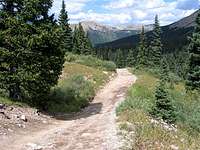 Road to Lake
External Links
Click to see the Forecast for the Town of Buena Vista, CO.