

-
 8842 Hits
-
 80.49% Score
-
 12 Votes
|
|
Route |
|---|---|
|
|
27.80300°N / 15.521°W |
|
|
Via Ferrata |
|
|
Spring, Summer, Fall, Winter |
|
|
Less than two hours |
|
|
Introduction
Gran Canaria, the third largest of the Canary Islands, is well known as a rock climbing destination. What’s less known is that the island has quite a few excellent via ferrata’s, including the longest via ferrata of Spain, La Guagua. The main via ferrata’s on Gran Canaria, worth visiting, are:- Baviera (Ayacata, center of the island)
- Extraplomix, Primera Luna, and Jesús Beitia (all in the Berriel Gorge at the south coast close to San Agustín)
- La Guagua (San Pedro, west coast)
The route is relatively short, as are all the Berriel Gorge via ferrata’s, ascending about 140 m meters from the base to the top. The route is secured by thin iron cables, attached to the bolts. There is an escape route about halfway up the via ferrata.
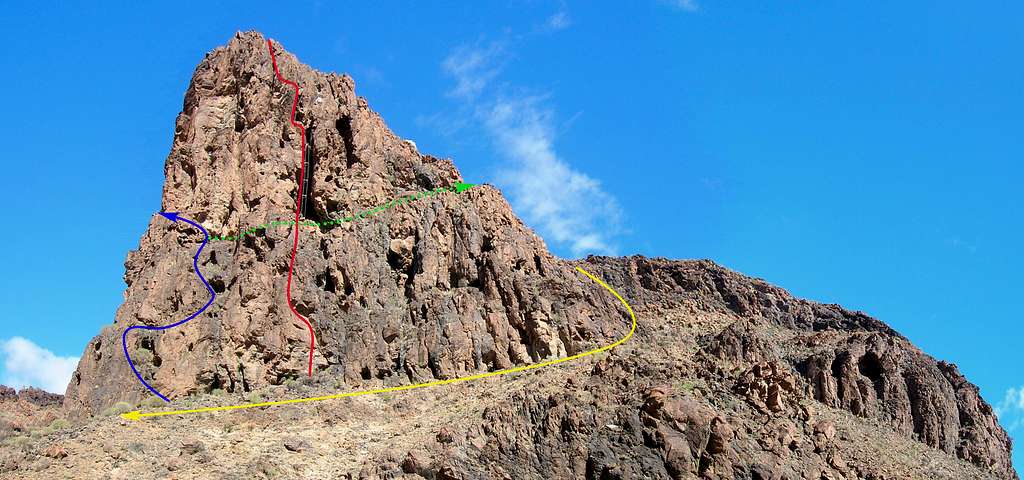
The Berriel Gorge via ferrata's: overview. Primera Luna is the blue route.
Getting There and Where to Stay
The green paddle points at the base of the rock face at the end of El Berriel. Zoom in for a closer view, or Click here to view a larger map
There are frequent flights from many European cities to Gran Canaria, and also a few from Africa.
There are buses all over the island, and connections are good. There is a bus stop at Bahía Feliz on the GC-500, from where the approach takes less than an hour on foot. If you want to be flexible, consider renting a car. We used Cicar.
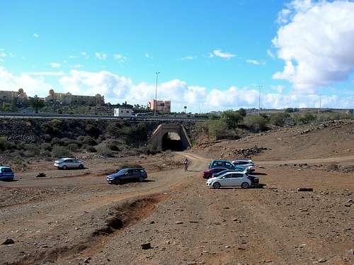 Parking lot at the start of the approach. In the back are some of the nearby hotels and holiday appartment dwellings. | In order to reach the Berriel Gorge, take exit "San Agustín / Bahía Feliz" on the highway GC-1. Drive a minute or so towards San Agustín on the GC-500, until you see "Monte Feliz" written in Hollywood-style on the slope of a hill. There are several hotel buildings atop the hill. Almost past the hill is a pedestrian bridge over the GC-500. When you see this, it’s time to slow down or you'll miss your exit. It's on the right, onto a dirt track 100 m before the bridge and immediately before a bus stop. There's a dirt parking lot right beside the GC-500. You can park there, or drive further to the NE on a dirt road towards a narrow tunnel under the GC-1. Pass through the tunnel and park just a few meters further on an another dirt parking lot. | The paddle points at the turnoff. The bus stop is the structure immediately to its left. Click here to view a larger map |
San Agustín is highly recommended as a base to stay during your adventures at the south coast of Gran Canaria. It has a sandy beach and somewhat less crowded than the popular beaches further west. There are several supermarkets, including a small very easily accessible HiperDino just beside the GC-500, which passes through the town.
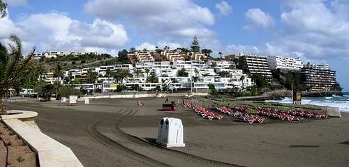
San Agustín Beach: a nice place to take a dip in the Atlantic Ocean after climbing in the Berriel Gorge
Wild camping is officially prohibited anywhere on the island. Overnight bivouacs are at your own risk, use the common sense and keep a very low profile. And, of course, do not leave any trace.
The route is located in the Berriel Gorge (Barranco El Berriel in Spanish), about 30-45 minutes walking from the last parking lot.
Approach
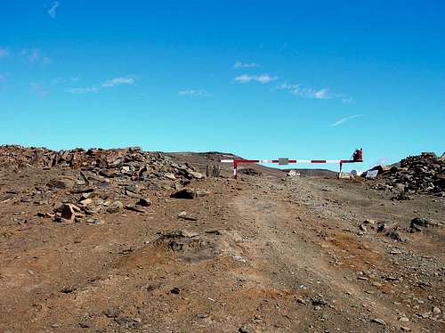
From the parking area behind the tunnel over the GC-1 head straight uphill on a dirt road, which is closed down for public traffic by a metal barrier at the hilltop. Continue further north along the road, towards a dam wall in distance.
The road leads you around a hill to a small flat plain. Upon reaching this flat area you see a marker on a big stone on your left – the green letters VF with an arrow pointing to the left, painted on white background.
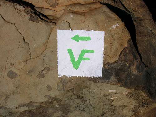
Follow this sign!
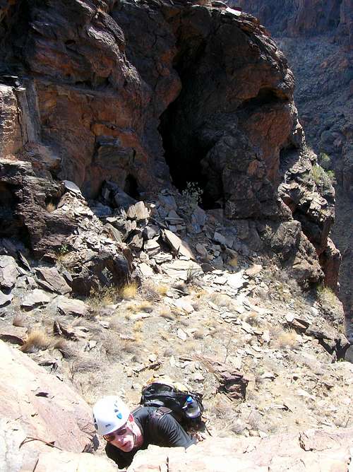
Turn to the left here and follow the 4WD trail for about 700 meters into the Berriel Gorge, until the trail ends with a flat (parking) area. The via ferrata’s are located on a cliff face on your right. Particularly, the Via Ferrata Jesús Beitia can be seen from far away due to its distinctive ladders.
From the flat area walk uphill to the right towards a big overhang. Here the Via Ferrata Extraplomix begins. Continue walking to the right around the cliff face, following an obvious path, until you reach the beginning of the Via Ferrata Primera Luna (marked!).
 Start of the approach route | 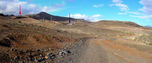 Approach to the Berriel Gorge | 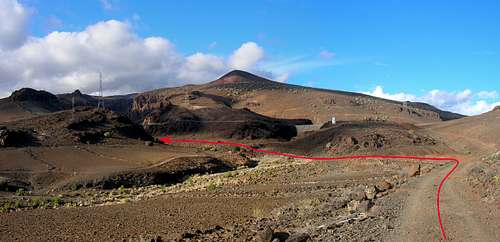 Approach to the Berriel Gorge |
 Approach to the Berriel Gorge | 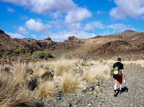 Rob on the way to the Berriel Gorge | 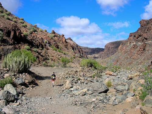 Rob entering the Berriel Gorge |
Route Description
Approaching the start of the Via Ferrata Primera Luna
The vertical stemples section then leads you up to an easier terrain, not secured by cables. It takes a moment to figure out the right direction. We saw a cable further on the left, but there was also one inside a huge crack, while looking straight up. As the crack seemed to be a far more interesting choice, we decided to continue through it.
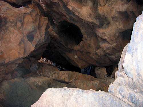
In order to reach the cable inside the crack, walk carefully up a short fairly steep slope of unstable scree towards the base of the crack, which looks like a big cave. Scramble further upwards inside the crack, until you reach the cable.
Obviously birds liked the crack too, as its lower part was covered in bird droppings.
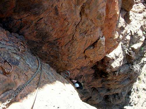
A series of stemples lead you up and through the crack. It is interesting climbing, with the crack providing welcome shade from the sun. Just before exiting from the crack you have to make an airy step over the depth.
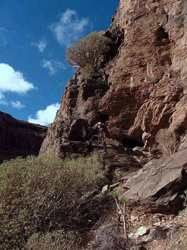
Once out of the crack, walk to the right towards a short fairly vertical wall, where the cabled route continues. This is the last vertical section of the route. After finishing that, it's easy scrambling to the top of the via ferrata by following a vague path over a few rock steps.
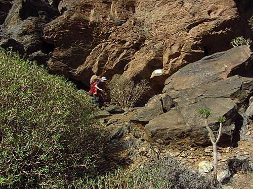
 At the start of the Via Ferrata Primera Luna | 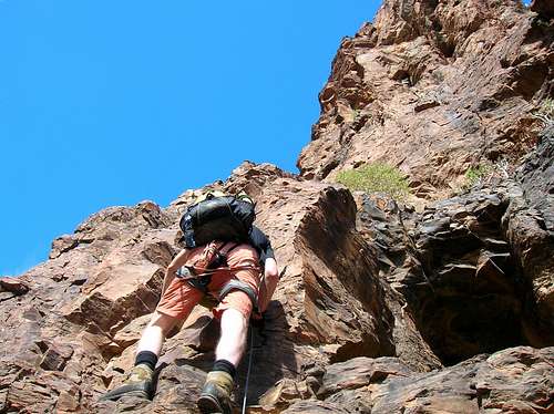 The lower section leads you past a series of caves | 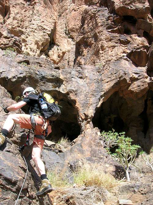 Passing huge caves en route |
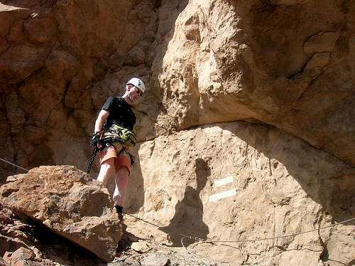 Just before the crux there's an emergency exit route to the right | 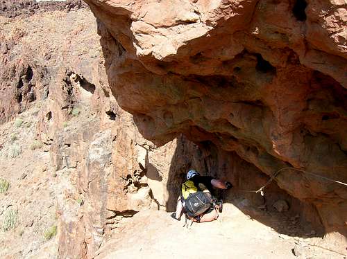 Downclimbing to the airy horizontal traverse | 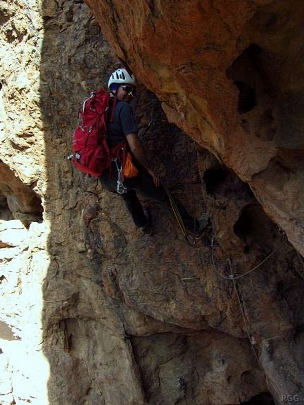 Resting after a complicated move to reach the first stemples after the traverse |
 Looking down at the crux of the climb | 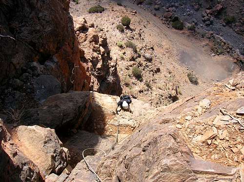 The vertical stemples section above the crux leads to a huge crack, which has to be climbed from inside | 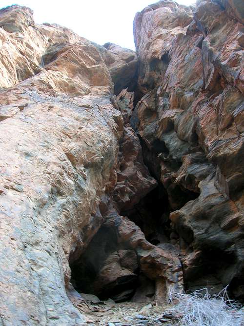 The route continues inside this huge crack |
 Inside the crack, looking down | 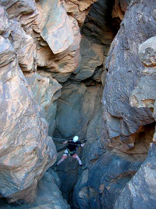 An airy step at the exit from the crack |  Last vertical section as seen at the exit from the crack |
 Rob on the last vertical section. The big dark hole in the background marks the end of the huge crack. | 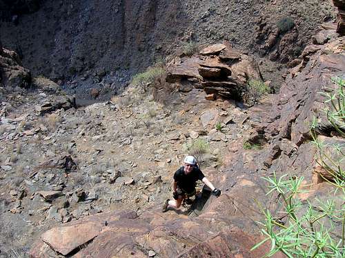 Rob finishing climbing the last vertical section | 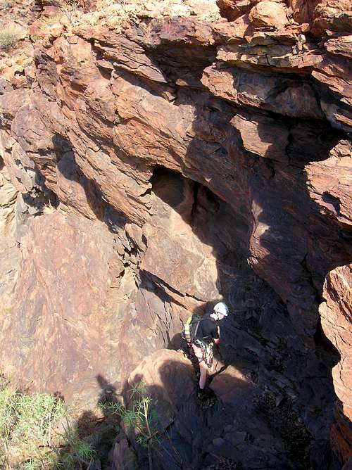 Easy scrambling below the top of the route |
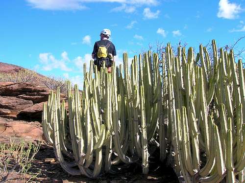 Rob and cacti at the top of the route | 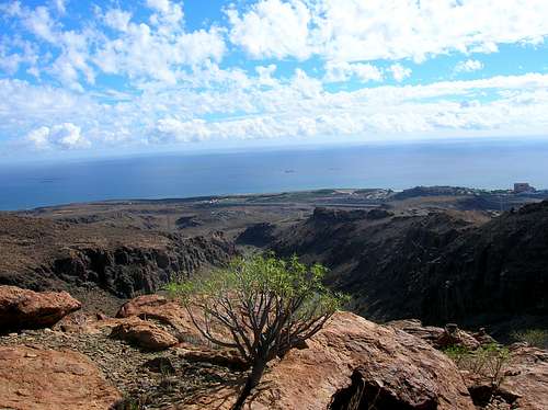 Atop the Via Ferrata Primera Luna, looking south | 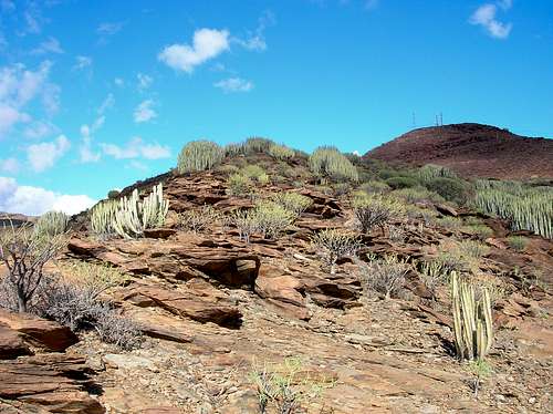 At the top of the Berriel Gorge via ferrata zone |
Descent Route
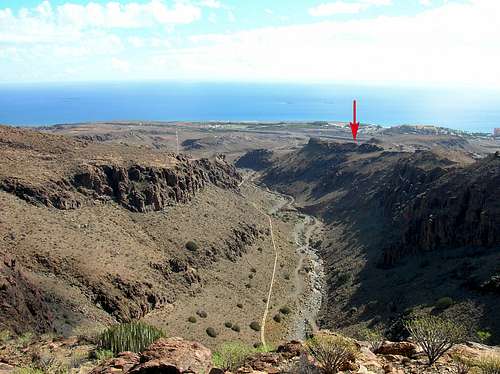
View from the top: the red arrow points at the parking lot
From the top of the Via Ferrata Primera Luna there’s a well marked trail back down to the base of the route.
After topping out on the via ferrata continue slightly further uphill following small cairns. These will lead you to the start of the descent path, which is marked by pale yellowish paint on stones. As the trailhead is a well-trodden path, it's fairly hard to miss.
In the beginning, the path is fairly easy to walk on, descending gently past huge cacti. Further downhill you need to descend a steep gully with fixed ropes in place. Once out of the gully, keep looking for the markers on stones as the terrain is rather rough without a clear path at times. The descent route takes you eventually back to the start of the Via Ferrata Primera Luna, by first passing the start of the Via Ferrata Jesús Beitia.
 Looking back at the first section of the descent route | 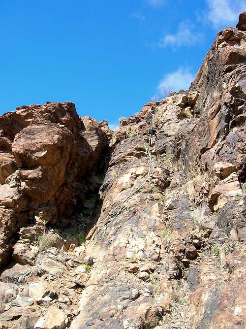 Fixed ropes on the descent route |  Going down involves easy scrambling |
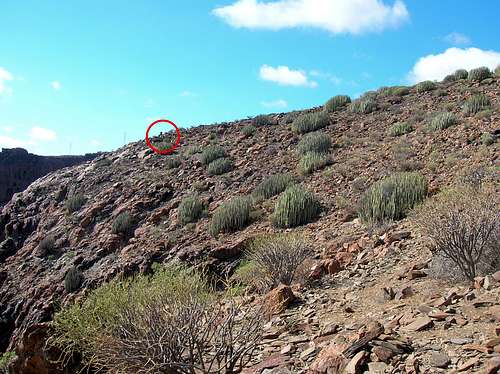
 Rob descending rough terrain | 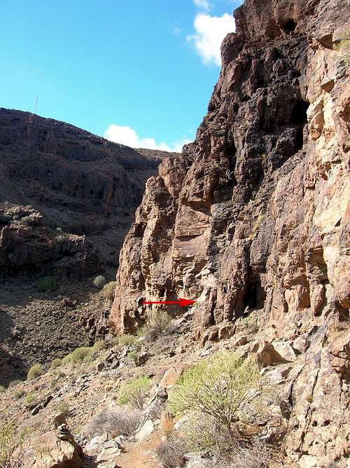 Red arrow points at the start of the Via Ferrata Jesús Beitia. A little further is the start of the Via Ferrata Primera Luna. |
Recommended Gear
Take the standard via ferrata kit, including a Y-shaped lanyard with 2 carabiners, harness, and helmet. Leather via ferrata gloves are highly recommended. An extra quick-draw is useful for occasional rest breaks on the most difficult sections.External Links
- A Spanish site of the Via Ferrata Primera Luna with the route description, GPS and Google Earth track. This page contains also a very nice aerial overview map of the routes in the Berriel Gorge via ferrata zone.