

-
 34387 Hits
-
 92.85% Score
-
 40 Votes
|
|
Area/Range |
|---|---|
|
|
27.96226°N / 15.58404°W |
|
|
Hiking, Trad Climbing, Sport Climbing |
|
|
Spring, Summer, Fall, Winter |
|
|
6401 ft / 1951 m |
|
|
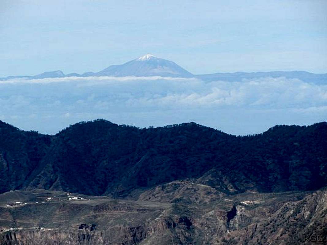
1 - A Minature Continent
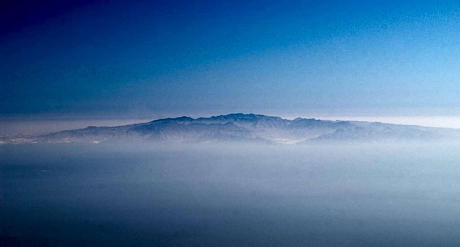 Gran Canaria as seen from Tenerife
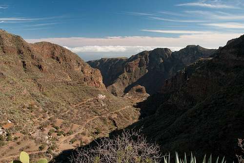
Gran Canaria is the third largest island of the Islas Canarias, after Tenerife and Fuerteventura. It also is the third highest with Pico de las Nieves barely missing the 2000m mark. With Roque Nublo and Roque Bentayga, two former volcanic plugs, it has two of the most impressive rock towers and with Caldera de Tejeda one of the largest craters of all the Canary Islands. Thanks to its size it offers quite a number of good hiking routes and the central highland around Roque Nublo is home to some of the best climbing of the archipelago. Gran Canaria shares a lot of history with La Gomera in the west. Both islands were created about 15 million years ago along a rift zone between the North Atlantic and North African tectonic plates. In both cases large stratovoclanoes rose out of the sea reaching heights of more than 2000m. For Gran Canaria this formation period took abut 6 million years until 9 million years ago. Many years later the volcano collapsed, creating the huge crater of Caldera de Tejeda, which at 20km in diameter is one of the largest craters of the Canaries. Further eruptions, between 3.5 and 4.5 million years ago changed the aspect and for the last 3 million years erosion was the most important factor in forming the current landscape of the island. The last eruption took place about 2000 years ago, when Caldera de Bandama in the north-east of Gran Canaria erupted. Weather, in particular the trade winds have had a large impact on Gran Canaria. Northeastern winds bring a lot of moisture which is deposited on the north-eastern slopes of the island. Therefore you will find a green agricultural area in this part of the island while the south-east as as dry as it can get. Also, the many barrancos have been formed by the erosive forces of water and while in the north smooth forms prevail in the south there are deep gullies and canyons. Gran Canaria is best known as a tourist location, thanks to its many beaches on the south and west coast. However, especially in the central part and right around Caldera de Tejeda there are quite a number of good and interesting hiking routes. The best trailheads are Tejeda on the (eastern) inside of the crater, serving the Roque Nublo and Pico de las Nieves areas and Artenara on the northern rim, which serves the Tamadaba Range and the northern highlands. Less known is Mogan in the south-east with its Laderones walls beneath Montaña de Tauro. As for climbing, the logistical centre is the hamlet of Ayacata (or rather its single inn) to the south of the central highlands. It is located at a three way road junction beneath impressive basalt walls. Roque Nublo is only a few km to the north and right around wonderful walls can be found. Also, in the Tamadaba range several good walls can be found and the volcanic plugs within Caldera de Tejeda – like Roque Bentayga or Roque de Palmes also are popular destinations.
2 - Gran Canaria on SP
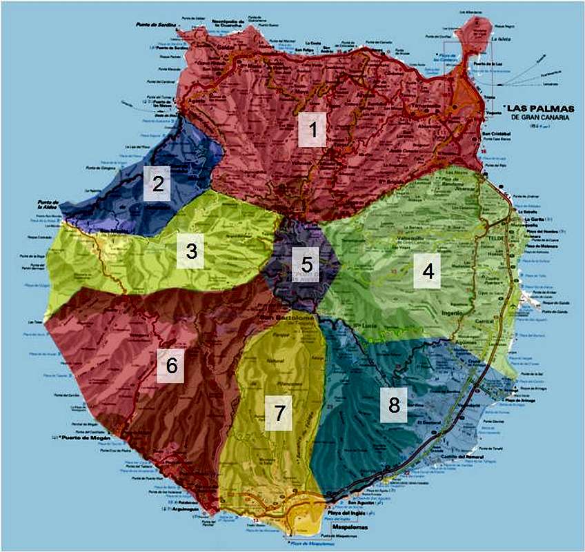 Interactive Overview Map of Gran Canaria. Click on the number to go to the relevant chapter. |
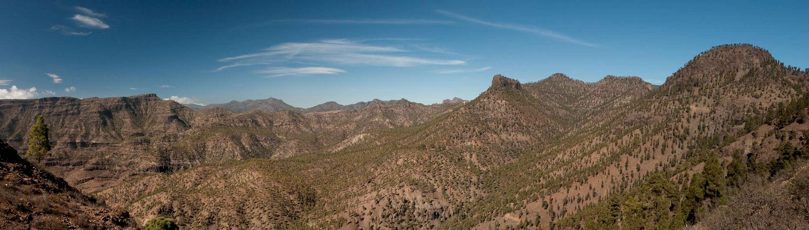
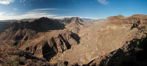
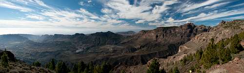
Gran Canaria, like La Gomera cannot be easily divided into different mountain ranges. In general there are two, The Tamadaba Range in the north-west of the island and the Plateau between Roque Nublo and Pico de las Nieves in the centre. There are two huge craters, the Caldera de Tejeda in the east (a real crater) and the Caldera de Tirajana (a huge erosion zone) in the south. Both almost touch eaach other at the island's highpoint, Pico de las Nieves. The remainder of the island consists of erosion valleys, between which you can find broad ridges, on which you can find occasional impressive summits or – more likely – near vertical barranco walls. This page divides the island into 8 zones, more or less following the existence of natural or regional parks, extending the latter boundaries a bit.
- The North
- Tamadaba Range
- Caldera de Tejeda
- The East
- Monumento Natural del Roque Nublo / Pico de las Nieves
- The South West
- Parque Natural de Pilancones
- The South East
3 - The North
The northern part of the island receives a sizeable amount of rain, thanks to the trade winds and thus is intensively used for agriculture. There are a couple of barrancos, through which interestink hiking trails lead, starting near the coast and ending in the central highlands. A number of sports climbing areas are located in these barrancos, notably Barranco de Moya. Also, in the far north-west, several coastal trails can be found.
4 - Tamadaba Range
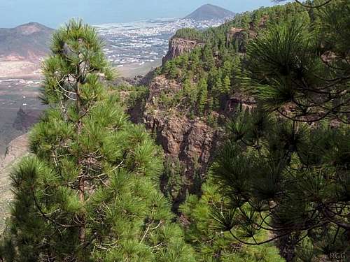 Looking down to Las Palmas from the Tamadaba high ground
The Tamadaba Range in the north-west of Gran Canaria is the only real mountain range of the island. It is bounded by Barranco de Agaete in the north, Barranco de la Coruna in the east and the large Caldera de Tejeda in the south. Its highest mountain is Montaña de Tamadaba at 1444m. The mountain is embedded in a large forest of Canarian pines, one of the biggest of the island. The forest and together with it the whole range have been protected by the Parque Natural de Tamadaba. Park regulations restrict activities to the roads and hiking trails within the park limits. The cliffs around the campground high up in the park offer great sports climbing.
 Altavista de Gran Canaria
Arguably the most important mountain is Altavista de Gran Canaria, a rim mountain of Caldera de Tejeda. Thanks to its forward location, Altavista is one of the best lookouts for viewing neighbouring Tenerife. To the north of the Range, Roque Bermejo a small tuff mountain can be found. It is famous since a sanctuary of the Guanches the pre-hispanic inhabitants of the Canary Islands can be found on its summit.
 Tenerife, with Pico del Teide, from Gran Canaria
5 - Caldera de Tejeda
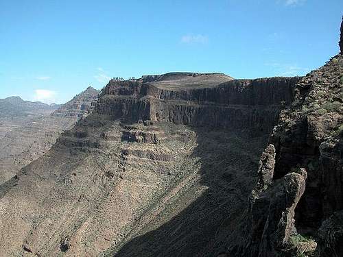
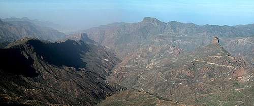 Caldera de Tejeda as seen from Tablon del Nublo
As mentioned in the Overview section, Caldera de Tejeda is the crater left over from the original volcano, which created Gran Canaria, millions of years ago. The crater is huge and bounded by impressive walls, mainly to the north and the west. Erosion has taken its toll and opened an outlet to the Atlantic Ocean in the west, where in present day you can find the coastal town of San Nicolas de Tolentino.
 Roque Bentayga
Unlike the northern part of Gran Canaria and the Tamadaba Range, the Caldera de Tejeda is a very dry region. Before reaching it the trade wind clouds have already been “milked” by the higher mountains around, leaving only the water which trickles into the crater by creeks from the caldera rim. Several reservoirs have been created in the western part of the crater, right before it narrows into the canyon, which is its outlet to the sea. This canyon is the most profound one on Gran Canaria, with its walls rising for almost 1000m towards the caldera rim. All around the caldera you can find impressive cylindrical rocks, leftovers from the original volcanic eruption. They are the remnants of funnels, made up from basalt, which was much more solid than the loose volcanic eruption material (cinder, ashes) which has already eroded and been washed away to the sea. Roque Bentayga is the most famous of these rocks, a standalone tower, which used to be a place of worship for the original Canarian inhabitants, the Guanches.
6 - The East
On the east side of the island, the coast is less interesting from a hiking and climbing perspective. It's home of the international airport, villages and small cities, many not particularly scenic. But you don't have to go far inland, and the scenery soon improves dramatically.
 The crater of Caldera de Bandama
In the north-east of this sector you can find the youngest volcano of the island, Caldera de Bandama, which was created roughly 2000 years ago. It is a short but popular hike with its highpoint, Pico de Bandama (available by car) overlooking the north-western part of the island. Inside the caldera a single shepherd has been living and caring for his stock for many decades. He and the buildings he lives in are part of the attraction of the crater. The hiking trails in and around the central highlands all date back to the 16th and 17th century when they were created to connect the local villages. The most important of these is the connection of Vega de San Mateo with Gran Canaria's highpoint, Pico de las Nieves.
 Barranco de Guayadeque
One particularly attractive hiking area is Barranco de Guayadeque, with the very scenic village of Aguïmes at its southeastern entrance.
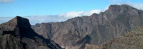
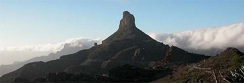
7 - Monumento Natural del Roque Nublo / Pico de las Nieves
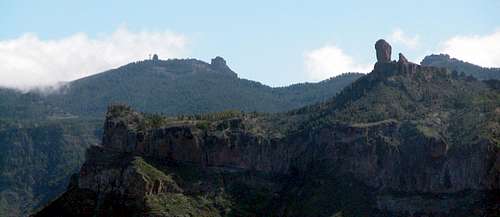 Pico de las Nieves (left) and Roque Nublo (right)
Between Caldera de Tejeda and Caldera de Tirajana you can find a small but important high plateau. It contains the best known mountains and rocks of the island, Pico de las Nieves and Roque Nublo. The former, Gran Canaria's highpoint, is a pine covered, round-topped mountain, the summit of which is off limits due to a radar station placed on its top. Roque Nublo, on the other hand, is Gran Canaria's most famous volcanic plug, the island natural landmark. It is placed on a small plateau, directly above Caldera de Tejeda and thus commands wonderful views.
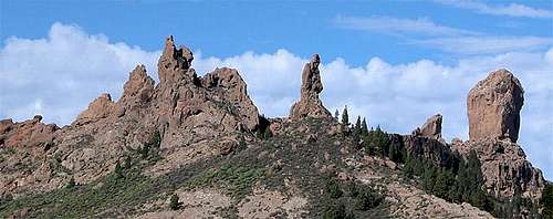 Roque San Jose, El Fraile (The Friar) and Roque Nublo
Roque Nublo also is the main attraction for climbers though the mountains to the south-west of it, mainly Montaña del Aserrador, are also known for their interesting routes. Ayacata, a small hamlet in the very south of the plateau, is the climbing centre of the island, thanks to its location between several climbing walls. Its only inn serves as logistical center for the climbing community.
 Rock face near Ayacata
8 – The South-West
 Los Laderones
The south-west of the island is the driest part of Gran Canaria. Apart from a few roads, which have been built to accommodate banana plantations, not much can be found here. The banana plantations are provided with water from large reservoirs in the north-east of the triangle and which also serve as kind of recreation centres. Though swimming is not allowed along their banks you can find small holiday settlements. An interesting part of the south-western sector is the south-side of Barranco de Mogan. Here huge walls rise out of the barranco, the so-called Laderones, which tower above the village of Mogan. They belong to the massif of Montaña de Tauro and have been protected by a natural park. The hiking trail along the top of the walls with its steep decent to Mogan belongs to the most important hikes of the island.
9 – The South
 |
 Barranco de Fataga
The southern sector, a narrow wedge between Barranco de Arguineguin in the west and Barranco Fataga in the east, is the back country of Gran Canaria's most important tourist town Playa del Ingles. There are several hiking trails along the barrancos, most of which follow wide dirt roads. The northern part of this sector has been protected by the Parque Natural de Pilancones, mainly because of the population of Canarian Pines. These had been severely diminished in the 19th and early 20th century as firewood for the cane sugar plantation, operated on the island at that time. This area is part of the municipality of San Bartolomé de Tirajana, by area the largest municipality of the island. Although only a fraction of the current population lives there, the small but pretty historic village with the same name is still the official capital of the municipailty.
 Maspalomas
From the 1970s onwards a huge reforestation program has taken place in the area, in which millions of pines have been planted. Towards the centre of the island you can see the results with large, though thinly populated forests, while to the south there are only young trees to be found. In the very south the region gets extremely dry with only little vegetation in the barranco floors. In the southernmost part of the island, beyond Playa del Ingles, you will find the sand dunes of Maspalomas, also set aside in a natural preserve, the Reserva Natural Especial Las Dunas de Maspalomas. It is one of the major natural attractions of Gran Canaria. However, where the dunes do not border on the ocean, they are completely surrounded by sprawling villages filled with sun and nightlife seeking tourists, and the many that visit the dunes put a heavy burden on the area.
10 – The South-East
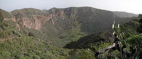
 Caldera de Tirajana
The main natural feature in the southeast is the Caldera de Tirajana. Unlike its western counterpart, the Caldera de Tejeda, this one is solely formed by erosion and thus offers a completely different aspect. Big, overgrown walls drop from the central highland into a sloping plane with several valleys cutting deep into the landcape, the biggest one being Barranco de Tirajana. The area offers some fine climbing and hiking opportunities. In the highlands, the main village is Santa Lucia de Tirajana. The coast is touristically used, a bit more inlands you find a mixture of barren lands, a few farms and plantations. The most interesting spot is Lomo de los Letteros, where you can find prehispanic rock drawings.
11 – Rock Climbing
 Roque Nublo
Of all the Canary Islands, Gran Canaria is the best one to go to if you want a climbing holiday. And since it's a year round destination, it's an excellent choice when elswhere the temperatures start dropping, and the days are getting shorter. You can choose between traditional routes, areas with short, bolted sports route and a number of fine Vias Ferratas. On warm days there are always possibilities higher up, and on cold days there are plenty of venues near the coast.
11.1 - Sports Climbing
Without a doubt, the best area for sports routes is Tamadaba. In this Natural Park, the cliffs around the campground have hundreds of bolted routes at all grades.
 Rock climbing at Fataga
Vying for second place are three areas. Two of those are in the south, where the climate is generally dry. My favorite is the one near the small sleepy village of Sorrueda. Just outside the village the valley floor narrows down to a canyon, and the walls have about 100 routes. In 2013, there were some very recently added new ones, and there is plenty of room for more. A slightly smaller area, also with about 100 routes, is Fataga. It's located near the main road, just south of the village of Fataga. There is less room to put up more routes here. On the north coast, the biggest area is Barranco de Moya. From the road, it's a 10 minute walk into the canyon to get to the first cliffs. The north coast of the island is where most people live, and this area is easy to reach from the larger population centers. Some other climbers we met there told us that occasionally cars left at the roadside were broken into, and I suspect that the fact that there are a lot of people living not all that far away has something to do with that. A smaller but definitely the most spectacular area is Roque Nublo, which offers several bolted multipitch routes. The easiest way up the main rock is 6a+ (French) / 5.10c (YDS), but there are a number of easier routes up Roque Rana, the smaller rock directly next to it. And there are many more smaller areas. For more information, see Climb in Canarias.
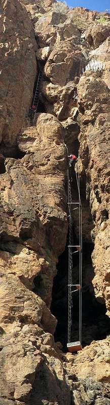 Jan (and Jan again) on the airy ladders of Via Ferrata Jesús Beitia
11.2 - Vias Ferratas
A number of fine routes have been constructed on the island. I don't know about any easy ones, but several are fine if you have climbed before. A trio of routes is near the end of Barranco El Berriel. While not suitable for beginners, but two of them are not too hard. Try your hand at Jesús Beitia, Primera Luna or both. In contrast, the third one, Extraplomix, is a very difficult one. Fortunately it begins with an overhang, and that will certainly stop the unprepared. A very long and exposed one, reputedly one of the finest in Spain, is La Guagua. You'll need good weather - i.e. no rain and not too much wind. We were unlucky in that department. In the center of the island, right next to Ayacata, Via Ferrata Baviera ascends steep rockface. The crux is at the start; if you make it up the first 10 meters, you have what it takes to do the rest as well.
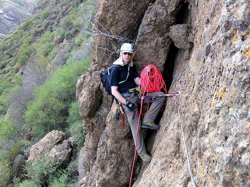
11.3 - Traditional Climbing
The most popular area is around the tiny village of Ayacata. That said, there are cliffs and sheer rock faces all over on the island. Your imagination is the only limit - well, that and your climbing skills perhaps.
 On Via Ferrata Baviera
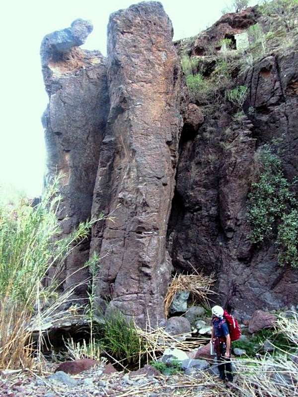 Rock pillars in Barranco de Tirajana, near Sorrueda
12 – Traffic and Accommodation
Gran Canaria has an international airport on its east coast, which is served by all major Europeaan charter carriers. Of course you can find a lot of hotels, fincas and casas on the island which you can book from any travel office. Those of you who prefer to camp are in for a pretty cumbersome process. There are two official campsites, both at sea level in the south of the island. There are a few camping zones in the central part of the island. One is at Tamabada, another one is at Llanos de la Paz between Roque Nublo and Pico de las Nieves. You can camp for free in these camping zones. The facilities are very basic. At most of them there are toilets and there is drinking water, sometimes fire pits. But you need a permit! Somewhat inconveniently, you have to get your permit in Las Palmas (don't forget your ID). The address: OIAC Cabildo Insular de Gran Canaria Medio Ambiente Pérez Galdós 53 35003 Las Palmas At OIAC they administer the following campsites
- Zona de acampada Alto del Morro de Santiago (San Bartolomé de Tirajana)
- Zona de Acampada Alto del Pozo (Vega de San Mateo)
- Zona de Acampada Bailaderos (San Bartolomé de Tirajana)
- Zona de Acampada Bailico (Tejeda)
- Zona de Acampada Corral de los Juncos (Tejeda)
- Zona de Acampada Llanos de El Salado (Vega de San Mateo)
- Zona de Acampada Llanos de la Mimbre - Tamadaba (Agaete)
- Zona de Acampada Llanos de la Pez (Tejeda)
- Zona de Acampada Los Garajes de la Cumbre (Gáldar)
- Zona de Acampada Montaña de Artenara (Artenara)
- Zona de Acampada Presa de la Cueva de las Niñas (Tejeda)
- Zona de Acampada Roque García (Artenara)
- Zona de Acampada Secadero de Cruz Grande (San Bartolomé de Tirajana)
- Zona de Acampada Vivero de Tirajana (San Bartolomé de Tirajana)
13 – Red Tape
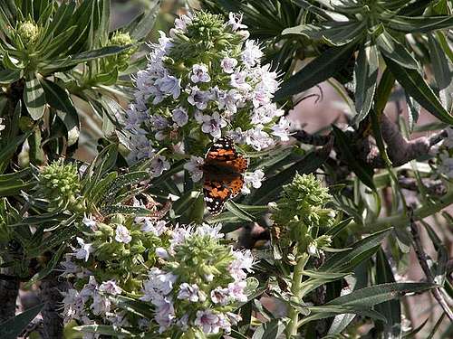 White Taginaste with Painted Lady
On Gran Canaria you can find all types of red tape. While the eastern half of the island is densely habitated and there are no restrictions to speak of, the centre of the island, Caldera de Tejeda, the Tamadaba Range and much of the southern highlands have been declared natural parks or monuments. In these parks accommodation (camping) is restricted to the designated sites (see above) and activities are limited to hiking along the designated trails. Gran Canaria is a climbers' island with many locations all across the place. There used to be some red tape if you wanted to go climbing, but by 2013 no permits were required anymore - provided you don't start bolting new routes.
14 – Weather Conditions
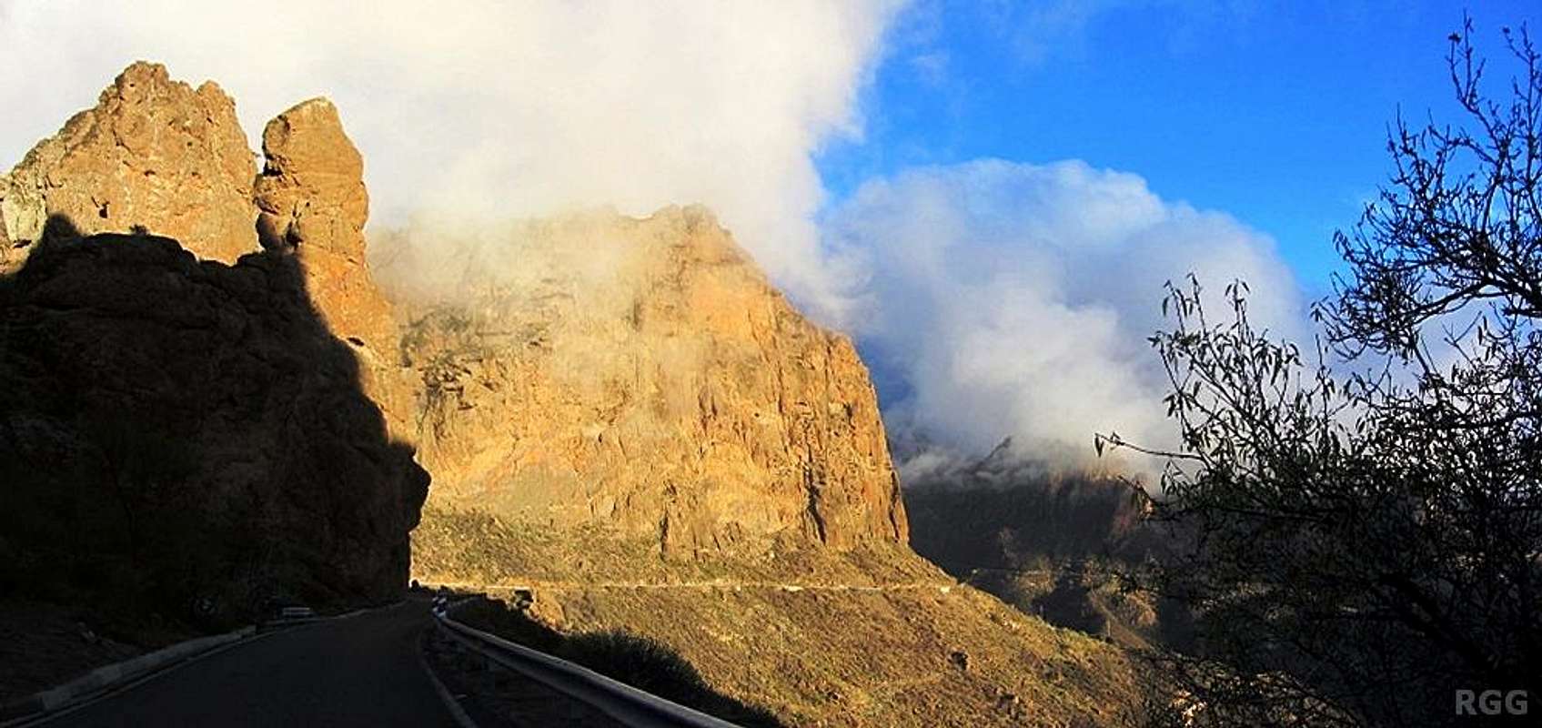
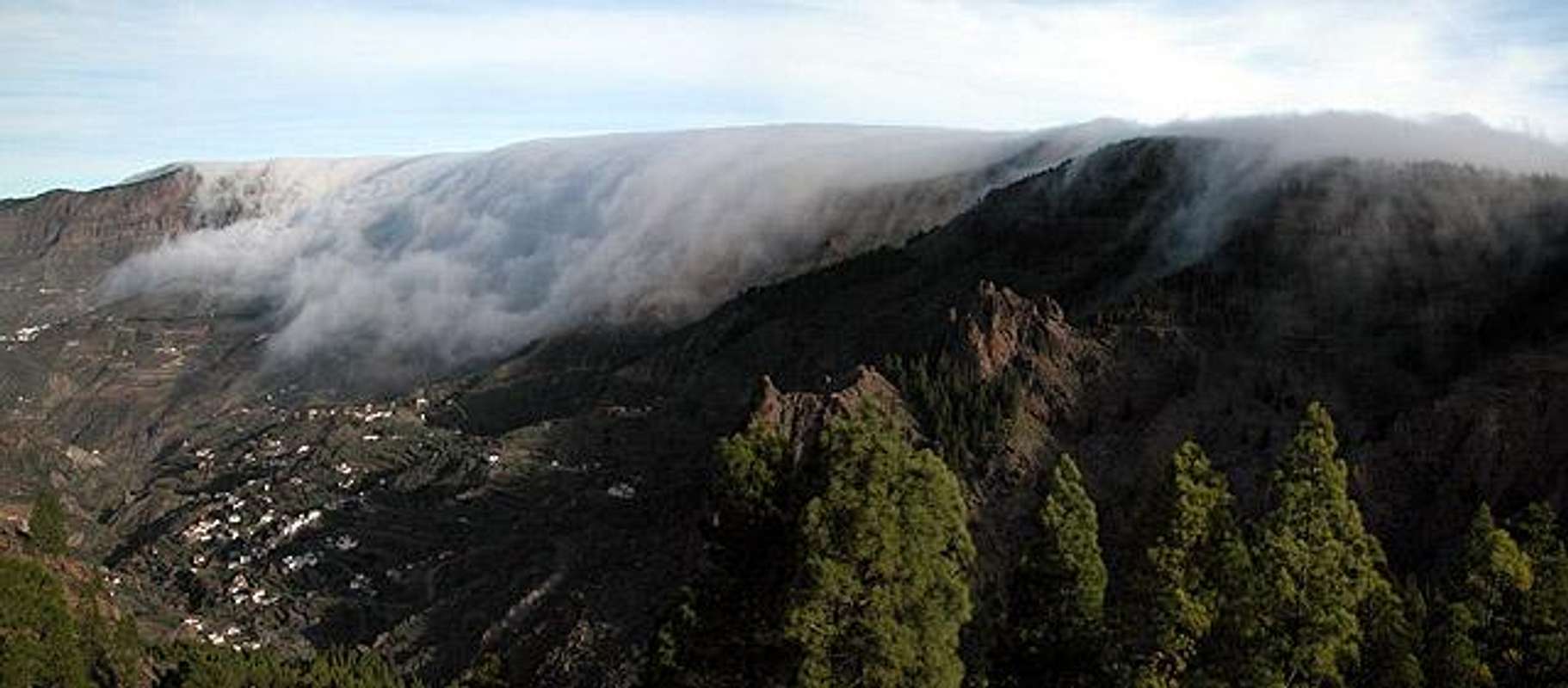 Trade wind clouds flowing across Caldera de Tejeda
The following table gives a rough general overview over the weather on Gran Canaria, at sea level.
| Month | Jan | Feb | Mar | Apr | May | Jun | Jul | Aug | Sep | Oct | Nov | Dec |
| Avg. day temp.[°C / °F] | 21 / 70 | 21 / 70 | 22 / 72 | 22 / 72 | 22 / 72 | 23 / 73 | 24 / 75 | 25 / 77 | 25 / 77 | 25 / 77 | 24 / 75 | 22 / 72 |
| Avg. night temp.[°C / °F] | 16 / 61 | 16 / 61 | 16 / 61 | 17 / 63 | 16 / 61 | 17 / 63 | 18 / 64 | 20 / 68 | 20 / 68 | 18 / 64 | 18 / 64 | 17 / 63 |
| Water temp.[°C / °F] | 19 / 66 | 18 / 64 | 19 / 66 | 19 / 66 | 19 / 66 | 20 / 68 | 22 / 72 | 23 / 73 | 23 / 73 | 23 / 73 | 21 / 70 | 20 / 68 |
| Rainy days | 4 | 3 | 2 | 2 | 1 | 1 | 1 | 1 | 1 | 3 | 3 | 3 |
The Canarian Islands (as well as Madeira) are located in the trade wind zone. You almost always encounter northeastern winds which carry a lot of humid air. Being forced to climb to higher altitudes this moisture condenses into clouds. This in return means that most of the time the northeastern part of the islands is covered in clouds from altitudes of 1000m through 1500m.
The mountainous region in the centre of the island is of the same alltitude and higher and thus stops the clouds. While the northern parts of the islands can be foggy and rainy the southern parts most often are sunny and hot. On Gran Canaria the north-eastern part of the island collects almost all moisture. However, unlike on the other Canary Islands no cloud forest remains. The laurisilva fell victim to the agricultural development of the island.
15 – Maps & Books
15.1 – Regular Maps
- Gran Canaria Kompass Map WK237 Kompass Verlag 1:50000 ISBN 3-85491-114-9
15.2 - Digital Maps
Kompass is the only company known to me which offers GPS digital Maps. In addition for those of you with Garmin GPS receivers there is a map source map set of all Canary islands out there.
- Gran Canaria Kompass GPS4237 Kompass Verlag ISBN 978-3-85491-219-4
- Islas Canarias Map Source custom map By Manfred Pepper downloadable zip-file
15.3 - Books
A fine guidebook is published by Rother Verlag, available in English and German. The book is an excellent hiking guide covering all the interesting areas of the island. Since it comes with small maps for each excursion it might even be used without a map to support them.
- Gran Canaria Izabella Gawin Rother Verlag ISBN 978-3-7633-4816-9 (English) ISBN 978-3-7633-4000-2 (German)
If you come for sports climbing, there is one very good book, and it's definitely a must have. It describes how to get to all the areas, and features many clear photos of all the rock walls and climbing routes.
- Gran Canaria: guía de escalada deportiva - sport climbing guide Christian Fernandez del Valle Rother Verlag ISBN 978-3-8461501649 Climb in Canarias