-
 6375 Hits
-
 75.81% Score
-
 6 Votes
|
|
Route |
|---|---|
|
|
Hiking, Scrambling, Canyoneering |
|
|
Spring, Fall, Winter |
|
|
Half a day |
|
|
Class 3 |
|
|
II |
|
|
Overview
Rakabat is an easy 3rd class canyon to the east of Wadi Rum Village it is a great 5-6 hour round trip or way to get cross through Jebel um ishim.Getting There
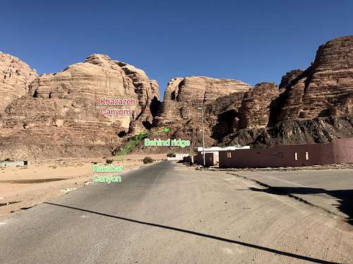
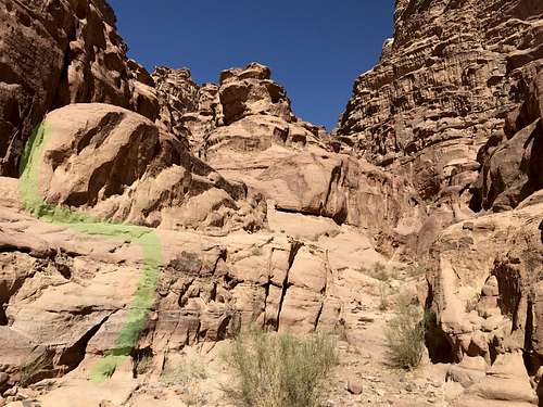
It can be initially hard to locate Rakabat Canyon amid the two deep Khazazeh Canyons to the left and the rarely done Canyon angling up a large gulley to the right. This is because Rakabat is tucked up and past Khazazeh and therefore hard to see. To start the route, walk East of town towards Khazazeh and the distant animal fence. At some point you will reach a thin barbed wire fence on the right of the encampment. Traveling past this fence should be an obvious trail.
Start
Route
I followed Tony Howard’s hikes and climbs of Wadi Rum but it was a little unclear in parts where the cairns were confusing. His map is hard to read too so I wrote down my experience.This is just right of the inward pinch of the rock and this is not the huge gulley a few 100m right of this and Khazazeh canyons. After a short bit, scramble up the last 20m of rock band, only looking like 10m at first, angling right. After this band, a plateau with a huge cairn will be seen. From now on there will be many cairns, even if you cannot always see the next one from the previous and sometimes they can be confusing.
From the large cairn, do not directly cross the river bed, that is for Khazazeh canyon. Instead go up the river bed on a worn trail to hike to the base of the left of two gullies.
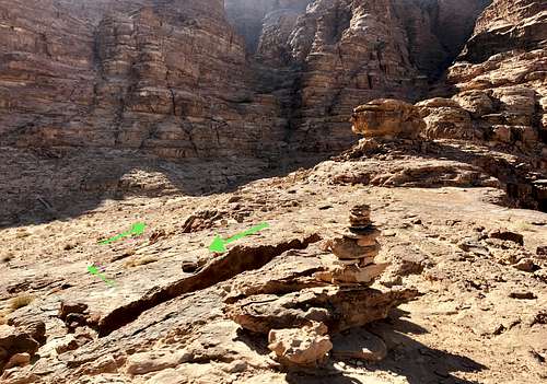
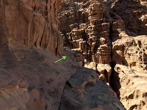
The plateau
Go up this gulley and either go up a steeper section or bypass it via a cut on the left. Near the top of the gulley you will see two large cairns on the left directing you to a different gulley that you will walk up. Continue right past a vertical obstruction and then turn left up another canyon like entrance.
After which you will weave your way left until you take a sharp left after a pin head boulder.
The pinhead
Here there are cairns and foot prints everywhere: down the sandy trail into the narrowing canyon, down the wash basin and on the right bank of the wash basin. None of these are the way. Climb the pink slab ridge, taking the left ridge of the narrowing canyon up until there is vertical section then you will walk right along the narrowing canyon. It may look like it might not continue, but it will eventually drop in the top of the narrow canyon with the sandy trail.
Left of pink slab looking down wash
Sandy canyon near slab traverse
Slab traverse alongside canyon
Climb up or around a vertical section and hike along this canyon. At some point head left by some cairns before another vertical section. Wind left and then right into a narrow canyon, past a cairn and then up onto a saddle
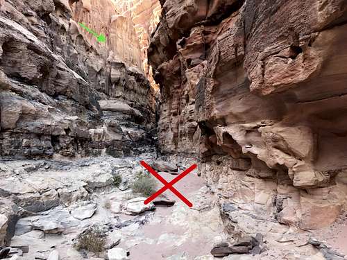
Climbing down to the bottom a “crossroads” appears with left to Khazazeh, straight to a narrow canyon and right to go out.
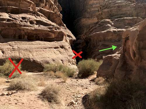
Crossroads
The rest is pretty straight forward to follow out. There is a remaining steeper section to downclimb onto stacked stones which is marked by pinkish sand below. Followed by a left into a narrow canyon. Follow this down and then through a boulder.
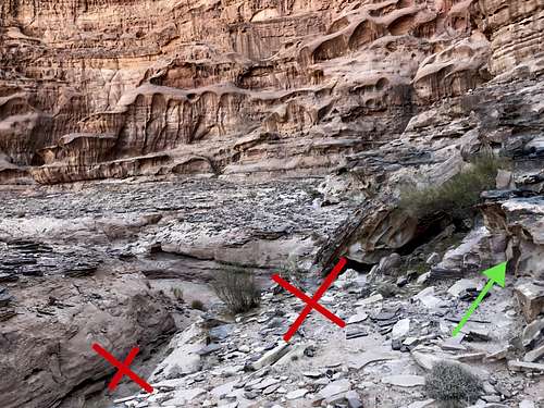
Don’t go left past a chocked stone which leads to a slick and small water runoff. Instead go right into a wide gulley leading to a boulder squeeze
Continue down and then out onto the orange sand.
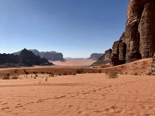
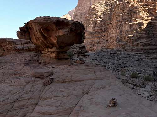
Reward on the other side
Time to complete: 3 hours due to route finding
Now either turn around or hike around the south back to the village.
Finding your way back
If you want to add some fun to the day head south at the top of the pass to scramble up some 3-4th class stuff for a mini summit and tall view.
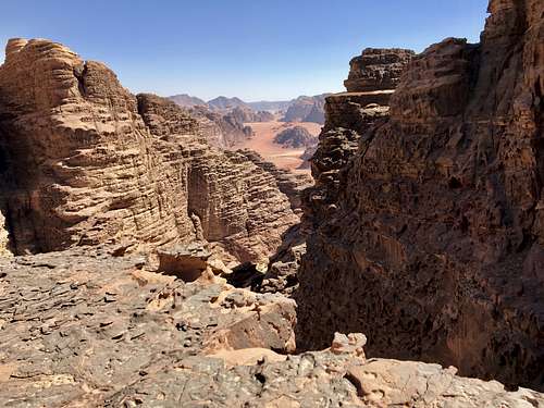
View from the summit scramble