

|
|
Mountain/Rock |
|---|---|
|
|
35.68880°N / 117.9091°W |
|
|
5174 ft / 1577 m |
|
|
Overview
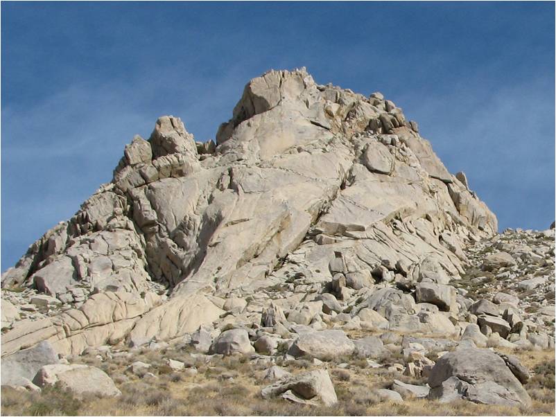
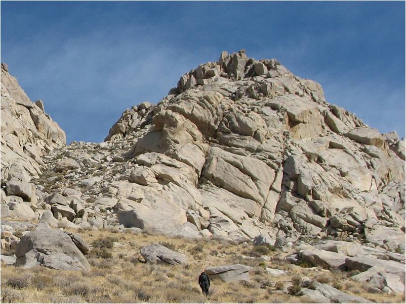
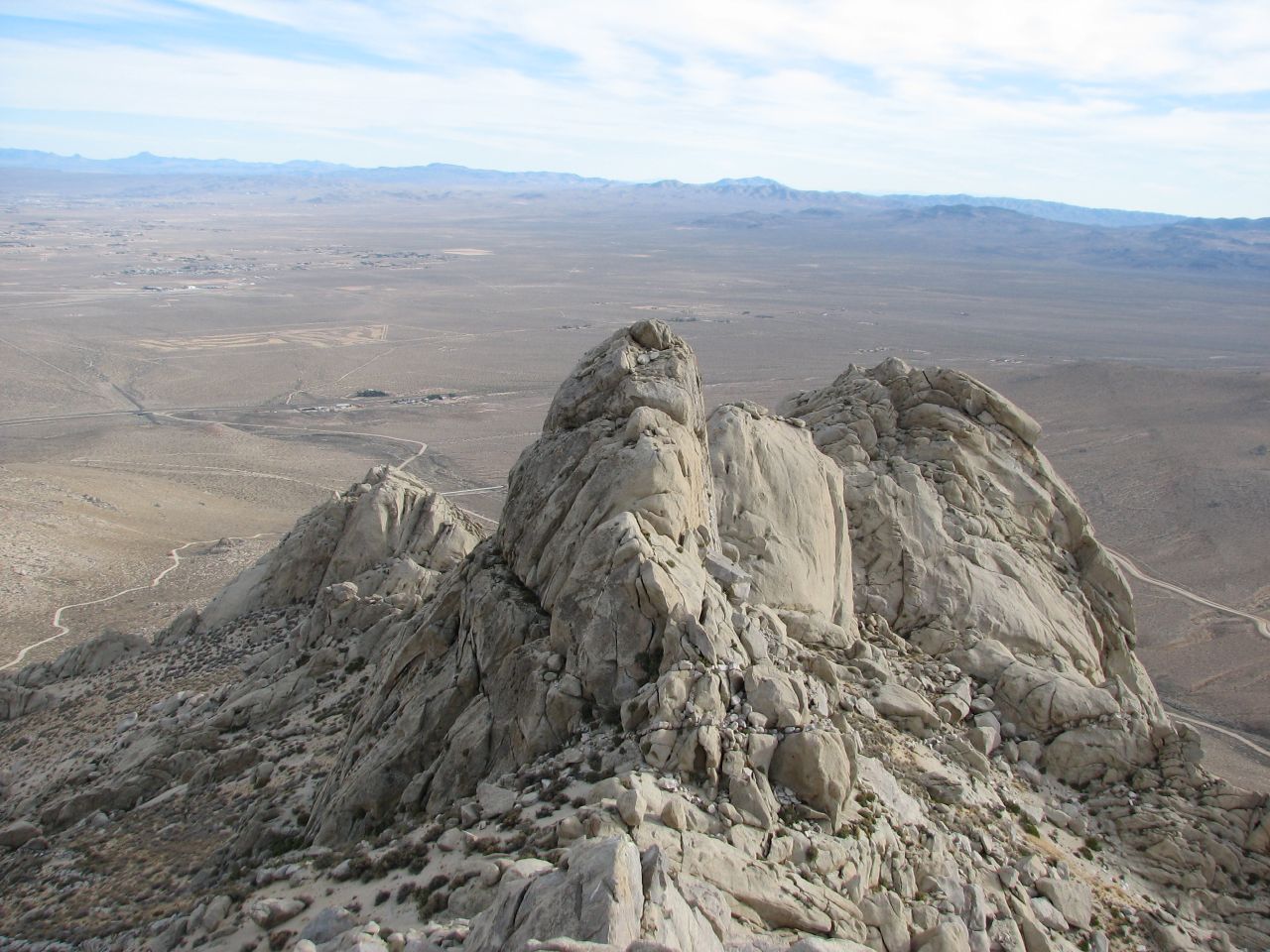
Five Fingers is a dramatic uprising of barren rock along the southeast ridge which extends from Owens Peak to the Indian Wells Valley floor. The peak overlooks the junction of Highways 14 and 395 outside of Ridgecrest and thus is easily noticed by those traveling the corridor between Southern California and the Eastern Sierra Nevada. The tallest pinnacle is designated one of the 276 peaks of the Hundred Peaks Section of the Sierra Club's Angeles Chapter. The Los Angeles Aqueduct runs beneath and around the peak so access roads abound.The steep 35-45% grade sand and scree slopes make the hike up a slog, but the solid rock scrambling and climbing at the top of the short hike up makes it well worth it.
 Five Fingers from the north
Getting There
The Five Fingers is accessed via Indian Wells Valley Road just off Highway 14 outside of Ridgecrest. This road can be easily accessed from all over as it lies just north of the Highway 178 junction (road to Lake Isabella and just south of the merger of I-395 and Highway 14. The road is easy to find as the entrance is less than ½ mile north of the Homestead Café and Indian Wells Brewing Company. The HPS website for Five Fingers provides good turn by turn directions.Routes
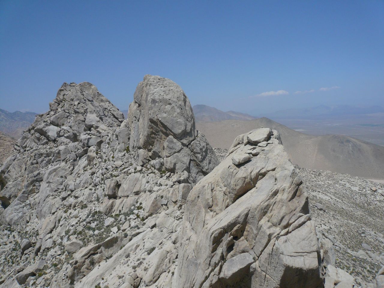
Interestingly enough, there are more than five “fingers” on this peak. Even ignoring the lower pinnacles that are outside the summit concentration, there are six worthy granite monoliths to ascend during a day-long scramble. The six pinnacles are easily visible from the northern approach but only five can be seen from the south. Route descriptions (demonstrated and potential) are listed.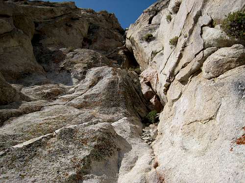 |
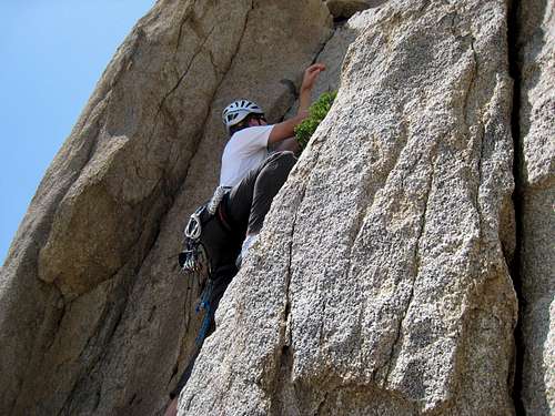
The Fifth Finger: Class 3 - 5 This peak is considered the summit and is the listed Hundred Peaks Section highpoint. The easiest route to climb is the north face where at least two Class 3 routes exist. Interestingly enough, to make it even easier both of these routes have steps carved into the rock. Several more technical routes exist on the east face directly above the notch and are graded anywhere from Class 4 to low Class 5. In addition, Glenn has posted the South Face technical route on this page. Clearly, there are more undocumented technical routes on this peak as well. |
 |
 |
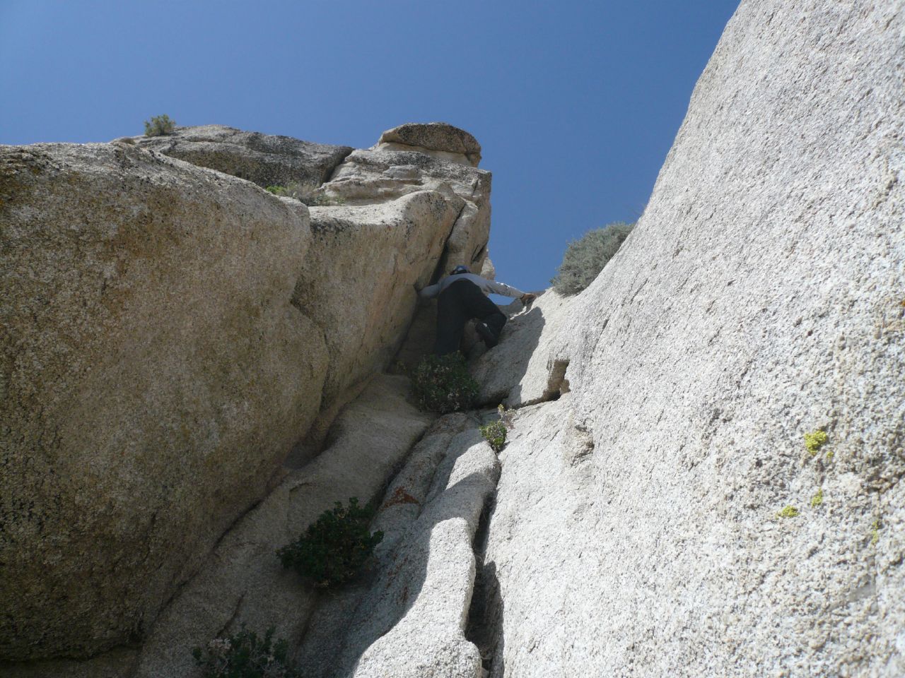
The Fourth Finger: Class 3 - 5 From the notch between the Fifth and Fourth Finger, the direct route is probably somewhere in the Class 5 range. However, a route on the north side makes a good Class 3 scramble up a chute. The other known Class 3 option can be reached from the notch by climbing left to right on the south side of the summit and then scrambling up large boulders on the east and southeast side of the pinnacle. |
 |
 |
Third Finger: Class 4 and up This dome pinnacle is the one that looks like it stops the traffic but in fact, a Class 3 route with a 20’ Class 4 pitch on the north side can be used to reach the summit. An obvious ledge runs along the north side about half way up. This ledge can be reached via a chute on the right side of the pinnacle as viewed from the north. Traverse the wide ledge to the left almost to the end and two possible Class 4 scrambles make themselves visible. Climb either pitch to another ledge and then scramble to the summit from this ledge. The rest of the routes all appear to be in the medium to high Class 5 category. |
 |
 |
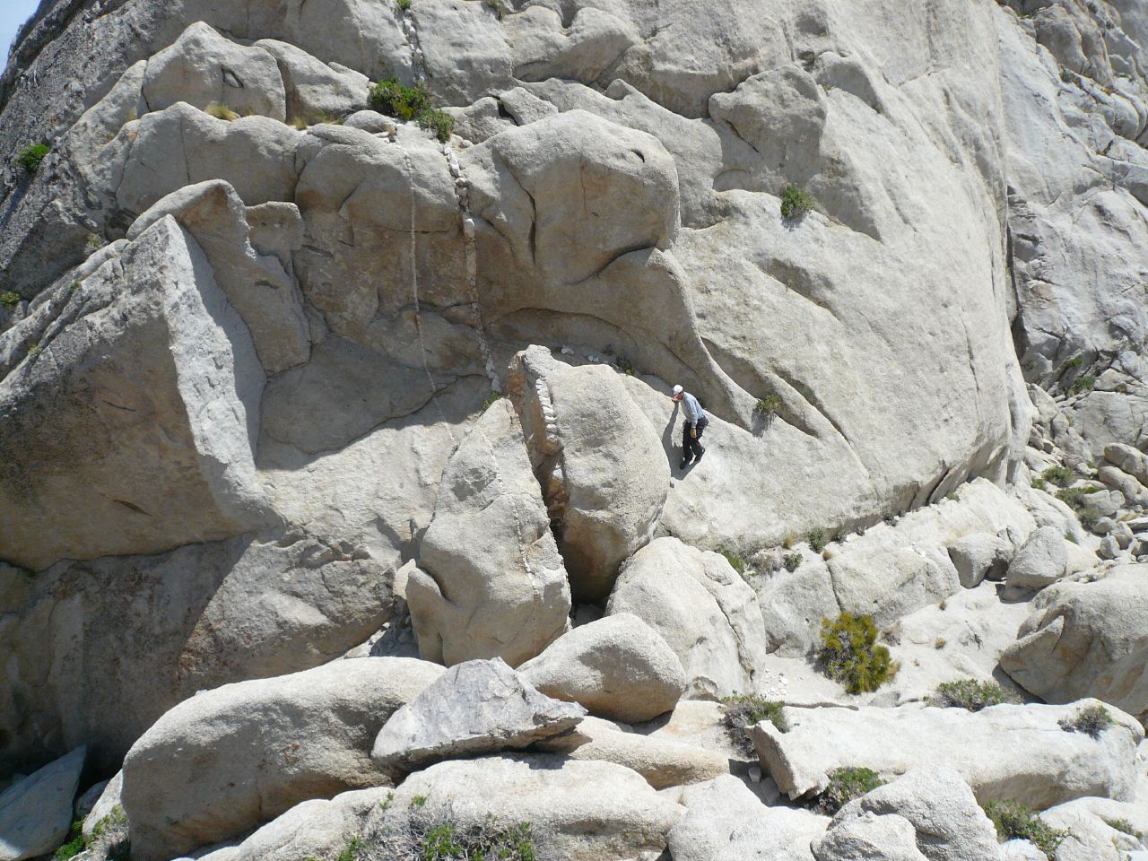
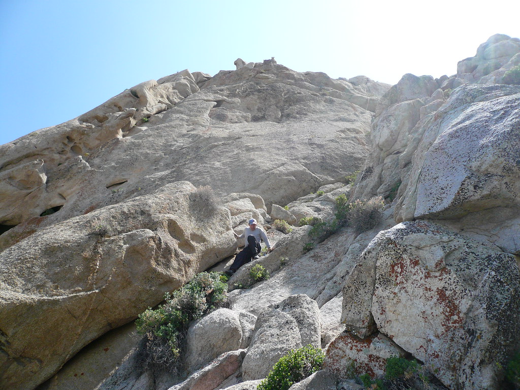
Second Finger: Class 5+ The smallest of the Fingers, this is the one that does stop the traffic. The obvious south face makes for a good technical climb. Glenn reports in his hazy memory that “We went up the south face but not positive which crack we went up. It is relatively short, so I think if you have a set of nuts, maybe 2 #1 cams, a couple of #2's, a #3 and maybe a .75 you should be fine”. While exploring possible routes (we aren’t in Glenn’s league), Augie and I stumbled upon a possible Class 4/5 route on the West face. A rock protrusion protects a crevasse (just right of Augie) that can be shimmied up to an intermediate step. A man sized quartz filled vein could be used to climb the pinnacle to a shallow north side ledge near the top. Friction climbing then leads to the summit. |
 |
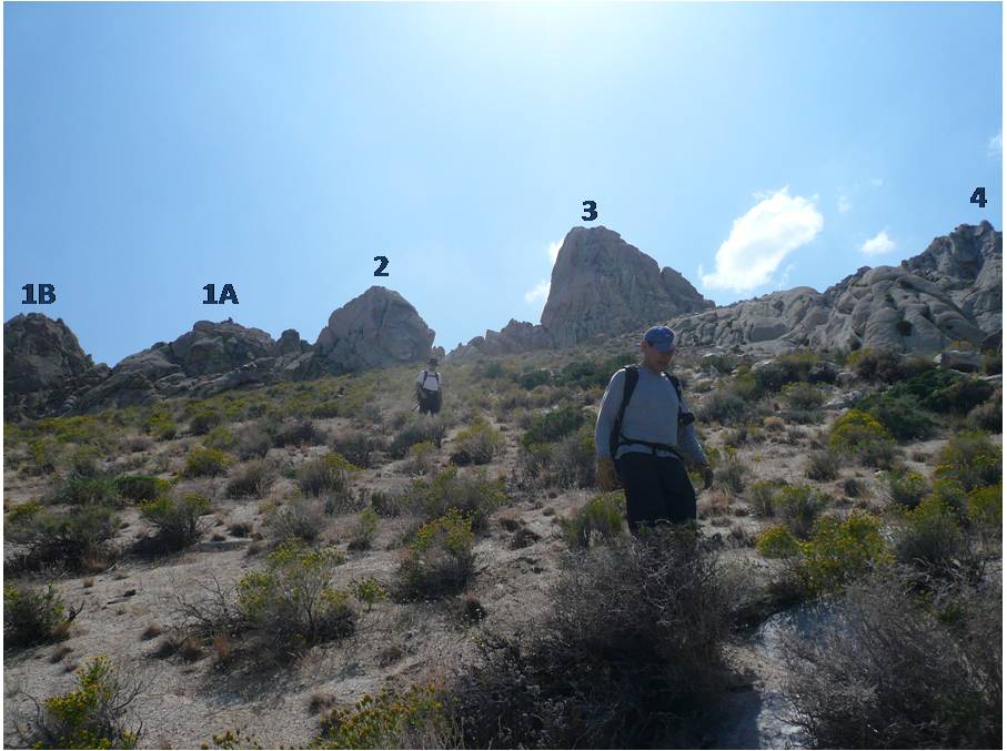 |
First Finger A & B: Class 3 and up There are actually two pinnacles side by side thus the A & B nomenclature. Both can be climbed using Class 3+ routes from the north. Only one of them is actually visible from the Indian Wells Canyon but both can be seen from the north. It was only climbing the first of these that we realized that the small monolith just west might be Second Finger. |
 |
Steve Larson - Jan 2, 2006 6:51 pm - Hasn't voted
Untitled CommentIf you don't like scree, and have a decent 4x4 vehicle, you can eliminate the tedious slopes and spend your time scrambling to the summits. Just past the aqueduct a well-graded road on the right (north) heads back east and slightly uphill. About 100' from this intersection a not-so-well-graded road heads straight up (north) the side of the peak. This road will take you to a saddle at about 4,400' just east of the summit ridge. The road is steep and sandy in places, so four wheel drive is necessary. It gets rough near the top, but nothing a stock 4x4 can't manage.