
-
 4694 Hits
-
 79.78% Score
-
 11 Votes
|
|
Mountain/Rock |
|---|---|
|
|
47.53131°N / 11.00667°E |
|
|
Hiking |
|
|
Spring, Summer, Fall |
|
|
5984 ft / 1824 m |
|
|
Overview
 Windstierlkopf as seen from Geißsprüngkopf ascent
Windstierlkopf is a summit within the Notkarspitze – subgroup of Ammergau Alps.
This subrange, located in the eastern part of Ammergau Alps, is, with the exception of Notkarspitze itself – which is a quite popular hike from Garmisch-Partenkirchen or Ettal, a rather lonely and remote region.
The highest point of this subgroup is not Notkarspitze but Kienjoch (1953 m) in the western part of the subrange.
Especially in spring and early summer the region is full of innumerable wildflowers and a paradise for those who love them.
Windstierlkopf, located between Felderkopf in the east and Geißsprüngkopf / Kienjoch in the west, is overgrown with dwarf pines and shows rocky slopes to the north and west. There is only one traverse trail, using the east ridge and the northwest ridge to gain the summit. Windstierlkopf normally is not an exclusive target for a days hike but one of several summits during an extended traverse hike.
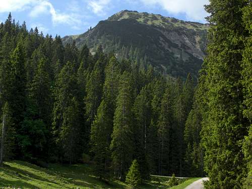
Getting There
There are two main trailheads in the valleys:Graswang in the Graswang / Ammer valley
Use highway A 95 from Munich to its end and follow the road B 2 to Oberau. At Oberau take B 23 to Ettal. After Ettal follow road St 2060 direction Graswang / Linderhof until you reach the eastern part of the little village of Graswang.
There is a little chapel on the right. On the left there is a small parking area in front of the bridge over the creek Linder.
This is the trailhead. Leave your car there.
If the parking area is complete cross the village and follow the signposts to "Wanderparkplatz" (hikers parking area) at the opposite end of the villages (parking fee required). Walk back to the trailhead.
Pflegersee / Garmisch-Partenkirchen
Use highway A 95 from Munich to its end and follow the road B 2 / 23 to Garmisch. It is the right hand road branching off after the Farchant road tunnel.
After the eye-catching Grandhotel Sonnenbichl at the entrance of Garmisch turn right (Thomas-Knorr-Straße) and then right again (Pflegerseestraße). Pflegersee should be signposted. Follow Pflegerseestraße up to the parking area at Pflegersee.
 Cypripedium calciolus Cypripedium calciolus |  Geranium sylvaticum Geranium sylvaticum |  Gentiana acaulis Gentiana acaulis |
Route & Trail Overview
 Windstierlkopf as seen from Felderkopf
Summit route from Graswang
For Hikers
For Mountain Bikers
Western ascent
Eastern ascent
Summit Route from Pflegersee
Red Tape
The German part of Ammergau Alps is a protected area (Naturschutzgebiet Ammergauer Alpen). I did not find an official web site of this NP. If you know one, let me know about it.There are no entrance fees or permissions required.
It is forbidden
Ammergau Alps contain many rare plant species, please respect them. Take nice pictures and let them grow.
 Aquilegia vulgaris Aquilegia vulgaris |  Silene diocia Silene diocia |  Dacylorhiza maculata Dacylorhiza maculata |
External Links & Accomodations
 Windstierlkopf as seen from Kuhalm
To find accommodations, try the following homepages:
Ammergauer Alpen
Ammergauer Alpen
Gemeinde Ettal
A good overview and more hiking tips can be found on:
Ammergauer Alpen
Check the current weather conditions here
Maps & Guide Books
 Windstierlkopf, Felderkopf; background: Kreuzspitze
Maps
The most detailed maps are:
Useful hiking map: