May 14th 2012 – Liverpool to Benasque
Wow!! we thought, the week has started auspisciously. We spotted world famous mountaineer Sir Chris Bonnington checking onto the same flight as us at John Lennon Airport in Liverpool. We suspected though that our efforts might not quite match those of that eminent personage.
After a timely departure and a short flight we were soon at El Prat airport in Barcelona calling the
car hire company to collect us for the short journey to their off-airport depot.
Johnnie made a swift exit from the bus to get first in the queue and we were soon loaded up and off driving down the ‘wrong’ side of the road towards our eagerly awaited destination around mid-day.
We stopped for coffee and bocadillos at Igualada
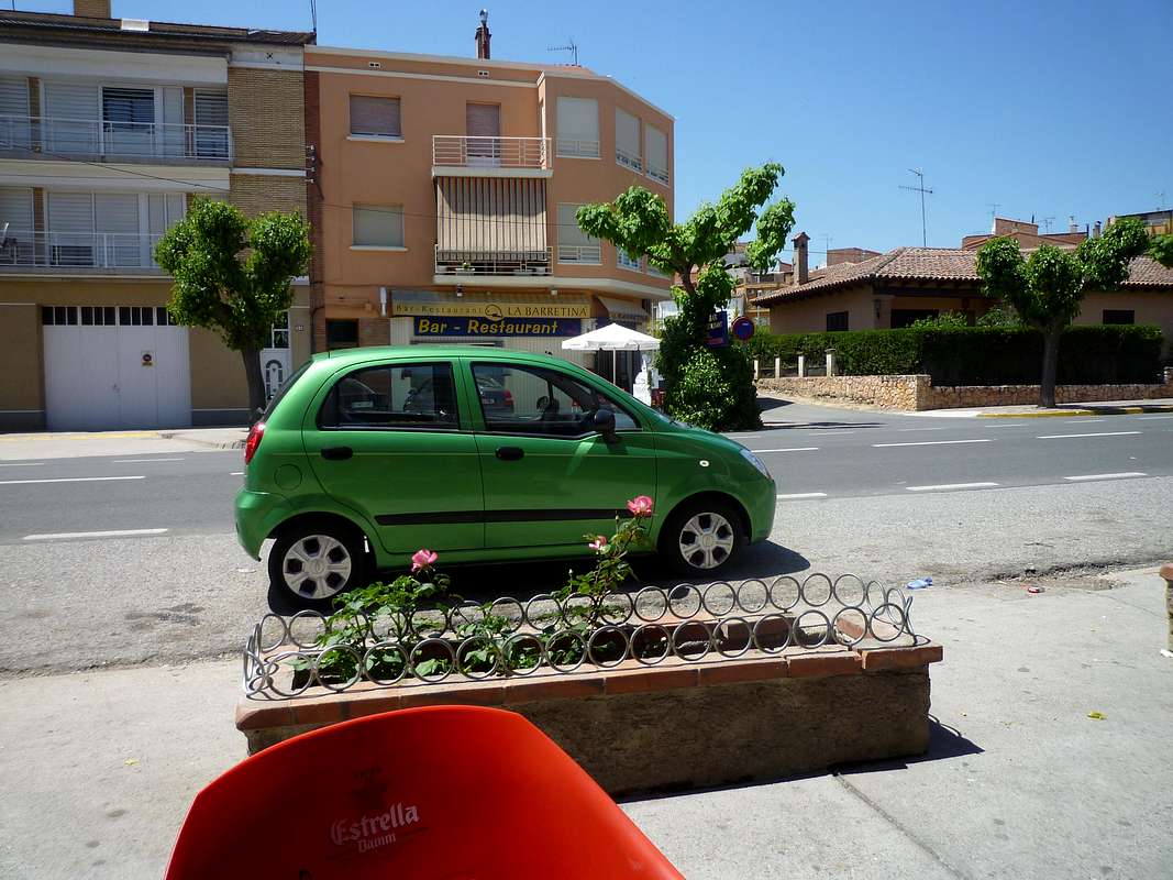
![Transportation]() Our hire car
Our hire carand debated the confusion caused by the change of name of the road from N11 to A2 (mainly to ensure we avoided the tolls).
Travelling steadily via Llerida, Barbastro and Graus we arrived in Benasque at 4 pm and checked into our refugio at
Camping Aneto. As luck would have it the week we stayed there was quiet so we had a 4 bed room with a bathroom all to ourselves.
We had heard that there would be snow low down the valley so we drove up to the
Hospital de Benas to check if we would need to hire snow shoes. Luckily the reports proved false as there was no snow at all below about 2000 metres. After a beer in the Hospital bar we drove back to Benasque and the
Mountaineering Emporium scaring a deer off the road on the way down. We wanted to get some gas for the bivvy stove so we could have a brew on the hills (gas cylinders are not allowed on the airline).
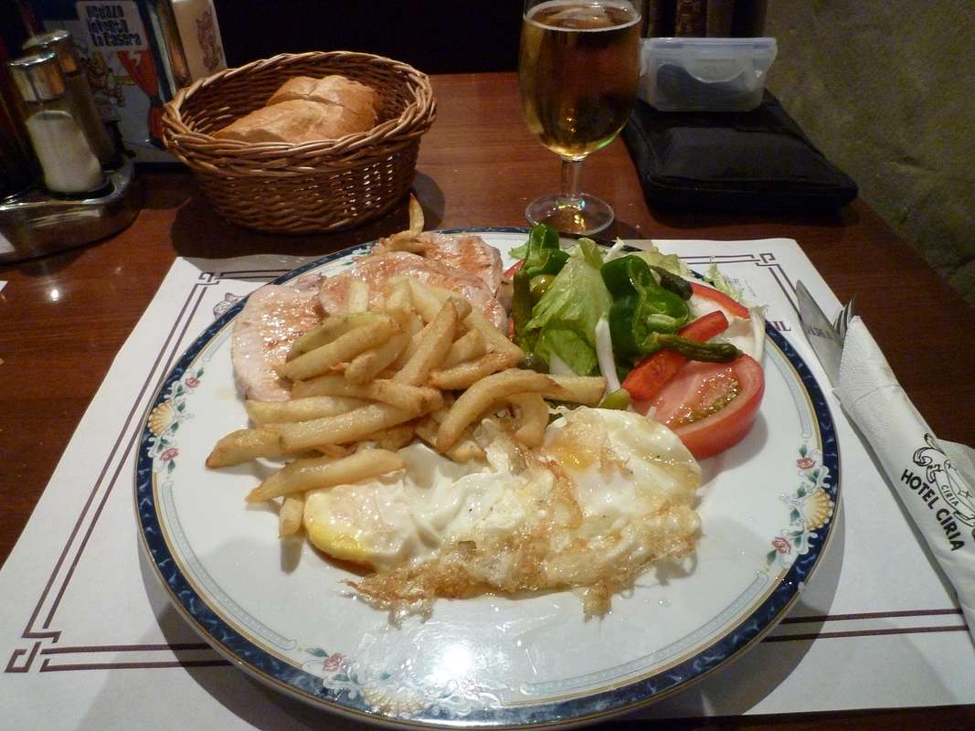
![Plato combinado con lomo]() A plato combonado de lomo
A plato combonado de lomo
A sudden heavy shower had us scurrying for cover and wondering if we were in for a similar drenching to last year but, by the time we’d finished our Tortilla snack, the skies had cleared and that was the only rain we saw during the day until the end of our weeks holiday although it rained a few evenings and nights.
We decided to get a Plato Combinado at the
Hotel Ciria for our dinner and ate it whilst watching the professional tennis tournament at Roland Garros on the telly.
Returning to the refugio we saw a red fox darting away as we headed up the hill.
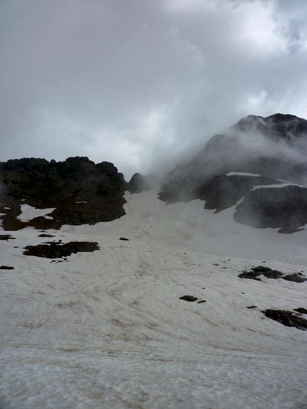
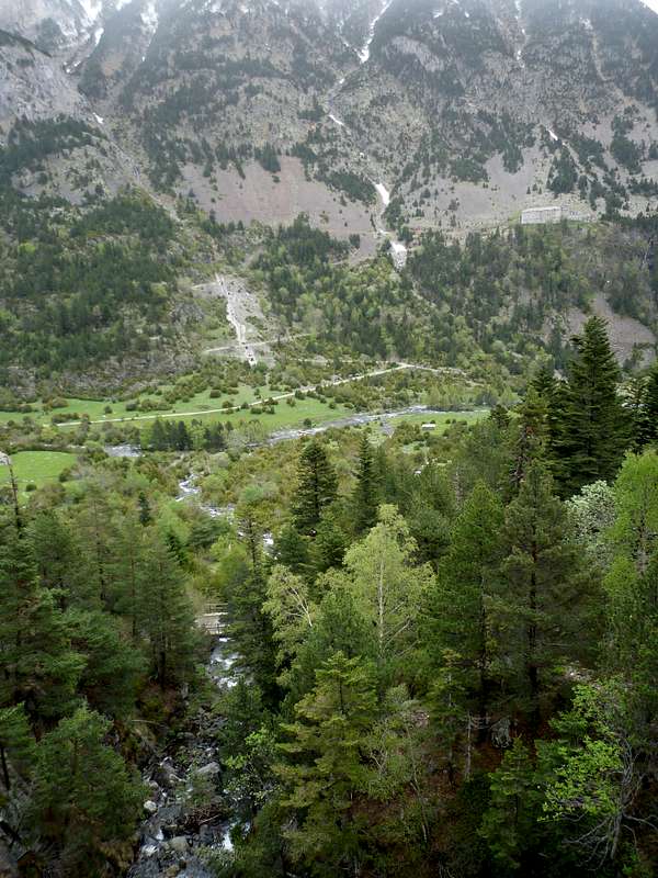
May 15th 2012 – Ballibierna
To get ourselves into gear for the higher mountains we decided to go for a hike up the
Ball de Ballibierna on the
GR11
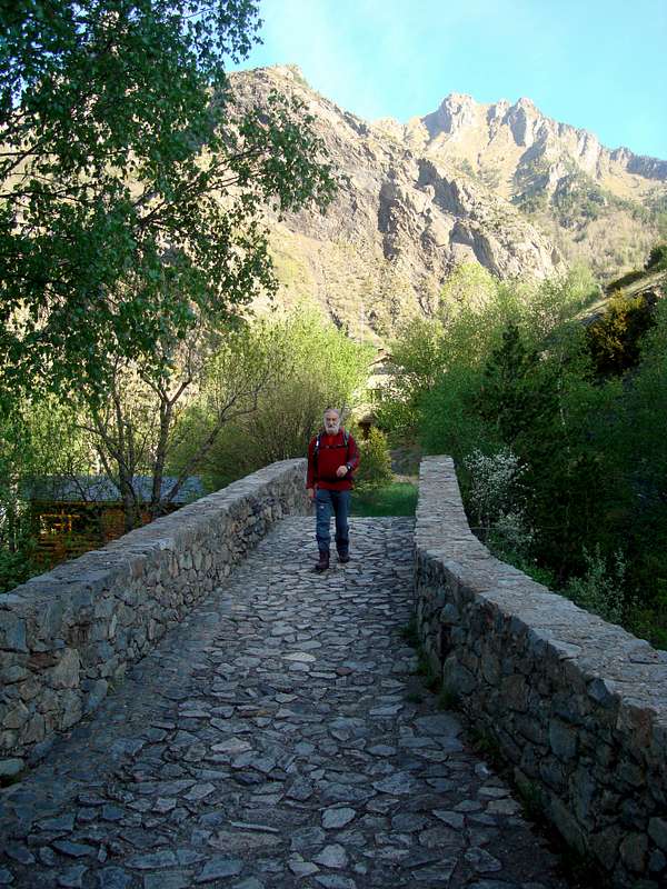
We started off at 8:15 from the refugio, crossing
![The old bridge]() The old puente
The old puentethe old puente and heading along the trail parallel with the Rio Ésera. After passing the Embalse de Paso Nuevo and the Puente de Ballibierna we started ascending the steep trail which although not indicated as such, is suitable for 4x4 vehicles and other vehicles with less careful owners.
We watched a common lizard
![Common Lizard (lacerta vivipara)]() common lizard
common lizarddodging around boulders at the road edge whilst having a breather.
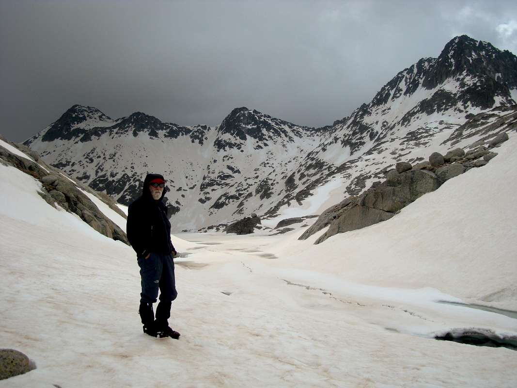
About 10:54 we arrived at a small hut known as the Cabaña-refugio de Quillón
![The Cabin of Quillon]() The refugio de Quillon
The refugio de Quillon where we had a short stop for a drink and a snack. Kicking up the dust
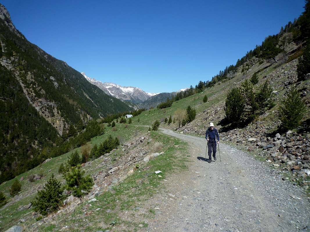
![Ken kicks up the dust]() Ken heads up the GR11
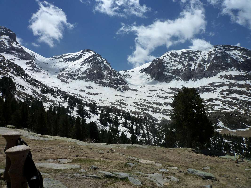
Ken heads up the GR11 we pressed on up the valley gazing with awe at the towering hills on either side.
![Ball de Balibierna - south side]() Towering peaks of Ballibierna
Towering peaks of Ballibierna
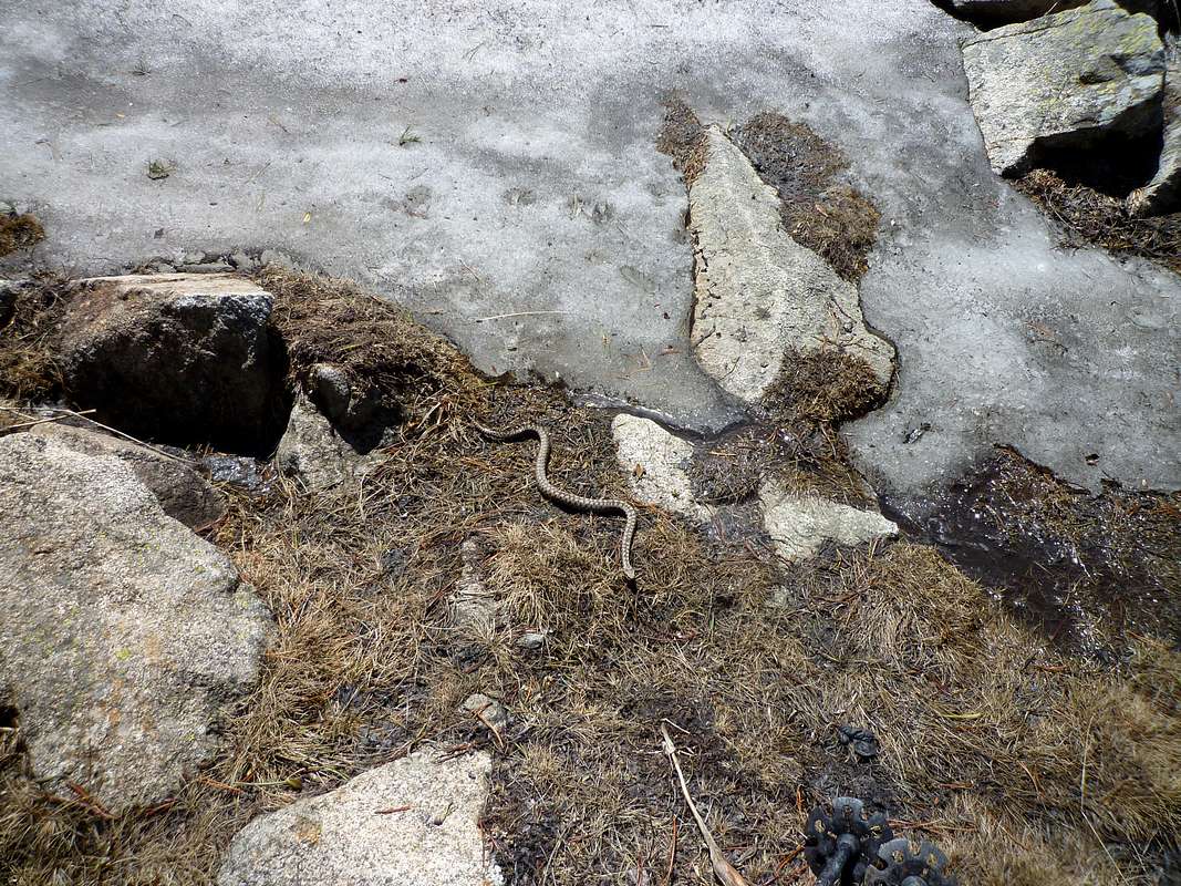
Further on we started to see old snow on the track and Ken nearly stepped onto an
![Viper (vipera berus)]() Adder veers towards us
Adder veers towards us Adder. Startled, it veered away onto an old snow patch but didn’t like the chill I guess because it veered away again towards Johnnie. After taking evasive action and a photograph, we left it in peace to get warm again. Higher up again we reached the
Refugio de Coronas.
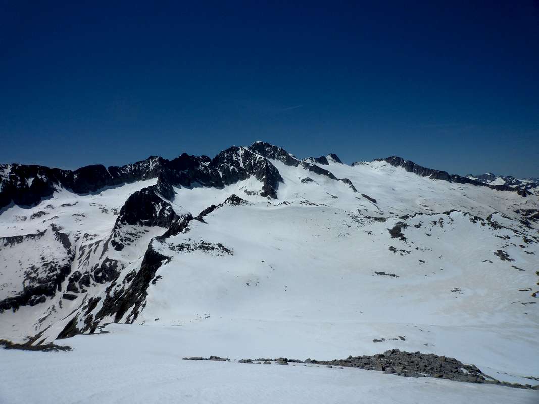
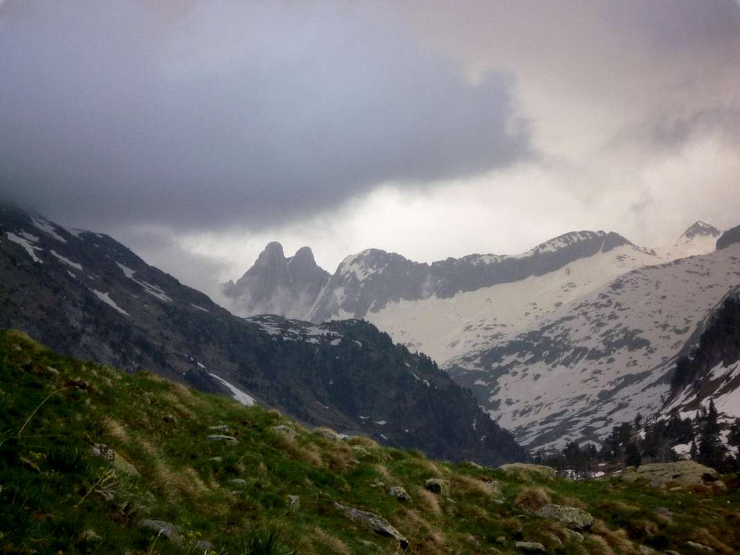
The refugio was in a poor state but structurally sound, so would provide overnight accommodation if you are not too fussy about hygiene. We stopped higher up for our lunch and to listen to the marmots calling across the valley. Ahead was the magnificent ridge of the Maladeta
![The Maladeta]() The Maladeta
The Maladeta, particularly the eastern end. According to our map and navigating skills we were close to another refugio (Cabana de Llosars) but we couldn’t find it (answers on a postcard please).
We were both pretty tired by then so we decided to head back down. On the way down we looked for a frog we had spotted in a pool on the way up but the only trace of it we could find was some spawn floating in the water.
Our high point was at 2235 metres and we had started out at about 1300 metres on our round trip of about 15 miles. We were quite exhausted by the time we got back to the refugio but were happy that we were at least able to still do a hard days hike.
As we passed the pines below the Coronas refugio, a Red Squirrel ran across the trail. The first one we had ever seen in the Pyrenees.
It was then down to Benasque for dinner.
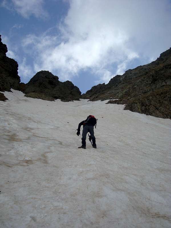
May 16th 2012 – Col d’Alfred and three tops
Way back in
2008 we attempted to locate the Col d’Alfred so that we could go and look at Forcanada but due to very adverse visibility and the lack of strong navigational features we were unable to locate it. This year we were more successful as the visibility was excellent.
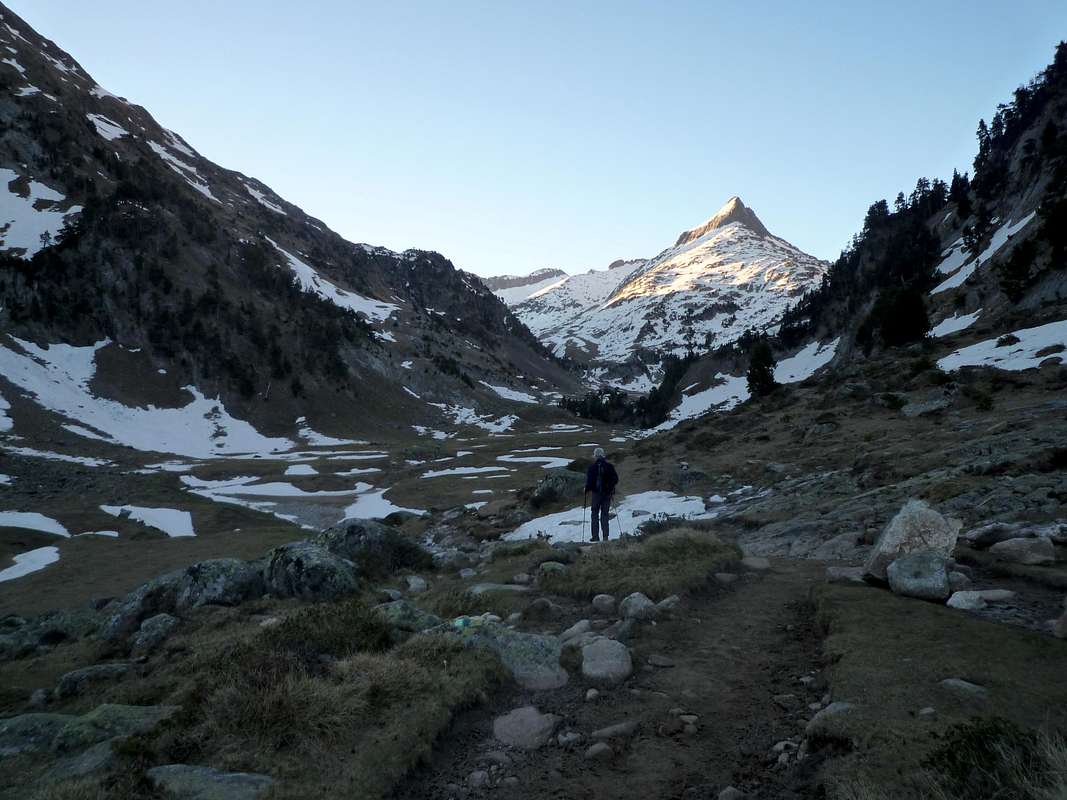
![Balleta de Escaletta]() Balleta-de-Escaletta
Balleta-de-Escaletta![Dawn in the Ball de Barancs]() The Ball-de-Barancs
The Ball-de-Barancs
We left our car at 6:30 am at the Besurta below the
Renclusa refugio and headed up the valley towards the Plan dels Aigualiuts, here the trails divide, the right hand one heading up the Ball de Barancs and our one on the left heading towards Balleta de L’Escaleta.
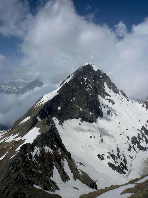
![Closer to Forcanada]() A closer view of Forcanada's twin peaks
A closer view of Forcanada's twin peaks.
As we climbed up into the valley my thermometer was reading minus 9 deg C, so we hoped for good snow conditions higher up. We were not disappointed, we soon had our crampons on and were crunching up the snow slopes.
![At last the sun!]() The sun rises over the ridge ahead
The sun rises over the ridge ahead
There were no difficulties with whiteout like the last time we were there and we could clearly see and track our progress under Forcanada and towards the obvious collado.
As we climbed higher, the sun at last reached us, not that we were cold by then considering the warming effort of ascending the steep snow slopes.
![Aneto and the Maladeta]() The stunning view of Aneto and the Maladeta
The stunning view of Aneto and the Maladeta
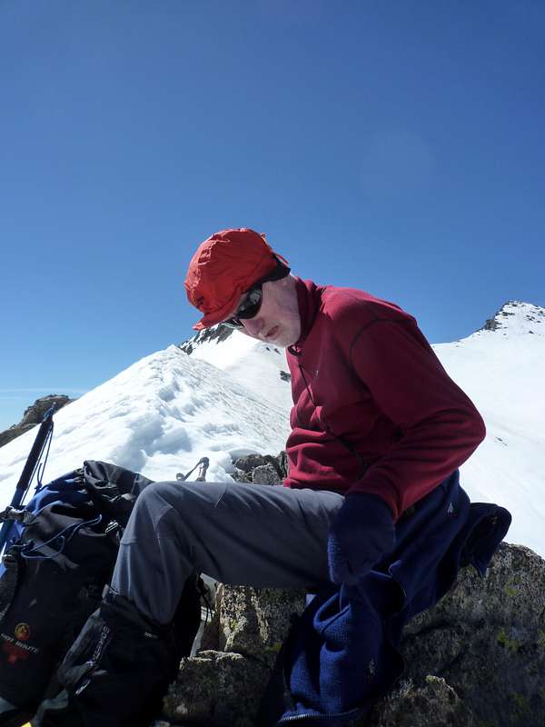
We arrived at the Col at 11:34am and rested in bright sunshine as we drank in the tremendous views around us. We were particularly interested in the obvious snow ridge leading up to the Puente de Mahoma on Aneto. Johnnie had been up this with Ken’s brother Peter in misty conditions back in 2010 and Ken was keen on showing Peter the vast drop off alongside the ridge that they hadn’t seen due to poor visibility.
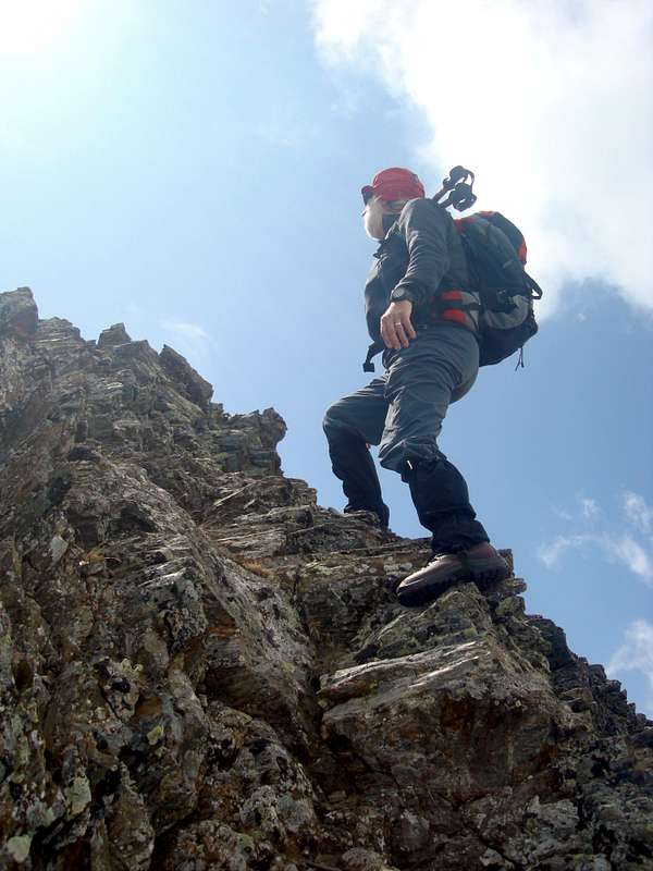
![Col d Alfred]() Ken takes a rest at the collado
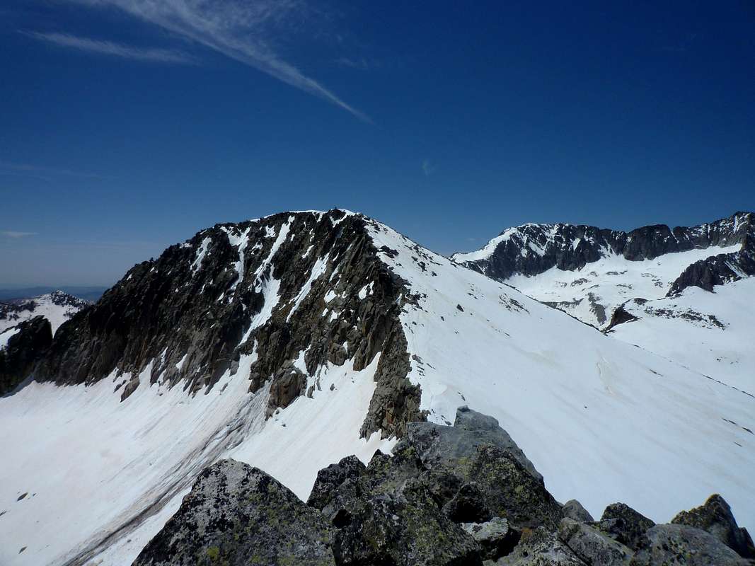
Ken takes a rest at the collado After deciding that climbing Forcanada without a rope was probably not a good idea for us we decided to traverse north along the ridge and do the Turo de Tres Puntes 2899m.
![On the ridge]() On the ridge
On the ridge
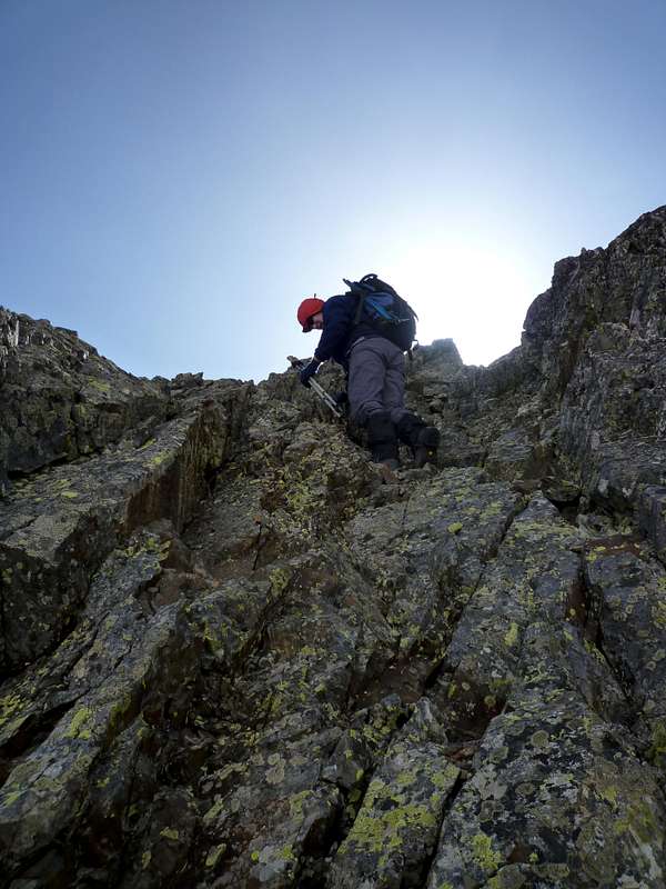
This was soon reached and getting to the highest of the Puntes required a bit of rock scrambling. The rock was sound and had good holds and friction so we soon were shaking hands on top.
Close to the summit we were amazed to see a small sedum growing ostensibly out of the blank rock face.
![Signs of natural life]() Sedum
Sedum
We could only wonder at the tenacity of nature.
![Turó de Tres Puntes - 2899m.]() On top of Tres Puntes
On top of Tres Puntes
After a short stop it was back to the collado where we had left our sacs and away in the opposite direction to the Cap deth Hòro 2969 m.
![Cap deth Hòro]() Ken approaches the Cap deth Horo
Ken approaches the Cap deth Horo![On the rocks]() Johnnie gets some rock action in - Foto by Ken
Johnnie gets some rock action in - Foto by Ken
The ridge looked quite imposing and steep from our position but after the snow section we reached the rock and found that it had no real difficulties and we were soon on top of our second hill of the day.
![Cap deth Hòro - 2969m.]() Cap deth Horo summit - Foto by Ken
Cap deth Horo summit - Foto by Ken![Tuc de Molières]() Tuc des Molliers
Tuc des Molliers![Tuc de Molières summit]() Tuc des Molliers summit - Foto by Ken
Tuc des Molliers summit - Foto by Ken
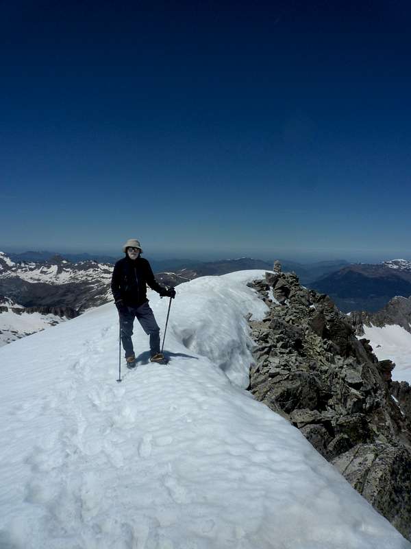
We decided to complete a trio of tops by climbing the Tuc de Molliéres 3010 m.
Then we dropped our sacs again and made an easy ascent, although our legs were feeling a trifle weary at that stage.
On the top we found a stone cairn that was quite reminiscent of some of those to be seen at home.
This one was a lot neater though, probably having been constructed by a builder on vacation.
As forseen earlier in the day, the snow condition was excellent, nice and crispy just how we like it and it was no effort to trundle back, collect our sacs and head down around 3:00pm.
Ken reminded me that on descending the Cap deth Hòro we had some difficulty route finding and that he had accidently kicked down a couple of boulders that narrowly missed me thus avoiding a potentially fatal conclusion to the day.
Although I do now faintly recall some mention of loose rock, at the time I was too high on adrenaline to notice my imminent demise or even losing my way down.
We got back to the car at 18:30 and drove down to the Hospital de Benas for a well earned large beer.
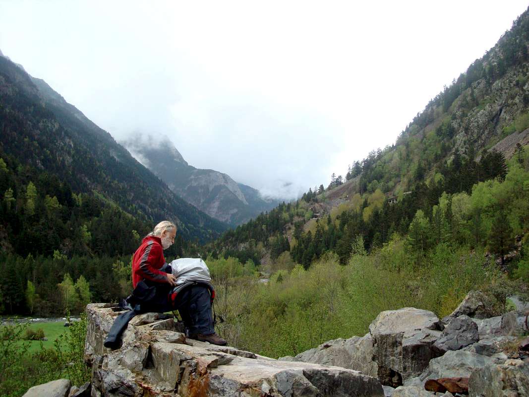
May 17th 2012 – Rest day – trip to Vielha in the Val d’Aran
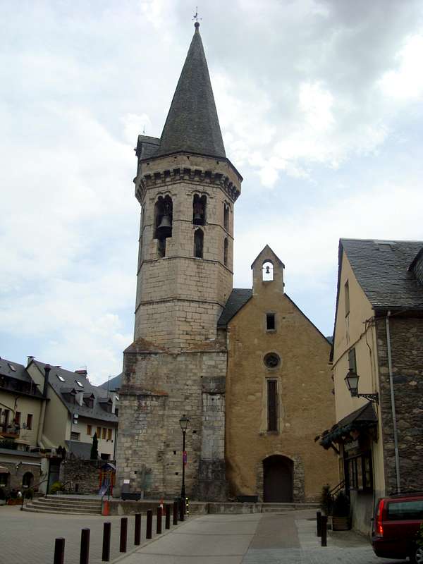
![Bell tower in Vielha]() Viehla town centre. Foto by Ken
Viehla town centre. Foto by Ken
After a leisurely breakfast in Benasque we drove down the valley to Castejón de Sos where we took the very scenic road over the hills to Pont de Suert and headed north through the 7 km. tunnel to Vielha.
Johnnie had been there briefly back in the seventies whilst working in Valencia but it was Ken’s first visit. The whole town was pretty quiet so Ken was not too impressed. We imagined that it would be much livelier in winter when the skiers are in town. We walked around a bit sightseeing and managed to locate a hotel and bar with some signs of life. We sat outside there in the sun and consumed our obligatory beers and tapas.
Although I mentioned earlier that we hadn't had much rain, the big exception was a brief storm with thunder and lightning about 8:30pm. Luckily for us we were back in Benasque by then and sheltering in the hotel whilst we consumed our evening meal.
![Viehla]() Crossing the river in Viehla.
Crossing the river in Viehla.
During our walks, I had managed to wreck one of my walking poles and had lost the steel tip. I went to the aforementioned Emporium to see if they had spares or could repair it. They offered to replace the tips on both poles and we left knowing that as they closed at 9:00pm so I would have to go back or be pole less the next day.
We went to a Pizzeria for pasta and this was served and eaten in good time. When I went back to the Emporium, the assistant showed me one of my poles that had had the lower section totally sheared off whilst they attempted the repair. I think the guy must have taken pity on my sad face and after failing to sell me a new set of poles, managed to find another lower section of a different make of pole that would fit my ancient one. I asked him ‘quanto cuesta’ but he refused any payment, so I could only praise them for their generosity.
There was a little more rain later in the evening whilst we were back at the refugio and whilst I was looking out at it at the
refugio entrance
I was buzzed by bats. I don’t know what breed they were but they were feeding off insects that were buzzing around the light. I could have reached out and grabbed them they were that close.
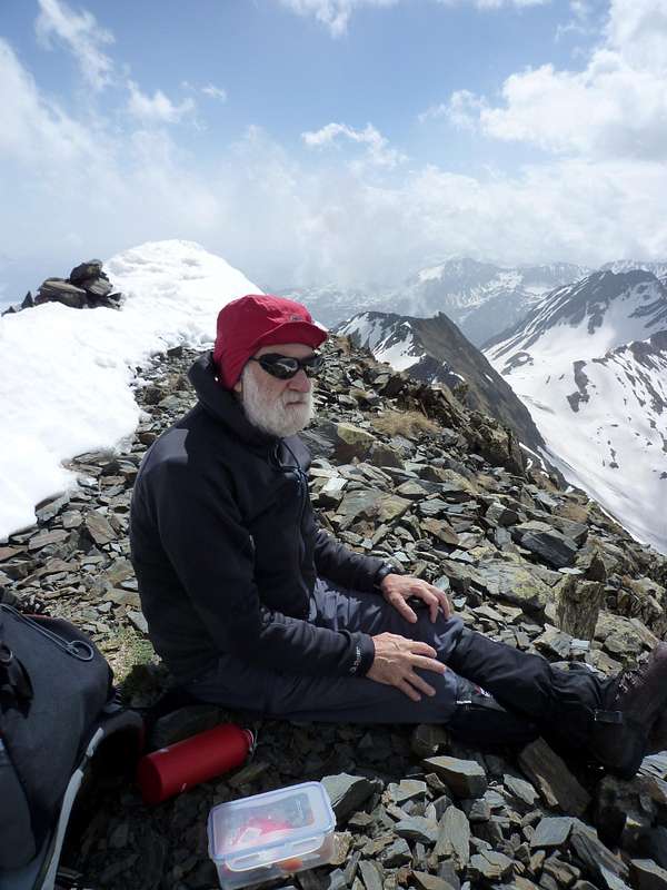
May 18th 2012 – Pico de la Mina – 2708 metres.
![Up the zig zags again]() Up the zig-zags again
Up the zig-zags again
We thought that after the hard day before, we should try lightweight exercise. So we decided to climb the Pico de la Mina above the Plan d’Estan. By lightweight I mean that we didn’t pack our crampons and spare emergency bags etc. etc. I didn’t mean lightweight in the continental sense, having seen in the past a local mountaineer with a tiny little rucksack with just a small jacket and a sandwich inside.
Us Brits tend to include everything as well as the kitchen sink in case of any conceivable emergency. Gazing up at the summit from below made Ken quite emotional and he said he would give me a hug if we made it to the top.
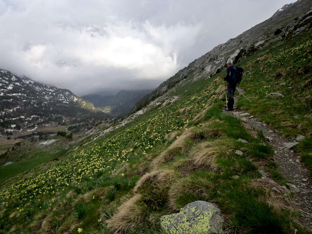
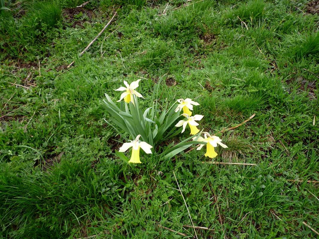
![Spring time flowers]() Spring daffodils
Spring daffodils
We set off from the Plan at 7:15am and arrived at our turning point at 10:25 after ascending the zig-zag pathway that leads to the pass that allows entry into France.
![Yes it goes up there!]() Our route ahead
Our route ahead![Ken kicks steps]() Ken kicks steps
Ken kicks steps
Leaving this pathway on the high plateau we had to climb a snow ramp to reach the ridge and to gain access to the Pico. The snow was in good condition and we ascended, kicking steps, until well over halfway up the ramp.
![Cutting Steps on Pico de la Mina]() Johnnie cuts steps in the icy section. Foto by Ken
Johnnie cuts steps in the icy section. Foto by Ken
At this stage we found that there was an icy layer under the snow crust and kicking was not an option. Here we could have used our crampons. However as we were going lightweight we had none so what followed was about 50 metres of step cutting up to the gap in the ridge.
![The top of the couloir]() Ken emerges from the snow ramp
Ken emerges from the snow ramp
Reaching the ridge we had excellent view down into France and also across to Aneto and The Maladeta although these were often obscured by clouds.
![Cloud inversion over the Bagnéres de Luchon]() Cloud Inversion in France
Cloud Inversion in France![More scrambling above the Boums du Port]() Ken appreciates the exposure
Ken appreciates the exposure
The ridge continued up to the summit and was reasonably steep, necessitating the use of hands.
What fantastic views
We arrived at the summit at 11:30am and true to his word Ken gave me a hug to which I responded an a typical manly fashion with a quick rib crusher.
![Shake on it matey]() Great stuf matey - an emotional moment!
Great stuf matey - an emotional moment!![High level lunch]() Johnnie on his lunch break
Johnnie on his lunch break
We shook hands too and sat down on the flat top of the Pico eating our lunch and admiring the stunning views.
![Useful steps]() Johnnie retraces our steps
Johnnie retraces our steps
Descending later we appreciated the steps that we had cut earlier, quickly losing height. We were soon back on the Plan and drove down to Benasque by ten to three.
May 19th 2012 – Up the Cregüeña .
![In the Cregüeña valley]() The Ball de Cregüeña
The Ball de Cregüeña
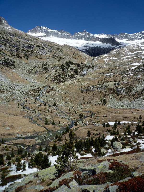
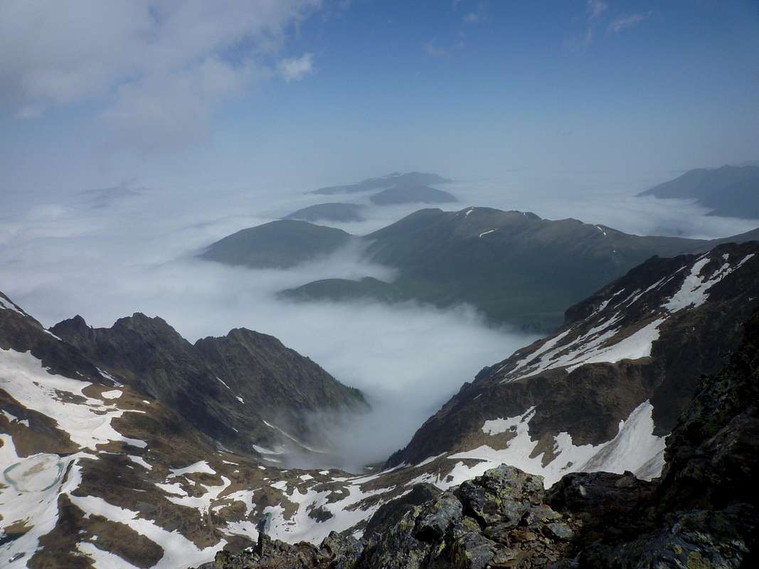
Having been on the north side of the Maladeta for most of the week and also during our previous visits, we thought it would be a good idea to see what the massive looked like from the south side. This can be achieved by ascending the valley of the Cregüeña. This has a trail that ascends unrelentingly from the Ésera valley at a continuously steep angle towards the Ibon de Creguena that lies below the Maladeta.
We eliminated some of the height needed by parking our car at 8am by the road tunnel above the reservoir and descended a steep slope of loose boulders and scrub to reach the access road.
![Rio Ésera]() Rio Ésera
Rio Ésera
Crossing the Ésera Puente, we soon found the trail and headed up through the trees. Above the tree line, the slopes continued at the same angle but the views of the surrounding peaks was not obscured.
![Ahead lies the Alba]() Lofty peaks surround the valley
Lofty peaks surround the valley
It was an impressive sight. We continued on until we arrived at the Ibon de Cregüeña which we found was frozen and covered with snow. A small melt pool near the outlet of the lake contained a mini iceberg.
![Frozen lake]() Ibon de Creguena frozen over
Ibon de Creguena frozen over![Ibon de Cregüeña]() High up in the Ball de Creguena
High up in the Ball de Creguena
We carried on a bit further up to around 2700m where we decided to stop and have our refreshments.
Above us the towering western end of the Maladeta ridge with the Alba peaks formed an awe inspiring scene.
Trying to identify individual mountains was no easy matter but we tried our best with map and compass for a while.
It was sad to leave such an impressive area but we had to go down. The descent was very hard on the knees so we were glad to reach the Puente again at around 5:30 pm.
It just remained to find a way of scrambling up the loose boulders to the road and we were back in the car heading off for Dinner in Benasque
May 20th 2012 – Rain Forecast.
![Forty shades of green]() Forty shades of green
Forty shades of green
As we had excellent weather all the week apart from a few showers/storms when we were not on the hills we weren’t too sad to see that Sunday was set for rain. Bearing in mind the state of our knees after the previous day we thought a gentle stroll up the valley would suit us just fine and if it rained so be it.
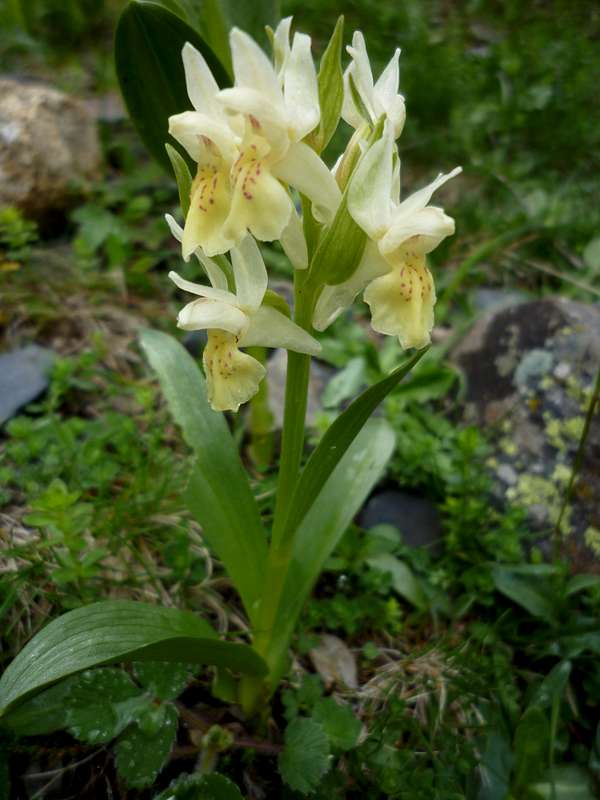
We decided to have a walk up from our refugio towards the Hospital and see how far we would get. The Ésera valley was resplendent in its spring colours of many bright shades of green.
The waters from the glaciers and the rain were foaming down the river and lapping our feet as we crossed the puentes.
![A fine specimen]() an Orchid blossoms by the trail
an Orchid blossoms by the trail ![The Bans de Benas]() The Esera valley and the Bans de Benas
The Esera valley and the Bans de Benas
Spring blossoms were evident everywhere and brightened our way. We eventually arrived at a small layby at the side of the Cascadas d’aiguespases and opposite the Bans de Benas across the valley.
The view back down the valley was very inspiring. As we returned, the promised rain started and we donned our wet gear and covered our sacs but mercifully it was light and not wind driven so it was quite pleasant strolling down the trail back to Camping Aneto for our final night in Spain.
![Rain covers on.]() Johnnie covers his sac
Johnnie covers his sacMay 21st 2012 – Benasque to Liverpool.
We totted up our expedition data from the week and it came to a total of 66.5 km distance covered with a total height gain of 4612 metres. Not too bad an effort for a couple of pensioners!.
We were very satisfied with our visit to Benasque and obviously look forward to a return some day.
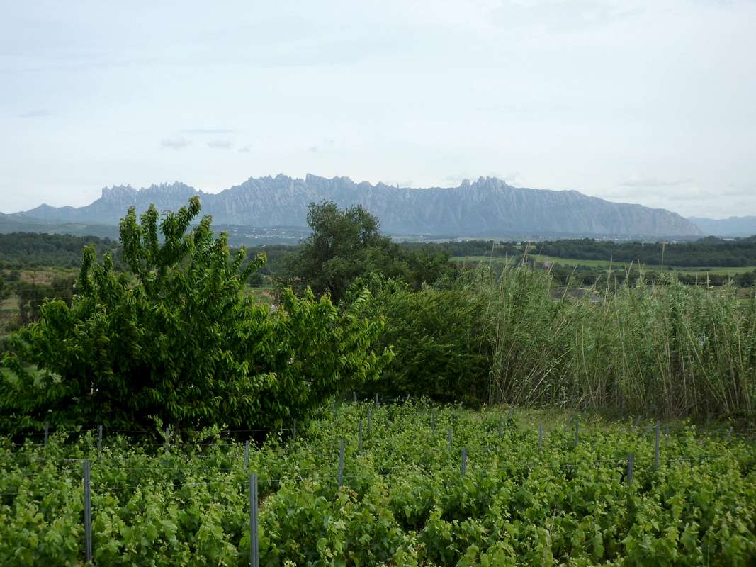
![Montserrat]() Montserrat from Penedes
Montserrat from Penedes
We drove back steadily to Barcelona stopping to admire the silhouette of Montserrat from the roadside in the Penedes wine growing region.
(If you are ever there I thoroughly recommend you try "Viña Esmerelda" from the house of Torres, it's fabulously refreshing.)
We had allowed enough time for a quick stop off in Sitjes for Tapas and refreshments before driving up the road to El Prat for our return flight.
Useful Information
The town of
Benasque is situated in the valley of the Esera in the north of the Huesca region of Aragon in Spain. It is easily accessed by road from Lleida via Barbastro and Pont de Suert or Graus.
The regional
Michelin map 574 Cataluna / Aragon will help with driver's navigation.
Once at Benasque all local mountains are easily navigated using the Editorial Alpina 1:25,000 scale maps:
Maladeta - Aneto
Posets - Perdiguero
An English language climbing guide is available from Cicerone Press:
Walks and Climbs in the Pyrenees by Kev Reynolds.
There is a Tourist Information Office in Benasque where you can get information about the local services such as Refugios, Campsites, Hotels etc.
More views
I always find it fun trying to edit trip reports and recounting tales of mountaineering activities. Sometimes though I miss out some pictures and find it difficult to insert these into existing reports. So this time I thought I would include an extra section with some shots that could prove informative for anyone considering visiting the area.
So in no particular order here they are:
![Past & Future objectives]() The Peaks of Salbaguardia and Pico de la Mina seen from the Plan dels Agualiuts
The Peaks of Salbaguardia and Pico de la Mina seen from the Plan dels Agualiuts![Loads more to do]() The ridge line above the Ibon de Creguena
The ridge line above the Ibon de Creguena![End of the trail]() Looking down onto the Ibon de Creguena
Looking down onto the Ibon de Creguena![Salbaguardia - 2738m.]() Salbaguardia 2738 metres from Pico de la Mina
Salbaguardia 2738 metres from Pico de la Mina![Forcanada beckons again]() Forcanada from above the Plan d'Estan
Forcanada from above the Plan d'Estan![Scrambling again]() Hands required on Pico de la Mina ridge
Hands required on Pico de la Mina ridge![The last few meters]() Summit ridge - Pico de la Mina
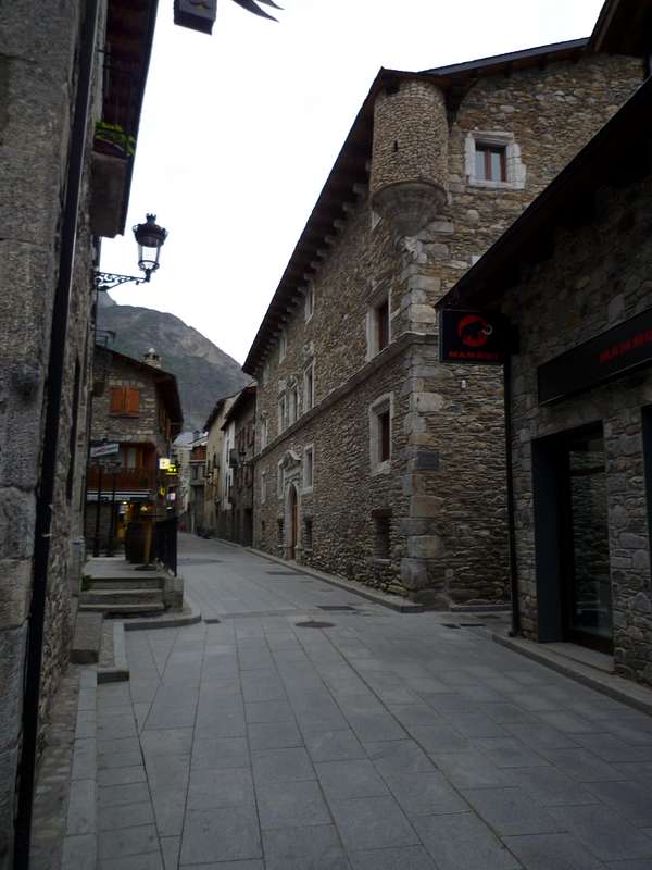
Summit ridge - Pico de la Mina![Benasque]() High Street in Benasque
High Street in Benasque


Comments
Post a Comment