Back in Paradise - June 2nd 2008
Oh joy unconfined! - back in
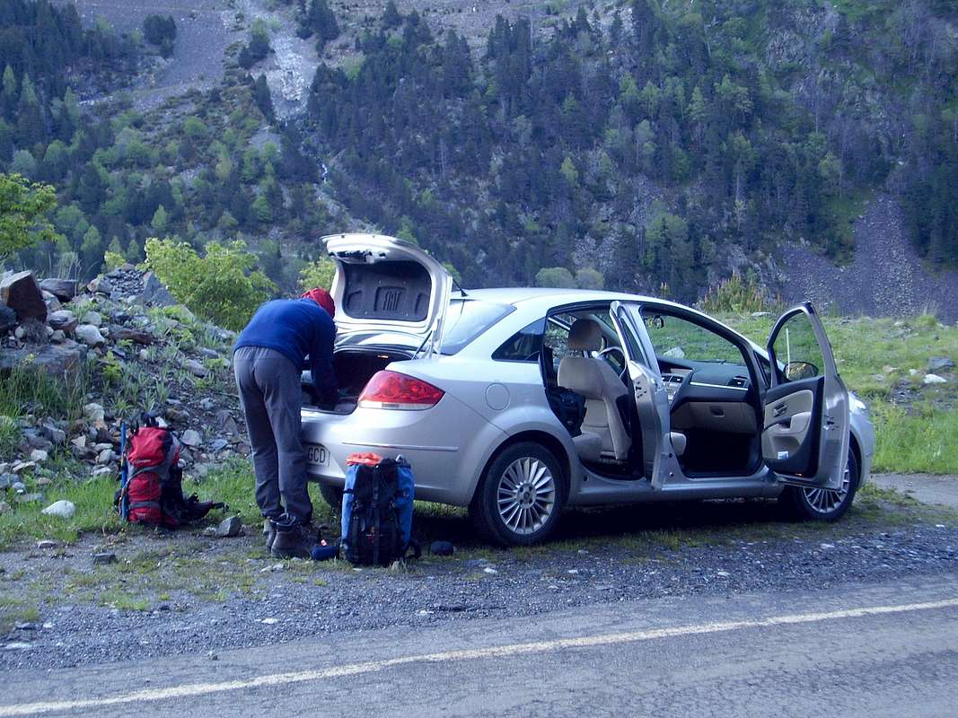
Benasque with a week of mountaineering ahead of us. Ken and I pulled our hire car into the familiar surroundings of Camping Aneto at 4:45 pm on June 2nd after a long day of travelling from Liverpool's John Lennon Airport.
Hola como estas?, if our Spanish was rusty before, we soon found our way back into it as we booked our stay at the refugio for a few days and made tentative enquiries about the forthcoming weekend and the likelyhood of hordes descending on the area.
We soon laid our gear out in the
dormitorio and headed back down to Benasque for beer and tapas.
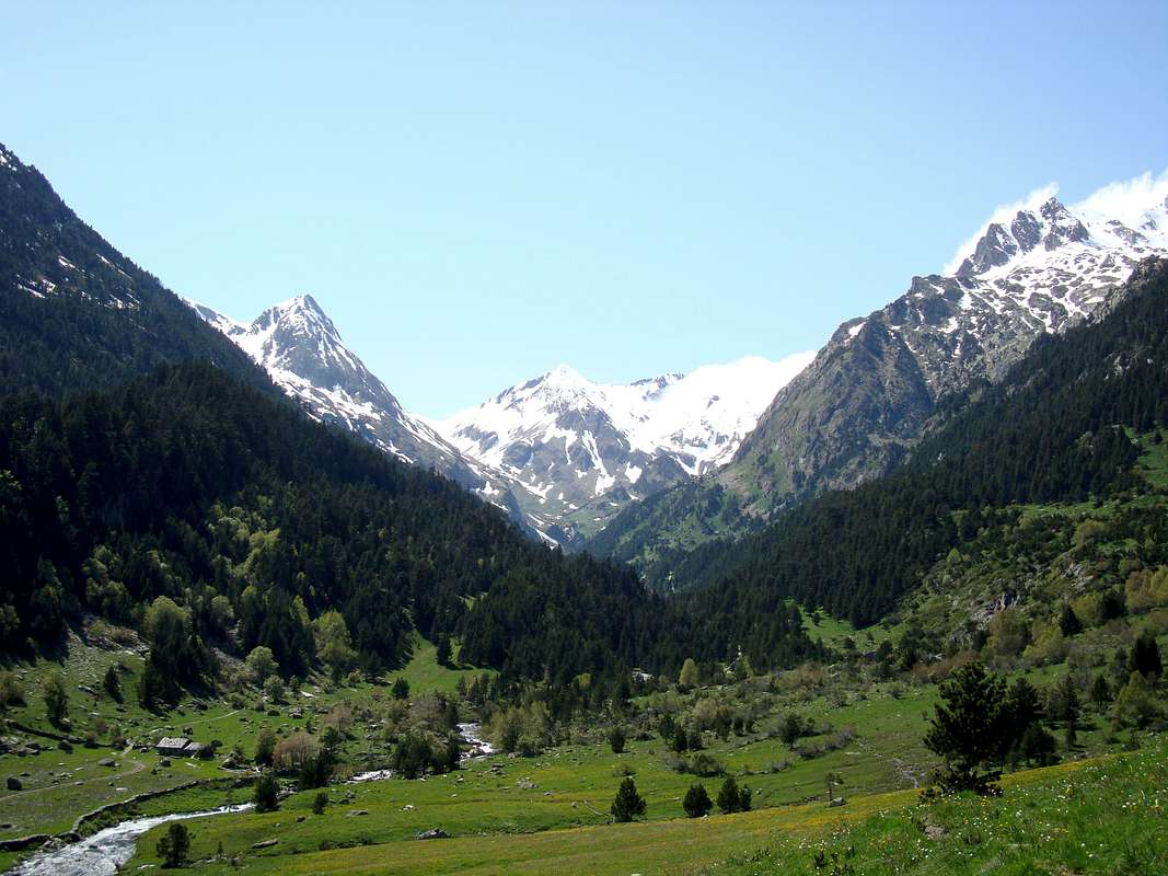
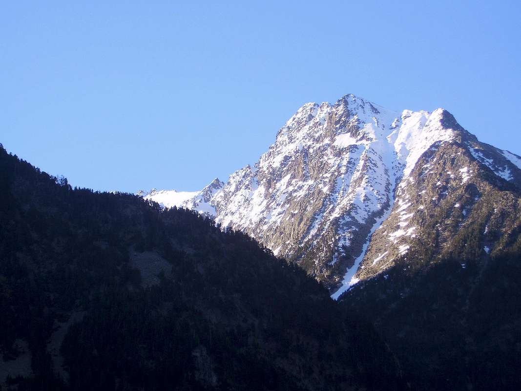
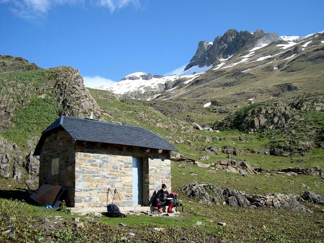
June 3rd - Our attempt on Forcanada 2881m.
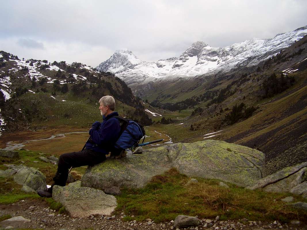
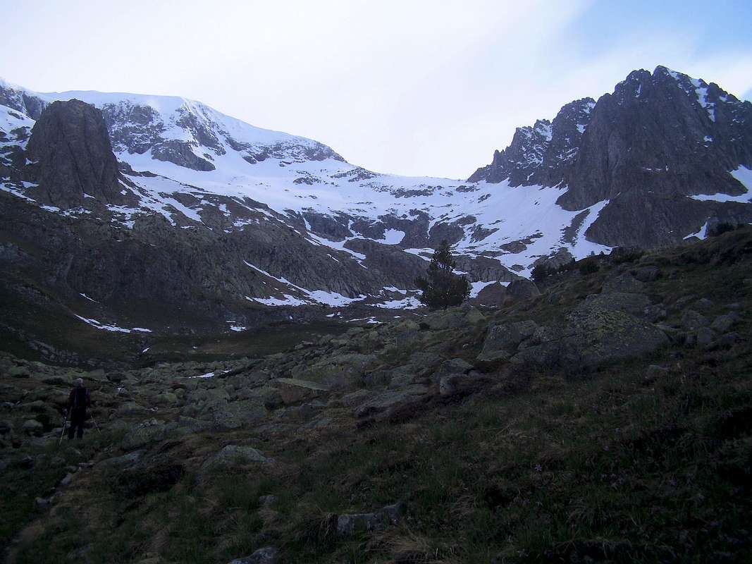
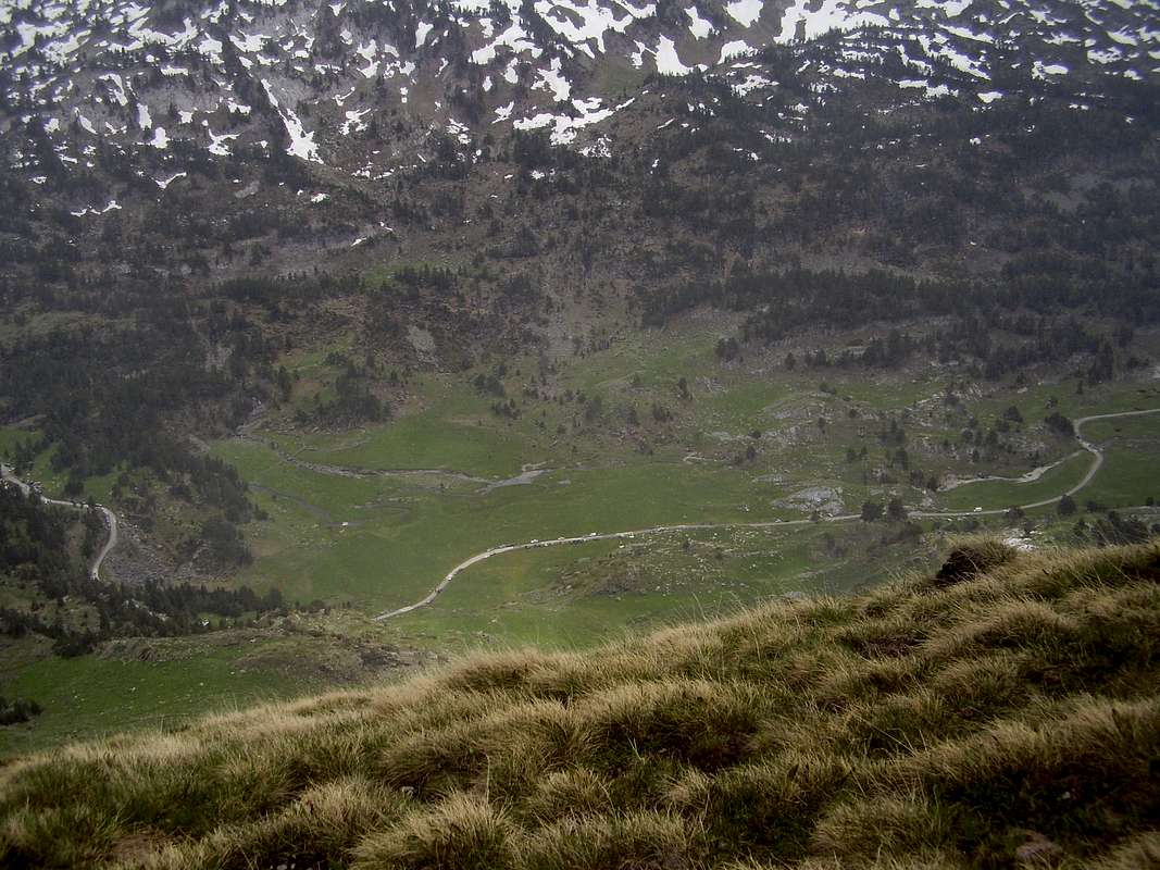
![Above the Plan dels Aigualiuts]() The Plan dels Aigualiuts
The Plan dels Aigualiuts![Pic dels Aigualiuts]() The Pico dels Aigualiuts
The Pico dels Aigualiuts
By 5:30am we were up at
La Besurta (1891m.) donning our gear and heading up to the
Forau dels Aigualiuts (2033m.) our objective being the almost 3000 metre peak of
Forcanada or
Malh des Pois (2881m.).
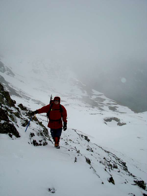
Above the
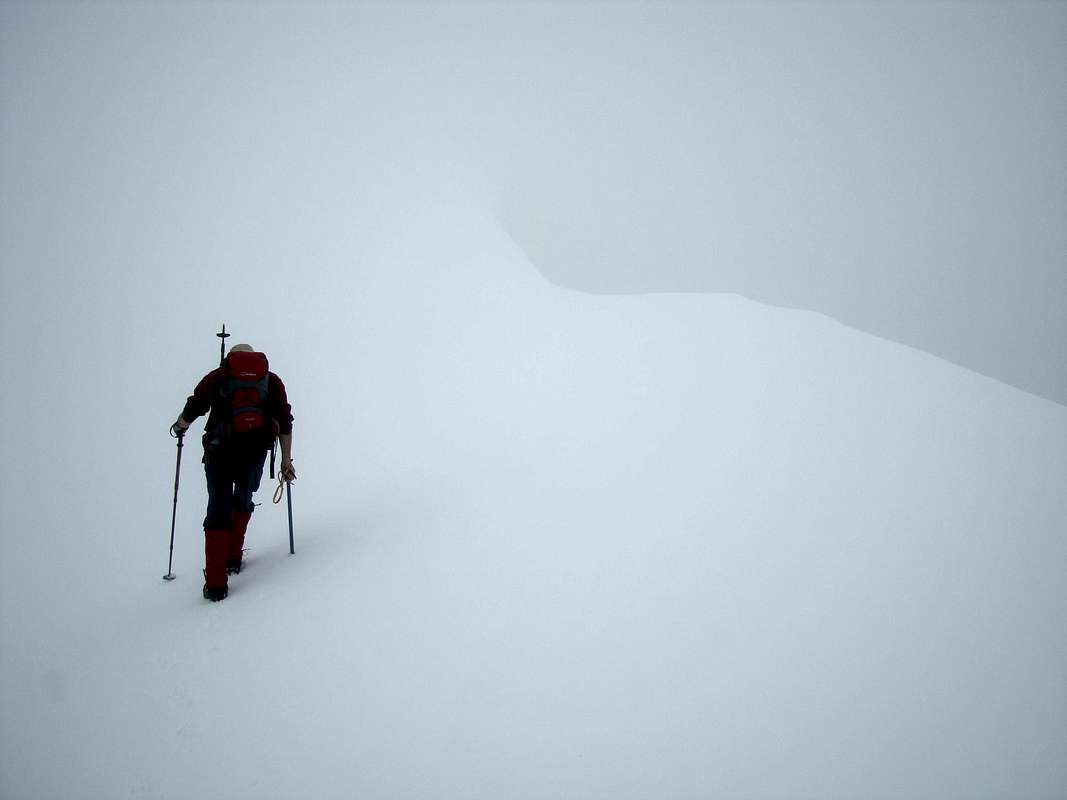
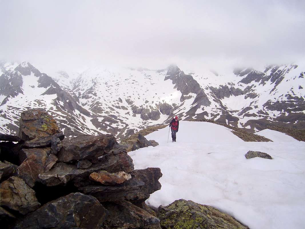
Forau we could immediately see that the snowline was much lower than we had found in previous years. As we crossed the
Plan dels Aigualiuts, we could see how the
Pico dels Aigualiuts neatly divided the terrain ahead into two branching valleys.
![Balleta de L Escalleta]() The Balleta de L'Escaleta
The Balleta de L'Escaleta![The Coth des Aranesi and the Huesca/Cataluna border]() The Coth des Aranesi
The Coth des Aranesi
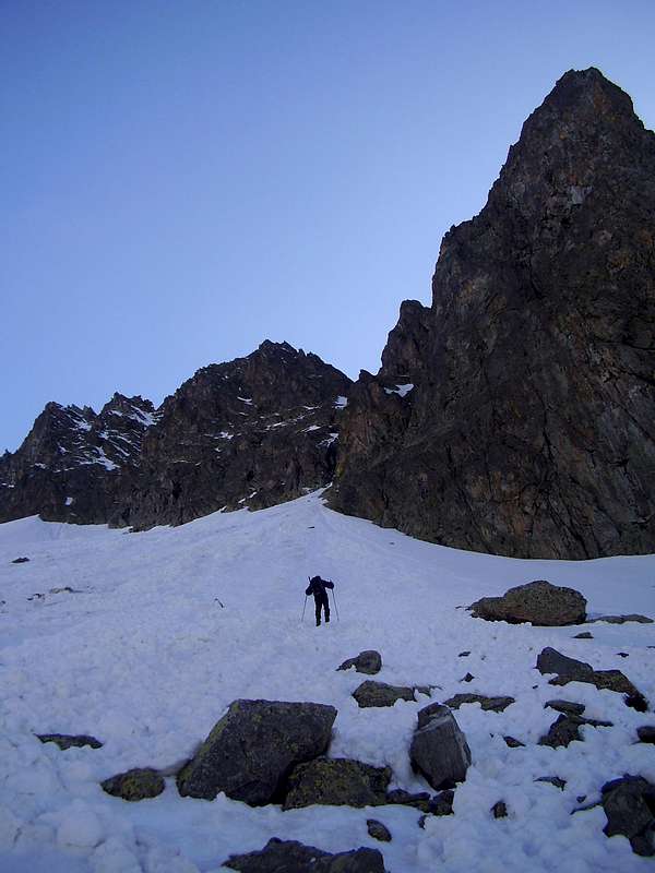
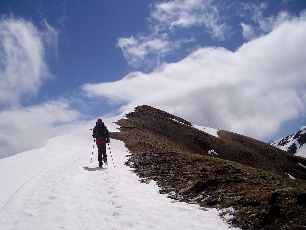
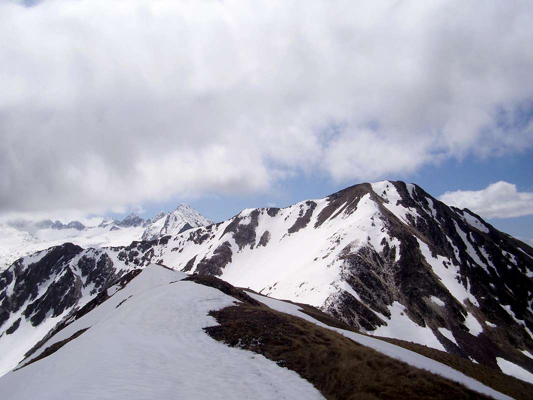
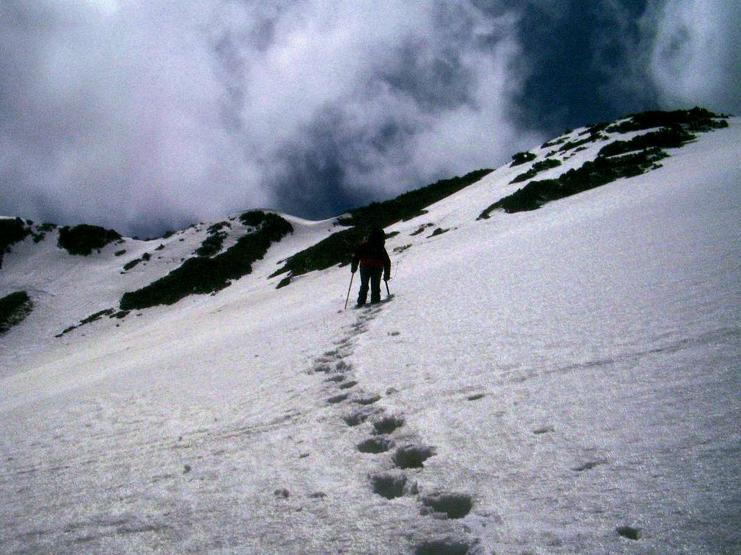
Taking the left hand valley we headed up over initially firm snow into the
Balleta de L'Escaleta . We were looking for the
Estanys de L'Escaleta where the trail divides. However, deep snow covered up any signs of the path and no cairns were evident. We decided to take a high line and shortly arrived at the top of a ridge, this being the
Coth des Aranesi (2446m.). For some reason, I had the mistaken impression that this marked the Franco/Spanish border. I think it amused Ken that I didn't know which country I was in! After wiping my shades and having another look at the map we recognised the border as regional, i.e. between Aragon and Catalonia. We realised we should have taken the lower trail but nothing was lost and we contoured along the ridge towards our target of the
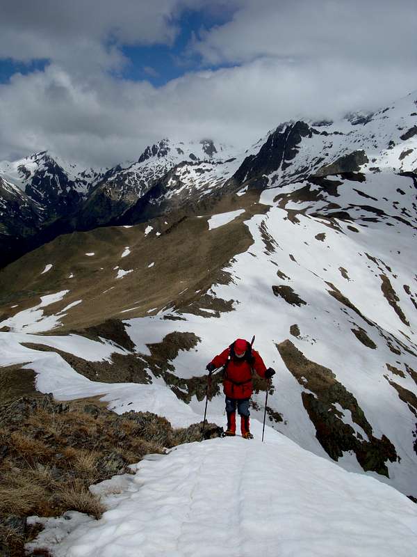
Estany Alt de L'Escaleta. However, by this time we were navigating on a bearing as total whiteout conditions prevailed and the snow was getting softer and the going heavier. Ken commented that when he was putting his foot down he didn't know if he expected to go up or down. I experienced similar disorientation. By my Suunto, the altitude was 2605 metres but we could see no signs of the lake or the entrance to the
Coll d'Alfred
(2844m.).
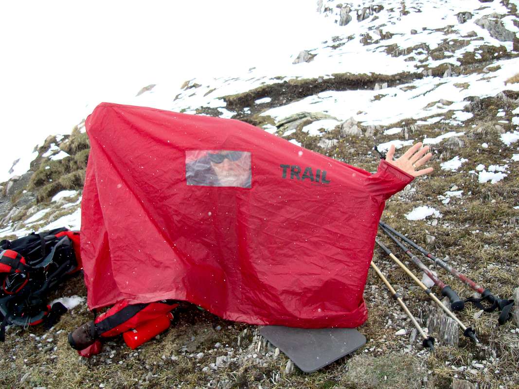
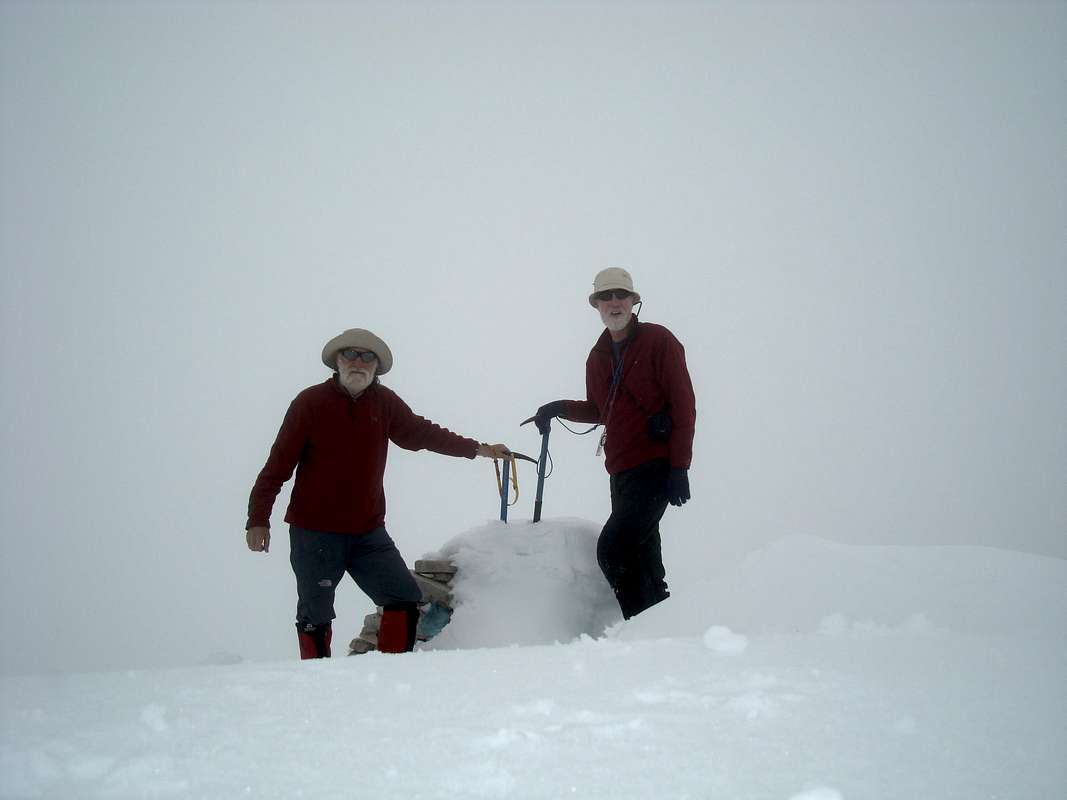
![Ken checks out the emergency shelter]() Ken checks out the emergency shelter
Ken checks out the emergency shelter![Johnnie checks the snowfall]() Johnnie feels to see if the snowfall has ended
Johnnie feels to see if the snowfall has ended
We searched around for a bit, crossing over some humps and dips in the snow-covered ground but still found no evidence of the
Estany.
We decided to stop and wait for a while to see if the weather would clear up and this gave us an ideal chance to try out my emergency shelter. We found an area where the snow had been blown clear by the wind and unpacked the shelter. Inside, it felt amazingly warm after being exposed to a stiff breeze previously.
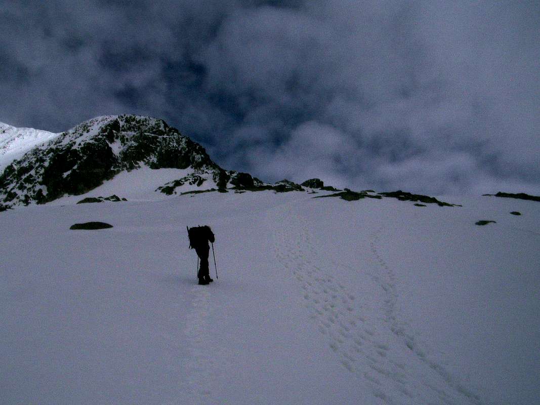
After about a half hour out of the wind, with no sign of any improvements in the weather and a potentially tiring flog over the deep snow before we crossed the
Coll d'Albert dropped down 100 metres and then climbed up to
Forcanada at 2881 metres, we decided to retreat. We took the decision because we were already a bit tired after wading through the soft snow for a couple of hours and another 2 hours of it to the summit couldn't be justified, particularly as navigation was very difficult.
It was around 1:00 pm by this time and we made our way back down through the snows to
La Besurta in 3 hours.
June 4th - The Estós valley
![Rest at the Palanca de Batisielles]() Modelling for garden gnomes
Modelling for garden gnomes![Ford for off roaders]() Ford at the Palanca de Batisielles
Ford at the Palanca de Batisielles![Pico Perdiguero 3222m.]() Pico Perdiguero
Pico Perdiguero![The Estós Refugio]() The Estós refugio
The Estós refugio
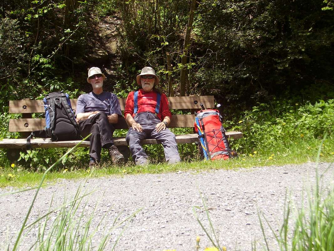
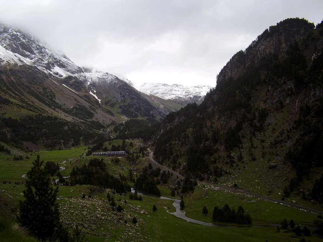
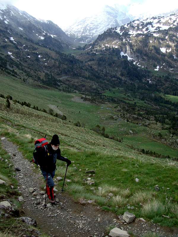
After our tiring first day we had a more liesurely start, going down to
Benasque for breakfast and so it was 1:00 pm before we started off down the
GR11 from the refugio.
It was a very warm day so we were glad of the shade provided by the pinewoods along the trail. We had 'phoned ahead to the
Estós Refugio to book our bed and dinner for the night so that we could get an early start on our next objective:
Perdiguero.
Although it was quite a long walk between the refugios, it was a very pleasant afternoon enjoying the scenery and the silence for most of the time.
Somewhat suprisingly in spite of the whiteout conditions the day before and liberal application of sunblock we had both acquired sunburn.
Sitting at a rest stop at the
Palanca de Batisielles we looked like models for a couple of garden gnomes.
It was a beautiful spot to rest up, the crystal clear waters of the
Aigueta de Batisielles running over the ford provided a soothing background music to our thoughts.
We had no need to wade through the waters though as some rickety wooden footbridges could be followed across the stream.
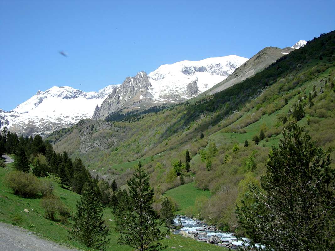
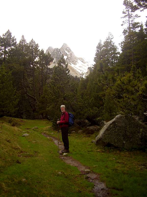
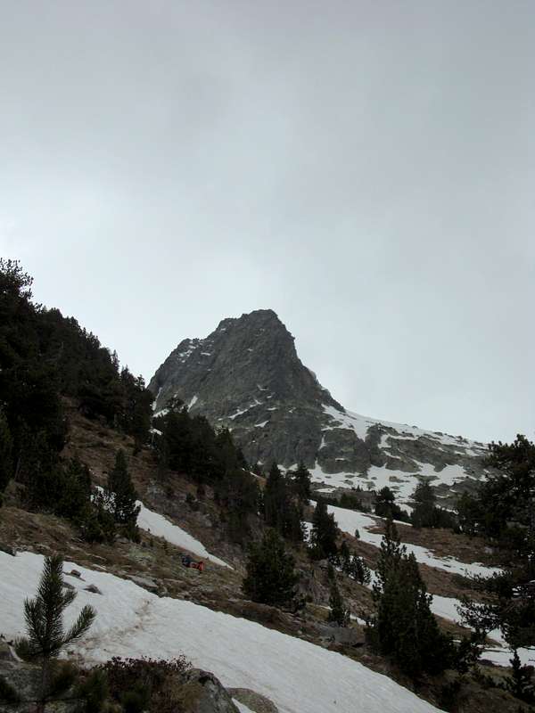
Further along the trail we suddenly arrived at a clearing in the pine woods and were greeted by the awe inspiring sight of Perdiguero high up on the northern side of the valley.
The National park authorities had kindly provided an information board at the side of the trail with a panoramic pictorial view of the valley complete with legends for each of the peaks in view.
We quickly agreed that Perdiguero was the snow peak that apparently topped the height of all others and was connected by a snow ridge to its lower subsidiary peak of Hito Este de Perdiguero.
We arrived at the refugio (1890m.) at 5:30pm to be greeted by Dani (Daniel) and his two dogs. I think they were working on the good cop/ bad cop principle as one licked me and the other tried to take a bite until the trekking pole deterrent worked. Ken reckoned it was the poles that caused the threatened attack or maybe I was using the wrong deodorant brand.
![Post-prandial vino]() Inside the Estos refugio
Inside the Estos refugio
There were only seven guests that night so the dining hall was quiet, we joined in with a couple of the Spanish guys, sharing with the serving of the courses and tidying up the crockery afterwards.
Dani was a jovial host and we enquired about his equally jovial
compadre Nando who we had met on previous visits to the refugio. Nando was on holiday apparently, so we asked Dani to pass on our regards and arranged for a breakfast tray to be left out for us early the next day.
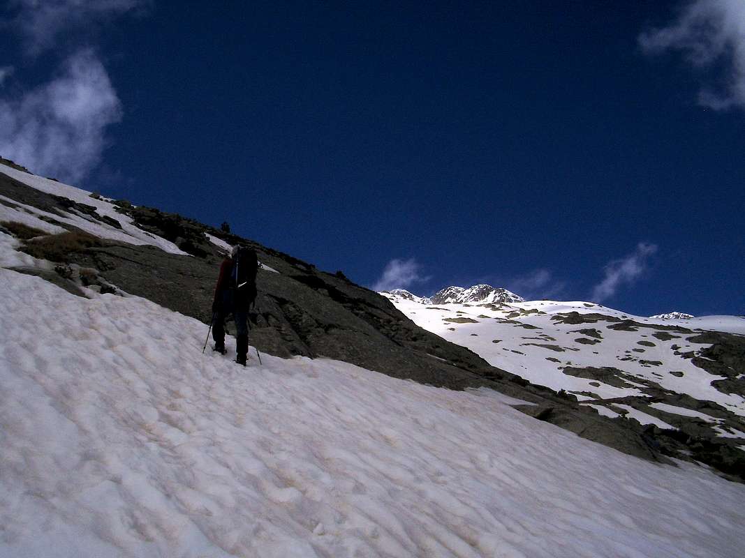
June 5th - Perdiguero
![Packing at the Estos refugio]() Pre-dawn at the Estos refugio
Pre-dawn at the Estos refugio![Ken leads off to the Cuartel Militar]() Ken starts down the trail
Ken starts down the trail![The cabana del Turmo and the rio de Estos]() Cabaña de Turmo in the Estos valley
Cabaña de Turmo in the Estos valley![The Quartel Militar de Estos]() Quartel Militar - gear stash location
Quartel Militar - gear stash location
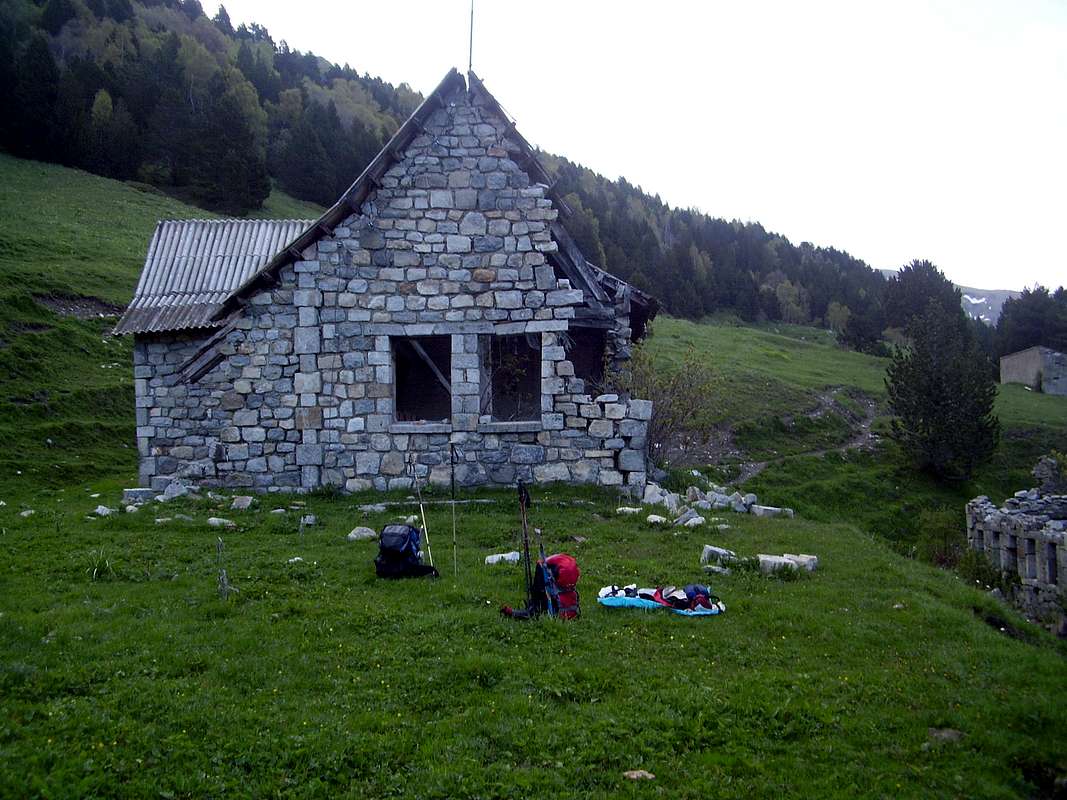
Rising at 4:30am we forced down our coffee and cakes and headed off to the abandoned
Quartel Militar back down the valley past the
Cabaña del Turmo where we planned to stash our superflous gear. The idea behind this being avoidance of a long round trip hike back to the Estos hut after a potentially tiring ascent of Perdiguero.
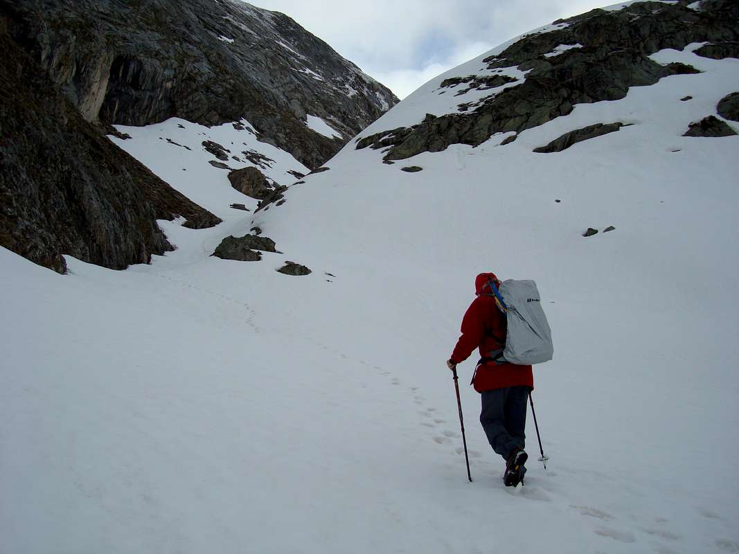
![Leaving the pine woods]() Pine woods trail
Pine woods trail![Collado Ubaga in sight]() Collodo Ubaga ahead
Collodo Ubaga ahead![West face of Perdigueret]() Crossing avalanche debris below Perdigueret
Crossing avalanche debris below Perdigueret![Arriving at the Collado Ubaga]() Arriving at Collado Ubaga
Arriving at Collado Ubaga
Just before 7:00am we headed away from the
Quartel through woods fresh with the early morning smell of pine.
Above the tree line we found that there was just as much snowfall as on the previous day and as we made our way up along the craggy side of
Perdigueret towards the
Collado Ubaga (2703m.) we found that we were crossing avalanche debris.
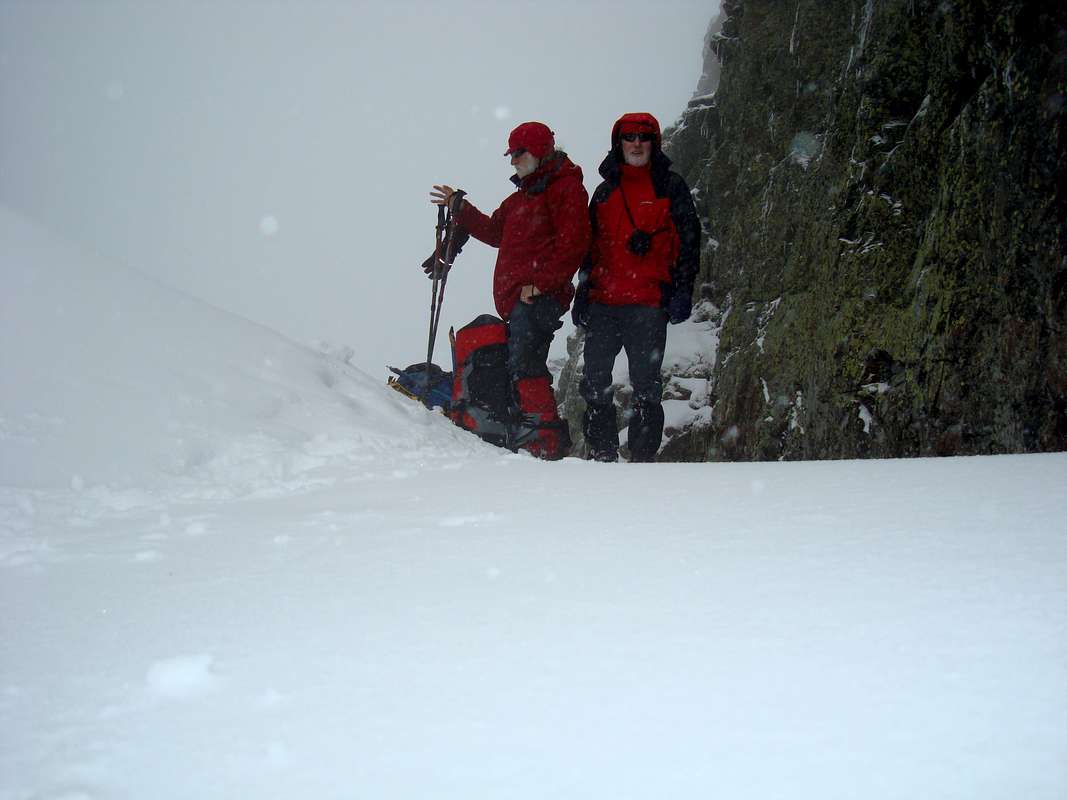
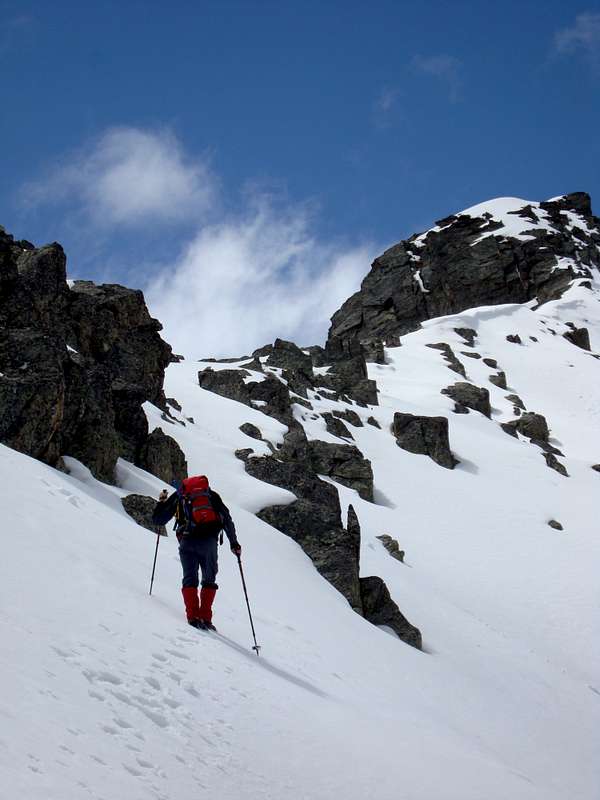
The temperature was just below freezing then, so we weren't too concerned about possible further avalanches. Arriving at the coll at 10:30am, we found that the clouds were down and compass navigation was required for the second day running.
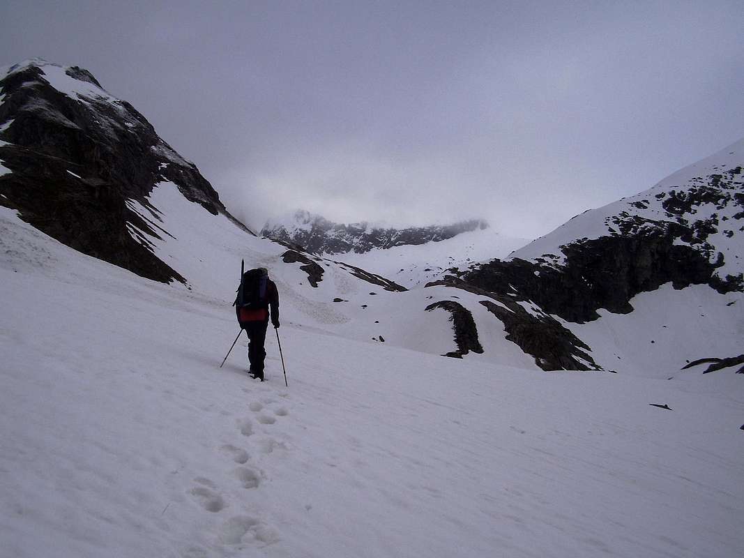
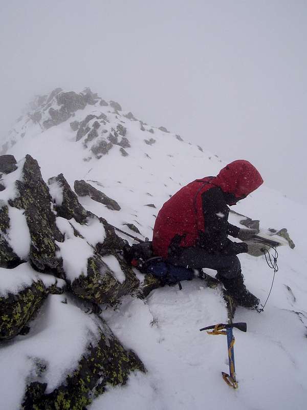
![Crampons on]() We decided to don our crampons at the coll
We decided to don our crampons at the coll![Trails meet]() Trails merge
Trails merge![Crossing a corniced ridge]() Whiteout near the Hito Este de Perdiguero
Whiteout near the Hito Este de Perdiguero
The ridge to
Perdiguero was to the North West according to the map and we headed in that direction, soon finding traces of previous ascendants. We found out the next day that these footprints were left by four Basque guys who also stayed at the Camping Aneto refugio. They told us that they had ascended Perdiguero on June 4th via the
Ball de Remune.
Tiring work through the softening snow led us to the East peak of
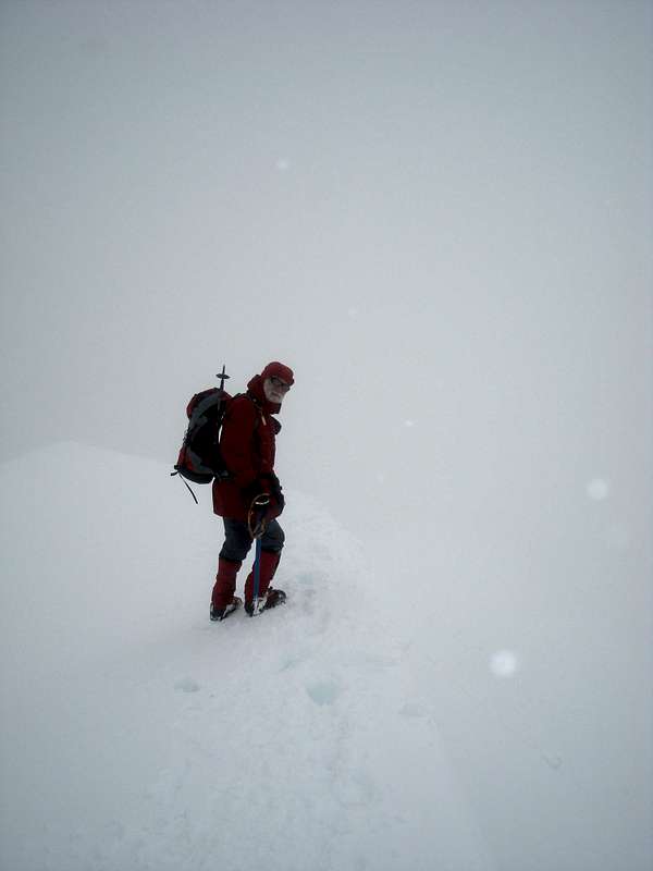
Perdiguero at 3170 metres, here we found that our intended course and the trail of footprints divided. However we were happy with our navigating and followed the narrow ridge between the east peak and the main summit. This was somewhat scary as we were still in whiteout and the ridge was very narrow.
We were going slowly, carefully probing for cornices until we reached the summit (3222m.) and found there a neatly stacked cairn with a prayer flag.
![Pico Perdiguero 3222 metres]() Perdiguero summit
Perdiguero summit
We didn't stop long as there were no views to be seen and so were back down at the collado by 2:50pm.
Down at the
Quartel we collected our stashed gear and made our way back down the Estos valley, arriving at Camping Aneto at 7:35pm. A long and satisfying day which we celebrated with a few beers in Benasque.
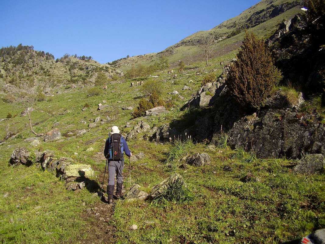
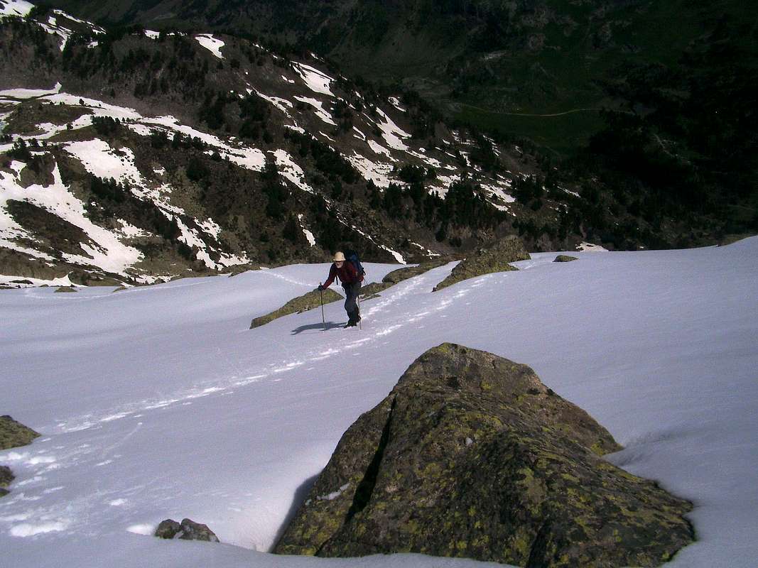
June 6th - An easy day at Ball de Remuñe
![Ball de Benas]() Ball de Benas and the Hospital de Benasque
Ball de Benas and the Hospital de Benasque![Ball de Remune]() Ball de Remune
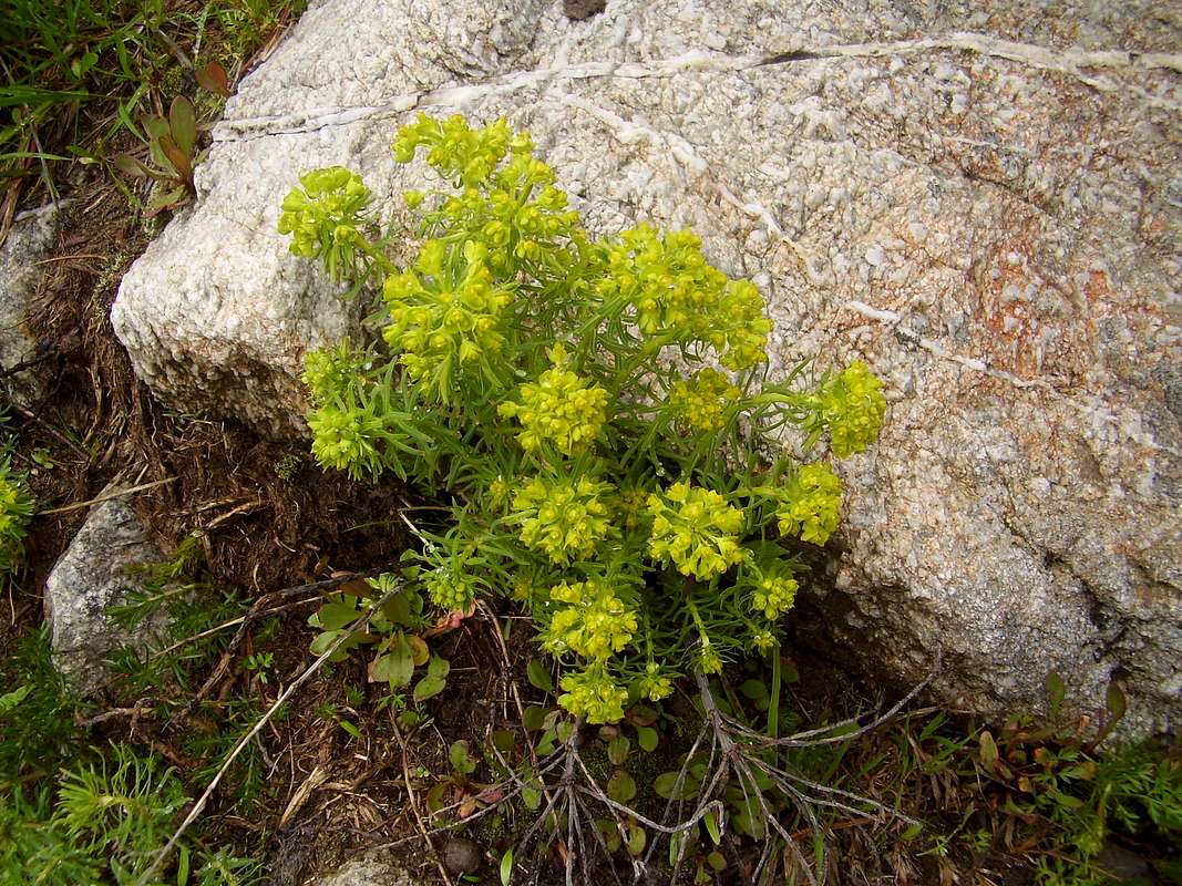
Ball de Remune![Euphorbia]() Euphorbia
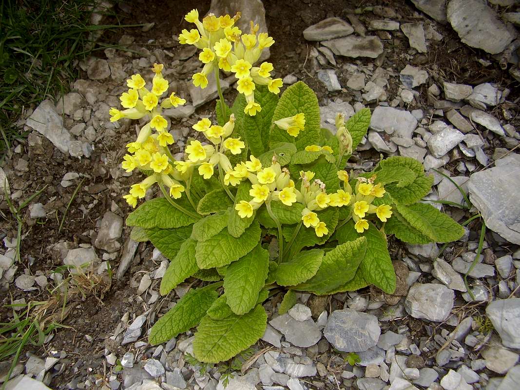
Euphorbia![Primula]() Primula
Primula
After our tiring Perdiguero day we decided to take it easy, breakfasting in Benasque before going up the Esera valley to park our car at 1750 metres above the
Hospital de Benasque and from there we took the marked trail along the
Ball de Remuñe.
Our idea was to try and see what we had ascended the previous day and get a view of Perdiguero from a different viewpoint.
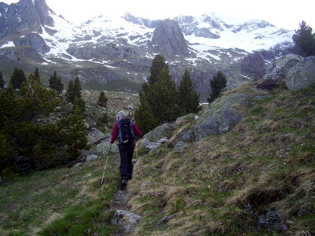
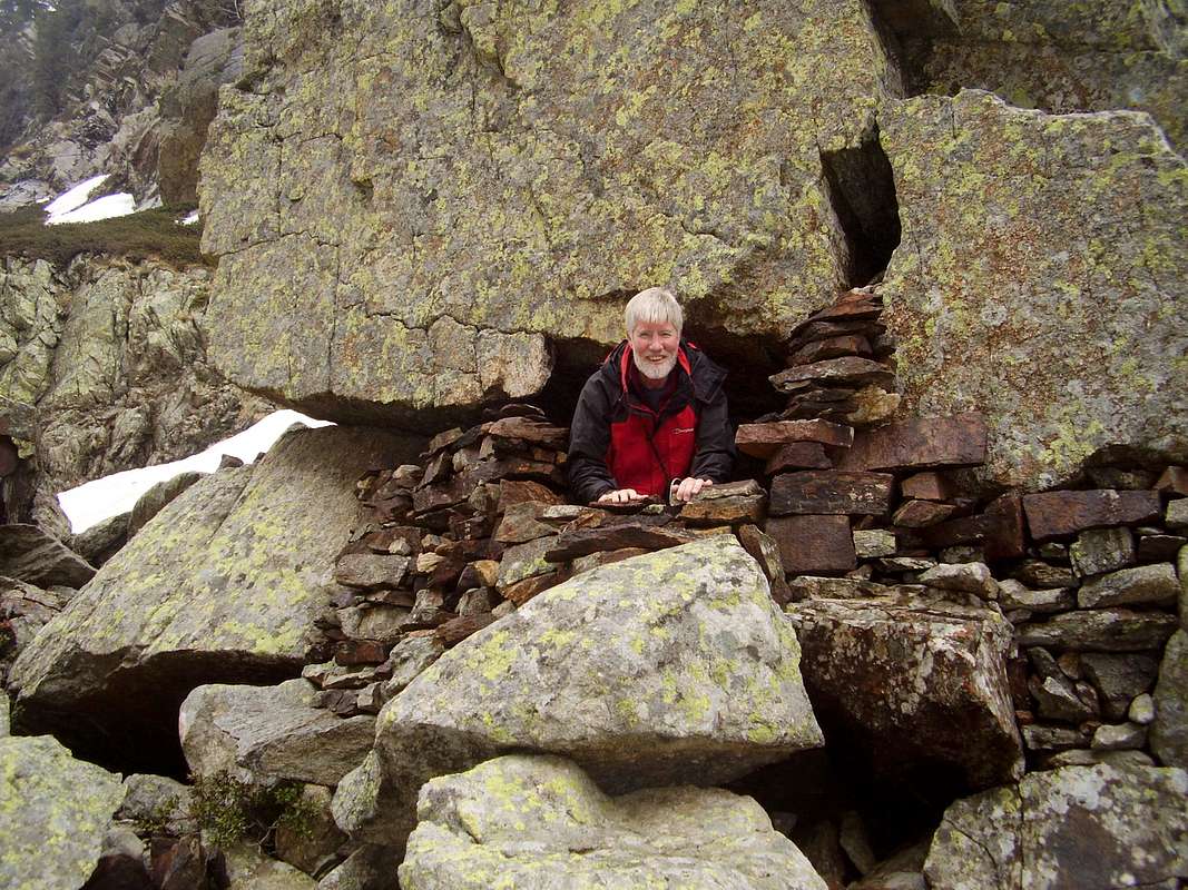
We walked up the valley admiring the spring flowers that grew in profusion all around us and were enjoying a brief spell of sunshine until we reached a point where a stone pillar arose between two valleys (2040m.).
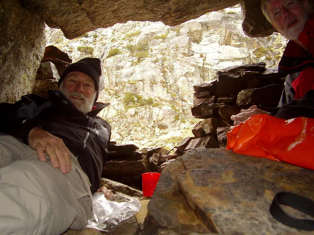
![Bivvy cave]() Ken discovers a bivvy cave
Ken discovers a bivvy cave![Just room for two]() Tea brewing in shelter
Tea brewing in shelter
Here it started raining and luckily Ken spotted a bivvy cave to shelter in. Safely ensconsed, Ken got out his stove and we brewed some green tea, waiting for the weather to clear. Unfortunately the clouds didn't disperse and the rain continued so we gave up on our hope of a
Perdiguero view and headed back down to the car.
As we got lower down the valley the rain eased so we decided to take a look at the GR11 trail where it went east through pine forests from a campsite in the
Plan de Senarta. We strolled up the hill for an hour or so but didn't go far enough to see the
Ball de Ballibierna above the trees as we soon started feeling a need for sustenance. We headed back to Benasque for tapas and beer.
June 7th - To the border with France
![Plan d Estan]() The Plan d'Estan from near the Peña Blanca
The Plan d'Estan from near the Peña Blanca
On Saturday morning we were parked up at the
Plan d'Estan (1836m.) near to
La Besurta around 8:30am.
Our objective was Ken's choice, the
Tuca de Salbaguardia (2838m.) and this peak lies right on the Franco/Spanish border.
The trail followed a zig-zag route up the hill to the coll that provides access to France. This is the
Portillon de Benas (2445m.).
![The border crossing trail]() High on the zig-zag border trail
High on the zig-zag border trail![Portillon de Benas 2445 metres]() Portillon de Benas - 2445 metres
Portillon de Benas - 2445 metres![Frontier marker]() Border marker
Border marker
From the 2100 metre level we found substantial snowfall and routefinding would have been difficult had we not been over the same terrain a few years earlier and therefore knew the position of the
Portillón.
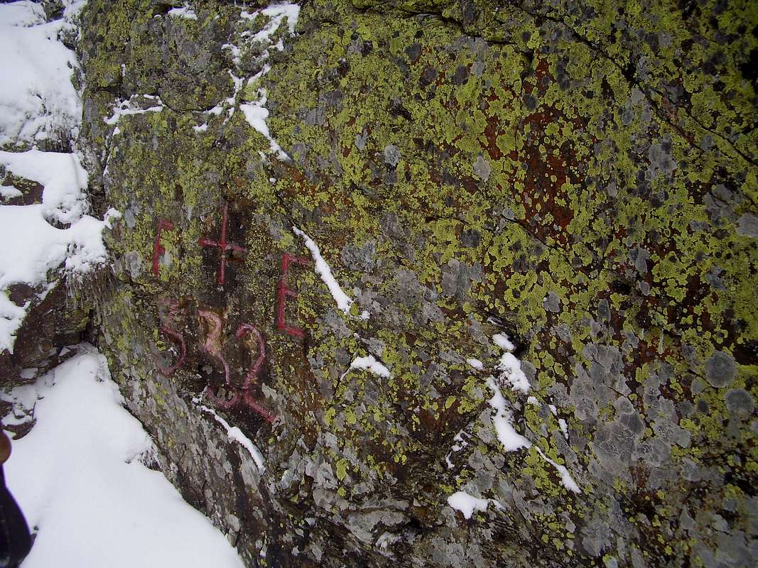
By the time we arrived at the
Portillón which was marked by an engraving on the sidewall, we were again in whiteout and therefore had to plot our onward course by compass, the trail to
Salbaguardia being completely obliterated.
![Johnnie tries to find the trail]() Trying to locate the trail
Trying to locate the trail![Frontier ridge]() Ken consults the map at a notch in the ridge
Ken consults the map at a notch in the ridge
We followed our bearing and an indistinct depression in the terrain that could have been a path. Going slightly downhill to the west of the
Portillon and then up again we found ourselves at a notch in the ridge. Still no visuals! so we set off diagonally down again and eventually found ourselves above a loose rock wall and a crevasse (or bergschrund).
A quick conflab decided that we didn't like the look of this and Ken proposed backtracking to the notch to try and trace the trail again.
![How to look good]() Fellow mountaineers appear
Fellow mountaineers appear![Whiteout]() Where is the route ?
Where is the route ?![Tuca de Salbaguardia 2738 metres]() Close to the summit of Salbaguardia
Close to the summit of Salbaguardia
We got back to the notch and as we were shuffling our kit to check maps and bearings again, two Spanish mountaineers appeared and we had a conversation with them about route finding. Although they said it was their first time on the hill too, they were fairly sure that the route should be followed diagonally upward from near our furthest point.
Being long on cunning if short on breath we said "lead on" to them and followed behind. After some time ascending rotten steps of loose snow, stones and grass we did arrive again on the ridge where we met up again.
They had been onto the ridge that led to the summit but had decided that it was too risky due to steep walls, poor vision and dangerous cornices.
We said we would go and have a look ourselves which we did.
Fair play to them, they seemed very concerned that we were taking a risk but we assured them that we were too long in the tooth to stick our necks out. My Suunto read 2715 metres, about 23 metres lower than the summit so we decided to call it a done deal and descended back down.
June 8th - Two tops in the sunshine
![Come on Ken!]() Ken grabs his gear from the car at Puente de Literola
Ken grabs his gear from the car at Puente de Literola![Mind that herd Ken!]() Ken hopes the herd are docile
Ken hopes the herd are docile
On Sunday it was my choice of hill so we parked up at the
Puente de Literola (1600m.) and followed the marked trail up the
Literola valley past a herd of docile cows to the sound of their gongs echoing off the sides of the hills.
![Pico d Estatas 2945 metres]() Pico de Estatas from the Literola valley
Pico de Estatas from the Literola valley![Cabana de Ubago]() Cabaña del Ubago
Cabaña del Ubago
Views of the valley and mountains across the
Rio Esera were stunning.
We soon arrived at the
Cabaña del Ubago (2000m.) and stopped for a snack in bright sunshine, things were looking better already.
![Turo de Frontonet 2420 metres]() On the ridge with the Turo de Frontonet above
On the ridge with the Turo de Frontonet above![Turo de Frontenet summit ridge]() Turo de Frontonet summit ridge
Turo de Frontonet summit ridge![Tuca del Dalliu 2531 metres]() Tuca del Dalliu
Tuca del Dalliu
Crossing a small river by wooden bridge to the south of the cabin, we soon found ourselves climbing steeply up snow towards a ridge.
The higher we got, the softer the snow. Ken was following at that stage and he was sinking knee deep until he realised that he would do better making his own steps than following mine.
The snow crust just about supported a flat edging of the boot, but as soon as a kick was made for a toehold, the crust collapsed and the tiring wading commenced.
We arrived at the top of the ridge and could see it rising to the southeast. The snow was crisper there and we followed the ridge up and arrived at the flat summit of
Turó de Frontonet (2420m.) from where we could see our final target, the
Tuca del Dalliu.
![Nearly there]() Just below the summit, the deep snow lower down made the going hard
Just below the summit, the deep snow lower down made the going hard![Deep snow below Dalliu]() Moving up from the coll
Moving up from the coll
Between the two summits was a coll (2365m.) down which we went and then up the other side for more wading in softening snow. We finally arrived on the
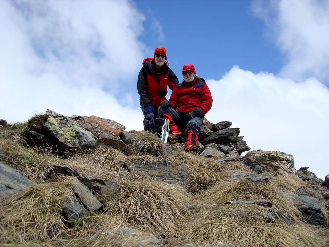
Tuca del Dalliu (2531m.) at 12:50pm.
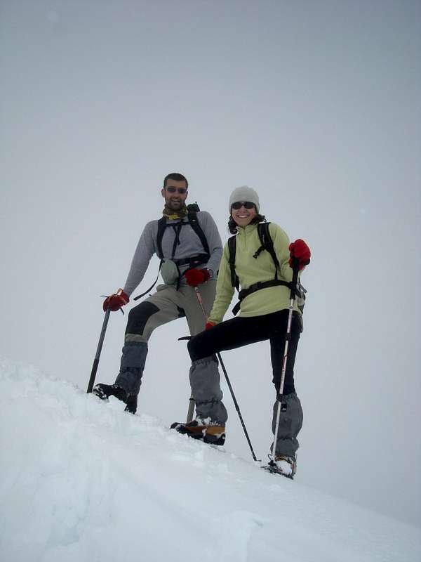
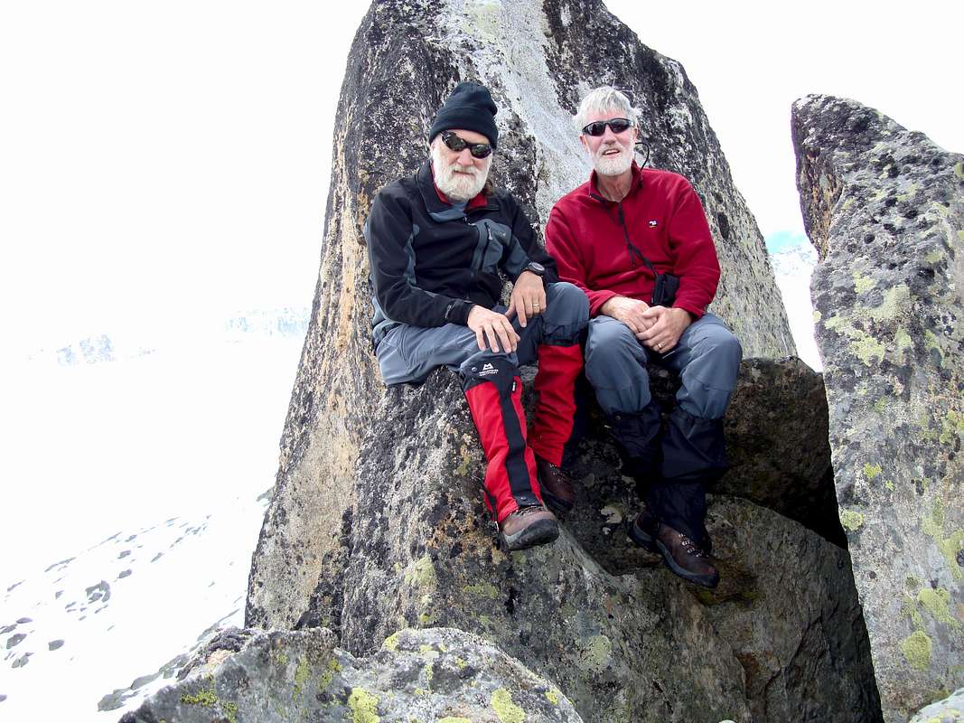
![Tuca del Dalliu summit]() Johnnie and Ken at the summit
Johnnie and Ken at the summit
As it was the first time in the week that we could actually see something from a summit we stayed for some time at the summit cairn enjoying the 360 degree panorama, eating snacks and taking fotos.
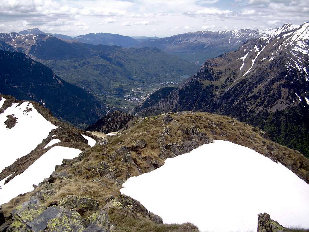
![Benasque from the Tuca del Dalliu]() Benasque from the Tuca de Dalliu
Benasque from the Tuca de Dalliu
This must be one of the best spots in the whole region for seeing so many 3000 metre peaks. To the east
Maladeta / Aneto, to the northwest
Perdiguero
and to the southwest
Posets.
After taking a few more fotos we retraced our steps and were back down in Benasque by 4:27pm.
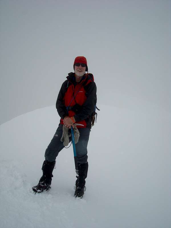
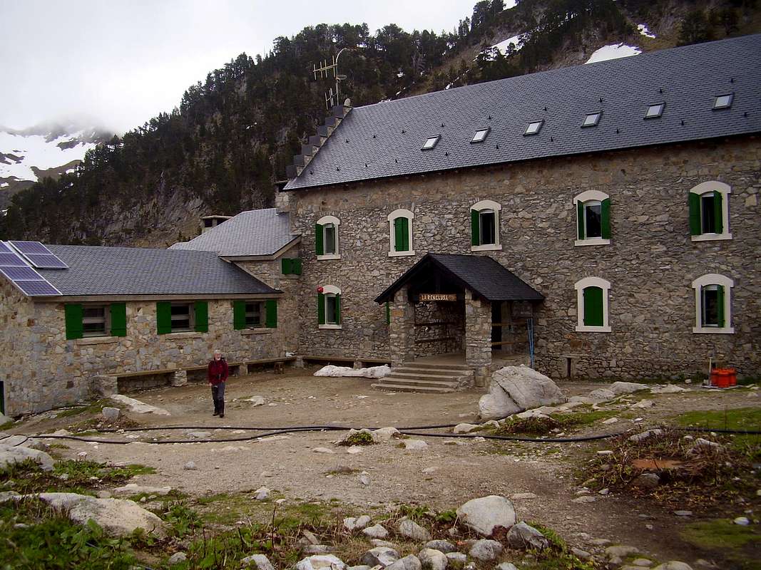
June 9th - Our last day - Pico de la Renclusa
![Renclusa refugio]() Renclusa refugio
Renclusa refugio![Coll de la Renclusa]() The Coll de la Renclusa
The Coll de la Renclusa
We had talked about doing
Pico de Paderna but in view of the excessive amount of snowfall and often poor visibility we decided to leave it for another season. Instead we agreed to have a go at the
Pico de la Renclusa. We returned to
La Besurta (1897m.) fairly early and made our way up to the Renclusa refugio where we stopped for a
cafe con leche and a chat with the guardianess.
The refugio lies at 2140 metres directly below the
Pico de la Renclusa.
![Heading for the Portillon ridge]() Heading towards the ridge
Heading towards the ridge![Above the Renclusa]() High above the refugio
High above the refugio
Instead of following the normal trail up to the
portillones, we made our way straight up over snow and rock, more or less directly to the Pico.
We gained the rocky ridge not too far from the summit, took off our rucsacs, put down our snow gear and took to scrambling and climbing the rocks until we reached the highest point around 1:15pm.
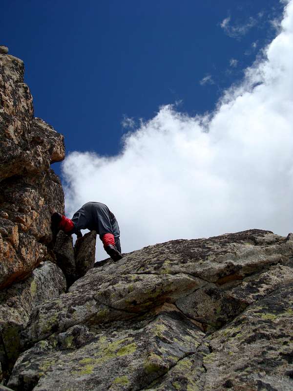
![A short chimney]() Ken climbs a short chimney
Ken climbs a short chimney![Chimney to the summit]() Johnnie climbs another short chimney
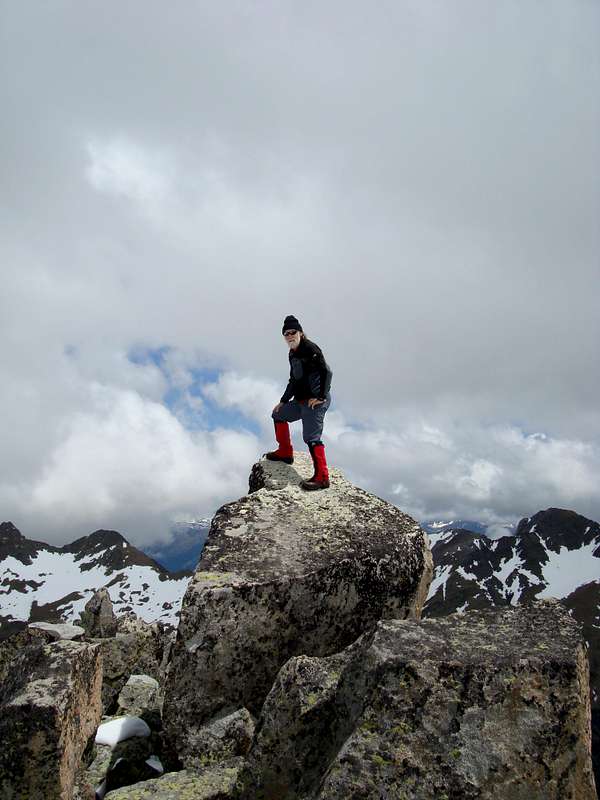
Johnnie climbs another short chimney![Summit of Pico de la Renclusa - 2700 metres]() Johnnie reaches the summit
Johnnie reaches the summit![We made it !]() We made it!
We made it!![Pico de la Renclusa]() The Pico de la Renclusa
The Pico de la Renclusa![Football crazy ?]() Football fever
Football fever
The map doesn't show the height but interpolating from the contours it is around 2630 metres(
Info from Rafa 9/7/08 - height is 2700m.)
By 3:30pm we were back down at the refugio quaffing beers and chewing the fat with some other mountaineers whilst eagles wheeled overhead and storm clouds threatened.
Eschewing another refreshment we headed back down to
La Besurta arriving at our car just as the heavens opened and the rain lashed down.
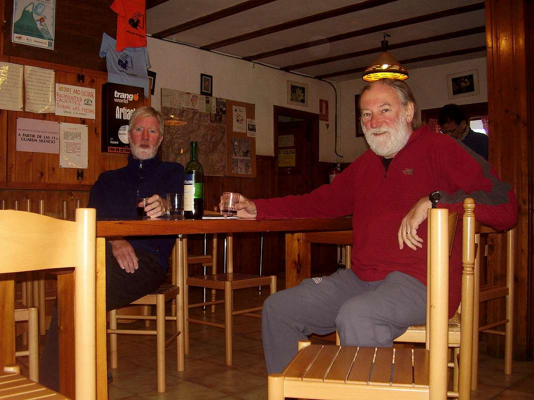
That evening we celebrated our excellent week in the bar of the
Hotel Ciria with a few more beers and a
plato combinado con lomo whilst watching the European football cup on the telly.
Useful Information
The town of
Benasque is situated in the valley of the Esera in the north of the Huesca region of Aragon in Spain. It is easily accessed by road from Lleida via Barbastro and Pont de Suert or Graus.
The regional
Michelin map 574 Cataluna / Aragon will help with driver's navigation.
Once at Benasque all local mountains are easily navigated using the Editorial Alpina 1:25,000 scale maps:
Maladeta - Aneto
Posets - Perdiguero
An English language climbing guide is available from Cicerone Press:
Walks and Climbs in the Pyrenees by Kev Reynolds.
There is a Tourist Information Office in Benasque where you can get information about the local services such as Refugios, Campsites, Hotels etc.


Comments
Post a Comment