|
|
Mountain/Rock |
|---|---|
|
|
37.35160°N / 115.326°W |
|
|
Lincoln |
|
|
Hiking |
|
|
Spring, Summer, Fall |
|
|
7975 ft / 2431 m |
|
|
Overview
Badger Mountain is directly west of the small town of Alamo in the great state of Nevada. It is rarely visited and sits east of the more popular area 51 viewing spot known as Tikaboo Peak. Badger Mountain however, is not only taller than Tikaboo Peak, it is one of Nevada's prominence peaks, coming in at #118 on that list with a prominence of 2382 feet. Thanks to the popularity of Tikaboo Peak, a well maintained graded dirt road leads to a saddle between the two peaks and that is a great aid to those wanting to find the best access to the top of Badger Mountain.This is a remote area and you need to plan accordingly. While we were out there, we saw no one else and during times of high heat, be sure to have
adequate water since there are no water sources available. The trailhead is close to 25 miles off of US 93. The nearby town of Alamo has gas stations and supplies so be sure and stop there first if you are in need of anything before venturing into the remote back area. You could also check with the locals concerning the condition of the road back to Badger Springs.
Getting There
From Las Vegas, take I-15 north towards Mesquite. Go about 15 miles and take the US-93 exit. The last chance for gas is to be found at this junction so fill up at the Love's gas station or go into Alamo to get it but there is no other gas stations between these two spots. Head north on US-93 for about 75 miles until you pass a shallow lake on the left (Lower Pahranagat Lake). Watch the milepost markers along the side of the road. Look for Milepost LN-32, which is near the Wildlife Refuge headquarters. About 2/10 mile after Milepost 32, there is a dirt road on the left. A gate is present but it should be be open most of the time but if closed, it shouldn't be locked . (If you find a locked gate, it is probably not the right one -- There are several other gated roads in this area.) Turn here, and check your odometer.
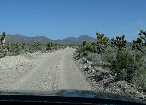
Immediately after entering the dirt road, you may see a symbolic "No Vehicles" sign. This sign refers to a side road to the right, and not the main road you are on. Continue on the main road across a narrow strip of the wildlife refuge into the desert hills. This is now public (BLM) land. Proceed on the main road as it heads southwest, cresting at Medsger Pass, dropping down on the other side and then at 8.5 miles, the road will swing north towards Badger Springs . We also passed some cattle near the road on the way to Medsger pass so be alert for them as you drive in this area. Stay on the most obviously travelled road. Nearly 19 miles in, you come to a fork with the main road going right, with a smaller road going straight. Take the straight road. This road is graded, but not as often as the main road. It is likely to be covered with snow or mud in winter and may be impassible then. It helps to have GPS waypoints to help guide you. At mile 22.5, you will come to Badger Spring, off to the left, where there is a cattle trough and the remains of a developed spring. Shortly after Badger Spring, the road gets rougher and becomes tougher for ordinary cars. Park anywhere that doesn't block the road and that is out of sight of Badger Spring. (Under Nevada Law, you must park at least 100 yards from the cattle trough.) Also, there will be times when the weather (snow, etc) might keep you from being able to get close to Badger Springs.
Hikers and 4WDs should continue along the same road for another 1/2 mile. We parked at this waypoint (see forthcoming map)
Our route (to be developed below) was less than 5 miles roundtrip and had an overall elevation gain of less than 2000 feet, which included elevation loss on both the way in and the way out. Plan on 4-5 hours round trip.
Red Tape
None that I am aware of since this is on BLM land. The only restriction would be parking near the springs as mentioned above.For more information:
Ely Field Office, Bureau of Land Management, HC 33 P.O. Box 33500, Ely, Nevada 89301-9408 Telephone: (775) 289-1800
or
Caliente Field Station, Bureau of Land Management, P.O. Box 237, Caliente, Nevada 89008 Telephone (775) 726-8100
Camping
Camping is allowed anywhere on BLM land (that is, almost anywhere in the outback of Nevada) without any fees or permits. There is a reasonable limit of 10 days in the same location.According to Nevada law, you cannot camp or park within 300 yards of any spring or watering trough used by cattle, because it scares them away. The main impact of this restriction is that you cannot camp or park at Badger Springs at the base of the mountain, but you can camp anyplace else.
Be careful with creating new campfire rings (avoid doing so) and try to use the "leave no trace" ethics and haul out your garbage. PLEASE. Also, be kind enough to pick up any trash you might find as many others are not so kind to
this fragile environment.
For those who'd like to camp nearer to the highway, there were good camping spots at the Upper Pahranagat Lake area. Unimproved camping and picnic sites are available along the eastern shoreline of Upper Pahranagat Lake (see map). All camping is restricted to these areas. Camping is limited to 7 consecutive days, within a 30-day period, beginning upon day of arrival. No generators are allowed to run in the campground. Restore your campsite to a clean and orderly condition when you leave. See this LINK for more information
Our route & summit registers
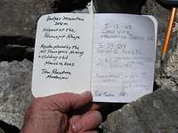
Our route is covered in the below mapIt was interesting to find two summit registers, one on the correct summit highpoint and one on what others had perceived to be the highpoint. The first register was placed in 1993 and has a few entries and the other was placed in 2002 and also has a few entries, with most entries duplicates of the other.
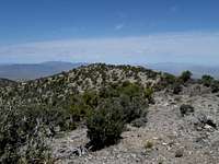
Summit and summit views
Alamo Weather

Click for weather forecast

Click for weather forecast
Nearby Alamo (not the one in Texas)
Taken from Nevada Travel:Alamo
The little town of Alamo is situated just 90 miles north of Las Vegas, but the friendly community feels decades away. The quaint town will mark its 110th anniversary in July of 2011, yet still maintains an appealing, small-town atmosphere reminiscent of an earlier time. The town’s appealing character charms visitors passing through on their way to nearby attractions and points of interest, of which there is no shortage. Alamo sits in the fertile Pahranagat Valley, which is home to the popular tourist attraction, the Pahranagat National Wildlife refuge. The Pahranagat Refuge, one of over 500 managed areas in the Refuge system, has more than 5,000 acres of wetlands and grasslands and serves as a critical stop on the Great Pacific Migratory Route. Thousands of migratory birds and waterfowl from dozens of different species pass through the valley annually, making for a truly incredible spectacle. Visitors to the Refuge may also find petroglyphs, rock art and rock sculptures, remnants of the native people who have lived in the Pahranagat Valley for thousands of years.
Alamo is surrounded by beautiful countryside with an abundance of lakes that offer fantastic fishing. The nearby hot springs and archaeological sites are also popular tourist attractions. And as Alamo enjoys the distinction of being one of the closest inhabited places to the mysterious Area 51, it also sees its share of UFO-hunters.
Accomodations
Map


